
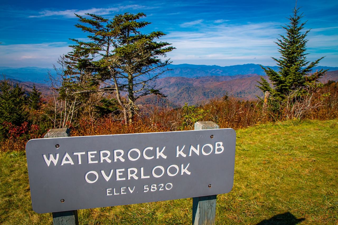
Located at Blue Ridge Parkway Milepost 451.2 (near Sylva NC), Waterrock Knob sits at an elevation of 5,820 feet, making it the highest Visitor Center on the BRP.
This area is home to several of the highest-elevation Blue Ridge Parkway Overlooks, including the Richland Balsam Overlook (6,053 ft) and the Browning Knob Overlook (5,770 ft).
It’s also home to the Waterrock Knob Trail, the southernmost hiking trail on the Blue Ridge Parkway as you head towards Great Smoky Mountains National Park.
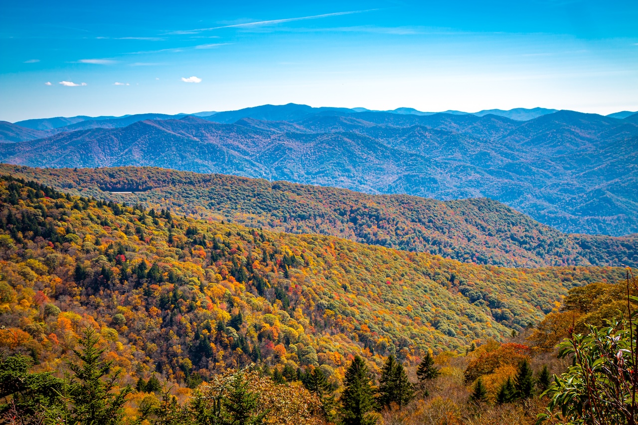
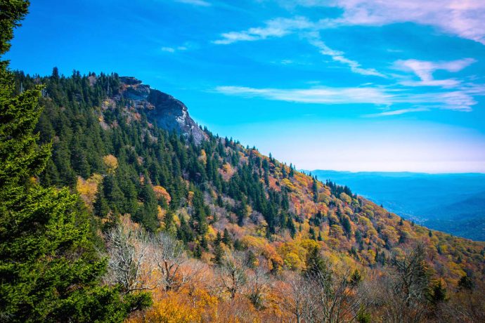
This 1.2-mile round-trip trail leads to the 6,292 ft summit of Waterrock Knob, where hikers will be rewarded with breathtaking 360º views of the Southern Highlands, including major mountain ranges such as the Great Balsams, Great Smokies, Cowees, Blacks and Craggies.
Even if you’re not up for a hike, Waterrrock Knob offers lots of things to do, including overlooks offering dazzling sunrise/sunset views, wheelchair-accessible Visitor Center and restrooms, and sensational stargazing at night.
Read on for our guide to exploring the Waterrock Knob Visitor Center, including all the important info you need to plan a visit as part of your Blue Ridge Parkway road trip!
READ MORE: The 20 Best Overlooks on the Blue Ridge Parkway in Fall
Waterrock Knob Info
ADDRESS: Rd to Waterrock Knob, Sylva NC (BRP Milepost 451.2)
PHONE NUMBER: 828-298-5330
HOURS: Visitor Center open daily from 10AM-5PM in Spring, Summer & Fall
ADMISSION: Free
Directions from Asheville
Things to Do at Waterrock Knob
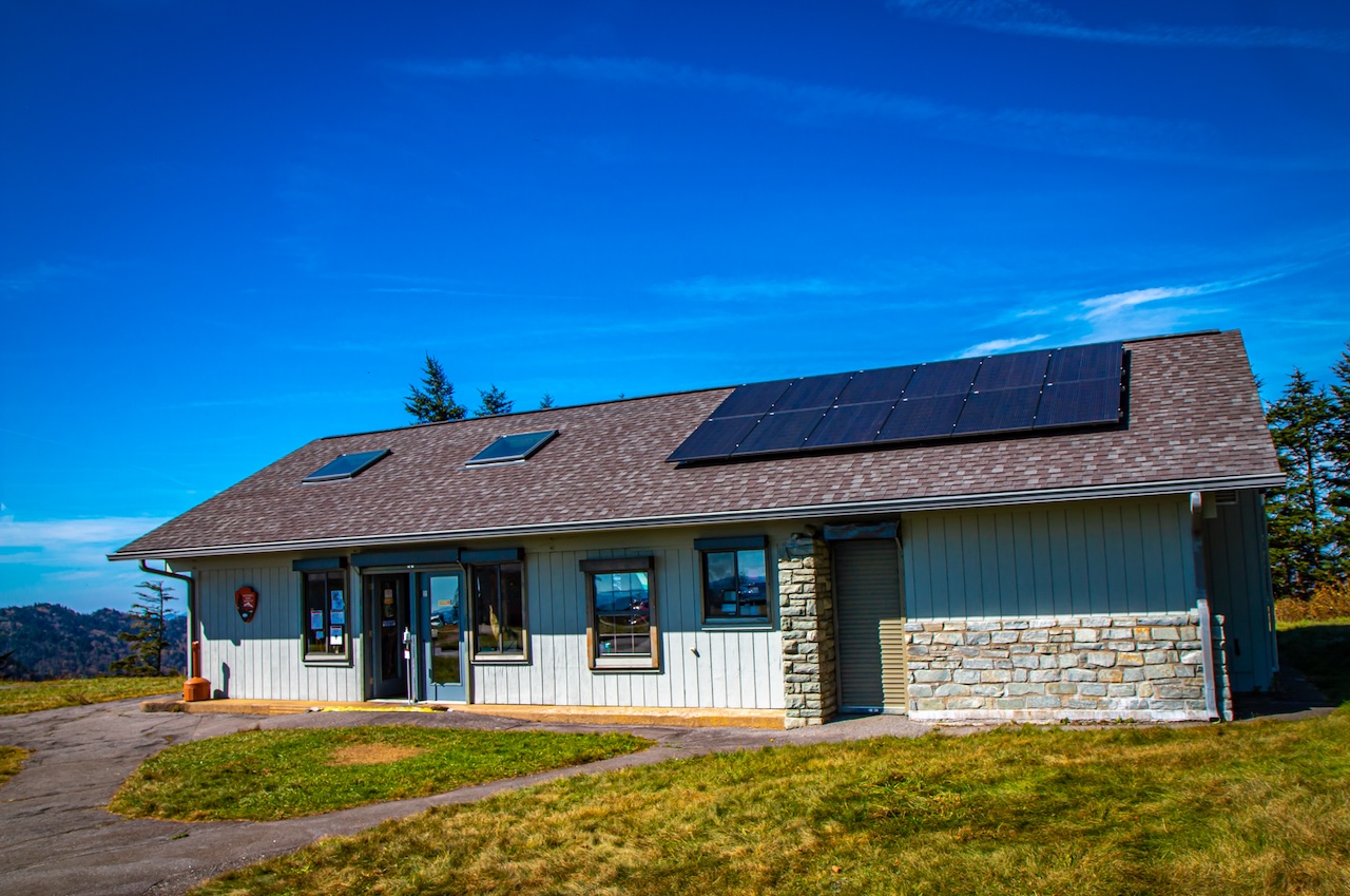
Explore the Visitor Center
The Waterrock Knob Visitor Center was a welcome stop on our Blue Ridge Parkway road trip, allowing us a chance to get out of the car, see some amazing views, and explore the area on foot.
It’s located in a small building right next to the parking lot, and most of its space is dedicated to a well-stocked gift shop filled with souvenirs, books, and other BRP memorabilia.
Here you can pick up a map and a Parkway brochure with tons of information about things to do and see along the way. You can easily explore the Visitor Center interior in under 30 minutes.
Despite its small size, the center has an interesting exhibit on local history and environmental concerns such as the Balsam Wooly Adelgid, an insect that mostly wiped out the balsam fir.
There is also some great information on local wildlife, including Black Bears, and the history of the reintroduction of Elk to Western North Carolina.
They also have restrooms here, making it a great place for a quick pit stop.
READ MORE: The 10 Best Mountain Towns Along the Blue Ridge Parkway to Visit
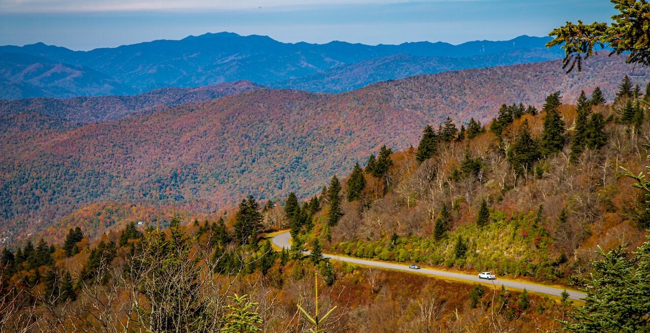
Stunning Scenic Overlooks
Even if a hike up to the summit of Waterrock Knob is not in the cards for you, the perfect scenic vistas that are available right from the Visitor Center’s parking lot will not leave you disappointed.
This vantage point is considered a prime place for stargazing due to the fact that there’s almost no light pollution here. It also offers some killer sunrise and sunset views.
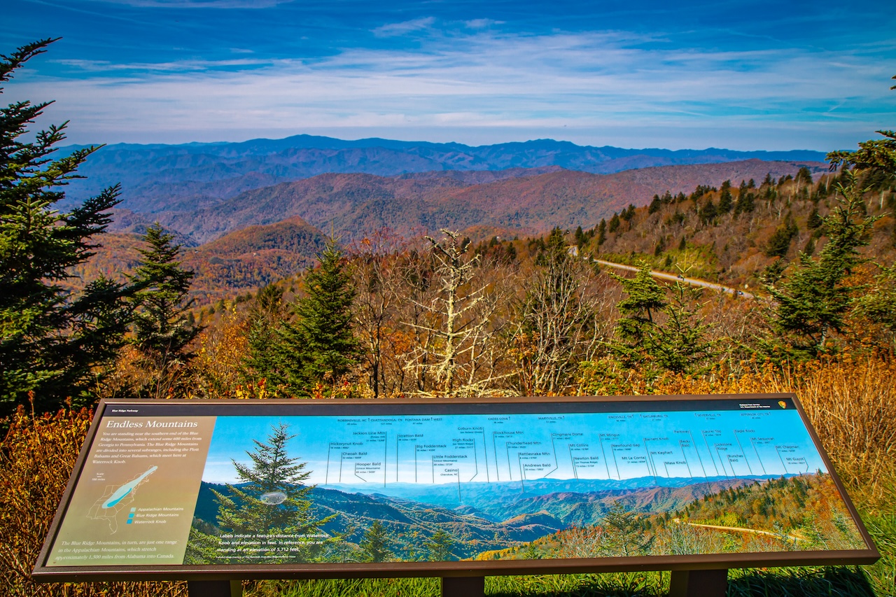
There are also two exceptional official overlooks that provide breathtaking panoramas of the surrounding Blue Ridge Mountains.
The “Endless Mountains” viewpoint offers a bird’s-eye view of the BRP, plus long-range views of Mt. LeConte, Newfound Gap, and Kuwohi in GSMNP.
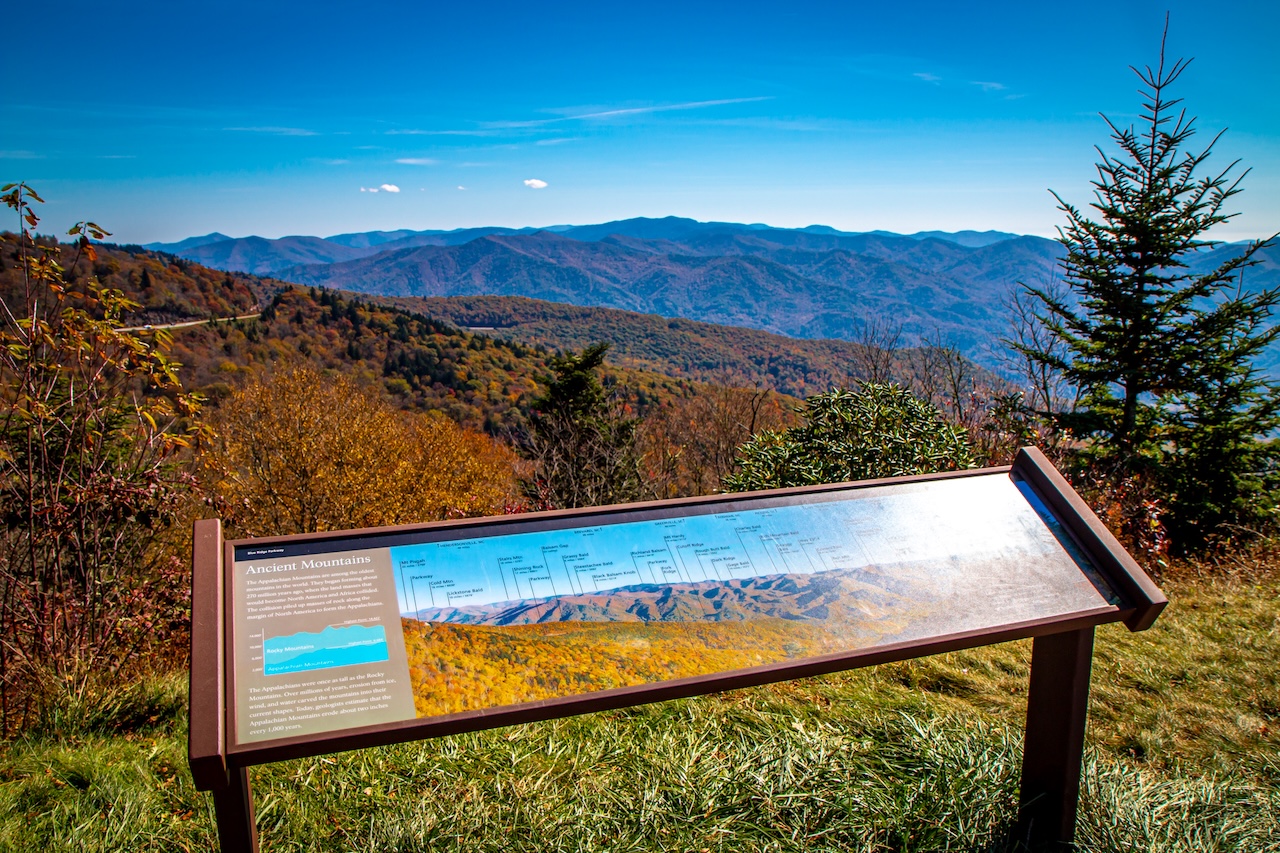
If you head 1/4-mile down the paved trail towards the Waterrock Knob summit, the “Ancient Mountains” viewpoint has great views of Mt. Pisgah, Cold Mountain, Richland Balsam, and more.
READ MORE: The 30 Best Blue Ridge Parkway Overlooks in NC & VA
Hiking & Picnicking
The Waterrock Knob parking lot has several picnic tables for visitors to enjoy, and there’s plenty of space to throw out a picnic blanket and dine as you savor the sensational scenery.
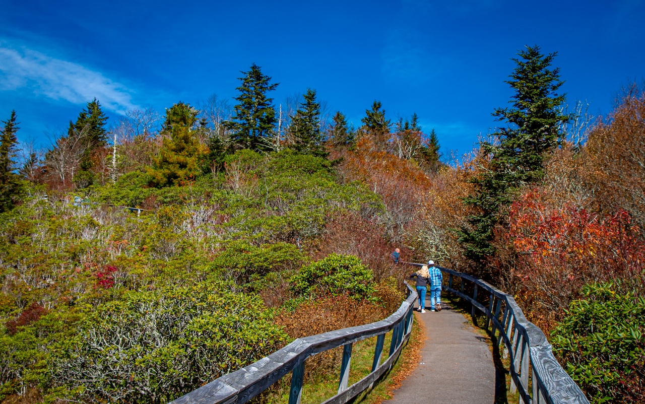
There’s also the Waterrock Knob Trail, which is just over 1 mile round-trip. But it’s definitely a strenuous one– steep and almost straight up!
The summit of Waterrock Knob is 6,292 feet in elevation, with a 412-foot gain from the parking lot. This is the highest point on the Parkway, and the 16th highest mountain in the Eastern US.
This trail is paved for the first 0.2 miles, which takes you to the overlook. After that, it turns into a dirt path, and eventually a rocky, uneven one.
Once you reach the top, you’ll have breathtaking 360º views of the surrounding mountain ranges. On a good day, you can spot the Great Smokies, the Great Balsams, the Nantahalas, and the Blue Ridge Mountains, just to name a few.
READ MORE: The 20 Best Blue Ridge Parkway Picnic Areas in NC & VA
Explore Nearby Attractions

Oconaluftee Visitor Center
Another amazing visitor center– the Oconaluftee Visitor Center in Great Smoky Mountains National Park– is located less than 20 miles away in Cherokee NC.
If you are heading into the Smokies, this visitor center is one you definitely cannot miss. Not only is there a wealth of information o help you plan your trip, but it’s an amazing attraction in itself.
The center has an extensive historical exhibition and a great gift shop. Outside you’ll find the Mountain Farm Museum, one of our favorite living history museums.
This area is also a great place to spot Elk, who love wading in the Oconluftee River!
READ MORE: The 10 Best Blue Ridge Parkway Museums to Visit
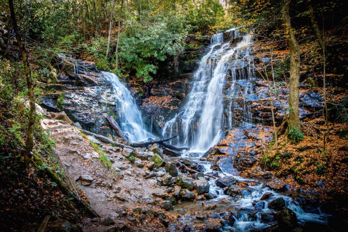
Soco Falls
Just a 12-minute drive from the Waterrock Knob Visitor Center, the spectacular Soco Falls is 30-foot waterfall that splits into two separate falls at the bottom.
The walk down to the recently renovated viewing platform is easy, but you may not get to see the whole of the waterfall from there.
Able-bodied visitors can use the provided rope to guide them down some pretty slippery rocks to the base of the falls, where you can get a much better view.
Winter is the best time to get a good view from the viewing platform, as many of the leaves will have already fallen by then.
READ MORE: The 25 Best Blue Ridge Parkway Waterfalls in North Carolina
Devil’s Courthouse Overlook
Located about 45 minutes away along the Parkway, the Devil’s Courthouse Overlook (Milepost 422.4) offers amazing views of the mountains with no hiking necessary.
From the overlook you’ll get a really good view of the “sinister” looking rock formation, and if you look closely you might see hikers atop it who have reached the summit.
According to Cherokee legend, a giant named Judaculla danced and held court in the cave beneath the summit. The mostly paved trail is only 0.8 miles out and back, but it is a strenuous uphill climb.
Nowadays, most visitors are more excited to witness the special flora and fauna that reside there due to the altitude (5,720 feet in elevation). –by Emma Gallagher & Bret Love; photos by Bret Love & Mary Gabbett
