
Located on US-19, just 1.5 miles off the Blue Ridge Parkway at Soco Gap (Milepost 455.7), Soco Falls is an extremely popular place to visit in Summer and Autumn.
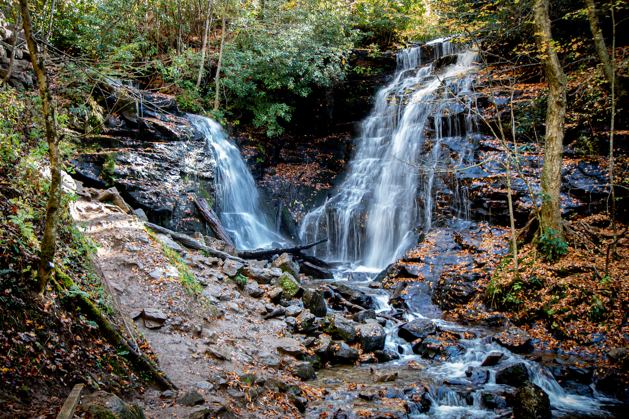
In addition to being very close to the BRP, people love Soco Falls because it’s a rare (and gorgeous) twin waterfall, meaning that two streams come together from different directions.
It also doesn’t hurt that Soco Falls is close to two beloved North Carolina mountain towns– 5.9 miles west of Maggie Valley, and 10.6 miles east of Cherokee.
If you still need more reasons to visit one of our favorite Blue Ridge Parkway waterfalls, there’s also the fact that the “hike” from the Soco Falls parking lot to the observation platform is less than 75 yards.
Read on for our review of Soco Falls, North Carolina, including info on driving directions, parking, hiking the Soco Falls trail, and some fantastic Soco Falls photos!
READ MORE: How to Plan an Amazing Blue Ridge Parkway Road Trip
Soco Falls NC Info
ADDRESS: 7708 Wolfetown Rd, Cherokee NC 28719
PHONE NUMBER: N/A
HOURS: 8AM-8PM Daily
ADMISSION: Free
Driving Directions from Cherokee NC
From Cherokee NC, head south on US-441 S toward U.S. Hwy 19 S, then turn left onto US-441 BUS/U.S. Hwy 19 N. Follow it for 10.6 miles, and you’ll see the Soco Falls parking lot on the right.
Driving Directions from Maggie Valley NC
From Maggie Valley NC, head south on Memory Ln toward Soco Rd. Turn right onto Soco Rd/U.S. Hwy 19 S and follow it for 5.7 miles, where you’ll see the Soco Falls parking lot on the left.
READ MORE: The 20 Best Blue Ridge Parkway Overlooks in North Carolina
Soco Falls/Soco Gap History
Soco Falls is named after the Soco Gap, which serves as the eastern border of the Qualla Boundary, the territory held as a land trust for the Eastern Band of Cherokee Indians.
Located at an elevation of 4,34o feet, the Soco Gap is a mountain pass between the Great Balsam Mountains (to the north) and the Plott Balsams (to the south).
The pass also separates Haywood County from Jackson County, and the river basins of the French Broad River and the Little Tennessee River.
Historically speaking, the Cherokee people knew the area as Ahalunun’yi (“Ambush Place”) or Uni’halu’na (“where they ambushed”).
It was known as such due to a mid-18th century incident in which Cherokee warriors ambushed invaders from the Shawnee tribe. They killed all but one, then cut off his ears and sent him back to tell his tribe what happened.
Soco Falls was a popular hunting place for the Cherokee, because the creeks that fed into it attracted deer, elk, and other NC wildlife.
In the 20th century, Soco Gap was made famous by the Soco Gap Dancers, which were led by my ancestor Sam Love Queen, a.k.a. “The Square Dance King.”
Queen is credited with popularizing Appalachian dance on an international level in the late 1920s, when Franklin D. Roosevelt invited the troupe to perform at the White House for the King and Queen of England.
READ MORE: Why You Need to Visit the Blue Ridge Parkway Visitor Center (MP 384)
Hiking the Soco Falls Trail
The first thing you need to know about Soco Falls NC is that the parking lot for it is small, easy to miss, and gets full VERY quickly in peak season.
If you’re coming from Cherokee NC, just keep an eye out for the small blue sign. There’s no sign on the Maggie Valley route, but the Soco Falls parking lot is around 1.5 miles after you cross under the Blue Ridge Parkway.
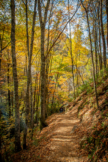
If you’re planning on hiking the Soco Falls trail, understand that while the “hike” is super-short (0.1 miles) and has only 19 feet of elevation gain, it’s not as easy as those stats might suggest.
This NC hiking trail can get very crowded in peak Summer and Autumn. And the brief trail to the wooden observation platform is very narrow, running along the ridge line just below the parking lot.
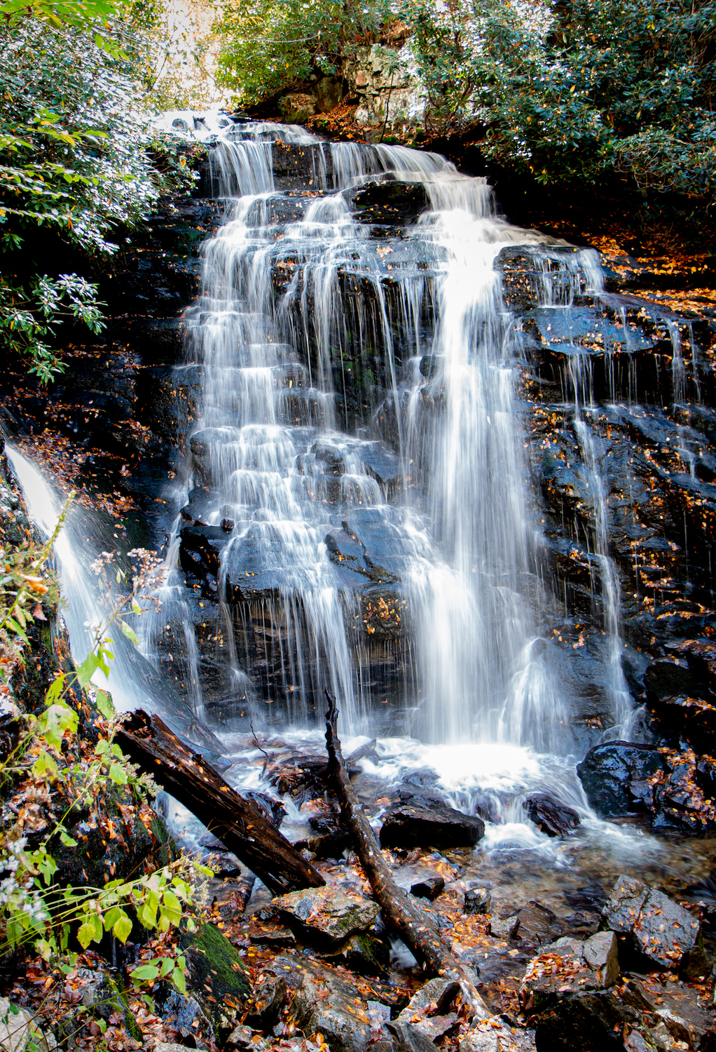
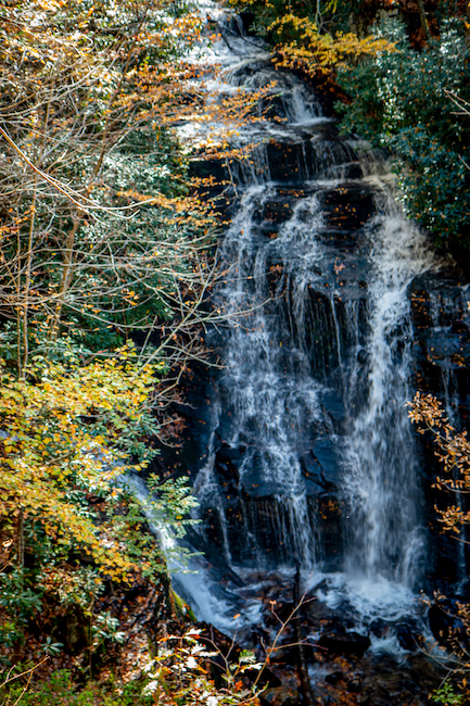
But if you’re content with the partially obstructed view from the platform (pictured above), it’s as easy as waterfall “hikes” get. Suffice it to say that we were NOT content with that view.
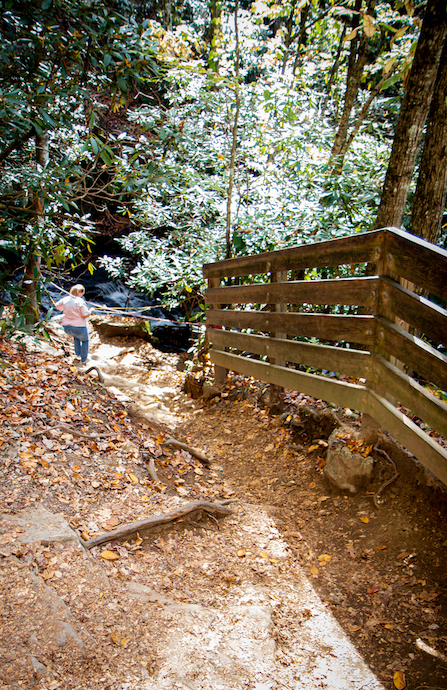
If you want the best Soco Falls photos, you have to make your way down a short but steep hill littered with roots and rocks, which can get very slippery when it rains (as it did the day before we visited).
There’s a wooden fence and guide ropes set up to help you make the descent safely, but we still saw multiple people slip and fall. So we strongly recommend wearing waterproof hiking shoes with good traction.
Once you reach the bottom, you’ll see the twin waterfalls closeup. But you’ll also have to hold onto ropes while scrambling over wet, slippery rocks, and there may be multiple people waiting to come up or down as you do it.
Take your time and be prepared to get a little muddy, but I’d suggest waiting until you reach the very bottom of the trail before even think about pulling out your camera (or phone) to take photos of Soco Falls.
READ MORE: The 10 Best Waterfalls Near Cherokee NC to Visit
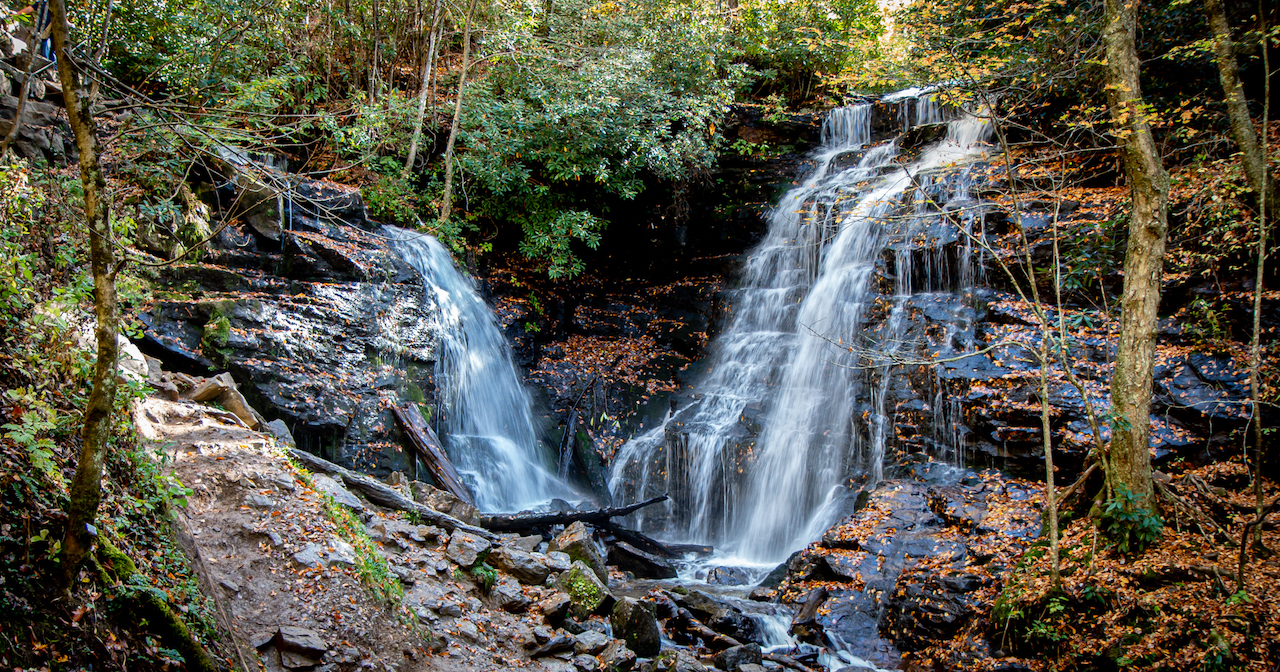
Soco Falls in Full View
Once you’ve made your way past the guide ropes and rock scrambles, the sight of the twin North Carolina waterfalls before you is truly spectacular.
The larger waterfall to the right makes it way some 50+ feet down the hillside before tumbling over the rocks into the pool below.
There’s a smaller waterfall to the left that is almost completely obscured by rhododendrons and other foliage in peak Summer and Autumn (when we visited).
But the spot at the very bottom of the hill at which the photo above was taken offers an exceptional view, not to mention a welcome chance to get steady on your feet after all the slipping, sliding, and scrambling.
Note that this trail is not fit for dogs, small children, or anyone who has bad knees or other mobility issues.
The walk to the observation platform may be easy, but getting down (and especially back up) the hill requires strength, agility, and patience.
We would rate it moderately challenging when the ground is dry, but difficult after recent rains.
Still, the Soco Falls trail remains well worth the effort for those who are up to the task, rewarding you with one of the most unique Western North Carolina waterfalls we’ve visited! –by Bret Love; all photos by Bret Love & Mary Gabbett
