
The Eastern Band of Cherokee Indians strongly resisted the Indian Removal Act of 1830, even as many other Native American tribes were forced westward and out of their own established lands.
After the signing of the Treaty of New Echota, thousands of the Cherokee people who walked the Trail of Tears to Oklahoma died. The rest resettled in the “Indian Territory” west of the Mississippi River.
Around 1000 Cherokee stayed in an area of Western North Carolina, their original homeland, under the condition of having to give the Cherokee citizenship and assimilate as US citizens.
This Eastern Band remained in a remote area along the Oconaluftee River, near what is now the Blue Ridge mountain town of Cherokee NC.
They purchased 57,000 acres of land, which is now known as the Qualla Boundary. It’s right next to what eventually became Great Smoky Mountains National Park.
Today the Qualla Boundary is recognized as a sovereign nation, with its own branches of democratic government. Cherokee schools teach the Cherokee language. (The meaning of oconaluftee is “by the river”.)
Much of the town of Cherokee is centered around telling the story of the Cherokee people, celebrating the culture of the Cherokee, and maintaining a place within their historic homeland for Cherokee people to live.
Read on for our guide to exploring the heart of the area, including the Oconaluftee Indian Village, Oconaluftee Visitor Center, and the best hiking trails in Cherokee NC.
READ MORE: The 25 Best Blue Ridge Parkway Hikes for NC Day Trips

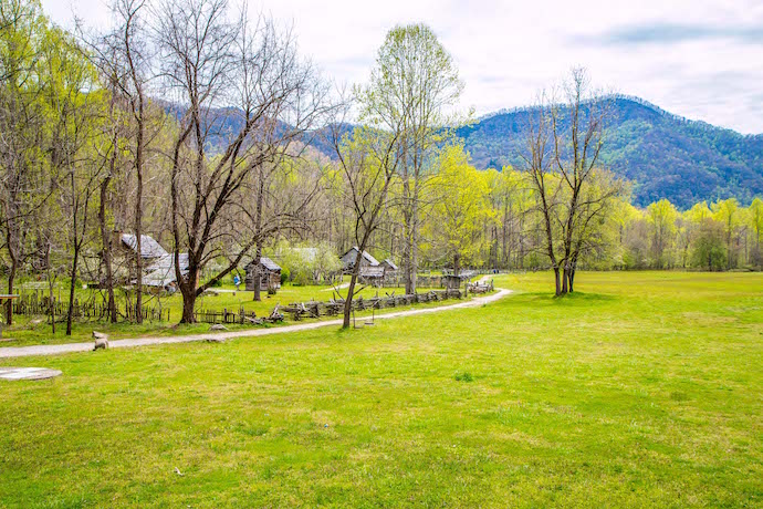
The Oconaluftee Indian Village
288 Drama Rd, Cherokee NC
Phone: 828-497-2111
Hours: April-Oct, 9:30 am – 4:30 pm
Website: Cherokee Historical Association
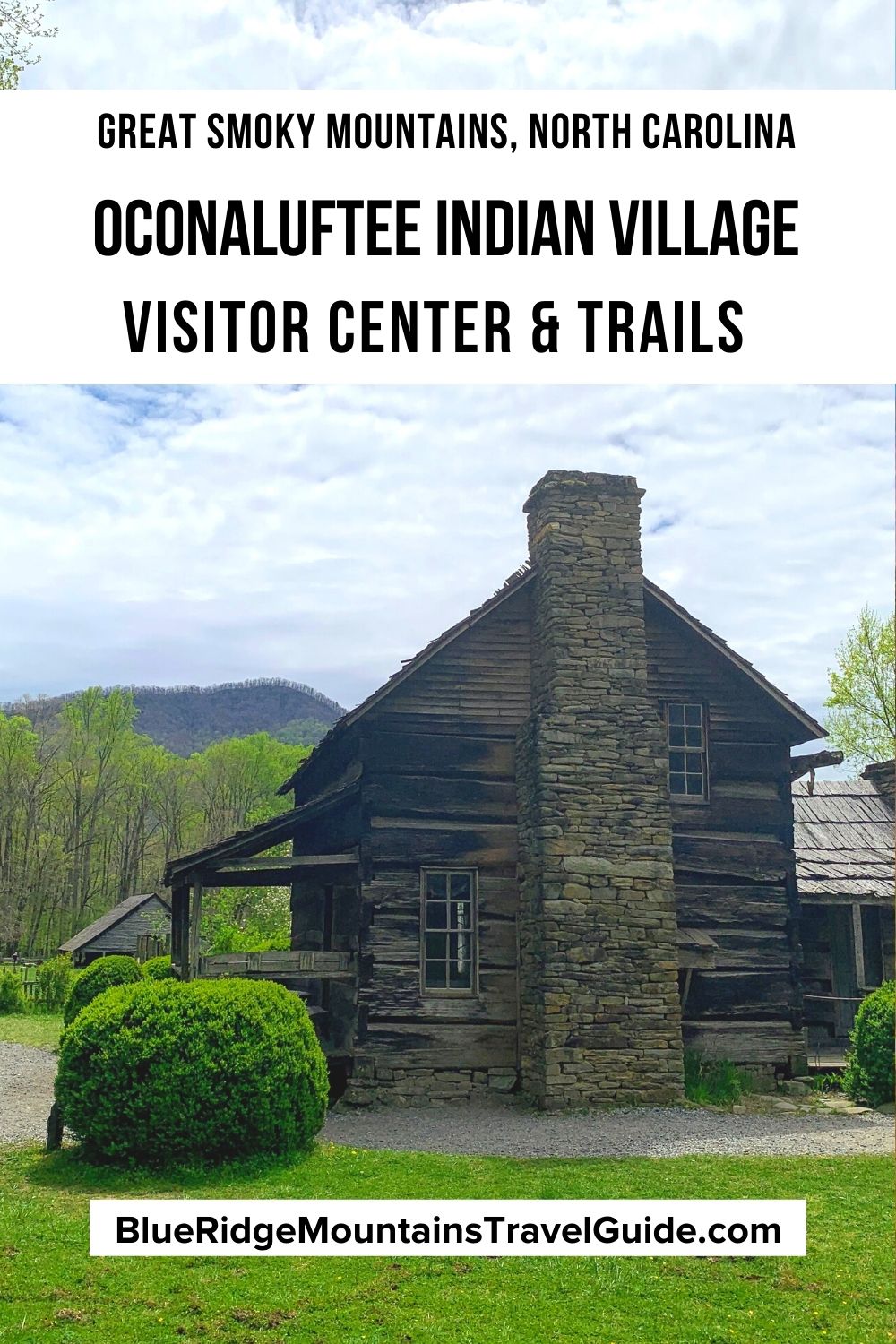
Operated by the Cherokee Historical Association, the Oconaluftee Indian Village is a living history museum in a replica of a late 18th century Cherokee community.
This was before the Indian Removal Act, the Revolutionary War, and Westward Expansion.
So the attraction paints an engaging portrait of Cherokee life before the people and culture had been forever altered by pioneering colonists and government coercion.
The Oconaluftee Indian Village has traditional Cherokee architecture, including homes, workplaces, and religious sites.
Living history interpreters in the village build canoes, make pottery, carve masks, weave baskets, and do beadwork. In addition to visual arts and crafts, they also perform cultural dances as well as a blowgun demonstration.
Oconaluftee Indian Village entry fees are $25 for adults and $15 for children, but it can also be bundled with other attractions in Cherokee NC.
Those bundled attractions include the outdoor drama “Unto These Hills” and the exceptional Museum of the Cherokee People. The mountain town of Cherokee is also home to the Qualla Arts & Crafts Mutual, an excellent co-op of native artisans.
READ MORE: 30 Fascinating Facts About the Appalachian Mountains for Trivia Buffs
The Oconaluftee Visitor Center
1194 Newfound Gap Road, Cherokee, NC • Phone: 828-497-1904
Hours: Dec-Feb 9 am–4:30 pm; March & Nov 9 am-5 pm; April-May & Sep-Oct 9 am-6 pm; June-Aug 9 am-7 pm
Website: Official Website
Great Smoky Mountains National Park is located less than five miles from the small town of Cherokee and the Qualla Boundary.
The Oconaluftee Visitor Center is the newest of the park’s four visitor centers (the others are Cades Cove, Clingmans Dome, and Sugarlands), and the first to be constructed since the 1960s.
The Oconaluftee Visitor Center encompasses 6,300 square feet, with a 1,700-square-foot comfort station next to it. It was built to be a model of energy-efficient design, following the LEED Green Building Rating System framework.
The site was carefully chosen to protect the nearby floodplain and wetlands, and drought-resistant native plants were used in the gardens. Innovative building techniques and materials were used throughout its construction.
The museum at the Oconaluftee Visitors Center provides a great history of the area, from the Native Americans and the European settlers to the Civilian Conservation Corps and the creation of the national park.
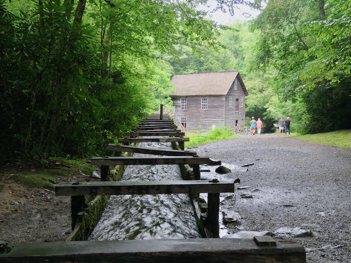
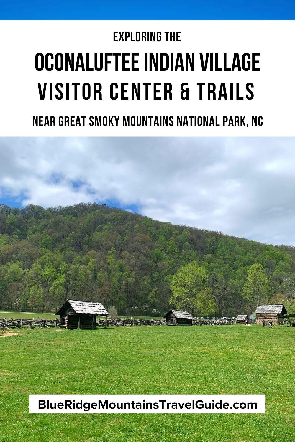
The center also features the Mountain Farm Museum, which is right on the Oconaluftee River and has several log structures to illustrate the farm life of the early European settlers.
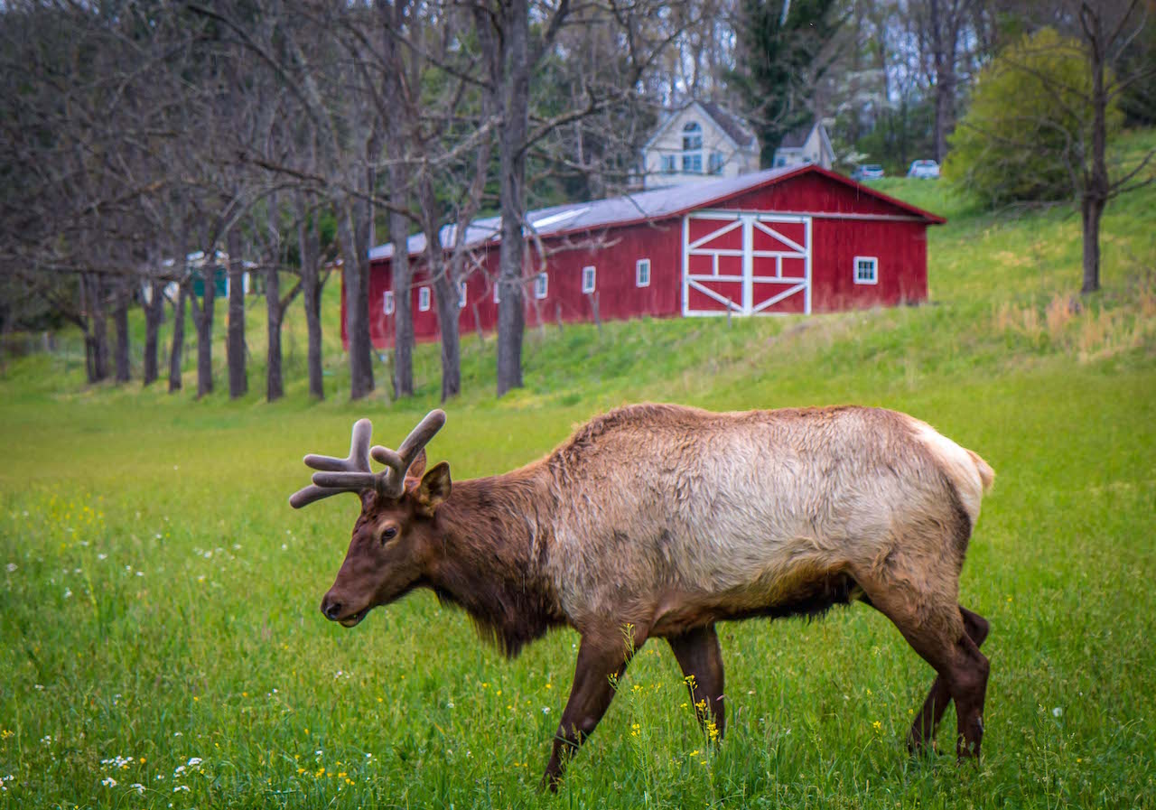
The Elk at the Oconaluftee Visitor Center can often be seen along the road coming in from the town of Cherokee. Other nearby attractions include the Blue Ridge Parkway, Mingus Mill, and the Smokemont Campground.
READ MORE: Appalachian Folklore, Monsters and Superstitions
5 Great Hiking Trails In & Around the Oconaluftee Area
Website: Official Site
The Oconaluftee Visitor Center lies just inside Great Smoky Mountains National Park boundaries, while the Oconaluftee Indian Village is just outside it and the river runs through both the park and Qualla Boundary.
There are several great hiking trails nearby, both in and out of GSMNP, including some first-rate waterfalls, great historic sites, and some deep delves into beautiful forests and mountains.
READ MORE: The 30 Best Waterfalls Near Asheville NC
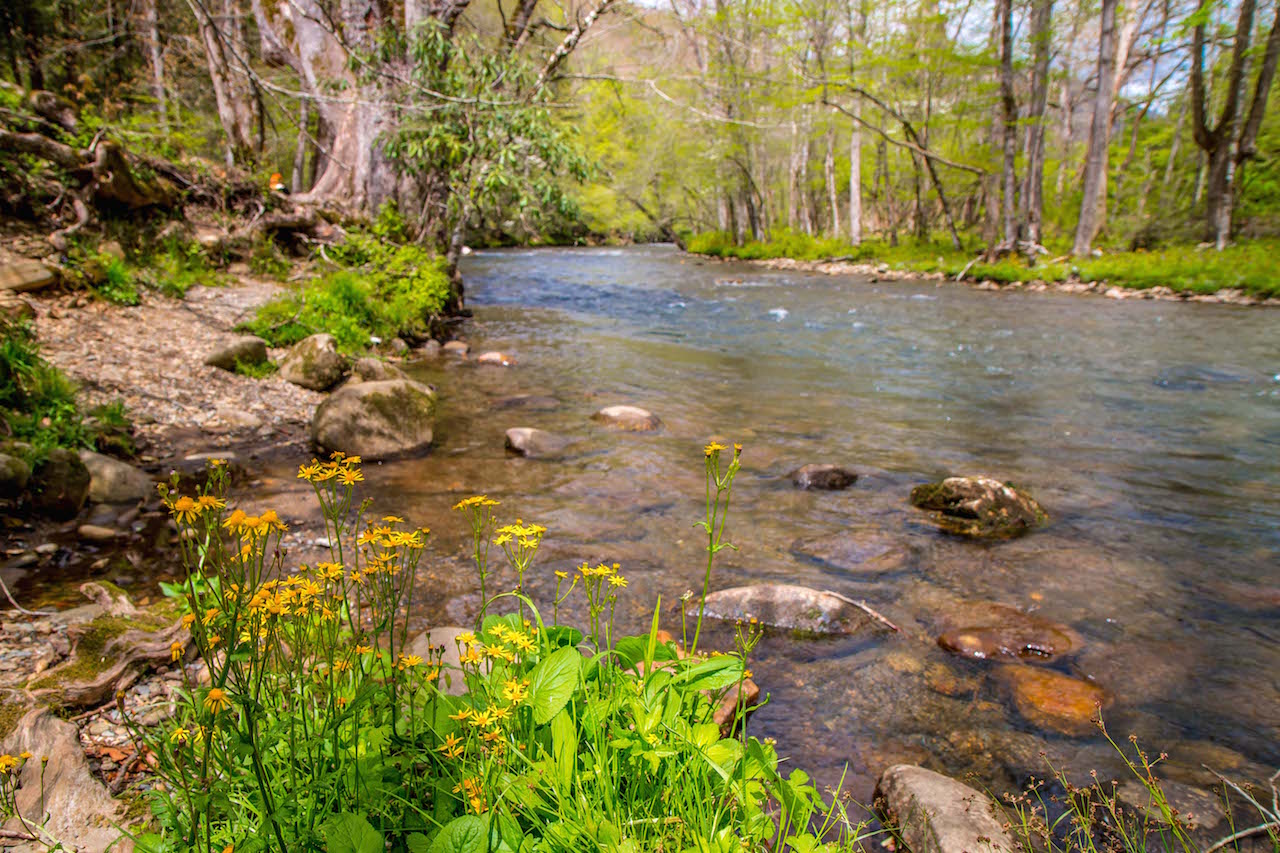
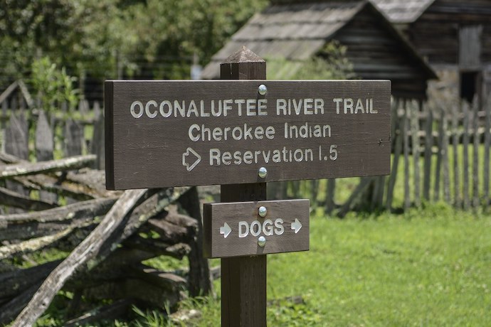
1. Oconaluftee River Trail
Trailhead: Oconaluftee Visitor Center
Distance: 3 miles
The Oconaluftee River Trail is one of only two trails in Great Smoky Mountains National Park upon which visitors can walk, ride bikes, and take dogs.
The easy trail is 1.5 miles long (3 miles roundtrip), traveling along the river from the visitor center to the outskirts of the mountain town of Cherokee.
The Oconaluftee River Trail has lots of placards along the way to teach hikers about the Cherokee history and culture along the river.
It also passes right by the Mountain Farm Museum, so you can learn about the European settlers’ history, too.
READ MORE: The 25 Best Blue Ridge Parkway Waterfalls in North Carolina
2. Mingus Creek Trail
Trailhead: Mingus Mill Parking Lot
Distance: 5.8 miles
This is a fairly difficult in-and-out hike, with an elevation gain of 1500+ feet and a total distance of over five miles.
However, it includes a beautiful stream, a historic grist mill, and lots of colorful North Carolina wildflowers along the way.
The Mingus Creek Trail reaches about 2.9 miles at Deeplow Gap, where hikers can turn back for a nice day hike.
It’s also possible to continue on the trail for another 2.8 miles and 1500 feet in elevation, all the way to Newton Bald!
READ MORE: The Top 15 Waterfalls Near Brevard NC (Transylvania County)
3. Chasteen Creek Trail
Trailhead: Smokemont Campground via Bradley Fork Trail
Distance: 3.6 miles
The Chasten Creek Trail is great because it’s got some leg-stretching distance to it, but it doesn’t kill those who aren’t super fit because the elevation change is very mild.
The hike is filled with beautiful creeks, a few cascades, and lovely wildflowers.
The Chasten Creek Trail actually extends another 3.5 miles beyond this hike, terminating at Hughes Ridge. But this is a lot of uphill travel, making it a fairly strenuous 7.1 miles.
For the milder hike, trekkers can just turn back after taking the spur to visit the Chasten Creek Cascades.
READ MORE: The 10 Best Campgrounds in the North Carolina Mountains
4. Smokemont Loop Trail
Trailhead: Smokemont Campground via Bradley Fork Trail
Distance: 6.5 miles
For those looking for longer, moderately challenging day hikes, the Smokemont Loop Trail is a good option.
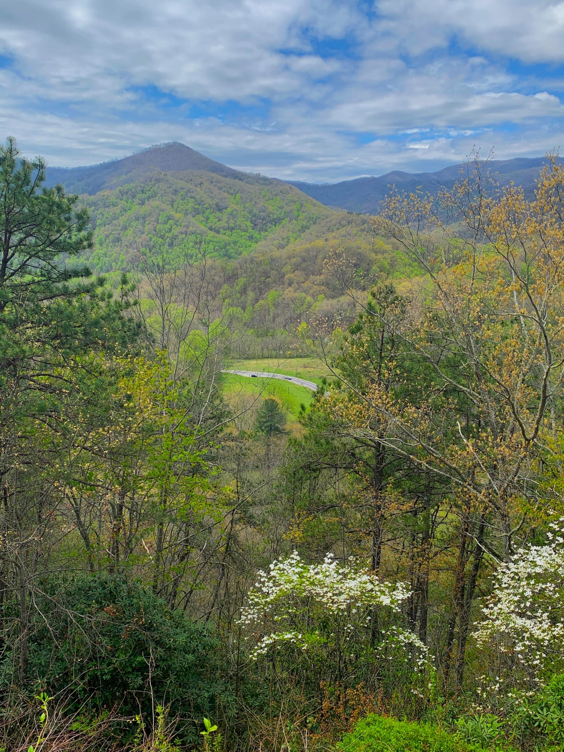
Taking the Bradley Fork Trail (on an old roadbed) leads to the Smokemont Loop Trail, about a half-mile after the Chasten Creek Trail intersection. This loop provides fantastic views of the Oconaluftee River Valley.
After leaving the Bradley Fork Trail, the hike gets considerably more challenging, with quite a lot of uphill hiking.
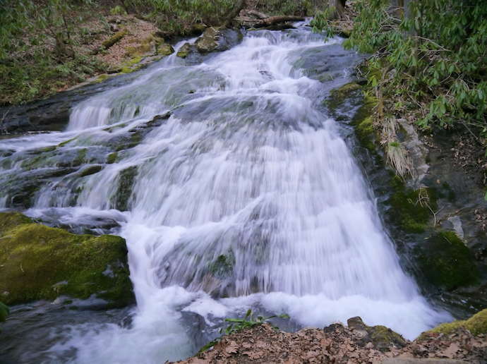
For those who want to add to the adventure, it’s worth taking a detour for an additional mile or so to see the Chasteen Creek Cascades on the Chasteen Creek Trail.
READ MORE: The 52 Best Hikes in North Carolina for the 52 Hikes Challenge
5. Mingo Falls Trail & Soco Falls Trail
Trailhead: Big Cove Road and US-19, respectively
Distance: Les than 0.5 miles
Less about the hiking and more about the waterfalls, the Mingo Falls Trail and Soco Falls Trail are a short drive away from the Oconaluftee area.
But they’re both within the Qualla Boundary and can easily be combined into one morning or afternoon.
Mingo Falls is located about 7 miles from Cherokee, and it is accessed via Big Cove Road. The hike to Mingo Falls is less than half a mile, but it is considered moderately difficult.
Still, the 120-foot-tall falls are totally worth the effort.
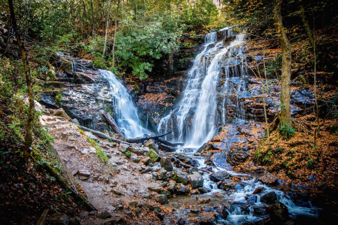
Soco Falls is about 10 miles from Cherokee, and it is accessed via US-19 N. Visitors park in a small lot right off the road and hike down about a quarter of a mile to a viewing platform.
Though short, the path is fairly challenging, but there are guide ropes to help maintain balance on slippery mud. Soco Falls is actually one of the fairly rare twin waterfalls, with beautiful adjacent drops. –by Jonathon Engels; lead image of Elk in Cherokee NC by Bret Love & Mary Gabbett
