
Although there are always a myriad of things to do in our home state, hiking in North Carolina ranks high among my favorite activities.
Many of the best North Carolina hiking trails involve hiking in the mountains in the western part of the state. But the Central Piedmont and Atlantic Coast also have some stellar places to hike in NC.
When my wife Emma and I moved to the state of North Carolina in 2017, we made it our personal mission to explore all the best hiking trails in North Carolina.
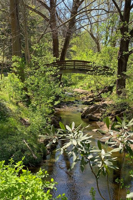
I personally love to hike by the water– creeks, lakes, and rivers– then settle in for a snack with a view.
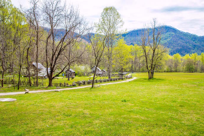
But I also love when trails in urban spaces buck the system. We live in a cabin 40 minutes from Elkin NC, at the foot of Doughton Park on the Blue Ridge Parkway.
In our experience, the best NC hiking trails provide a beautiful glimpse into what makes the state such a great place to live.
Read on for our in-depth guide to the 20 best hikes in North Carolina, including great hiking trails near Asheville, the NC High Country, Charlotte, Raleigh/Durham, and more.
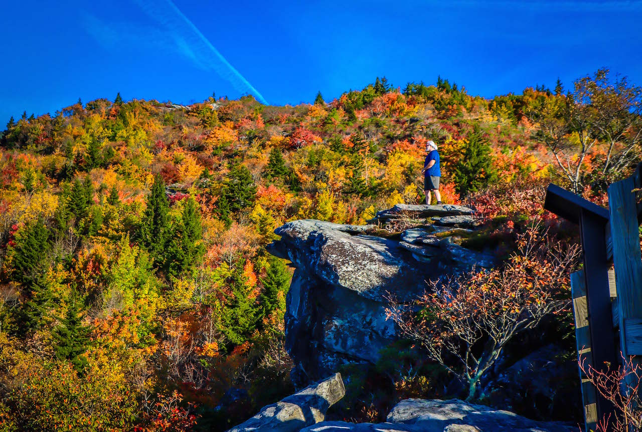
READ MORE: The 20 Best Overlooks on the Blue Ridge Parkway in Fall
Best North Carolina Hiking Trails
(Arranged Geographically & by Level of Difficulty)
- Asheville Urban Trail
- Hard Times Road Trail
- Moore Cove Falls Trail
- Craggy Gardens Trail
- 3-Waterfall Hike in Dupont State Forest
- Bass Lake Loop Trail
- Boone Fork Trail
- Profile Trail to Calloway Peak
- Stone Mountain Loop
- Summit Trail at Elk Knob State Park
- Fall Mountain Trail Loop
- Latta Nature Preserve Trail
- Oconaluftee River Trail
- Deep Creek 3-Waterfall Hike
- Nat Greene Trail
- American Tobacco Trail
- Cox Mountain Trail
- Company Mill Loop
- Grindstone Trail and Mountain Trail Loop
- Hanging Rock Trail
READ MORE: Where are the Blue Ridge Mountains? A State-by-State Guide
Hiking Near Asheville NC

1. Asheville Urban Trail (Asheville NC)
Level of Difficulty: Easy
Distance: 1.7 miles
Elevation Gain: NA
For a fun departure from the typical nature trail, the Asheville Urban Trail is a fantastic way to explore Downtown Asheville, learn some Asheville history, and check out local art along the way
This Asheville trail is 1.7 miles, with 30 stations across 5 historical eras. Each has a piece of art and a plaque explaining the cultural and/or historical significance of the site.
The lovely stroll along Asheville’s sidewalks can take as little as an hour. But we like to linger in different places as we go, checking out cafes, bookstores, shops, and Asheville Breweries.
So many people visit Asheville, only to rush out into the wilds of the Blue Ridge Mountains and Great Smoky Mountains. But great Asheville hiking is available right in town!
READ MORE: The 35 Best Things to Do in Asheville NC
2. Hard Times Road Trail (Asheville NC)
Level of Difficulty: Easy
Distance: 6 miles
Elevation Gain: 60 feet
Frequently cited as some of the best hiking in Asheville NC, the Hard Times Road Trail offers a long (but gentle) trek through the Bent Creek Experimental Forest.
This route through a 6,000-acre section of Pisgah National Forest is a favorite among locals. It has trailheads in Bent Creek, as well as the NC Arboretum and Blue Ridge Parkway.
The trail provides fabulous vistas of Lake Powhatan and the Appalachian Mountains, as well as distant views of the Biltmore House and Asheville’s skyline.
Hard Times Road Trail also has mountains, lakes, creeks, rivers, and wide walking paths, and even connects with the Mountains-to-Sea Trail for a short time.
READ MORE: The 10 Best Things to Do in Winston Salem NC
3. Moore Cove Falls Trail (Brevard NC)
Level of Difficulty: Easy
Distance: 1.4 miles
Elevation Gain: 250 feet
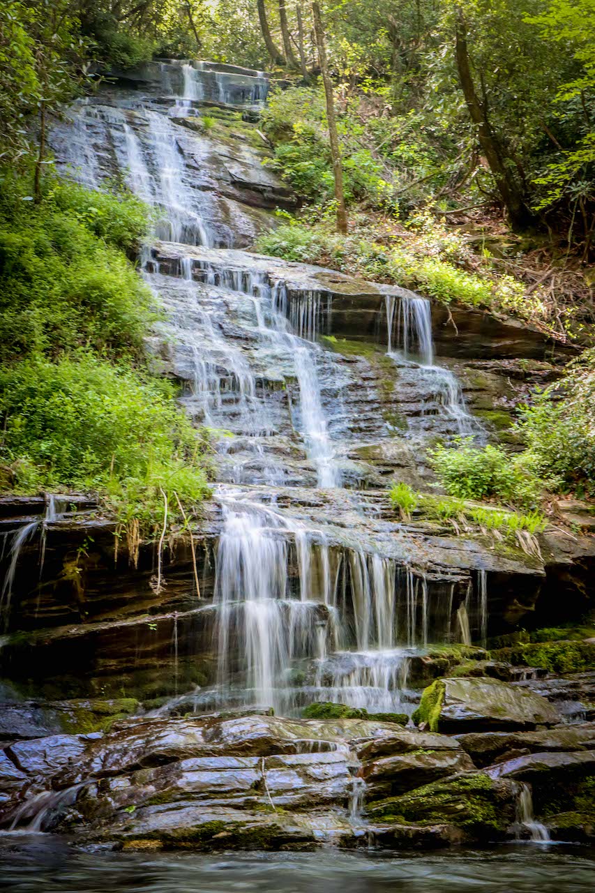
This is a quick, rewarding trek in the heart of Pisgah National Forest amongst a gluttony of North Carolina waterfalls. We consider it one of the best hikes near Brevard NC.
The Moore Cove Falls trailhead is right off US-276, which runs through the Pisgah Ranger District of PNF.
This trail is 1.4 miles round-trip, with about 250 feet of elevation gain. At the waterfall, it’s possible for agile hikers who are unafraid of getting wet to wade into the water for better views.
Accessible, no-hike-necessary waterfalls like Looking Glass Falls and Sliding Rock Falls are about a mile from Moore Cove Falls. The Cradle of Forestry is also close by on US-276.
READ MORE: Camping in Asheville NC: The 15 Best Campgrounds to Visit
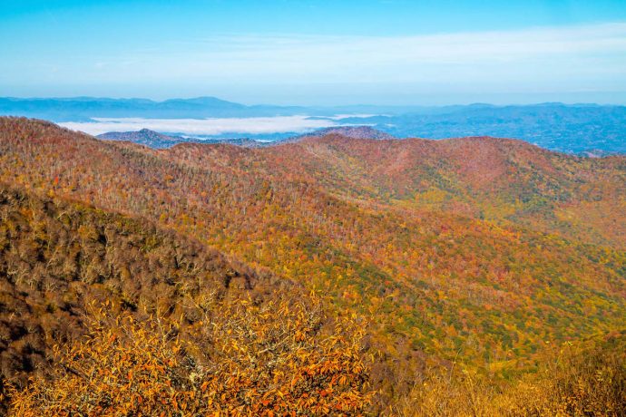
4. Craggy Gardens (Blue Ridge Parkway NC)
Level of Difficulty: Moderate
Distance: 1.9 miles
Elevation Gain: 575 feet
Too remote to be part of any town, Craggy Gardens has some of the most beloved hikes near Asheville NC on the Blue Ridge Parkway.
Though technically closer to the town of Black Mountain, Craggy Gardens offers magnificent views, hiking trails, and wildflowers just 20 miles from Downtown Asheville.
The 1.9-mile Craggy Gardens Trail offers the best hiking in the area, with great North Carolina birdwatching and blueberry foraging along the way.
For those seeking less of a challenge, the Craggy Pinnacle Trail is only a mile and has less than half the elevation gain. It also has a phenomenal view from the summit, especially during Fall in North Carolina!
READ MORE: The 25 Best Blue Ridge Parkway Hikes for NC Day Trips
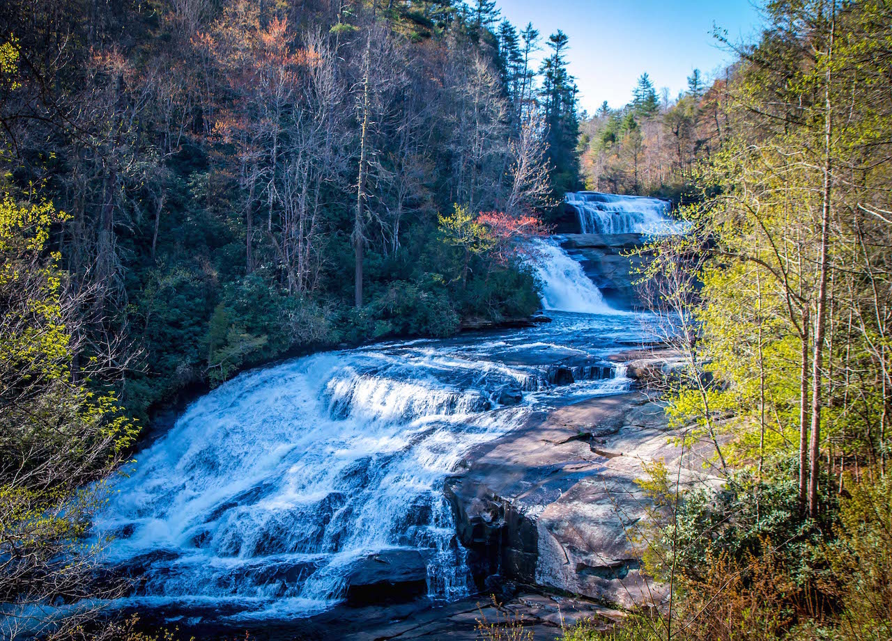
5. DuPont State Forest Waterfalls Trail (Brevard NC)
Level of Difficulty: Moderate
Distance: 3 miles
Elevation Gain: 510 feet
In reality, the best hiking in Asheville NC usually means finding hiking trails near Asheville. About an hour south, near Brevard NC, is where you’ll find many of the best hikes near Asheville.
Being an ardent waterfall chaser, my favorite is the 3-mile waterfall hike in Dupont State Forest. It’s home to my top waterfall near Brevard (and in the entire state of North Carolina), Triple Falls.
The other two waterfalls on the hike, Hooker Falls and High Falls, can also be accessed from their respective trailheads (High Falls Access Area is near the forest’s Visitor Center).
Another popular waterfall in the park is Bridal Veil Falls, which was famously featured in the Daniel Day-Lewis film, The Last of the Mohicans.
READ MORE: The 20 Best Things to Do in Brevard NC & Transylvania County
Hiking Near Boone NC
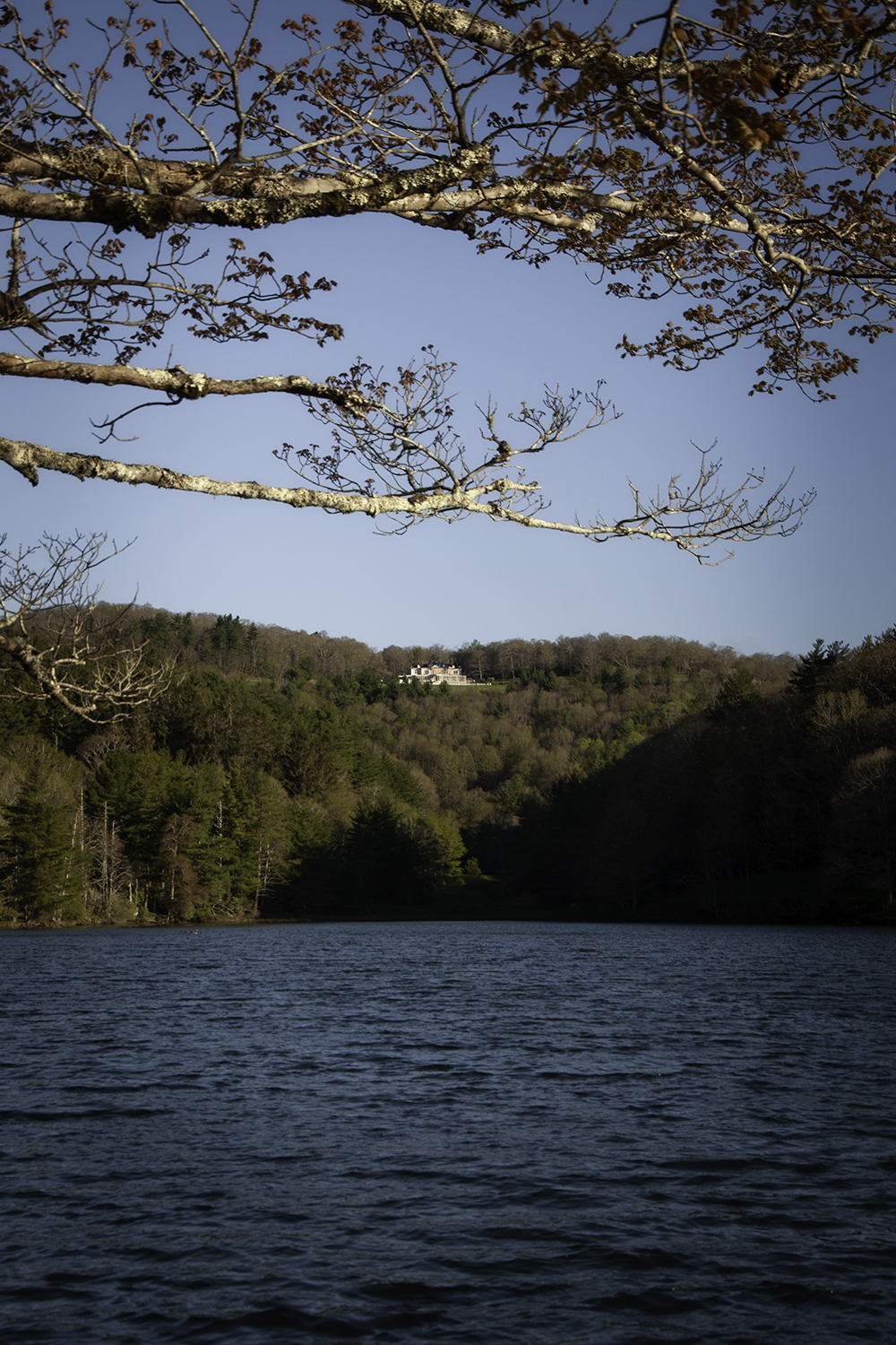
6. Bass Lake Loop Trail (Blowing Rock)
Level of Difficulty: Easy
Distance: 0.9 miles
Elevation Gain: 20 feet
Moses H. Cone Memorial Park features are more than 25 miles of horse-and-carriage roads that double as fantastic NC hiking trails.
There are three lakes on the property, old apple orchards, and the impressive Moses Cone Manor House.
The horse-and-carriage tracks were built with inclines shallow enough for horses to pull wagons on, which makes for miles of easy-going hiking trails in NC.
Bass Lake Trail is a quick, easy hike that circles a beautiful mountain lake, gives distant glimpses of the manor, and has amazing views of the Blue Ridge Mountains.
I usually like to go for a lengthy hike, so I recommend making a longer loop circle down to Bass Lake from the Manor House and climbing back up on the other side of the lake.
READ MORE: The 20 Best Places for Horseback Riding In/Near Asheville NC
7. Boone Fork Trail (Blowing Rock NC)
Level of Difficulty: Moderate
Distance: 5.5 miles
Elevation Gain: 525 feet
One of the best hiking trails in Boone NC, the Boone Fork Trail is about 9 miles south of town, right off of the Blue Ridge Parkway.
It’s part of Julian Price Memorial Park, which features an amazing North Carolina lake surrounded by mountains, campgrounds, a picnic area, and 4,200 acres to explore.
The Boone Fork Trail is an awesome loop that provides access to Hebron Falls, neighbors beautiful mountain creeks, and has lots of rhododendrons. It’s first mile includes an interactive TRACK Trail for the kids.
This route is also part of the Mountains-to-Sea Trail, linking the Great Smoky Mountains to the Outer Banks of North Carolina.
READ MORE: The 20 Best Things to Do in Blowing Rock NC
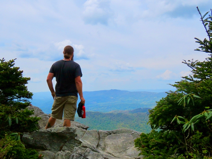
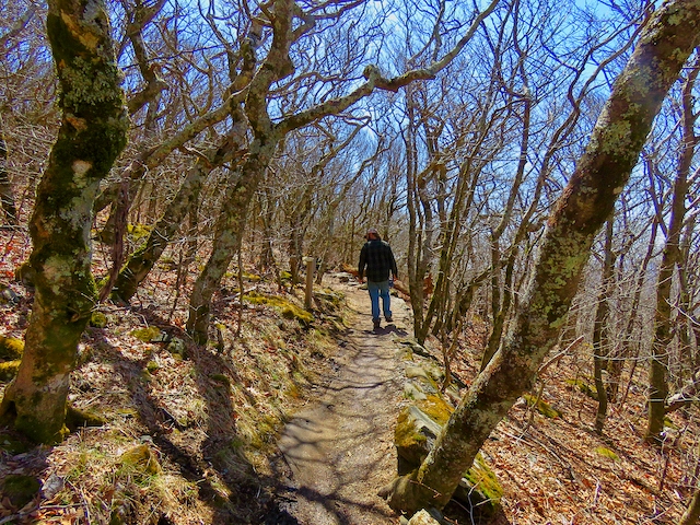
8. Profile Trail to Callaway Peak (Blowing Rock NC)
Level of Difficulty: Strenuous
Distance: 7.4 miles
Elevation Gain: 2125 feet
Hiking from Profile Trail to Callaway Peak (the highest point in Grandfather Mountain State Park) includes serious elevation gain. But it’s filled with magical cascades, rock formations, and insane views.
It’s the only trailhead at the entrance near Banner Elk, and the hike to the peak is longer this way. So this is definitely a trail for serious hikers only!
First the Profile Trail crosses over the Watauga River, then climbs through hardwood forests en route to Shanty Spring.
Then the path turns to a staircase of tumble-down rocks all the way up to the Grandfather Trail, which leads to Callaway Peak.
If you’re up for a truly challenging day hike, I highly recommend this route, which is one of my personal favorites in the state.
READ MORE: The 15 Best Things to Do in Banner Elk NC
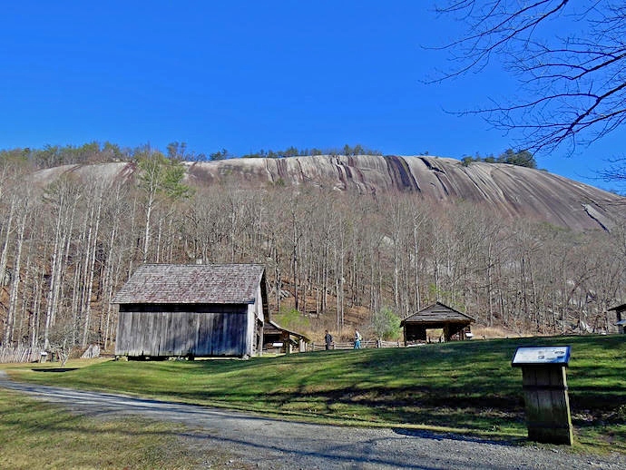
9. Stone Mountain Loop (Elkin NC)
Level of Difficulty: Strenuous
Distance: 4.5 miles
Elevation Gain: 940 feet
Located about an hour northeast of Boone NC, Stone Mountain State Park is a fantastic destination.
It has a number of Western North Carolina waterfalls, an old homestead, and the famous (not infamous, a la Georgia’s Stone Mountain) rock face.
The premier hike in Stone Mountain State Park is the Stone Mountain Loop, which summits the mountain, passes the Hutchinson Homestead, and visits the 200-foot-tall Stone Mountain Falls.
This hiking trail is 4.5 miles long, has an elevation change of nearly 1000 feet, and features some spots with rough terrain.
Starting at the Lower Parking Lot, climbing the mountain, and looping back around through the valley is the way to go.
I love this hike because it’s really close to my house, and I typically do it several times a year.
READ MORE: The 15 Best Things to Do in Elkin NC & the Yadkin Valley
10. Summit Trail (Todd NC)
Level of Difficulty: Strenuous
Distance: 3.8 miles
Elevation Gain: 975 feet
Elk Knob is one of the taller mountains for hiking in the North Carolina High Country. It’s located just a few minutes north of Boone NC, inside one of the newer NC state parks.
This park was formed in the early 2000s to protect the headwaters of the New River, which is ironically one of the oldest rivers in the world.
Elk Knob State Park now has over 5 miles of hiking trails, and it’s open for cross-country snow skiing in the winter.
The top hike in Elk Knob State Park is the Summit Trail, which climbs to the top of Elk Knob (5,520 feet).
From the summit, it’s possible to see Mount Rogers (the highest peak in the Blue Ridge Mountains of Virginia) and Grandfather Mountain (the highest in Watauga County NC).
I found this NC hike to be particularly good because the flora was quite distinct, and volunteers spent months making a wonderful route up the mountain.
READ MORE: The 10 Best Waterfalls Near Boone NC
Hiking Near Charlotte NC
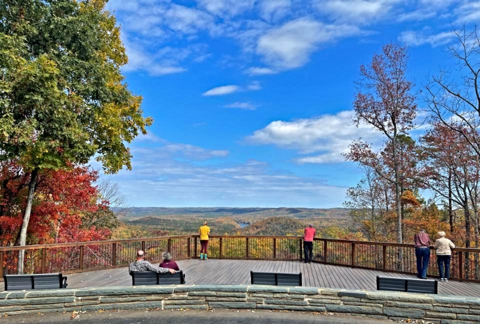
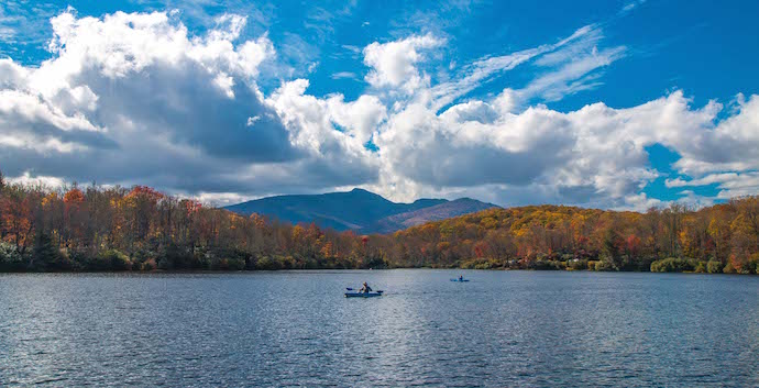
11. Fall Mountain Trail Loop (Morrow Mountain State Park)
Level of Difficulty: Moderate
Distance: 4.1 miles
Elevation Gain: 550 feet
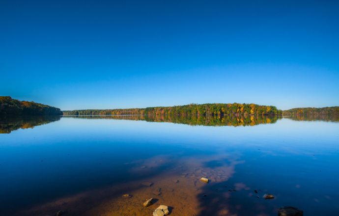
Morrow Mountain State Park is located about 50 miles east of Charlotte NC, next to the Uwharrie National Forest.
The state park’s major features include the Yadkin River, Lake Tillery, and Morrow Mountain, plus approximately 20 miles of hiking trails.
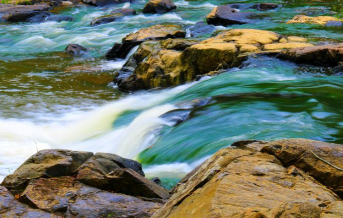
Our favorite route, the Fall Mountain Trail Loop, follows along the Yadkin River for a while before heading up in elevation to the mountain’s summit.
I really love loop trails and walking by the water, and this one has both the Yadkin River and a nice mountain stream as well.
Who doesn’t love a good vista from atop a mountain? That’s why this is the most popular hiking trail in the park!
READ MORE: The 10 Best National Parks in North Carolina to Visit
12. Latta Nature Preserve Trail (Huntersville NC)
Level of Difficulty: Moderate
Distance: 5 miles
Elevation Gain: 337 feet
Located just north of Charlotte (next to Lake Norman), the Latta Nature Preserve offers 16 miles of hiking trails, picnic areas with shelters, and kayak launch areas.
It also features the Carolina Raptor Center and Quest Center, which are great for families with kids.
There’s a lot to see in the Latta Nature Preserve on the Historic Latta Plantation (which is reportedly haunted). It borders Mountain Island Lake, and is open to fishing and kayaking.
The Latta Nature Preserve Trail is a combination of trails that create a relatively flat and smooth figure-8 route.
This is an awesome place away from the hustle and bustle of Charlotte, and the traffic moving north from it.
Regardless of your route, this is one of the best hiking trails near Charlotte NC. The town of Huntersville NC also has lots of nice restaurants and spots to grab a beer.
READ MORE: Christmas Town USA: 10 Ways to Celebrate in McAdenville NC
Hiking Near Cherokee NC
13. Oconaluftee River Trail (Cherokee)
Level of Difficulty: Easy
Distance: 3.1 miles
Elevation Gain: 50 feet
The town of Cherokee in the Qualla Boundary is right next to Great Smoky Mountain National Park. So finding a good trail to hike isn’t a difficult task.
That being said, I recommend the Oconaluftee River Trail, because hiking by water is always more fun!
It leaves from the Oconaluftee Visitor Center, passing by the Mountain Farm Museum (a favorite resting place for a small heard of elk).
This in-and-out route is a great way to get your feet wet in the park.
The trail is easily accessed from Cherokee NC or the Blue Ridge Parkway. It’s also near Mingus Mill, one of the coolest historic sites in the national park.
READ MORE: The 10 Best Waterfalls Near Cherokee NC to Visit
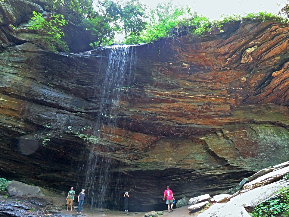
14. Deep Creek 3-Waterfall Hike (Bryson City)
Level of Difficulty: Moderate
Distance: 2.4 miles
Elevation Gain: 450 feet
Easily one of the best hiking routes in the Great Smoky Mountains, the Deep Creek Loop Trail has three unique and impressive waterfalls. I was blown away in different ways by each of them.
The first waterfall on the hike is the crazy Tom Branch Falls. It’s an easy ¼-mile hike on a wide, level dirt road.
It’s 60 feet tall and drops down a cliff face into Deep Creek. It’s unlike any waterfall I’ve ever seen, and you can often see people river tubing nearby.
The second waterfall is Indian Creek Falls, which is an awesome picnic spot. A little spur route goes down to the base of the falls, where you can sit on an island looking up at the falls while having a snack.
Juney Whank Falls is a 90-foot waterfall with a bridge that goes across it halfway down. All in all, this route is a major one on our bucket list for NC hiking trails.
READ MORE: 20 Best Things to Do in Bryson City NC & Swain County
Hiking Near Greensboro NC
15. Nat Greene Trail (Greensboro NC)
Level of Difficulty: Moderate
Distance: 6.6 miles
Elevation Gain: 380 feet
Greensboro has over 30 miles of hiking trails, and another 30+ miles of multi-use trails.
Many of the routes are along North Carolina’s Mountain-to-Sea Trail, which stretches over 1,400 miles from Great Smoky Mountains National Park to the Outer Banks.
Sections on the MST in the northern reaches of Greensboro include walks by Belews Lake, Lake Brandt, Lake Townsend, and in Haw River State Park. In other words, all of these trails are worthy of a hike!
Pressed to pick just one, I went with the Nat Greene Trail because it’s among the oldest and most popular hiking trails in Greensboro NC.
The path traces Lake Brandt’s southern edge and includes a marina, a 400-foot boardwalk, and interpretive signs to learn about the local trees.
READ MORE: The 20 Best Places to Celebrate Christmas in NC
Hiking Near Raleigh/Durham

16. American Tobacco Trail (Durham NC)
Level of Difficulty: Easy
Distance: 22.6 miles
Elevation Gain: NA
The American Tobacco Trail is part of the Rails-to-Trails project, which uses abandoned railroad beds to make awesome hiking trails. This railway was built by the American Tobacco Company in the 1970s.
Part of the East Coast Greenway, the route in its entirety links Durham County, Chatham County, and Wake County, including the City of Durham and the Town of Cary.
If you’re looking for hiking in Durham, the American Tobacco Trail is an excellent option, offering a 10-foot-wide, paved path within the city.
Its northern terminus is at the Durham Bulls Athletic Park, and it travels south through the city from there.
This is a set-your-own distance, in-and-out type hike. It can link the Athletic Park to The Streets at Southpoint Mall in 7.7 miles, one way.
READ MORE: 10 Great Train Rides in North Carolina
17. Cox Mountain Trail (Durham NC)
Level of Difficulty: Moderate
Distance: 4.2 miles
Elevation Gain: 410 feet
Located just 10 miles from Downtown Durham, Eno River State Park is one of the best places for enjoying nature in the Triangle (which includes Raleigh, Durham, and Chapel Hill).
This park has over 30 miles of hiking trails, some paddling routes, and numerous fishing spots.
Its most popular (and largest) access area is Fews Ford, which also provides access to the Cox Mountain Trail.
The Cox Mountain Trail follows along the river for some time before veering up to the top of Cox Mountain.
It’s a lovely loop trail that is both well-trodden and well-marked.
READ MORE: The 20 Best Places to Visit in North Carolina
18. Company Mill Loop
Level of Difficulty: Moderate
Distance: 5.9 miles
Elevation Gain: 640 feet
I’ll almost always choose a good loop trail over an in-and-out route, because loops expose hikers to more of the surrounding landscape.
The Company Mill Loop is my favorite trail at Umstead State Park in Wake County, just 10 minutes from Downtown Raleigh NC.
In reality, the park has tons of hiking (nearly 35 miles), as well as 13 miles of biking trails, 13 miles of horseback riding trails, and paddling to boot.
But the Company Mill Loop is the most popular route in the park. It’s located right at the main entrance, has plenty of length without the challenging elevation shifts, and features beautiful waterways.
READ MORE: The 15 Best Romantic Getaways in NC (Cabins, Inns & Resorts)
Hiking Near Winston Salem NC
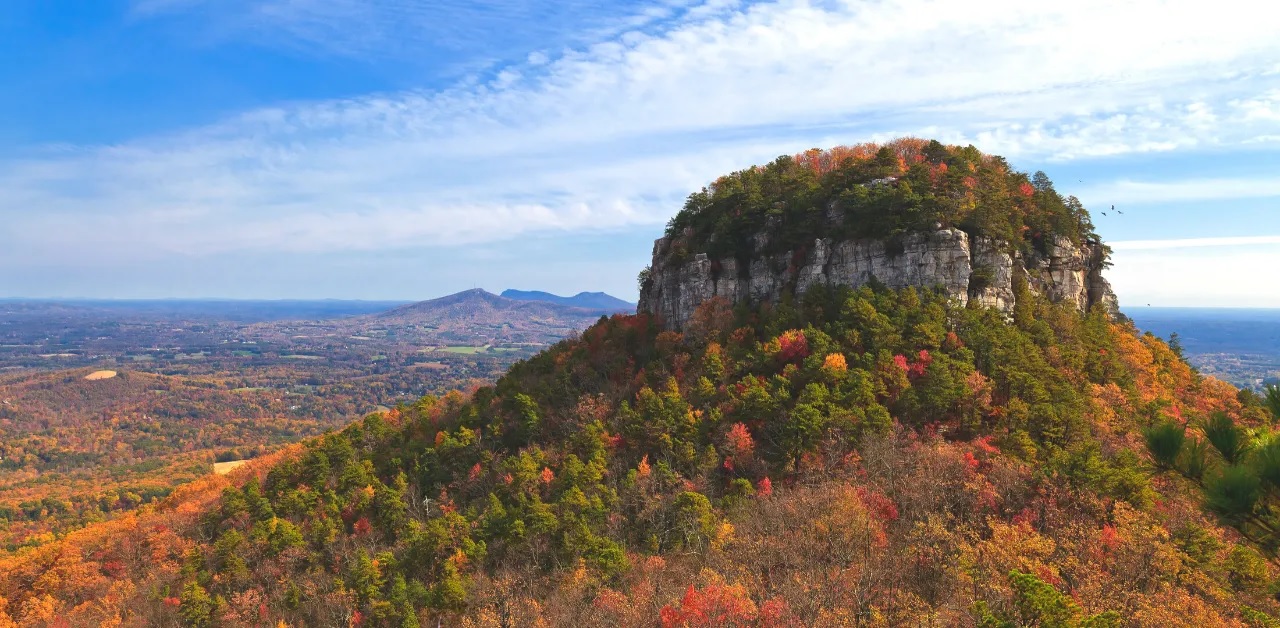
19. Grindstone Trail & Mountain Trail Loop (Pilot Mountain)
Level of Difficulty: Moderate
Distance: 9.6 miles
Elevation Gain: 1555 feet
Located between Mount Airy and Winston Salem, Pilot Mountain has been an iconic beacon for navigation for centuries (and maybe millennia).
It’s a dynamic, distinctive feature that towers above the North Carolina Piedmont landscape that surrounds it.
I absolutely adore this hike. It’s a tough climb up, but there is a lot to see and do at the summit(s). There are fantastic views, a fabulous picnic area, and two peaks, Little Pinnacle and Big Pinnacle.
Pilot Mountain State Park also has a really nice visitor center, as well as an entire section of other trails that celebrate the Yadkin River and Bean Shoals.
READ MORE: The 10 Best Things to Do in Mount Airy NC (& Surry County)
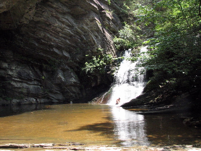
20. Hanging Rock Trail (Danbury NC)
Level of Difficulty: Moderate
Distance: 2.4 miles
Elevation Gain: 600 feet
There are some steep sections and rocky terrain to deal with on the Hanging Rock Trail. But it’s a really rewarding summit with comfy spots to sprawl, boulders for clambering, and sweeping views to behold.
It’s located in the Sauratown Mountains, an interesting range that is separate from the nearby Blue Ridge and includes the famous Pilot Mountain.
Hanging Rock State Park also has lots of other features that warrant a visit, many of which can be combined with this hiking trail.
There are several nice waterfalls in the park with a swimming hole (Lower Cascades is my favorite), and there’s a nice lake with a beach.
The park is located 28 miles east of Mt Airy NC, and 30 miles north of Winston-Salem. –Jonathon Engels; lead photo by Bret Love & Mary Gabbett
