
Located in Virginia’s Blue Ridge region, Roanoke VA boasts a winning blend of the attractions and activities you’d expect from a small city, surrounded by the immense natural beauty of the best mountain towns.
The McAfee Knob trail is by far the most popular place for hiking in the Blue Ridge Mountains near Roanoke.
It arguably ranks alongside the Appalachian Trail and NC’s Mountains to Sea Trail among the most popular hikes in the entire region (or the United States, for that matter).
At nearly 8 miles round-trip, the McAfee Knob hike is long enough that you’ll feel justified getting French fries and an awesome Roanoke microbrew for lunch. But it’s tame enough that the trail stays justifiably crowded.
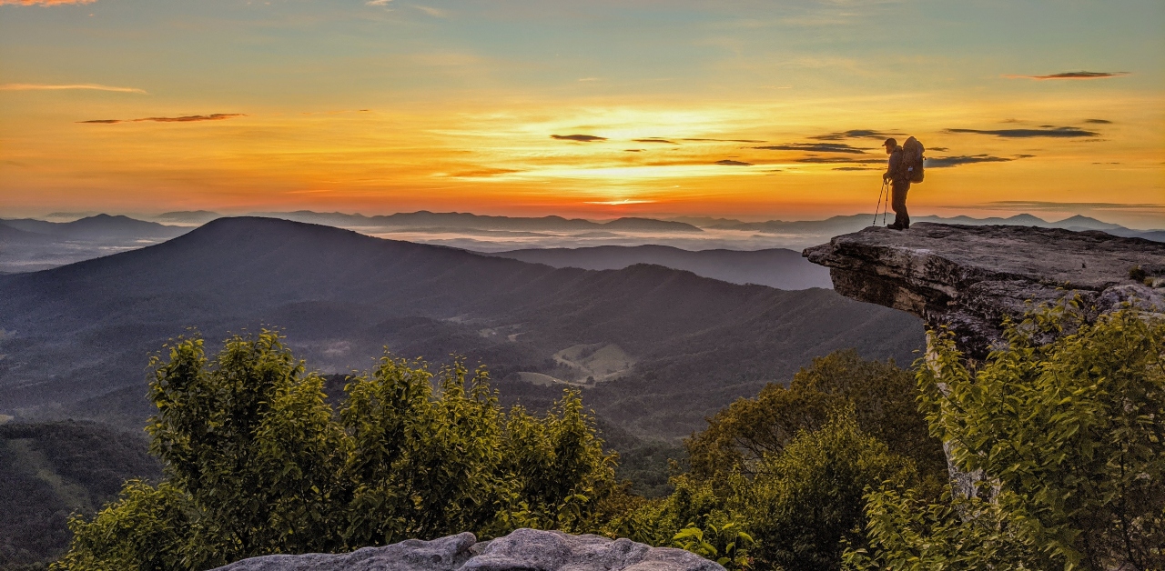
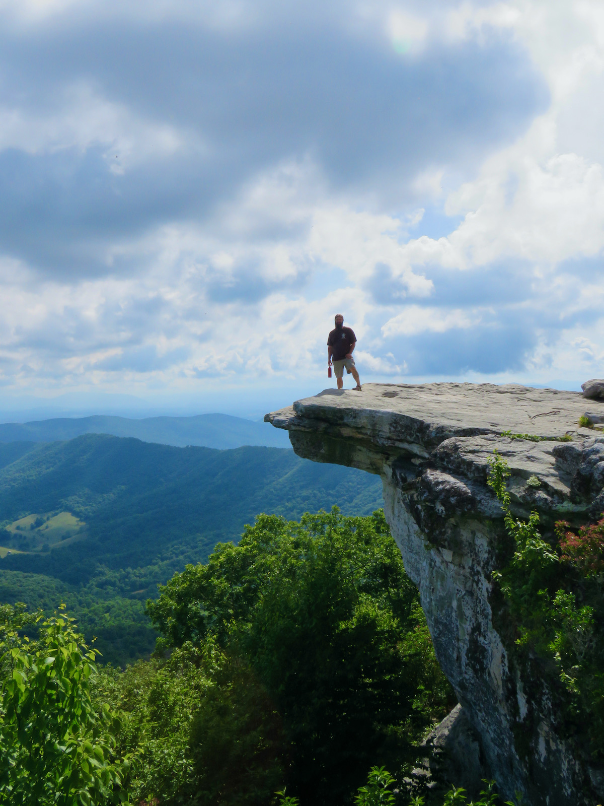
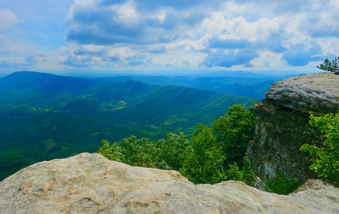
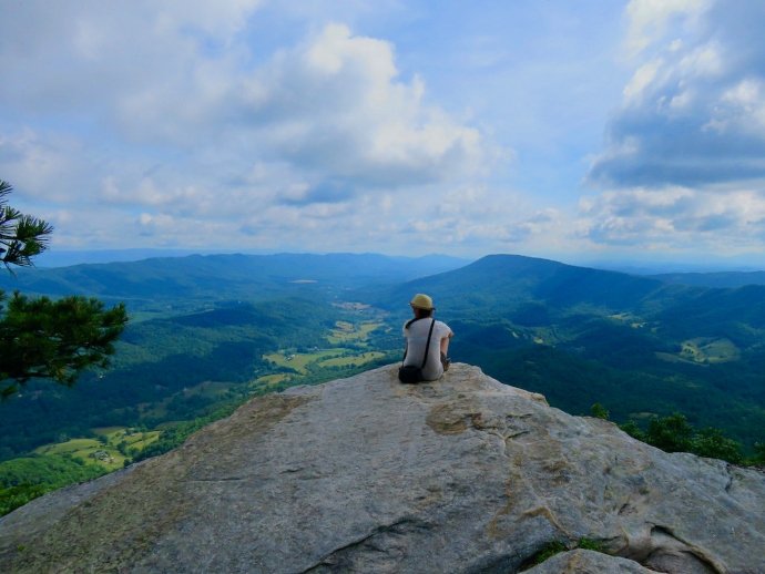
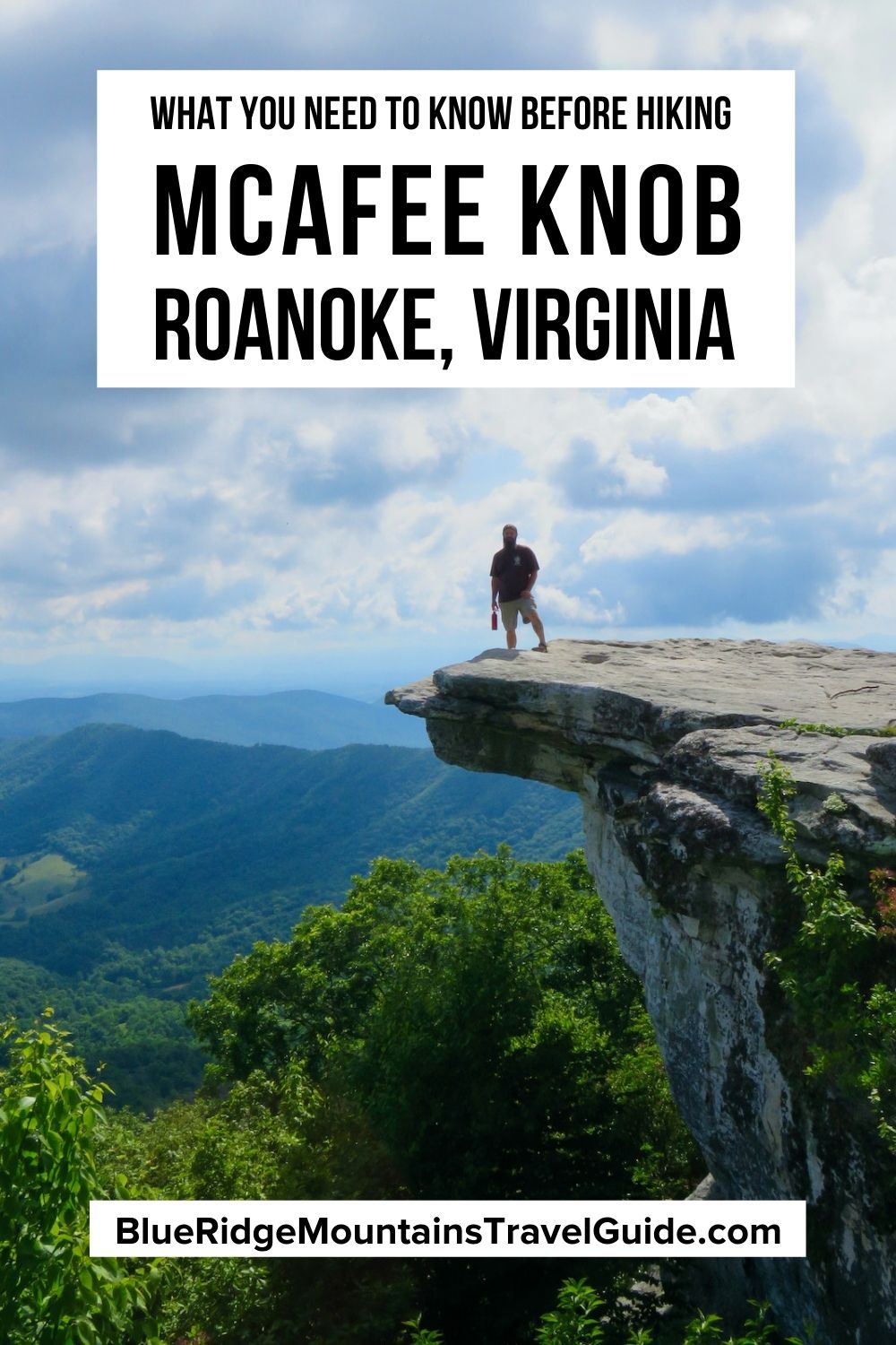
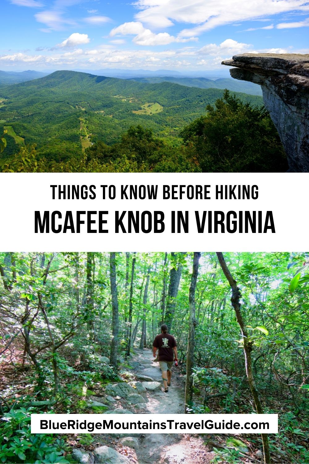
McAfee Knob is located atop the 3200-foot Catawba Mountain, from which a jaw-dropping 270º panorama of the Catawba Valley spreads out into several magnificent vistas.
If you’re up for a challenging mountain trek with a pretty powerful payoff at the end, read on for our tips for hiking the McAfee Knob trail.
READ MORE: The 10 Best Things to Do in Roanoke VA
McAfee Knob Info
ADDRESS: Catawba Valley Drive, Catawba VA, 24070 (McAfee Knob Trailhead)
PHONE: 540-986-5301 (Roanoke Appalachian Trail Club)
WEBSITES: Roanoke Appalachian Trail Club, Appalachian Trail Conservancy, Appalachian National Scenic Trail
ADMISSION: Free
DRIVING DIRECTIONS: From Roanoke, go south on the I-81 towards Salem/Bristol. Take exit 141 for the VA-419 and turn left (north) onto the VA-419.
In less than half a mile, the VA-311 will be on the right. McAfee Knob parking will be on the left in 5.6 miles, and the McAfee Knob Trail is on the right, across the road. Be careful crossing.
READ MORE: The 10 Best Things to Do in Luray VA
History of McAfee Knob
McAfee Knob is named after James McAfee, a Scotch-Irish settler in the 1730s, but there were Native Americans settled throughout the area long before then.
It seems fitting to talk about the history of the Appalachian Trail, because McAfee Knob is arguably the most often-photographed area along the famous footpath.
The Appalachian Trail was the brainchild of forest conservation icon Benton MacKaye, and the idea was made public in 1921 through an article in the American Institute of Architects.
MacKaye was dismayed by the development of cities being centered primarily around work and factories.
He noted that the great national parks and recreation areas of the United States were largely relegated to the country’s western half. So he wanted to create a massive outdoor recreation area for the east coast.
The Appalachian Trail was meant to stretch the “full length of the Appalachian skyline, from the highest peak in the north to the highest peak in the south—from Mt. Washington to Mt. Mitchell.”

The trail would be constructed by linking together existing paths to make a nearly 2,200-mile walking route through the Appalachian Mountains.
In the decades since, the AT has extended beyond the highest points, reaching all the way down into North Georgia and all the way up into Maine (beyond New Hampshire’s Mt. Washington).
The Commonwealth of Virginia has more miles of the Appalachian Trail than any other state, with 531.7 miles in the state and 25 miles along the Virginia-West Virginia border.
The McAfee Knob section of the Appalachian Trail was part of a rerouting effort led by Jim Denton of the Roanoke Appalachian Trail Club. The project moved 170 miles of the AT (the stretch from the Jefferson National Forest) to the Roanoke area.
Before the route was relocated in 1955, much of the AT in Virginia was right along major roadways. As those roads developed, the “trail” became less and less appealing for nature lovers to walk.
The Roanoke Appalachian Trail Club continues to maintain this improved section of the AT today, with McAfee Knob, the showpiece of the journey, attracting around 90,000 people a year.
READ MORE: Visiting Mill Mountain Park & the Roanoke Star in Roanoke VA
Parking at McAfee Knob
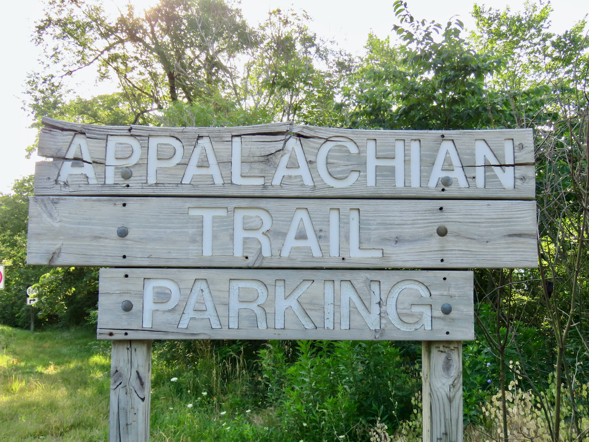
The parking situation at McAfee Knob is no joke, so you’ll want to plan ahead to avoid frustration.
The parking lot fills up quickly and early, especially on the weekends. And cars that park on VA-311 will get ticketed and towed.
Here are a few tips for limiting your headaches while searching for a spot:
- Hike the McAfee Knob trail during the week if at all possible. You’ll find fewer cars needing to park, and the trail will be less crowded as well.
- If the main parking lot is full, roadside parking is possible on nearby VA-864. Just be sure to pull off the road as far as possible, and avoid parking on sharp turns.
- Carpool whenever possible, or consider using a shuttle driver to bring large groups to the trailhead.
- There’s also Daleville Park and Ride, which offers a shuttle service to the various trailheads as well.
READ MORE: Things to Do at Center In The Square in Downtown Roanoke VA
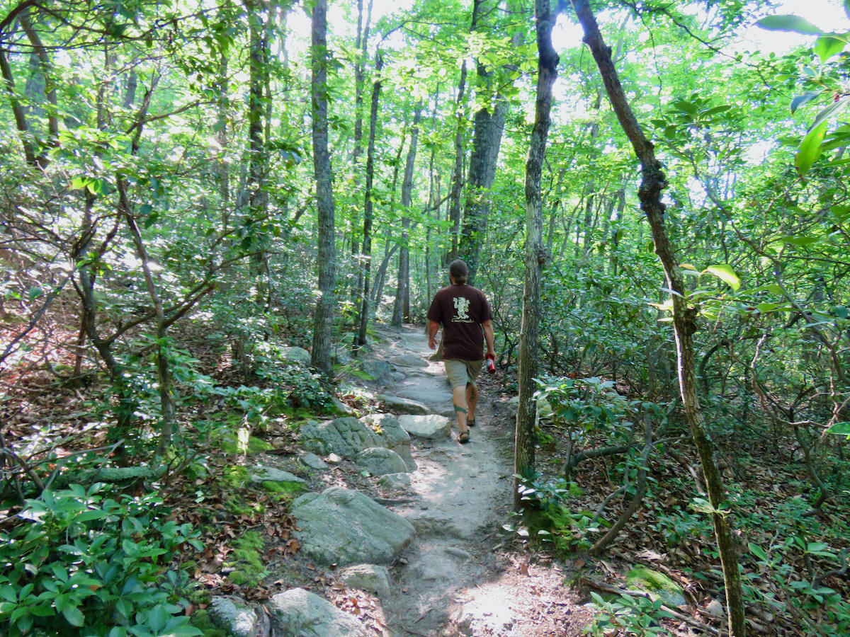
The McAfee Knob Day-Hike
The day-hike to the summit is 3.9 miles long, which equates to just under 8 miles of hiking on the round-trip route. So the trek is certainly not for the faint of heart, in both the figurative and literal sense.
Adding to the challenge, the elevation change from the McAfee Knob trailhead to the mountain summit is 1700 feet, with the second half of the trail being considerably steeper than the first half.
Due to the elevation increase and the time required to walk the trail (generally 4-6 hours), the McAfree Knob hike is infamous for weather changes, including temperature drops and rain/snow events.
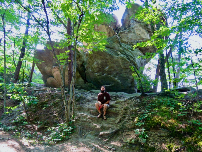
Nevertheless, the trail is very popular. It’s also well-marked and maintained, shaded nicely, and culminates in the most famous scenic views along the entire Appalachian Trail.
Beyond the stunning beauty of the surrounding area, which includes the Catawba Valley, Roanoke Valley, and the city of Roanoke, McAfee Knob sunrises are notoriously spectacular.
There’s also the insane jutting rock formation that hikers love to stand on for triumphant photographs (as seen in the lead image above, and on the movie poster for Robert Redford’s A Walk in the Woods).
READ MORE: The Best Things to Do at Carvins Cove Natural Reserve in Roanoke VA
Hiking Virginia’s Triple Crown on the AT
Though McAfee Knob is the most popular AT hike in Virginia, it’s also part of an iconic 20-mile trek that features two other highly regarded viewing areas: Dragon’s Tooth and Tinker Cliffs.
The three legs of this hike easily rank among the most popular hiking trails in Virginia. They’re also each challenging in their own way, combining to make quite a backpacking adventure.
The Dragon’s Tooth Trail is quite short at just 2.3 miles, and the first two-thirds of it often lull hikers into a comfortable gait. However, the last section is impressively steep and often requires using your hands as well as your feet to reach the top of the Tooth!
At around 8 miles, the Tinker Cliffs Trail is not quite as long as the McAfee Knob day-hike, but the change in elevation (1900 feet) is actually a bit more.
The day-hike to it combines the 3+ mile Andy Lane Trail with the Appalachian Trail (less than a mile).
These can be reached in three separate day-hikes. Or they can be conquered with a monster Appalachian Trail trek, starting at Dragon’s Tooth, then moving north to McAfee Knob and Tinker Cliffs.
Hiking to all three is generally done over a 2-day or even 3-day period. But for super fit, experienced hikers it is possible to do it one extremely exhausting day that starts very early and ends very late.
READ MORE: The 7 Best Roanoke Restaurants in Virginia’s Blue Ridge
Camping at McAfee Knob
In reality, there is no camping at McAfee Knob proper. But there is plenty of camping near McAfee Knob, as well as en route to it.
As with all AT campsites and shelters, they are first-come, first-served, and cannot be reserved.
The Catawba Campsite and Pig Farm Campsite are both along the Appalachian Trail. Catawba Campsite is west of McAfee Knob (on the parking side), while Pig Farm is east of it, moving toward Tinker Cliffs.
In this section of the AT, all camping must be done in designated areas. Campsites along the AT are primitive, often with a nearby natural water source like a stream and no privy. However, shelters along the AT do usually have rustic toilets available.
The John’s Spring Shelter (AT Mile 708.7), Catawba Shelter (AT Mile 709.7), and Campbell Shelter (AT Mile 712.1) are all located near McAfee Knob.
The Catawba Shelter is located next to the Catawba Campsite, while the Campbell Shelter is near the Pig Farm Campsite.
These shelters are usually wooden, shed-like structures that can sleep around eight people. They do tend to fill up quickly, and it would probably be thoughtful to allow thru-hikers (who are attempting the entire AT) to get first dibs.
For those wishing to see the renowned McAfee Knob sunrise, camping might be just the ticket! –by Jonathon Engels; lead image by Where’s Gordo Photography via Visit Virginia’s Blue Ridge; all other photos by Emma Gallagher unless otherwise noted
