

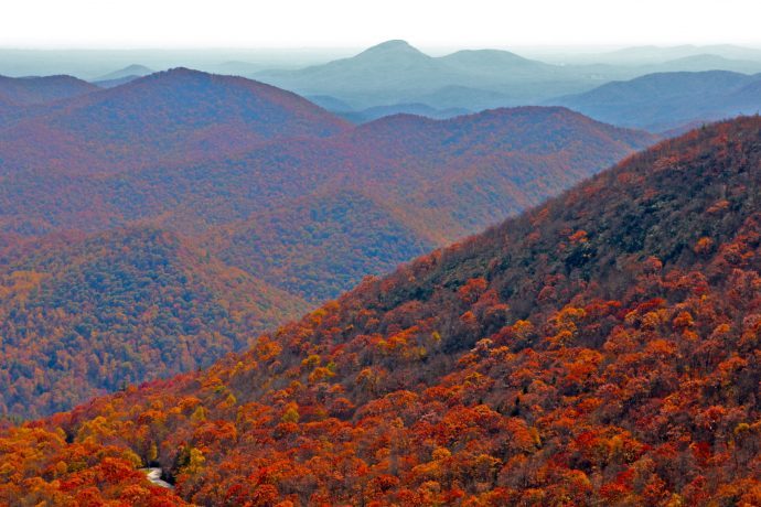
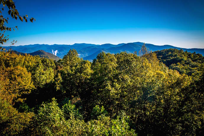
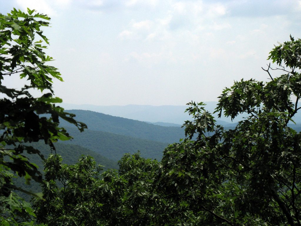
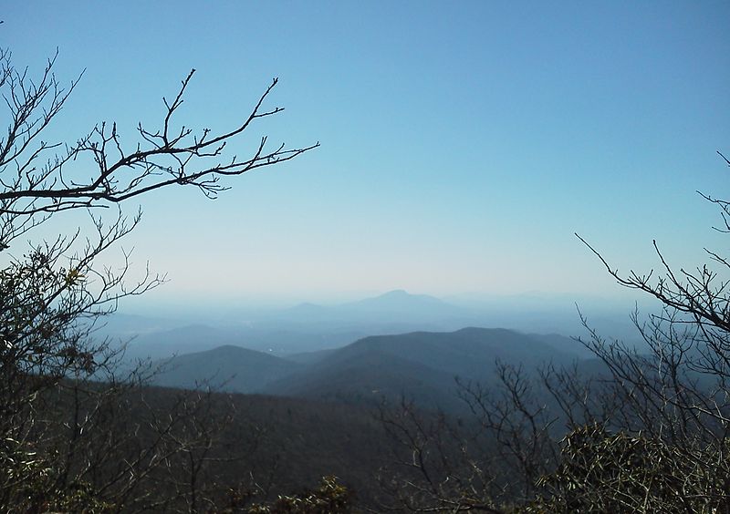
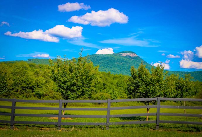
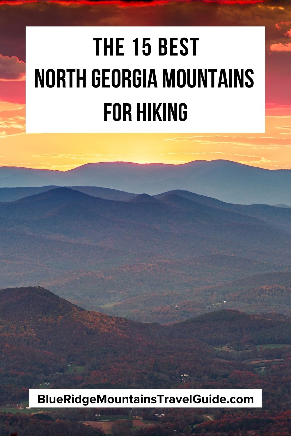
[Updated July 18, 2021] If you’re looking to immerse yourself in nature, soak in stunning views, and tackle unforgettable outdoor adventures, look no further than the majestic mountains of North Georgia.
Hiking through lush national forests along wildflower-strewn paths, crossing sparkling streams, and around mossy boulders has always been one of our favorite things to do in North Georgia.
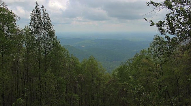
The hiking trails that meander through this surprisingly pristine wilderness are nothing short of beautiful, rewarding you with an array of wildlife, wondrous waterfalls, and expansive views of the Blue Ridge Mountains.
So if you’re looking to breathe in the fresh mountain air, keep on reading to see our staff picks for the 15 Best North Georgia Mountains for Hiking!
Best North Georgia Mountains for Hiking Guide
- Amicalola Mountain
- Big Cedar Mountain
- Black Rock Mountain
- Blood Mountain
- Brasstown Bald
- Cowrock Mountain
- Grassy Mountain
- Powell Mountain
- Rabun Bald
- Ramrock Mountain
- Rocky Mountain
- Slaughter Mountain
- Springer Mountai
- Tray Mountain
- Yonah Mountain
READ MORE: The 20 Best Hiking Trails in North Georgia Bucket List
1. Amicalola Mountain
Elevation: 3,382 feet
Hiking Distance: 2.1 miles
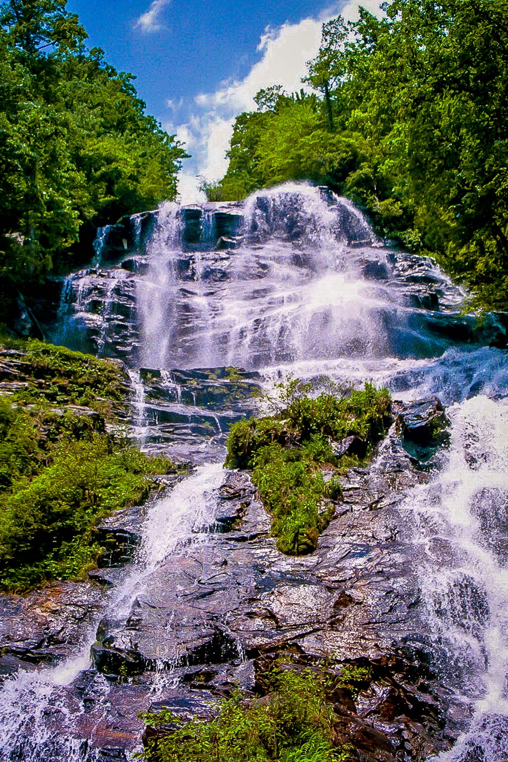
Hiking to the top of the 729-foot cascades of Georgia’s tallest waterfall is arguably one of the most popular things to do in North Georgia.
Once you get there (after exploring lush Chattahoochee National Forest hiking trails), the sight will truly take your breath away!
Amicalola Mountain is part of Amicalola Falls State Park, which offers some of the most rewarding hiking trails in North Georgia.
The popular Amicalola Falls Loop Trail is just 2.1 miles round trip, and starts under a commemorative stone arch for the Appalachian Trail. It leads you on a set of winding stairs along the flowing waters of the falls to a wooden viewing platform.
From there you can take in the plummeting falls, as well as some of the most gorgeous scenic vistas you’ll find anywhere in the mountains of Georgia.
READ MORE: The Top 20 North Georgia Waterfalls (& How to Get to Them)
2. Big Cedar Mountain
Elevation: 3,721 feet
Hiking Distance: 2 miles
Situated in the Blood Mountain Wilderness portion of the Chattahoochee National Forest, Big Cedar Mountain is another one of the must-see mountains of North Georgia.
A famous landmark on the Appalachian Trail, Preacher’s Rock sits near the summit of Big Cedar Mountain, offering views that can only be described as extraordinary.
The awesome hike is just 2 miles round trip. It starts at Woody Gap on GA Hwy 60, where you can already start to get glimpses of the stunning North GA mountains.
Heading into the forest, the hike follows the blazes of the Appalachian Trail and gradually climbs through sharp switchbacks to eventually reach Preacher’s Rock.
After taking in the incredible views (including a glimpse of Dockery Lake below), the hike traces its steps outbound to Woody Gap.
READ MORE: The Top 20 Blue Ridge Mountain Towns in GA & NC
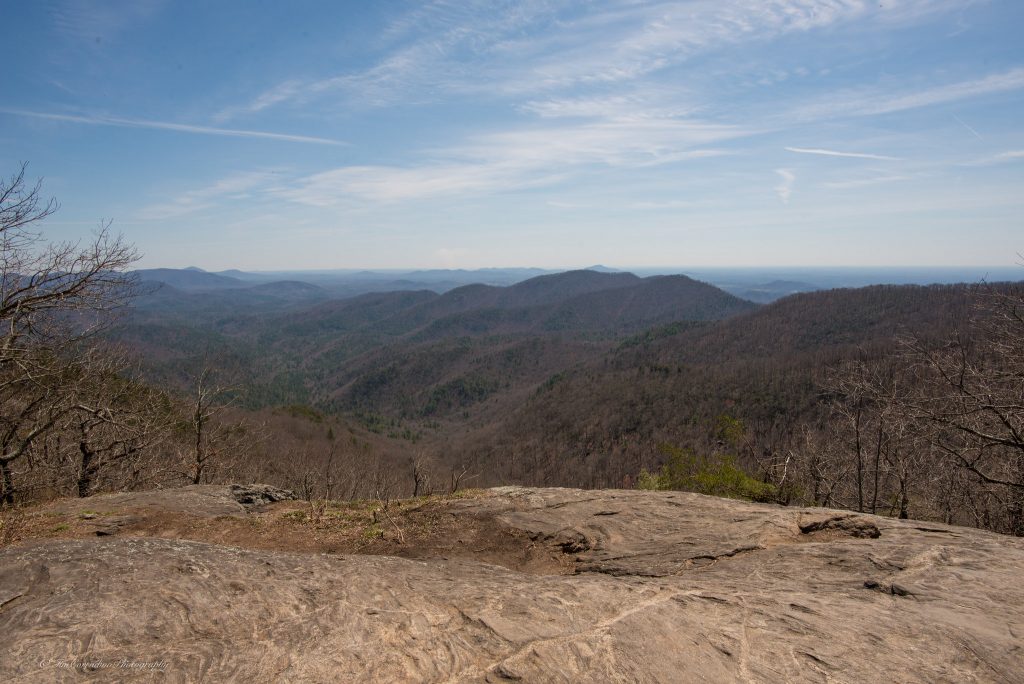
3. Black Rock Mountain
Elevation: 3,640 feet
Hiking Distance: 2.2 miles
Located near Clayton GA, Black Rock Mountain looms large above the beautiful terrain, offering dazzling views and unforgettable hiking adventures.
To reach the summit of the mountain, take one of the most picturesque and best hiking trails in Georgia, the Tennessee Rock Trail.
Departing from Black Rock Mountain State Park’s main trailhead area, the hike climbs into the forest, which is usually lined with enchanting wildflowers and ferns in late Spring.
The summit of the mountain is marked with a large engraved stone. While the views there are somewhat obscured by the trees, the trail continues on, climbing a set of wooden stairs to reach the Tennessee Rock overlook at 1.75 miles.
This is where your breath will truly be taken away as you take in the sights of the towering mountains of north Georgia, spanning out as far as the eye can see. To complete the hike, the trail descends northbound toward the trailhead.
READ MORE: The 15 Best North Georgia State Parks & Historic Sites
4. Blood Mountain
Elevation: 4,461 feet
Hiking Distance: 4.3 miles
Though it’s considered one of the more difficult North Georgia hiking trails on this list, the hike to Blood Mountain’s summit is well worth the trek.
The reward for your effort is some truly magnificent views from atop the Appalachian Trail’s highest summit in Georgia.
Starting at the Byron Reece Trailhead (near Neels Gap), you’ll start your journey into a creek valley lined with rhododendron. There you’ll meet the Appalachian Trail at .7 mile and head westbound.
The Blood Mountain trail reaches the summit at 2.15 miles, where you can take in sights of the pristine Georgia mountains from a huge, Instagram-worthy outcrop.
It’s located beside a rock building that was constructed by the Civilian Conservation Corps back in the 1930s.
Once you’ve soaked up the views, the hike retraces the outbound route to return to the trailhead, completing the adventurous hike at 4.3 miles.
READ MORE: The 15 Best Things to Do in Blairsville GA & Union County
5. Brasstown Bald
Elevation: 4,784 feet
Hiking Distance: 1.1 miles
Holding the record for the tallest mountain in the state of Georgia, Brasstown Bald towers over the gorgeous Chattahoochee–Oconee National Forest. The summit offers expansive views that, on a clear day, includes four states (Georgia, Tennessee, North Carolina, and South Carolina).
To reach these breathtaking views, follow the paved trail that starts from the Brasstown Bald parking lot and heads up towards the Visitor Center at the summit.
The short, 0.55-mile hike is surprisingly challenging due to its constant incline. But with frequent places along the trail to stop and take a rest, most people find the trail doable.
For those who want a quick trip to the top, you can also access the summit via shuttle for a small fee.
At just over 0.5 miles, you’ll reach the cloud level observation deck and a museum, where you can see interactive cultural and natural history exhibits. Go down the same way you came up to complete the trip at 1.1 miles.
READ MORE: The 10 Best Wineries in the North Georgia Mountains
6. Cowrock Mountain
Elevation: 3,852 feet
Hiking Distance: 2.25 miles
Another one of the most majestic mountains in North Georgia, Cowrock is known for having some difficult hikes that reward you with jaw-dropping views.
The moderately difficult hike to Cowrock’s summit begins at Tesnatee Gap, where you’ll travel westbound on the white-blazed Appalachian Trail.
Continuing through a series of narrow switchbacks, the forest will thicken and likely be scattered with colorful North GA wildflowers during warmer months.
At 0.85 miles, the hike will reach the summit on a smooth rock outcrop that’s perfect for stopping for a rest and taking in the beauty of the Blue Ridge Mountain scenery.
To finish the hike, simply follow the scenic Appalachian Trail westbound, then retrace your steps back to the Tesnatee Gap trailhead.
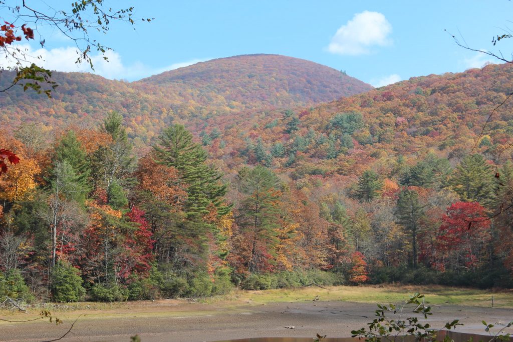
READ MORE: Fall in the Mountains of North Georgia (Where to See the Best Fall Colors)
7. Grassy Mountain
Elevation: 3,694 feet
Hiking Distance: 3 miles
Rising from the deep Cohutta Wilderness 15 to 20 miles west of Blue Ridge GA, the Grassy Mountain hiking trails take you through remote wilderness to see some of North Georgia’s most dynamic peaks of the Appalachian Mountains.
The hike to the summit begins at the Grassy Mountain Tower trailhead, then heads into the forest to a beaver dam, ultimately meeting up with the Songbird Trail.
The route climbs in elevation through vibrant flora and fauna and eventually a rocky trail bed before reaching the summit.
Here you’ll see the Grassy Mountain fire tower. Climb it and you’ll be treated to nearly 360º views of the vast Cohutta Wilderness.
To complete the 3-mile circuit, follow the outbound hike to the Lake Conasauga Trail. It should be noted that this trail is pretty challenging and very remote, so be sure to take precautions!
READ MORE: The 13 Best Restaurants in Blue Ridge GA
8. Powell Mountain
Elevation: 3,840 feet
Hiking Distance: 5.2 miles
One of the more secluded hiking trails in Georgia, the trek to the top of Powell Mountain explores a lush forest of towering hardwoods, leading to gorgeous views of the rolling Blue Ridge Mountains.
Starting at the Dicks Creek Gap trailhead in Hiawassee, the hike follows the Appalachian Trail southbound, climbing in elevation to eventually cross a small waterfall and shallow creek.
Continuing through McClure Gap and climbing upwards, the hike departs the AT as the trees open up to reveal the expansive views for which the North GA mountains are known.
You can even spot the glistening waters of some of the best lakes in the North Georgia Mountains including Lake Burton, Lake Seed, and Lake Rabun from the summit.
When you’re ready to depart, the route goes in reverse back to the trailhead.
READ MORE: The 15 Best Things to Do in Hiawassee GA & Young Harris GA
9. Rabun Bald
Elevation: 4,695 feet
Hiking Distance: 3 miles
The second tallest mountain in the state (after Brasstown Bald), Rabun Bald offers spectacular views that are accessed by some of the best hiking in Northeast Georgia.
The hike to the summit climbs in elevation through a dense forest, eventually meeting up with the Bartram Trail. The elevation gain is notoriously intense, but it’s manageable thanks to a series of switchbacks.
Continuing along a trail filled in warmer months with vibrant rhododendron, ferns, and eye-catching wildflowers, the trail passes a small campsite, eventually reaching the Rabun Bald summit.
There’s an observation platform where you can stop to take in the 360º views that span all the way into North Carolina’s wilderness. To the southeast, you’ll spot Black Rock Mountain; to the northwest, you’ll see Standing Indian Mountain.
When you’re ready to head back, the hike reverses on its outbound route, ultimately reconnecting with the Bartram Trail.
READ MORE: The 15 Best Things to Do in Clayton GA
10. Ramrock Mountain
Elevation: 3,200 feet
Hiking Distance: 2.9 miles
One of the most gorgeous mountains in Georgia, the hike to the top of Ramrock is great for a relatively short day-hike.
The adventure begins at Woody Gap, where you’ll follow the Appalachian Trail south along a rocky trail.
The path continues through stone steps and large boulders, where you’ll reach a 4-way split.
The AT continues straight, there’s a campsite to the right, and to the left you’ll find a short trail that will take you to the most exceptional views Ramrock Mountain has to offer.
At the summit you’ll be delighted to see wide open skies, gorgeous rolling mountains on the horizon, as well as a variety of wildflowers that bloom around the area in spring.
READ MORE: Apple Picking in Georgia: The 10 Best North GA Apple Orchards to Visit
11. Rocky Mountain
Elevation: 4,016 feet
Hiking distance: 5.1 miles
If you’re a hardy hiker who wants a true test of stamina, the aptly-named Rocky Mountain is the place to go.
The day hike from Unicoi Gap to Rocky Mountain’s summit and Indian Grave Gap is one of the most popular (and difficult) hikes on the Appalachian Trail in Georgia.
If you’re up for the challenge, your journey will start at the Unicoi Gap trailhead and follow the AT east to climb a set of stairs into the rocky forest.
The hike steadily continues to gain elevation until you reach Rocky Mountain’s peak, where you can stop to rest and take in some truly unforgettable views.
You’ll be able to soak in more picturesque views of the Georgia mountains as you continue the trek to Indian Grave Gap through a dense forest trail that crosses several trickling streams.
Taking the Appalachian Trail west, the adventure will come to an end at a total of 5.1 invigorating miles.
READ MORE: The 25 Best Things to Do in Helen GA
12. Slaughter Mountain
Elevation: 4,337 feet
Hiking Distance: 7.5 miles
Located in Union County just southwest of Vogel State Park, this mountain nestled in the Chattahoochee National Forest is a great place for experienced trekkers seeking some of the best hiking in Georgia.
To reach the summit of Slaughter Mountain, you’ll start by taking the Byron Reese Trail uphill to the Appalachian Trail and following it to Blood Mountain.
From there, the epic hike will continue through the rocky forest and connect to the Duncan Ridge Trail.
At this point, you’ll come to a faint trail leading to the summit, where you’ll be greeted with the sort of staggering views that make you want to just sit and soak it in for a while.
When you’re finally ready to head home, simply follow the trail back the way you came.
READ MORE: The 15 Best Campgrounds in North Georgia
13. Springer Mountain
Elevation: 3,780 feet
Hiking Distance: 4.7 miles
Springer Mountain is one of the most popular mountains in North Georgia, in large part because it is here that the southernmost blaze of the Appalachian Trail is located.
If you want to take in the sights, but not conquer the entire length of the AT trek, the Springer Mountain Loop trail will take you to Springer’s summit as well as various other picturesque overlooks.
Starting at the Springer Mountain parking area on Forest Road 42, the hike follows the AT westward, quickly gaining elevation as it enters the forest.
You’ll reach the summit after just 1 mile. Although the overlook there doesn’t give quite the expansive views offered by other mountains on this list, the experience is just as special.
Departing the summit, the hike continues on to the Benton Mackeye Trail before ascending shortly on Ball Mountain, where another outlook offers a chance to take in more mountain views.
The trail crosses several streams, including Davis Creek (which feeds into Dukes Creek Falls), before finally reaching its end back at the Springer Mountain parking area.
READ MORE: The Top 10 Treehouse Rentals in the Georgia Mountains
14. Tray Mountain
Elevation: 4,429 feet
Hiking Distance: 5 miles
Tray Mountain is one of the most popular mountains in GA for hiking, with trails full of natural beauty and stunning views from the top. It’s also where the two creeks that feed into Anna Ruby Falls originate.
The Tray Mountain trail follows the Appalachian Trail through an evergreen and rhododendron-filled forest. After ascending a wooden staircase, the trail continues gaining elevation.
At 1.7 miles, you’ll cross a gravel road and enter the Tray Mountain Wilderness. The incline will become noticeably steeper, but will ultimately be worth the trek as you come up on the Tray Mountain summit.
Here you can see the immense Chattahoochee National Forest in all its rugged beauty, as well as the rolling Blue Ridge Mountains sprawling on the horizon.
You’ll eventually have to pull yourself away from this intensely beautiful view, but the hike back is a good bit easier since it’s all downhill.
READ MORE: 10 Fun, Festive Ways to Celebrate Christmas in Helen GA
15. Yonah Mountain
Elevation: 3,166 feet
Hiking Distance: 4.4 mile
Located between the towns of Cleveland and Helen GA, hiking the Yonah Mountain trail offers some of the best North Georgia views of the Appalachian range.
The hike to the summit starts at a trailhead off of Chambers Mountain Road, leading you into the forest and then over a small bridge.
Climbing in elevation, you’ll continue along a gravel road and come upon a US Army training camp, where multiple trails branch off in different directions. To head towards the Yonah Mountain summit, just continue on the gravel road.
Note that the rocky summit has steep drop-offs and can get very slippery after recent rains. So please wear hiking shoes with good traction and exercise serious caution near the edges.
At just over 2 miles you’ll enter a picturesque mountaintop meadow where you can relax, have a picnic, and savor the staggering views before heading down the North Georgia Mountain hiking trail. –by Christina Maggitas; lead image by Bret Love & Mary Gabbett


Comments are closed.