
[Updated March 26, 2022]
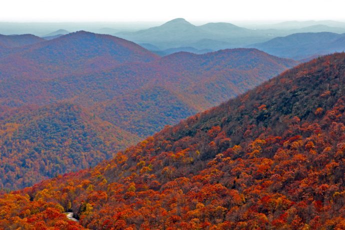
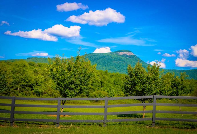
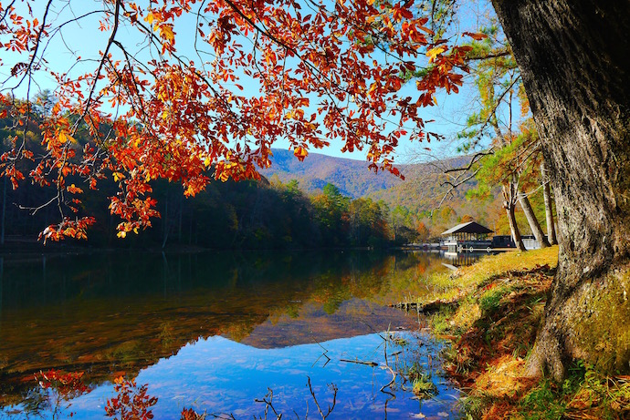
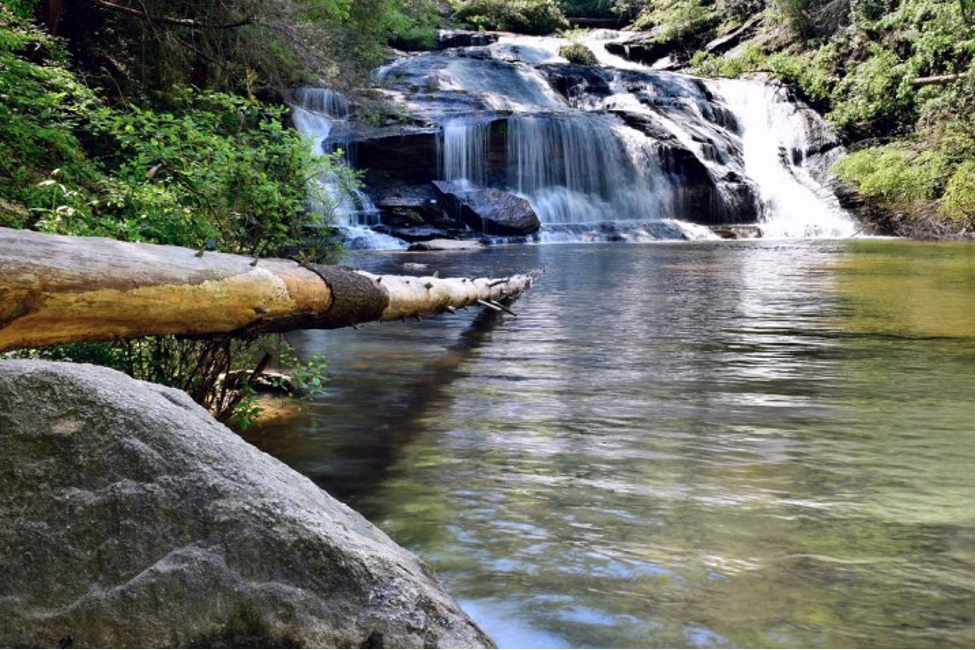
From the soaring summits of Blood Mountain and Brasstown Bald to the cascades of enchanting waterfalls like Anna Ruby and Amicalola, there’s no shortage of impressive natural attractions and things to do in North Georgia.
The terrain of the state’s dynamic Blue Ridge Mountains are filled with beauty and plenty of history. Thanks to an incredible network of trails, it can all be accessed relatively easy by hikers of varying abilities.
But with so much picture-perfect acreage to explore, it can be difficult to narrow down which adventures to tackle. To that end, we’ve compiled a bucket list featuring 30 of the best hiking trails in North Georgia.
We’ve also divided them into three levels of difficulty (easy, moderate, and strenuous) and highlighted some of the things that make each trail unique.
Hopefully our staff picks will inspire you to grab your hiking boots and get out to explore our gorgeous Georgia mountains!
READ MORE: The 15 Best North Georgia Mountains for Hiking
Best Hiking Trails in North Georgia Guide
- Preacher’s Rock
- Toccoa Swinging Bridge
- Tennessee Rock Trail at Black Rock Mountain State Park
- Brasstown Bald
- Minnehaha Falls
- Hemlock Falls at Moccasin Creek State Park
- Anna Ruby Falls
- Shirley Miller Wildflower Trail
- Sea Creek Falls
- Sosebee Cove
- Lula Lake Land Trust
- West Rim & Waterfalls Trail at Cloudland Canyon State Park
- Sliding Rock Trail at Tallulah Gorge State Park
- Rabun Bald
- Amicalola Falls Loop Trail
- Indian Seats
- Woody Gap to Big Cedar Mountain
- Raven Cliff Falls
- Fort Mountain Stone Tower/Summit Trail
- Ramrock Mountain
- Yonah Mountain
- Appalachian Trail: 3 Forks to Springer Mountain
- Blood Mountain Loop
- Smith Creek Trail at Unicoi State Park
- Coosa Backcountry Trail at Vogel State Park
- Panther Creek Falls
- Lower Conasauga River Trail
- Emery Creek Falls
- Bartram Trail from Sandy Ford to Warwoman Dell
- Dicks Creek Gap to Powell Mountain
Easy Hiking Trails in North Georgia
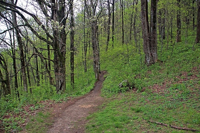
1. Preachers Rock (Suches, GA)
Level of difficulty: Easy
Distance: 1.9 miles
Elevation Gain: 439 feet
Located just an hour and a half north of Atlanta, this hike is perfect for those looking to escape the city and spend some time exploring nature.
At just under two miles, the hike is relatively easy. Its moderate elevation and stunning sights make it one of the most popular day hikes on the Appalachian Trail in Georgia.
For its short length, the Preachers Rock trail has no shortage of magnificent views. Some of them can be seen even before you embark on the hike from the trailhead at Woody Gap.
You’ll pass several stunning overlooks before reaching the main attraction, Preachers Rock, a large rock outcrop that offers expansive views near the summit of Big Cedar Mountain.
On a clear day, you can even spot Dockery Lake in the valley below!
READ MORE: The 52 Best Georgia Hiking Trails for the 52 Hikes Challenge
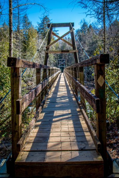
2. Toccoa Swinging Bridge (Blue Ridge, GA)
Level of difficulty: Easy
Distance: 0.8 miles
Elevation Gain: 118 feet
The Toccoa Swinging Bridge was built by the USDA Forest Service and the Appalachian Trail Club in 1977.
At 270 feet long, it’s the longest swinging bridge east of the Mississippi River and one of the best things to do in Blue Ridge, GA.
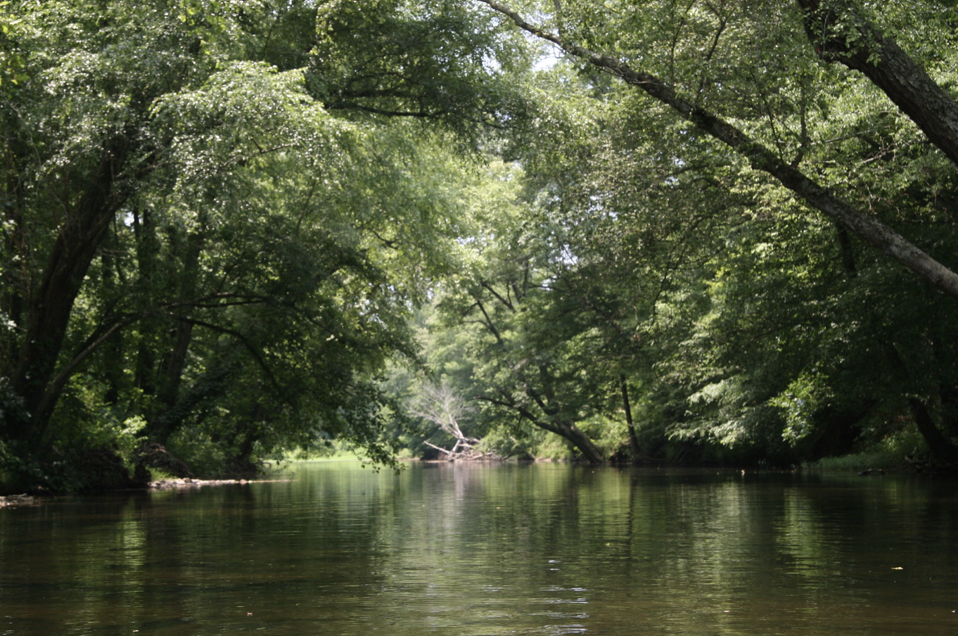
Located on the Benton Mackaye Trail and Duncan Ridge National Recreation Trail, the bridge swings over the Toccoa River and offers plenty of picturesque scenery along the route.
The shortest trail is just under a mile and is perfect for small children, as there’s plenty of spots where you can stop to relax or have a picnic along the way.
You can also get down to the water to splash around and cool off on hot summer days.
For a longer hiking trail in North Georgia, you can continue on the Benton Mackaye Trail after you cross the bridge and explore more of the surrounding area.
READ MORE: The 15 Best Blue Ridge Georgia Cabins to Rent
3. Tennessee Rock Trail at Black Rock Mountain State Park (Mountain City, GA)
Level of difficulty: Easy
Distance: 2.2 miles
Elevation Gain: 561 feet
Located in Black Rock Mountain State Park (Georgia’s highest elevation park), the Tennessee Rock Trail is the park’s most popular hike, offering stunning sights from start to finish.
The easy to moderate hike explores a forest filled with boulders and beautiful scenery, which is especially captivating when colorful North GA wildflowers bloom along the path each spring.
Reaching the summit of Black Rock Mountain is definitely a noteworthy point, but the truly breathtaking views come a little further along the hike at the Tennessee Rock overlook.
The rolling hills of Northeast Georgia seem endless here, and you can even spot the summits of Albert Mountain and Pickens Nose Mountain in North Carolina.
This is also a great hike for dogs but remember to keep them on a leash at all times.
READ MORE: The 10 Best State Parks With Cabins In Georgia
4. Brasstown Bald (Hiawassee, GA)
Level of difficulty: Easy
Distance: 1.1 miles
Elevation Gain: 426 feet
At 4,784 feet, Brasstown Bald is Georgia’s highest summit. With the incredible views from the observation area at the top, it’s also understandably one of Georgia’s most popular best hikes.
While the hike up has a steady incline, it’s just over half a mile each way on a paved trail. So it’s not too difficult, making it a great hiking trail in North Georgia for families and dogs.
At the top there’s a huge viewing platform where you’ll find yourself immersed in breathtaking 360-degree views that span four states (Georgia, Tennessee, North Carolina, and South Carolina) on a clear day.
This place truly shows off the best of Georgia’s Blue Ridge Mountains, with postcard-worthy sights of the classic misty hills the area is known for.
READ MORE: Fall in the Mountains of North Georgia (Where to See the Best Fall Colors)
5. Minnehaha Falls (Tallulah Falls, GA)
Level of difficulty: Easy
Distance: 0.4 miles
Elevation Gain: 62 feet
While multi-day expeditions exploring dense forests may have its appeal to hardy hikers, sometimes it’s nice to go on a short, beautiful hike with a remarkable payoff at the end.
That’s precisely what the Minnehaha Falls trail offers, which is why it ranks among our favorite North Georgia hiking trails.
At just 0.4 miles round-trip, the hike is one of the easiest waterfall hikes in North Georgia. But it’s also incredibly rewarding, showcasing one of the most picturesque cascades in the area.
While the shallow pool at the base of the 60-foot falls isn’t deep enough to swim in, you can wade in the water and admire the gorgeous scenery. It offers exceptional ROI for a .4-mile hike!
READ MORE: The 20 Best Easy Hiking Trails to Waterfalls in Georgia
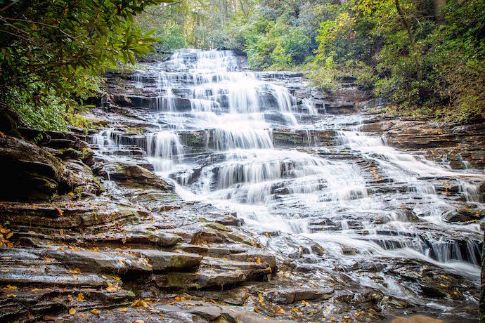
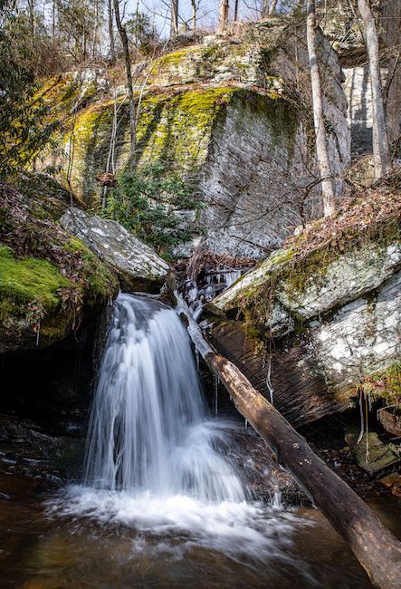
6. Hemlock Falls Trail at Moccasin Creek State Park (Clarksville, GA)
Level of difficulty: Easy
Distance: 2 miles
Elevation Gain: 242 feet
If you like waterfalls with easy hiking trails, the Hemlock Falls Trail at Moccasin Creek State Park is an awesome adventure you won’t want to miss.
This is one of the most well-maintained hiking trails in North Georgia, leading to one of the most photogenic waterfalls in the state.
The trail follows Moccasin Creek upstream, leading you through a hardwood forest until you reach Hemlock Falls. Though the waterfall’s drop is just 15 feet, the width and power make it impressive.
The beautiful background– with massive rhododendron on top and large boulders down below– makes this a great place to relax for a while, enjoy a picnic, and soak in the serene scenery.
Also, don’t miss the second, smaller cascade in the bushes on the left just before you reach the main cascade at Hemlock Falls!
READ MORE: The Top 10 Treehouse Rentals in the Georgia Mountains
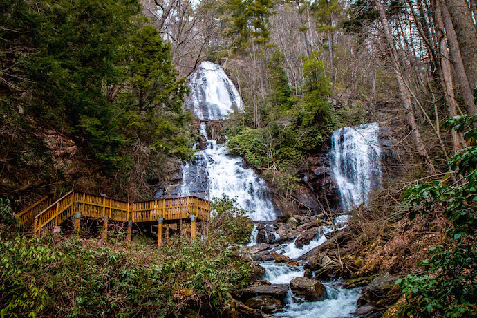
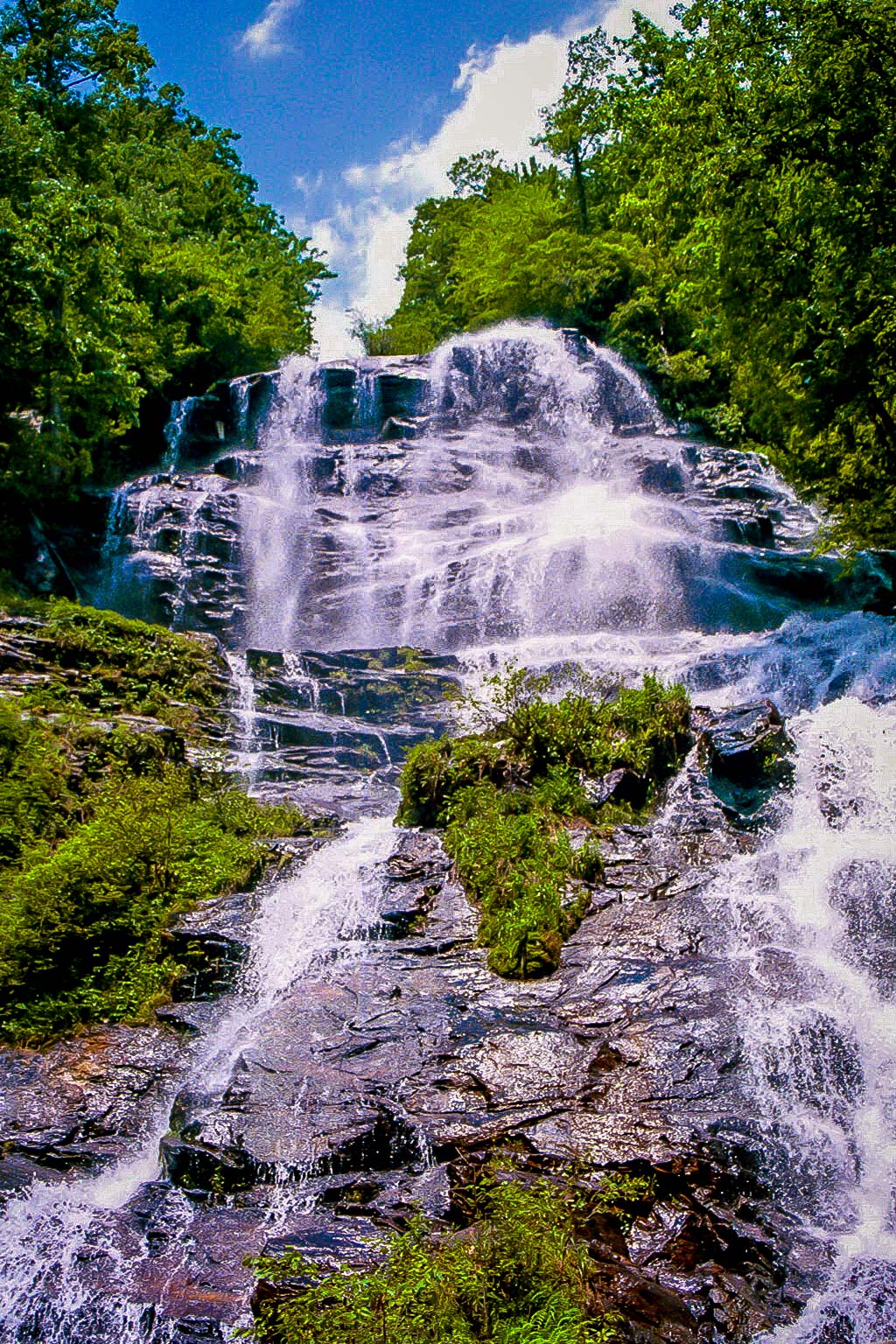
7. Anna Ruby Falls (Helen, GA)
Level of difficulty: Easy
Distance: 0.9 miles
Elevation Gain: 219 feet
The Anna Ruby Falls Trail guides you through one of the many gorgeous hiking trails in the Chattahoochee National Forest to a rare pair of side-by-side waterfalls, which are formed at the junction of Curtis Creek and York Creek.
Starting at the Anna Ruby Falls Visitor Center, the path to the falls is entirely paved. And at less than a mile round-trip, it ranks among the easiest waterfall hikes in Georgia.
The peaceful stroll follows a rushing stream lined with patches of rhododendron, blooming wildflowers, granite boulders, and interpretive signs explaining the area’s history, geology, and wildlife.
Since the trail is relatively short, it’s a perfect excursion to pair with other outdoor activities, such as fishing, zip lining, visiting neighboring Unicoi State Park, or exploring the town of Helen GA.
READ MORE: The 10 Best Places for Ziplining in North Georgia
8. Shirley Miller Wildflower Trail (Chickamauga, GA)
Level of difficulty: Easy
Distance: 0.9 miles
Elevation Gain: 144 feet
Considered by many as one of the best hikes in Georgia if you want to see wildflowers, this easy trail is part of an area known as “The Pocket.”
It’s dedicated in honor of Shirley Miller, an advocate for wildlife conservation and habitat acquisition.
The trail is as easy as it is beautiful featuring a serene boardwalk, peaceful waterfall, and nearly 50 types of native Georgia wildflowers including Celandine Poppy, Star Chickweed, Wild Hyacinth, and Yellow Mandarin.
Some articles will say this trail is on private property. But as long as you have bought a Hunting, Fishing, or Lands pass License (available online from the Georgia Dept of Natural Resources website) you’re good to go!
READ MORE: Non-Venomous vs Venomous Snakes In Georgia (Identification Guide)
9. Sea Creek Falls (Suches, GA)
Level of difficulty: Easy
Distance: 0.5 miles
Elevation Gain: 32 feet
Located about an hour south of Blue Ridge, Sea Creek Falls is a beautiful 30-foot waterfall tucked away in the Coopers Creek Recreation Area of the Chattahoochee National Forest.
It can be reached by taking a quick half-mile, in-and-out trail, making it one of the easiest hiking trails to waterfalls in North Georgia.
The trail is well-marked and follows alongside its namesake creek. One thing to note is that this trail can get pretty muddy after heavy rains, so be sure to check the weather and/or wear good waterproof hiking shoes.
Before you know it you’ll reach Sea Creek Falls, where you can admire the sight of the water as it flows into a shallow, rock-filled pool.
It’s a popular spot to splash around in and cool off during the warmer months, but if you want to see the falls in all their glory visit in the late winter or spring. The water flow tends to be stronger during those times!
READ MORE: The Best 15 Hiking Trails in the Chattahoochee National Forest
10. Sosebee Cove Trail (Blairsville, GA)
Level of difficulty: Easy
Distance: 0.4 miles
Elevation Gain: 55 feet
While this trail in Blairsville GA is less than half a mile long, it shouldn’t be discounted in terms of beauty, as it packs in plenty of scenery along the way.
Located in the Chattahoochee National Forest, the trail explores a 175-acre forest that is widely regarded as one of the best spots in North Georgia for wildflower viewing.
Some of the wildflowers commonly spotted along the trail in the spring and summer are White Trillium, Dutchman’s Breeches, Jack in the Pulpit, Solomon’s Seal, and a variety of native Georgia orchids.
The trail is also known for being a great wildlife viewing spot, with frequent sightings of white-tailed deer, ruffed grouse, an array of beautiful Georgia birds, and even the occasional black bear!
READ MORE: The 15 Best Things to Do in Blairsville GA & Union County
Moderate Hiking in North Georgia
11. Lula Lake Land Trust (Lookout Mountain, GA)
Level of difficulty: Moderate
Distance: 4.5 miles
Elevation Gain: 700 feet
The Lula Lake Land Trust was established in 1994, and is dedicated to preserving the Rock Creek Watershed through education, research, and other conservation efforts.
The private property is home to over 8 miles of north Georgia hiking trails featuring beautiful hardwood forests, overlooks, and waterfalls.
The most popular hike, the Classic Loop, shows off the best the property has to offer including the emerald-colored Lula Lake, 120 foot tall Lula Falls, and a scenic overlook that extends across Northeast Georgia and Chattanooga.
If you’re into mountain biking there is also the Mountain Bike Loop which is 8.7 miles of more advanced terrain!
Since it is private property, Lula Lake is only open to the general public on the first and last weekends of the month. For visiting on other days reservations are required.
READ MORE: The 15 Best Lakes in the North Georgia Mountains
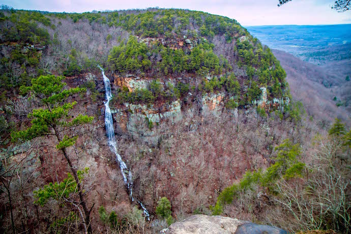
12. Cloudland Canyon West Rim Loop & Waterfalls Trail (Rising Fawn, GA)
Level of difficulty: Moderate
Distance: 5.8 miles
Elevation Gain: 731 feet
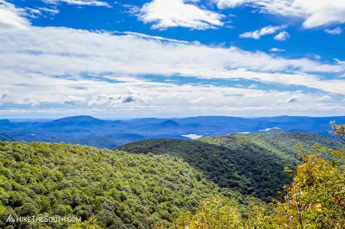
Encompassing 3,538 acres of dynamic terrain– lush woodlands, sandstone cliffs, and 1,000-foot-deep canyons– it’s no wonder Cloudland Canyon State Park should end up on a best Georgia hiking trails bucket list.
The West Rim Loop and Waterfalls Trail are our picks here because they explore some of the park’s most breathtaking scenic views.
These include the boulder-filled canyon floor and the canyon’s western wall, where rock outcrops and overlooks offer spectacular sights stretching all the way to Lookout Mountain on the Tennessee border.
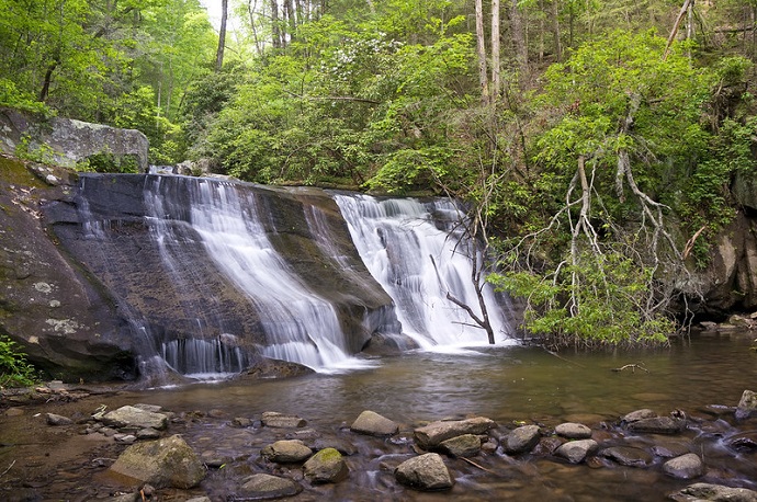
Also on this trail are two cascading North Georgia waterfalls: Cherokee Falls drops 60 feet into a crystalline pool, while Hemlock Falls plunges over 90 feet into the canyon floor.
The hike to the falls does include quite a few stairs, so be prepared for a serious thighmaster challenge!
READ MORE: Cloudland Canyon State Park Cabins Review (Rising Fawn, GA)

13. Sliding Rock Trail at Tallulah Gorge State Park (Tallulah Falls, GA)
Level of difficulty: Moderate
Distance: 3 miles
Elevation Gain: 820 feet
Easily one of the best hikes in north Georgia, the Sliding Rock Trail at Tallulah Gorge State Park explores the floor of the gorge– a 2-mile long, 1,000-feet deep canyon that was carved over centuries by the Tallulah River.
The hiking trail is just three miles round-trip. But because it’s made up almost completely of rocks and boulders, it offers quite the intense workout.
One of the highlights of this hike is getting an up-close view of the beautiful Bridal Veil Falls, which tumbles into a clear blue pool perfect for cooling off mid-hike.
Permits are required to embark on the adventure, and the park only allows 100 permits per day.
So visit during the week or get there as close to opening as possible on weekends if you want to get a pass!
READ MORE: The 15 Best North Georgia State Parks & Historic Sites
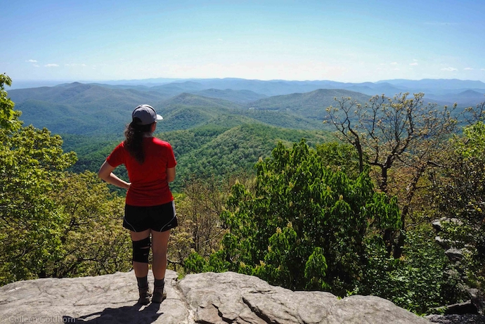
14. Rabun Bald (Clayton, GA)
Level of difficulty: Moderate
Distance: 3 miles
Elevation Gain: 960 feet
Towering over the Appalachian range near the mountain town of Clayton, Rabun Bald is the second tallest mountain in Georgia (after Brasstown Bald) at 4,695 feet.
As you could probably imagine, the views from the summit are nothing short of spectacular, and the hike there doesn’t disappoint either.
Following the Bartram Trail, the path immediately gains some pretty intense elevation, which makes it one of the more difficult “moderate” hikes on our list.
But there’s plenty of beautiful scenery to keep you motivated as you make your way through the rhododendron- filled forest. At the summit you’ll find a stone observation tower and jaw-dropping panoramic views.
Look to the southwest and you can make out Black Rock Mountain, and to the northwest you can see the Standing Indian, Pickens Nose, and Albert mountains of North Carolina.
READ MORE: The Best Things to Do in Clayton, GA (the Gem of Northeast Georgia)
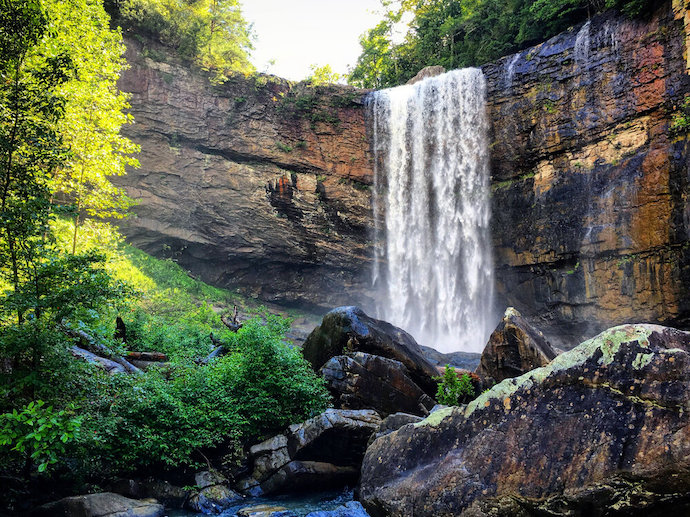
15. Amicalola Falls Loop Trail (Dawsonville, GA)
Level of difficulty: Moderate
Distance: 2 miles
Elevation Gain: 784 feet
Tucked away in the Chattahoochee National Forest, Amicalola Falls State Park is home to the tallest waterfall in the state and offers some of the best hiking trails in Georgia
Amicalola Falls tumbles over seven cascades with a total height of 729 feet, making it a stunning sight to behold.
The waterfalls are captivating in any season. But they’re especially beautiful in Autumn, when the changing colors of the Fall foliage provides a brilliant background of vibrant red, yellow, and orange hues.
There are multiple trails that give you access to the falls, including the wheelchair accessible West Ridge Falls Access Trail and the one-mile East Ridge Trail. But the most popular is the two-mile Amicalola Falls Loop Trail.
While it is still relatively short at just two miles, the elevation gain and number of stairs here makes this trail more of a moderate hike. Note that the metal grate stairs can be pretty difficult for some dogs.
READ MORE: 15 Fun Activities Where You Can Experience Fall in Georgia
16. Indian Seats Trail (Cumming, GA)
Level of difficulty: Moderate
Distance: 3.2 miles
Elevation Gain: 479 feet
Located just 40 miles north of Atlanta, the Indian Seats Trail is part of a network of hiking trails that run through the Sawnee Mountain Preserve. It’s great for nature lovers and history buffs alike.
The trail gets its name from the natural rock formation at the top of the trail, This is believed to be where Cherokee Indians would sit and meditate before they were forcefully removed by the Treaty of New Echota.
Along the way to the top (which has jaw-dropping views of the Georgia mountains), you’ll pass abandoned gold mines and interpretive signs you can read to learn more about the history of the area.
For more information about the area, stop at the Sawnee Mountain Preserve Visitor Center to see ancient Native American artifacts and learn about the flora and fauna you might see on the mountain.
READ MORE: 40 Fascinating Facts About Cherokee Culture & History
17. Appalachian Trail: Woody Gap to Big Cedar Mountain (Dahlonega, GA)
Level of difficulty: Moderate
Distance: 3 miles
Elevation Gain: 600 feet
Situated in the Blood Mountain Wilderness portion of the Chattahoochee National Forest, Big Cedar Mountain is one of the must-see mountains of North Georgia.
The summit can be accessed via a section of the Appalachian Trail starting at Woody Gap, which has multiple areas that are perfect for a pre- or post-hike picnic.
Entering into the dense forest, the trail follows the blazes of the Appalachian Trail through a series of steep switchbacks, eventually reaching the scenic landmark of Preachers Rock.
Staying on the Appalachian Trail past Preachers Rock, you’ll skim along the top of Big Cedar Mountain and be treated to some incredible long-range views of the rolling Blue Ridge Mountains.
READ MORE: The 15 Best Things to Do in Dahlonega GA & Lumpkin County
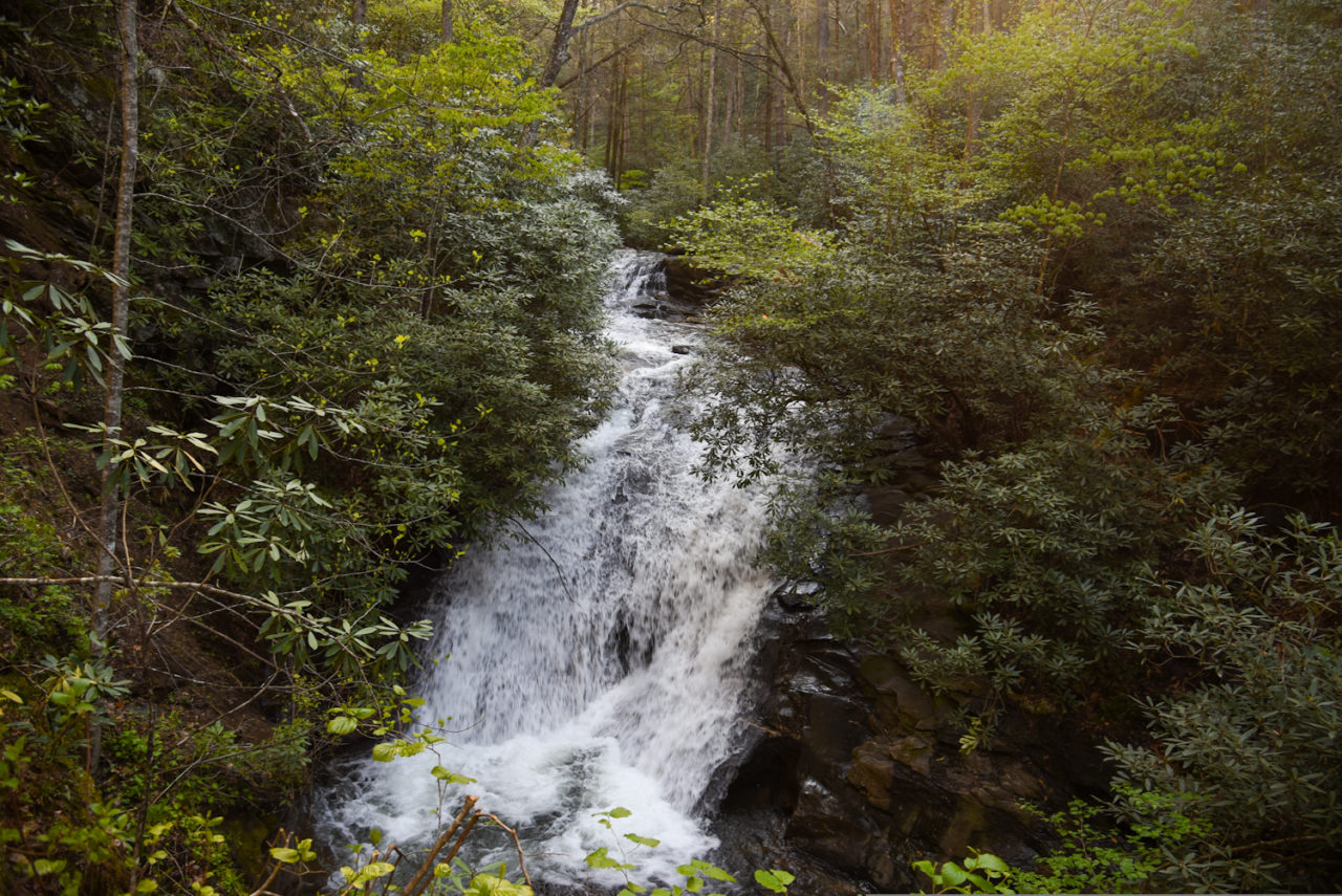
18. Raven Cliff Falls (Helen, GA)
Level of difficulty: Moderate
Distance: 4.9 miles
Elevation Gain: 400 feet
One of the best waterfalls near Helen GA, the journey to Raven Cliff Falls begins at a gravel trailhead and immediately begins to follow Dodd Creek upstream.
The path is incredibly beautiful, with towering hardwood trees surrounding you as the trail crosses several small streams lined with vibrantly colored wildflowers.
At just over a quarter of a mile, you’ll pass a campsite and a small swimming hole you can stop to splash around in. If you’re traveling with a furry companion, this may be their favorite spot!
The sound of the 40-foot falls will fill your ears before the cascades become visible at just over two miles in.
Here you can relax and enjoy the sights that make this another great waterfall hike in North Georgia!
READ MORE: The 15 Best Things to Do in Helen GA
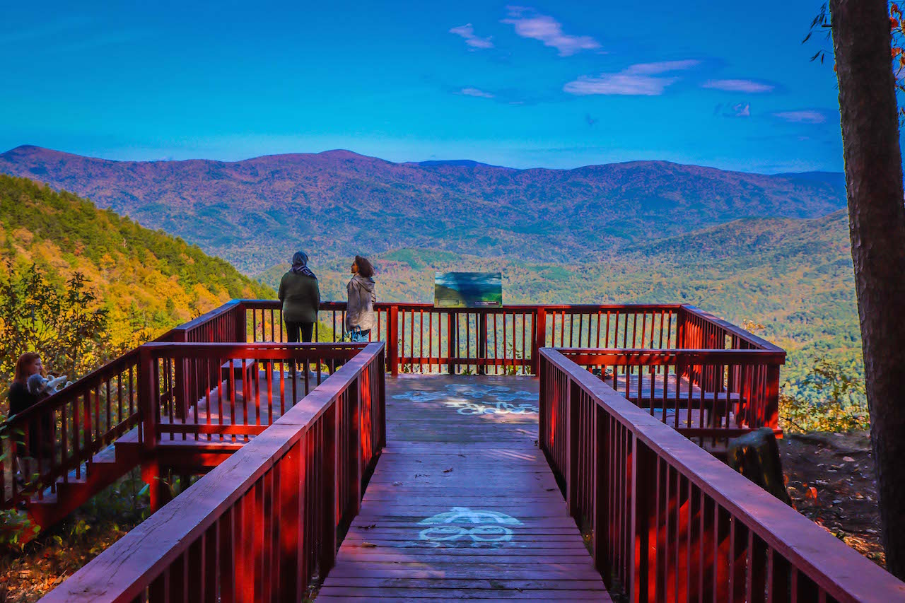
19. CCC Fire Tower Combination at Fort Mountain State Park (Chatsworth, GA)
Level of difficulty: Moderate
Distance: 1 mile
Elevation Gain: 423 feet
This moderate 1-mile loop is arguably our favorite of the Fort Mountain State Park hiking trails, visiting three of the park’s most fascinating features.
You’ll begin with an uphill hike on the West Overlook Trail, which offers jaw-dropping panoramas of the vast Cohutta Wilderness. In our opinion it ranks up there among the best North Georgia overlooks.
From there, head east and climb to a 4-story stone tower built in the 1930s by the Civilian Conservation Corps as a forest fire overlook. Used until the early ’60s, it was beautifully restored in 2014-2015.
On your way back down the Stone Tower Trail, you’ll use stone steps that were built by the CCC. You’ll also pass the remnants of a mysterious stone wall built between 500 and 1500 AD.
Nobody knows who built the 885-foot wall. Some say it was the Cherokee people, others say it was early European settlers, while Appalachian folklore suggests it was an alien race known as “the Moon-Eyed People.”
READ MORE: The 10 Best Restaurants in Ellijay GA for Breakfast, Lunch & Dinner
20. Ramrock Mountain (Suches, GA)
Level of difficulty: Moderate
Distance: 2.9 miles
Elevation Gain: 600 feet
Located 16 miles north of Dahlonega GA, Ramrock Mountain is one of the most gorgeous mountains in Georgia and requires less than a 3-mile hike to the summit.
While that distance may seem like a walk in the park to some folks, there’s pretty intense elevation gain along the way to earn this picturesque trail a moderate rating.
The hike starts at Woody Gap and immediately follows the Appalachian Trail south through stone steps and large boulders.
You’ll reach a 4-way split, where you’ll go left to find a short trail that will take you to the most spectacular views Ramrock Mountain has to offer.
At the summit, you’ll be gifted with breathtaking views of the rolling mountains on the horizon.
READ MORE: The 7 Best Restaurants in Dahlonega GA for Foodies
Strenuous Hikes in North Georgia
21. Yonah Mountain Trail (Cleveland, GA)
Level of difficulty: Strenuous
Distance: 4.2 miles
Elevation Gain: 1,489 feet
Situated between the Blue Ridge mountain towns of Cleveland and Helen, Yonah Mountain rises from the southern Appalachians and offers one of the best hikes in North Georgia.
While the beloved hiking trail is just over 4 miles, it’s incredibly steep and has an intense elevation gain that doesn’t let up until you reach the summit.
But with the breathtaking panoramic views at the top, experienced hikers would argue that exploring the Yonah Mountain Trail is a must.
In the spring, the hike features a bountiful array of wildflowers, including various species of Trillium, Rhododendron, and Violets. In autumn, the summit provides exceptional views of the changing colors.
This trail is also perfect for hikers who want a multi-day trip, as there are plenty of backcountry campsites available along the way.
READ MORE: The 15 Best Wineries in the North Georgia Mountains
22. Appalachian Trail: 3 Forks to Springer Mountain (Ellijay, GA)
Level of difficulty: Strenuous
Distance: 8.6 miles
Elevation Gain: 1,525 feet
Traversing 2,190 miles of the Appalachian Mountains from Georgia north to Maine, the Appalachian Trail is one of the most famous and popular hiking trails in the world.
Doing a 5- to 7-month thru-hike of the entire trail isn’t possible (or recommended) for most nature lovers. But the 3 Forks to Springer Mountain trail offers a great taste of the AT’s southernmost blaze.
This 8.6-mile hiking trail follows the AT’s gorgeous final stretch in Georgia, with the end commemorated by a bronze plaque.
The strenuous hike is perfect for a day trip, exploring a diverse landscape that includes several creeks (Chester Creek, Stover Creek, and Davis Creek) and offers incredible views from the summit of Springer Mountain.
READ MORE: The 10 Best Things to Do in Ellijay GA & Gilmer County

23. Blood Mountain Loop (Blairsville, GA)
Level of difficulty: Strenuous
Distance: 6 miles
Elevation Gain: 1,555 feet
One of the most popular and tallest mountains in North Georgia, this Blood Mountain trail is a favorite among many hikers because of its varied terrain and heart-stopping summit views.
The hike begins on the Byron Reece Trail and merges with the Appalachian Trail going westbound, immediately gaining elevation.
Along with the intense climb, this trail can get pretty rugged at times, making the hike even more strenuous. But the increasingly beautiful sights of the Chattahoochee National Forest are sure to keep you motivated.
A little over 2 miles into the hike you’ll reach a massive rock outcrop that offers exceptional views of the surrounding area from Blood Mountain’s summit.
There’s also a historic stone shelter that offers accommodations for hikers tackling the Appalachian Trail.
READ MORE: How to Get to Helton Creek Falls in Blairsville GA

24. Smith Creek Trail at Unicoi State Park (Helen, GA)
Level of difficulty: Strenuous
Distance: 8.4 miles
Elevation Gain: 1,663 feet
Starting at Unicoi State Park and making its way to the captivating Anna Ruby Falls, Smith Creek Trail is one of the longest and most uncrowded North Georgia waterfall hikes.
While there are no dramatic mountaintop views here, the trail is packed full of pristine flora and fauna. So it’s perfect for nature lovers looking to be immersed in the serene beauty of the North Georgia forest.
At 8.4 miles the hike is rather long, and you may find yourself climbing over a few fallen trees or working through overgrown sections.
But the sights along Smith Creek and the reward of Anna Ruby Falls at the end makes it well worth your efforts.
Originating atop Tray Mountain, the glistening waterfall is made up of two mountain streams coming together.
Curtis Creek drops 153 feet and York Creek drops 50 feet, merging to form Smith Creek, which eventually flows into Unicoi Lake.
READ MORE: Unicoi State Park & Lodge: Camping & Hiking Near Helen, GA
25. Coosa Backcountry Trail at Vogel State Park (Blairsville, GA)
Level of difficulty: Strenuous
Distance: 12.9 miles
Elevation Gain: 3,628 feet
If you’re looking for a challenge and are willing to face some tough terrain, the Coosa Backcountry Trail is widely considered one of North Georgia’s best hiking trails.
Starting at Vogel State Park in Blairsville, the trail gradually ascends into the dense Chattahoochee National Forest, crossing over a few creeks before entering the Blood Mountain Wilderness Area.
The trail is in really good condition and there are several campsites along the way, which makes it perfect for backpackers who are looking for an overnight trail.
But it also offers some serious elevation gain, giving you that rewarding sense of accomplishment once you reach the end. Plus, the Coosa Backcountry Trail is pretty secluded, so it’s rare to encounter other hikers!
READ MORE: The 15 Coolest Covered Bridges in Georgia
26. Panther Creek Falls Trail (Clarksville, GA)
Level of difficulty: Strenuous
Distance: 6.9 miles
Elevation Gain: Less than 800 feet
(NOTE: As of March 26, 2022, this trail remains temporarily closed due to damage caused by storms in 2020. Please check the official US Forest Service website to find out the trail’s status before visiting.)
The Panther Creek Falls trail follows a scenic stretch of the Chattahoochee National Forest to one of the most popular and beautiful waterfalls in Georgia.
Dotted along the route are campsites that are open on a first-come, first-served basis, which make the hike a great option for overnight backpacking trips.
The highlight of the adventure are the falls at the end of the nearly 7-mile hike, which drop in multi-tiered cascades into a sparkling pool below.
You can swim and cool off in the water, which makes this waterfall trail a huge hit in the summertime. There’s also a sandy beach area that’s great for picnics, or just relaxing and enjoying the scenery.
READ MORE: How to Get to Dukes Creek Falls Near Helen GA
27. Lower Conasauga River Trail (Ellijay, GA)
Level of difficulty: Strenuous
Distance: 13.2 miles
Elevation Gain: 2,000 feet
The Cohutta Wilderness is the largest wilderness area east of the Mississippi River, and has some of the most exhilarating biking trails in Georgia.
The Lower Conasauga River Trail is the second longest trail within the wilderness area, offering an intense adventure that should be reserved for more experienced hikers.
Entering the wilderness from Betty Gap near the headwaters of the Conasauga River, the trail is definitely a challenging feat to accomplish.
It has 18 river crossings (so it is guaranteed that at some point you’ll get wet) and plenty of boulders and fallen trees you’ll have to maneuver around.
While the hike is long and strenuous, there are plenty of campsites to stop at along the way, which many hikers tend to take advantage of!
READ MORE: The 15 Best Cabin Rentals in Ellijay GA
28. Emery Creek Falls (Ellijay, GA)
Level of difficulty: Strenuous
Distance: 6.2 miles
Elevation Gain: 900 feet
While the Emery Creek is one of the more difficult waterfall hikes in GA, the payoff is multiple fantastic viewpoints of the waterfall’s enchanting double cascades.
Located near the Ellijay (best known for its apple-picking opportunities), this hiking trail makes you feel as though you’re a million miles away as you explore the vast southern section of the Cohutta Wilderness.
Considering there are 20 creek crossings along the way, it’s perfect for a summertime adventure. As you follow the trail through lush deciduous forest, there are several trailside campsites where you can stop at for a rest.
Because of the slippery creek beds and the fact that the trail isn’t clearly marked, we would only recommend this trail for more experienced hikers. But if you’re up for the challenge, it will be an experience you won’t forget!
READ MORE: The 20 Best Places to Live in the Georgia Mountains
29. Bartram Trail from Sandy Ford to Warwoman Dell (Clayton, GA)
Level of difficulty: Strenuous
Distance: 9.3 miles
Elevation Gain: More than 1000 feet
Following the path explorer William Bartram took in the late 18th century as he documented over 100 new species of flora and fauna, the Bartram Trail covers 114 miles in Western North Carolina and North Georgia.
In Georgia, there’s a 35-mile stretch of the trail that travels through some of the state’s most beautiful forests, waterfalls, and peaks.
For our ultimate hiking bucket list we’ve picked a 9.3-mile section of the trail that runs from Sandy Ford to Warwoman Dell. It features many campsites, and is perfect for a multi-day backpacking adventure.
When you make it to Warwoman Dell, be sure to explore the area. There’s a sheltered picnic area, a valley that blooms with wildflowers in the spring, and several small waterfalls hidden throughout!
READ MORE: The 10 Best Romantic Getaways in the North Georgia Mountains
30. Dicks Creek Gap to Powell Mountain (Hiawassee, GA)
Level of difficulty: Strenuous
Distance: 5.2 miles
Elevation Gain: 1,025 feet
Offering a more secluded hiking experience than some of the trails on this list, the trek to the summit of Powell Mountain explores a lush forest of towering hardwoods before showcasing far-flung scenic vistas.
The adventure begins at the Dicks Creek Gap trailhead in Hiawassee and follows the Appalachian Trail southbound. The trail will climb some pretty intense elevation before crossing a small waterfall and shallow creek.
After continuing through McClure Gap, the hike leaves the AT and enters a clearing that reveals the spectacular beauty of North Georgia in all its splendor.
The views here are typically so clear, you can even spot Lake Seed, Lake Burton, and Lake Rabun (three of our favorite mountain lakes in Georgia).
When you’re ready to complete the hike, the route simply reverses back to the trailhead. –by Christina Maggitas; photos by Bret Love & Mary Gabbett unless otherwise noted
