
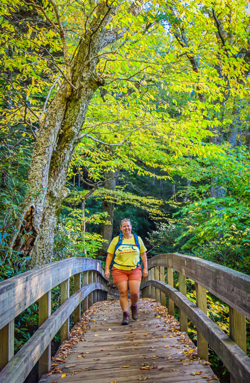
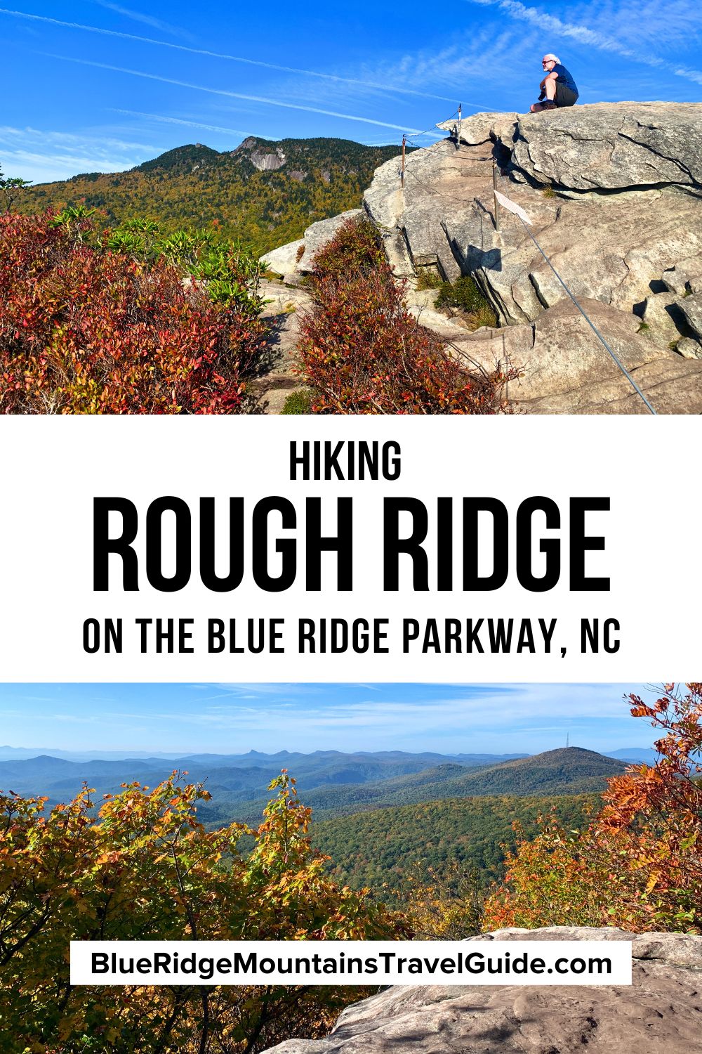
Starting at the Rough Ridge Overlook (Milepost 302.8), this 1.5-mile Blue Ridge Parkway hike will have you crossing a bridge over a creek, standing atop massive boulders, and beholding rare and fragile wildflowers.
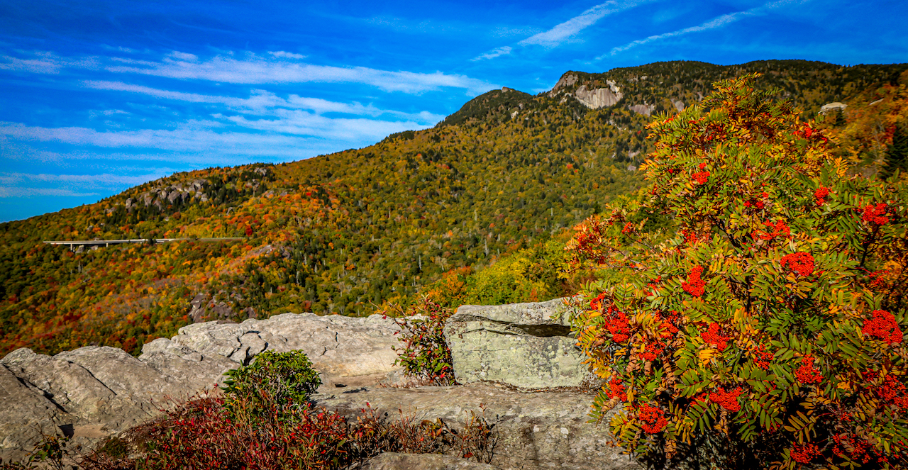
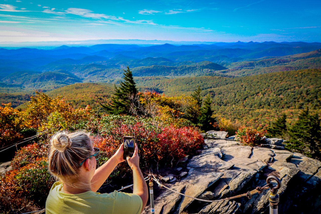
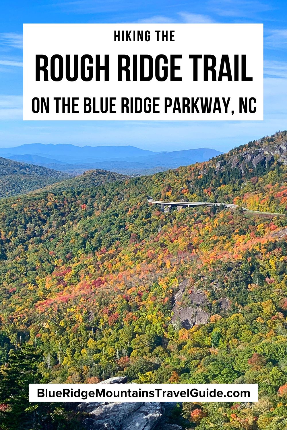
At the 4,773-foot summit of the Rough Ridge hiking trail, you’ll savor spectacular view overlooking the Blue Ridge Mountains, Linn Cove Viaduct, and Grandfather Mountain.
Top Places to Stay Near Rough Ridge NC
- The Pineola (lodge, cabin, RV, & tent camping in ideal location w/beer cave & Tap Room)
- The Inn at Shady Lawn (family-owned dog-friendly mountain retreat w/country cafe)
- Meadowbrook Inn (downtown Blowing Rock boutique hotel w/pool & gardens)
- Dog-Friendly Cabin by Lake (cozy 2bd/2ba home w/heated pool & lake views)
- Blue Ridge Bungalow w/ Spa in Linville (2bd/2ba home w/hot tub & pool, & boat rentals)
Rough Ridge Trail NC Info
ADDRESS: Milepost 302.8 on the Blue Ridge Parkway
PHONE: 828-348-3400
COST OF ENTRY: Free
HOURS: Always open
PARKING: Free parking at the trailhead
Driving Directions from Boone NC
From downtown Boone NC, head southwest on Edgewood Dr toward Councill St. In 39 feet, turn left onto Councill St/Tracy Circle and continue for 131 ft until the road turns into Hardin St.
In 0.3 miles, continue straight onto US-321 S/Blowing Rock Rd. Go 2.8 miles, then continue straight onto US-221 S/US-321 S.
After 4.2 miles, turn right onto Main St. In 0.7 miles, turn right onto US-221 S/Yonahlossee Rd, and continue for 12.4 miles. Follow signs to the Blue Ridge Parkway and the Rough Ridge Lookout.
READ MORE: The 20 Best Cabin Rentals in Boone NC
Hiking the Rough Ridge Trail
The Rough Ridge Trail makes up a section of the larger 13.5-mile-long Tanawha Trail, which is also a part of the Mountains to Sea Trail in Western North Carolina.
Park at the Rough Ridge Lookout (BRP Milepost 302.8) and you’ll see the Rough Ridge trailhead to the right.
Note that this parking lot tends to fill up early, especially on weekends in Summer and peak Autumn. So our advice is to get there early or go on weekdays if you want a spot!
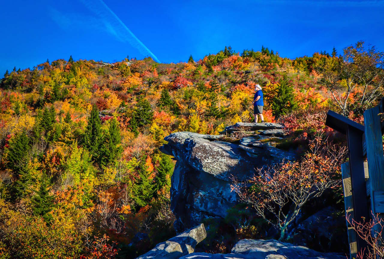
Hikers cross a bridge over a creek and ascend a 1/3-mile from the parking lot, then you’ll come to a boardwalk that meanders out over rocky outcrops, boulders, and mountain vegetation.
Continue hiking for another 1/2-mile to reach the Rough Ridge summit, at an elevation of 4,773 feet.
There are permanent cables to help you clamber up the boulders to the very top, but this last part might be more challenging for some hikers.
While this is a short hiking trail at about 1.5 miles round-trip, the hike is somewhat strenuous due to the 480-foot gain in elevation.
This trail can also get muddy at times, and there are some rocky parts to navigate. Dogs are allowed on the Rough Ridge Trail, but they must be kept on a leash at all times.
Give yourself at least 45 minutes to complete the trail. But we recommend making it longer by stopping at one of the many great overlooks, where you can take in the breathtaking views and even have a picnic.
READ MORE: The 15 Best Blowing Rock Cabin Rentals (1 to 4+ Bedrooms)
Rough Ridge Trail Campgrounds
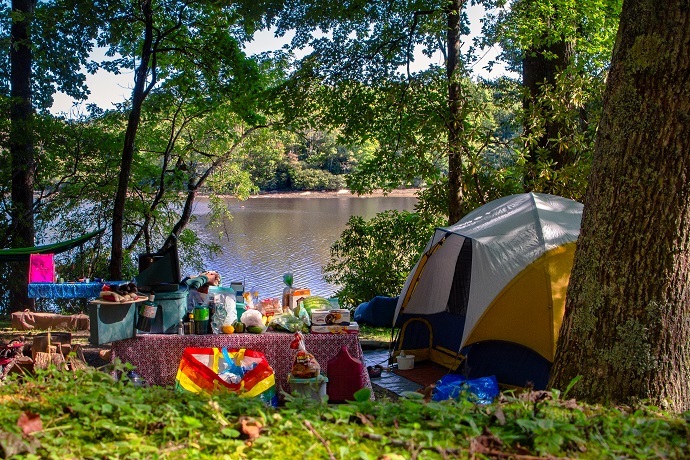
The closest Blue Ridge Parkway campground to the Rough Ridge Trail is at Julian Price Memorial Park (MP 297), which is just over 4 miles from the trailhead.
Julian Price Campground is a wonderful place for camping, with awesome views of Price Lake and close proximity to many other Blue Ridge Parkway attractions in the area.
This campground straddles the Parkway, with great hiking trails all around. The stunning North Carolina lake across from the campground is perfect for anyone who enjoys canoeing, kayaking, and paddleboarding.
There are often ranger-led events at the campground, such as talks on the local wildlife, plants, and wildflowers. Keep an eye on the bulletin boards that are dotted around the park for updated schedules.
Moses H Cone Memorial Park is just 2.5 miles from the campground, offering 25 miles of hiking trails, Bass Lake, and a mansion that houses a Southern Highland Craft Guild gift shop.
Just off the Blue Ridge Parkway, the Grandfather Campground is 23 minutes from the Rough Ridge trailhead. It’s open year-round, and is only 20 minutes away from Boone and Blowing Rock.
READ MORE: The 10 Best North Carolina Mountain Resorts to Visit
Other Trails Near the Rough Ridge Trail
There are plenty of other trails near Rough Ridge, including some of our favorite Blue Ridge Parkway waterfalls.
The moderately strenuous 13.5-mile Tanawha Trail stretches from Julian Price Memorial Park to Beacon Heights and winds along the Blue Ridge Parkway.
You’ll find diverse terrain along the trail, from giant boulders to rhododendron thickets, hardwood forest, and jaw-dropping views of the Blue Ridge Mountains of North Carolina.
There are also several great trails around the Julian Price Campground: The moderate-to-strenuous, 5.5-mile Boone Fork Trail was one of our favorite hikes when we camped there last summer.
The moderately strenuous, 2.3-mile Green Knob Trail is just down the road from the campground. It starts at the Sim’s Pond Parking area and takes you through rhododendron thickets and past huge hemlocks.
We recommend you hike this trail counter-clockwise to avoid climbing a very steep hill!
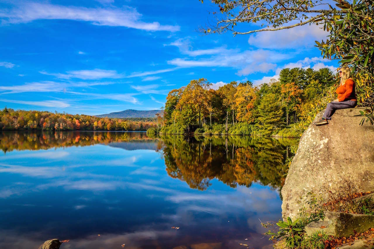
Price Lake Trail is a family-friendly 2.7-mile trail that loops around the gorgeous 47-acre lake, with flat terrain and beautiful morning views of the mist crawling across the water.
Once you’ve finished looking at Grandfather Mountain from the Rough Ridge Summit, drive 4 miles to visit Grandfather Mountain State Park, where you’ll find trails of all lengths and exertion levels. -by Emma Gallagher; all photos by Bret Love & Mary Gabbett unless otherwise noted
