

[Updated January 21, 2022] Smartphones have made it easier than ever to access information at home.
We can book flights and rental cabins with the push of a button. We can learn fascinating facts about Appalachian folklore, history, and culture in seconds, without having to leave the couch.
This access to info has created a surge of interest in outdoor recreation. People can experience what it’s like to free-climb El Capitan on Netflix, or hike the Appalachian Trail via a YouTube video.
Backpacking used to require hiking essentials such as a compass, paper maps, and more. But now cell phones can provide a vast network of information without even connecting to the internet!
Popular hiking apps such as AllTrails, FarOut, Gaia, and OnX Backcountry have made it increasingly simple to find, plan, and track our hikes with our cell phones.
All of these apps are free on the App Store, but most have options for a paid premium subscription or require in-app purchases to access offline content.
They often include weather reports, saved routes for popular hiking trails, maps to water sources, and alerts from official sites.
Read on for our guide to the 10 Best Apps for Hikers and Backpackers, which can help make it easier to discover and explore hiking trails in the Blue Ridge Mountains and all across the USA.
READ MORE: The 25 Best Blue Ridge Parkway Hikes for NC Day Trips
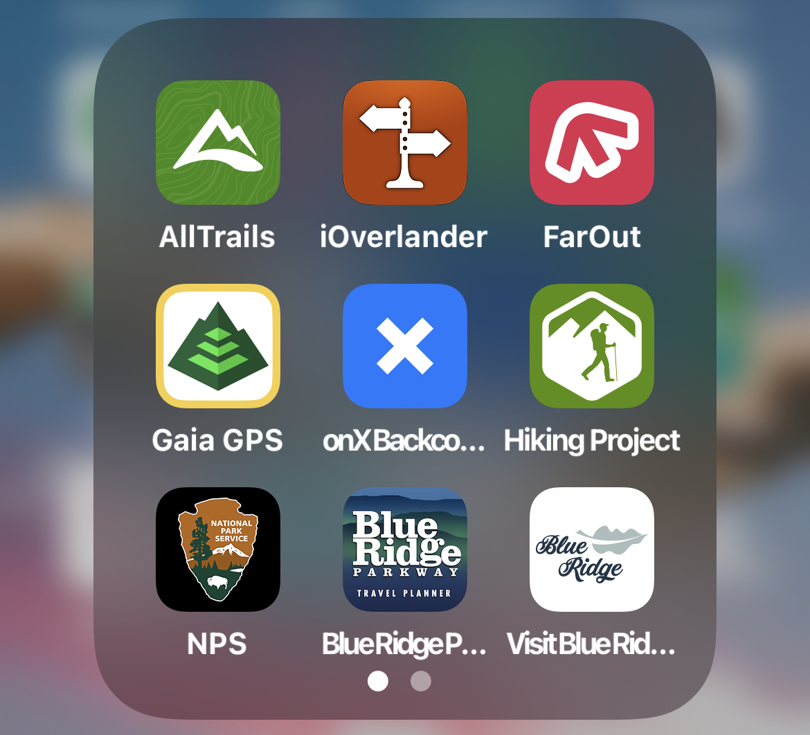
10 Best Hiking Apps of 2022 Guide
- AllTrails
- FarOut
- Gaia GPS
- OnX Backcountry
- Hiking Project
- iNaturalist
- National Park Service
- Blue Ridge Parkway Travel Planner
- iOverlander
- RunKeeper
1. AllTrails
Currently ranked 13th in the Health & Fitness charts, AllTrails is one of the best hiking apps available on app stores today.
It’s comprehensive, easy to use, and great for socializing with other outdoor enthusiasts.
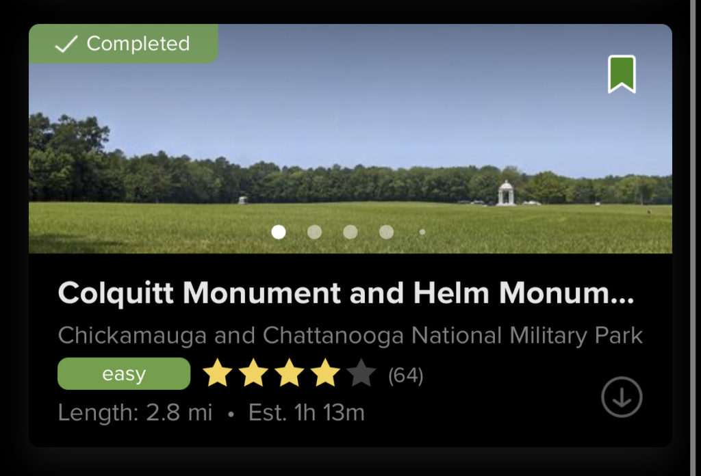
The Explore section shows popular trails, views, and waterfalls nearby. Uses can save the trails to lists for future trips, or mark them as completed.
The app will filter nearby hiking trails by distance, difficulty, elevation gain, and more, making it one of the best apps for quickly finding hikes near you.
When you click on a trail, the app makes it easy to find driving directions to the trailhead, or navigate when on the trail.
AllTrails Pro users can pay $29.99/year to download offline maps to navigate without cell service. This also includes Lifeline, a feature that will alert up to 5 chosen contacts of your expected finish time.
One feature that makes it the best app for hiking trails is “Browse by Suitability.” This allows you to find nearby easy hiking trails that are stroller- and wheelchair accessible, or suitable for kids and pets.
AllTrails has an enormous user base, and its success well-deserved. Anyone interested in hiking can quickly find all the information they need to plan a successful day trip or multi-day trip in minutes.
READ MORE: The 30 Best Hiking Trails in North Georgia Bucket List

2. FarOut
FarOut (formerly known as the Guthooks Guide) is the best backpacking app for anyone who frequents the Appalachian Trail.
The free trekking app includes paid guides for all the major trails in the US, including the Appalachian Trail, Benton-MacKaye Trail, Pacific Crest Trail, and more.
The FarOut app is incredibly user friendly, especially when you’re out on the trail. The buttons along the bottom of the app make it easy to switch between its many features.
Users can purchase guides to sections of Appalachian Trail in Georgia, North Carolina, Virginia, or the whole 2,190-mile trail from the FarOut store. The whole AT guide costs $59.99, while the guides to each of its 10 sections costs $8.99.
When you’re in the guide, FarOut makes it easy to switch between different map options. The elevation guide, detailed list, and traditional map are all available when offline.
Hikers can switch between the elevation guide and traditional map when hiking through the forest. The list option is best for planning upcoming stops or water refills.
FarOut makes it easy to see what’s coming up on the trail so you can figure out exactly how much time you have between water crossings, or where to find a good scenic vista to stop for a picnic lunch.
READ MORE: 30 Fascinating Facts About the Appalachian Mountains for Trivia Buffs
3. Gaia
One of the most popular GPS hiking apps on the market, Gaia is a great tool for anyone who prefers to plan their hiking trips offline.
The app, which works offline, allows you to quickly create a route after planning a trip. You can then use your phone on the hiking trails to track your route, leaving any paper maps and guides at home.
One unique feature of Gaia GPS is that users can download GPX files to the app. GPX files, which are easily accessible online, are saved routes that are created and shared by other people.
This allows users to create, find, and download routes that are not as common, or are a combination of different trail systems.
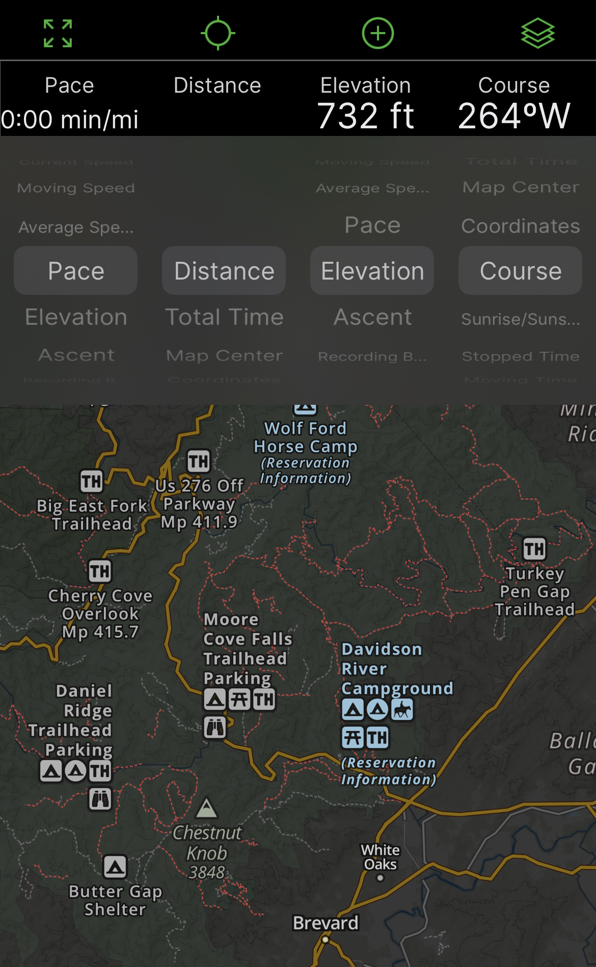
Users can choose the overlay option at the top of the screen to see different map overlays.
In cities and towns, the Gaia topography option shows streets and major landmarks. The satellite, USFS roads and trails, and precipitation forecast options could also be useful during a hike.
The bar at the top also allows you to see different options while hiking, such as distance, time, pace, coordinates, course, and sunrise/sunset time.
Gaia Premium is available for $39.99 to anyone who wants to sync and back up their routes or share them with others. The app regularly offers discounts for the Premium version around Christmas.
READ MORE: The 20 Best Pisgah National Forest Hiking Trails in North Carolina

4. OnX Backcountry
OnX Backcountry is one of the best hiking apps for trekkers and skiers alike. The app allows users to easily switch between the hike and ski modes.
OnXmaps was created to help hikers, skiers, and hunters see clear land boundaries on their comprehensive GPS apps. They also work with non-profits to protect public land access for all types of outdoor recreation.
This is one of the best GPS hiking apps because of their advanced GPS system. Uses can click on any point of the map to see whether the area is government-owned, BLM, or private land.
Trails, roads, recreation areas, and city and state parks are all clearly marked on the map, making nearby trails easy to find.
One of the best features of the trail map app is that it clearly shows the current weather conditions. When you open the app, the weather icon on the top right shows a detailed report of the local forecast.
Skiers (and snow tubers) can also find avalanche forecasts, previous avalanche incidents, and other important forecast information for a safe day on the slopes.
OnXmaps, Inc. also has separate apps available for hunting and off-roading, both of which are ranked in the Top 15 of navigation apps on the Apple app store.
READ MORE: The Best Places for Snow-Skiing in North Carolina
5. Hiking Project
This app, which originally began as mountainproject.com, is a compilation of free information on hiking, biking, trail running, climbing, and skiing all over the USA.
After being purchased by REI in 2015, the Hiking Project was created to bring the website’s features to iOS and Android users.
Downloadable maps of every U.S. state are available on the app. Maps of Australia, Canada, Brazil, Mexico, Norway, Switzerland, and many other countries are available as well.
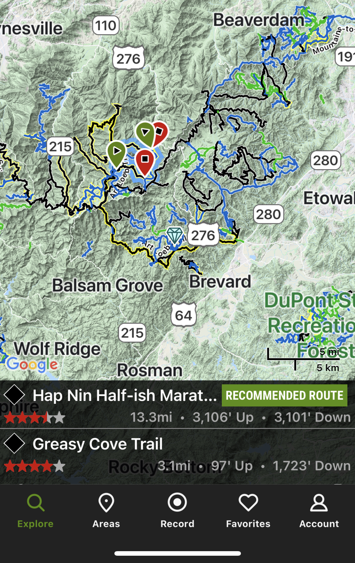
Users can explore hiking trails in their area, favorite future hikes, and record their own hikes to share on the app. One of the app’s most notable features is the “record” function, which allows users to contribute to the growing list of available trails.
Choosing a trail on the map shows the name of the trail, distance, elevation guide, and more. After recording a trail, creators can add in any important information to share with others.
Notes on each trail include specific notes on trail conditions, suitability for young kids, notes for trail runners, and the history of the trail.
OnXmaps purchased Adventure Projects Inc. from REI in December 2020. The purchase is obvious when you see the advanced mapping system shared by both apps.
Adventure Projects Inc. has also created the National Park Trail Guide, Powder Project (for skiing), Trail Run Project, MTB Project (for mountain biking(, and Mountain Project (for climbing).
READ MORE: The 20 Best North Georgia Waterfalls (& How to Get to Them)
6. National Park Service
Release in Spring 2021, this new National Park Service app is quickly growing in popularity as one of the best hike apps for offline use.
The app includes updated information on road closures, park maps, and parking fees. All relevant information from the national park websites can also be found on the app for easy viewing on-the-go.
It is not currently as comprehensive as the other apps on this list, but that will likely change with time.
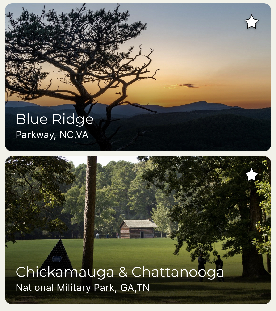
But the Blue Ridge Parkway is the most visited of all the national park units in the U.S., and it also seems to be the most updated section of the app.
The NPS app shows visitors where to access the park, where to find historical signs, and even where to get your National Park Passport stamped.
The “Things To Do” section shows users the most popular hiking, biking, fishing, stargazing, and wildlife areas of a park, such as the Cataloochee Valley Elk of Great Smoky Mountains National Park.
It also includes self-guided tours of the Blue Ridge Parkway and lists of National Park campgrounds, with links to reserve spots.
READ MORE: The 10 Best National Parks in Georgia to Visit
7. iNaturalist
iNaturalist is a nature identification app intended to create data that can be useful to scientists all over the world. Amateur naturalists can make observations that will be used to inform scientific research.
Basically, you can use your phone to take photos of plants and animals you see on your hike. The app then shows you species that match your observations to help you identify them.
Your observations are organized into your profile, which is located under the “Me” tab.
The main map will show you animals, birds, plants, and fungi in your area that have been recorded by other users. Navigating to a hike you want to do will show you what flora and fauna you might see.
This map feature makes iNaturalist one of the best trail hiking apps for families. You can give your kids a scavenger hunt of plants and bugs they might encounter, or turn it into a bingo-like game.
A collaborative group feature allows educators, hiking groups, and other communities to create a collection of observations.
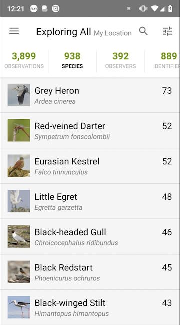
Each national park also has their own group, which any user in the park can add to. The Blue Ridge Parkway group alone has over 4,000 observers, with almost 45,000 observations between them!
READ MORE: 20 Beautiful Birds of North Carolina

8. Blue Ridge Parkway Travel Planner
The Blue Ridge Parkway Travel Planner app is a comprehensive app that give users easy access to everything they need to know about the world-renowned scenic route.
By clicking on a region, you can find a detailed guide that includes the BRP’s best hikes, overlooks, tunnels, hotels and cabins rentals, as well as attractions such as Mt. Mitchell and Price Lake.
The app also makes it easy to find access points to the Blue Ridge Parkway, with detailed directions to the nearest point from wherever you are.
One feature that makes the Blue Ridge Parkway Travel Planner one of the best apps for hikers is the list of accessible places on the BRP.
Traveling with a mobility aid can be difficult to plan, but this app lists trails, picnic areas, and restrooms that are accessible to everyone.
The app also lists hiking trails and waterfalls by region. If you’re driving the BRP and want to stop to hike along the way, this app shows you exactly which trails are coming up on your route.
READ MORE: The 20 Best Blue Ridge Parkway Overlooks in NC & VA
9. iOverlander
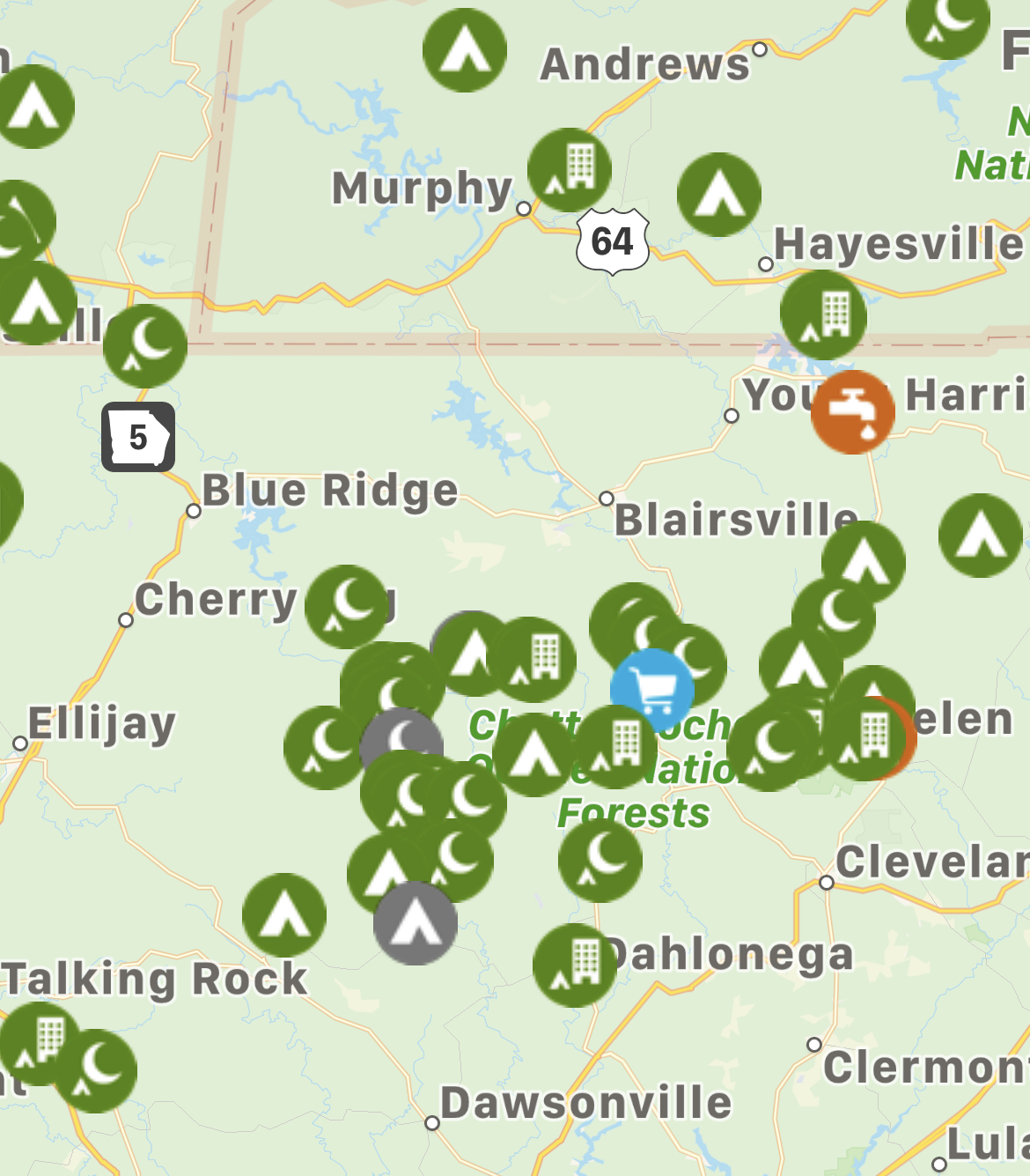
iOverlander is one of the best GPS apps for hikers. This is a collaborative app that makes it easy to find food, water, shelter, and other important services while traveling.
There are a lot of different factors to consider when planning a hiking trip. Knowing where to find a mechanic, hospital, or wild camping site at the last minute can be lifesaving.
iOverlander helps users find campgrounds, potable water, fuel, shelter, emergency services, and more when traveling. The map allows you to filter results to show you only what you need.
The best thing about iOverlander is that users can add to the map. If you find a place to stay that hasn’t been mentioned, or come across a spot that is no longer accessible, you can let others know.
You can also find pictures, comments, and up-to-date information about each site when you click on it in the map. The app shows closures, gps coordinates, distance, and the last visited date.
Scroll down on the “place details” page to find easy links to the site on Google Maps or Gaia, as well as a share link and an option to check-in at that location.
In our eyes, iOverlander is one of the best GPS hiking apps because it gives us the peace of mind to know we can get out of a tough spot quickly.
READ MORE: Non-Venomous vs Venomous Snakes In Georgia (Identification Guide)

10. RunKeeper
RunKeeper has been a constant on my list of favorite GPS hiking apps since I started hiking.
Designed primarily for runners, the easy-to-use app also tracks the mileage, times, and locations of your hikes and trail runs.
The quick start page lets users quickly switch between different types of workouts, like running, trail running, hiking, cross country skiing, or mountain biking.
Specific workouts can be added to a hike or run in order to help keep you on track with your time or distance goals.
Pacing notifications, time intervals, or distance training plans can all be easily programmed.
The app will also pair with Spotify and Apple Music, and will automatically turn down the volume to give you pacing, time, or distance notifications if you have that feature turned on.
Most hikers and runners have a favorite GPS app to use on the trail. RunKeeper makes it easy to keep track of routes and mileage, especially if you frequent the same trails for training. –by Amy Lewis


