
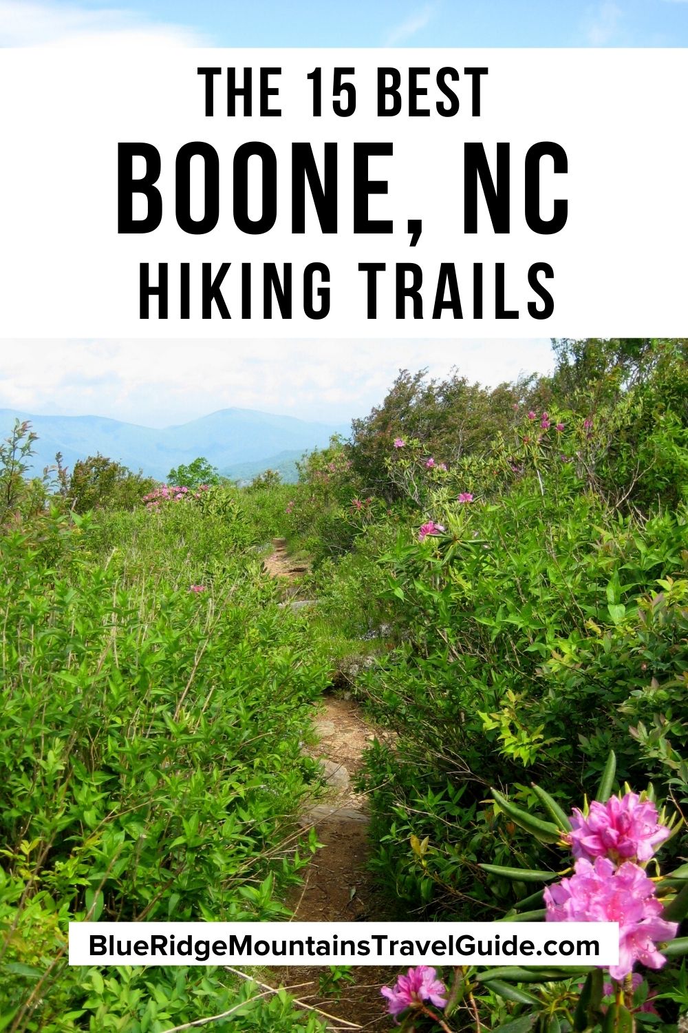
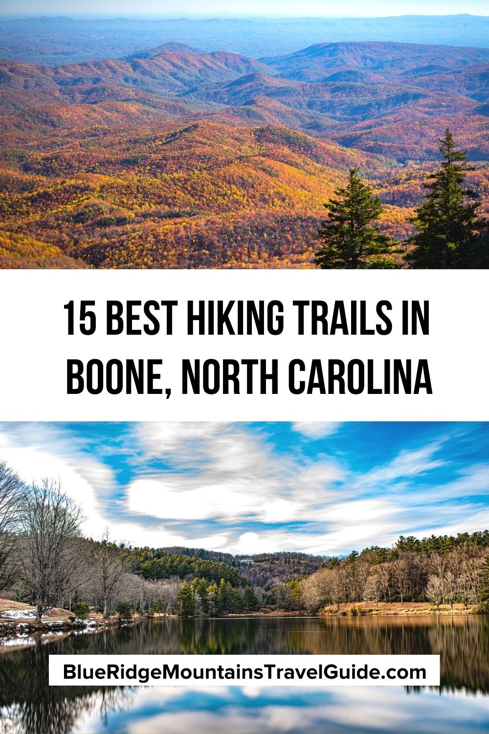
[Updated August 3, 2021]
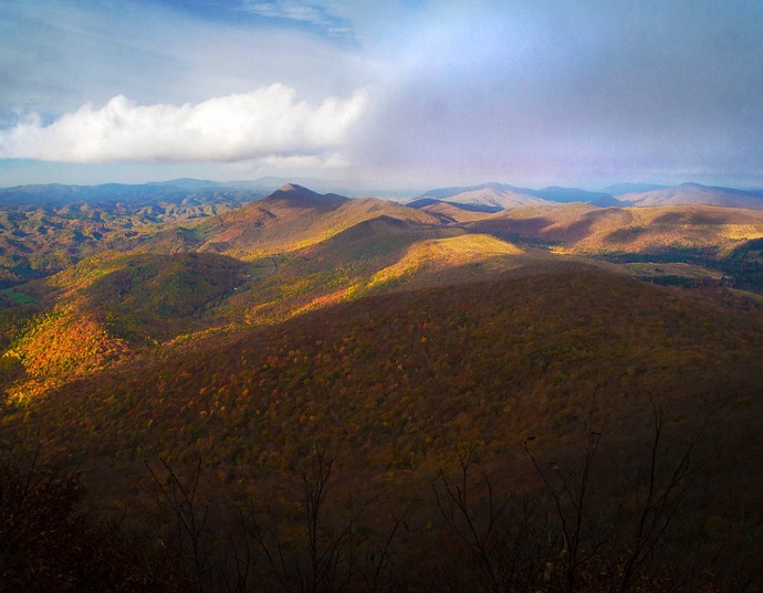
The Blue Ridge Mountain town of Boone NC is best-known for its Christmas tree farms and outdoor recreation opportunities, offering everything from mountain biking and rock climbing to whitewater rafting and snow skiing.
The county seat of Watauga County has a population of around 20,000, which is pretty big for the Western North Carolina High Country.
That’s partly because Boone is home to Appalachian State University, whose student enrollment stats are neck-and-neck with the city’s population. As a result, there are loads of microbreweries, innovative eateries, and trendy shops here.
The university, the beauty of the Blue Ridge Mountains, and the rich history of the region have created a wonderfully inviting blend of personality, panache, and panoramas that make Boone a pleasure to visit.
Another noteworthy attraction? The bevy of Boone NC hiking trails the area offers.
The charming mountain town is stuffed and wrapped in first-class trails. Whether it’s stunning summits, easy strolls, or wondrous waterfalls you want to see, there are countless hiking trails near Boone worthy of exploration.
Read on for details on 15 of our favorite Boone trails for an epic outdoor experience!
READ MORE: The 15 Best Things to Do in Boone NC
BOONE NC HIKING TRAILS GUIDE
- Bass Lake Loop
- Boone Fork Trail
- Cascades Trail
- Summit Trail
- Flat Top Road
- Glen Burney Trail
- Green Knob Loop
- Boone Greenway Trail
- Price Lake Loop
- Grandfather Mountain Profile Trail to Calloway Peak
- Rocky Branch Loop
- Rich Mountain Trail w/Trout Lake
- Beacon Heights Trail
- Otter Falls Trail
- Tanawha Trail
READ MORE: The Best Places to Celebrate Christmas in North Carolina

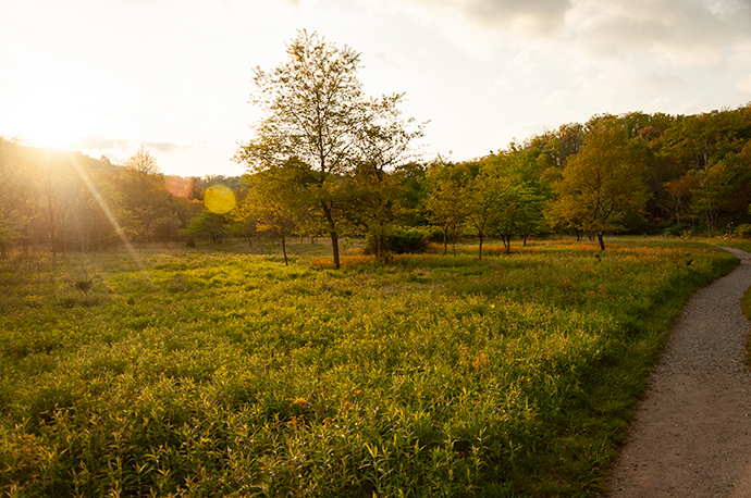
Bass Lake Loop
Moses H. Cone Memorial Park
BRP Milepost 294
Hiking Distance: 1 Mile
Named for the area’s notorious “Denim King,” Moses H. Cone Memorial Park is located just a few miles from Downtown Boone.
It can be accessed either via the Blue Ridge Parkway or via US-221, just west of Blowing Rock. Either way, it’s just under a 10-mile drive.
The park itself is wonderful to visit, and actually offers several worthwhile hiking trails. However, the loop trail around Bass Lake ranks among the very best hiking trails in North Carolina .
This is an easy one-mile route that circles one of NC’s most beautiful mountain lakes. It’s accessible for wheelchairs and baby carriages (via US-221), and there are plenty of pretty photos to take and picnic spots to stop at along the way.
The Bass Lake hike can be extended several miles by starting from the Parkway and adding detours to the Cone Manor House, Apple Barn, and a winding trail called The Maze.
Most of the trails in Moses H. Cone Memorial Park are suitable for horseback riding and even horse-drawn carriages, so that’s another bit of fun to have in the area.
READ MORE: The Top 15 NC State Parks in the North Carolina Mountains
Boone Fork Trail
Julian Price Memorial Park
BRP Milepost 297
Hiking Distance: 5 Miles
Julian Price Memorial Park is another beautiful recreational area, located right on the Blue Ridge Parkway. It’s home to several of our favorite places for hiking near Boone.
The 4,200-acre plot was originally bought by insurance magnate/philanthropist Julian Price as a retreat for his employees. After Price’s death in 1946, his family donated the land to the Parkway.
The Boone Fork Trail is one of the most popular hiking trails in Boone NC. Due to its relative ease, but noteworthy beauty, the five-mile loop has daily traffic, and can get particularly busy on the weekends.
The trail follows along cascading creeks, tunnels beneath thickets of rhododendron, and weaves betwixt giant boulders. It even shows off some of the area’s most lovely waterfalls.
The Boone Fork Trail also circles right by the Price Park Picnic Area, so why not bring along a nice spread to enjoy while you’re out for the day?
READ MORE: The 15 Best Blue Ridge Parkway Hikes for NC Day Trips

Cascades Trail
E.B. Jeffress Park
BRP Milepost 271.9
Hiking Distance: 1 Mile
Located just north of Boone on the Blue Ridge Parkway, the 600-acre E.B. Jeffress Park is a small recreational area by Blue Ridge Parkway standards.
But what it lacks in size, it more than makes up for in waterworks.
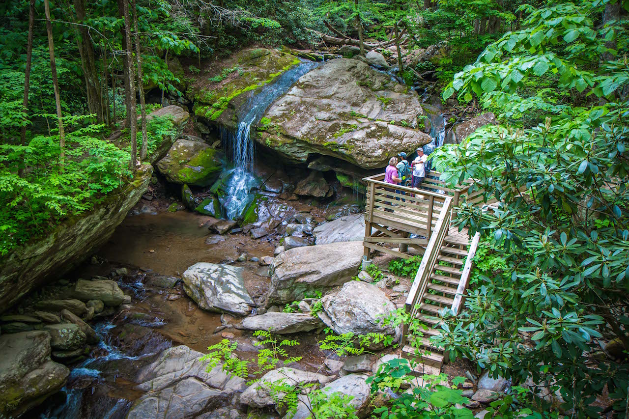
The Cascades Trail is a one-mile loop, and it is one of the most heavily trodden trails in the NC High Country. That’s because it’s home to one of the best waterfalls near Boone, with plenty of cascades to appreciate along Falls Creek.
To add some length to the hike, it’s possible to combine the Cascade Trail with Tompkins Knob Trail, which brings trekkers past Jesse Brown Cabin, Cool Springs Baptist Church, an old spring house, and Tompkins Knob Overlook.
Combined, these two trails add up to about 2.2 miles of hiking. Again, there are some nice picnic tables here, suggesting that visitors might like to linger for some fresh mountain air and a hearty snack.
READ MORE: The 15 Best Blue Ridge Parkway Waterfalls in North Carolina
Summit Trail
Elk Knob State Park
5564 Meat Camp Road
Hiking Distance: 3.8 Miles
Approximately 10 miles north of the town of Boone, Elk Knob State Park encompasses over 4,000 acres of wilderness and features one of the region’s highest peaks, the 5520-foot Elk Knob.
If you love the challenge of a good summit trek with steady elevation gain, Elk Knob is a great option.
The Summit Trail offers a strenuous 2-mile climb to the top, from which successful climbers can see stunning highlights such as Grandfather Mountain, Mount Jefferson, and Mount Mitchell in all their glory.
This Boone NC hiking trail is all about scenic vistas, and there are a handful of selected viewpoints from which to soak it in along the way.
Backcountry camping, picnic tables, an educational trail for kids, and a park office are all available at Elk Knob State Park. So it’s definitely worth a visit even if a daunting two-mile climb doesn’t peak your interest.
READ MORE: Things to Do in Elk Knob State Park Near Boone NC
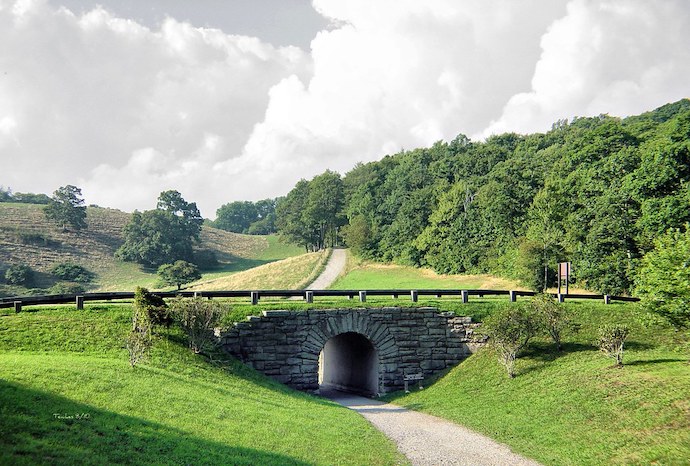
Flat Top Road
Moses H. Cone Memorial Park
BRP Milepost 294
Hiking Distance: 5 Miles
Crossing under the Blue Ridge Parkway from the Carriage Barn near the Cone Manor House, visitors run into Flat Top Road.
It was originally constructed for horse-drawn carriages.Now it’s a hiking trail, and immensely enjoyable to walk.
The seemingly flat, wide gravel path travels about 2.5 miles to the summit of Flat Top Mountain (4,558 feet). There, a historic lookout tower provides 360-degree panoramas of the Blue Ridge Mountains and North Carolina Piedmont.
The walk along Flat Top Road winds through meadows laden with wildflowers, into sections of lush forest, and beneath plenty of fresh air and sunshine. For those interested, a slight detour will also bring you to the Cone Family Cemetery.
This is a remarkable summertime hike. But please be sure to carry plenty of water, as there is a lot of sun exposure along the route.
READ MORE: The Best Things to Do in DuPont State Forest, NC
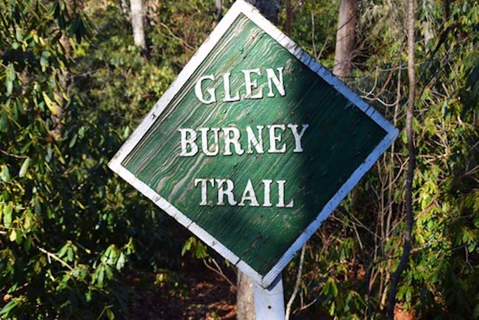
Glen Burney Trail
Downtown Blowing Rock
243 Laurel Lane
Hiking Distance: 3.2 Miles
This hiking trail is believed to have been used by Native Americans in the pre-Colonial era. It has definitely been used by tourists since the 1800s, as well as loggers in the early 1900s.
The trail has been periodically updated over the years, but the main reason folks have used it for so long remains– the beautiful cascades along New Year’s Creek.
The hike on Glen Burney Trail is deceptively difficult. The one-way trail descends 1.2 miles to Glen Burney Falls, then continues down another 0.4 miles to Glen Marie Falls.
The problem is that this requires hikers to turn around and climb 1.6 miles to get back to the trailhead! Nevertheless, it’s a fantastic hiking trail that’s often marked with a colorful rainbow’s end (caused by the mist on the waterfalls).
Plus, the trail is located right in the heart of Blowing Rock, so a good meal and a pint of microbrew will be waiting nearby when all the trekking is over.
READ MORE:The 15 Best Things to Do in Bryson City NC & Swain County
Green Knob Loop
Blue Ridge Parkway
BRP Milepost 295.9
2.2 Miles
Accessed by either the Sims Creek Overlook (Milepost 295.3) or Sim’s Pond Overlook (Milepost 295.9), which has better parking, the Green Knob Loop is highly regarded as an easy-to-hike trail with lots of pretty features.
The trail includes Sim’s Pond, as well as a couple of crossings of Sim’s Creek. Additionally, there are wildflower meadows, dense forests, and noteworthy views of Grandfather Mountain.
For those seeking an easy-like-Sunday-morning hike, the Green Knob Loop might fit just right.
Plus, the Green Knob Loop is only a couple of miles north of Price Lake (Julian Price Memorial Park) and south of Bass Lake (Moses H. Cone Memorial Park).
So there is plenty of other stuff to do and see around this part of Boone. Heck, five of the hikes on this list are within a couple of miles of one another.
READ MORE: The Best Christmas Lights in North Carolina
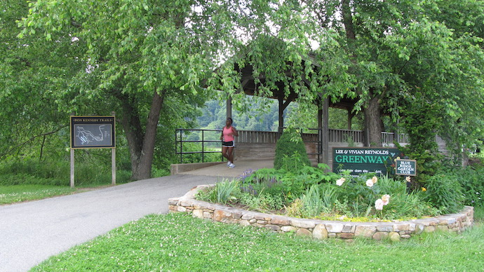
Boone Greenway Trail
Clawson Burnley Park, Boone
355 Hunting Hills Lane
Hiking Distance: 4 miles
Strutting through downtown Boone, with sections along Winklers Creek, the Middle Fork, and South Fork New Rivers, the Greenway Trail in Boone is a paved path that provides a great walk without leaving town at all.
Officially called the Lee & Vivian Reynolds Greenway, this walkway is accessible from all over town.
There are routes feeding into it from the Southgate Shopping Center, Watauga High School, Watauga County Recreation Complex, and the Boone Wastewater Treatment Plant.
All-in-all, the trail is about four miles, most of which is waterside. Included on the trail are picnic tables, a historic dam site, and covered bridges straddling the New River, one of the oldest rivers in the world!
READ MORE: The 20 Best Western NC Small Towns to Visit (& Live In)
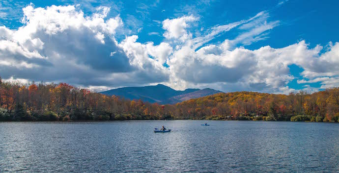
Price Lake Loop
Julian Price Memorial Park
BRP Milepost 297
Hiking Distance: 2.7 Miles
There is something magical about being at high elevation, with the wind moving through trees and the world down below as you walk beside a lake.
Lakes are beautiful anywhere you go, but they somehow seem damn near miraculous in the mountains!
One of our favorites is Price Lake, which is located in Julian Price Memorial Park on the Blue Ridge Parkway. Magically, there is an agreeably easy 2.7-mile loop trail circling it.
The trail has nice bridges over streams, routes through rhododendron thickets, boardwalks atop marshy spots, and plenty of mountaintop vistas.
Lots of hikers opt for the Boone Fork Trail or Tanawha Trail when they visit this park. But the Price Lake Loop is the shortest and most relaxed option for those seeking that kind of laid-back experience.
READ MORE: The Best Western NC Christmas Tree Farms in Boone, Asheville & Beyond
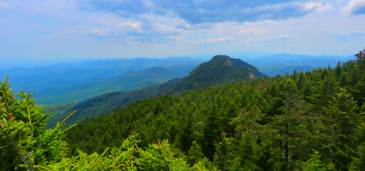
Profile Trail to Calloway Peak
Grandfather Mountain State Park
4198 NC Highway 105 N
Hiking Distance: 10 miles
There are many different ways to summit Grandfather Mountain, the tallest peak in North Carolina’s High Country. But the Profile Trail is arguably the most beautiful route.
The Profile Trail itself is 3.6 miles, the first half of which dances back and forth over creeks and cascades.
The second half starts a more serious ascent, offering stunning views of the surrounding valley, peaks, and rock formations.
At the end of the Profile Trail, hikers can (and should) opt to hike another mile or more to summit Grandfather Mountain at Calloway Peak.
This route does require a certain level of fitness: You need to be able to walk 10 miles and climb a couple thousand feet in elevation. If that sounds doable, then this hiking trail near Boone is well worth the effort!
READ MORE: Things to Do at Grandfather Mountain State Park in Banner Elk NC

Rocky Branch Loop
Rocky Knob Mountain Bike Park
285 Mountain Bike Way
Hiking Distance: 1.6 miles
The Rocky Branch Loop is part of Rocky Knob Mountain Bike Park, a nationally-known mountain biking paradise with a great selection of moderate to advanced trails.
This particular trail is rated as the easiest of the bunch for cyclists, and therefore best suited for beginners.
But for hikers, it’s probably a bit more appealing because it doesn’t have all the switchbacks and other challenging elements that steeper mountain biking trails tend to have.
While most of the park’s trails are open to hiking and biking, the park asks the hikers and bikers to move in opposite directions in an effort to avoid collisions.
The bike park is located right outside of Boone off US-421, before it crosses paths with the Blue Ridge Parkway.
READ MORE: 20 Best Blue Ridge Parkway Overlooks in NC & VA
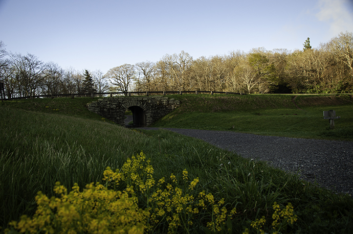
Rich Mountain Trail w/ Trout Lake
Moses H. Cone Memorial Park
BRP Milepost 294
Hiking Distance: 7 miles
You’ll note that Moses H. Cone Memorial Park has made this list three times, and that’s with good reason: It’s a massive place to explore, has pleasantly long but easy trails, and has three lakes to enjoy.
The Rich Mountain Trail can be accessed from the main Blue Ridge Parkway parking area at the park (near Cone Manor), which includes a cool tunnel beneath the BRP.
The trail meanders its way to the summit of Rich Mountain. It was originally designed for horse-drawn carriages, so the path is wide and has only a very gradual slope.
On the trek back from summiting the mountain, a detour to check out Trout Lake adds a couple of worthwhile miles to the otherwise 5-mile hike.
READ MORE: Things to Do at Moses H. Cone Memorial Park Near Blowing Rock NC
Beacon Heights Trail
Beacon Heights Overlook
BRP Milepost 305.2
Hiking Distance: 1 mile
The Beacon Heights Overlook is really just a parking area on the Blue Ridge Parkway. To reach the truly stunning scenic vistas, visitors need to hike to the summit, which is at the end of a short 1/2-mile trail.
While brief, the hike does climb a significant 1,400 feet in elevation in a rather short amount of time. But the payoff for your efforts is a really good one!
At the summit, two large rock outcrops offer jaw-dropping panoramic views that include Table Rock, Hawksbill Mountain, Grandmother Mountain, and Grandfather Mountain.
It’s one of our favorite places in the area to watch sunrises and sunsets.
The Beacon Heights Trail is the beginning of the much longer Tanawha Trail, which goes all the way to Julian Price Memorial Park (13 miles away). Just remember to veer right when the trail splits, which will take you to Beacon Heights.
READ MORE: The 10 Best Places for Snow Skiing in North Carolina
Otter Falls Trail
Town of Seven Devils
825 Skyland Drive
Hiking Distance: 1.2 miles
The chance to visit a solid, shapely waterfall is always a quality reason to get out and go for a hike.
Otter Falls isn’t skyscraping. It isn’t huge. But it’s got the right stuff to make for a lovely walk in the woods.
The Town of Seven Devils has dabbled in winter sports for some time now, with a premier snow tubing resort there. The town also has zip lines and a wonderful hiking trail— the Otter Falls Trail —to enjoy.
The Otter Falls Trail is short, with a couple of loops and two in-and-out routes that offer benches, observation decks, and the waterfall as the prize at the end.
Otter Falls starts with a slide down a mossy rock ledge, a plunge onto splash rocks, and a few cascades until becoming a regular creek that kids enjoy romping in.
READ MORE: The 15 Best Things to Do in Cherokee NC & the Qualla Boundary
Tanawha Trail
Julian Price Memorial Park
Holloway Mountain Road
Hiking Distance: 13.5 Miles
This trail requires a serious commitment, and is probably only suitable for truly confident hikers. But if that doesn’t deter you, it’s an amazing route and offers real adventure!
The Tanawha Trail is a section of the Mountains-to-Sea Trail, an 1,175-mile hiking route connecting Clingman’s Dome in Great Smoky Mountains National Park to Jockey’s Ridge on North Carolina’s Outer Banks.
The 13.5-mile stretch is one-way, meaning it’ll be necessary to either leave a car or arrange a pickup where the trail ends at the Beacon Heights Overlook.
The trailhead nearest to Boone is in Julian Price Memorial Park, but it should be accessed via NC-105 rather than the Blue Ridge Parkway.
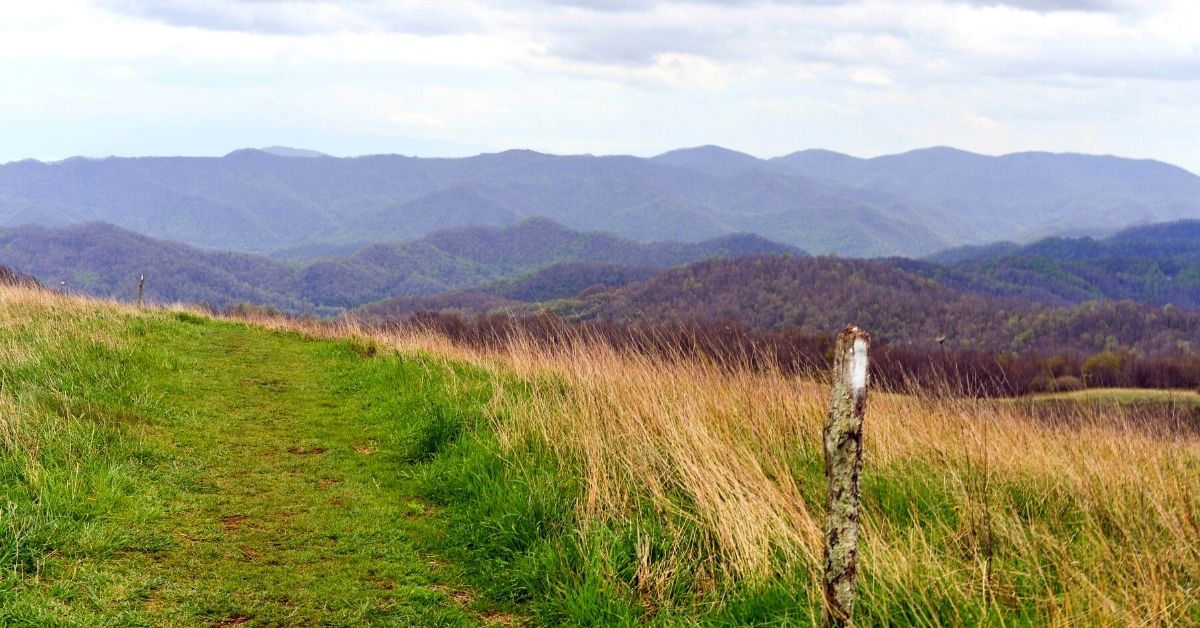
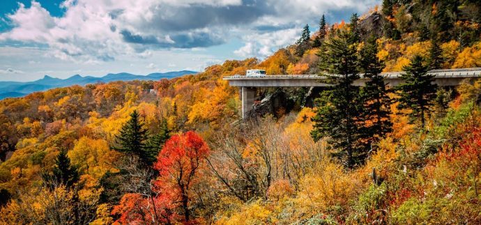
Named after the Cherokee word for “fabulous hawk/eagle,” the trail offers many highlights, including the Linn Cove Viaduct, Rough Ridge, Raven Rock, Grandfather Mountain, and Boone Fork Creek. –by Jonathon Engels; lead photo via Canva
