North Carolina is home to the five highest mountains east of the Mississippi: Mt. Mitchell, Clingman’s Dome, Mt. Guyot, Richland Balsam, and Potato Knob.
In fact, over half of the tallest 20 mountains in the eastern US are in Western North Carolina!
And we aren’t talking run-of-the-mill mountains here. These are the Appalachians, replete with culture, history, countless beautiful waterfalls, and world-class hiking trails.
So perhaps it’s no surprise that the Blue Ridge Parkway, which crawls over the ridge line of the Blue Ridge Mountains, is the most visited US national park unit, annually attracting some 15 million visitors.
Meanwhile, Great Smoky Mountains National Park is the most visited national park in the United States, drawing nearly 13 million people in 2019.
Suffice it to say, if it’s trekking you’re into and gorgeous scenery you’re hoping to see while you do it, there may be no better place in America than the majestic mountains of North Carolina.
To that end, read on for our picks for the 15 best Western North Carolina mountains for hiking, including mountains near Asheville, Boone, Brevard and Bryson City.
READ MORE: The Appalachian Culture & History of the Blue Ridge Mountains
HIKING NEAR ASHEVILLE NC
CRAGGY DOME
Elevation: 6105 feet
Hiking Distance: 1.6 miles
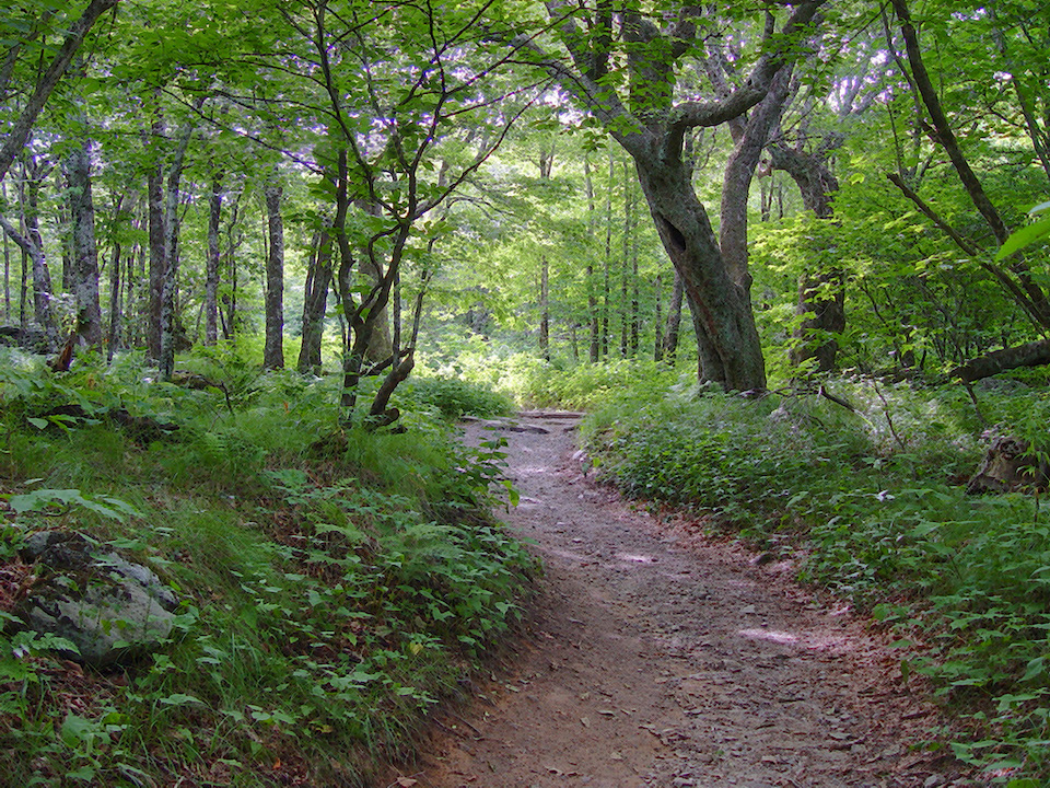
The highest point in the Great Craggy Mountains (colloquially called “the Craggies”), Craggy Dome can be accessed from the Greybeard Overlook at MP 363.4.
Craggy Dome may not be the most beautiful hiking trail in North Carolina– it has a reputation for being overgrown. But it is the highest point, for those who like such superlatives.
Craggy Gardens and Craggy Pinnacle are both located nearby on the BRP, and have their own parking areas for separate, shorter hikes. So it’s worth visiting all 3 and making a day of it.
Many of the mountain hiking trails in the Craggies are part of Section 3 of NC’s Mountain-to-Sea Trail, which stretches from Clingman’s Dome to the North Carolina coast.
READ MORE: The 15 Best Things to Do in Waynesville NC

MAX PATCH
Elevation: 4629 Feet
Hiking Distance: 1.5 Miles
One of the top spots to stop along the Appalachian Trail, Max Patch is a mountain near the border of North Carolina and Tennessee.
It’s widely regarded for its sunny disposition and for its exceptional views of surrounding mountain ranges, including the Great Smokies, Great Balsams, and Black Mountains.
Luckily, summiting Max Patch doesn’t require traversing the entire Appalachian Trail. There is a heavily trafficked 1.5-mile loop here that is quite easy to hike.
Max Patch is a bald mountain, completely lacking in trees. But the open summit is renowned for its wild berries and wildflowers.
READ MORE: The 27 Best Waterfalls Near Asheville NC
MOUNT MITCHELL
Elevation: 6,684 Feet
Hiking Distance: 12 miles
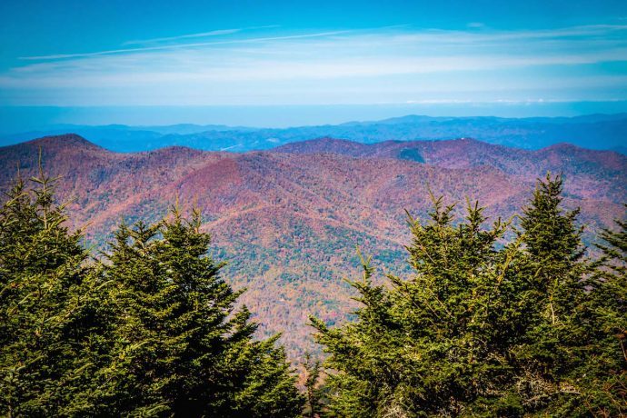
With its summit reaching 6,684 feet, Mount Mitchell is both the tallest mountain in the state of North Carolina and the highest point east of the Colorado Rockies.
For these reasons alone, it would be worthy of its popularity in the NC hiking annals. But of course reaching the top has the added payoff of 360º views of the Blue Ridge Mountains.
Though the Black Mountain Campground and Mount Mitchell Trail head are located in Pisgah National Forest, the mountain itself is in Mount Mitchell State Park.
The 12-mile trail to the summit is strenuous and requires an estimated 8 hours to hike– 4.5 hours for the six miles going up, and 3.5 for the same six coming down.
But if a 12-mile mountain hike doesn’t appeal to you, you can drive up the summit of Mount Mitchell and simply walk 300 yards to the observation platform instead.
READ MORE: The Top 10 NC State Parks in the North Carolina Mountains
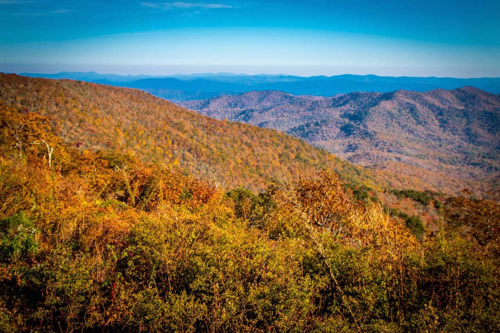
MOUNT PISGAH
Elevation: 5,721 Feet
Hiking Distance: 3.2 miles
The namesake of Pisgah National Forest, Mount Pisgah reaches over a mile in elevation. It’s the most recognizable feature of the landscape south of Asheville NC.
The Mount Pisgah Trail is easily accessed via the Blue Ridge Parkway at Milepost 407.6, and the trail going up to the peak is a moderately difficult 1.6 miles.
The trail to the summit winds through oak forest until it clears out into a bald, opening up stunning views of the French Broad River Valley and Shining Rock Wilderness (near Waynesville NC).
This trail is very popular and can get crowded on weekends. The trailhead is located near the historic Pisgah Inn, which also has stunning views, outdoor seating, and a great restaurant.
READ MORE: The 15 Best Pisgah National Forest Hiking Trails
HIKING NEAR BOONE NC
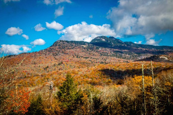
GRANDFATHER MOUNTAIN
Elevation: 5,946 Feet
Hiking Distance: 10.7 Miles
The centerpiece of Grandfather Mountain State Park, this epic monolith is the landmark to spot when roaming through the North Carolina mountains .
Grandfather Mountain has two peaks, MacRae and Calloway, both of which are difficult to reach. Note that Grandfather Mountain trails include ladders, ropes, and extremely rocky terrain.
For experienced and capable hikers, these Blue Ridge Parkway hikes—combining the Profile Trail and Grandfather Trail—are well worth the effort.
However, if the difficulty and length of accessing both peaks is too daunting, a milder option is the still strenuous Daniel Boone Scout Trail, which is 3.0 miles one way.
READ MORE: The 15 Best Things to Do in Boone NC (BRP MP 291.8)
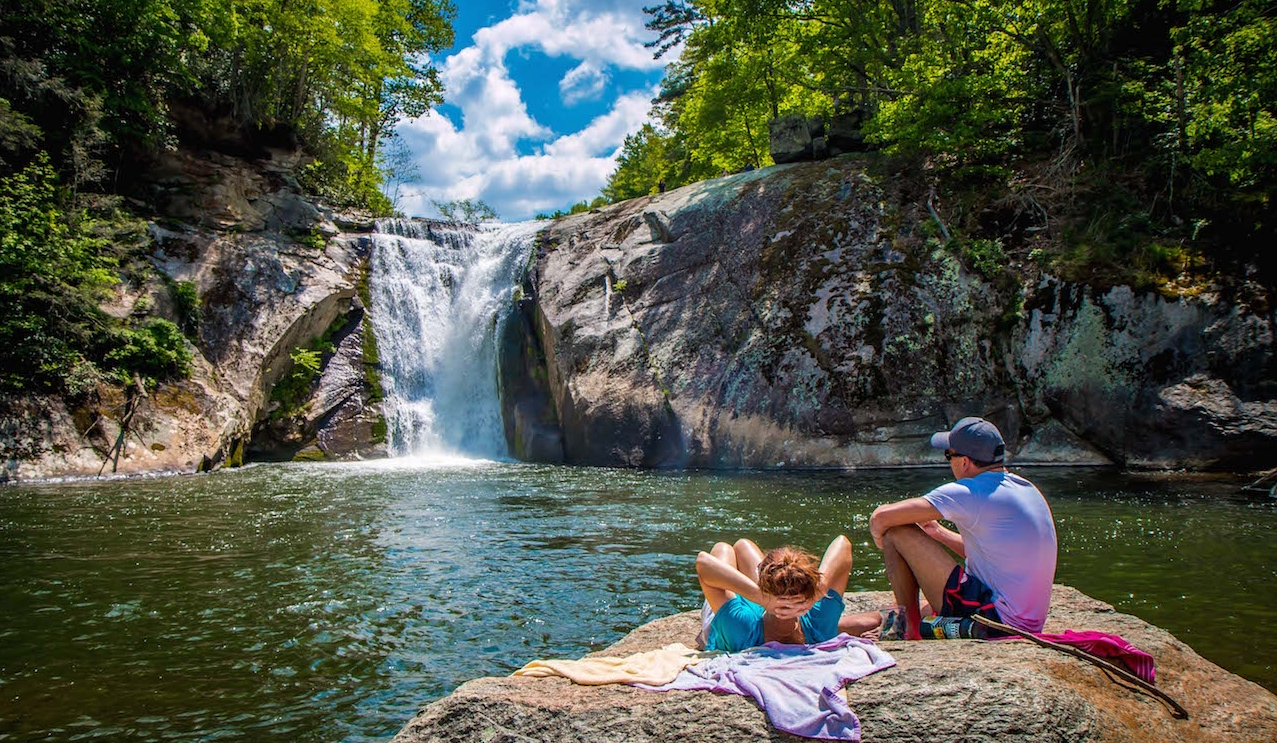
ROAN MOUNTAIN
Elevation: 6,285 Feet
Hiking Distance: 4.5 miles
Rather than a single summit, Roan Mountain has a series of noteworthy 6,000+ foot peaks. There’s also an amazing trail—the Appalachian Trail—connecting them.
The most popular and most beautiful Roan Mountain hiking trail stretches east from Carvers Gap to Grassy Ridge Bald. However, it doesn’t include the highest point in these mountains.
To reach Roan High Knob, hikers have to go in the opposite direction (northwest) from Carvers Gap, and the round-trip is a much more challenging and forest-covered 4.5 miles.
Included on the hike to Roan High Knob is a stop at the historic Cloudland Hotel, which dates back to the late 1800s.
READ MORE: The Best NC Christmas Tree Farms in Boone, Asheville & Beyond
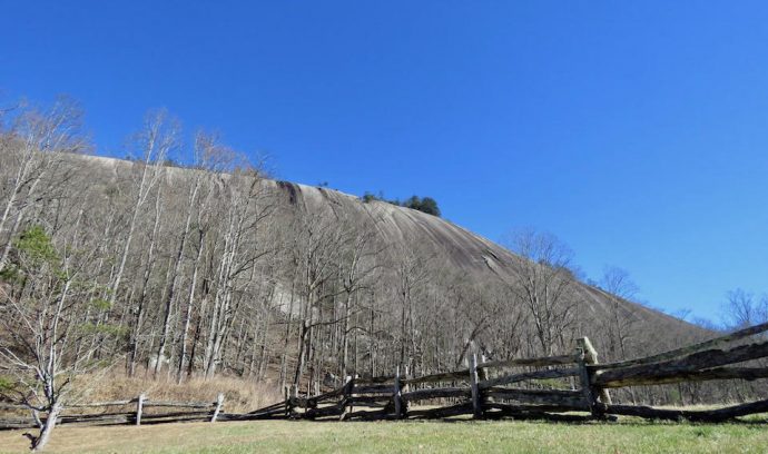
STONE MOUNTAIN
Elevation: 2,305 Feet
Hiking Distance: 4.5 miles
Located near my hometown of Elkin NC, Stone Mountain, North Carolina should not be confused with the more controversial one (due to its carved Confederate Memorial) in Georgia.
This Stone Mountain has a 600-foot granite rock face that looks every bit as beautiful from the base of it as the view from the top of it.
The hike to the 2,305-foot summit of Stone Mountain is a fantastic loop that also includes a brush with history at the Hutchinson Homestead and a chance to cool off at the base of the 200-foot Stone Mountain Falls.
Stone Mountain State Park, which lies beyond the loop, is also well worth exploring. It boasts 18 miles of trout streams, more waterfalls, horseback trails, and a great campground.
READ MORE: Stone Mountain NC: State Park Camping, Hiking & History
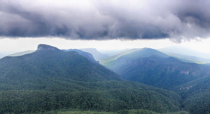
TABLE ROCK MOUNTAIN
Elevation: 3,940 Feet
Hiking Distance: 1.8 Miles
Table Rock Mountain is located east of Little Switzerland NC in one of the most beautiful stretches of Pisgah National Forest, the Linville Gorge.
Initially made famous by a Jules Verne novel, Master of the World, the mountain is also nationally appreciated as the best place for rock climbing in the Southeastern United States.
The hike to it isn’t exceptionally long or difficult, but the reward for making the trek is sublime. Table Rock Mountain sits at the rim of Linville Gorge, and provides sweeping views down into it.
The biggest challenge of summiting Table Rock is likely the adventure of driving to the trailhead, which is quite a few turns off the Parkway and several miles down a gravel road.
READ MORE: How to Get to Crabtree Falls Near Little Switzerland NC
HIKING NEAR BREVARD NC
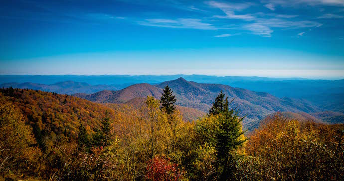
BLACK BALSAM KNOB
Elevation: 6,214 Feet
Hiking Distance: 1.4 miles
Also known as Black Balsam Bald, Black Balsam Knob is located in Pisgah National Forest, just off the Blue Ridge Parkway on Black Balsam Road (BRP milepost 420.2).
Because the summit is bald and exceptionally high, Black Balsam offers grand views of the beautiful landscape of the Western North Carolina mountains.
Black Balsam Knob is one of the most popular features on the Art Loeb Trail, a 30-mile trek through the southern section of Pisgah Forest. But from the drive-up parking lot, the round-trip hike to Black Balsam’s apex is just 1.4 miles.
There are several add-ons and spurs possible for those who want to extend this hike, including trips to Sam Knob and Tennent Mountain.
READ MORE: Fall in North Carolina: The Best Places to See Autumn Colors
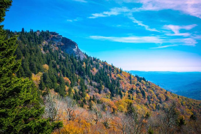
DEVIL’S COURTHOUSE
Elevation: 5,720 Feet
Hike Distance: 1 mile
As the name suggests, The Devil’s Courthouse is the setting for numerous legends that have been passed down for generations, both within Cherokee folklore and in post-colonial times.
Something about the unusual rock formation just hints at something slightly sinister.
The hike to the Devil’s Courthouse is just under half a mile from the parking area, right off the BRP, from which there is a spectacular view of the mountain’s peak.
In addition to the site’s air of mystery, the trail is known for having numerous North Carolina birds of prey soaring in the skies above it. It’s also famed for allowing hikers to see four states from it, including the North Carolina, South Carolina, Tennessee, and Georgia mountains.
The Devi’s Courthouse Trail can be accessed from the Blue Ridge Parkway at milepost 422.4.
READ MORE: The Best Blue Ridge Parkway Overlooks in NC & VA
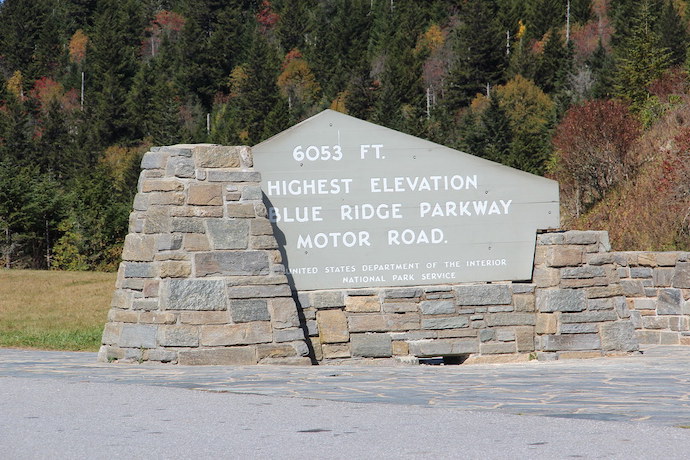
RICHLAND BALSAM
Elevation: 6,410 Feet
Hiking Distance: 1.3 miles
Richland Balsam is the tallest mountain in the Great Balsam Mountains, and it is the highest point on the 469-mile Blue Ridge Parkway.
The Richland Balsam Trail, a 1.3-mile loop route, can be accessed from the Haywood-Jackson Overlook at BRP milepost 431.
Richland Balsam actually stretches through two national forests, with Pisgah National Forest to the east and Nantahala National Forest to the west.
The consistently cool, 5500+ foot elevations of Richland Balsam are remarkable for spruce-fir forest, which is a rarity in the generally warm, humid southern US.
READ MORE: The Top 20 National Forests in America for Camping & Hiking
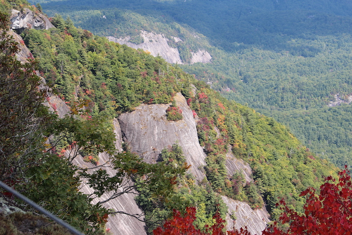
WHITESIDE MOUNTAIN
Elevation: 4,930 Feet
Hiking Distance: 2.5 miles
Whiteside Mountain is stunning due to the unique cliffs that zig-zag up the mountainside, which are the highest in the Eastern United States.
Undoubtedly, it’s this stunning natural beauty that garnered the Whiteside Mountain hiking trail its designation as a National Recreational Trail.
The forests that top the cliffs are full of rhododendron and mountain laurel, which make for beautiful flowers in the springtime.
Whiteside Mountain Rd. is located off US-64, and Whiteside Mountain Recreation Area requires a $2.00 usage fee for access to this gorgeous NC mountain.
READ MORE: The 20 Best Western NC Small Towns to Visit (& Live In)
HIKING NEAR BRYSON CITY
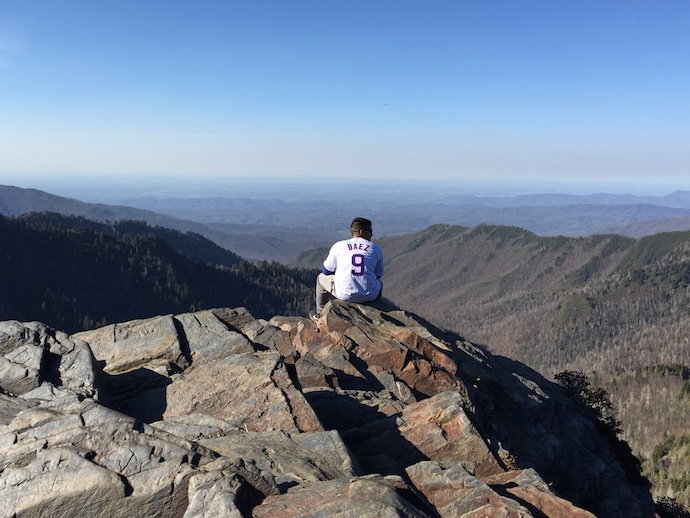
CHARLES BUNION
Elevation: 5,528 Feet
Hiking Distance: 8.0 Miles
Another of the most spectacular features along the Appalachian Trail, Charles Bunion is located a day’s hike from Clingmans Dome (12 miles). But it can be accessed from between the two via Newfound Gap.
Not only is the hike to Charles Bunion a long one, but it is also considered quite difficult, with a lot of ups and downs in elevation.
However, this equates to spectacular vistas all the way to the summit!
Charles Bunion is also highly regarded as a geological site, and the view from the rocky outcrop at the top of the mountain is second-to-none.
The access point where Newfound Gap crosses US-441 is actually the only spot in Great Smoky Mountains National Park where the AT crosses a road!
READ MORE: The 10 Best Places for Snow Skiing in North Carolina

CLINGMANS DOME
Elevation: 6,643 Feet
Hiking Distance: 1 mile
Considered the highest peak in Tennessee and either the second or third highest in North Carolina (after Mt. Mitchell and, debatably, Mt. Craig), Clingmans Dome is the tallest part of Great Smoky Mountains National Park and the apex of the Appalachian Trail.
Fortunately, given the mountain’s extreme height, the Clingmans Dome hiking trail is only half a mile each way. Though rated as strenuous, it is also on a paved trail.
As a bonus to visitors in search of breathtaking vistas, the hike to Clingmans Dome culminates at an observation tower with 360º views of the mountains of North Carolina and Tennessee.
Though the “hiking” aspect of this mountain isn’t extensive, the payoff at the summit is so remarkable that it has to be on the list!
READ MORE: Cataloochee Valley Elk Herd in Great Smoky Mountains National Park
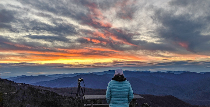
WATERROCK KNOB
Elevation: 6,273
Hiking Distance: 1.2 miles
Another NC peak that tops 6,000 feet, Waterrock Knob is located on the Blue Ridge Parkway at milepost 451.1, fairly close to the scenic route’s southern terminus.
The Waterrock Knob Visitor Center– the highest on the parkway at 5,820 feet– is a renowned spot for catching incredible sunrises and sunsets.
The hike to the top of Waterrock Knob and back is just 1.2 miles. You can also take the trail another ¾-mile past Waterrock Knob to visit a plane crash site from the early ’80s.
The views from the area in general are just stupendous, and the hike is easy enough to feel more like a pleasant stroll. –Jonathon Engels, lead photo by Bret Love & Mary Gabbett

