
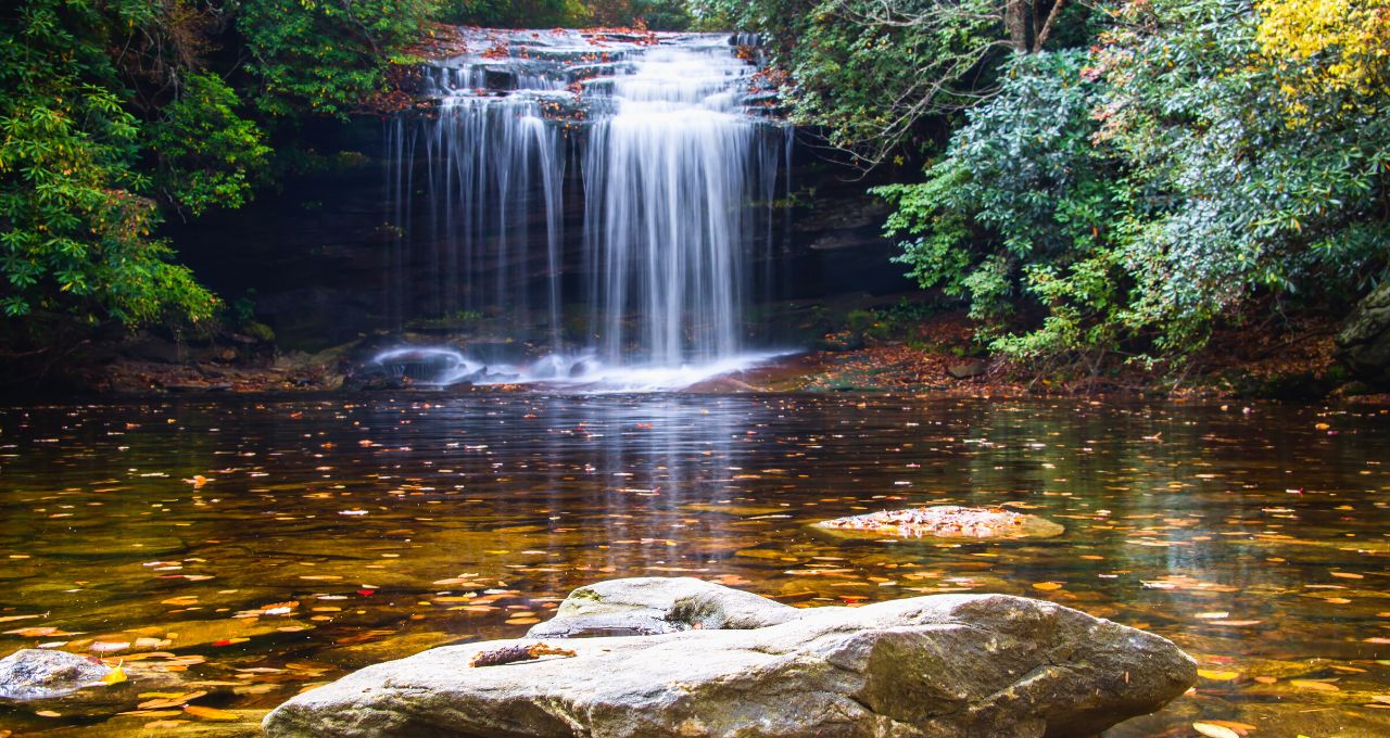
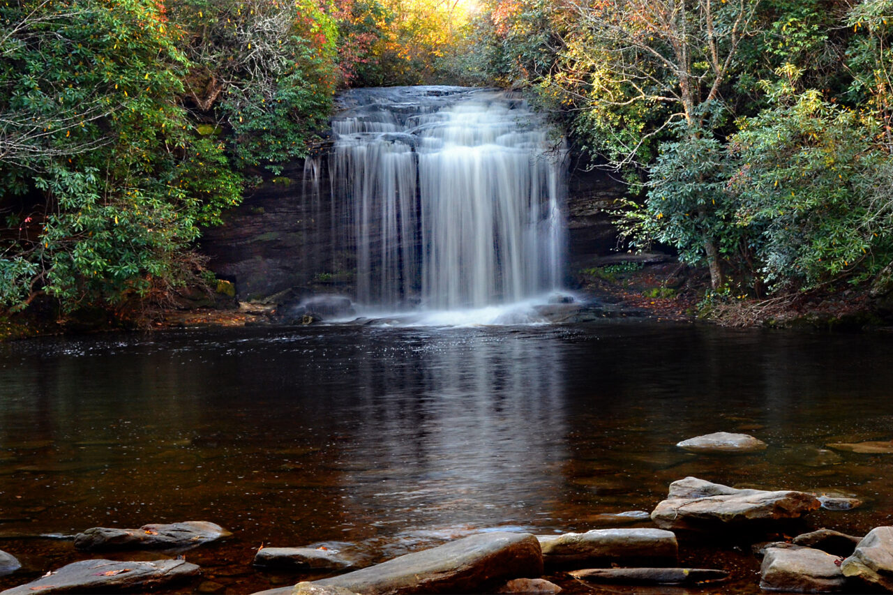
Schoolhouse Falls NC is widely considered one of the most popular Panthertown Valley waterfalls, and it’s not difficult to understand why.
Pathertown Valley is a backcountry wilderness area and bear sanctuary that is part of the Nantahala National Forest in Western NC.
There are nearly 30 miles of excellent hiking trails in this valley, winding their way through stunning hardwood forests and tangled rhododendron thickets.
But if you have your eye on just this one Western North Carolina waterfall, a relatively easy 2.5-mile round-trip hike will get you there.
When my husband and I visited, we were on our way from the Davidson River Campground in Pisgah National Forest to the Cheoah Point Campground, one of our favorite places for camping in Nantahala National Forest.
So we were grateful for the short-but-sweet Schoolhouse Falls trail. It allowed us to fit in all of the driving we had to do that day, as well as get in a bit of a hike and see one of the prettiest waterfalls of our vacation.
We also enjoyed the scenic drive along the eastern bank of Lake Toxaway, enjoying the views on our way to the Schoolhouse Falls trailhead.
If you’ve already explored many of the epic Pisgah National Forest waterfalls, you’ll definitely enjoy exploring the Nantahala National Forest and checking some of the waterfalls near Cashiers NC off your list.
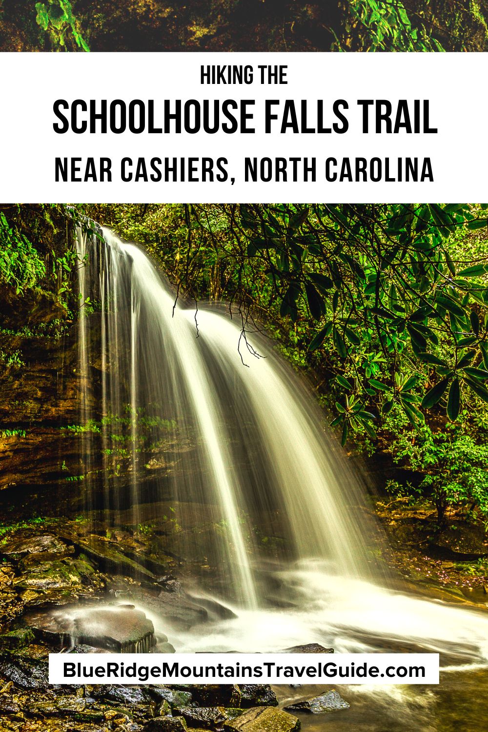
Read on for our in-depth guide to hiking the Schoolhouse Falls trail, including driving directions, some history of the area, and an overview of the picturesque hike.
READ MORE: The 50 Best North Carolina Waterfalls to Visit
Schoolhouse Falls NC Info
ADDRESS: Cold Mountain Gap Trailhead, Hogback Spur A, Lake Toxaway NC, 28747
PHONE: 828-524-6441 (Nantahala Ranger District in Franklin NC)
COST OF ENTRY: Free (including free parking)
HOURS: Always open
AMENITIES: Campgrounds, hiking trail
Directions from Cashiers NC
Take the US-64 E out of downtown Cashiers and travel for 12.7 miles before turning left onto Blue Ridge Road. Snake around Lake Toxaway on your left for 0.9 miles, then turn left again onto Cold Mountain Road.
Travel this road for 9.7 miles, then make another left onto Panthertown Road. Go 0.1 miles further and turn right onto Hogback Spur A. The Cold Mountain Gap parking area is located at the end of the road.
Directions from Brevard NC
Take the US-64 E out of downtown Brevard and travel for about 15.5 miles before turning right onto Blue Ridge Road. Snake around Lake Toxaway on your left for 0.9 miles, then turn left again onto Cold Mountain Road.
Go 9.7 miles before taking another left onto Panthertown Road. Travel 0.1 miles, then turn right onto Hogback Spur A. You’ll find the Cold Mountain Gap parking area at the end of the road.
READ MORE: The 20 Best Lakes in North Carolina (Mountains, Coast & Beyond)

Schoolhouse Falls History
Like most parts of the Western North Carolina mountains, the area around Cashiers was originally inhabited by the Cherokee people.
After the Georgia gold rush drew thousands of prospectors to the area in the late 1820s, most of the indigenous people were removed from their native lands via the tragic Trail the Tears.
Schoolhouse Falls got its name due to its proximity to an actual schoolhouse that was located nearby, which was used by the area’s early European settlers.
The 6,311-acre Panthertown Valley, where this waterfall is located, is said to have been named by those settlers after they noticed the significant number of Eastern cougars that populated the area.
The valley sidestepped plans in the 1960s to develop it into a major North Carolina resort, as well as Duke Energy’s effort to put in an electrical transmission line that would have spanned the entire valley.
Thankfully, the North Carolina chapter of the Nature Conservancy eventually bought the land and turned it into the protected stretch of wilderness we can all enjoy today.
Today the property is managed by the U.S. Forest Service, with help from the Friends of Panthertown.
READ MORE: The 15 Best Things to Do in Brevard NC & Transylvania County

Hiking the Schoolhouse Falls Trail
Of all the Cashiers NC waterfalls, Schoolhouse Falls is one of the most easily reached.
The most direct way to get to Schoolhouse Falls NC is from the Cold Mountain Gap parking lot via the Panthertown Valley Trail. This gives you a 2.5-mile round-trip option.
To do this, go to the Cold Mountain Gap visitors’ kiosk. Take the trail to the right and head slightly downhill to hit Panthertown Valley Trail #474, crossing a wooden bridge over a creek before continuing on an old logging road.
This hiking trail is mostly made up of switchbacks, which makes the hike back out a bit of an uphill climb. You may want to keep this in mind and hydrate well during your relaxing time down at the waterfall.
After the switchbacks, you’ll see a sign for Devil’s Elbow Trail #448 on the right, but you’ll want to continue straight on Panthertown Valley Trail #474.
You’ll see another wooden bridge to cross over Greenland Creek, then head left down Little Green Trail #485. It is around here that you’ll start hearing the sounds of the crashing water and possibly voices of other visitors.
Once you’ve soaked in the stunning scenery of Schoolhouse Falls as much as you can, it’s time to head back out. Make your way back to the Panthertown Valley Trail and backtrack to the parking lot.
If you’re up for more of a trek, you can turn your hike into a strenuous 5-mile loop by continuing along Little Green Trail #485 and following the green blazes.
Following this trail will have you summit and descend Green Mountain. You’ll pick up the Mac’s Gap Trail #482 at the base of the mountain, eventually crossing a creek and turning right onto the Greenland Creek Trail.
This 1-mile trail will lead you to Greenland Creek Falls. After your visit, simply backtrack along the Greenland Creek Trail and take a right onto Mac’s Gap Trail, which leads back to the Cold Mountain Gap parking lot.
For an all-encompassing NC waterfalls map, check out Google Maps. Otherwise, you can click here for a Pathertown Valley trail map.
READ MORE: The 30 Best Waterfalls Near Asheville NC

Schoolhouse Falls Viewpoints
Once you reach Schoolhouse Falls, you’ll find a large sandy, rocky beach of sorts.
Here you might see people with spread-out blankets enjoying a picnic, or spot the shoes of those wading into the cool, crystal-clear water.
There are large flat rocks along the water’s edge that make perfect perches for bathing in the forest and taking in the gleaming cascades before you.
You might see people enjoying one of the best NC swimming holes, and maybe even make out the shadows of people playing behind the waterfall itself.
If you’re lucky, you might be the only one there, allowing you to enjoy the serenity of the area’s pristine natural beauty while witnessing the crashing waters of this 20-foot waterfall.
One very unique view of the falls is from directly behind it. You can swim right up to the waterfall, climb onto the rock and stand in the cavern behind the cascade, feeling the power and water spraying on your face.
Otherwise, for a somewhat drier experience, there are trails on either side of the waterfall that lead you there. Just be careful of slick rocks and mindful of the delicate wildflowers that grow there.
READ MORE: North Carolina Wildflowers Guide (& Where to See Them in Western NC)

Other Waterfalls Near Schoolhouse Falls
Western NC waterfalls are a major highlight of this area of the state.
They’re all stunning in their own way (and definitely plentiful), and you might have already seen a good share of them while exploring the Pisgah National Forest hiking trails.
Spending a bit of time in Panthertown Valley and the surrounding area will help you work on your waterfalls near Brevard NC checklist.
Along with Schoolhouse Falls, we also recommend checking out Wilderness Falls, Greenland Creek Falls, Granny Burrell Falls, and Frolictown Falls, all of which are located within Panthertown Valley.
Gorges State Park is just 30 minutes away by car, and offers you a chance to visit Rainbow Falls as well as several other remarkable Pisgah National Forest waterfalls.
If you’re looking for some family-friendly fun at waterfalls, the Cashiers Sliding Rock is located about 4 miles from downtown Cashiers, as is the trailhead to Silver Run Falls.
And don’t miss out on Whitewater Falls, which is just 13 miles southeast of Cashiers. Supposedly the tallest waterfall east of the Rockies, this 400-foot waterfall can be reached via a family-friendly 1/2-mile trail.
READ MORE: The 12 Best Brevard Breweries and Cideries to Visit

Overnight Stays Near Schoolhouse Falls
There are campgrounds within the Pathertown Valley and along the Schoolhouse Falls trail network, but note that these camps are limited to 12 people per site.
The closest ones to Schoolhouse Falls are the Green Valley Trail campsite, the Panthertown Valley Trail campsite, and the Mac’s Gap Trail Campsite.
If you want something more secluded, check out the Green Valley Trail Campsite, while the Pathertown Valley Trail site is just off the main trail.
Nate that in order to reach any of these campsites, you’ll have to park at the trailheads and hike in. There are also options for camping in Pisgah National Forest.
For a less rustic, but still quaint mountain experience, check out the many VRBO rentals near Lake Toxaway, or Cashiers cabin rentals. If you’d prefer 4-star luxury accommodations, check out the historic Greystone Inn.
The historic Inn is about located 20 miles away from Panthertown Valley.
But it allows you to be near an array of good restaurants, bars, and other local attractions, including more amazing North Carolina waterfalls. -by Emma Gallagher; featured image and pins via Canva

