
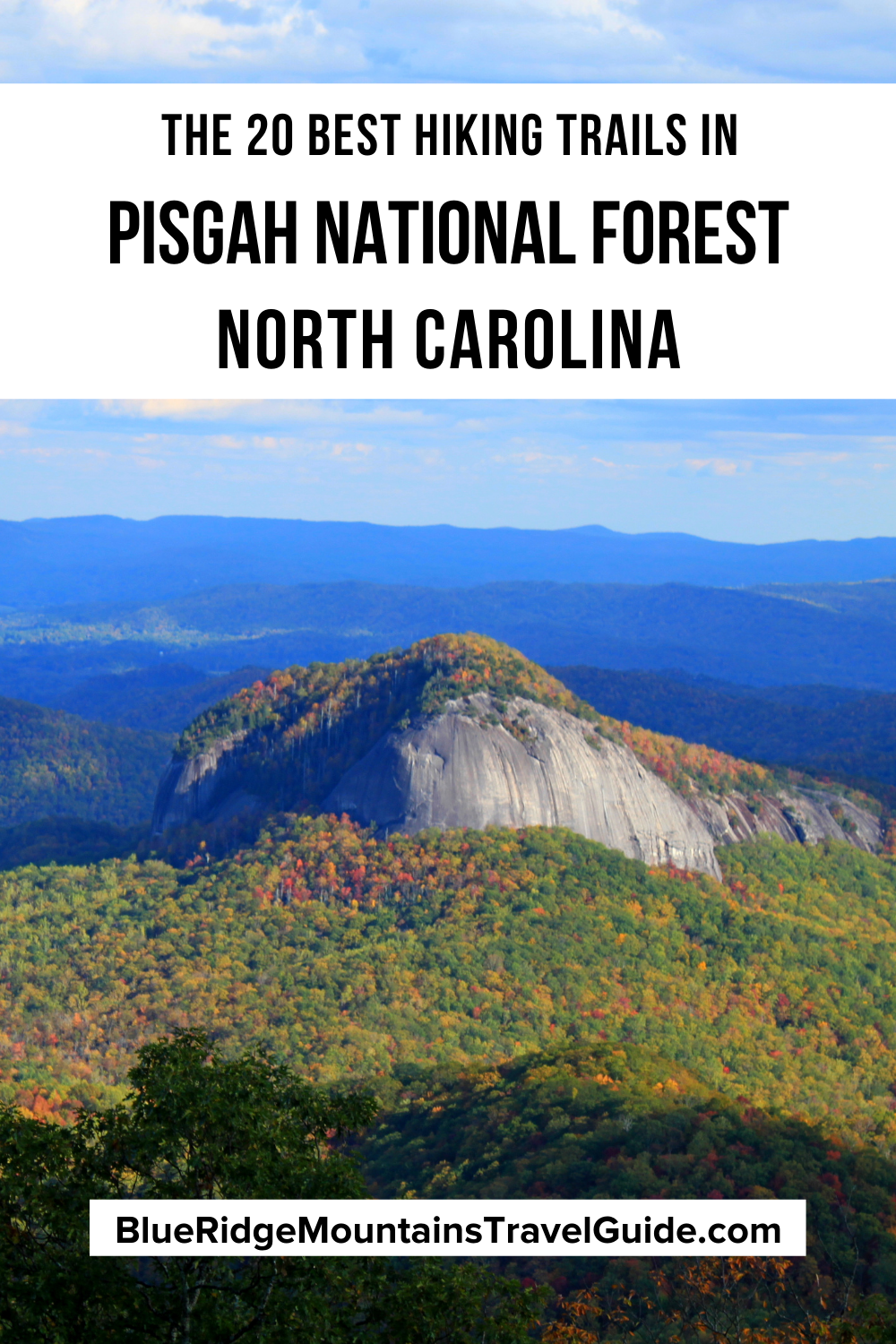
[Updated 1/19/2025]
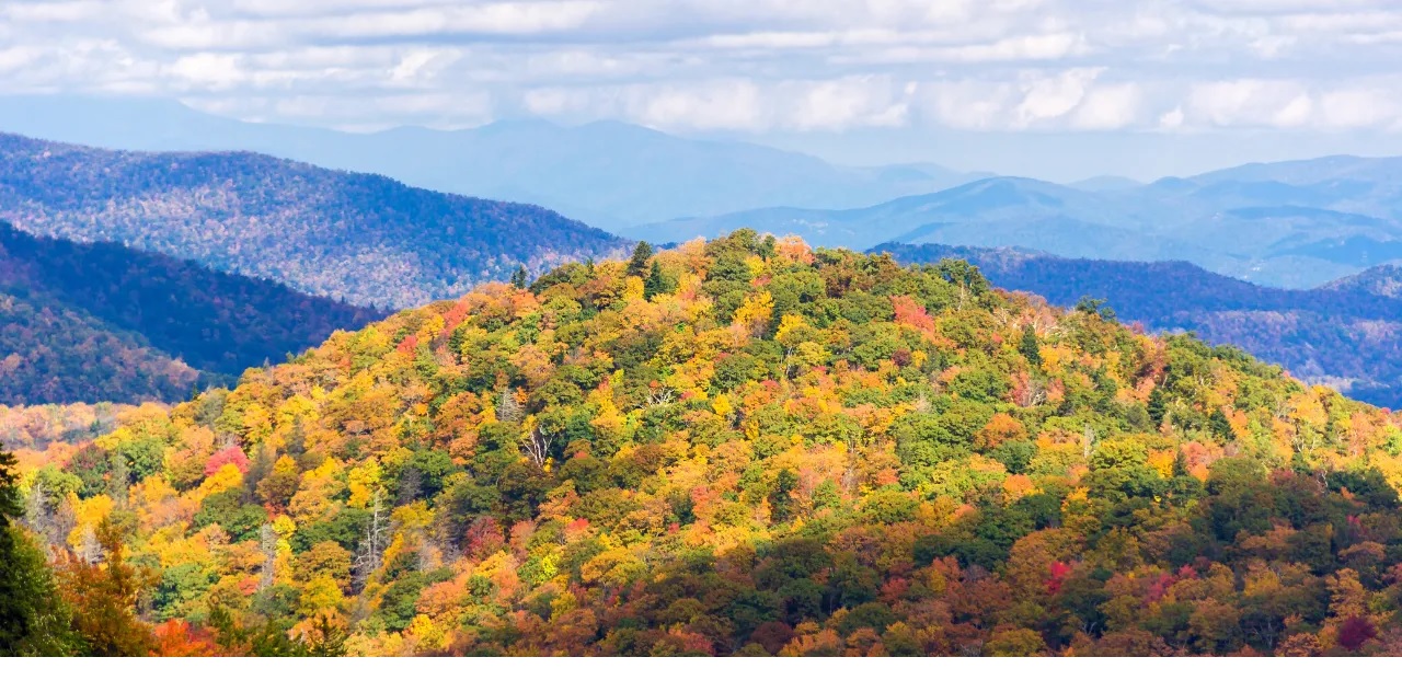
If you enjoy getting deep into the forest, exploring the Blue Ridge Mountains, and looking up as gorgeous waterfalls cascade down, then Pisgah National Forest is going to be a winner.
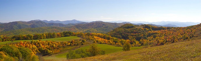
Encompassing over 500,000 acres in Western North Carolina, Pisgah Forest offers lots of room to roam. Its hundreds of miles of trails provide an ample network for doing so.
These national forest hiking trails take you over moss-laden tree trunks to rocky outcrops, and provide picturesque panoramas too breathtaking to describe in words.
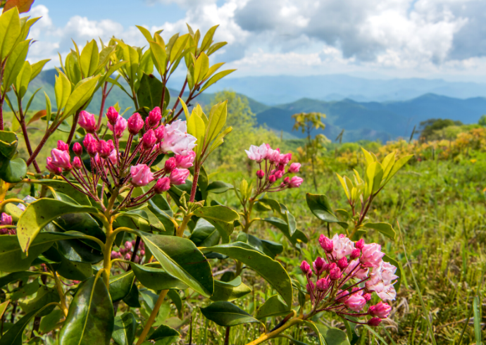
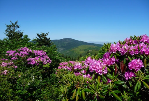
Wildflowers, hardwood trees, roaring mountain creeks, and plenty of wildlife will feature just about every which way you turn in Pisgah.
While getting lost in the wilderness might not exactly be on your travel agenda, this is arguably among the best places to do so!
So brace yourself for cool mountain breezes and wide-open vistas, because these are our picks for the top hiking trails in Pisgah National Forest.
READ MORE: Pisgah National Forest: A Beginner’s Guide
EDITOR’S NOTE: Many popular Pisgah National Forest hiking trails currently remain closed due to damage caused by Hurricane Helene. The following trails in the Grandfather Ranger District have been reopened as of 1/19/2025:
OLD FORT AREA-Catawba Falls-Heartbreak Ridge-Star Gap – west end to HeartbreakLINVILLE AREA-Wiseman’s View-Bynum Bluff-Babel Tower-Brushy Ridge-Table Rock Climbers Access-Steeles Creek – west end to Steeles Creek Rd-Mountains to Sea – Old NC 105 to FSRD 106-Mountains to Sea – Pinnacle section from 105 to RiverMORGANTON AREA-GreentownWILSON CREEK AREA-Wilson Ridge-North Harper Creek Shortcut-Persimmon Ridge-Pine Ridge-China Creek-Thunderhole Falls-Bill Vines-Timber Ridge-Mountains to Sea – Lost Cove Loop section-Mountains to Sea – Old House Gap to Beacon Heights

Best Pisgah National Forest Hiking Trails
- Catawba Falls Trail
- South Toe River Loop
- Graveyard Fields Trail
- Harper Creek Falls Trail
- Mount Mitchell Trail
- Graybeard Trail
- Moore Cove Falls Trail
- Pink Beds Trail
- Log Hollow Waterfalls
- Lost Cove Loop Trail
- Jones Falls from Elk River Falls
- Twin Falls
- Appalachian Trail: Lemon Gap to Max Patch
- Mountain-to-Sea Trail, Segment 4: Gorges, Peaks, and Waterfalls
- Art Loeb Trail
- Looking Glass Rock Trail
- Grassy Ridge Bald via AT
- John Rock Loop
- Glen Burney Trail
- Daniel Ridge Loop Trail
READ MORE: The Best Places to Celebrate Christmas in NC
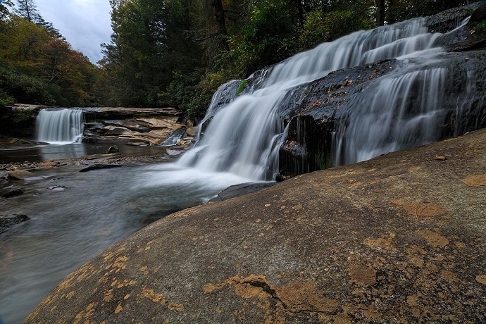
1. Catawba Falls Trail
Elevation: 1,932 feet
Hiking Distance: 3 miles
Located in the southeastern reaches of the Blue Ridge Mountains (flirting with the elevation of foothills), Catawba Falls is formed by headwaters of the Catawba River.
Their elegant beauty truly warrants a hike of any distance, but this trail is a mere three miles, in-and-out.
Without the thin air common in higher elevations, the Catawba Falls Trail is a completely doable hike for novices, and offers plenty of ROI.
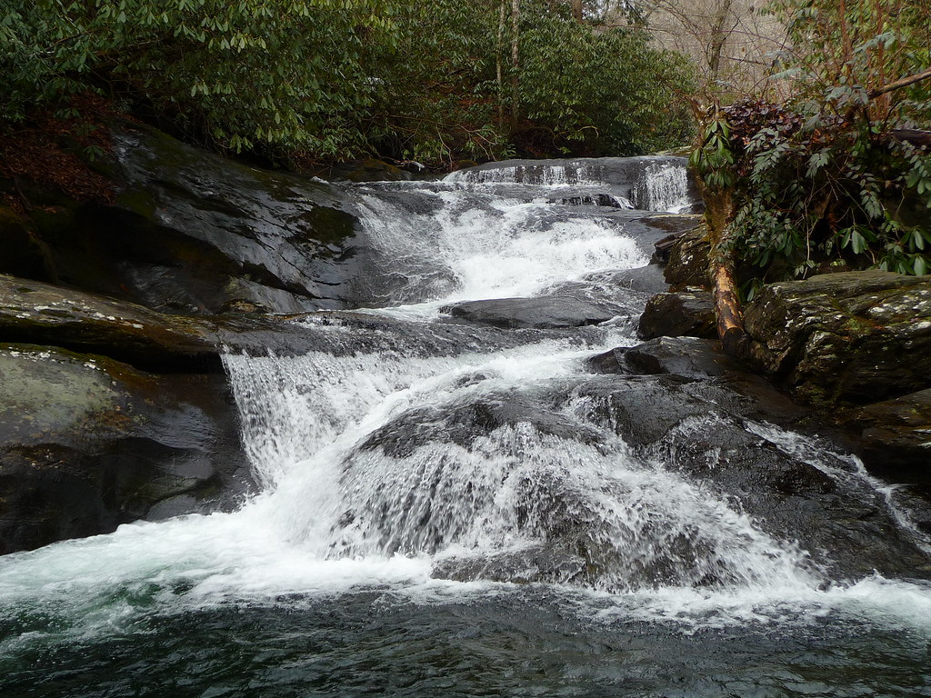
There are a series of waterfalls to enjoy here, including over 100 feet of plunging from two major drops.
Catawba Falls is easy to access from I-40 via Old Fort (Exit 73). Moss, rhododendrons, and cascades await.
This is one of the premier waterfalls and hikes in Pisgah National Forest, as well as a regular feature in travel guides for both Boone and Asheville NC.
READ MORE: The 20 Best Western North Carolina Waterfalls for Hiking
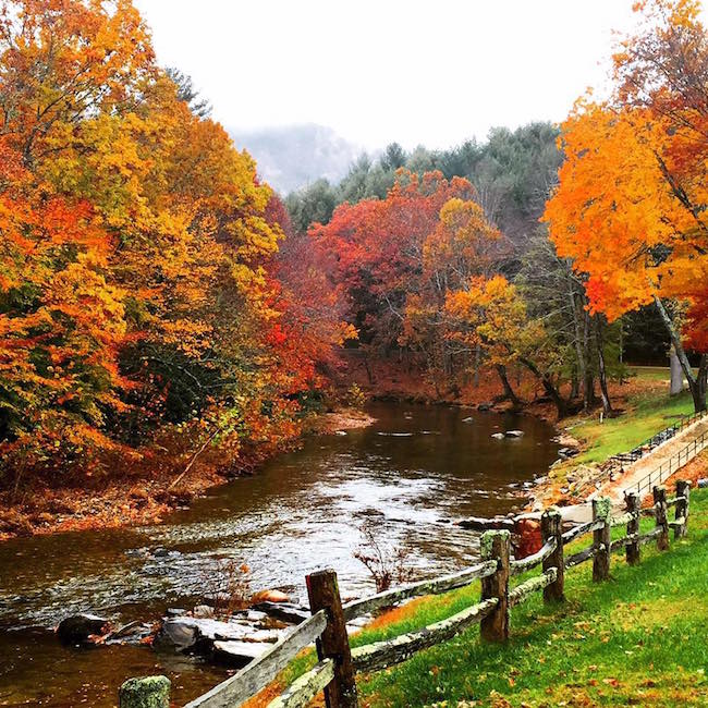
2. South Toe River Loop
Elevation: 3,282 feet
Hiking Distance: 3.5 miles
I find walking beside rivers incredibly soothing. The South Toe River, with its rocks and low-rumbling rapids, is particularly so.
The South Toe River Loop takes full advantage of its surroundings. Big trees and tall mountains envelope the trail as it hugs the South Toe on both banks.
This trail leaves from, and circles back to, the Black Mountain Campground. This is a relaxing trail that makes a great after-breakfast or early evening jaunt for campers.
Located just southeast of Burnsville, this trail and campground can also be reached in under 90 minutes from Downtown Asheville or Boone.
READ MORE: Top 10 NC State Parks in the North Carolina Mountains
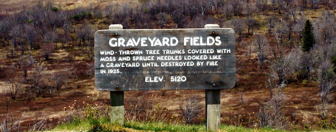
3. Graveyard Fields Trail
Elevation: 5,289 feet
Hiking Distance: 2.9 miles
Graveyard Fields is one of the most beloved sites along the Blue Ridge Parkway.
It is renowned locally for being a great place to forage blueberries (and, consequently, spot Black Bears).
This Pisgah Forest hike has a lot of history to go along with it. The area is named Graveyard Fields due to stumps, resembling tombstones, that were there about a century ago.
Though these remnants are now long gone, the spot still carries the name, and is widely considered one of the top day trips from Asheville.
In addition to the history and hiking, the Graveyard Fields Trail has some fantastic waterfalls along its route. So wearing a good pair of water shoes will make this hike all the more enjoyable.
READ MORE: The Best Things to Do in Asheville NC
4. Harper Creek Falls Trail
Elevation: 1,756 feet
Hiking Distance: 2.8 miles
A walk in the woods, a gushing waterfall, and a few swimming holes… If this sounds like your idea of a good afternoon, then the Harper Creek Falls Trail delivers the goods.
This place sees a lot of foot traffic in the summertime, as it offers cool pools for dipping those tootsies in.
The trail is well-maintained, the elevation is less than 2000 feet, and the elevation climb of the hike isn’t all that much. This equates to some accessible hiking.
Harper Creek Falls is also blessed with a great location, less than 20 miles south of Blowing Rock and Grandfather Mountain State Park.
READ MORE: The 15 Best Blue Ridge Parkway Hikes for NC Day Trips

5. Mount Mitchell Trail
Elevation: 6,914 feet
Hiking Distance: 11.3 miles
The summit of Mount Mitchell is not just the tallest of the North Carolina mountains, but also the highest point east of the Rockies.
The Pisgah Forest trail has to make this list for that very fact alone.
Obviously, this route requires some fairly fit legs and a little perseverance. The Mount Mitchell Trail has an altitude change of over 3,000 feet, and is only recommended for experienced hikers.
That said, for those who are fit enough and like a physical challenge, this is an exciting trail to tackle. Expect to clamber over roots and rocks along the way.
The Mount Mitchell trailhead is located at the Black Mountain Campground. The trail is an out-and-back route that can be done in a day, but there are also some hike-in campsites along the way.
READ MORE: The 15 Best Things to Do in Bryson City NC & Swain County
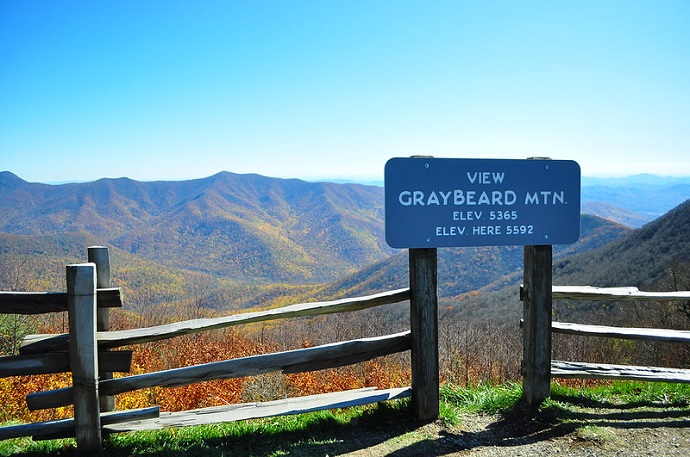
6. Graybeard Trail
Elevation: 5,555 feet
Hiking Distance: 8.9 miles
Graybeard Trail is another hiking trail in Pisgah National Forest that is best reserved for more seasoned hikers. It climbs over 2,400 feet in nearly nine miles.
Nevertheless, it’s located in Western North Carolina, so there are lovely waterfalls and postcard-worthy vistas of the all along the way.
The Graybeard trailhead is located in Montreat, a quaint little Blue Ridge mountain town established back in the 1890s.
From various spots along the trail, it’s possible to spot all of “The Seven Sisters,” as the stunning peaks of the Black Mountains are commonly known.
Graybeard Trail is hugely popular from mid-October into early November, revered as a premier location for seeing Fall colors in NC. It’s less than 20 miles east of Asheville.
READ MORE: The 27 Best Waterfalls Near Asheville NC
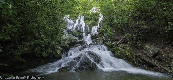
7. Moore Cove Falls Trail
Elevation: 2,589 feet
Hiking Distance: 1.2 miles
Known to be a family-friendly hike, the Moore Cove Falls Trail often attracts a crowd.
That’s primarily because it is both easy to do, and it offers up an amazing waterfall as a reward for your effort.
Moore Cove Falls drops about 50 feet from an overhanging outcrop. It is accessed by a well-established, well-worn path that leads hikers through fern-laden woodlands and has bridges for all the creek crossings.
Not far from Asheville (and even closer to Brevard), the Moore Cove Falls trailhead is easily reached as well.
It’s a surefire winner for those looking for a laid-back, but totally amazing, nature experience day trip.
READ MORE: The Best Downtown Asheville Restaurants
8. Pink Beds Trail
Elevation: 3,307 feet
Hiking Distance: 6 miles
The looping Pink Beds Trail, despite being over 3,000 feet above sea level, is a relatively flat and agreeable route for all hiking levels.
This Pisgah hiking trail includes wildflower meadows, babbling mountain brooks, and a beaver dam on the South Fork Mills River.
There are also rare mountain bogs with unique flora and fauna along the way.
Pink Beds gets its name from the pink blooms of mountain laurel and rhododendron you’ll find here in the spring.
This trail is about 11 miles into Pisgah National Forest on US-276 from the town of Pisgah Forest, located right near the Forest Discovery Center.
READ MORE: The 15 Best Things to Do in Cherokee NC & the Qualla Boundary
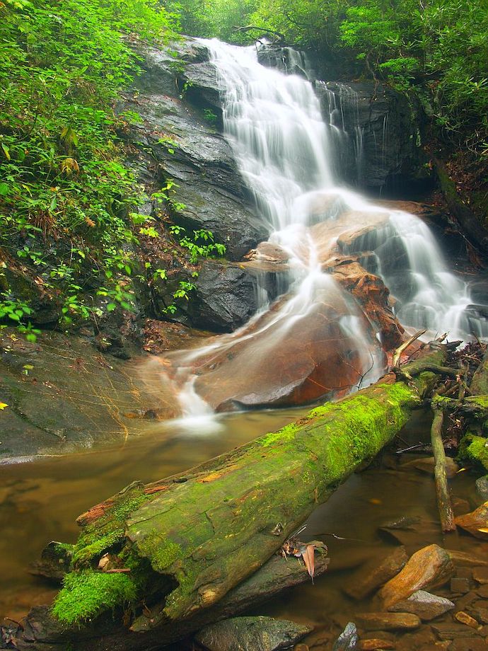
9. Log Hollow Waterfalls
Elevation: 3,445 feet
Hiking Distance: 2.5 miles
Based on its name alone, Log Hollow Waterfalls just sounds like it deserves a look for the best hiking trails in Pisgah.
Even cursory research on the trail will reveal the fact that Log Hollow has four waterfalls in under two miles of path!
The official “Log Hollow Falls,” the main attraction here, is only a half-mile from the trailhead, making it a great hike for kids and beginning hikers.
But the other waterfalls also dazzle, particularly Discovery Falls. The trail itself is an old logging road, which now leads trekkers through a beautiful stand of Pisgah Forest.
This trail is only about a 30-minute drive from Brevard, just off US-276, and it’s roughly an hour south of Downtown Asheville.
READ MORE: The 20 Best Western NC Small Towns To Visit (and Live In!)
10. Lost Cove Loop Trail
Elevation: 2,946 feet
Hiking Distance: 7.4 miles
Loop trails are almost always a treat because they provide fresh scenery the entire time you’re trekking.
Lost Cove Loop has lots of great stuff to see, including creeks, waterfalls, Timber Ridge, and swimming holes.
Included as part of the Mountains-to-Sea Trail, Lost Cove Loop is a rustic romp, with multiple creek crossings and an ascent of Bee Mountain along the way.
Two noteworthy waterfalls– Hunt Fish Falls and Gragg Prong Falls– are part of the 7.4-mile hike as well.
This trail is located near Linville Gorge and Grandfather Mountain State Park. Other notable attractions nearby include Banner Elk and Blowing Rock.
READ MORE: Visiting Doughton Park (Blue Ridge Parkway MM 238.5 – 244.7)
11. Jones Falls from Elk River Falls
Elevation: 3,193 feet
Hiking Distance: 5.3 miles
Elk River Falls is beloved for being a stunning waterfall that requires very little hiking to reach (less than five minutes).
But if you’re willing to put in a bit more effort, the same trail also yields a second impressive waterfall, Jones Falls.
With a 50-foot plunge into a large, inviting pool, Elk River Falls is beautiful. It’s also a great place to swim and sun on the large boulders you’ll find strewn about.
The less-visited, oft-forgotten Jones Falls is a hundred feet high, and is actually just across the Tennessee border.
The trail is near the town of Elk Park, which is accessed at the end of Elk River Road. The falls can also be visited by using a spur off of the Appalachian Trail.
READ MORE: The Cataloochee Valley Elk in Great Smoky Mountains National Park
12. Twin Falls
Elevation: 3,213 feet
Hiking Distance: 6.5 miles
Though the Twin Falls trail is listed as a lengthy 6.5 miles, it’s a busy walkway because lots of people are vying to see the two 100-foot waterfalls that give the loop its moniker.
This is a really nice hike at any time of year. But if a view of the falls is your main reason for going, winter is the best time because the leaves won’t block the visual splendor.
For those who aren’t into hiking long distances (or who just particularly enjoy horseback riding), Pisgah Forest Stables offers 9-mile tours via horse.
Located near Brevard in Transylvania County (a.k.a. “Land of Waterfalls”), Twin Falls is notable enough to get top billing.
But the Blue Ridge Parkway and Forest Heritage National Scenic Byway are both nearby as well.
READ MORE: 20 Best Blue Ridge Parkway Overlooks in NC & VA
13. Appalachian Trail: Lemon Gap to Max Patch
Elevation: 4,689 feet
Hiking Distance: 9.7 miles
Max Patch easily ranks among the most popular spots along the Appalachian Trail.
This 9.7-mile hiking trail from Lemon Gap to Max Patch is the best way to get the most of the trip there.
Summiting at flower-laden mountaintop meadows is the reward for venturing nearly ten miles through Pisgah National Forest and over small creeks.
The small area on top of the summit can get crowded at times, but that’s for good reason: the view from up there is out of this world!
This hike is a stout day-trip, or possibly better divided into an overnight camping adventure.
For those not into longer hikes, but who still wish to visit this staggering viewpoint, the Max Patch Trail is just a short, 1.5-mile loop.
READ MORE: The 15 Best North Georgia Mountains for Hiking
14. Mountain-to-Sea Trail, Segment 4: Gorges, Peaks & Waterfalls
Elevation: Approx. 4,400 feet
Hiking Distance: 75.3 miles
The Mountains-to-Sea Trail offers 1,200 miles of hiking across North Carolina.
It starts from Clingman’s Dome in Great Smoky Mountains National Park, and ends at Jockey’s Ridge on the coastal Outer Banks.
Segment 4 of the MST stretches over 75 miles through Pisgah National Forest. This section begins at Black Mountain Campground, pushes through Linville Gorge, and climbs to Beacon Heights Overlook.
It includes lots of creeks and cascades along the way, as well as views of Lake James and Lake Tahoma.
Segment 4 can be further divided into four overnight hikes, ranging from 14 to 22 miles each. But do be aware that the trail wavers between moderate and strenuous.
READ MORE: Cottages at Spring House Farm in Pisgah National Forest
15. Art Loeb Trail
Elevation: 6,463 feet
Hiking Distance: 28.5 miles
When long-distance, multi-day hikes are on the agenda, the Art Loeb Trail is worth considering.
While it’s not nearly as long as the Appalachian Trail or Mountains-to-Sea Trail, it’s a great alternative for a few days of backpacking in Pisgah National Forest.
Named in honor of an activist from the Carolina Mountain Club, this trail moves from peak to peak as opposed to dipping down into the valleys.
It provides some of the best panoramas Pisgah has to offer. There are also plenty of campgrounds along the route to accommodate backpackers.
The Art Loeb Trail starts near the Davidson River Campground outside of Brevard, and ends near Cold Mountain.
Its most popular area is Black Balsam Knob, which can be accessed from a nearby car lot if hiking the entire NC trail isn’t a good fit for you.
READ MORE: The 10 Best Places for Snow Skiing in North Carolina
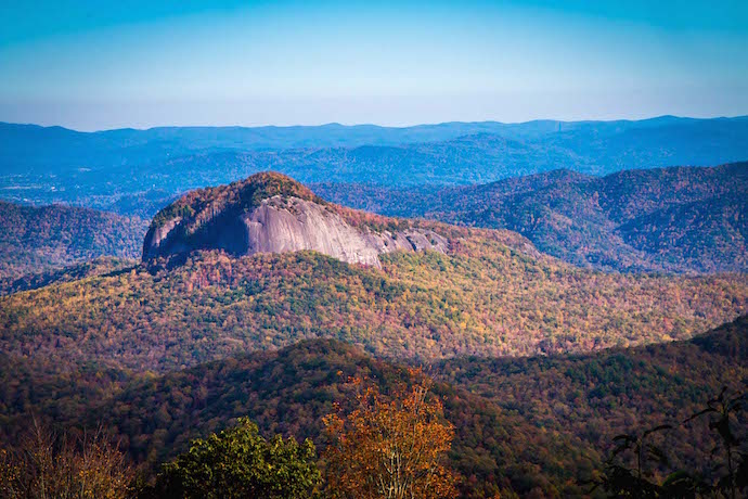
16. Looking Glass Rock Trail
Elevation: 3,970 feet
Hiking Distance: 5.5 miles
I will gladly hike a long way to catch a glimpse of a waterfall. So it’s especially interesting when a fantastic one—Looking Glass Fall—is really just a side-note at the beginning of a hiking trail.
The point of the Looking Glass Rock Trail is to ascend the iconic rock formation in the lower section of Pisgah National Forest.
Ironically, the views of the mountain from the BRP overlook are probably more famous than the amazing views from it.
The summit of Looking Glass Rock is a rocky outcrop that yields 180-degree, unimpeded panoramas of the valley below.
The trailhead can be accessed via FS 475, a little south of the falls. From there, it quickly criss-crosses up the mountain.
READ MORE: How to Get to Crabtree Falls Near Little Switzerland NC
17. Grassy Ridge Bald via the Appalachian Trail
Elevation: 6,184 feet
Hiking Distance: 4.7 miles
The route to Grassy Ridge Bald is a spur off the Appalachian Trail, and it can be easily accessed via Carver’s Gap, moving east from there for a day-hike.
The trail includes three of the five Roan Mountain summits: Round Bald (5,823 feet), Jane Bald (5,810 feet), and, ultimately, Grassy Ridge Bald (6,184).
At the summit of Grassy Ridge Bald, there is a rockpile to honor a local farmer, who was coincidentally named Cornelius Rex Peake.
From this summit, there are exceptional views of the Black Mountains to the south and Grandfather Mountain to the east.
Another fabulous trail to Roan Mountain’s other two peaks extends west from Carver’s Gap. Consequently, the parking lot fills up quickly on nice days, so get there early!
READ MORE: Cottages at Spring House Farm in Pisgah National Forest

18. John Rock Loop
Elevation: 3,320 feet
Hiking Distance: 4.9 miles
The John Rock Loop is a fun hike near Brevard NC . The trailhead can be accessed in the parking area for the Pisgah Center for Wildlife Education (FR 475), which also has a fish hatchery.
The hike winds through oak-pine cove forest, with the floor carpeted in a beautiful groundcover called “running cedar.” It also features Cedar Rock Creek and, eventually, Cedar Rock Creek Falls.
Though John Rock is not the highest point on the trail, it does offer the most amazing view– a stunning shot of Looking Glass Rock.
The remainder of the loop involves lots more streams and tributaries, as well as beautiful thickets of rhododendron and mountain laurel.
READ MORE: The Best Western NC Christmas Events in Asheville, Brevard & Beyond

19. Glen Burney Trail
Elevation: 3500 feet
Hiking Distance: 3.2 miles
The Glen Burney Trail dates back to the 1800s. That’s probably because even 19th century people loved to visit waterfalls, and this trail has three!
Located right off Main Street in the charming mountain town of Blowing Rock, the Glen Burney Trail is 3.2 miles for a round-trip exploration of New Year’s Creek.
The waterfalls on this route include Cascades, Glen Burney Falls, and Glen Marie Falls. The trail also features “the ruins,” relics of the towns old sewage system from the 1920s.
It’s important to realize that the trailhead of the Glen Burney Trail is the highest point, so the hike back will be uphill and more stringent than the one leading out.
READ MORE: Little Switzerland NC, Cutest Mountain Town on the Blue Ridge Parkway
20. Daniel Ridge Loop Trail
Elevation: 3,416
Hiking Distance: 4 miles
This confusingly named Pisgah Forest hiking trail is actually nowhere near Daniel Ridge, but rather on Lanning Ridge, which is two mountains away!
Nevertheless, the hike offers a great adventure as it weaves over a series of creeks via an eclectic collection of bridges. The trail is shared by both hikers and mountain bikers.
The highlights of the hike are the fabulous Tom Spring Falls and Jackson Falls (a.k.a. Daniel Ridge Falls), but there are other cascades to appreciate along the way.
To reach the Daniel Ridge Loop Trail near Brevard, turn off US-276 onto FS-475 and continue past the Pisgah Center for Wildlife Education.
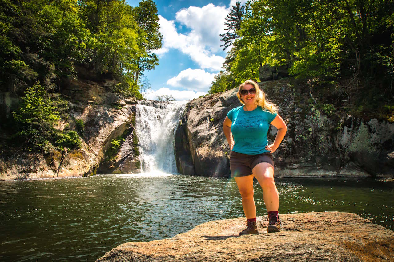
Go beyond the Cove Creek Group Camping Area and look for a gated road on the right. Just don’t block the gate when parking! –by Jonathon Engels; lead photo by msprague is licensed under CC BY-SA 2.0

Comments are closed.