
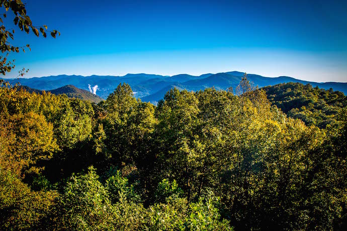
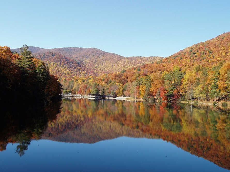
[Updated 5/25/2022] Comprising 867,000 acres of gorgeous, largely pristine land, the Chattahoochee National Forest offers some of the most rewarding and scenic opportunities for outdoor adventure in Georgia.
The forest spans a whopping 26 counties and is truly a nature lover’s paradise.
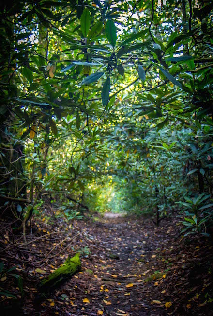
There are hundreds of miles of hiking trails that lead to picturesque, wildflower-lined streams, glistening waterfalls, peaceful lakes, and jaw-dropping North Georgia mountain summits.
There’s also plenty of history and culture in the area, which went from being home to the Mississippian and Cherokee people to being the site of the first gold rush and many prominent Civil War Battles.
While there are really no bad trails to trek here, we’ve compiled a list of our staff’s picks for the best hiking trails in the Chattahoochee National Forest to highlight some of the top sights the forest has to offer.
We’ve divided them into three levels of difficulty (easy, moderate, and strenuous), so there are hiking trails for all types of hikers, from those seeking a quick and easy excursion to hardy hikers wanting to tackle a multi-day adventure.
READ MORE: The 10 Hiking Essentials Packing List for the Blue Ridge Mountains
Hiking Trails in the Chattahoochee National Forest Guide
- Brasstown Bald
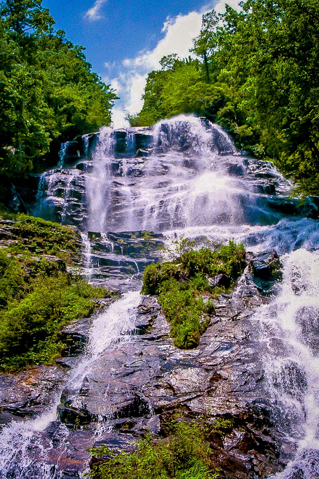
- Helton Creek Falls Trail
- DeSoto Falls
- Dukes Creek Falls
- Panther Falls & Angel Falls
- Toccoa Swinging Bridge
- Sosebee Cove Trail
- Trahlyta Falls
- Lake Chatuge Trail
- Amicalola Falls
- Cowrock Mountain
- Grassy Mountain
- High Shoals Falls
- Rabun Bald
- Raven Cliff Falls
- High Shoals Falls
- Yonah Mountain
- Smith Creek Trail at Unicoi State Park
- Coosa Backcountry Trail at Vogel State Park
- Bartram Trail From Sandy Ford to Warwoman Dell
Easy Chattahoochee National Forest Hikes
1. Brasstown Bald
Level of difficulty: Easy
Distance: 1.1 miles round-trip
Elevation Gain: 426 feet
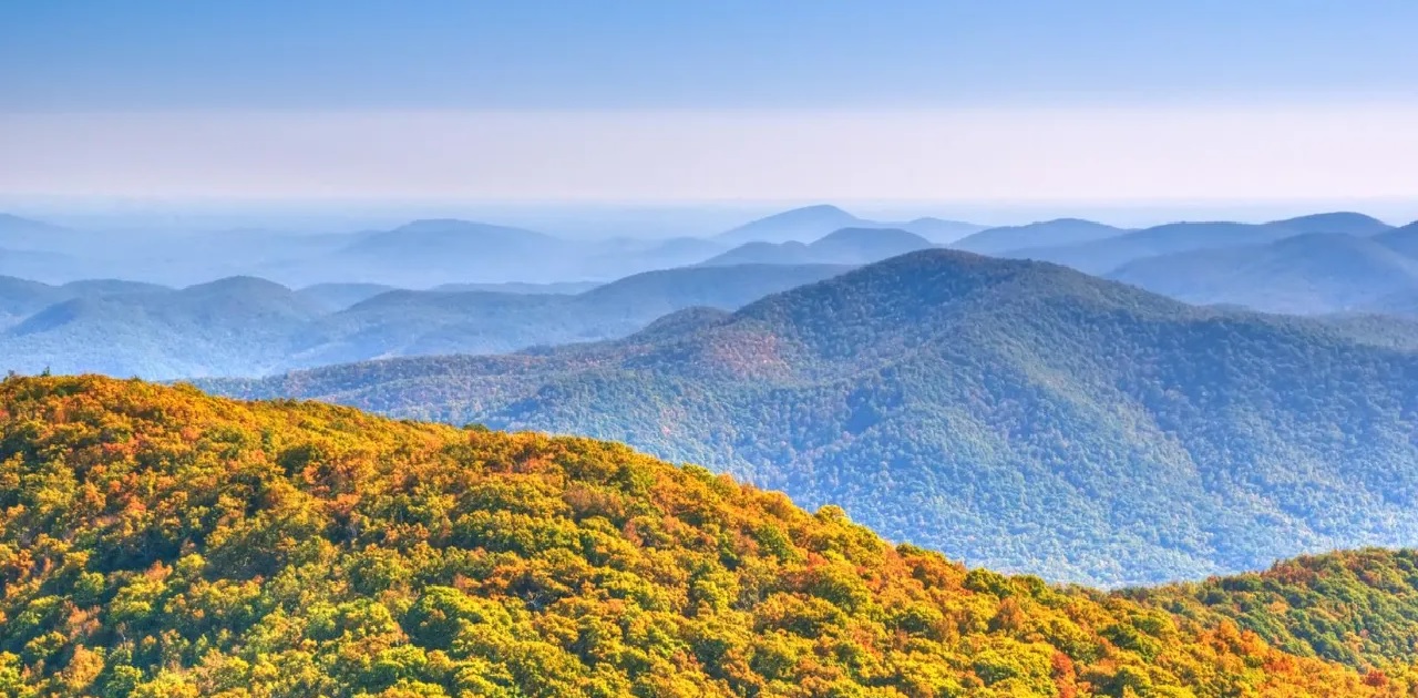
Standing at 4,784 feet, Brasstown Bald is the tallest mountain in Georgia. So it’s a great vantage point for viewing the surrounding scenery of the national forest.
The hike to the top of Brasstown Bald from where the shuttle drops you off (which is included in the $5 entrance fee) is relatively short at just 0.55 miles each way. But it can be challenging for some people because of its steady incline.
However, there are frequent places along the paved trail to stop and rest, so most people will find the it within their ability.
When you reach the Visitor Information Center at the top, you’ll be gifted with jaw-dropping 360º views. On a clear day, you can see into four states (Georgia, Tennessee, North Carolina, and South Carolina).
There’s also a museum where you can see interactive cultural and natural history exhibits.
READ MORE: Fall in the Mountains of North Georgia (Where to See the Best Fall Colors)
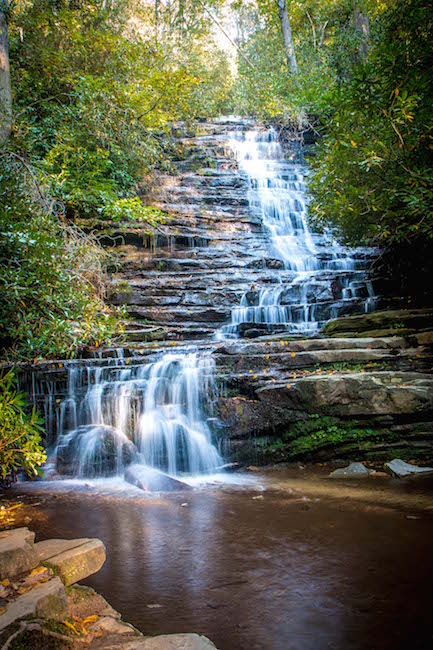
2. Helton Creek Falls Trail
Level of difficulty: Easy
Distance: 0.6 miles
Elevation Gain: 29 feet
(Editor’s Note: As of 5/25/22, this trail is temporarily closed for repairs. We’ll update when it reopens.)
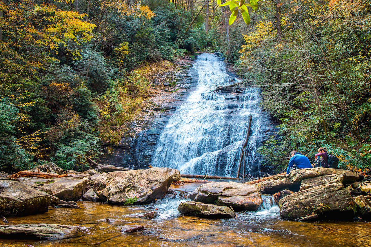
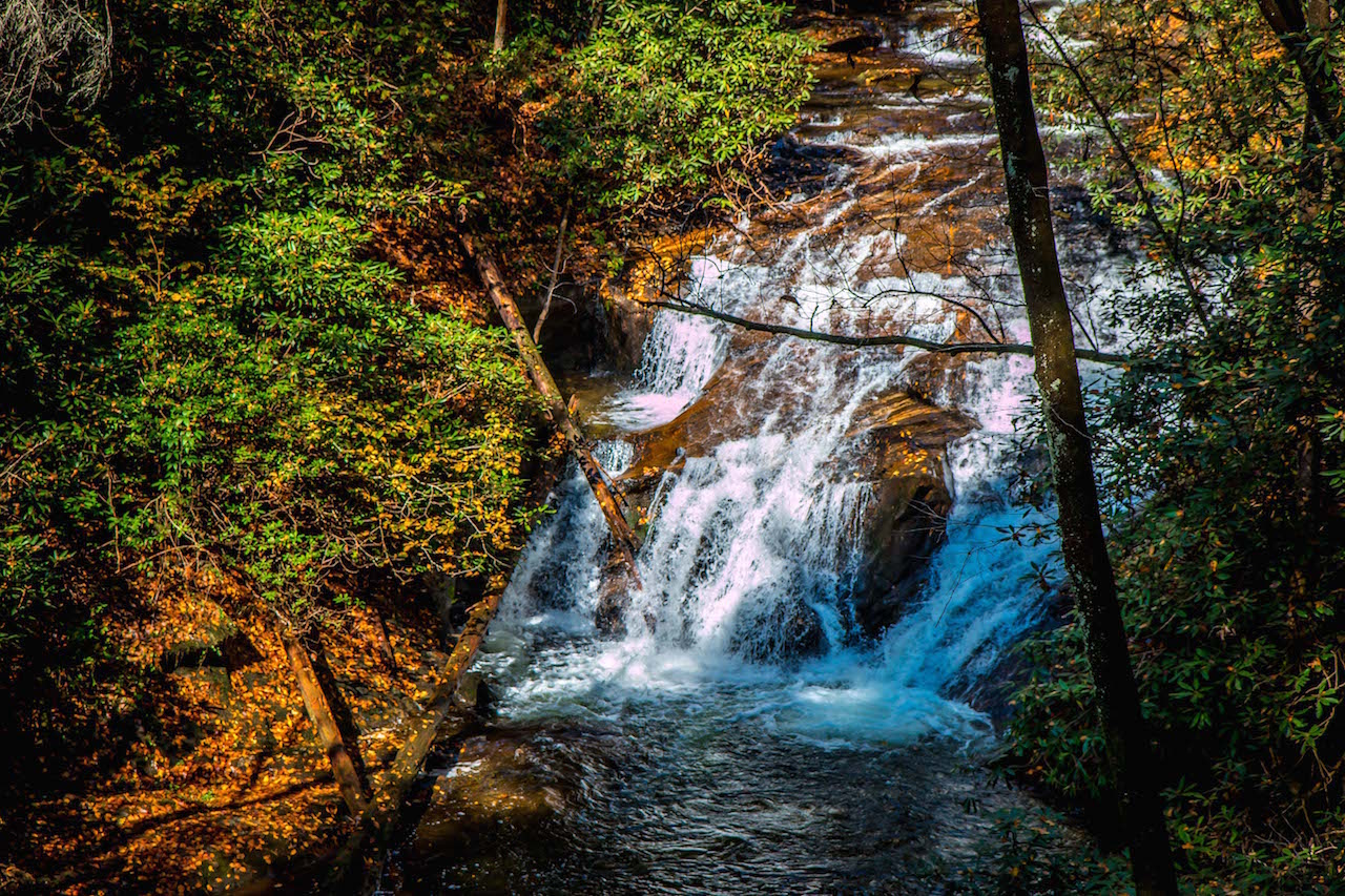
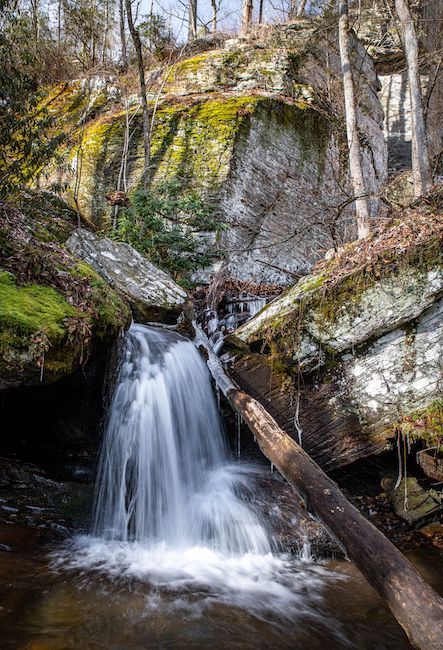
At just over half a mile round-trip, this short, scenic trail guides you to one of the most beautiful Chattahoochee National Forest waterfalls, Helton Creek Falls.
Given its short distance and minimal elevation gain, it’s a great trail for small kids and dogs.
Immediately descending a set of stairs, the trail wanders into a lush forest filled with vibrant North GA wildflowers, hardwood trees, and conifers before reaching a short side trail to descend another set of stairs.
This leads to the base of Lower Helton Creek Falls, where you can splash around in the pool of water before continuing on the main trail to the viewing platform at the top.
There you can catch incredible views of the upper falls or spread out on one of the large boulders for a picnic before heading back the way you came to complete the hike.
READ MORE: The 20 Best Easy Hiking Trails to Waterfalls in Georgia

3. DeSoto Falls
Level of difficulty: Easy
Distance: 2.2 miles
Elevation Gain: 160 feet
DeSoto Falls is a mesmerizing pair of waterfalls in Georgia near Helen.
It is particularly intriguing because it’s believed to be where a piece of Hernando de Soto’s armor was found from his expedition to the New World in the 1500s.
To experience the sight for yourself, the hike begins at a parking area and follows a paved path to a wooden bridge that crosses Frogtown Creek.
Soon after crossing the bridge, you’ll get a glimpse of the lower falls, and you’ll reach a wooden viewing platform at 1/4-mile.
After crossing just one more wooden bridge you will reach the mystical 80-foot cascades of upper DeSoto Falls.
There is a spacious viewing platform where you can bask in the beauty of the falls before heading back to complete the hike.
READ MORE: The 25 Best Things to Do in Helen GA
4. Dukes Creek Falls
Level of difficulty: Easy
Distance: 2 miles
Elevation Gain: 300 feet
The trail to Dukes Creek Falls is one of the most popular waterfall hikes in North Georgia. This is thanks to its beauty and the fact that it is great for kids and dogs and is partially wheelchair-accessible.
You’ll begin the hike at the Dukes Creek trailhead, where you can grab an awesome view of Yonah Mountain before starting the trip.
The trail is paved and guides you to an ADA-accessible viewing platform where you will get a first look at the falls before descending a set of stairs.
Not long after, the trail will reach a viewing platform where you can admire the beauty of the waterfalls cascading an incredible 150 feet!
READ MORE: How Gold Mining in Georgia Led to Land Lotteries & the Trail of Tears
5. Panther Falls & Angel Falls
Level of difficulty: Easy
Distance: 1.75 miles
Elevation Gain: 436 feet
If you’re looking to explore hiking trails in the Chattahoochee National Forest where you’ll get a lot of bang for your buck, this is the one.
In under two miles, you’ll explore a gorgeous stretch of the forest filled with hemlock and rhododendron, and you’ll get to see two beautiful North Georgia waterfalls!
The Panther Falls & Angel Falls official trailhead starts off with a serene cascade over a terraced rock ledge as you cross a wooden bridge over Joe Creek.
After climbing a set of stone stairs deeper into the forest you’ll reach Panther Falls at just over half of a mile.
This is easily the more impressive waterfall of the two so be sure to stop here for a while and take it all in before continuing on.
From there, the trail will get a bit more challenging as it has some switchbacks and a pretty steep incline. But when you reach Angel Falls’ viewing platform, it’ll be worth your efforts.
READ MORE: The 20 Best Things to Do in Clayton, GA (the Gem of Northeast Georgia)
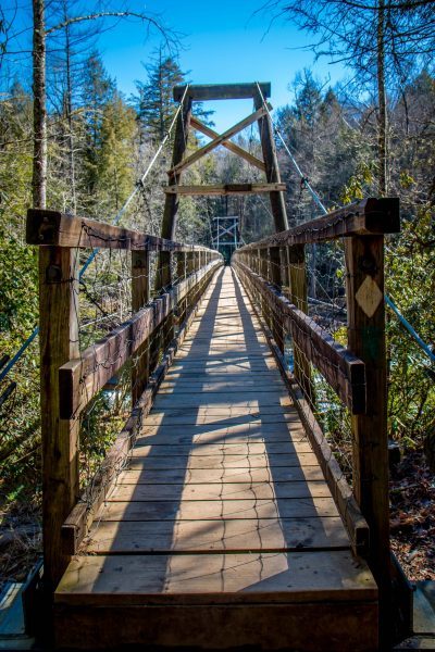
6. Toccoa Swinging Bridge
Level of difficulty: Easy
Distance: 0.8 miles
Elevation Gain: 118 feet
Built by the USDA Forest Service and the Georgia Appalachian Trail Club in 1977, the 270-foot-long Toccoa Swinging Bridge is the longest suspension bridge east of the Mississippi River.
It’s located on the Benton MacKaye Trail and Duncan Ridge National Recreation Trail near Blue Ridge GA, where it swings over the Toccoa River and provides an abundance of picturesque scenery along its short route.
The trail that allows you to cross the bridge is just under a mile round-trip, and has plenty of spots where you can stop and relax along the way.
For a longer adventure, just continue on the Benton MacKaye Trail (which traverses 81.8 miles in Georgia and 205.8 miles in Tennessee and North Carolina) for as long as you wish to explore more of this pristine natural area.
READ MORE: The 20 Best Things to Do in Blue Ridge, GA

7. Sosebee Cove Trail
Level of difficulty: Easy
Distance: 0.4 miles
Elevation Gain: 55 feet
One of the best hiking trails in the Chattahoochee National Forest for wildflower viewing, the Sosebee Cove loop trail explores a 175-acre forest in the Blue Ridge Mountain Town of Blairsville GA.
The preserve is dedicated to Georgia conservationist Arthur Woody, who helped acquire the land that became the Chattahoochee National Forest and was the driving force in creating the Blue Ridge Wildlife Management Area.
In spring and summer, you can spot a variety of wildflowers along the trail, including White Trillium, Jack in the Pulpit, Dutchman’s Breeches, Solomon’s Seal, and a variety of native Georgia orchids.
The trail is also known for having frequent wildlife, sightings including white-tailed deer, ruffed grouse, a variety of snakes, and occasional black bears.
READ MORE: The 15 Best Things to Do in Blairsville GA & Union County
8. Trahlyta Falls
Level of difficulty: Easy
Distance: 0.8 miles
Elevation Gain: 219 feet
Tucked away in one of the oldest and best North Georgia State Parks, Trahlyta Falls is easily one of the most beautiful waterfall hikes in GA.
The 0.8-mile round-trip trail begins by the Vogel State Park visitors center and crosses a wooden boardwalk before guiding you onto an earthen damn.
After catching some striking views of Trahlyta Lake and Blood Mountain, the trail descends a set of wooden stairs before reaching the cascades of Trahlyta Falls.
There’s a large viewing platform here where you can get close-up views of the incredible 110-foot falls as they tumble down the gigantic rock face. The waterfall is especially beautiful when surrounded by fall colors.
READ MORE: The 10 Best State Parks With Cabins In Georgia
9. Lake Chatuge Trail
Level of difficulty: Easy
Distance: 1 mile
Elevation Gain: 15 feet
Formed in the 1940s, when the Tennessee Valley Authority constructed a 2,950-foot earth-and-rock damn across the Hiawassee River, Lake Chatuge is a gorgeous lake that spans the border of Georgia and North Carolina.
The lake boasts over 130 miles of shoreline and has public boat ramps that provide easy access to water sports.
There are also two marinas where you can rent jet skis, pontoon boats, kayaks, and more.
For on-land exploration opportunities, the Lake Chatuge Recreation Area has a low-impact wooded shoreline as well as a one-mile hiking trail.
The trail winds through a pine and hardwood forest, while still offering spectacular views of Lake Chatuge.
READ MORE: The 15 Best Things to Do in Hiawassee GA & Young Harris GA
Moderate Chattahoochee National Forest Hikes
10. Amicalola Falls
Level of difficulty: Moderate
Distance: 2 miles
Elevation Gain: 784 feet
One of the most popular Chattahoochee National Forest waterfalls and the tallest waterfall in the state, Amicalola Falls reaches a total height of 729 feet.
There are a few different trails that lead you to the impressive cascades, including the one-mile East Ridge Trail and the wheelchair-accessible West Ridge Falls Access Trail.
But by far the most popular hiking trail here is the two-mile Amicalola Falls Loop Trail.
The loop trail takes you up a series of metal grate stairs, climbing alongside the falls to a long viewing platform, where you can get a look at the water up close as it rushes down seven different cascades.
To complete your hike, you can just go back the way you came or continue along the path to explore more of Amicalola Falls State Park.
READ MORE: 15 Fun Activities Where You Can Experience Fall in Georgia
11. Cowrock Mountain
Level of difficulty: Moderate
Distance: 2.25 miles
Elevation Gain: 400 feet
Known as being one of the best North Georgia mountains for hiking, Cowrock Mountain has some incredible hikes that gift you with spectacular views.
The hike to the mountain’s summit starts at Tesnatee Gap and follows the white-blazed Appalachian Trail westbound.
After continuing through a series of switchbacks, you’ll enter a thick forest that is often dotted with vibrant North GA wildflowers during spring and summer.
At 0.85 miles, the trail reaches a smooth outcrop that is the perfect place to rest and take in the summit views.
When you are ready to complete the hike, just follow the AT eastbound and retrace your steps back to Tesnatee Gap.
READ MORE: The 15 Best Breweries in Georgia
12. Grassy Mountain
Level of difficulty: Moderate
Distance: 3 miles
Elevation Gain: 738 feet
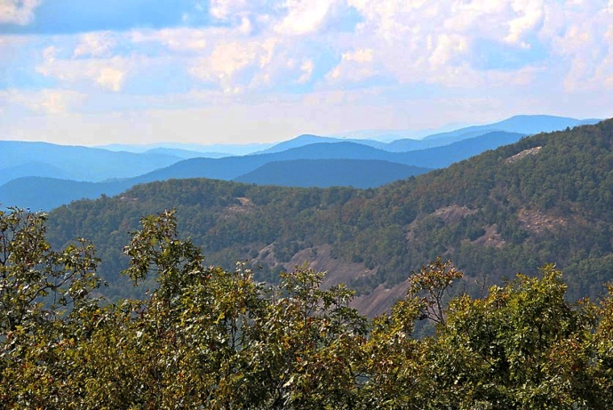
Located near Lake Conasauga and not far from Ellijay GA and Fort Mountain State Park, Grassy Mountain provides some truly dynamic hiking trails in the Chattahoochee National Forest that allow you to see some of North Georgia’s most spectacular Appalachian Mountain peaks.
To reach the summit of Grassy Mountain, the hike begins at the Grassy Mountain Tower trailhead.
From there, the trail ventures into the forest alongside a beaver dam before meeting up with the Songbird Trail.
The trial will begin to climb in elevation and pass through a rocky trail bed before reaching the summit, where you’ll see the Grassy Mountain fire tower.
If you climb the tower, you will be gifted with nearly 360º views of Fort Mountain and the expansive Cohutta Wilderness.
READ MORE: The 15 Best Things to Do in Ellijay GA & Gilmer County
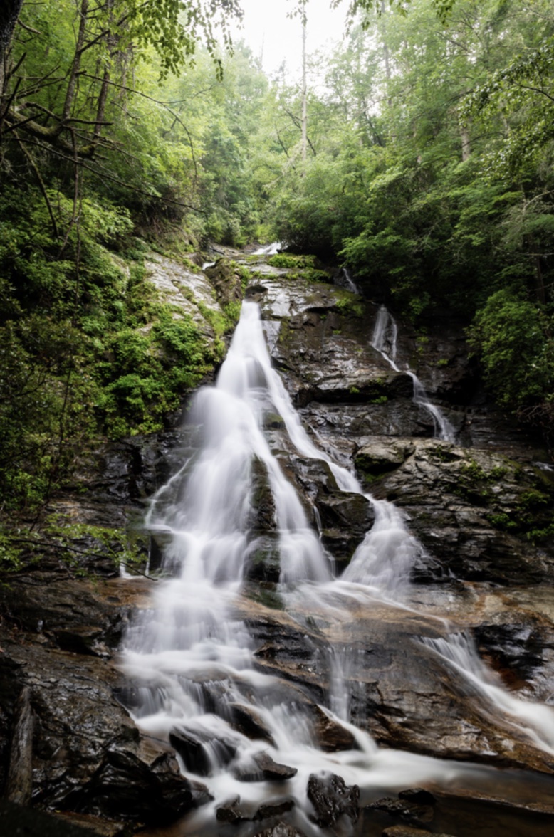
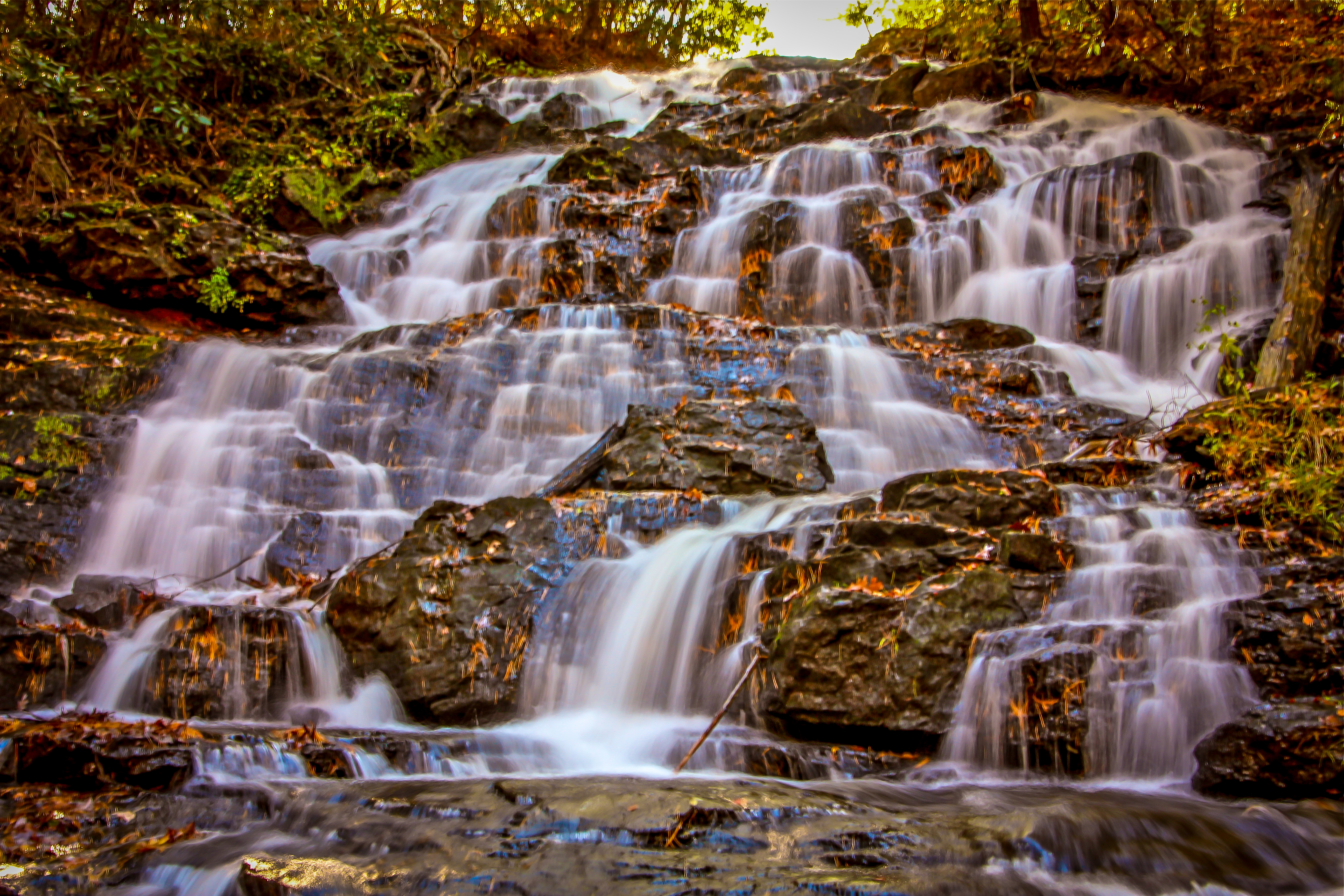
13. High Shoals Falls
Level of difficulty: Moderate
Distance: 2.4 miles
Elevation Gain: 577 feet
Leading to two of the most beautiful waterfalls in North Georgia and exploring a pristine stretch of the Chattahoochee Forest, the High Shoals Falls trail is a great moderately difficult trail to tackle.
Located just 12 miles north of downtown Helen’s restaurants and shops, the trail explores an old-growth forest and passes plenty of primitive campsites before crossing High Shoals Creek.
After about a mile, you’ll reach Blue Hole Falls, which features a single cascade that drops into a gorgeous turquoise pool. The pool is fairly deep, so it makes for a great summer swimming hole!
Continuing on, you’ll find a series of switchbacks and stone stairs before the forest opens up to reveal the breathtaking, 50-foot-tall High Shoals Falls.
After soaking in its beauty, you can follow the trail back out to complete the adventure at 2.4 miles.
READ MORE: The 20 Best Places to Live in the Georgia Mountains
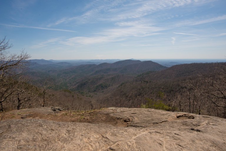
14. Rabun Bald
Level of difficulty: Moderate
Distance: 3 miles
Elevation Gain: 960 feet
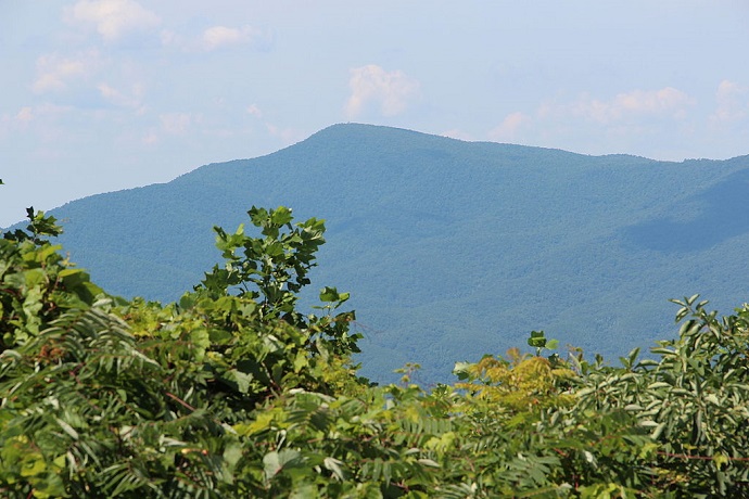
At 4,695 feet tall, Rabun Bald is the second tallest mountain in Georgia (after Brasstown Bald). As you can probably imagine, the summit views it offers are spectacular.
While the views at the top are clearly the star of the show, the hike to get there doesn’t disappoint either.
The 3-mile round-trip hike follows the Bartram Trail and has some pretty intense elevation. So it’s one of the more labor-intensive “moderate” hiking trails on this list.
However, the scenery and your own eagerness to get to the top are sure to keep you motivated.
When you do reach the summit, you’ll find a stone observation tower and incredible views of the surrounding forest.
To the southwest you can spot Black Rock Mountain, and to the northwest you can see the Standing Indian, Pickens Nose, and Albert mountains of North Carolina.
READ MORE: The 25 Best Hiking Trails in North Georgia Bucket List
15. Raven Cliff Falls
Level of difficulty: Moderate
Distance: 4.9 miles
Elevation Gain: 400 feet
Located 6 miles from the heart of Helen GA, Raven Cliff Falls is one of the popular and picturesque waterfalls in the area.
It’s surrounded by towering hardwood trees, verdant moss, and creeks lined with wildflowers in all sorts of different colors, which makes for one of the most beautiful Chattahoochee National Forest hikes you can imagine.
Starting out at a gravel trailhead, the Raven Cliff Falls trail follows Dodd Creek upstream before crossing the creek on a wooden bridge and continuing through the forest.
Along the way, you’ll come across a few other streams and smaller cascades before you reach the 40-foot Raven Cliff Falls, where you can watch in awe as the water tumbles over large boulders before collecting in a serene pool below.
READ MORE: The 15 Best Waterfalls Near Helen GA
16. Woody Gap to Big Cedar Mountain
Level of difficulty: Moderate
Distance: 3 miles
Elevation Gain: 600 feet
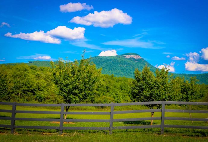
Located in the Blood Mountain Wilderness portion of the Chattahoochee National Forest near Dahlonega GA, Big Cedar Mountain is a truly magnificent mountain in North Georgia.
To reach the summit and the spectacular views that it provides, you’ll start at Woody Gap and follow a section of the famous Appalachian Trail.
The trail enters a dense forest and follows the blazes of the AT through a series of steep switchbacks before reaching Preachers Rock.
It continues on the AT past the landmark and will eventually guide you to the top of Big Cedar Mountain.
There, you will get to see far-flung views of the Blue Ridge Mountains that are nothing short of breathtaking. After your hike quench your thirst at one of the eight great Dahlonega Wineries or grab a bite at nearby Dahlonega Restaurants.
READ MORE: The 20 Best Things to Do in Dahlonega GA & Lumpkin County
Strenuous Chattahoochee National Forest Hikes
17. Yonah Mountain
Level of difficulty: Strenuous
Distance: 4.4 miles
Elevation Gain: 1,489 feet
Offering spectacular views of North Georgia’s Blue Ridge Mountains, the popular hike to Yonah Mountain’s summit begins at a trailhead off of Chambers Mountain Road in Helen.
Immediately entering the forest, the trail crosses over a small bridge before climbing in elevation and continuing along a gravel road.
You’ll soon come across a US Army training camp, where multiple trails branch off in varying directions. To make your way to the Yonah summit, just continue along the gravel road.
At around 2 miles in you’ll reach a beautiful mountaintop meadow, which makes a perfect spot to relax, have a picnic, or just take in the jaw-dropping views.
It should be noted that the rocky summit has sudden drop-offs and can be slippery after heavy rains. So please exercise caution and be sure to wear hiking shoes with good traction!
READ MORE: The 15 Best Rental Cabins in Helen GA

18. Smith Creek Trail at Unicoi State Park
Level of difficulty: Strenuous
Distance: 8.4 miles
Elevation Gain: 1,663 feet
If you’re seeking a more private hike and are willing to tackle a bit of distance and elevation gain, the Smith Creek Trail in Helen GA is one of the most uncrowded of the paths leading to North Georgia waterfalls.
The 8.4-mile round-trip trail starts near the lake at Unicoi State Park and is filled with all sorts of pristine flora and fauna.
Note that you’ll likely find yourself climbing over a few fallen trees or making your way through some overgrown sections.
But the unspoiled sights along the way and the reward of Anna Ruby Falls at the end make it worth the effort.
The twin falls originate atop Tray Mountain and are made up of two streams (Curtis Creek and York Creek), which come together to form Smith Creek and eventually flow into Unicoi Lake.
READ MORE: Inside the Utterly Unique Unicoi State Park Barrel Cabins in Helen GA
19. Coosa Backcountry Trail at Vogel State Park
Level of difficulty: Strenuous
Distance: 12.9 miles
Elevation Gain: 3,628 feet
The 12.9-mile Coosa Backcountry Trail covers some pretty tough terrain. But it’s considered by many trekkers to be one of the most rewarding hiking trails in the Chattahoochee National Forest.
If you want to make an overnight backpacking adventure of it, you can easily do so by stopping at one of the several North Georgia campgrounds along the way.
Departing from Vogel State Park, the trail gradually climbs up through the forest before crossing a few creeks and heading into the Blood Mountain Wilderness Area.
Throughout the hike, you (and your legs) will face some pretty intense elevation gain. But once you reach the end, it will all be worth the effort.
This Chattahoochee Forest trail is also fairly secluded, so this is a great hiker those looking to immerse themselves in nature without any distractions.
Just make sure to let friends/family know where you’re going, in case you get lost along the way!
READ MORE: The Top 10 Treehouse Rentals in the Georgia Mountains
20. Bartram Trail from Sandy Ford to Warwoman Dell
Level of difficulty: Strenuous
Distance: 9.3 miles
Elevation Gain: More than 1,000 feet
Covering 114 miles across North Georgia and Western North Carolina, the Bartram Trail follows the path explorer William Bartram took in the late 18th century as he documented over 100 new species of flora and fauna.
In Georgia, there’s a 35-mile stretch of the trail that traverses through the Chattahoochee National Forest, allowing hikers to explore some of the state’s most scenic forests, peaks, and waterfalls.
Hiking the 9.3-mile section of the trail that runs from Sandy Ford to Warwoman Dell near Clayton GA is a great way to experience the Bartram Trail without having to take on the entire length.
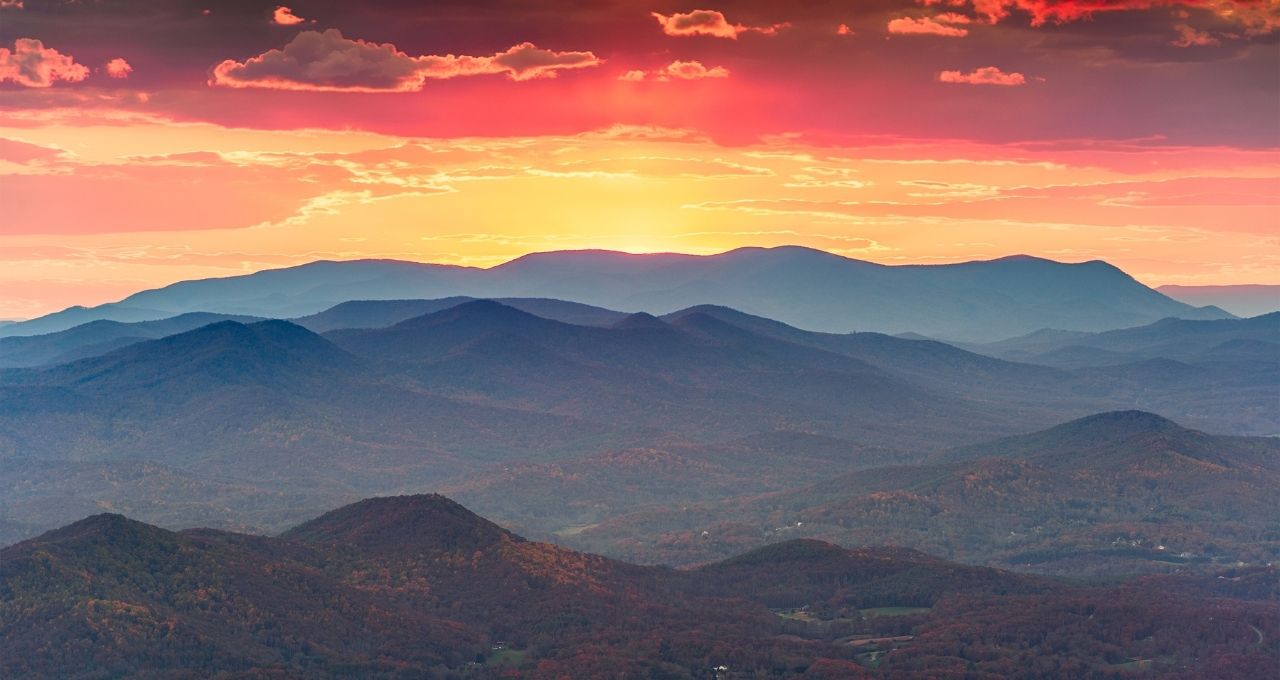
This trail also has many campsites along the way, so it makes for a great multi-day backpacking adventure! –by Christina Maggitas; lead image of sunset on Brasstown Bald via Canva
