
The Blue Ridge Parkway is one of the premier scenic drives in the USA, and also the most visited national park in the country.
Created by Franklin D Roosevelt to connect Shenandoah National Park in Virginia with Great Smoky Mountains National Park in North Carolina, construction of the BRP began in the 1930s.
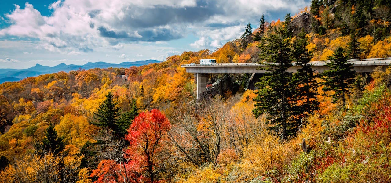
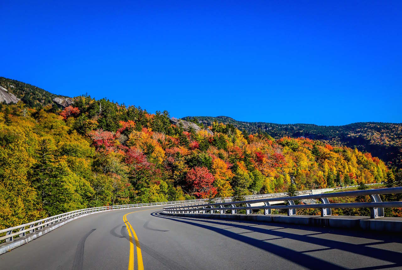
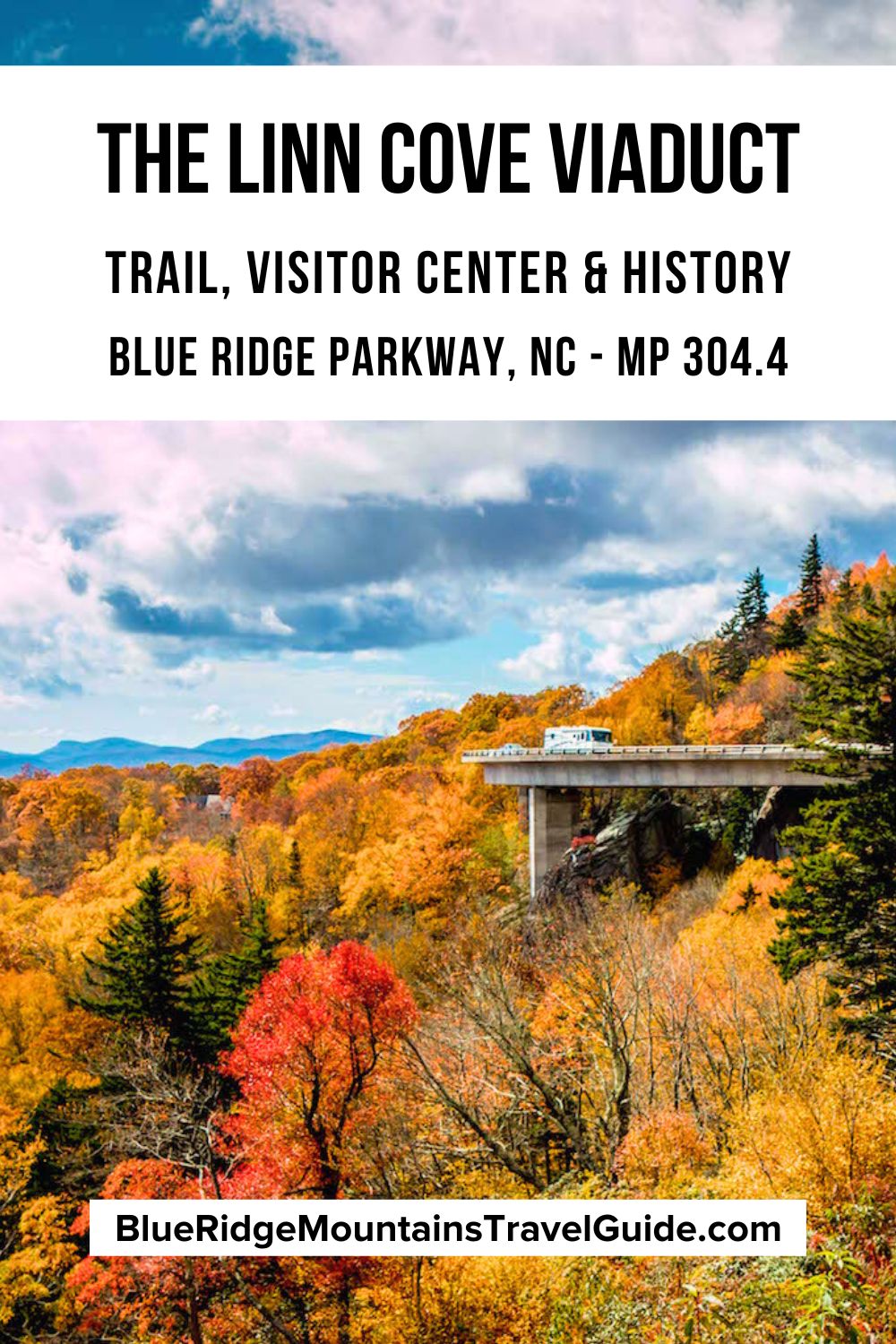
By the mid-1960s, most of the 469-mile scenic route had been completed. But work on the Linn Cove Viaduct in NC, part of a 7-mile section that curves around Grandfather Mountain, took nearly two decades.
Designed to preserve the special ecological and geological features of the mountain, this final section opened in 1987, 50+ years after Blue Ridge Parkway construction began.
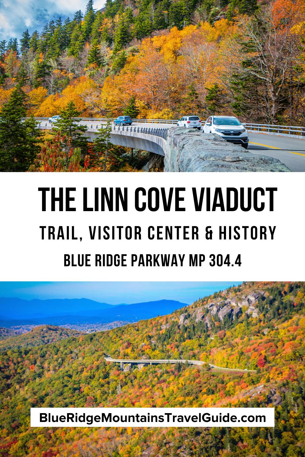
Today, the viaduct (an elevated roadway supported by columns, arches, or piers) is regarded as an ingenious engineering marvel, stretching 1,243 feet around BRP Milepost 304.4.
Read on for our guide to this National Civil Engineering Landmark, including details on the Linn Cove Viaduct Trail, Visitor Center, and construction history.
READ MORE: The 15 Best Blue Ridge Parkway Hotels & Cabin Rentals in NC & VA
Linn Cove Viaduct Visitor Center Info
ADDRESS: Blue Ridge Parkway Milepost 304.4, Linville NC
PHONE: 828-733-1354
VISITOR CENTER HOURS: Currently closed for building repair work.
ADMISSION: Free
DRIVING DIRECTIONS FROM BLOWING ROCK NC
From Downtown Blowing Rock, go south on Main St and take a right on US-221 S/Yonahlossee Rd. It’ll be about 1.6 miles to the Blue Ridge Parkway. Take the BRP going south, and you’ll see the entrance to the Linn Cove Visitor Center on the left in approximnately 10 miles.
DRIVING DIRECTIONS FROM BOONE NC
From Downtown Boone, take NC-105 S for roughly 17 miles. Then turn left onto US-221 N and continue for just over 3 miles, where you’ll see a BRP onramp on the left. Head north on the Blue Ridge Parkway for about a mile, and the entrance to the Linn Cove Visitor Center will be on the right.
READ MORE: How to Plan an Amazing Blue Ridge Parkway Road Trip
Linn Cove Viaduct History
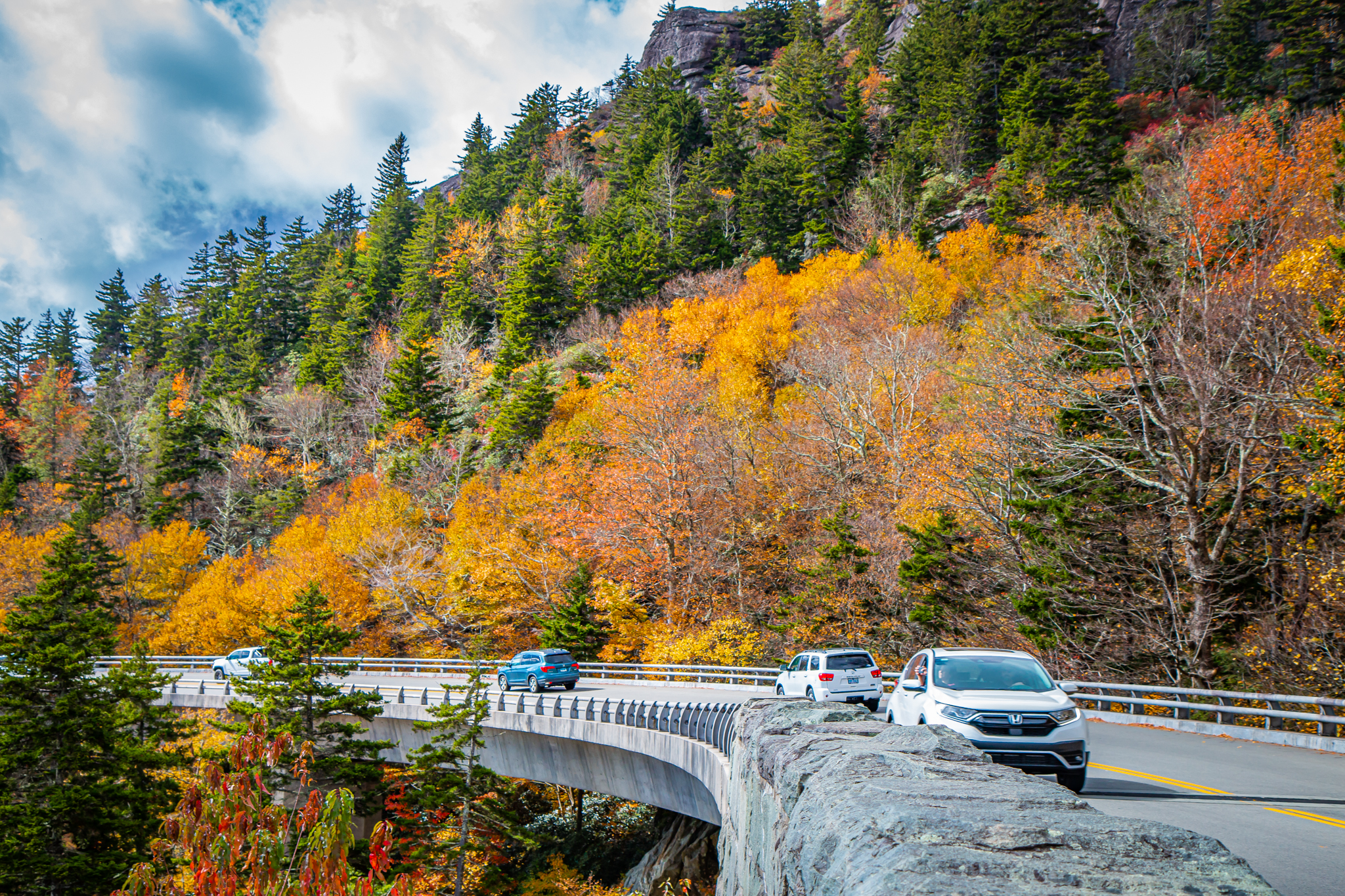
The Linn Cove Viaduct curves around the side of Grandfather Mountain and is made up of 153 segments, each of which weighs a whopping 50 tons.
This part of Blue Ridge Parkway history was riddled with controversy, because Grandfather Mountain owner Hugh Morton (who inherited it from his grandfather) was fiercely protective of the mountain’s fragile ecology.
So when the National Park Service proposed having the BRP cut along its slopes, he initially refused.
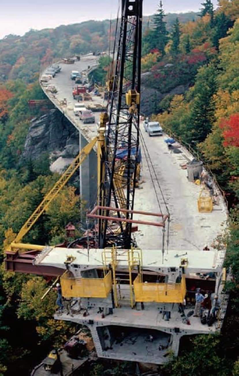
Figg and Muller Engineers had to figure out how to build a road at an elevation of 4,100 feet without damaging one of the world’s oldest mountains.
What they came up with was an elevated roadway (to avoid cuts and fills in the mountain) and a sweeping “S” curve that skirted the mountainside.
At the time, it was the most complex concrete bridge ever constructed, and it was completed in 1983 at a cost of nearly $10 million!
READ MORE: The 25 Best Blue Ridge Parkway Hikes for NC Day Trips
Constructing the Blue Ridge Parkway Viaduct
To minimize environmental damage, constructing the Linn Cove Viaduct on the Blue Ridge Parkway was done from the top down, which made a “pioneer” road unnecessary.
Each concrete segment was cast a few miles from the construction site, brought in on the Parkway with heavy equipment, then lowered into position by a crane.
Fun Fact #1: Only one of the 153 segments that make up the Linn Cove Viaduct– the southernmost segment– is straight. The rest of them are curved to create the “S” shape that hugs Grandfather Mountain.
Fun Fact #2: Exposed rocks were covered during construction to avoid staining them with concrete, epoxy, or grout. Later, the concrete at ground level was tinted with iron oxide to blend in with the existing rock.
While they were building the Linn Cove Viaduct (the lengthiest Blue Ridge Parkway bridge), other small sections along the BRP were finished so that it could finally be one continuous scenic route for everyone to enjoy.
In 1987, there was a ribbon-cutting ceremony to celebrate the completion of the Blue Ridge Parkway after 52 years of construction.
The opening of the Blue Ridge viaduct ended the 14-mile detour along the Tonahlossee Trail (US-221), which had long served as the link between the two disconnected sides of the BRP.
READ MORE: The 20 Best Blue Ridge Parkway Restaurants in VA & NC
Hiking the Linn Cove Viaduct Trails
The following three hiking trails are directly connected with the Linn Cove Viaduct.
However, there are lots of other great hikes on the Blue Ridge Parkway nearby, including in Grandfather Mountain State Park, Julian Price Memorial Park, and Moses H. Cone Memorial Park.
READ MORE: The 20 Best Overlooks on the Blue Ridge Parkway in Fall
1. Linn Cove Viaduct Trail
Starting at the far end of the Linn Cove Viaduct Visitors Center parking lot (Milepost 304.4), the Linn Cove Viaduct Trail is short and paved, so most visitors can hike it. It is less than a mile round-trip.
The trail leads to a unique Blue Ridge Parkway overlook: Rather than looking out at the landscape, visitors are looking up at the viaduct itself.
Beyond the overlook platform, there is still plenty of exploring to do.
The North Carolina hiking trail is part of the much longer Tanawha Trail, which skirts along the edge of the viaduct and offers several different views and angles of it.
READ MORE: Visiting the Southern Highland Craft Guild Folk Art Center (Asheville NC)
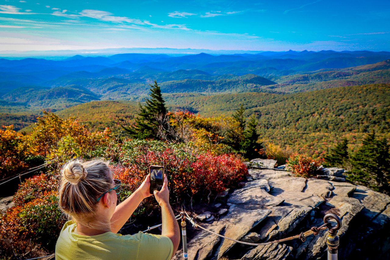
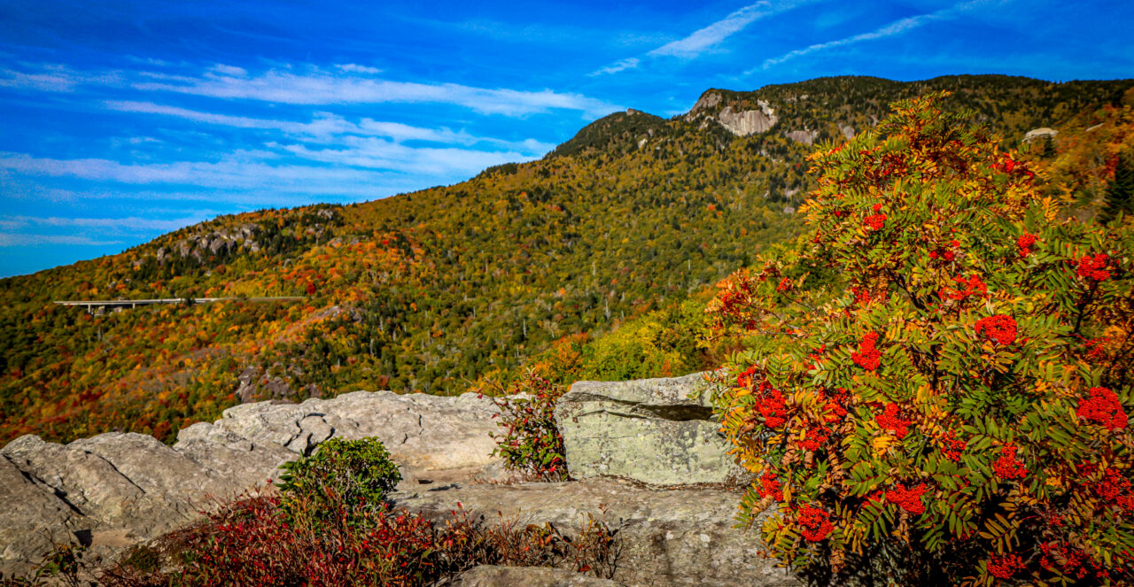
2. Rough Ridge Trail
The exceptionally beautiful Rough Ridge Trail starts at the Rough Ridge Lookout (Milepost 302.8), just north of the Linn Cove Viaduct. It’s 1.5 miles round-trip, and part of the longer Tanahwa Trail.
This must-see trail takes adventurous hikers on a gradual climb to the 4,773-foot summit, where you can take in an expansive view of Grandfather Mountain, Linn Cove Viaduct, and the Blue Ridge Mountains‘ horizon.
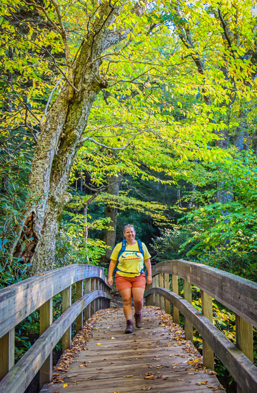
Other highlights of the Rough Ridge Trail include a bridge over a creek, a boardwalk over a boulder-strewn area, and plenty of rare North Carolina wildflowers.
At the summit, the trail becomes more challenging, with permanent cables to help you up and over the boulders that provide a jaw-dropping view. In all, the trail gains nearly 500 feet in elevation in less than 3/4 of a mile.
Note that it’s worth getting there early (before 9am) on the weekends, as the small parking lot often fills up by lunchtime. Rough Ridge is one of our favorite spots for Linn Cove Viaduct photos!
READ MORE: The 20 Best Cabin Rentals in Boone NC
3. Tanawha Trail
The 13.5-mile Tanawha Trail stretches from the Beacon Heights Overlook at the southernmost end to Julian Price Memorial Park at the northern end.
This trail runs parallel to the Blue Ridge Parkway, and traverses Grandfather Mountain. It was completed in 1993, and provides up-close access to the ancient ecosystem that the Viaduct bridge was built to protect.
Although it’s undeniably long, the Tanawha Trail is mostly an easy-to-moderate hike, with some strenuous points along Rough Ridge (as its name suggests).
It moves through thickets of rhododendron and mountain laurel, secluded hardwood coves, and evergreen glens. There are also giant boulder fields and cool mountain streams along the way.
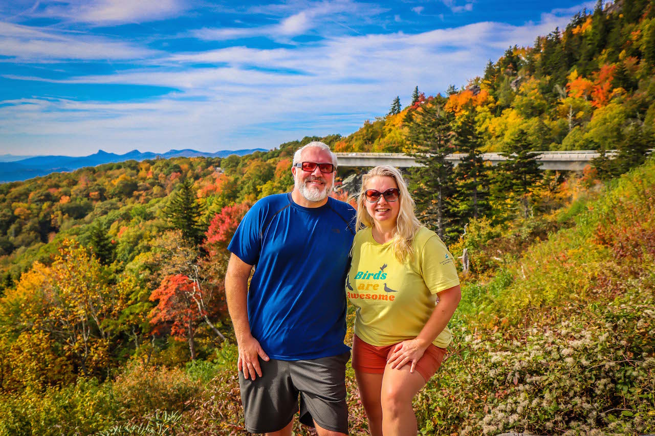
Tanawha is part of the much longer Mountains-to-Sea Trail that goes from Clingmans Dome in Great Smoky Mountain National Park all the way to Jockeys Ridge State Park on the Outer Banks. It’s a nearly 1200-mile journey. -by Jonathon Engels; all photos by Bret Love & Mary Gabbett unless otherwise noted
