
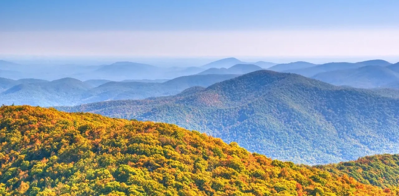
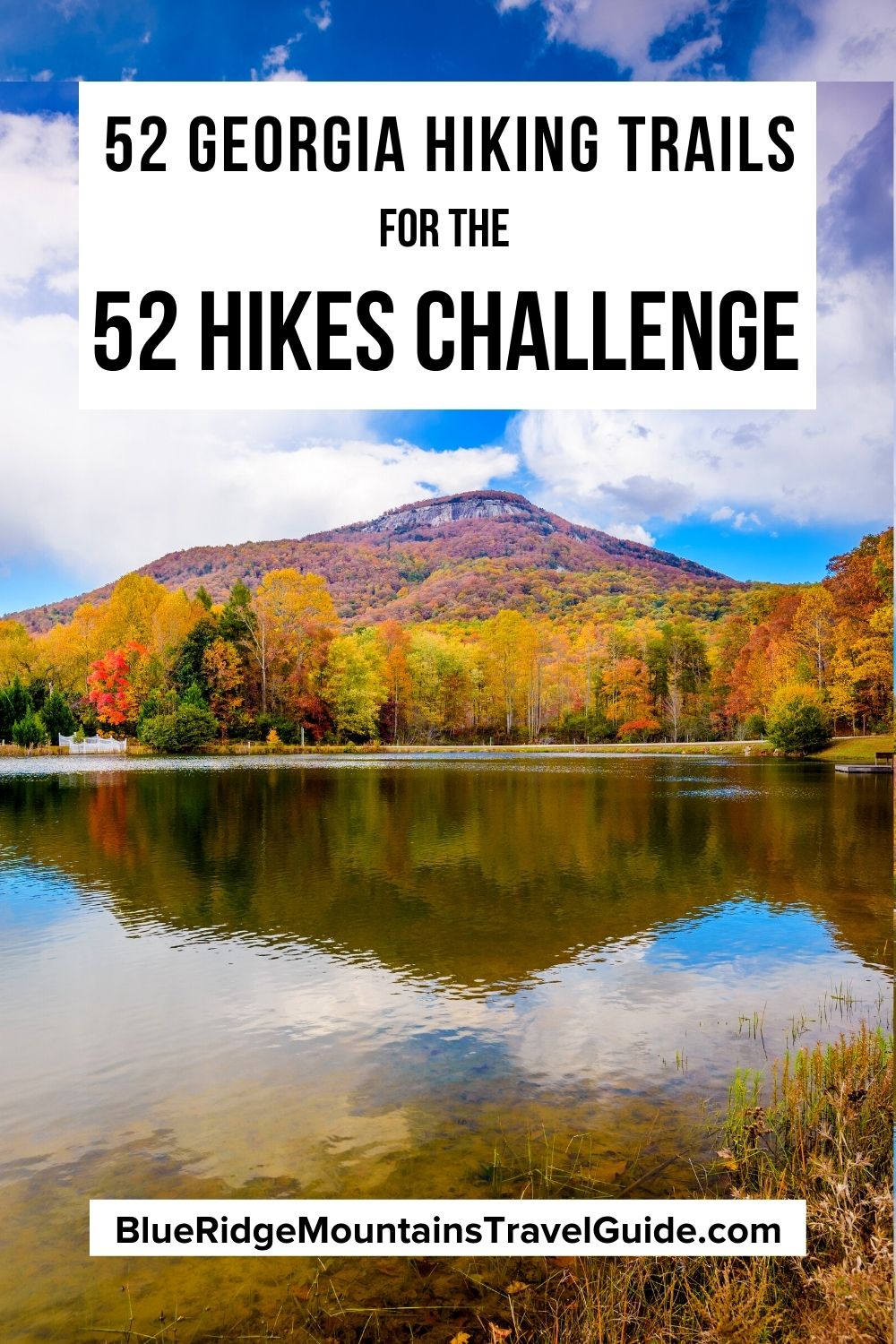
If you’re ready to improve your physical and mental well-being, explore new landscapes, and reconnect with yourself and nature, check out our list of the best Georgia Hiking Trails for the 52 Hike Challenge.
This global challenge encourages people to get outside and get active by completing 52 hikes in a year, which is one for every week. But of course you can break up your hikes however you want.
After each hike, participants are encouraged to share their progress on social media by posting a photo with the #52HikeChallenge hashtag and the number of hikes they’ve completed (i.e. #hike1, #hike2).
This way everyone participating can stay connected and cheer each other on. You might even meet some new hiking buddies in your area this way, or inspire someone else to get in on the fun!
When you’re ready to start the challenge, the task of finding 52 different hiking trails to embark on throughout the year may seem a bit daunting.
To make things a little easier, we’ve compiled our picks for the 52 best hiking trails in North Georgia, divided by geographical regions and levels of difficulty.
Read on for our epic guide to hiking in North Georgia (including a map of all the trails included), and good luck with the challenge!
READ MORE: The 10 Hiking Essentials Packing List for the Blue Ridge Mountains
Hiking Near Atlanta
Easy Hiking Trails Near Atlanta
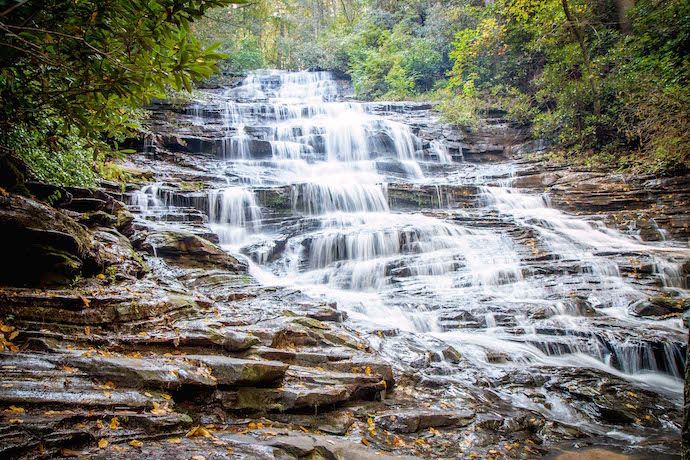
1. Sweetwater Creek Red Trail– Located in Sweetwater Creek State Park in Lithia Springs, this trail is just under two miles and explores a beautiful deciduous forest. It guides you along Sweetwater Creek and past the ruins of New Manchester Mill. The overlook at the end offers excellent views of the creek’s tumbling cascades.
2. River Boardwalk Trail- This easy 1/2-mile trail is located at the Chattahoochee Nature Center, a great place to learn about Georgia‘s nature and wildlife. There are 5 interconnected trails, but the River Boardwalk is the longest and most diverse. It runs through multiple habitats and leads you to the Chattahoochee River.
3. Perimeter Trail at Etowah Indian Mounds- At just over a mile, the Perimeter Trail is the longest trail at the Etowah Indian Mounds Historic Site in Cartersville. Packed with history and natural beauty, the route circles the boundaries where the Defensive Ditch protected residents from attacks by a rival Mississippian tribe.
READ MORE: The 25 Best Day Trips From Atlanta GA

Moderate/Strenuous Hiking Trails Near Atlanta
4. Indian Seats Trail- The Indian Seats Trail is part of a network of hiking trails in Cumming’s Sawnee Mountain Preserve. Great for both nature lovers and history buffs, the 3.2-mile trail passes abandoned gold mines on the way to the top. It also has interpretive signs you can read to learn more about the area’s natural history.
5. Vickery Creek Trail at Roswell Mill- This 3.4-mile trail guides you along the banks of Vickery Creek to the ruins of the Roswell Manufacturing Company Mill. The man-made waterfall was created when the creek was dammed to provide power, and is a popular place for locals to splash around in during the summer.
6. Toonigh Creek Falls Trail- Canton’s Toonigh Creek Falls (a.k.a. Allatoona Falls) is a 20-foot waterfall near the mouth of Toonigh Creek, where it spills into Lake Allatoona. The creek is accessible by kayak or canoe, but there’s an unofficial hiking trail as well. It reaches the falls at 1.5 miles, for a total hike of 3 miles.
READ MORE: The 15 Best North Georgia State Parks & Historic Sites
Hiking Near Blue Ridge GA
Easy Hiking Trails Near Blue Ridge GA
7. Sea Creek Falls Trail- Just a half-mile hike, the Sea Creek Falls Trail is a quick and easy trail that leads to the 30-foot-tall Sea Creek Falls. It’s nestled in the Cooper Creek Recreation Area of the Chattahoochee National Forest, and provides scenic views throughout.
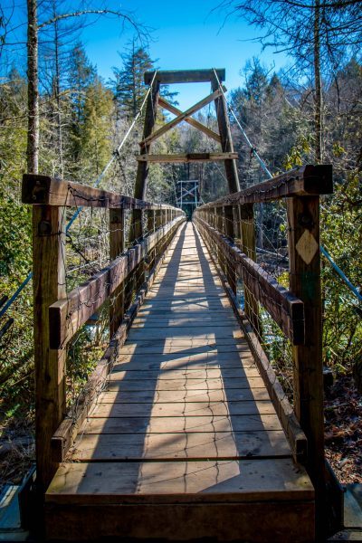
8. Toccoa River Swinging Bridge– At 270 feet, the Toccoa Swinging Bridge is the longest of its kind east of the Mississippi. It’s located on the Benton Mackay Trail and Duncan Ridge National Recreation Trail, but the shortest trail is just under a mile and offers a perfect way to access the iconic bridge.
9. Long Creek Falls Trail- The Long Creek Falls Trail leads to one of the few waterfalls at the Appalachian Trail’s southern end, and one of the best waterfalls near Blue Ridge GA. The 2-mile hike starts on Forest Road 58 and follows the AT northeast alongside Long Creek, ending at the 50-foot cascades of Long Creek Falls.
10. Falls Branch Falls Trail- At just under a mile round-trip, this trail takes hikers along the Benton MacKaye Trail. It’s lined with beautiful North GA wildflowers in spring, and has minimal elevation gain. The fun, easy hike leads to a wooden observation platform where you can take in the beauty of the 75-foot Falls Branch Falls.
11. Lake Blue Ridge Loop Trail– The Lake Blue Ridge Loop Trail is a short, but scenic hike that leads to one of our favorite lakes in Georgia. At just under a mile, the trail is a great way to see wildlife and enjoy the stunning views of the lake. It can also be combined with other activities for a full day of fun on the water.
READ MORE: The 20 Best Things to Do in Blue Ridge, GA
Moderate/Strenuous Hiking Trails Near Blue Ridge GA
12. Flat Creek Loop- The Flat Creek Loop is in the Aska Adventure Area, which is located south of Blue Ridge along the banks of the Toccoa River. The trail is 6 miles long and crosses over a number of tributaries that flow into Flat Creek. So you can expect to get a little wet at times, but it just makes it all the more fun!
13. Grassy Mountain Tower- This 4-mile round-trip hike begins at the Grassy Mountain Tower trailhead and ventures into the Chattahoochee National Forest. It passes a beaver dam and follows the Songbird Trail before reaching the Grassy Mountain summit, where the tower offers nearly 360º views of the surrounding landscape.
READ MORE: The 15 Best Blue Ridge Georgia Cabins to Rent
Hiking Near Helen GA
Easy Hiking Trails Near Helen GA
14. Tesnatee Gap to Cowrock Mountain- This 2.25-mile hiking trail to Cowrock Mountain’s summit begins at Tesnatee Gap and follows the AT westbound. In late spring and early summer, the trail is dotted with beautiful wildflowers. At the summit, you’ll be treated to spectacular views of the Blue Ridge Mountain scenery.
15. Dukes Creek Falls- The 2-mile hike to Dukes Creek Falls is a kid-friendly adventure that’s partially wheelchair accessible. The scenic trail offers glimpses of Dukes Creek and the upper part of the 150-foot waterfall. The views when you reach the observation platform at the bottom make this one of the best waterfalls near Helen.
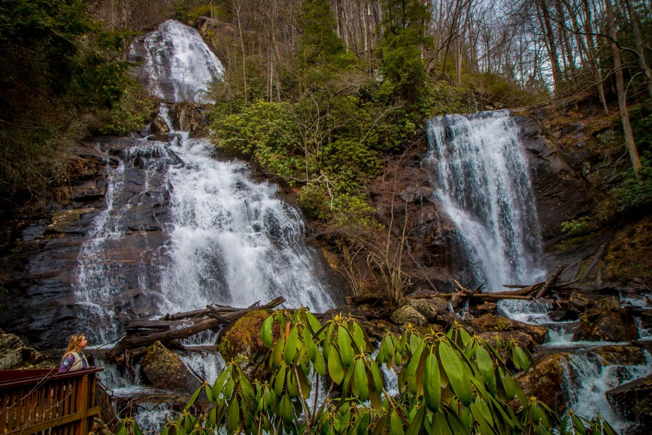
16. Anna Ruby Falls Trail- Starting at the Anna Ruby Falls Visitor Center, this easy waterfall hiking trail guides you through a gorgeous section of the Chattahoochee National Forest. The rare pair of side-by-side waterfalls are formed at the junction of Curtis Creek and York Creek, and are a beautiful sight for such a short hike (0.9 miles).
17. Unicoi Lake Loop Trail- This spacious, well-maintained, 2.2-mile hiking trail is one of the most popular trails at Unicoi State Park. It loops around the lake near the Unicoi Barrel Cabins, and can get pretty busy on summer weekends. But if you can go during weekdays or off-season when it’s less crowded, it’s surprisingly serene.
18. Horse Trough Falls- Located in the Upper Chattahoochee River Campgrounds, the Horse Trough Falls Trail offers remarkable ROI for such a short, easy path. The hardest part is just getting there on the 5-mile, pothole-riddled forest service road, which is best navigated via truck or 4WD vehicle.
READ MORE: The 20 Best Things to Do in Helen GA
Moderate/Strenuous Hiking Trails Near Helen GA
19. Raven Cliff Falls – Beginning at a gravel trailhead and following Dodd Creek upstream, the path to Raven Cliff Falls is incredibly scenic. It explores a hardwood forest with several wildflower-lined streams before reaching the 40-foot waterfall. The trail is just under 5 miles, and has a moderate amount of elevation gain.
20. Yonah Mountain Trail- This popular trail is just over 4 miles, with a steady elevation gain that doesn’t let up until you reach the summit. It’s more of a strenuous hike, but rewards your efforts with captivating panoramic views. It can also be turned into a multi-day trip, as there are plenty of backcountry campsites along the way.
21. Smith Creek Trail- One of the longer waterfall hiking trails in North Georgia, the Smith Creek Trail from Unicoi State Park to Anna Ruby Falls is 8.4 miles round-trip. But it explores a beautiful stretch of forest that is packed full of pristine flora and fauna. Unicoi also features beautiful Christmas lights for the holidays.
22. Indian Grave Gap to Tray Mountain- This popular 5-mile day hike on the Appalachian Trail in Georgia stravels through an evergreen- and rhododendron-filled forest to the summit of Tray Mountain. It has over 1,000 feet of elevation gain, but the sweeping views make this one of the best North Georgia Mountains for Hiking.
READ MORE: The 15 Best Restaurants in Helen GA for Breakfast, Lunch & Dinner
Hiking Near Ellijay GA
Easy Hiking Trails Near Ellijay GA
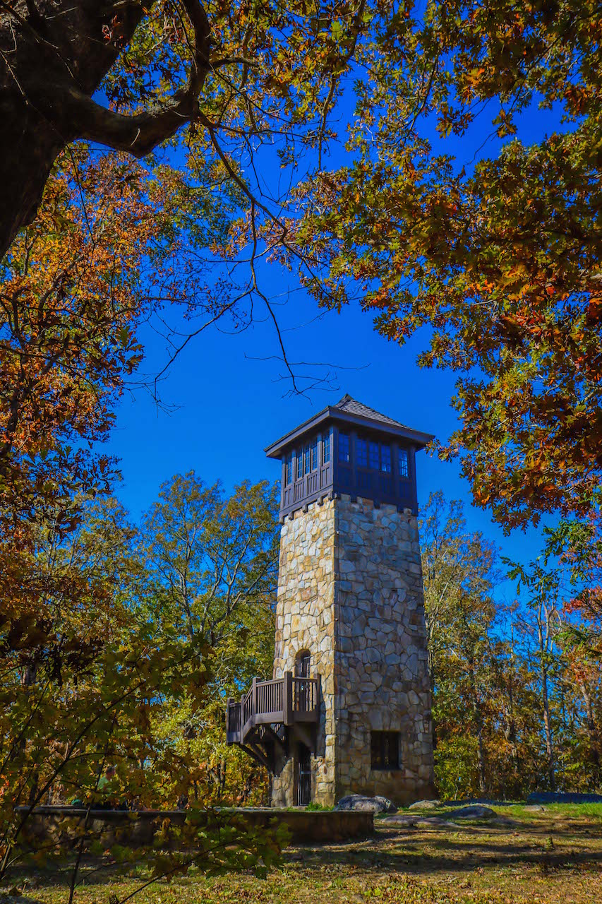
23. CCC Fire Tower Combination Loop- This popular trail at Fort Mountain State Park is listed as a mile, but you can easily extend it to two. Take the trail on the right past the “Stone Tower Trail” sign and follow the Stone Wall Trail for a gorgeous path around the summit, with the CCC Fire Tower and an observation platform at the end.
24. Carters Lake Oak Ridge Nature Trail- This trail offers some of the best views of Carters Lake, one of the best lakes in the North Georgia mountains. The 1.6-mile hike begins on the northern shore and explores a fern-filled forest, and is relatively easy aside from a little elevation gain on the second half.
25. Tumbling Waters Trail- This lovely trail begins at the Ridgeway Recreation Area at Carters Lake, heading into a forest that’s most beautiful when fall colors start to peak. It’s just over a mile, with stops along the way including an overlook and a 150-foot long bridge that crosses over Tails Creek. It’s a great place for an afternoon picnic!
READ MORE: The 15 Best Cabin Rentals in Ellijay GA
Moderate/Strenuous Hiking Trails Near Ellijay GA
26. Three Forks to Springer Mountain- This 8.6-mile trail offers a great taste of the Appalachian Trail, following its final stretch through a diverse landscape with several creeks. It finally reaches the summit of Springer Mountain, where you’ll find a bronze plaque commemorating the trail’s southern terminus.
25. Lower Conasauga River Trail- This 13.2-mile trail is the second-longest in the Cohutta Wilderness, entering through Betty Gap near the river’s headwaters. There are 18 river crossings along the way, plus boulders and fallen trees to clamber over. Overall, it’s one of the most challenging, but invigorating hikes near Ellijay GA.
26. Emery Creek Trail- Located in the vast southern section of the Cohutta Wilderness, the 6.2-mile Emery Creek Falls Trail is incredibly scenic from start to finish. It explores a lush deciduous forest and has 20 creek crossings before making it to the waterfalls. All in all, it’s a beautiful hike that’s great for a summertime adventure.
READ MORE: The 10 Best Things to Do in Ellijay GA & Gilmer County
Hiking Near Dahlonega GA

Easy Hiking Trails Near Dahlonega GA
29. Preachers Rock- One of the most popular stretches of the Appalachian Trail in Georgia, this trail is under two miles and offers stunning Blue Ridge Mountains views. The hike starts at the Woody Gap trailhead and leads to jaw-dropping views at Preachers Rock, a large rock outcrop located near the summit of Big Cedar Mountain.
READ MORE: The 15 Best Things to Do in Dahlonega GA & Lumpkin County
Moderate/Strenuous Hiking Trails Near Dahlonega GA
30. Amicalola Falls via East Ridge Loop- This 2-mile trail takes visitors from the bottom of Amicalola Falls to the very top, and then to the AT Approach Trail. It’s a fun, well-marked loop trail that offers-up close views of one of the best North Georgia Waterfalls. Just be prepared for the Thighmaster-style workout of the stairs!
31. Woody Gap to Big Cedar Mountain- This 3-mile section of the AT starts at Woody Gap and leads to the summit of Big Cedar Mountain. It follows the blazes of the AT through the Blood Mountain Wilderness, while showcasing some incredibly scenic views of the Blue Ridge Mountains.
32. Ramrock Mountain- This moderately challenging 3.6-mile trail takes you from Woody Gap to the summit of Ramrock Mountain. Offering nearly 700 feet of elevation gain along the way, it’s a great hike for exploring some of the most picturesque vistas in the Georgia mountains.
33. Appalachian Approach Trail to Springer Mountain- There are many ways to summit Springer Mountian, but this 15.5-mile trail takes you on a longer, more scenic adventure. It starts near Amicalola Falls and reaches the summit of Springer Mountain at around 8 miles before returning back the way you came.
READ MORE: The 7 Best Restaurants in Dahlonega GA for Foodies
Hiking Near Clayton GA
Easy Hiking Trails Near Clayton GA
34. Tennessee Rock Trail- One of Black Rock Mountain State Park’s most popular hikes, this 2.2-mile trail explores a wildflower-filled forest before summiting Black Rock Mountain and reaching the Tennessee Rock overlook. It’s a great place to watch the sunset, with views that reach all the way into North Carolina.
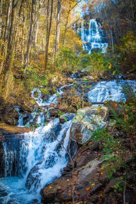
35. Minnehaha Falls- At just under half a mile round-trip, with less than 100 feet of elevation gain, the Minnehaha Falls trail is a quick and easy hike with a remarkable payoff. It leads to the 60-foot-tall Minnehaha Falls which is regarded as one of the most beautiful waterfalls in north Georgia.
36. Hemlock Falls Trail- This 2-mile trail in Moccasin Creek State Park leads to the picturesque Hemlock Falls. While the waterfall’s drop is just 15 feet, the width and force of the falls make them immensely impressive. The trail follows Moccasin Creek upstream through a gorgeous forest, and is very well-maintained.
37. Dicks Creek Falls Trail- The hike to Dicks Creek Falls (near the Warwoman Wildlife Management Area) follows a section of the Bartram Trail. It explores a pristine hardwood forest before reaching the banks of the scenic Chattooga River , whose headwaters begin in Cashiers NC..
READ MORE: The 20 Best Things to Do in Clayton, GA (the Gem of Northeast Georgia)
Moderate/Strenuous Hiking Trails Near Clayton GA
38. Sliding Rock Trail- Located in one of our favorite Georgia State Parks, this trail explores Tallulah Gorge, a 2-mile long, 1,000-feet deep canyon carved by the Tallulah River. The trail is just 3 miles round-trip, but it’s made up almost completely of rocks and boulders. It also requires a permit, which are given out in limited numbers daily.
39. Rabun Bald- At 4,695 feet, Rabun Bald is the second tallest mountain in Georgia after Brasstown Bald. The trail to the summit is 3 miles, with intense elevation gain that makes it a somewhat strenuous hike. However, your efforts will be rewarded at the summit, where there’s a stone observation tower and breathtaking views.
40. Bartram Trail from Sandy Ford to Warwoman Dell- Following along a stretch of the famous Bartram Trail, this 9.3-mile hike runs from Sandy Ford to Warwoman Dell. The elevation gain is intense, but it provides an awesome taste of the 115-mile Bartram Trail and explores a beautiful stretch of the North Georgia mountains.
41. Dicks Creek Gap to Powell Mountain- This 5-mile hike takes you on the Appalachian Trail from Dicks Creek Gap to the summit of Powell Mountain. It passes a small waterfall, a few campsites, and a shallow creek before reaching a rocky overlook with wide-open views from atop Powell Mountain.
42. Holcomb Creek Falls Trail- This 1.75-mile loop trail showcases two waterfalls along its route. You’ll reach Ammons Creek Falls first, then the massive 150-foot drop of Holcomb Creek Falls before looping back around to the start. While it is a relatively short trail, the considerable elevation gain makes this a moderate hike.
READ MORE: The Top 10 Treehouse Rentals in the Georgia Mountains
Hiking Near Blairsville GA
Easy Hiking Trails Near Blairsville GA
43. Brasstown Bald- At 4,784 feet, Brasstown Bald is the highest summit in Georgia. With 360º views at the top that span four states, it’s also one of the best places to experience Fall in the mountains of North Georgia. The paved trail has a steady incline, but it’s just over a half-mile each way.
44. Helton Creek Falls Trail- At just over a half-mile round-trip, this short, fun hike guides you to one of the most beautiful waterfalls in the Chattahoochee National Forest. Despite its short distance, it still packs in the scenery with hardwood trees, conifers, and wildflowers lining the path as you approach Helton Creek Falls.
45. Sosebee Cove Trail- Regarded as one of the best hiking trails in the Chattahoochee National Forest for wildflowers, the Sosebee Cove Trail explores a 175-acre forest. Commonly seen flowers along the path include Jack in the Pulpit, Dutchman’s Breeches, Solomon’s Seal, and a variety of lovely native Georgia orchids.
46. Trahlyta Falls- Located in Vogel State Park, this easy trail starts at the visitors center and gifts you with views of Trahlyta Lake and Blood Mountain before descending a short set of stairs. At the bottom there’s a large viewing platform, where you can revel in the beauty of the 110-foot falls close up!
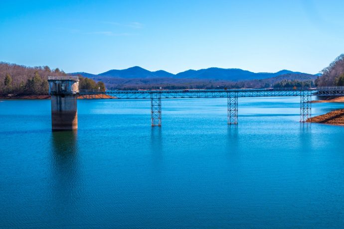
47. Lake Chatuge Trail- Formed in the 1940s, when the Tennessee Valley Authority constructed a 2,950-foot earth-and-rock dam on the Hiawassee River, Lake Chatuge has 130+ miles of shoreline. This one-mile trail winds through a pine and hardwood forest around one of Georgia’s most beautiful lakes.
READ MORE: The 15 Best Things to Do in Blairsville GA & Union County
Moderate/Strenuous Hiking Trails Near Blairsville GA
48. Blood Mountain Loop- Starting on the Byron Reece Trail and merging with the AT, the Blood Mountain Trail is a 6-mile hike through varied terrain. The trail leads to a huge rock outcrop with spectacular views from Blood Mountain’s summit, as well as a historic stone shelter that accommodates AT thru-hikers.
49. Coosa Backcountry Trail- If you want to tackle tough terrain, the 12.9-mile Coosa Backcountry Trail at Vogel State Park is widely considered one of North Georgia’s best hiking trails. Exploring the Chattahoochee National Forest and Blood Mountain Wilderness Area, this trail provides a great adventure for those seeking a challenge.
50. Lake Winfield Scott to Slaughter Mountain- Beginning at one of North Georgia’s highest altitude lakes, this 5.6-mile trail explores the Blood Mountain Wilderness. Following both the Slaughter Creek Trail and Appalachian Trail, it crosses the Gaddis Mountain summit before reaching the top of Slaughter Mountain.
51. Hogpen Gap to Unicoi Gap- While this 14.5-mile stretch of the AT lacks the jaw-dropping summit views others are known for, this trail’s appeal lies in the forest itself. You’re unlikely to come across many other hikers here, so you can savor the unobstructed peacefulness of nature in the pristine North Georgia forest.
52. Unicoi Gap to Rocky Mountain- If you’re OK with intense elevation gains, this is an awesome 5.1-mile trail to experience. It starts at the Unicoi Gap trailhead and summits Rocky Mountain, with spectacular scenic views as the hike continues towards Indian Grave Gap before making its way back to the beginning. -by Christina Maggitas; lead image of Brasstown Bald via Canva

