
[Updated August 12, 2021] A relatively new tourist attraction in the Western North Carolina mountains, Otter Falls isn’t anywhere near the biggest of the waterfalls in North Carolina’s High Country.
The waterfall doesn’t have a huge volume of water running through per second, or an especially impressive drop. It doesn’t even require an epic hike to reach it!
Still, Otter Falls does have all the right stuff that makes waterfalls in the Blue Ridge Mountains so spectacular.
There’s a bold mountain stream, moss-strewn boulders, inviting pools, lush flora dancing in the breezes around them, and well-kept hiking trails to access it all.
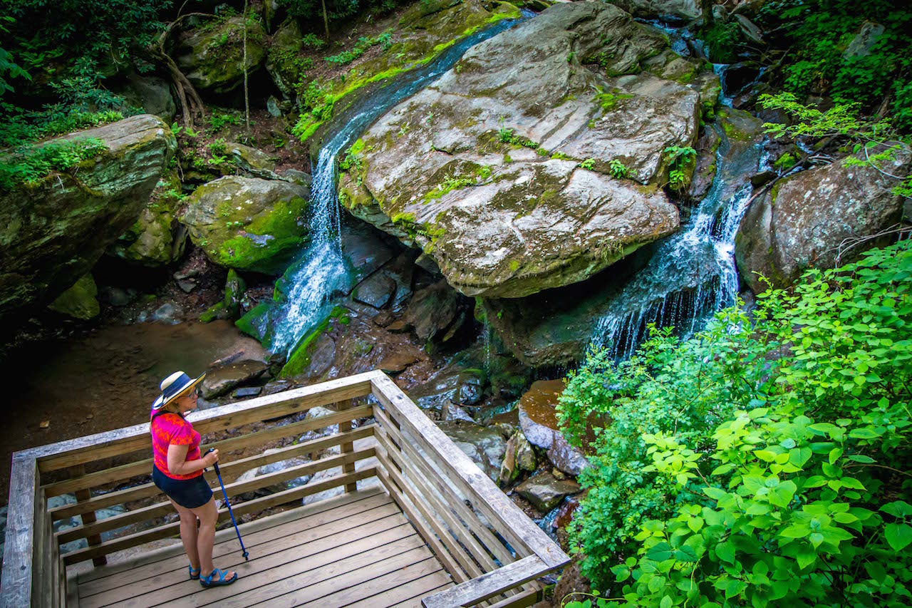
The Otter Falls Trail, which consists of two loops and two out-and-back segments, debuted in 2015. In 2017, an observation deck was built to provide an excellent overview of the waterfall.
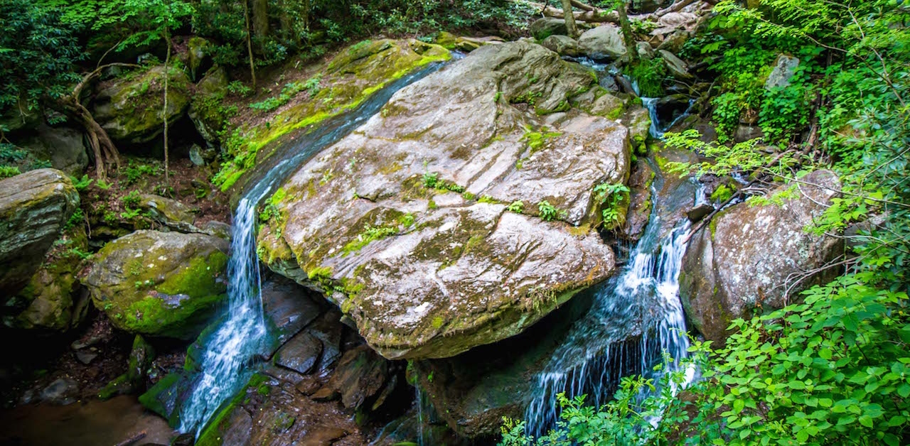
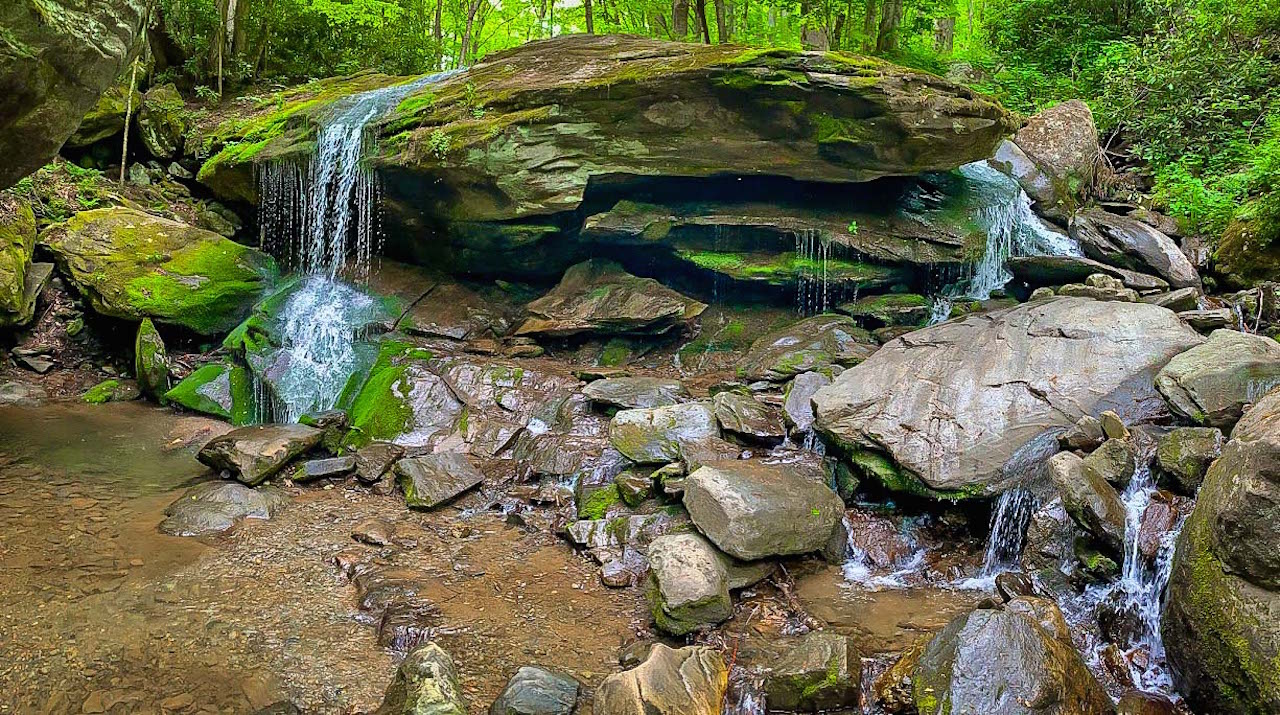
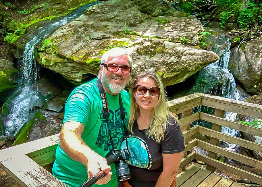
The falls are formed by Valley Creek in the tiny mountain town of Seven Devils. They drop roughly 25 feet, with one sizable free fall and a few cascades leading down to a pool.
For those visiting Banner Elk, Blowing Rock, Boone, Beech Mountain, or Sugar Mountain, this pretty little waterfall is just a short drive away. And the trails provide an easy-going hike down to it, though the hill back up may prove difficult for those with mobility issues.
Read on for our guide to hiking the Otter Falls Trails, including driving directions, history, and more….
READ MORE: The 15 Best Things to Do in Cherokee NC & the Qualla Boundary
OTTER FALLS INFO
ADDRESS: 825 Skyland Dr, Seven Devils NC 28604
PHONE: 828-963-5343
COST OF ENTRY: None
OTTER FALLS HOURS: 7:30 am to 7:30 pm
WEBSITE: Town of Seven Devils
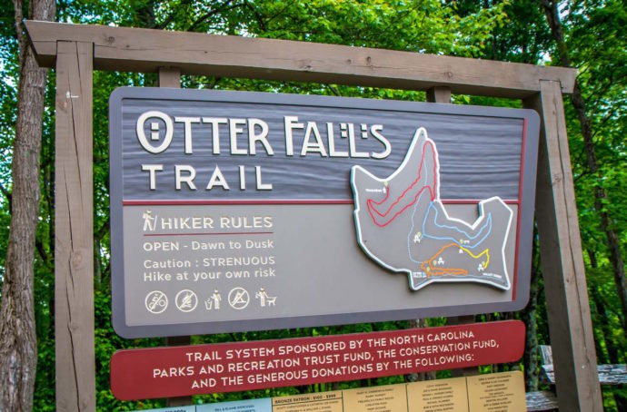
HIKING TRAIL: Easy to Moderate, 1.1 miles in-and-out.
AMENITIES: There are no amenities at this trail, and it is not handicap accessible.
Love North Carolina Waterfalls? Check out these guides!
The 20 Best Western North Carolina Waterfalls for Hiking
The 15 Best Blue Ridge Parkway Waterfalls in North Carolina
The 27 Best Waterfalls Near Asheville NC
The Top 10 Waterfalls Near Brevard NC (Transylvania County)
The 10 Best Lakes in the North Carolina Mountains to Visit
READ MORE: The 10 Best Boone NC Hiking Trails to Explore
OTTER FALLS AND SEVEN DEVILS HISTORY
Seven Devils is a small resort town (population 327) that was established in the 1960s by four Reynolds brothers out of Winston-Salem, with three additional partners.
The town’s name derives from the howling winds that come audibly whisking through the hills in the wintertime, like devils screaming in the night. There’s also the fact that there were seven founders, and seven peaks from the Blue Ridge Parkway that viewed the area.
In the mid-1960s, the resort was created to provide recreational pursuits for well-to-do travelers, offering up golfing, snow skiing, hiking, fishing, swimming, and horseback riding in the Appalachian Mountains.
The town and the resort flourished for a while, but in the late ‘70s both met with financial hardship. Then, in the early 2000s, hurricanes closed the golf course one year and the ski slopes another.
Fortunately the town survived, and the recreational activities have persisted. Now, Seven Devils is best known for its snow-tubing resort and ziplining outfit, Hawksnest.
Additionally, there has been a concerted effort to develop and improve the parklands around the town, including Bear Paw State Natural Area’s 148-acres of wilderness.
The Otter Falls Park, a 10-acre patch of pristine public land, opened in 2015 thanks to a grant from NC Parks and Recreation Trust Fund.
The Otter Falls hiking trails were further improved a couple of years later, when an observation deck overlooking the falls was added in 2017.
READ MORE: The Top 15 NC State Parks in the North Carolina Mountains
HIKING THE OTTER FALLS TRAILS
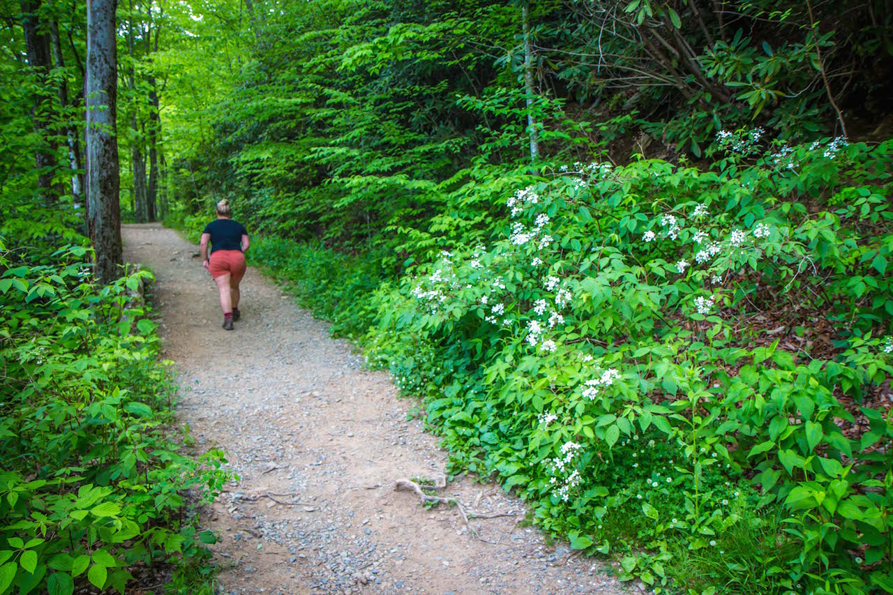
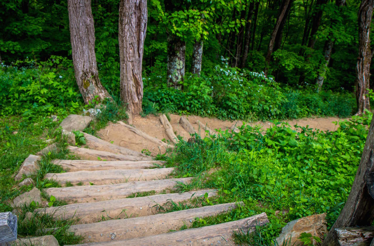
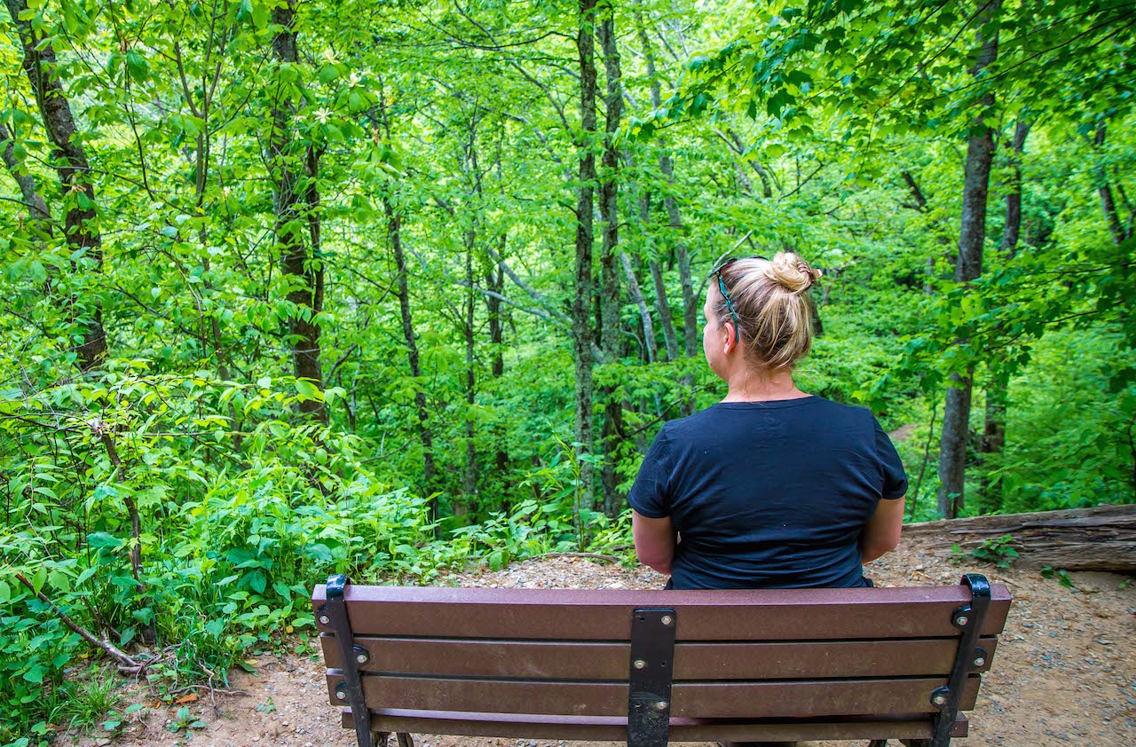
Hiking to Otter Falls is doable, and even enjoyable, for most physically able visitors. The entire hike is only 1.1 miles round-trip, and there are plenty of benches and sites to enjoy if you need a break along the way .
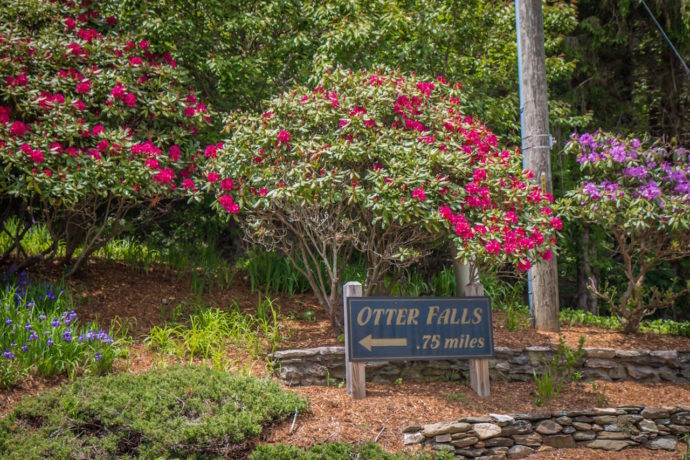
The trailhead is located in Seven Devils proper at 825 Skyland Drive, and there is free parking there. The trail descends from the parking lot (3,840 feet above sea level) to Otter Falls (3,620 feet).
For most of the year– spring through autumn– the hike takes visitors through a forest dotted with wildflowers that is pleasantly cool.
In the winter, ice and snow are fairly common, and the trail does shut down at times because of severe weather.
Looking at the trail map, the two loops and a couple of dead-end routes for observing the falls seem to be impressively long. But that’s not the case at all (nor is the “Strenuous” description you’ll see on the parking lot sign).
While the hike isn’t exceptionally long or challenging, it’s important to remember that the trip back is uphill and climbs more than 200 feet in just over half a mile.
It’s possible to take one side of each loop on the way there and the other side of each loop on the way back, providing unique scenery for most of the hike.
There are four designated observation spots from which to view falls, and the Orange Trail takes visitors right down to the base of it.
The falls themselves are amazing, with two streams taking a true plunge over a rocky outcrop and splashing down onto boulders before cascading down a little further and coasting into a cool pool.
READ MORE: The 15 Best Things to Do in Bryson City NC & Swain County
DIRECTIONS TO OTTER FALLS
From Boone (12.7 miles)
Otter Falls is about 12 miles southwest of Boone, which takes 20 minutes by car.
From East King St. in Downtown Boone, head south on Blowing Rock Road for about 0.6 miles and take a right onto NC-105 S, which will take you right alongside the Watauga River.
After about 10 miles, you’ll have passed through Foscoe, and you’ll want to turn right onto 7 Devils Road (State Road 1151), heading northwest.
In a little under a mile and a half, around the Seven Devils Police Department, Skyland Drive will cut left and in less than a mile you’ll reach the parking lot for Otter Falls (on the left).
READ MORE:The 20 Best Things to Do in Blowing Rock NC
From Blowing Rock (12.6 miles)
Otter Falls is 12 miles west of Blowing Rock, which takes about 30 minutes to drive.
From Main St., move south to US-221/Yonahlossee Rd., and take a right onto it.
In a little over a mile and a half, you’ll have to take a right onto State Road 1552 and quick left onto Shulls Mill Rd., following it for nearly six miles.
Shulls Mill Rd. will take a slight left and turn into NC-105 S, and 7 Devils Road will be just over three miles after the switch.
After a right onto 7 Devils Road, look for Skyline Drive when you approach the Seven Devils Police Department. Take a left onto Skyline and look for the parking lot on the left.
READ MORE: Things to Do at Moses H Cone Memorial Park Near Blowing Rock NC
From Banner Elk (9.3 miles)
Otter Falls is less than 10 miles from Banner Elk, which takes less than 15 minutes.,
Take NC-184 S/Shawneehaw Ave S about four miles until taking a left turn onto the NC-105 N.
After three miles on the NC-105-N, you’ll cross paths with 7 Devils Road, and it’ll be a left onto it.
Go 1.3 miles and turn left on Skyline Drive, at which time the Otter Falls Parking Area will be less than a mile down the road on the left.
READ MORE: The 20 Best Western NC Small Towns To Visit (and Live In!)
From Sugar Mountain (7.2 miles)
Otter Falls is just over seven miles from Sugar Mountain, which takes about 15 minutes.
Find the NC-184 S on the eastern reaches of town, and take it for about a mile until it crosses tracks with NC-105 N.
It’s three miles for a left onto 7 Devils Road, and a mile or more after that, Skyline Road requires another left.
The parking lot for Otter Falls in the on the left.
READ MORE: The 10 Best Places for Snow-Skiing in North Carolina
From Asheville (75+ Miles)
Otter Falls is 75 to 80 miles from Asheville, and basically boils down to taking I-40 E to US-221 N to NC-105 N.
The trip takes about an hour and a half, but a visit to Otter Falls can be combined with other exciting stuff in the area.
Nearby attractions you can combine to make a great day trip include Grandfather Mountain, Julian Price Memorial Park, Moses H. Cone Memorial Park, and/or Linville Falls. —Jonathon Engels, photos by Bret Love & Mary Gabbett
