
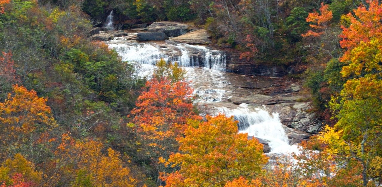
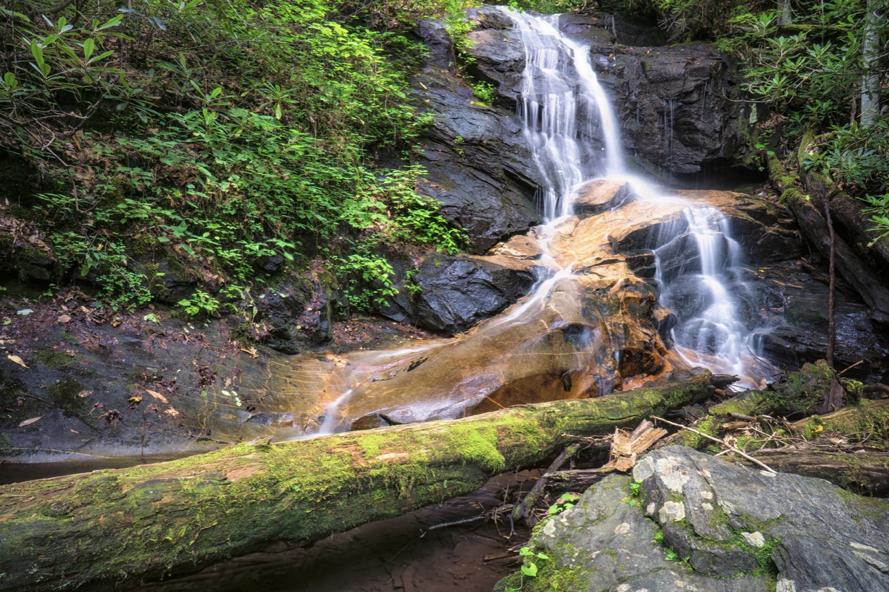
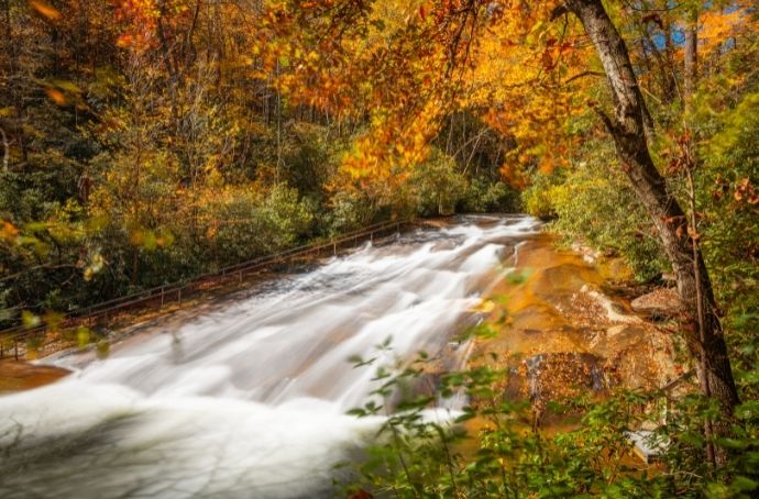
The waterfalls in Pisgah National Forest rank among the best waterfalls in Western North Carolina. Some of their cascades plummet over 100 feet, pushing thousands of gallons of water per minute into crystalline pools.
Pisgah NF occupies over half a million acres in the Blue Ridge Mountains, stretching from the border with Virginia in the north to a stone’s throw from the border with Georgia in the south.
The most plentiful collection of Pisgah waterfalls are near Brevard NC, but they can also be found throughout the three sections of forest.
Pisgah National Forest is split into three ranger districts– the Pisgah district south of Asheville, the Grandfather district east of Asheville, and the Appalachian district north along the Tennessee border.
Primo waterfalls can also be found further east on the Catawba Rive, while others are within walking distance of Tennessee.
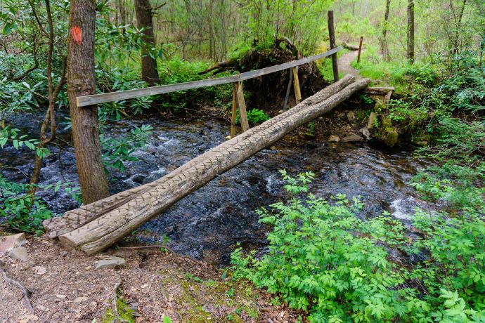
Many of the most popular waterfalls in Pisgah National Forest have short, easy hiking trails, but provide huge payoffs. Others become bigger adventures, requiring driving and/or hiking to spots deep within the forest.
Read on for our guide to the best Pisgah National Forest waterfalls to explore, including their ranger district, the total mileage for the trip to the falls and back, and details on the hike itself.
READ MORE: The 10 Hiking Essentials Packing List for the Blue Ridge Mountains
Pisgah National Forest Waterfalls Guide
- Catawba Falls (2.7 miles)
- Cathey’s Creek Falls (< 1 mile)
- Cedar Rock Falls (1.8 miles_
- Cove Creek Falls (2 miles)
- Daniel Ridge Falls/Tom’s Spring Falls (1 mile in-and-out or 4 mile loop)
- Elk River Falls (<1 mile)
- Grogan Creek Falls (5.5 miles)
- (South) Harper Creek Falls (2.8 miles)
- Log Hollow Falls (< 1 mile)
- Looking Glass Falls (roadside)
- Moore Cove Falls (1.4 miles)
- Roaring Fork Falls (< 1 mile)
- Sliding Rock Falls (< 1 mile)
- Twin Falls (4 miles)
- Upper Creek Falls (1.6 miles)
1. Catawba Falls
Pisgah National Forest, Grandfather Ranger District
Hiking Distance: 2.7 miles
Located approximately 27 miles east of Downtown Asheville, Catawba Falls is one of the most beautiful waterfall hikes in Pisgah Forest.
At just under three miles round-trip, the Catawba Falls trail is one most hikers can feel comfortable doing.
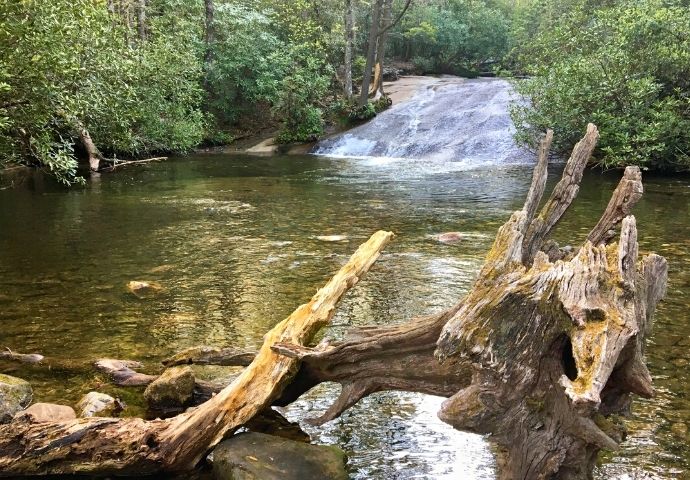
The sources of the Catawba River tumble and toss down mossy riverbed rocks to create stunning cascades and provide numerous waterfalls, ultimately finding its way to Catawba Falls proper.
The hike includes weaving through the verdant forest, fording the creeks, and discovering the remnants of all old hydroelectric dam.
READ MORE: The 27 Best Waterfalls Near Asheville NC
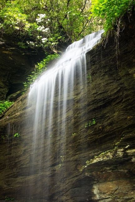
2. Cathey’s Creek Falls
Pisgah National Forest, Pisgah Ranger District
Hiking Distance: < 1 mile
For visitors to Brevard NC and the Pisgah Ranger District, a side trip to scenic Cathey’s Creek Falls is worth adding to the itinerary.
Though Transylvania County is blessed with an abundance of beautiful waterfalls, this somewhat hidden 80-foot behemoth is located in a lesser-visited part of Pisgah Forest.
It could almost classify as a waterfall near Pisgah National Forest, but in reality it just uses a back entrance.
The hike to Cathey’s Creek Falls is only 1/4-mile. But it is on steep, rugged terrain that seems less like a trail and more like a quick path off FS-471.
READ MORE: The Best Hiking in Asheville NC Bucket List (Top 20 Hiking Trails)
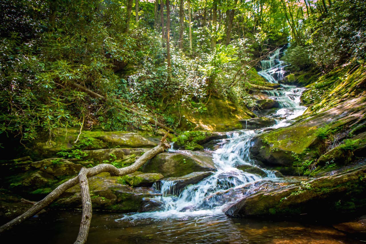
3. Cedar Rock Falls
Pisgah National Forest, Pisgah Ranger District
Hiking Distance: 1.8 miles
Parking for the hike to Cedar Rock Falls is available at the Pisgah Center for Wildlife Education, which can be accessed via US-276 on FS-475.
Cedar Rock Falls is only the first of a series of waterfalls located along this popular Pisgah hiking trail.
Cedar Rock Falls is a 20-foot spill over a moss-laden rock face, which is surrounded by North Carolina wildflowers such as rhododendron and mountain laurel.
The smaller Upper Cedar Rock Falls is a little further along the trail.
At this point, hikers can either double back the way they came for a shorter hike, or continue along to the other waterfalls along Cat Gap Loop.
READ MORE: Pisgah National Forest: A Beginner’s Guide
4. Cove Creek Falls
Pisgah National Forest, Pisgah Ranger District
Hiking Distance: 2 miles
There are several cascades located along Cove Creek, but Cove Creek Falls is a big one. It stands at 50 feet tall, with water sliding down an enormous rock face.
The Cove Creek Trail is a nice walking path that makes a short loop with several detours along the way, including jaunts to other waterfalls nearby.
Cove Creek Falls is accessed via FS-475, and is located less than a mile from Daniel Ridge Falls.
It also shares a parking lot with the Whaleback Swimming Hole. Look for the Cove Creek Group Campground.
READ MORE: The Top 10 Treehouse Rentals near Asheville, NC
5. Daniel Ridge Falls/Tom’s Spring Falls
Pisgah National Forest, Pisgah Ranger District
Hiking Distance: 1 mile (in-and-out), 4 mile (loop)
A skyscraper of a waterfall, Daniel Ridge Falls—which is also called Tom’s Spring Falls— is a showstopper you can find on any good Pisgah National Forest waterfalls map.
There are several other waterfalls on the same road (FS-475), including Cove Creek Falls, Cedar Rock Falls, and Slick Rock Falls.
That being said, Daniel Ridge Falls is the one that just can’t be missed.
It’s just a short hike (one mile round-trip) to reach the falls. But for a longer walk, there’s also a four-mile loop that includes Daniel Ridge.
Note that reaching the trailhead to the falls requires driving beyond the paved road (which stops at the Cove Creek Group Campground) for another half a mile.
READ MORE: The 20 Best Pisgah National Forest Hiking Trails in North Carolina
6. Elk River Falls
Pisgah National Forest, Appalachian Ranger District
Hiking Distance: <1 mile
Pushing to the extreme boundaries of Pisgah NF near the Tennessee border, Elk River Falls is an amazing plunge waterfall that drops 50 feet into a gorgeous pool.
Elk River Falls is located near the town of Elk Park, and it has its own access point in the woods outside of town.
The easy hike to it is about 1/4-mile, and there are lots of spots for having a picnic or sunbathing on the rocks while enjoying the falls.
To give hikers more of an adventure, a second waterfall—Jones Falls—is located under 2 miles away in Tennessee.
But that one unfortunately doesn’t make it on the Pisgah National Forest waterfall map.
READ MORE: The 10 Best Waterfalls Near Boone NC

7. Grogan Creek Falls
Pisgah National Forest, Pisgah Ranger District
Hiking Distance: 5.5 miles
For those who visit Cedar Rock Falls, making the extra effort to get to Grogan Creek Falls is well worth it.
But it does make it a considerably longer trek, from 2 miles to 5.5 miles round-trip.
Grogan Creek Falls somersaults over a wide rock face about 20 feet high, with several gradual ledges that the water spills over until finally splashing into a shallow pool.
The hike to Grogan Creek Falls is one of the longer Pisgah National Forest waterfall hikes, and the Cat Gap Loop begins at the Pisgah Center for Wildlife Education.
READ MORE: Fall in North Carolina: 20 Great Places to See Fall Colors in Western NC
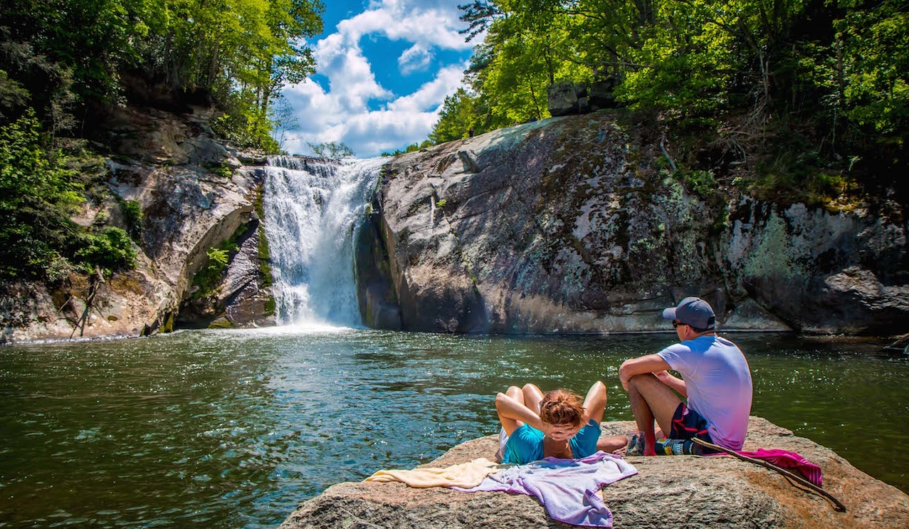
8. (South) Harper Creek Falls
Pisgah National Forest, Grandfather Ranger District
Hiking Distance: 2.8 miles
Located about 20 miles south of Blowing Rock NC, Harper Creek Falls is another great Pisgah National Forest waterfall hiking experience we recommend for anyone visiting the NC High Country region.
The round-trip hike is less than three miles, and is a popular route for tourists and residents alike.
The trail features a couple of great swimming holes as well as the waterfalls.
There’s also an even more impressive South Harper Creek Falls—120 feet tall, with 200-foot cliffs a;; around it—several miles further down the trail, creating an 11-mile hike for those up to the challenge.
READ MORE: The 15 Best Things to Do in Banner Elk NC
9. Log Hollow Falls
Pisgah National Forest, Pisgah Ranger District
Hiking Distance: < 1 mile
Located near heavily visited waterfalls such as Looking Glass Falls and Sliding Rock Falls, Log Hollow Falls is sometimes overlooked along the easier-to-find roadside attractions along US-276.
This attractive, but poorly marked waterfall spills some 25 feet down jagged rocks.
Take a little trek further down the Forest Service Road (5043) and you’ll find another, larger waterfall (Kissing Falls) that gets even less attention.
Reaching these two waterfalls requires taking FS-475B until it intersects with the gated FS-5043, which visitors can walk down to see the falls.
READ MORE: The 15 Best Things to Do in Hendersonville NC
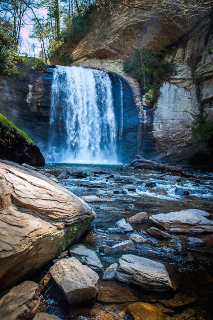
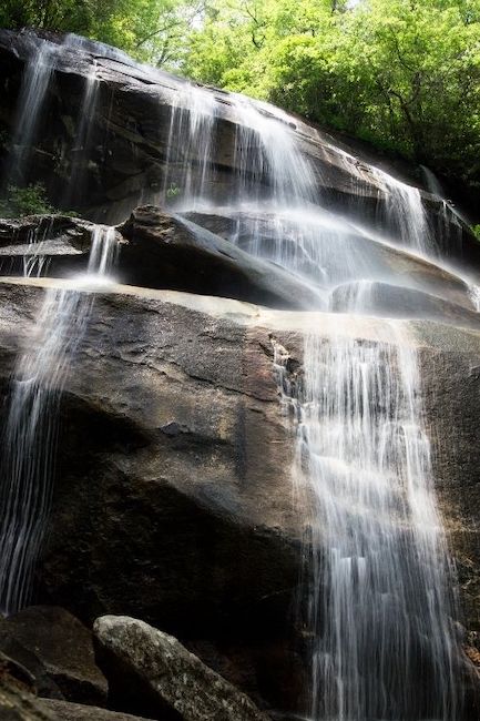
10. Looking Glass Falls
Pisgah National Forest, Pisgah Ranger District
Hiking Distance: Roadside
The shortest hiking trail these Pisgah National Forest waterfalls have to offer, Looking Glass Falls is far too impressive for the ridiculous ease it takes to find and see it.
The stunning 60-footer is visible right from the road (US-276), nearly 6 miles south of the Cradle of Forestry in America.
You’ll know when it’s close by, because the roadside parking lot is usually heaving with onlookers taking advantage of the no-hike waterfall.
Looking Glass Falls is totally visible without taking the stairs to reach its base. But there are steps that take visitors even closer, and provide a spectacular view from below.
READ MORE: The Cradle of Forestry in Pisgah National Forest (Near Brevard NC)
11. Moore Cove Falls
Pisgah National Forest, Pisgah Ranger District
Hiking Distance: 1.4 miles
Located along the main drag through the Pisgah Ranger District, Moore Cove Falls is a totally reasonable 1.4-mile hike you can take without overexerting yourself to get the spoils.
In addition to the waterfall (which visitors can walk behind), the trail to Moore Cove Falls Trail is renowned for abundant wildflowers, including trillium, crested iris, jack-in-the-pulpit, and showy orchid.
Visiting Moore Cove Falls can easily be combined with trips to Looking Glass and Sliding Rock Falls.
All three are located within about 2 miles of each other on US-276.
READ MORE: The 25 Best Western NC Small Towns To Visit (and Live In!)
12. Roaring Fork Falls
Pisgah National Forest, Grandfather Ranger District
Hiking Distance: < 1 mile
Measuring over 100 feet tall and slinking down a rocky conduit, Roaring Fork Falls is an impressive waterfall that is just far enough off the beaten track (about 4 miles) to remain uncrowded.
However, it is a beautiful waterfall that mixes slides, plunges, and cascades into one extensive package.
There’s a lovely pool at the bottom to finish it off, and rocks that make a perfect place for a picnic.
Roaring Fork Falls trailhead is not far from the Blue Ridge Parkway, about 19 miles south of Burnsville NC. From there, the “hike” is really more a walk to the mailbox (and a package worth getting).
READ MORE: The 21 Best Blue Ridge Parkway Waterfalls in North Carolina
13. Sliding Rock Falls
Pisgah National Forest, Pisgah Ranger District
Hiking Distance: < 1 mile
Sliding Rock is understandably one of the most popular spots in the entire Pisgah Ranger District.
Sliding Rock Falls is a 60-foot waterfall that glides down a rock face that’s smooth enough to use as a natural water slide, literally.
In summertime, hundreds of visitors line up to go down Sliding Rock each day, with lifeguards on duty, entrance fees, and the whole shebang. The pool at the bottom is a cool and refreshing 8 feet deep.
Aside from finding a parking spot on a summer’s day, Sliding Rock is easy to get to. The parking area is located on US-276, and the walk from the parking lot to the falls is paved, gentle, and short.
READ MORE: The 20 Best Blue Ridge Parkway Hikes for NC Day Trips
14. Twin Falls
Pisgah National Forest, Pisgah Ranger District
Hiking Distance: 4 miles
Twin Falls is yet another fantastic waterfall (two, actually, as the name suggests) located in the Pisgah Ranger District. Like a few of the others waterfalls on this list, it requires a bit of recon to get to it.
The hike to Twin Falls includes another impressive Pisgah waterfall, Avery Falls.
All three are located along a 4-mile out-and-back hike along the Avery Creek Trail and Buckhorn Gap Trail.
The trailhead is a turn-off from the Forest Heritage Scenic Byway (US-276) on FS-477. The parking lot is just past the Pisgah Forest Riding Stables, a few miles from the Byway.
READ MORE: The Best Things to Do in DuPont State Forest, NC

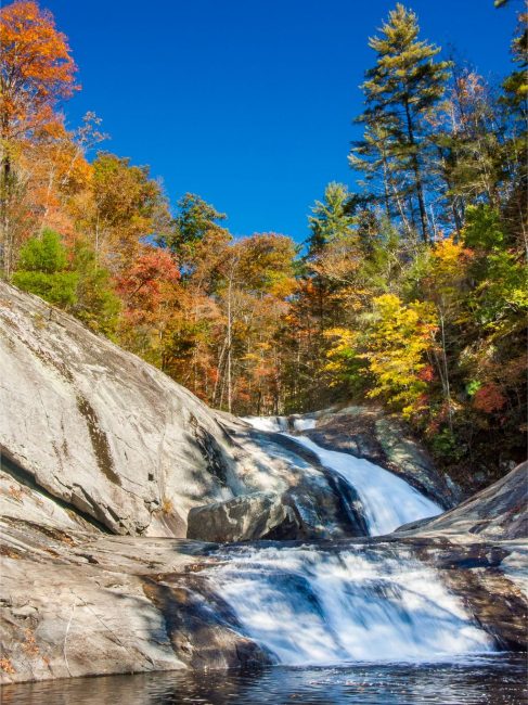
15. Upper Creek Falls
Pisgah National Forest, Grandfather Ranger District
Hiking Distance: 1.6 miles
Located near the town of Morganton NC and the Brown Mountain Overlook, Upper Creek Falls has several beautiful cascades.
It also offer a serious swimming hole, with a handy rope for swinging out into it!
The hike to Upper Creek Falls is a choose-your-own-adventure affair, with options for visiting the swimming hole, climbing to the top of the falls, or fording the creek to complete a 1.6-mile loop.
Upper Creek Falls can also be accessed via a 5.5-mile detour (on NC-181) from the Blue Ridge Parkway, not far from another amazing waterfall, Linville Falls. –by Jonathon Engels; lead photo by Dawson Tozier
