
There are some challenging hiking trails that navigate rough terrain and steep elevation. But there are also easy waterfall hikes that can fit into a relaxing day of picnicking and museum visits.
Whether you’re staying on the Tennessee side or the North Carolina side of the Smokies, there are a host of gorgeous Great Smoky Mountains National Park waterfalls to visit.
And most of them are located within a stone’s throw of popular mountain towns like Gatlinburg, Pigeon Forge, Cherokee, and Bryson City.
Read on for our in-depth guide to our favorite Great Smoky Mountain waterfalls to visit, including hiking distance and difficulty, a description of the hiking trails and waterfalls, and insider tips!
READ MORE: The 15 Best Things to Do in Great Smoky Mountains National Park
Best Smoky Mountains Waterfalls Guide
(Alphabetized by Region)
- Cataract Falls
- Rainbow Falls
- Grotto Falls
- Baskins Creek Falls
- Laurel Falls
- Ramsey Cascades
- Place of A Thousand Drips
- Hen Wallow Falls
- Spruce Flats Falls
- Tom Branch Falls
- Indian Creek Falls
- Juney Whank Falls
- Mingo Falls
- Soco Falls
- Flat Creek Falls/Nellie’s Falls
READ MORE: 20 Ways to Celebrate Christmas in the Smoky Mountains (NC & TN)
Waterfalls near Gatlinburg & Pigeon Forge TN
1. Cataract Falls
Distance from Gatlinburg: 3.7 miles
Distance from Pigeon Forge: 10.4 miles
Hiking Distance: 0.75 miles round-trip
This Smoky Mountains waterfall hike is a great option for a family excursion.
It’s an easy 3/4-mile trail that is accessible to even the smallest of hikers, and everyone is rewarded with a great view of Cataract Falls’ 25-foot drop.
The Cataract Falls trail is to the left of the Visitor Center, where a paved path soon turns into a gravel trail.
There are some sturdy wooden bridges that cross over creeks on your way, and a few steps to climb at the end of the hike before you’re rewarded with a view of this gorgeous waterfall.
As is the case with many of the waterfalls of the Smokies, Cataract Falls is at its most impressive after rainfall, when the water is more abundantly flowing down into the tranquil pool at its base.
READ MORE: The 10 Best Apps for Hikers and Backpackers
2. Rainbow Falls
Distance from Gatlinburg: 5.3 miles
Distance from Pigeon Forge: 11.8 miles
Hiking Distance: 5.4 miles round-trip
Not to be confused with the Rainbow Falls near Brevard NC and Cashiers NC, this Tennessee waterfall requires a 5.4-mile round-trip hike.
It’s worth every step if you visit the 80-foot Rainbow Falls on a sunny afternoon, as you’re likely to see the vivid colors of a rainbow appearing out of the copious mist.
This moderately difficult hike takes 3-5 hours, with a rocky and steep 1500-foot elevation increase along the way. So make sure to wear good hiking shoes and take water and other hiking essentials with you.
If you’re up for a longer trek, you can continue another 4 miles along the trail beyond the waterfall to the summit of Mount LeConte.
On your way to the Rainbow Falls trailhead, you’ll likely pass Noah “Bud” Ogle‘s homesite, where you can visit the historic 19th century cabin and see an old tub mill.
READ MORE: Where are the Blue Ridge Mountains? A State-by-State Guide
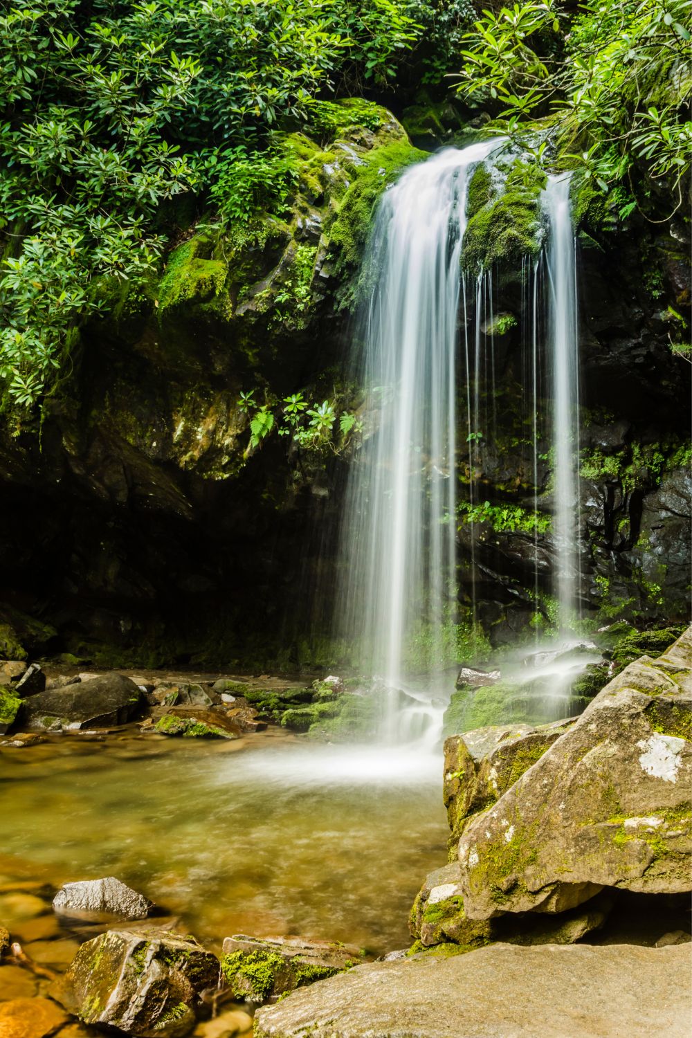
3. Grotto Falls
Distance from Gatlinburg: 6.2 miles
Distance from Pigeon Forge: 12.7 miles
Hiking Distance: 3 miles round-trip
Officially named the Trillium Gap Trail, the 3-mile Grotto Falls hike is a pretty one that takes you through old-growth forest and hemlock groves.
In the spring, you’ll likely see a lovely blanket of trillium and other wildflowers along the way.
This trail is fairly gentle, but there are some creeks to cross along the way, so be prepared for wet feet.
One special feature of Grotto Falls is that it’s the only waterfall in the Great Smoky Mountains that visitors can walk behind to watch the water plunging 25 feet down into the pool below.
After you’re done there, you can either head back to the parking lot or continue for another 2 miles to summit Brushy Mountain (or another 5.6 miles to reach the top of Mount LeConte).
READ MORE: 15 Beautiful Wildflowers of Tennessee (and Where to See Them)

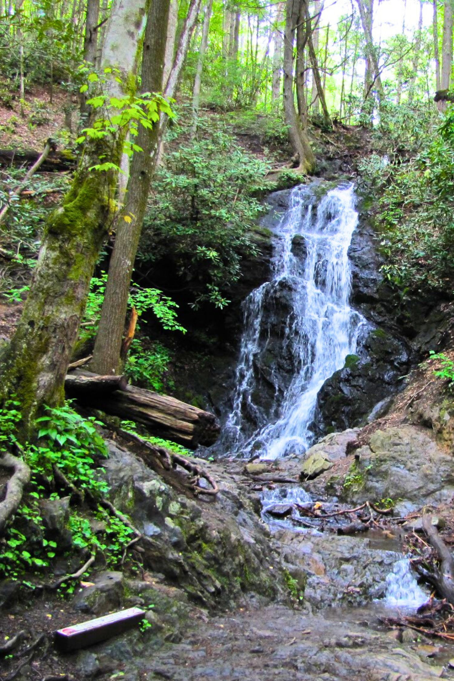
4. Baskins Creek Falls
Distance from Gatlinburg: 7.9 miles
Distance from Pigeon Forge: 14.4 miles
Hiking Distance: 3 miles round-trip
Though there is a climb at the beginning of the trail to these lovely Smoky Mountain falls, it is considered a reasonably easy 3-mile round-trip hike.
As you head towards Baskins Creek Falls, you can catch a glimpse of Gatlinburg in the distance if you’re hiking in early spring or winter.
During the summer and fall, the view will be obscured by luscious greenery.
There are a couple of creeks to cross along the way that can be quite bold after a good rain, so be ready to get wet. At around 1.3 miles, turn left at the junction to head to the falls.
We recommend taking a picnic to Baskins Creek Falls so you can kick back and take time to enjoy the 40-foot, 2-tiered waterfall.
READ MORE: The 10 Best Lakes in Tennessee to Visit
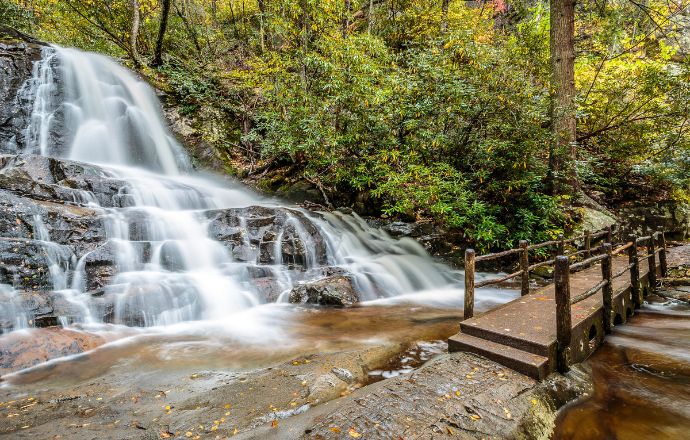
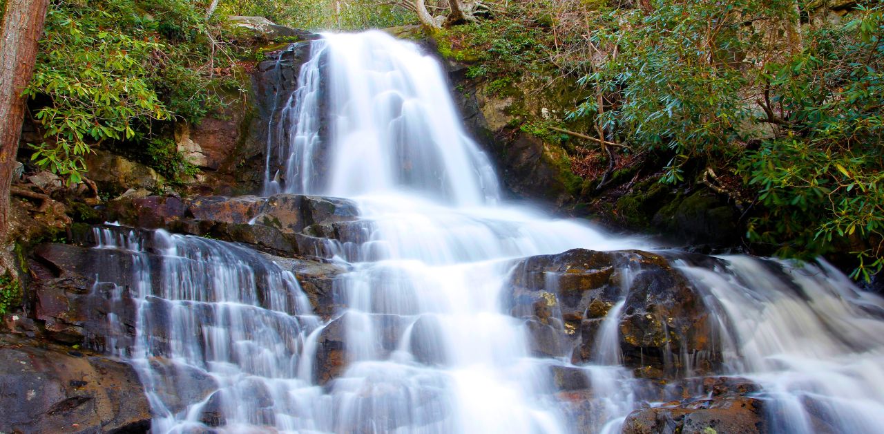
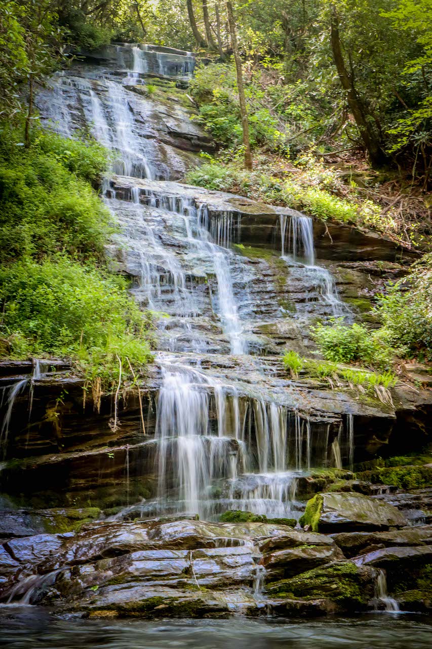
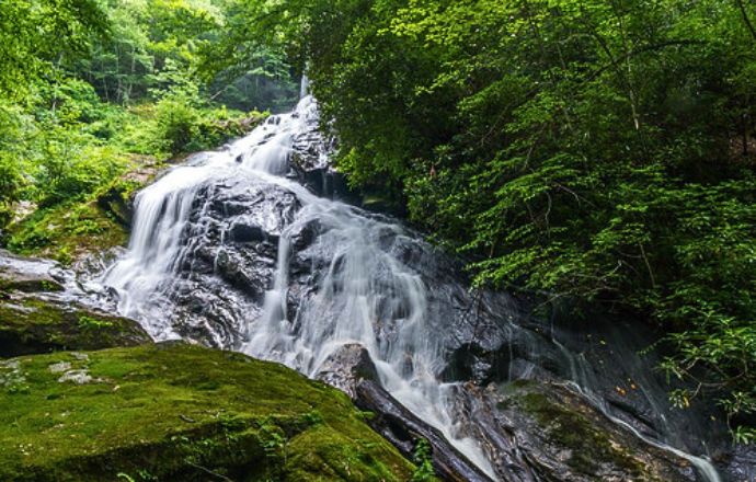
5. Laurel Falls
Distance from Gatlinburg: 8.1 miles
Distance from Pigeon Forge: 14.7 miles
Hiking Distance: 2.6 miles round-trip
Named after Mountain Laurel, the evergreen shrub that’s so prolific in the Blue Ridge Mountains, Laurel Falls is one of the most popular Smoky Mountain waterfalls.
But it has limited parking and is super busy on weekends and mid-week during the summer.
So start your Laurel Falls hike early in the morning to avoid the crowds. You can access the Laurel Falls Trail from the Sugarlands Visitor Center.
This 2.6-mile hike is considered easy to moderate in difficulty, with an elevation climb of 314 feet before you reach the 80-foot-tall waterfall.
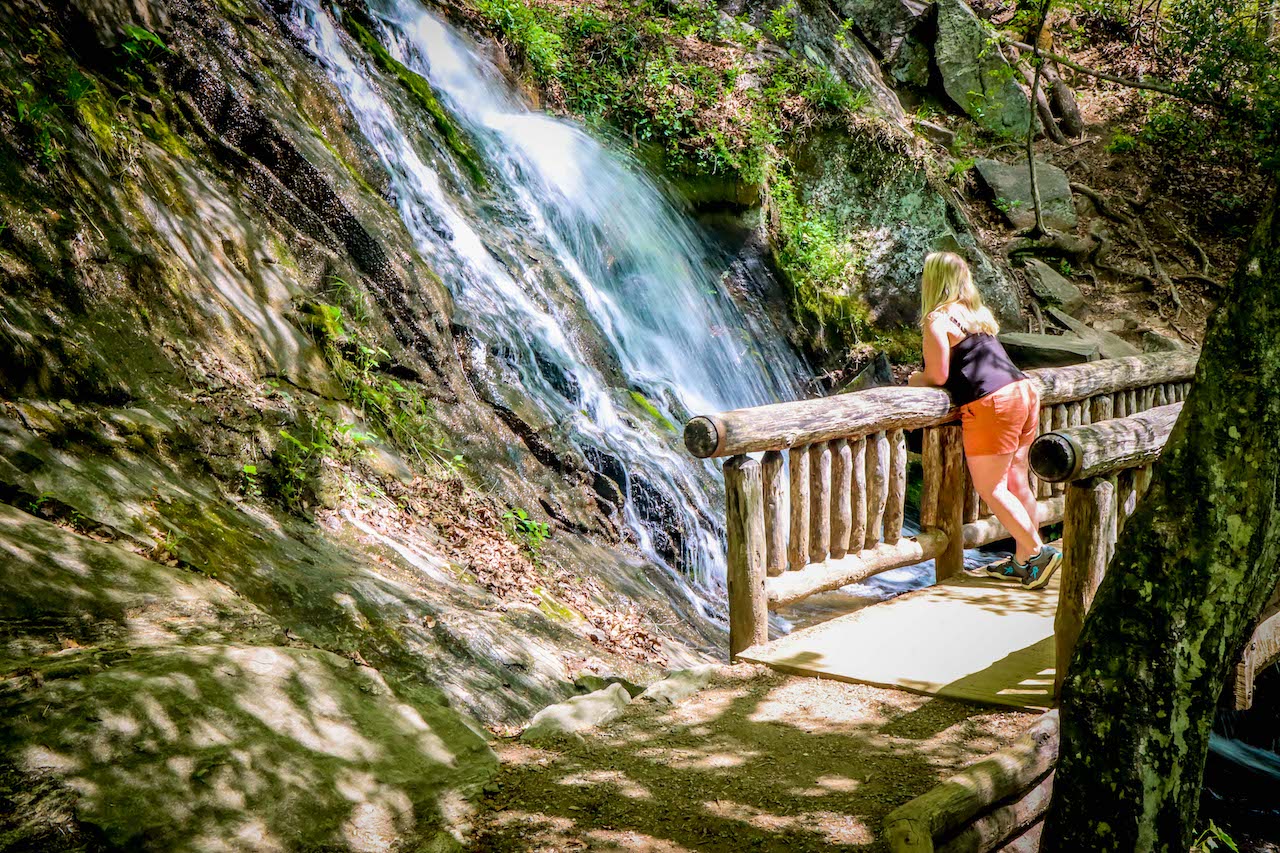
I find Laurel Falls particularly stunning, with an upper and lower section that are dissected by a walkway at the base of the upper falls. It’s a great place for taking close-up photos of the falls!
READ MORE: 20 Beautiful Birds of Tennessee
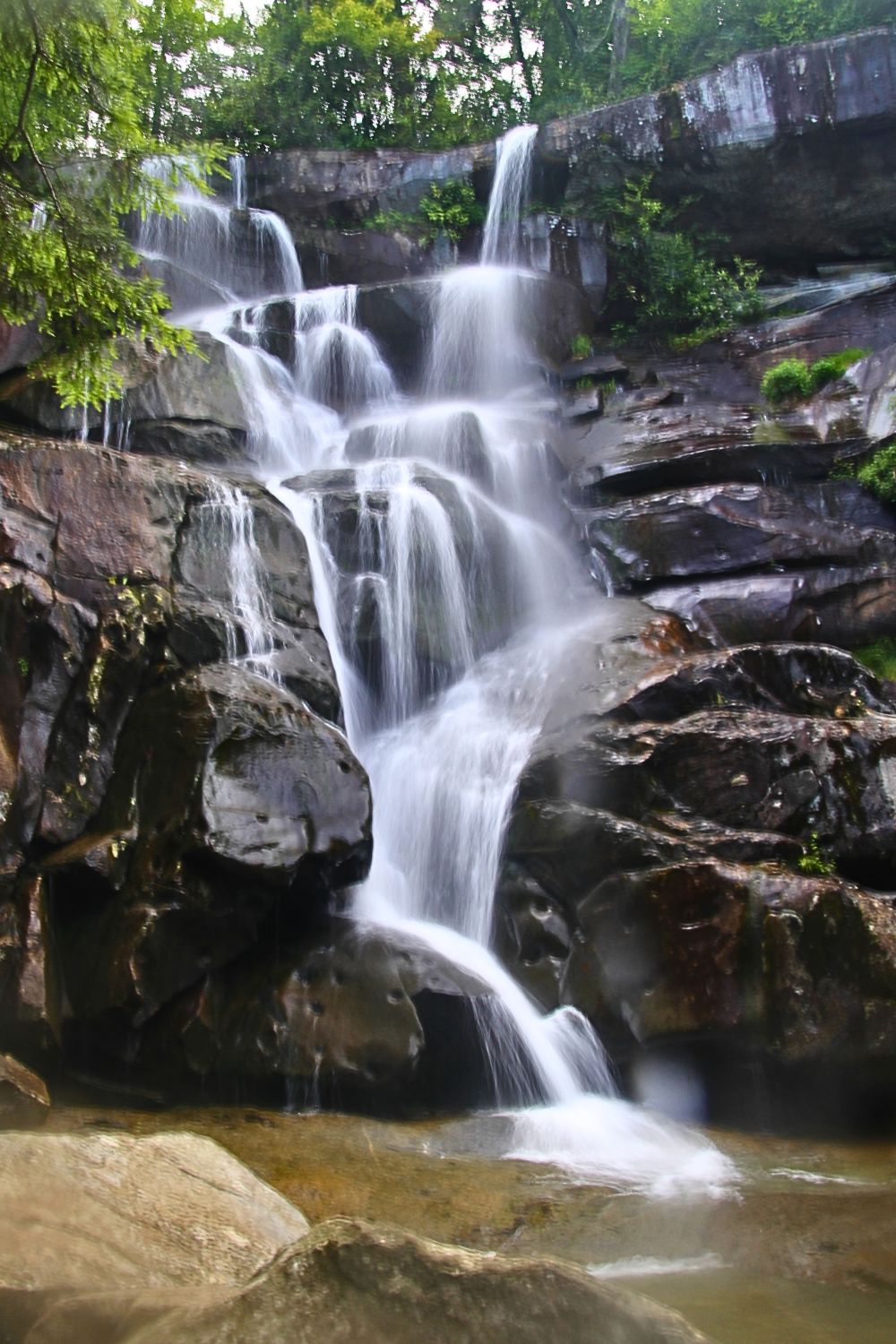
6. Ramsey Cascades
Distance from Gatlinburg: 10.7 miles
Distance from Pigeon Forge: 17.1 miles
Hiking Distance: 8 miles round-trip
Ramsey Cascades is the tallest (and one of the most breathtaking) of the Smoky Mountains waterfalls, but it’s also one of the longest hiking trails on this list.
This 8-mile round-trip hike has an elevation gain of 2000 feet, and is definitely considered strenuous.
The Ramsey Cascades Trail takes hikers alongs bold rivers and streams, with the last two miles moving through an old-growth forest (where you’ll see some of the park’s largesttrees).
After that, you’ll soon find the stunning 100-foot drop of one of the best waterfalls in the Smoky Mountains in your sight!
READ MORE: Non-Venomous vs Venomous Snakes in Tennessee (ID Guide)
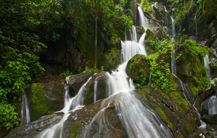
7. Place of A Thousand Drips
Distance from Gatlinburg: 9.3 miles
Distance from Pigeon Forge: 15.8 miles
Hiking Distance: 0 miles
Though it may not rank among the biggest of the waterfalls in the Smoky Mountains, what I love about the colorfully-named Place of a Thousand Drips is the fact that you can see it from your car.
Although the water flow (which falls down a 20-30 foot drop) is usually somewhat sparse, it has carved out an interesting path through the rock.
Located on the Roaring Fork Motor Nature Trail, the Place of a Thousand Drips tends to be much more impressive after a good rain,
The road is a 5.5-mile one-way loop road that follows along Roaring Fork Creek, one of the larger and faster flowing streams in Great Smoky Mountains National Park.
READ MORE: The Tennessee Legend of the Bell Witch Haunting
8. Hen Wallow Falls
Distance from Gatlinburg: 16.7 miles
Distance from Pigeon Forge: 23.1 miles
Hiking Distance: 4.4 miles round-trip
Access to the Hen Wallow Falls Trail is right next to the Cosby Picnic Area, which is near the entrance to the Cosby Campgrounds.
After parking, head back along the road about 100 yards to find the Gabes Mountain Trailhead.
This 4.4-mile hike is considered moderate in difficulty due to distance and uneven terrain, and takes about 3-4 hours to complete. It’s got a good bit of elevation, so good hiking shoes are essential.
You’ll pass through gorgeous forest with rhododendron thickets, lush ferns, and wildflowers. There’s a sign that will guide you on the side trail to the waterfall.
The 90-foot-tall waterfall is only two feet wide at the top, but billows out to an impressive 20 feet at its base. There’s also a small cave to the right of the falls that you can explore, but be careful of slippery rocks!
READ MORE: The 15 Best Great Smoky Mountains Campgrounds to Visit

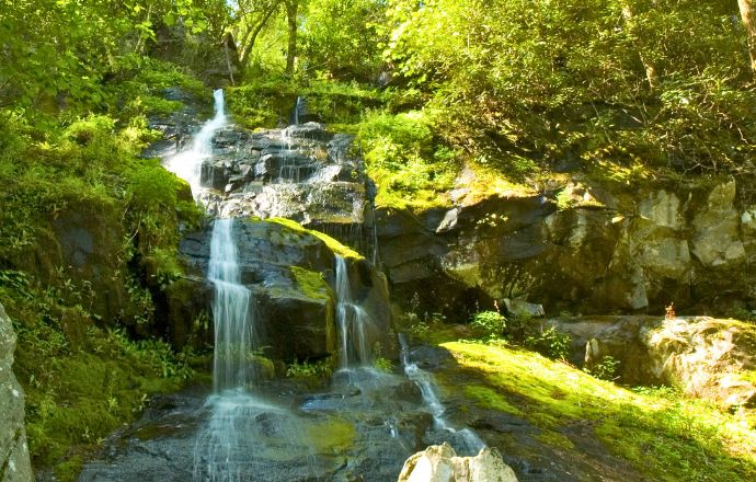
9. Spruce Flats Falls
Distance from Gatlinburg: 24.3 miles
Distance from Pigeon Forge: 22.2 miles
Hiking Distance: 1.8 miles round-trip
Located beside the Great Smoky Mountains Institute building, the Spruce Flats Falls trail is considered moderate in difficulty, with an elevation gain of 413 feet.
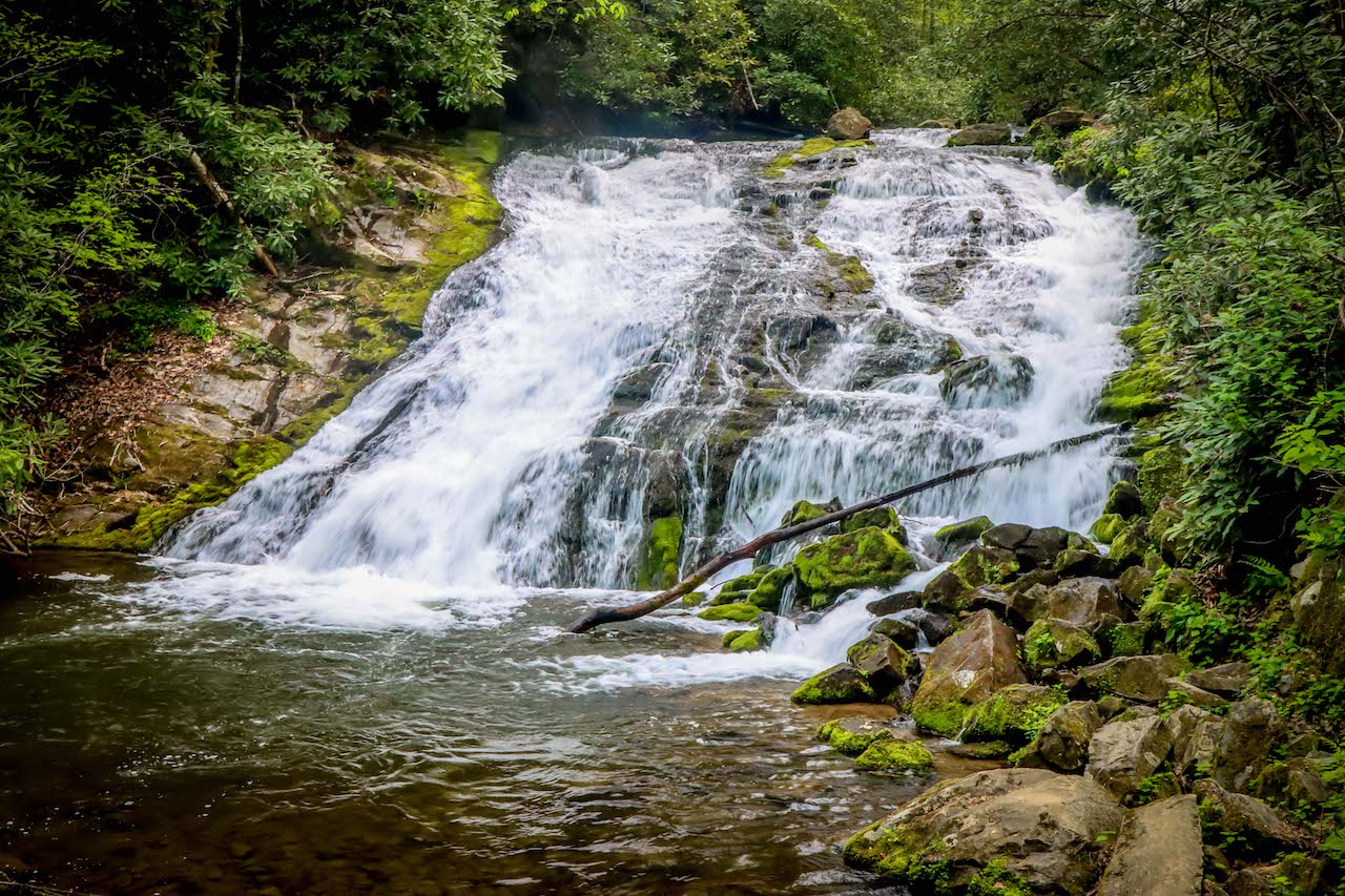
Standing 30 feet tall, Spruce Flats Falls is made up of four separate tiers. Water cascades over the tiers and plummets into a pool at its base, ultimately running into the Middle Prong of the Little River.
This trail isn’t terribly busy, so it’s a great place to watch for wildlife, including birds, butterflies, and bears.
Once you reach the waterfall, you may also see local fish and salamanders. But be careful not to disturb them by stacking or moving rocks.
READ MORE: 40 Facts About the History of the Banjo (From Africa to Appalachia)
Waterfalls near Bryson City & Cherokee NC
10. Tom Branch Falls
Distance from Cherokee: 8.4 miles
Distance from Bryson City: 6.2 miles
Hiking Distance: 0.3 miles
Tom Branch Falls is perfect for family-oriented waterfall fun. The trail is very accessible, wide, and flat, with benches in front of the falls that are perfect for sitting a spell.
People head out along the Deep Creek Trail, which is adjacent to the parking lot, with picnic, kids, fishing gear and/or river tubes in tow.
This impressive 60-foot waterfall is a stunning place for selfies, and it’s widely considered one of the best places for river tubing in North Carolina.
The Deep Creek Campground is one of our favorite Bryson City Campgrounds, with a prime waterfront location that sprawls along the creek, providing easy access to the hiking trails.
READ MORE: The 15 Best Cabin Rentals in Bryson City NC
11. Indian Creek Falls
Distance from Cherokee: 8.3 miles
Distance from Bryson City: 6.1 miles
Hiking Distance: 1.6 miles round-trip
The great thing about heading out on the Deep Creek Trail is that there is more than one gem of a waterfall to find along the way.
If you’re up for a bit more adventure after visiting Tom Branch Falls, continue along the Deep Creek Trail until you cross the wooden bridge and reach the turn-off for the Indian Creek Trail.
Take this trail and continue on for another 200 feet until you reach the beautiful Indian Creek Falls.
This is another family-friendly hike and resting spot, with a shallow swimming hole at the base of the falls for cooling off on hot summer days.
READ MORE: 20 Best Things to Do in Bryson City NC & Swain County
12. Juney Whank
Distance from Cherokee: 8.9 miles
Distance from Bryson City: 2.9 miles
Hiking Distance: 0.8 miles round-trip
Juney Whank Falls is the third in the trilogy of waterfalls to visit on the Deep Creek Trail. Able-bodied hikers can easily hit up all three North Carolina waterfalls in one very enjoyable hike.
When my husband and I hiked to Juney Whank Falls, we found this trail to be less accessible than the others, with some elevation gain, roots and rocks, and narrow width.
But if you’re sure-footed, head out to the wooden bridge right at the base of the lower falls, where you can get a great view of upper and lower Juney Whank Falls.
The Juney Whank Falls trail is actually a loop that exits onto the main Deep Creek Trail, so you could do this one before or after heading over to Tom Branch and Indian Creek.
READ MORE: 20 Things to Do in the Blue Ridge Mountains of North Carolina
13. Mingo Falls
Distance from Cherokee: 6.7 miles
Distance from Bryson City: 16.8 miles
Hiking Distance: 0.3 miles round-trip
Do not miss seeing Mingo Falls, one of the tallest and most impressive waterfalls in the Great Smoky Mountains . Afterwards, it’s worth making the 6.5-mile drive to the historic Mingus Mill.
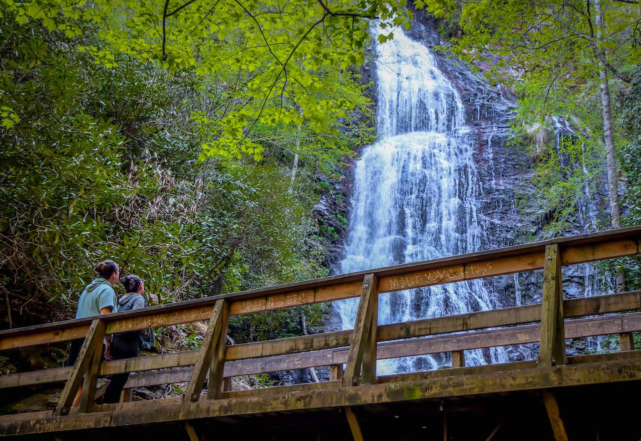
Mingo, which means “Big Bear” in the Cherokee language, is a 120-foot waterfall that is truly a sight to see. The Mingo Falls trail is only a 1/4 mile round-trip, but don’t let this fool you!
In our experience, the 161 stairs will make the hike feel a lot longer f you aren’t up for it. At the end, you’ll reach a wooden observation bridge at the base of the waterfall.
There weren’t many people around on the mornings we visited– just enough to ask for help getting a couple of photos of us in front of the fantastic falls.
READ MORE: The 20 Best Things to Do in Cherokee NC & the Qualla Boundary
14. Soco Falls
Distance from Cherokee: 11.1 miles
Distance from Bryson City: 22.4 miles
Hiking Distance: 0.2 miles round-trip
Rated as one of the best things to do in Maggie Valley NC as well as one of the best waterfalls near Cherokee NC, Soco Falls is a real jewel of a waterfall that you can see with very little effort.
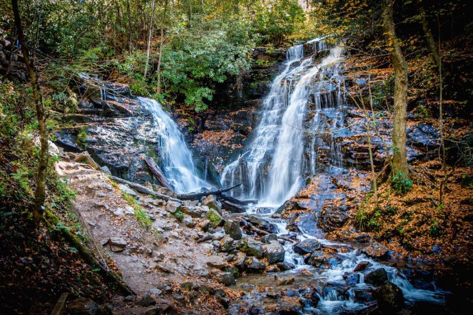
It’s just a short walk from the small parking lot to a wooden overlook where you can view the tallest (120 feet) of the twin waterfalls.
If you’re seeking a bold and adventurous thing to do in winter in North Carolina, climb down to the bottom to spy the second waterfall.
But note that this involves scrambling down slippery rocks, hanging onto well-placed ropes.
In our eyes, it’s well worth it once you see the spectacular view of both Western North Carolina waterfalls converging at the foot of the drop.
READ MORE: The 15 Best Cabins in Cherokee NC for Rent
15. Flat Creek Falls & Nellie’s Falls
Distance from Cherokee: 19.4 miles
Distance from Bryson City: 30.7 miles
Hiking Distance: 4.6 miles round-trip
If you’re near Panthertown Valley or the Cataloochee Valley, it’s worth taking a detour to check out two cool waterfalls on one gorgeous hike.
Both Flat Creek Falls and Nellie’s Falls can be reached from the same trailhead. But this hiking trail involves crossing a ford on foot, so be prepared to get wet!
The first stop, Flat Creek Falls, is a beautiful 200-foot waterfall surrounded by plenty of sitting rocks. Nellie’s Falls is just a couple of miles further upstream.
Though not quite the height of Flat Creek Falls, Nellie’s Falls is still worth a visit. It’s a perfect setting for a picnic, or quiet contemplation in the forest. -by Emma Gallagher; featured image of Laurel Falls in the Smoky Mountains via Canva

