
[Updated 2/16/22]
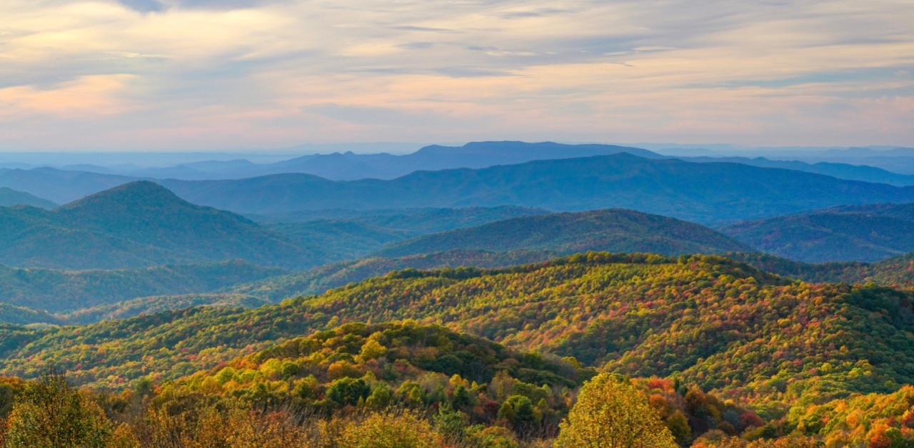
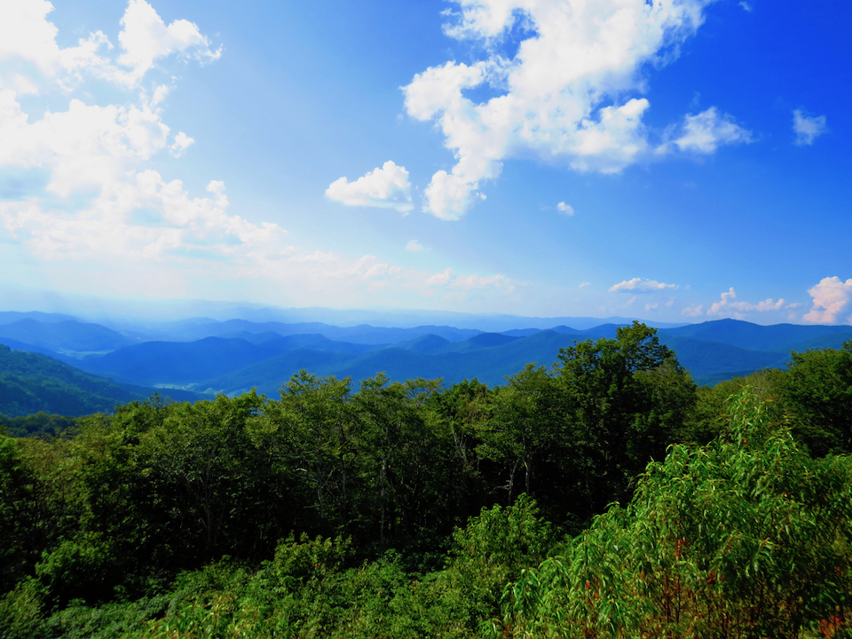
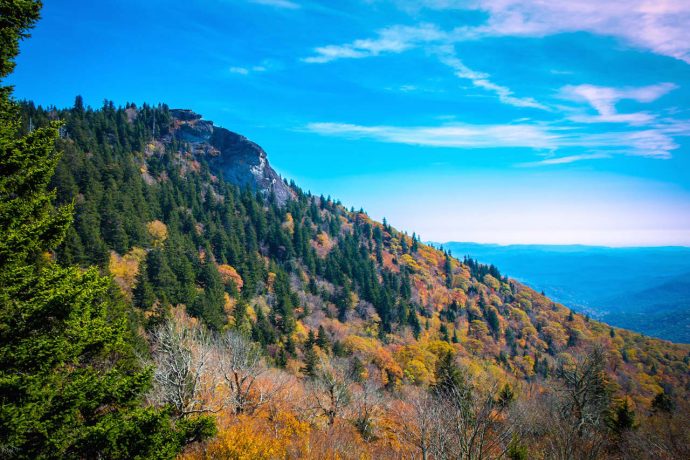
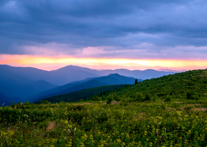
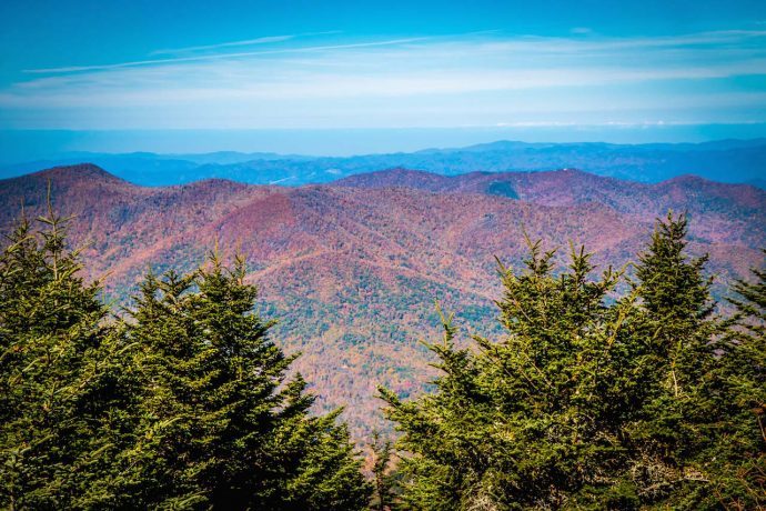
Between the vast Pisgah National Forest, rolling Blue Ridge Mountains, wondrous waterfalls, and countless meandering creeks and verdant meadows, there’s no shortage of natural beauty in Western North Carolina.
The area is also home to some of the most charming Blue Ridge mountain towns, from quaint towns such as Banner Elk and Burnsville to larger towns such as Boone and Asheville.
Known for a bustling downtown area packed with art deco architecture, stylish shops, critically acclaimed restaurants, art galleries, and breweries, Asheville has a little something for everyone.
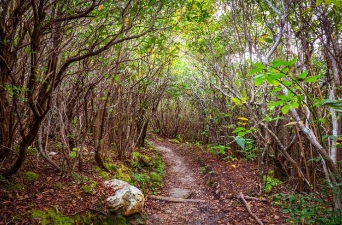
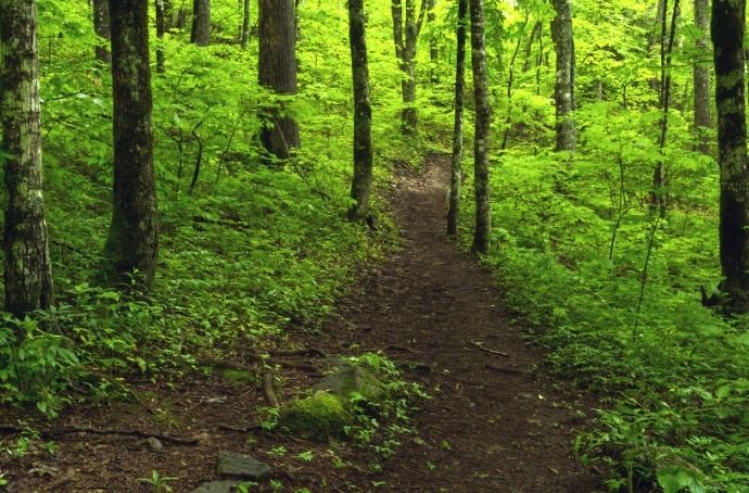
It also offers close proximity to some of the best hiking trails around. Hundreds of trails wind their way through the North Carolina mountains near Asheville, offering sublime views and all sorts of awesome adventures.
So whether you’re looking for a multi-day trek or a quick day trip before a night out on the town, we’ve compiled a bucket list featuring some of the best hiking trails in Asheville NC.
To help you choose the best ones for you, we’ve divided them into three levels of difficulty (easy, moderate, and strenuous), including details on trail length and elevation gain, and highlighted the unique aspects of each trail.
READ MORE: The 25 Best Things to Do in Asheville NC
Best Hiking in Asheville NC Guide
- Moore Cove Falls Trail
- Craggy Gardens Trail
- Fryingpan Mountain Lookout Tower Trail
- Skinny Dip Falls Trail
- Devils Courthouse Trail
- Log Hollow Trail
- Beacon Heights Trail
- Max Patch Loop
- Glassy Mountain Trail
- Black Balsam Knob Trail
- Sam Knob Trail
- Catawba Falls Trail
- Mount Pisgah Trail
- Graveyard Fields Trail
- Bridal Veil Falls Trail
- Rattlesnake Lodge Trail
- Hawksbill Mountain Trail
- Crabtree Falls Trail
- Daniel Ridge Falls
- Bearwallow Mountain Trail
- Rainbow Falls Trail
- Mount Mitchell Trail
- Art Loeb Trail
- Graybeard Trail
- Looking Glass Rock Trail
READ MORE: 15 Festive Ways to Celebrate an Asheville NC Christmas
Easy Hikes Near Asheville
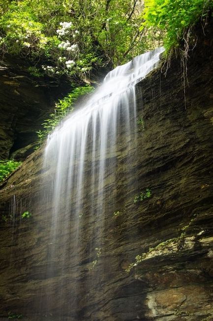
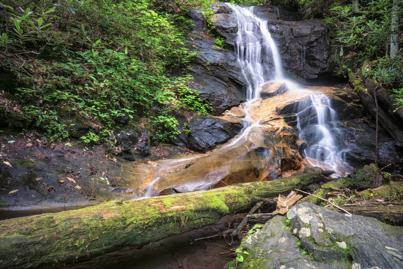
1. Moore Cove Falls Trail
Level of difficulty: Easy
Distance: 1.2 miles
Elevation Gain: 154 feet
The Moore Cove Falls Trail is one of the most easy waterfall hikes near Asheville, making it a great pick for families with kids or anyone who’s new to hiking.
The well-maintained trail travels mostly downhill on the way in and has bridges that cross creeks lined with lush greenery and North Carolina Wildflowers, including trillium and jack-in-the-pulpit.
Soon you’ll reach a wooden platform for viewing the captivating 50-foot waterfall. For a different view, you can also make your way over the rocks to get behind the falls.
Just make sure to be careful and wear shoes with traction, as the wet rocks here can be extremely slippery!
All in all, this out-and-back trail is just over a mile long.
READ MORE: The Best Downtown Asheville Restaurants
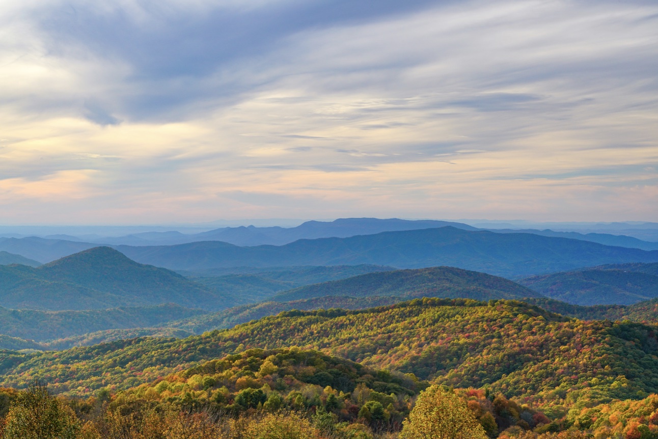
2. Craggy Gardens Trail
Level of difficulty: Easy
Distance: 1.9 miles
Elevation Gain: 574 feet
Located just off the Blue Ridge Parkway at MP 364, you’ll find a signed trailhead signaling the start of the Craggy Gardens hike.
Known as one of the best Asheville trails for seeing foliage, Craggy Gardens NC doesn’t disappoint. There are blooming rhododendron and other vibrant wildflowers scattered about in late spring, and glorious fall colors all around in October.
After making your way through the hardwood forest, you’ll reach the summit meadow, where you can find wild blueberries and blackberries dotting the landscape in late summer months.
The views of the surrounding Pisgah National Forest are remarkable, with the majestic peaks of Mount Mitchell and Mount Craig in the near distance.
After pulling yourself away from the stunning summit views, you can follow the hiking trail to a picturesque picnic area before retracing your steps back to the trailhead.
READ MORE: The 20 Best Blue Ridge Parkway Hikes for NC Day Trips

3. Fryingpan Mountain Lookout Tower Trail
Level of difficulty: Easy
Distance: 1.5 miles
Elevation Gain: 357 feet
Just south of Asheville, Fryingpan Mountain offers a great hike to its summit, where you’ll be treated to sweeping views of the surrounding Blue Ridge Mountains landscape.
The Fryingpan Mountain Lookout Tower trail starts at a parking area off the Blue Ridge Parkway at MP 409.6. It immediately begins climbing towards the summit on a path lined with colorful wildflowers and wild blueberries.
At 0.75 miles in, you’ll reach the summit and its historic 700-foot-tall steel lookout tower.
Once a place reserved for rangers to watch for forest fires in the area, it now provides visitors with an awesome vantage point for admiring Looking Glass Rock, Mount Pisgah, and Cold Mountain.
The jaw-dropping scenic views here will be hard to leave. But when you’re ready to head back down the mountain, you can follow the trail back the way you came.
READ MORE: The Top 10 Treehouse Rentals near Asheville NC
4. Skinny Dip Falls Trail
Level of difficulty: Easy
Distance: 1 mile
Elevation Gain: 200 feet
While the name alone may grab your attention, Skinny Dip Falls offers a series of cascading waterfalls that are sure to captivate you with their simple beauty.
It’s no wonder Skinny Dip Falls is one of the most popular waterfalls near Asheville: It’s located just off the Blue Ridge Parkway, with a short, easy hike and excellent payoff at the end.
The family-friendly hike departs from the Looking Glass Rock Overlook before following the Mountains to Sea Trail to the southwest and descending a steep set of wooden stairs.
At just a half-mile in, the trail makes its way down a curved rock outcropping. Here you will reach the lower pool, which offers unimpeded views of the lower Skinny Dip Falls.
You can stay here or take a wooden bridge to get the best views of the upper falls. But note that the bridge is very narrow and only railed on one side. To head back, just follow the trail back the way you came.
READ MORE: The 21 Best Blue Ridge Parkway Waterfalls in North Carolina
5. Devils Courthouse Trail
Level of difficulty: Easy
Distance: 1 mile
Elevation Gain: 272 feet
Departing from the Blue Ridge Parkway Overlook at MP 422, the Devils Courthouse Trail is one of the best hikes near Asheville because of its short length and absolutely breathtaking views.
The trail gets its unique name because the summit appears to resemble a menacing face when you look up at it from the base of the mountain.
There are also quite a few Appalachian legends attached to the area, including the belief that the devil holds court in a North Carolina cave deep below the summit rock.
The path itself is paved, but fairly steep, and travels continuously uphill. So don’t let the short length fool you into thinking it won’t be a workout. However, all things considered, we still rate this as an easy hike.
Before long, you’ll reach the magnificent summit, where you’ll find panoramic views spanning all the way into South Carolina, Georgia, and Tennessee on a clear day!
There are also bronze plaques you can read to help you identify the different landmarks.
READ MORE: The Best Places to Celebrate Christmas in NC
6. Log Hollow Falls Trail
Level of difficulty: Easy
Distance: 2.5 miles
Elevation Gain: 347 feet
What once was an old logging road is now a beloved hiking trail that leads to four spectacular waterfalls in just a 2.5-mile trek.
Located about an hour south of Downtown Asheville, the hike starts just off of US-276.
Discovery Falls, Logging Road Falls, Upper Log Hollow Falls, and Log Hollow Falls can all be seen over the course of the scenic hike.
But the trail’s popular namesake waterfall, Log Hollow Falls, can be found just a half-mile from the trailhead!
Surrounded by the lush scenery and wildlife of the Pisgah National Forest, each of these waterfalls feels like a little surprise.
All of them offer great photo opportunities, as well as spots to sit and enjoy being immersed in nature.
READ MORE: The 30 Best Waterfalls Near Asheville NC
7. Beacon Heights Trail
Level of difficulty: Easy
Distance: 0.8 miles
Elevation Gain: 150 feet
Easily accessed via the Blue Ridge Parkway near MP 305, the Beacon Heights Trail is a favorite among families because of its short distance and spectacular payoff.
After following the Mountains to Sea Trail for a short while, the hike veers to the left and reaches the southern overlook, which features far-reaching views.
From here, you can spot the Linville Gorge, Table Rock Mountain, and Mount Mitchell.
Departing from this overlook, more beauty awaits as the trail heads to the northern Beacon Heights overlook. The views there are simply stunning, and the summit makes for a great photo or picnic spot.
When you’re ready to head back, the trail retraces its steps to complete the short, but view-packed adventure.
READ MORE: 20 Best Blue Ridge Parkway Overlooks in NC & VA
8. Max Patch Loop
Level of difficulty: Easy
Distance: 1.5 miles
Elevation Gain: 308 feet
Max Patch is a popular mountain located near the Tennessee-North Carolina border. It is widely regarded as one of the best spots to stop along the AT.
Hiking the entire 2,190 miles of the Appalachian Trail from Georgia to Maine isn’t in the cards for most people. But this short, 1.5-mile loop trail can give you a wonderful taste.
Starting from a gravel parking area, the trail begins a gradual climb up Max Patch Mountain, gifting you with increasingly expansive views along the way.
You’ll be led through a lush forest before coming to an intersection where the trail goes left and right. Take the one on the right and you’ll reach the summit shortly thereafter!
Max Patch is a bald mountain, which means that there are no trees at the summit. But an abundance of beautiful wildflowers make this one of the area’s best places for picnics.
Of course there are also breathtaking views of the surrounding mountain ranges, including the Black Mountains (the tallest mountains in the Eastern US), Great Balsams, and Great Smoky Mountains.
READ MORE: The 7 Best Hikes on the Appalachian Trail in North Carolina
9. Glassy Mountain Trail
Level of difficulty: Easy
Distance: 1.3 miles
Elevation Gain: 523 feet
The Glassy Mountain Trail begins at the Carl Sandburg Home, a National Historic Site near Hendersonville NC that preserves the legacy of “the People’s Poet.”
You can tour the historic house and learn more about this famous writer before exploring the five miles of hiking trails that are located on the property.
The 1.3-mile Glassy Mountain Trail begins right behind the house. It has some fairly steep sections, but overall is relatively easy, with several benches along the way in case you want to rest a bit.
You’ll pass a few rock outcroppings before reaching the top of Glassy Mountain, where an exposed granite slab offers stunning sights of Mount Pisgah to the northwest and South Carolina to the south.
To finish the hike, just go back the way you came. You can also explore other trails, like the 0.3-mile Little Glassy Trail and the 0.9-mile Memminger Loop.
READ MORE: The 15 Best VRBO Cabins in Asheville NC
10. Black Balsam Knob
Level of difficulty: Easy
Distance: 1.4 miles
Elevation Gain: 300 feet
If you want to experience part of the Art Loeb Trail, but aren’t ready to tackle 28.5 miles, try the easy 1.4-mile hike to Black Balsam Knob. It offers relatively minimal elevation gain, yet still gifts you with magnificent views.
The hike starts at the Art Loeb Trailhead (just off the Blue Ridge Parkway at milepost 420) and heads northbound through a beautiful balsam forest.
Soon after starting, you’ll reach a large outcrop where you can catch your first glimpse of the panoramic views.
Continuing north, the trail makes its final stretch to the summit of the bald mountain at 0.7 miles. You’ll find views stretching all the way to Shining Rock Mountain, as well as a plaque dedicated to conservationist Art Loeb.
When you’re ready to head back, the hike retraces its outbound steps to the trailhead.
READ MORE: 30 Fun Facts About North Carolina State History & Culture
Moderate Hikes Near Asheville
11. Sam Knob Trail
Level of difficulty: Moderate
Distance: 2.5 miles
Elevation Gain: 492 feet
Located about 38 miles from Asheville, Sam Knob is a striking mountain that stands over 6,000 feet tall.
The hike to the summit is under 3 miles and has moderate elevation gain, so it is usually managed well by most reasonably fit hikers.
The Sam Knob Trail starts off the Blue Ridge Parkway at MP 420 and follows a wildflower-lined gravel road through a forest before the trees open up to reveal a broad, grassy meadow.
After traversing the meadow and crossing a set of wooden stairs, your ascent up the mountain begins. At a little over one mile, you’ll reach the summit.
The views are exceptional, with the Devils Courthouse visible to the south, the summit of Black Balsam Knob peeking out in the east, and the Middle Prong Wilderness and Shining Rock Wilderness all around.
Once you’ve had enough of the magnificent views, the trail retraces its steps, completing the hike at 2.5 miles.
READ MORE: The Appalachian Culture & History of the Blue Ridge Mountains
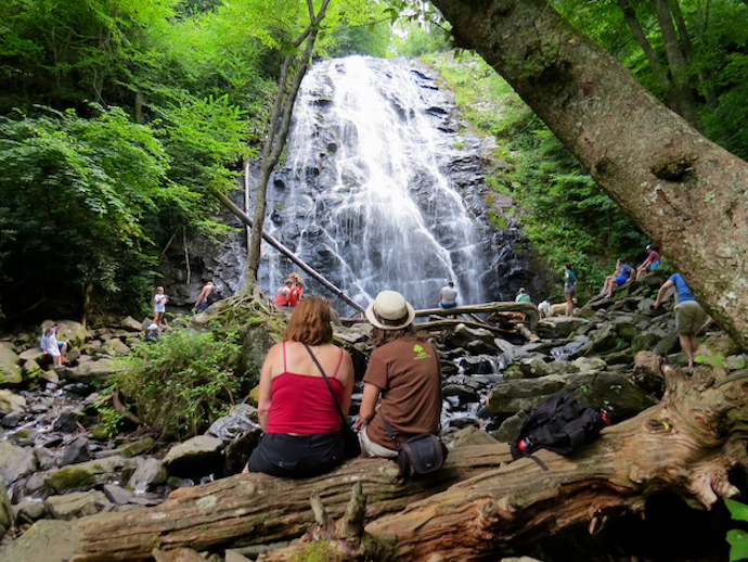
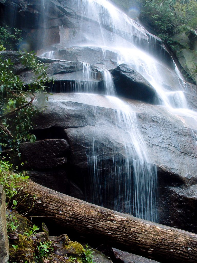
12. Catawba Falls Trail
Level of difficulty: Moderate
Distance: 3 miles
Elevation Gain: 465 feet
Just 25 miles from downtown Asheville, the Catawba Falls Trail is one of the most popular waterfall hikes near Asheville, especially during the summer months.
Named for the Catawba Indians and formed by the headwaters of the Catawba River, Catawba Falls features an impressive series of cascades plummeting over 100 feet from two major drops.
The trail to the falls can be accessed from I-40 via Old Fort (Exit 73), and follows a former wagon route from Old Fort to Asheville.
Along the trail, keep your eyes peeled for stone ruins from the early 1900s, including the wall of an old dam.
As the path winds through the hardwood forest, you’ll be close to water the whole way. The peaceful gurgling of small streams and cascades provides a soothing soundtrack as you hike the 3-mile round-trip trail.
READ MORE: 40 Fascinating Facts About Cherokee Culture & History
13. Mount Pisgah
Level of difficulty: Moderate
Distance: 2.6 miles
Elevation Gain: 750 feet
One of the most iconic and tallest North Carolina mountains, Mount Pisgah towers at 5,721 feet, allowing it to be seen all the way from downtown Asheville.
If you want to tackle the summit, the trail begins at Blue Ridge Parkway MP 407.7, just south of Asheville.
The first half-mile of the hike will seem easy, with very little elevation gain. But don’t let that fool you: From that point on, it’s a steep ascent to the top, with several sets of stone stairs you’ll have to climb along the way.
At 1.1 miles in, there’s a large rock outcrop that provides a great view of the tower on Frying Pan Mountain (and a good spot to take a rest if you need it).
Soon thereafter, your efforts will be rewarded as you reach a wooden observation deck where you can admire the long-ranging summit views.
The city of Asheville can be seen to the northeast, with Cold Mountain to the west and Looking Glass Rock and Frying Pan Mountain to the southwest.
READ MORE: The 20 Best Pisgah National Forest Hiking Trails in North Carolina
14. Graveyard Fields Trail
Level of difficulty: Moderate
Distance: 3.5 miles
Elevation Gain: 450 feet
The name Graveyard Fields may evoke images of a dark and eerie stretch of wilderness. But this is actually a beautiful trail, with sparkling waterfalls and fields of wildflowers along the route.
The trail gets its odd name from stumps that were said to resemble tombstones, which were once dispersed across the area after a terrible wildfire.
Those haunting remnants are long gone, and the area is now one of the most popular day trips from Asheville.
Along with the high-elevation meadows and wildflowers, blueberry bushes can be seen all over the area.
Around August, lots of people come here to pick their own berries, with National Park Service rules allowing visitors to pick up to 1 gallon of blueberries per day!
READ MORE: Apple Picking in North Carolina: The 10 Best NC Apple Orchards to Visit
15. Bridal Veil Falls Trail
Level of difficulty: Moderate
Distance: 4.4 miles
Elevation Gain: 587 feet
Best known for appearing in the film The Last of the Mohicans and most recently The Hunger Games, Bridal Veil Falls is a spectacular waterfall located in the DuPont State Recreational Forest.
There are many trails that can take you to the falls, but the most popular is the 4.4-mile Bridal Veil Falls Trail. (You can also extend the hike by adding Triple Falls, High Falls, and/or Hooker Falls.)
The trail will lead you through a gorgeous stretch of DuPont Forest. At around 2.25 miles into the hike, you’ll reach a wooden platform at the base of the 120-foot Bridal Veil Falls.
For a closer look, continue along a dirt path that descends to the base of the falls.
Here you can admire the cascading water up close as it rushes down the granite rock face before collecting in a series of pools and settling in the area below.
READ MORE: The 10 Best Campgrounds in the North Carolina Mountains
16. Rattlesnake Lodge Trail
Level of difficulty: Moderate
Distance: 3.7 miles
Elevation Gain: 882 feet
While it may not have the jaw-dropping summit views that some of the other Asheville hiking trails on this list offer, the Rattlesnake Lodge Trail makes up for it with its understated beauty and rich history.
A popular hike among locals, this trek follows the Mountains to Sea Trail eastbound. It allows hikers to explore the ruins of Rattlesnake Lodge, which was built by physician-turned-conservationist Dr. Chase Ambler.
Named for its living room ceiling, which was covered in rattlesnake skins, the lodge was originally built in the early 1900s as a summer home for the Ambler family. But it was later sold, and ultimately destroyed in a fire in the 1920s.
Now you can see what’s left of the lodge, which includes the stone foundations, a barn, tool house, spring house, swimming pool, tennis court, and caretaker’s cabin. It’s almost like a little living history museum.
To help you identify what you’re seeing, there’s a display board that shows a map as well as pictures and descriptions of the lodge and outbuildings.
READ MORE: The 15 Best Treehouse Rentals in the North Carolina Mountains
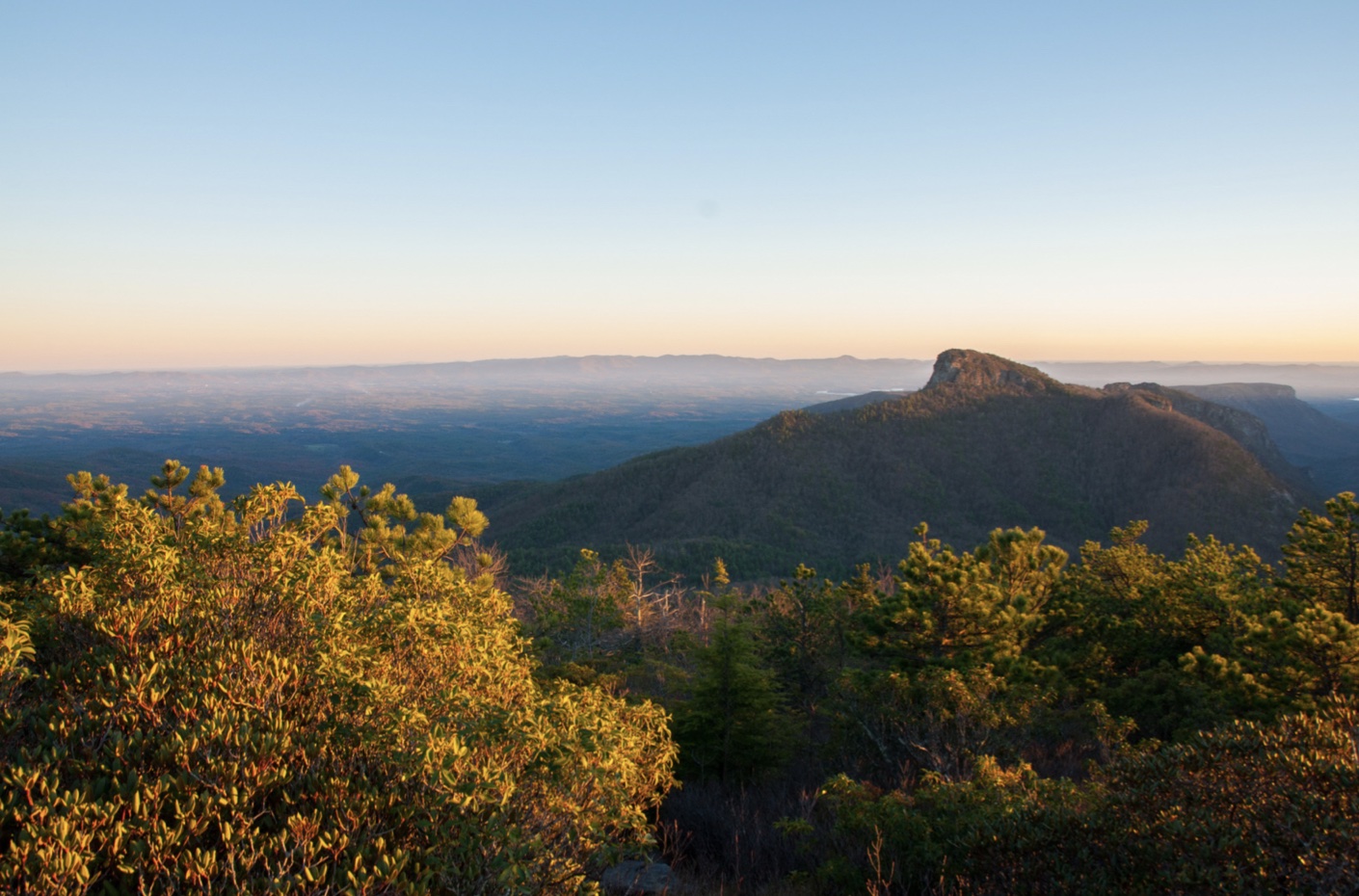
17. Hawksbill Mountain Trail
Level of difficulty: Moderate
Distance: 2.4 miles
Elevation Gain: 695 feet
Offering spectacular sunrises and sunsets, Hawksbill Mountain is nestled on the eastern rim of the Linville Gorge, where it provides incredible 360º panoramic views.
The hike to the summit is relatively short, but we rate this trail as moderate for its fairly intense elevation gain.
Departing from a trailhead off of NC Forest Service 210, the trail delves into a hardwood and pine forest. You’ll travel through a series of switchbacks as the trail continuously gets more steep.
At around a mile you’ll reach the summit, where the views stretch all the way to Linville Gorge, Shortoff Mountain, and Table Rock.
When you’re ready to head down, the trail doubles back the way you came, completing the hike at 2.4 miles.
READ MORE: The Best Places to See Christmas Lights in North Carolina
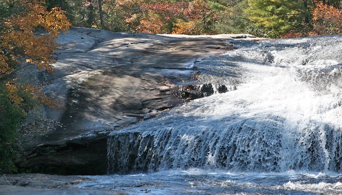
18. Crabtree Falls Trail
Level of difficulty: Moderate
Distance: 2.6 miles
Elevation Gain: 577 feet
Located on the Blue Ridge Parkway at MP 339.5 (just north of Asheville), the Crabtree Falls Trail features a gorgeous 70-foot waterfall tucked away in the Pisgah National Forest near the cute town of Little Switzerland NC.
Along with featuring beautiful Crabtree Falls in the middle of the hike, this trail is also unique because it passes an amphitheater that hosts ranger talks and demonstrations.
You’ll pass the amphitheater early in the hike before descending into a hardwood forest that’s filled with mountain laurel and rhododendron.
The sound of rushing water will fill your ears as the trail crosses a wooden bridge over the base of the falls. This is a picturesque spot for photos and admiring the sparkling water as it cascades down a massive rock face.
You can simply retrace your steps back to the trailhead from here or continue on for a more scenic route that passes a shallow cave and another smaller waterfall.
READ MORE: The 10 Best Blue Ridge Parkway Hotels & Cabin Rentals in NC
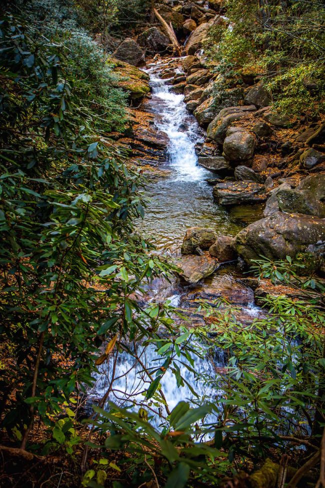
19. Daniel Ridge Falls Loop Trail
Level of difficulty: Moderate
Distance: 4 miles
Elevation Gain: 800 feet
Tucked within the Pisgah National Forest, Daniel Ridge Falls is a beautiful 150-foot cascade on Lanning Branch.
This relatively hidden waterfall doesn’t have as many visitors as other waterfalls in the area. It’s rare to see many other people on the trail, so it’s a great option if you’re wanting a peaceful hike to yourself.
The trail follows Davidson River upstream, passing by several smaller cascades along the way. There are also some roots and larger rocks you have to make your way around, so be sure to watch your step!
Once you reach the falls and spend some time admiring the scenery, you can continue along the loop trail to complete the NC hike at four miles.
If you aren’t up for a full 4-mile hike, but still want to see the falls, there is a shorter option. It’s just a mile there and back, and it’s marked with signs so it’s an easy path to follow.
READ MORE: The 15 Best Pisgah National Forest Waterfalls to Explore
20. Bearwallow Mountain Trail
Level of difficulty: Moderate
Distance: 2 miles
Elevation Gain: 611 feet
The Bearwallow Mountain Trail leads you to a picturesque meadow that’s widely considered a perfect picnic spot.
The views are also pretty incredible, with Mount Mitchell, Mount Pisgah, the Black Mountains, and the Great Smoky Mountains all within view on a clear day.
The hike to this scenic area starts off with a few steep switchbacks. Fair warning: The elevation gain is pretty tough, which is why the trail is listed as moderate even though it’s just two miles long.
Before you reach the meadow, you’ll see babbling streams and even wildflowers along the path in Spring.
When you finally reach the meadow, don’t be shocked if you’re greeted by a couple of friendly cows, as they’re known to roam this area.
READ MORE: The 15 Best North Carolina Mountain Towns to Visit
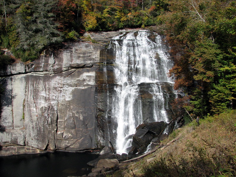
21. Rainbow Falls Trail
Level of difficulty: Moderate
Distance: 3.9 miles
Elevation Gain: 500 feet
Tumbling nearly 150 feet down a cliff into a boulder-strewn pool, Rainbow Falls is a beautiful sight to behold. And when the sun hits it just right, this waterfall creates a brilliant rainbow in the mist.
If you want to see this stunning sight, the hike departs from the Grassy Ridge Trailhead in Gorges State Park, one of the newer state parks in North Carolina.
The trail passes through dense thickets of mountain laurel and a creek valley before leaving the state park and entering the Nantahala National Forest.
Following the Horsepasture River, the trail crosses a small stream before beginning an uphill climb. The sound of the waterfalls will become increasingly loud before the spectacular cascades come into view.
After admiring the waterfall, retrace your steps back to the trailhead to end the adventure at just under four miles.
READ MORE: The Best Christmas Lights in North Carolina
Strenuous Hikes Near Asheville
22. Mount Mitchell Trail
Level of difficulty: Strenuous
Distance: 11.3 miles
Elevation Gain: 3,694 feet
Both the tallest mountain in the Appalachian range and the highest point east of the Rockies, the Mount Mitchell summit should be on every adventurer’s bucket list.
The payoff here is incredible, with seemingly endless views spanning across a magnificent spruce-fir forest.
But it comes at the cost of an intense elevation gain of nearly 3,700 feet. So if you’re going to tackle this trail, be prepared for a SERIOUS workout!
There are also many large roots and rocks you’ll have to tackle along the way, so this trail is recommended for more experienced hikers only.
Note that you can also reach the summit by driving to Mount Mitchell State Park.
If you’re up for the challenge, the trailhead is located at the Black Mountain Campground.
The trail is an out-and-back route that can be done in a day, but there are also hike-in campsites along the way!
READ MORE: The Top 15 NC State Parks in the North Carolina Mountains

23. Art Loeb Trail
Level of difficulty: Strenuous
Distance: 28.5 miles
Elevation Gain: 6,463 feet
One of the longer, more strenuous hikes near Asheville, the Art Loeb Trail is a great option for trekkers looking for a long distance, multi-day backpacking adventure.
The trail makes its way across myriad peaks and ridges, which provides hikers with astounding views across the Pisgah National Forest and allows you to see most of the surrounding mountains.
If you’re up for the 28.5-mile challenge, the hike begins near the Davidson River Campground, makes its way past the Blue Ridge Parkway, and crosses some of the highest Black Balsam peaks before ending at Cold Mountain.
There are plenty of campsites along the trail, since the trek is usually done over multiple days.
But if you just want a taste of the Art Loeb Trail, you can always explore shorter sections via easier day hikes.
READ MORE: The 10 Best Things to Do in Hendersonville NC
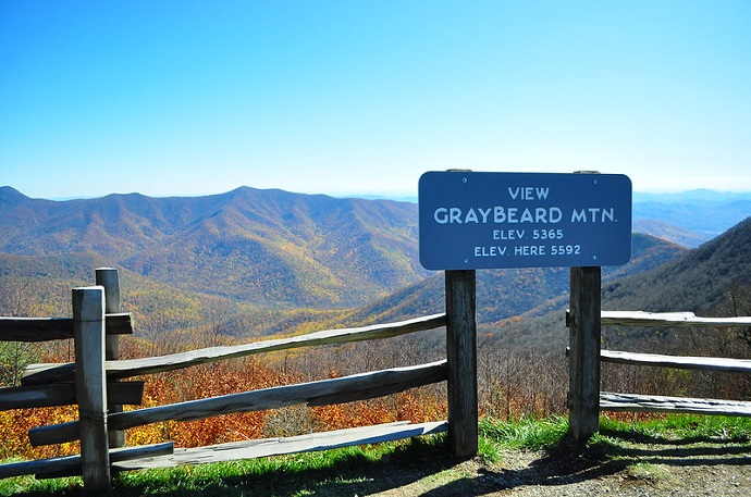
24. Graybeard Trail
Level of difficulty: Strenuous
Distance: 8.8 miles
Elevation Gain: 2,404 feet
Located less than 20 miles east of Asheville, the Graybeard Trail is a beautiful place at any time of the year.
But it’s especially popular from mid-October into early November, as it is widely regarded to be one of the best places to see fall colors in the North Carolina Mountains.
It’s also a popular hike because you can spot all of the peaks of the Black Mountains (a.k.a. “The Seven Sisters”) along the trail’s 8.8-mile stretch.
The trail departs a gravel parking lot and enters a hardwood forest, immediately ascending Graybeard Mountain. In around 1.5 miles, the views begin to open up and you’ll see a short spur trail that leads to Graybeard Falls.
The main trail will grow increasingly steep, but the continuously incredible views are sure to keep you motivated!
READ MORE: The 15 Best Western North Carolina Mountains For Hiking
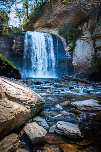
25. Looking Glass Rock Trail
Level of difficulty: Strenuous
Distance: 5.8 miles
Elevation Gain: 1,722 feet
The 5.8-mile trail to the iconic Looking Glass Rock offers jaw-dropping mountain views.
But one of our favorite things about it is that you can stop along the way to visit Looking Glass Falls (one of the top 10 Waterfalls near Brevard, NC) and the Cradle of Forestry in Pisgah National Forest.
One of the few roadside waterfalls in the state, Looking Glass Falls offers an excellent reward for minimal effort. But if you’re willing to make the arduous trek, the Looking Glass Rock Trail also offers some incredible ROI.
After entering a fern-filled forest, the trail heads westbound and begins an unrelenting climb to the summit.
The intense elevation gain will require some strong legs. But before you know it, the forest opens up (at just over 2.5 miles) to reveal 180º views of the verdant valley below.
The huge rocky outcrop is a great spot to relish in the natural beauty of Western North Carolina. But the rocks can be slippery and the drop-off is incredibly steep, so be careful and watch your footing! –by Christina Maggitas


