
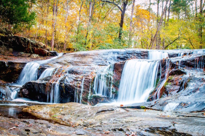
In our eyes, one of the highlights of hiking in the North Georgia Mountains is finding yourself at the base of an eye-popping waterfall.
Thankfully, there are an abundance of breathtaking Georgia waterfalls to explore, from the 729-foot Amicalola Falls (the tallest waterfall east of the Mississippi) to the stunningly beautiful Minnehaha Falls.
You might think that reaching these impressive cascades inherently requires a long trek, or a laborious climb up the side of some remote mountain. And in the case of some waterfalls in Georgia, that’s 100% true!
But there are plenty of North Georgia waterfalls that can be reached by hiking less than 3 miles, with minimal elevation gain. It’s all about knowing where to start!
So whether you’re hiking with kids, older dogs, or just looking for a quick, yet rewarding outdoor adventure, you’ll want to check out our picks for the best easy hiking trails to waterfalls in Georgia.
We’ve broken them up geographically, including waterfalls near Blairsville, waterfalls near Blue Ridge, waterfalls near Clayton, waterfalls near Helen, waterfalls near Dahlonega, waterfalls near Ellijay, and waterfalls near Atlanta.
Each listing includes the overall trail length, elevation gain, plus an overview of the hike itself. So read on to find your new favorite North Georgia hiking trails!
READ MORE: 101+ Things to Do in North Georgia
Guide to Easy Hiking Trails to Waterfalls in Georgia
- Trahlyta Falls
- Helton Creek Falls
- DeSoto Falls
- Falls Branch Falls
- Long Creek Falls
- Sea Creek Falls
- Amicalola Falls
- Minnehaha Falls
- Hemlock Falls
- Dicks Creek Falls
- Holcomb Creek Falls
- Panther Falls & Angel Falls
- Toccoa Falls
- Becky Branch Falls
- Anna Ruby Falls
- Dukes Creek Falls
- Horse Trough Falls
- Blue Hole Falls
- Water’s Creek Falls
- Cane Creek Falls
- Upper Gold Mine Creek Falls
- Sweetwater Creek Red Trail
- Vickery Creek at Roswell Mill
- Toonigh Creek Falls
- Woodward Mill Falls
READ MORE: The 15 Best Fall Fairs in Georgia
Waterfalls Near Blairsville GA
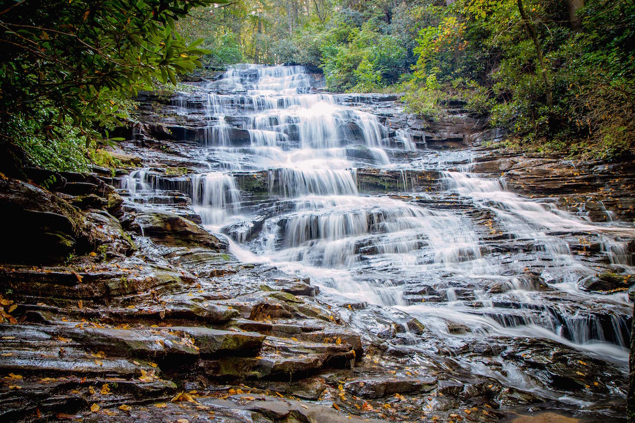
1. Trahlyta Falls
Trail Length: 0.8 miles
Elevation Gain: 219 feet
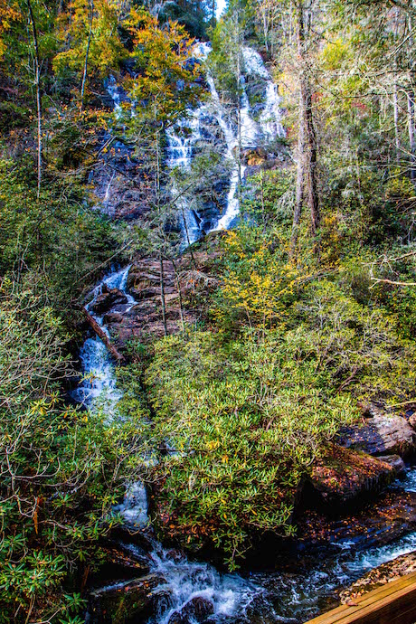
Located in one of North Georgia’s oldest state parks and surrounded by hiking trails in the Chattahoochee National Forest, Trahlyta Falls ranks among the most beautiful waterfall hikes in GA.
The easy hiking trail begins near the Vogel State Park Visitors Center, where you’ll cross a wooden boardwalk and be guided onto an earthen dam.
The trail offers incredible views of Trahlyta Lake and Blood Mountain before making its way down the wooden stairs to the cascades.
After descending the stairs, you’ll reach a spacious platform where you can get closeup views of the massive 110-foot-tall Trahlyta Falls in all their glory.
Note that this waterfall can also be seen from a pull-off along Gainesville Hwy without even entering the park.
READ MORE: The 15 Best Things to Do in Blairsville GA & Union County
2. Helton Creek Falls
Trail Length: 0.6 miles
Elevation Gain: 29 feet
Clocking in at just over a half-mile (with minimal elevation gain), the Helton Creek Falls trail is short and easy, but offers a scenic and fun-filled adventure.
The trail immediately descends a set of stairs enveloped in a mixture of wildflowers, hardwood trees, and conifers before taking a short side trail to descend one more set of wooden stairs.
Soon after, you’ll reach the base of Helton Creek’s lower falls, where crystal clear water tumbles over a rock face into a pool that small kids and dogs love to splash around in.
The hike isn’t done yet, because the trail continues climbing up to a viewing platform where you can catch awesome views of Upper Helton Creek Falls in all its glory.
The large boulders scattered around the pool at the base of the falls also make a perfect spot for enjoying a picnic or simply soaking in the spectacular views.
READ MORE: The 10 Best Restaurants in Blairsville GA for Foodies
3. DeSoto Falls
Trail Length: 2.2 miles
Elevation Gain: 160 feet
According to local folklore, Desoto Falls is believed to be where a piece of Spanish explorer Hernando de Soto’s armor was found from his expedition to the New World in the 1500s.
To reach the mystical set of waterfalls, your journey begins at a paid parking area and follows a paved path before crossing over Frogtown Creek.
At the rhododendron-lined creek, you’ll get your first glimpse of lower DeSoto Falls through the trees. But keep going, because at around 1/4-mile you’ll reach a wooden viewing platform where you can see them up close.
After one more bridge crossing, you’ll reach the spectacular 80-foot cascades of Upper DeSoto Falls and another large viewing platform, where you can marvel at the beauty of the falls.
Note that these waterfalls are much more impressive after recent rains.
READ MORE: The Top 10 Treehouse Rentals in the Georgia Mountains
Waterfalls Near Blue Ridge GA
4. Fall Branch Falls
Trail Length: 0.9 miles
Elevation Gain: 200 feet
Guiding hikers along part of the Benton MacKaye Trail (which is filled in spring with North GA wildflowers like rhododendron and mountain laurel), the Fall Branch Falls trail packs a lot of scenery into its short length.
The short hiking trail explores a mossy forest before descending to a wooden observation platform at the base of the multi-tiered, 75-foot waterfall.
The photo opportunities here are especially great after recent rains, and the views of the surrounding forest are simply stunning when the fall colors of North Georgia are on full display.
From there, you can opt to continue along the Benton MacKaye Trail and tackle a longer adventure. But if you simply retrace your steps back to the parking lot, you can complete the hike at just under a mile.
READ MORE: The 20 Best Things to Do in Blue Ridge, GA
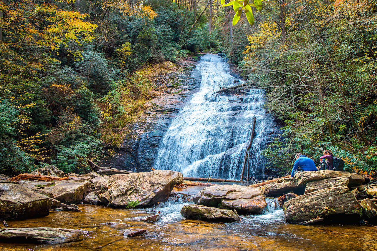
5. Long Creek Falls
Trail Length: 1.9 miles
Elevation Gain: 301 feet
Arguably the most popular of the five waterfalls in Fannin County, Long Creek Falls is a picturesque 50-foot waterfall.
But the glistening cascades aren’t the only reason this waterfall trail is so popular.
Long Creek Falls has a unique location near Three Forks, where some of the Best Hiking Trails in North Georgia (the Appalachian Trail, Benton MacKaye Trail, and Duncan Ridge Trail) come together.
The hike guides visitors along Long Creek, through a lush forest that’s filled with rhododendron and other wildflowers, hemlock, and tulip poplar.
You’ll reach the falls in less than a mile, leaving you plenty of time to relax and admire the water as it surges downward before collecting in a tranquil creek dotted with moss-covered boulders and stones.
READ MORE: The 15 Best Blue Ridge Georgia Cabins to Rent
6. Sea Creek Falls
Trail Length: 0.5 miles
Elevation Gain: 32 feet
Nestled in the Coopers Creek Recreation Area of the Chattahoochee National Forest, Sea Creek Falls is a captivating 30-foot waterfall that can be reached by a quick half-mile, in-and-out trail.
The well-marked trail follows alongside its namesake creek. But it can get quite muddy after heavy rains, so it’s good to check the weather and/or wear grippy hiking shoes.
Soon you’ll reach Sea Creek Falls, which flows into a shallow, rock-filled pool that’s great to splash around in and cool off during warmer months.
While this Blue Ridge GA waterfall is a popular spot during the summer, they’re particularly striking in late winter or spring, when the water flow tends to be stronger.
READ MORE: The 13 Best Restaurants in Blue Ridge GA
7. Amicalola Falls
Trail Length: 0.6 miles
Elevation Gain: N/A
Amicalola Falls is one of the most popular waterfalls in north Georgia. It’s also the tallest waterfall in the state, reaching an incredible total height of 729 feet.
There are a number of Amicalola hiking trails that give you access to the falls, including the one-mile East Ridge Trail and the two-mile Amicalola Falls Loop Trail.
But the easiest of them all is the ADA-accessible West Ridge Falls Access Trail.
The 0.6-mile out-and-back trail is made out of a recycled tire surface that is both wheelchair- and stroller-friendly.
It leads to the midsection of the falls, which offers an awesome view of the cascades and a great spot for photos.
READ MORE: Fall in the Mountains of North Georgia (Where to See the Best Fall Colors)
Waterfalls Near Clayton GA
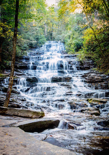
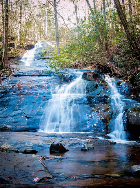
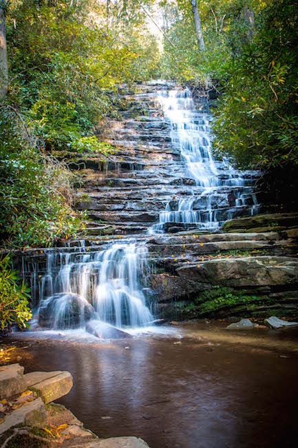
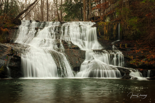
8. Minnehaha Falls
Trail Length: 0.4 miles
Elevation Gain: 62 feet
One of the easiest and most rewarding North Georgia waterfall hikes, the Minnehaha Falls Trail begins at the Bear Gap trailhead, which is distinguished by a green diamond and the number 147.
Traveling near the banks of Lake Rabun, the short but beautiful trail climbs a set of wooden stairs and guides you on a gentle incline through the forest.
In approximately 0.2 miles, the trees open up to reveal the multi-tiered cascades of Minnehaha Falls.
There is a wide area at the base of the falls that’s scattered with rocks that are perfect for relaxing, having a picnic, and taking in the enchanting views of the 50-foot waterfall.
When you’re ready to head back down, just follow the trail the way you came to complete the scenic trek at less than half a mile!
READ MORE: The 20 Best Lakes in the North Georgia Mountains
9. Hemlock Falls
Trail Length: 2 miles
Elevation Gain: 242 feet
Located across the road from Moccasin Creek State Park, Hemlock Falls is a picturesque 15-foot-tall North Georgia waterfall whose smaller stature belies its beauty.
The Hemlock Falls Trail begins near the shores of Lake Burton, with a gradual incline before crossing a wooden bridge over Moccasin Creek.
At just one mile in you’ll reach a clearing where you can admire the Hemlock Falls as it tumbles over a rocky cliff into a serene pool below.
The area is sandy and has large rocks where you can stop for a rest or enjoy a nice afternoon picnic. You can also explore the area further and see a smaller cascade just a few hundred feet downstream.
After soaking in the sights, you can retrace your steps to complete the relatively easy hike at a total of 2 miles.
READ MORE: The 20 Best Things to Do in Clayton, GA (the Gem of Northeast Georgia)
10. Dicks Creek Falls
Trail Length: 1.2 miles
Elevation Gain: 173 feet
Dicks Creek Falls is located near the Warwoman Wildlife Management Area, on the Georgia-South Carolina border near downtown Clayton (one of our favorite Blue Ridge mountain towns in GA).
The hiking trail to the falls follows a section of the Bartram Trail north towards Dick’s Creek, exploring a beautiful hardwood forest along the way.
You’ll pass a point where three beloved North GA hiking trails (Dicks Creek, Chattooga River, and the Bartram) intersect before reaching the banks of the wild and scenic Chattooga River.
There, you can admire the breathtaking view of Dicks Creek Falls as it cascades into the rushing river.
All in all, the easy hike can be completed in just over one mile.
READ MORE: Things to Do in Black Rock Mountain State Park Near Clayton GA
11. Holcomb Creek Falls
Trail Length: 1.75 miles
Elevation Gain: 505 feet
Featuring a nearly 150-foot drop, Holcomb Creek Falls is easily one of the most striking waterfalls in Georgia.
To reach the gorgeous display, follow a 1.75-mile loop trail that explores the Chattahoochee National Forest and also showcases another great GA waterfall, Ammons Creek Falls, along the way.
The hike begins at the intersection of Hale Ridge Road and Overflow Road. It then descends into the forest, eventually reaching Holcomb Falls and looping back around to where you started.
While the total hike is under two miles, the elevation gain of the loop trail is more moderate than easy.
But you can easily modify the trail: Just hike until you reach Holcomb Creek Falls, then follow it back out the way you came for a quicker, less strenuous trip.
READ MORE: The 25 Best Fall Festivals in Georgia
12. Panther Falls & Angel Falls
Trail Length: 1.75 miles
Elevation Gain: 436 feet
Tucked away in the Chattahoochee-Oconee National Forest close to the western end of Lake Rabun, Panther Falls and Angel Falls can both be seen on a relatively easy 1.75-mile trail.
The trail starts on Loop 2 of the Lake Rabun Beach Campground in North Georgia, where it begins following Joe Creek upstream.
From there you’ll ascend a set of stone stairs and pass a moss-covered stone bench that was built by the Civilian Conservation Corps in 1933.
At around 0.6 miles, you’ll reach Panther Falls. This is a wonderful place to stop for a while and admire the rushing waters of the creek as they fall down the rocks and collect in a serene pool at the base.
Note that the elevation gain of the hike up to Angel Falls is more strenuous. So if you want an easier hike, you could retrace your steps from here. But the second section of the hike is just 1/3-mile further, with ropes for assistance!
READ MORE: READ MORE: The 30 Best Hiking Trails in North Georgia Bucket List
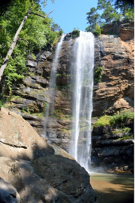
13. Toccoa Falls
Trail Length: 0.4 miles
Elevation Gain: Negligible
One of the tallest free-falling waterfalls east of the Mississippi River, Toccoa Falls is a breathtaking waterfall that surprisingly doesn’t require any sort of hike to reach.
In fact, the path to the falls (which are located on the grounds of Toccoa Falls College) is more of a short walk, just 100 yards from the visitor center and gift shop. This waterfall trail is also ADA-accessible.
The trail begins on asphalt and ends with gravel as you approach the 186-foot-tall falls. To put their massive height in perspective, Niagara Falls is a mere 167 feet tall!
The enormous waterfall drops into a steady stream that flows throughout the 1,000-acre campus.
READ MORE: The 10 Best Kayaking Rivers in Georgia
14. Becky Branch Falls
Trail Length: 1.4 miles
Elevation Gain: 150 feet
Warwoman Dell is a captivating area that’s filled with towering trees and beautiful wildflowers in the warmer months.
The hike to Becky Branch Falls begins there, and follows the Warwoman Dell Trail and Bartram Trail through the forest.
At just 0.3 miles into the hike, you’ll see views of the Becky Branch Falls from a wooden bridge. The water slips down a rockface before collecting in a serene pool below the waterfall.
It’s a serene sight that shows why this is one of the most popular waterfalls in Rabun County.
From there, you can continue the hike along the Bartram Trail to Martin Creek Falls (which makes it into a 3.5-mile hike), or simply return to the lovely Warwoman Dell picnic area. There are several small, unnamed falls there.
READ MORE: The 10 Best Romantic Getaways in the North Georgia Mountains
Waterfalls Near Helen GA
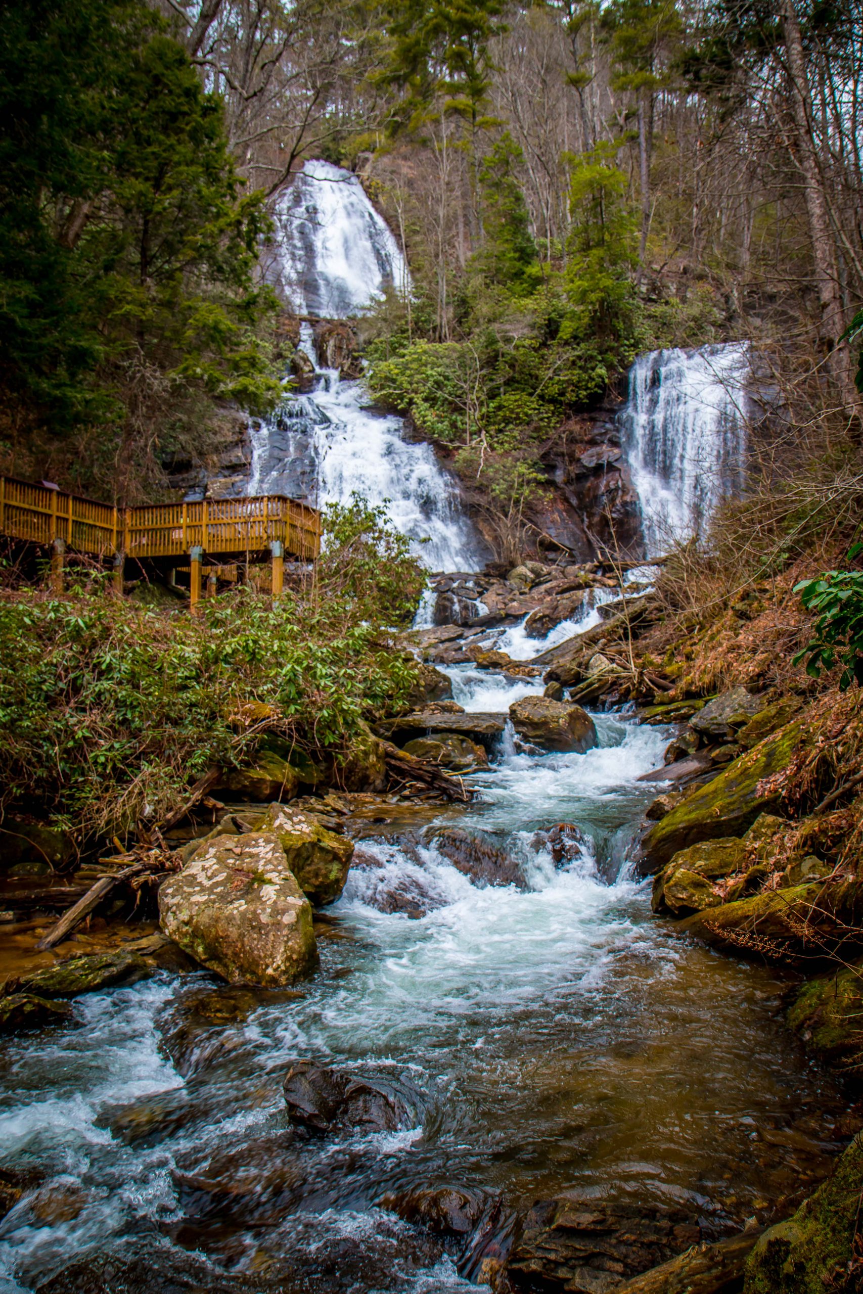
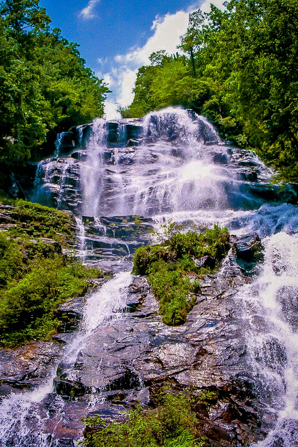
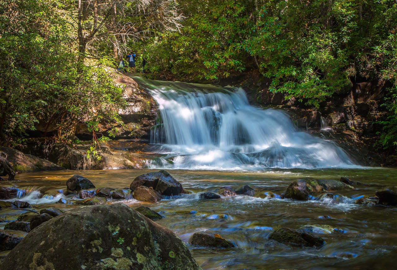
15. Anna Ruby Falls
Trail Length: 0.8 miles
Elevation Gain: 219 feet
One of the easiest out-and-back waterfall hikes in North Georgia, the 0.8-mile Anna Ruby Falls trail begins at the Visitor Center.
The path is entirely paved, and has a variety of interpretive signs along the way detailing the area’s fascinating history, geology, and wildlife.
As you travel along the photogenic path (which explores a gorgeous section of the Chattahoochee National Forest), you’ll see the rushing waters of Smith Creek the entire way.
Before long you’ll reach two wooden viewing platforms, where you can watch in awe as Curtis Creek drops 150+ feet and York Creek drops 50 feet before merging to form Smith Creek.
They eventually flow into the lake at Unicoi State Park, which can be reached via the 8-mile Smith Creek Trail.
READ MORE: The 15 Best Things to Do in Helen GA
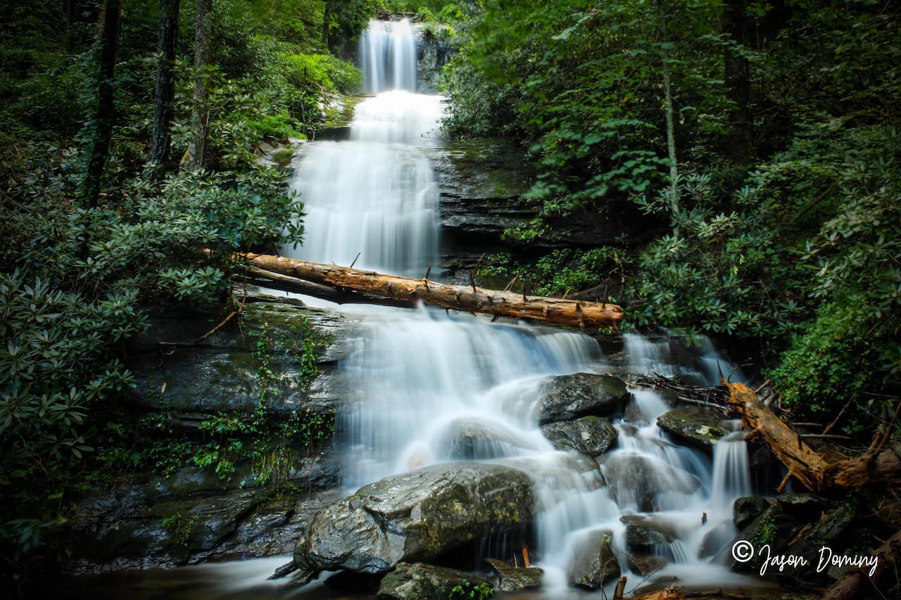
16. Dukes Creek Falls
Trail Length: 2 miles
Elevation Gain: 300 feet
Partially wheelchair-accessible and great for kids and dogs, the Dukes Creek Falls Trail is one of the most popular hikes to North Georgia waterfalls.
Beginning at the Dukes Creek trailhead (where you can catch an awesome view of Yonah Mountain), the paved trail will guide you to an ADA-accessible viewing platform at around 1/10th of a mile.
There you can get a first look at the falls from a distance before the trail descends a set of wooden stairs and turns into a wide dirt path.
The trail is very well-maintained, treating hikers to several sightings of smaller cascades as well as previews of the upper part of Dukes Creek Falls peaking out between the trees.
At around 1 mile, the trail descends to reach several large viewing platforms, where you can admire the spectacular waterfalls, the largest of which drops nearly 150 feet!
READ MORE: The 15 Best Rental Cabins in Helen GA
17. Horse Trough Falls
Trail Length: 0.4 miles
Elevation Gain: Negligible
If you want a more private and secluded waterfall near Helen GA, the Horse Trough Falls trail is a great option.
The hike is incredibly short and easy. What makes this waterfall less popular is its location at the end of a rugged 5-mile Forest Service Road that has large ruts and requires either a 4X4 or an experienced driver.
Once you make your way there, the trailhead is located in the back of the Upper Chattahoochee River Campgrounds (which has been closed since 2018) and guides you to the 60-foot cascades of Horse Trough Falls.
Even when the campground reopens, the gate to the campground will likely be locked from early November through mid-March. But don’t worry, you can still get to the waterfall!
Just park outside the gate and walk through the campground to find the trail at the very back. Note that this option will add around a half-mile to the hike each way, but there’s no elevation gain to speak of.
READ MORE: The 15 Best Restaurants in Helen GA for Breakfast, Lunch & Dinner
18. Blue Hole Falls
Trail Length: 2 miles
Elevation Gain: 500 feet
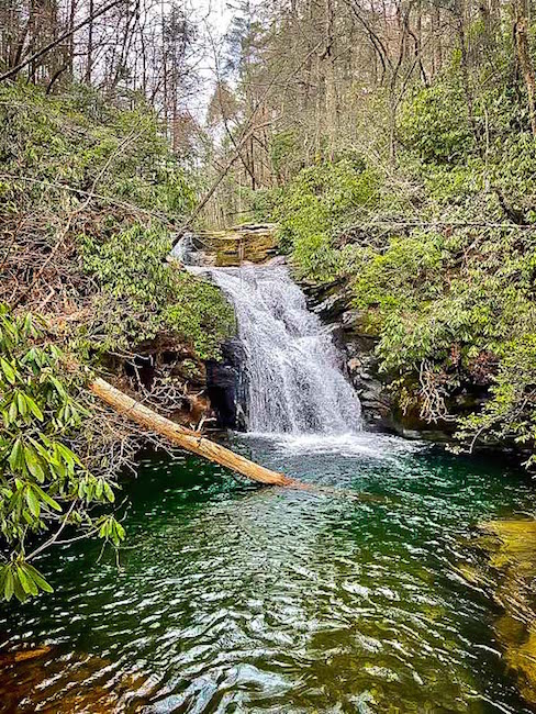
Blue Hole Falls is an enchanting 20-foot waterfall that collects in the deep, turquoise pool which inspired its name.
To reach this beautiful sight, follow the High Shoals Falls Trail downhill through the forest, across High Shoals Creek, and past a few primitive campsites.
You’ll reach Blue Hole Falls at around one mile in, where you can admire the area’s sheer natural beauty and even jump in to cool off on a hot summer’s day.
The pool is over 10 feet deep and has incredibly clear water, making it one of the most popular swimming holes in the North Georgia mountains.
When you’re done, you can either continue on to High Shoals Falls (where the trail becomes moderately difficult), or just follow the trail back the way you came.
READ MORE: 10 Fun, Festive Ways to Celebrate Christmas in Helen GA
Waterfalls Near Dahlonega GA
19. Water’s Creek Falls (a.k.a. Dick’s Creek Falls)
Trail Length: 0.1 mile
Elevation Gain: Negligible
While this is one of the most beautiful and easiest waterfalls in Georgia to get to, it’s a little confusing to some folks. This is simply due to the name.
The City of Dahlonega GA and the White County Chamber of Commerce call it Dick’s Creek Falls (not to be confused with the other Dick’s Creek Falls in Clayton).
But the U.S. Forest Service, AllTrails, and Google Maps all refer to it as Water’s Creek Falls, even though it is located on Dick’s Creek.
Once you get past the name, it’s an awesome waterfall to visit, and has two waterfalls located within about 50 yards of the parking lot.
Lots of locals visit this waterfall to swim, so summer weekends are pretty crowded. Try to get there early or on weekdays if you want to have a more private adventure!
READ MORE: The 15 Best Things to Do in Dahlonega GA & Lumpkin County
20. Cane Creek Falls
Trail Length: 0.5 miles
Elevation Gain: 78 feet
Crane Creek Falls is a waterfall found on the grounds of Camp Glisson, a Christian retreat located about 4 miles north of Downtown Dahlonega.
Though privately-owned, the waterfall is open to the public during daylight hours, except when camp is in session.
There’s a parking area near the bottom of the falls, and from there it is just a quick half-mile round-trip hike.
It only takes about 15 minutes to complete the trail, making it great for a quick excursion during your travels.
You can get up right close to the falls, so be sure to bring your camera to snap some awesome photos!
READ MORE: 8 Great Wineries in Dahlonega GA
Waterfalls near Ellijay GA
21. Upper Gold Mine Creek Falls
Trail Length: About a mile
Elevation Gain: 75 feet
Located in Fort Mountain State Park near Ellijay GA, Upper Gold Mine Creek Falls can be reached as part of the Upper Cabin Combination trail.
That trail is considered moderate, as it is a full 1.6-miles long and has a bit more elevation to it. To modify the hike and make it easier, follow the Lake Loop Trail to the Gold Mine Creek spur.
Simply take a left from the main picnic/parking area (next to the beach), and head clockwise around the lake, which will be a less than half of the total lake loop.
From there, the waterfall spur will be on your left which will lead you to the multi-tiered cascades of the falls. This area was a hotspot during the Georgia gold rush, and you can still see some of the old mining pits along the trail today.
READ MORE: The 16 Best Things to Do in Ellijay GA & Gilmer County
Waterfalls Near Atlanta
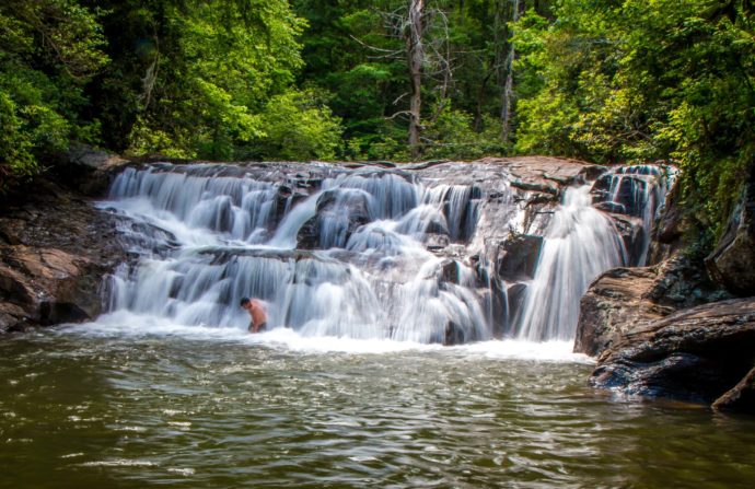
22. Sweetwater Creek Red Trail
Trail Length: 1.9 miles
Elevation Gain: 111 feet
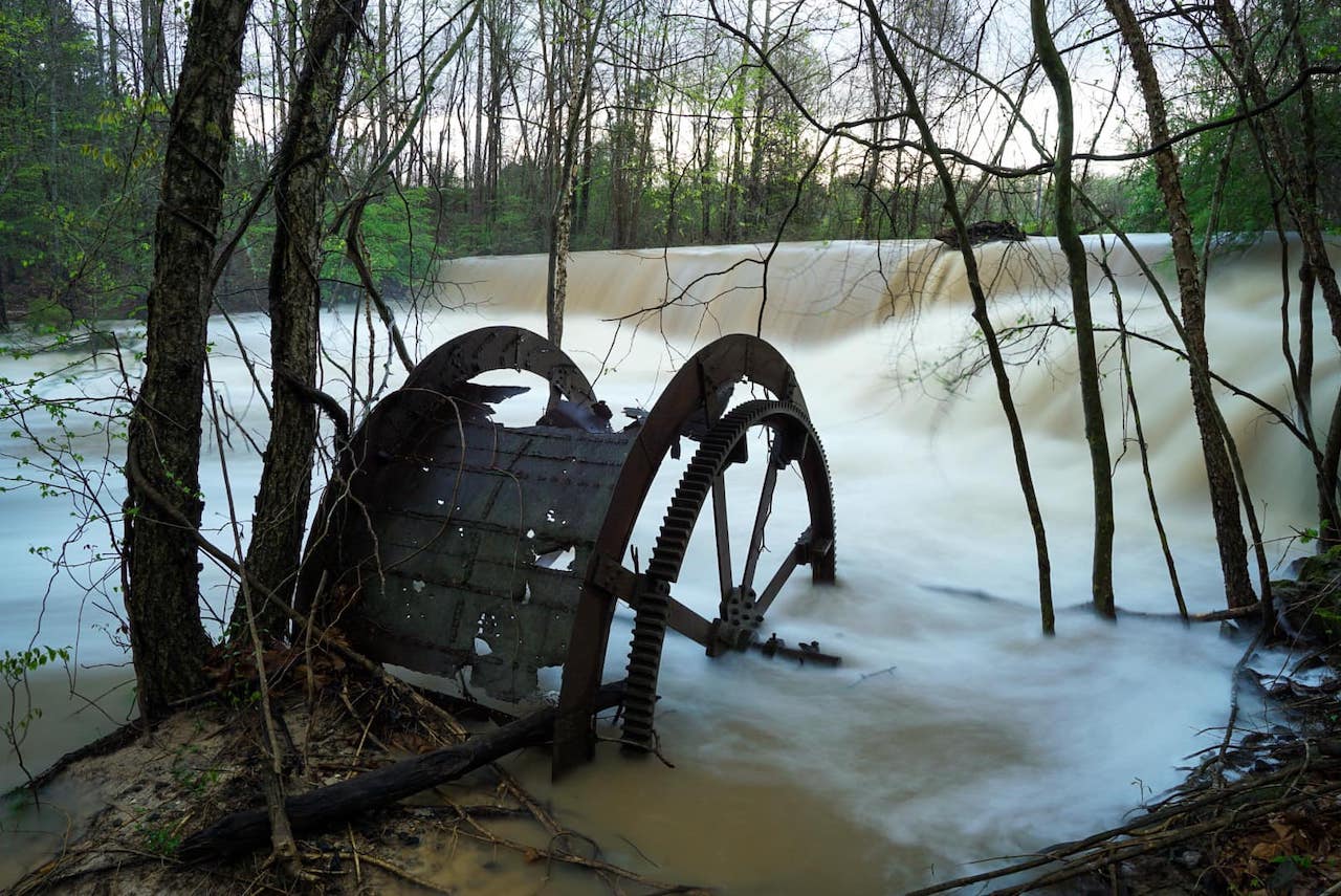
One of the most popular hiking trails at Sweetwater Creek State Park in Lithia Springs, the Red Trail is just under two miles and explores a beautiful deciduous forest.
Starting at a trailhead near the interpretive center, the path follows Sweetwater Creek downstream. At around half a mile you’ll reach the ruins of New Manchester Mill, which was destroyed by Union troops during the Civil War in Georgia.
Departing the ruins, the trail will become rocky and cross a small bridge before ascending a wooden staircase.
There you’ll reach an overlook offering great views of the tumbling cascades of Sweetwater Creek.
The hike then retraces its path in reverse, passing by the mill ruins again on the way back to the trailhead.
READ MORE: The 15 Best North Georgia State Parks & Historic Sites
23. Vickery Creek at Roswell Mill
Trail Length: 3.4 miles
Elevation Gain: 337 feet
Offering both a beautiful waterfall and a peek into Georgia state history, the Vickery Creek Trail at the Roswell Mill is a longtime favorite of Atlanta locals and visitors alike.
The trail leads you along the banks of Vickery Creek to the ruins of the Roswell Manufacturing Company Mills.
Constructed back in the late 1830s and 1850s, the mills burned down by Union forces during the Civil War. They were eventually rebuilt in 1853, only to be destroyed again by fire in 1926.
The waterfall you’ll see during the hike is man-made, created when the creek was dammed to provide waterpower. If you just want to get to the waterfall and back, the trail is probably less than a mile round-trip.
This is a great place to practice your photography skills, jump in and swim during the warmer months, or just enjoy the rich history of the area.
READ MORE: Non-Venomous vs Venomous Snakes In Georgia (Identification Guide)
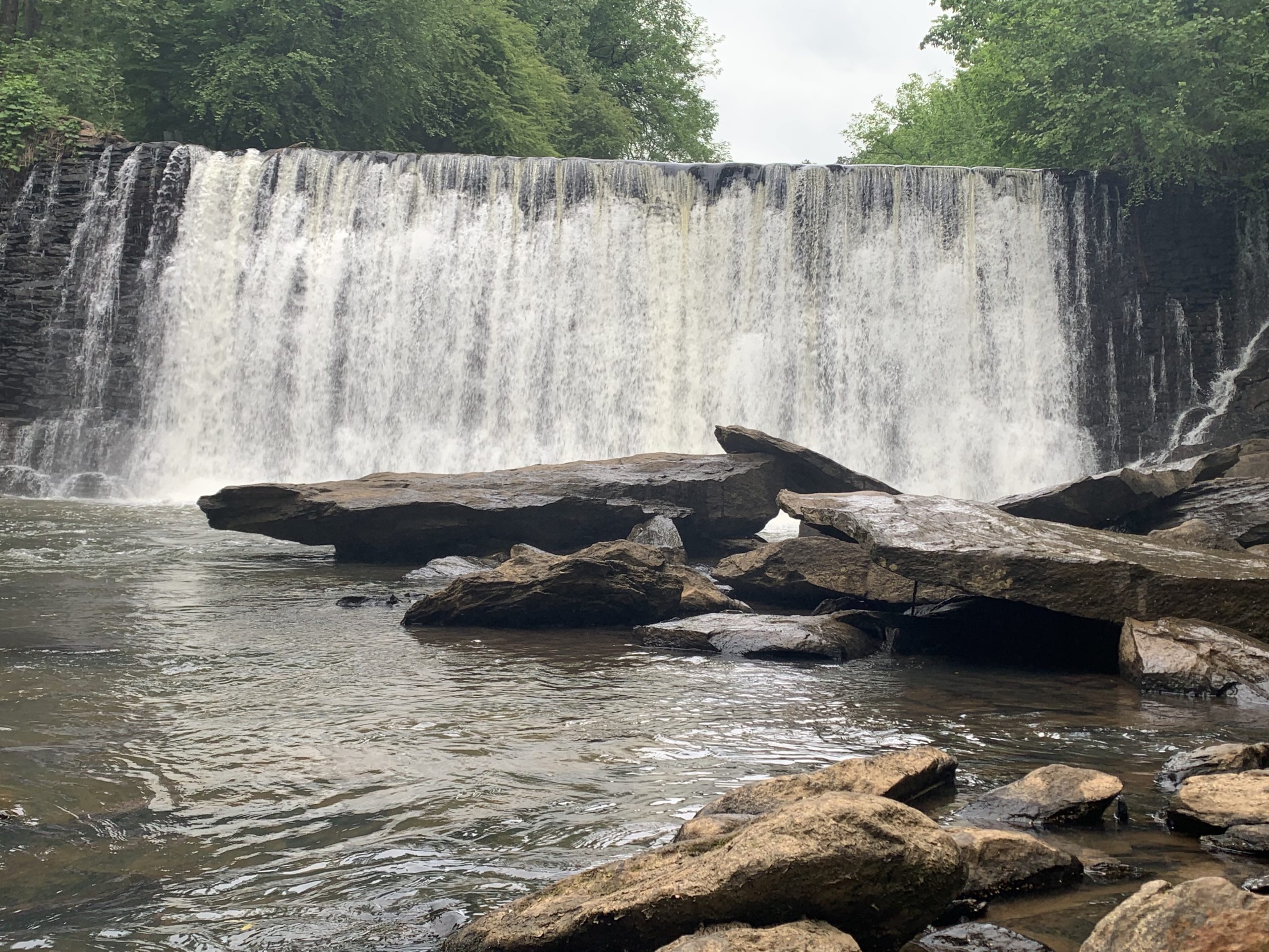
24. Toonigh Creek Falls (a.k.a Allatoona Falls)
Trail Length: 3 miles
Elevation Gain: Unknown (but easy)
Located at Olde Rope Mill Park in Woodstock GA, Toonigh Creek Falls (also known as Allatoona Falls) is a 20-foot waterfall near the mouth of Toonigh Creek, where it spills into Lake Allatoona.
To reach the falls, you have to either take the water route in a kayak or canoe or take an unofficial hiking trail.
The trail option starts at Olde Rope Mill Park, crossing a bridge over the Little River before following a path north for about .3 miles.
You will then turn left and follow a broad road under the I-575 overpass, eventually making your way onto a well-worn path following along the Little River.
Follow the sounds of the waterfall to your left and you’ll reach the falls at around 1.5 miles. When you’re ready to head back, just follow the path back the way you came.
READ MORE: The 25 Best Day Trips From Atlanta GA
25. Woodward Mill Falls
Trail Length: Around one mile
Elevation Gain: Negligible
Woodward Mill Falls is a 15-foot-tall, partially man-made waterfall that was created by the old Woodward Mill.
It’s located along the Ivy Creek Greenway near the Gwinnett Environmental & Heritage Center, which offers educational exhibits as well as ziplines.
The trip to the waterfall is a great excursion to add to a day of exploring the center, which is used as a history, culture, heritage, and environment facility. It’s also a model of innovative green building techniques.
Inside the center, you can find interactive exhibits, walking trails and greenways, and even a gift shop.
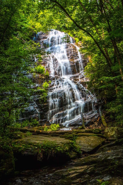
So Woodward Mill Falls is a great one to visit to learn a little something new and get to see a beautiful waterfall as a bonus! -by Christina Maggitas; lead image of Minnehaha Falls by Bret Love & Mary Gabbett
