
[Updated May 8, 2022]
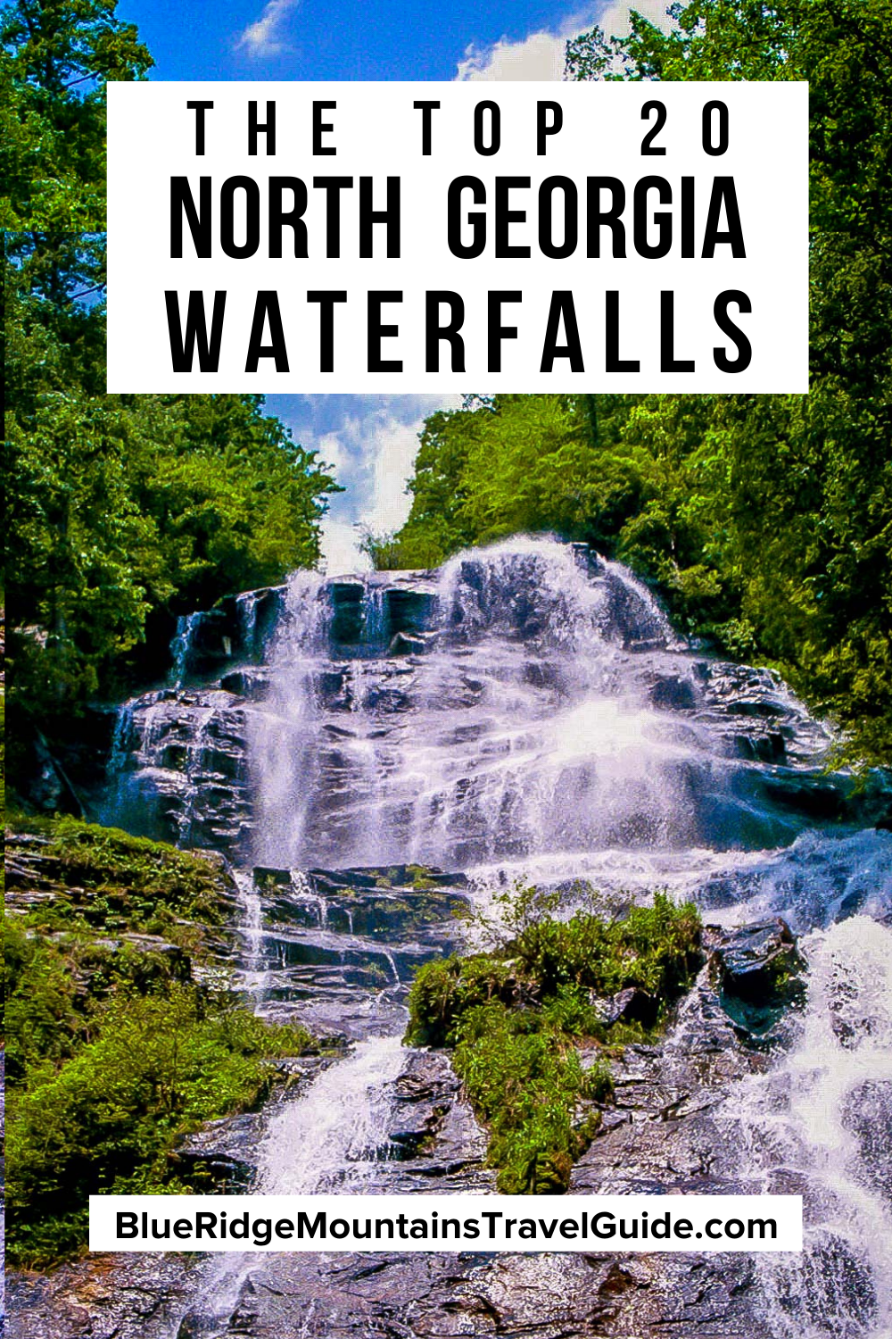
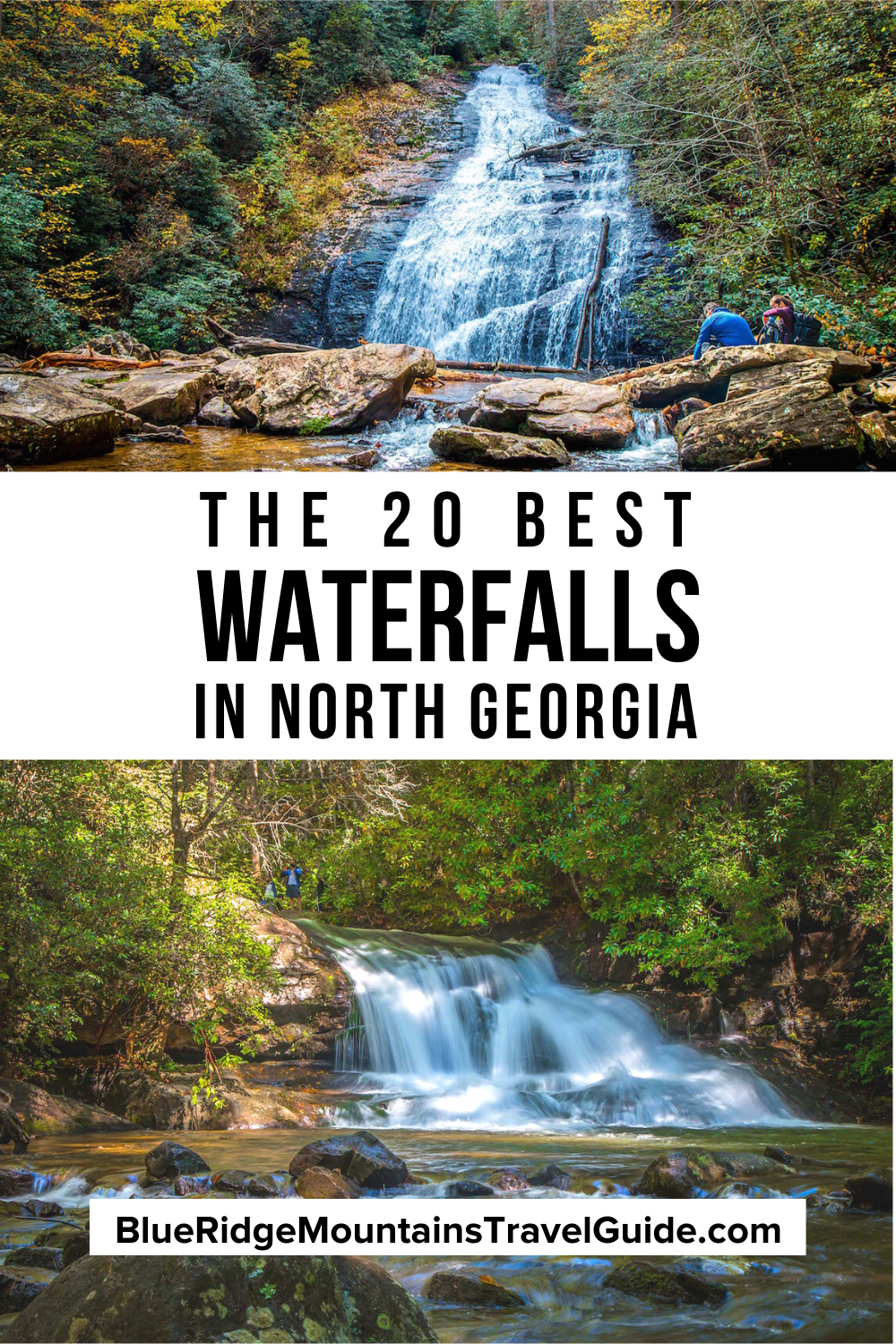
When you explore the enchanting Blue Ridge Mountains of North Georgia, you’re bound to run across stunning waterfalls tucked away in remote parts of the Chattahoochee National Forest.
Tumbling over massive rock outcrops and spilling into meandering streams lined with towering trees, mossy boulders, and beautiful wildflowers, these natural wonders are an inspiring sight to see.
Whether you prefer easy hiking trails with short distances and gentle elevation gains or challenging treks with lots of incline (or 500+ stairs), there are myriad memorable Georgia waterfall hikes to choose from.
So if you love trekking to massive cascades, or just having a relaxing day marveling at the beauty of nature, read on for our guide to the 25 best North Georgia waterfalls!
READ MORE: 101+ Things to Do in North Georgia
Best North Georgia Waterfalls Guide
- Amicalola Falls
- Anna Ruby Falls
- Blue Hole Falls/High Shoals Falls
- DeSoto Falls
- Dicks Creek Falls
- Dukes Creek Falls
- Emery Creek Falls
- Helton Creek Falls
- Hemlock Falls (Cloudland Canyon)
- Hemlock Falls (Clayton)
- Holcomb Creek Falls/Ammons Creek Falls
- Horsetrough Falls
- Jacks River Falls
- Long Creek Falls
- Minnehaha Falls
- Panther Falls/Angel Falls
- Panther Creek Falls
- Raven Cliff Falls
- Sea Creek Falls
- Tallulah Falls
- Toccoa Falls
- Toonigh Creek Falls (a.k.a. Allatoona Falls)
- Trahlyta Falls
- Vickery Creek Falls
- Waters Creek Falls (a.k.a. Dicks Creek Falls)
Love North GA Waterfalls? Check out these great guides!
The 15 Best Waterfalls Near Helen GA
The 15 Best Waterfalls Near Blue Ridge GA
How to Get to Anna Ruby Falls Near Helen GA
How to Get to Dukes Creek Falls Near Helen GA
How to Get to Helton Creek Falls in Blairsville GA
How to Get to Hemlock Falls at Moccasin Creek State Park
How to Get to Minnehaha Falls on Lake Rabun
How to Get to Panther Falls & Angel Falls at Lake Rabun Beach
How to Get to Long Creek Falls in Blue Ridge GA
How to Get to Sea Creek Falls in Suches, GA
How to Get to the DeSoto Falls Scenic Area Near Helen GA
How to Get to Horse Trough Falls in Helen GA (Upper Chattahoochee River Campground)
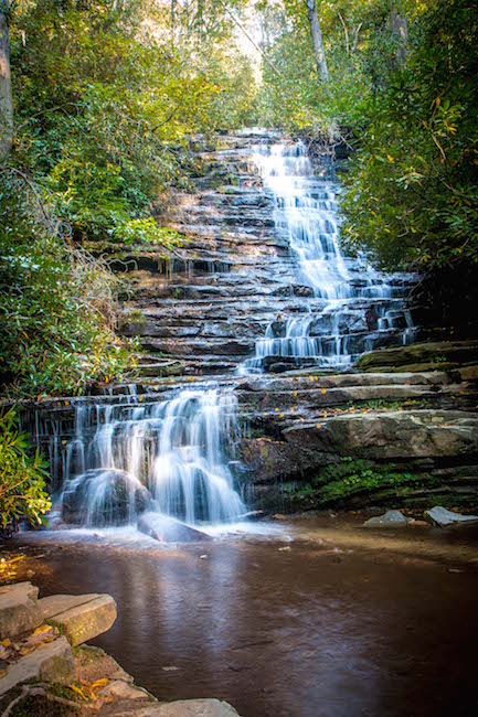
1. Amicalola Falls
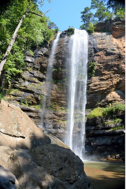
Located in the Chattahoochee National Forest, just eight miles from the southern end of the Appalachian Trail, Amicalola Falls State Park is home to the tallest waterfall in Georgia.
The word Amicalola is Cherokee for “tumbling waters,” which is a fitting description for these 729-foot falls, which cover seven cascades.
Various hiking trails that run through the park will give you glimpses of the gorgeous falls from different angles.
Check out the wheelchair-accessible West Ridge Falls Access Trail and the one-mile East Ridge Trail.
But the park’s most scenic views come via the 2-mile Amicalola Falls Loop Trail. It starts under a commemorative stone arch for the Appalachian Trail, leading you through a ridge and down a multitude of winding stairs alongside the stunning falls.
Driving Directions to Amicalola Falls:
Amicalola State Park is located 15 miles northwest of Dawsonville on GA Hwy 52. Take GA Hwy 53 West to GA Hwy 183 North, then GA Hwy 52 East. Turn left onto Amicalola Falls State Park Road and take the first left onto Top of the Falls Road.
READ MORE: Apple Picking in Georgia: The 10 Best North GA Apple Orchards to Visit
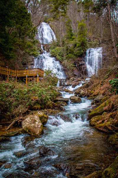
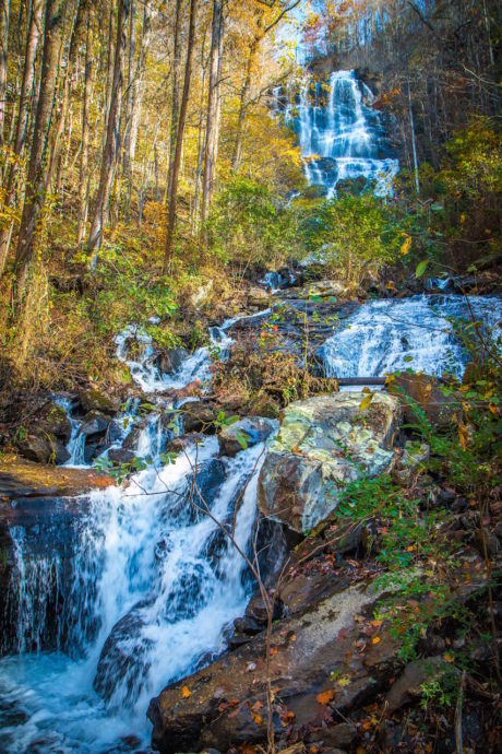
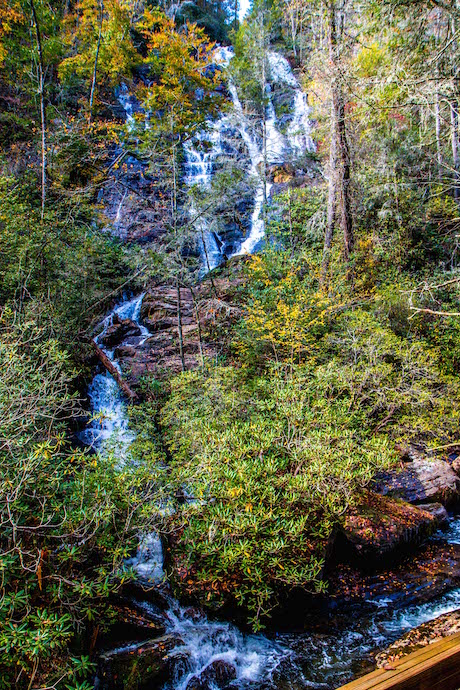
2. Anna Ruby Falls
Anna Ruby Falls is a rare pair of enchanting side-by-side waterfalls near Helen GA, which are formed at the junction of Curtis Creek and York Creek.
Curtis Creek tumbles over 150 feet, and York Creek 50 feet, to form the intriguing double falls, which spill into Smith Creek and flow downhill into the Chattahoochee River.
To reach this dazzling display, your brief (but scenic) hike begins at the visitor’s center, which is right outside of Unicoi State Park.
The paved trail will take you across a bridge over Smith Creek and continue through the forest. You’ll hear the roaring of the falls before you see the cascading water emerge through the trees.
The two wooden viewing platforms at the top offer the best views and photo opportunities of Anna Ruby Falls.
The easy round-trip hike is a total of just under a mile.
Driving Directions to Anna Ruby Falls:
From Downtown Helen, drive north for one mile on GA Hwy 17 to Robertstown, then turn right on Hwy 356. Go 1.3 miles and turn left on Anna Ruby Falls Road to reach a paved parking lot.
READ MORE: The 25 Best Things to Do in Helen GA
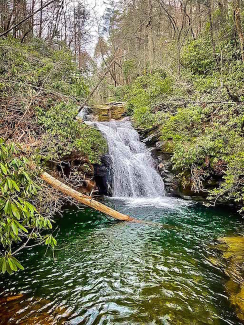
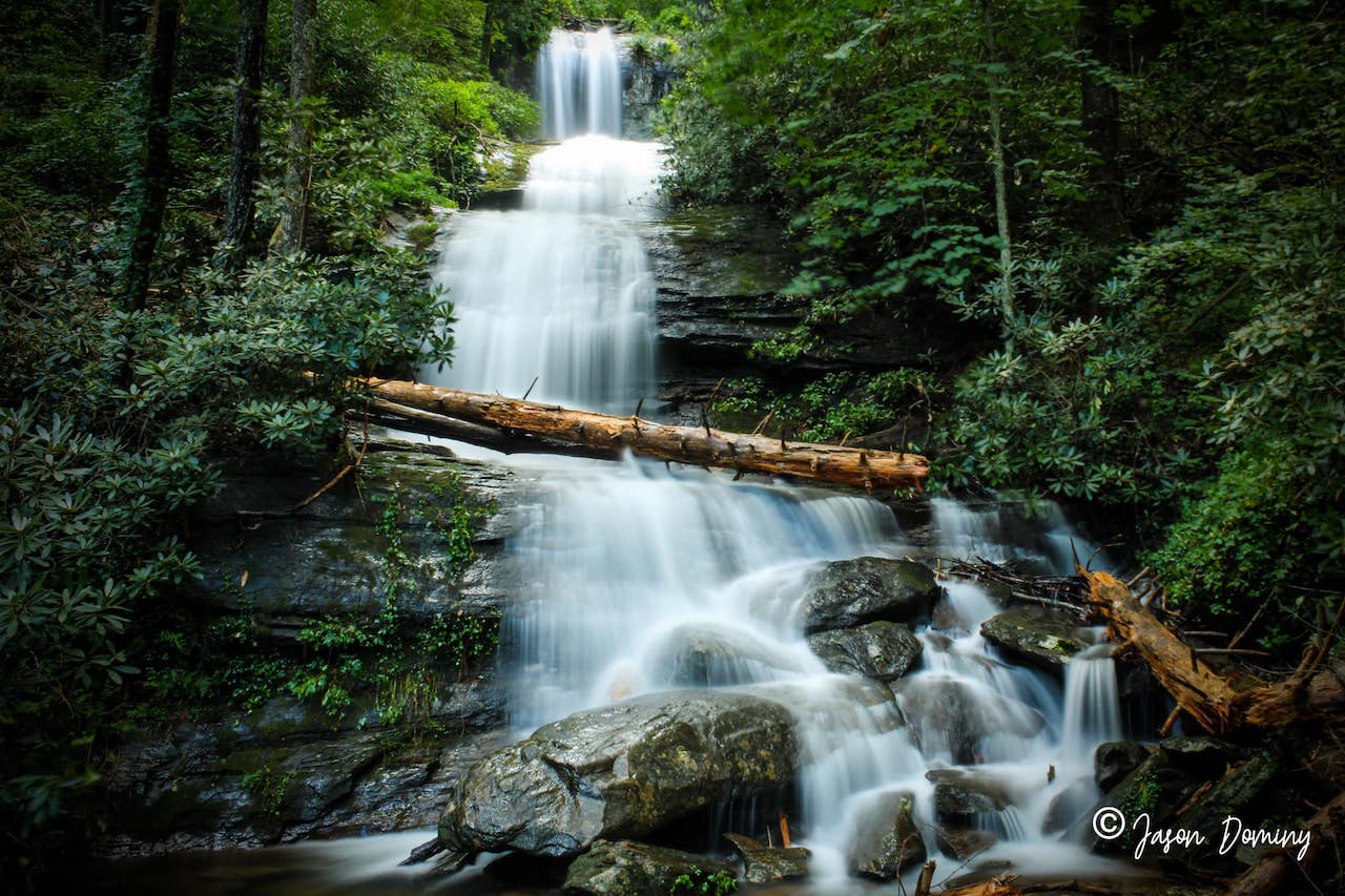
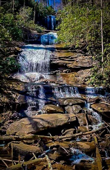
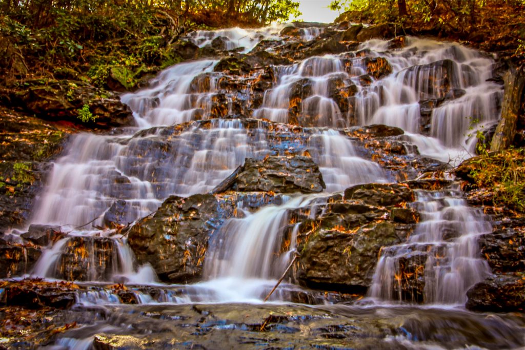
3. Blue Hole Falls/High Shoals Falls
Located just north of Helen in the Chattahoochee National Forest, this relatively moderate hike leads to two of the prettiest North GA waterfalls we’ve seen.
The 2.4-mile round-trip trek takes you through old-growth forest and along a creek through a verdant valley, past some excellent primitive campsites backpackers will love.
Note that the bridge across High Shoals Creek suffered irreparable storm damage, so you’ll need to use stepping stones to get across.
But the view at Blue Hole Falls– a single drop falling into a brilliant blue pool– is 100% worth the risk of getting your feet wet.
The same goes for the switchbacks and slick stone stairs leading down to High Shoals Falls, which boasts a breathtaking 50-foot plummet that makes this one of our favorite North Georgia waterfall hikes.
Driving Directions to Blue Hole/High Shoals Falls:
From downtown Helen, head west on GA-17 N/GA-75 N/N Main St/Unicoi Turnpike toward White Strasse. After 11.1 miles, take a sharp right onto Indian Grave Gap Rd. Follow that for 1.3 miles, and you’ll see the High Shoals Falls trailhead on your left.
READ MORE: 10 Fun, Festive Ways to Celebrate Christmas in Helen GA
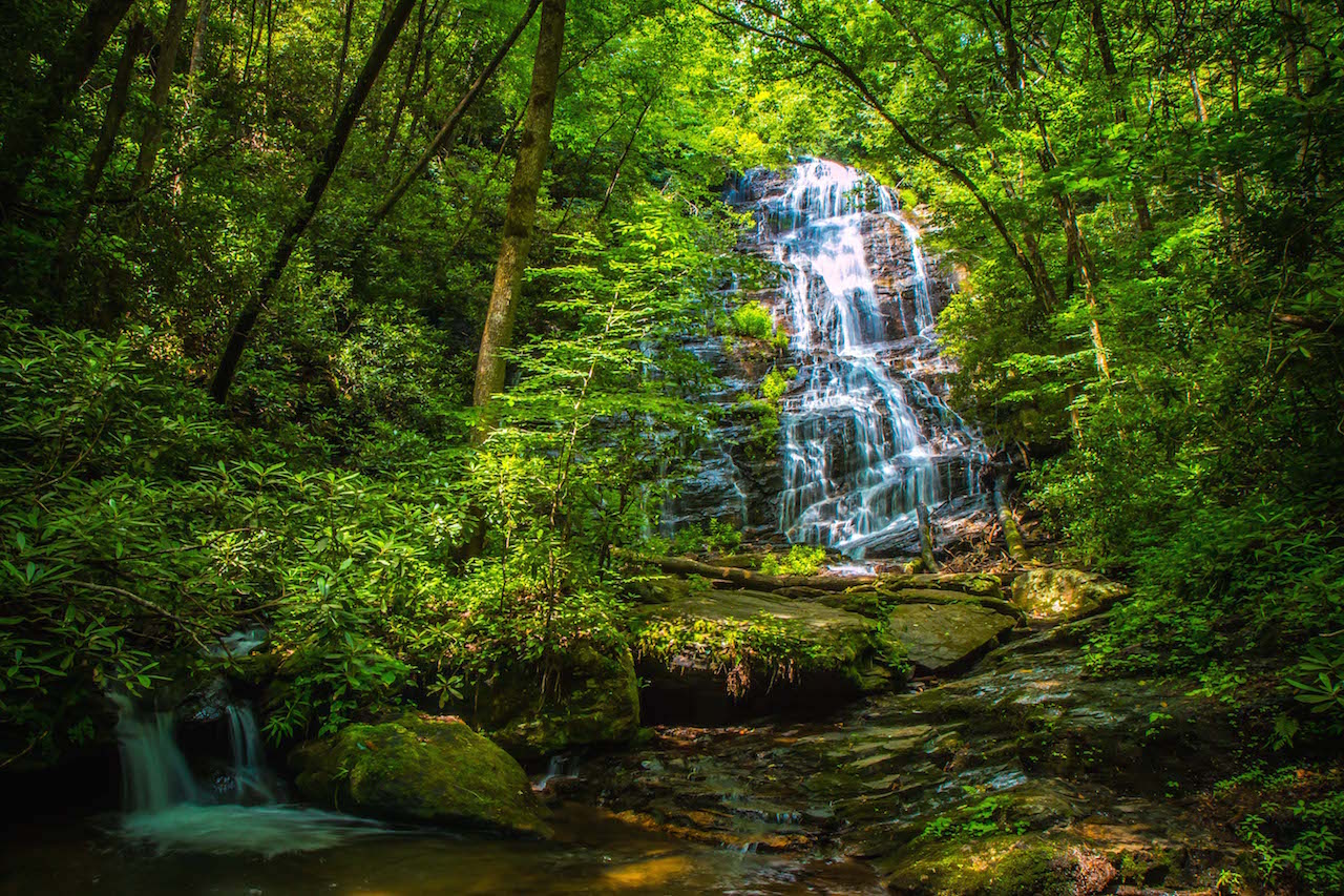
4. DeSoto Falls
Another stunning pair of waterfalls in Georgia, Desoto Falls is a sight of breathtaking natural beauty.
They’re also believed to be where Spanish explorer Hernando de Soto’s armor was found from his expedition in the 1500s.
The hike to the falls starts off at a parking area and follows a paved path to a wooden bridge across the rhododendron-lined banks of Frogtown Creek.
After the bridge, you’ll get your first sight of the rushing lower falls, reaching a wooden viewing platform at a 1/4-mile. You’ll cross one more wooden bridge before you reach the magnificent cascades of upper DeSoto Falls.
There’s a viewing platform where you can stop for a rest, picnic, or just savor the beauty of the nearly 80-foot falls. The round-trip hike will be approximately 2.2 miles.
Driving Directions to DeSoto Falls:
DeSoto Falls are located in Lumpkin County, in the Chattahoochee National Forest DeSoto Falls Scenic Area. From Dahlonega GA, drive north on GA9 /Morrison Moore Parkway for 13 miles, then turn left on to US 129 for 4 miles. Not long after passing the Walasi-yi Center/Mountain Crossings, you’ll see a left turn into the park.
READ MORE: The 15 Best Things to Do in Dahlonega GA & Lumpkin County
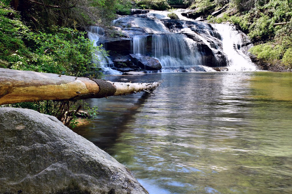
5. Dicks Creek Falls
One of two Dicks Creek Falls in North GA, this one is located near the Warwoman Wildlife Management Area in Clayton GA, near Black Rock Mountain State Park.
The relatively easy 1.2-mile hike follows a beautiful section of the Bartram Trail north to Dick’s Creek, which allows access to the Chattooga Wild & Scenic National Recreation Area.
This ranks right up there among the best of the 17 Rabun County waterfall hikes, with towering hardwoods above, the gurgling of Dicks Creek beside you, and stunning scenery all around (especially when the Fall colors peak).
After you pass the point where 3 of the best North GA hiking trails (the Bartram, Chatooga River, and Dicks Creek trails) intersect, you’ll reach the banks of the Chatooga.
The view that awaits you, overlooking the Chatooga basic from an elevated bluff, where the waterfall tumbles into one of America’s most picturesque rivers, is nothing short of jaw-dropping.
Driving Directions to Dicks Creek Falls:
From downtown Clayton, drive six miles east on Warwoman Road. Turn right onto Dick’s Creek Road/Sandy Ford Road. Go .5 miles, then take a left to cross the creek. Go 3.5 miles, cross a second ford and park at the Bartram Trail sign. Follow the trail north to Dick’s Creek.
READ MORE: The 15 Best Treehouse Rentals in the Georgia Mountains
6. Dukes Creek Falls
Dukes Creek Falls is a trio of beautiful waterfalls located just north of Helen GA, in the heart of North Georgia’s Blue Ridge region.
The hike to the falls departs at the Dukes Creek trailhead, where you can catch an excellent view of Yonah Mountain before embarking on your adventure.
The trail passes an ADA-accessible viewing platform and continues downhill on a series of stairs and platforms before reaching a junction.
Turn right to take a quick trip to the crystal-clear waters of Davis Creek, or continue on the main trail to reach a viewing platform.
From there you can admire the beauty of the waterfalls cascading from the cliffs high above… 150 feet high, to be exact!
After soaking in the breathtaking views, it’s a more laborious uphill climb back to the trailhead to complete the 2-mile round trip hike.
Driving Directions to Dukes Creek Falls:
From Downtown Helen, take GA-75 north for 1.5 miles. Turn left on GA-356 and take it for 2.3 miles to the Richard Russell Scenic Highway. Turn right and continue 2 miles to the Dukes Creek Falls trailhead and parking area.
READ MORE: The 15 Best North Georgia State Parks & Historic Sites
7. Emery Creek Falls
Hidden away in lush, deciduous forest, Emery Creek Falls is a remote pair of beautiful waterfalls located near the town of Ellijay GA.
Although more difficult than most hiking trails in north Georgia, the trek to Emery Creek Falls is well worth the effort.
Along the way you’ll get 20+ creek crossings, intriguing wildflowers, stellar views of the falls, and the bliss of being immersed in nature.
The adventure starts at a trailhead and follows a ridge, where you’ll reach the convergence of Emery and Holly Creek– the first and most difficult of the creek crossings.
Fair warning, the rocks can be extremely slippery here, and you probably will get wet!
At just over two miles, the trail reaches a signed intersection. Turn left to reach the lower falls, and then the hike continues along to the double cascades of the upper waterfall.
After you’ve taken in the serene views there, the hike turns outbound and is completed at about six miles.
Driving Directions to Emery Creek Falls:
From Downtown Ellijay, follow GA State Route 52 for just over 9 miles. Turn right onto Conasauga Road and continue straight when the road turns to gravel. In another 2.1 miles bear left on Old CCC Camp Road. In 2.8 miles, the parking area will be on the right at a switchback in the road.
READ MORE: The 15 Best Things to Do in Ellijay GA & Gilmer County
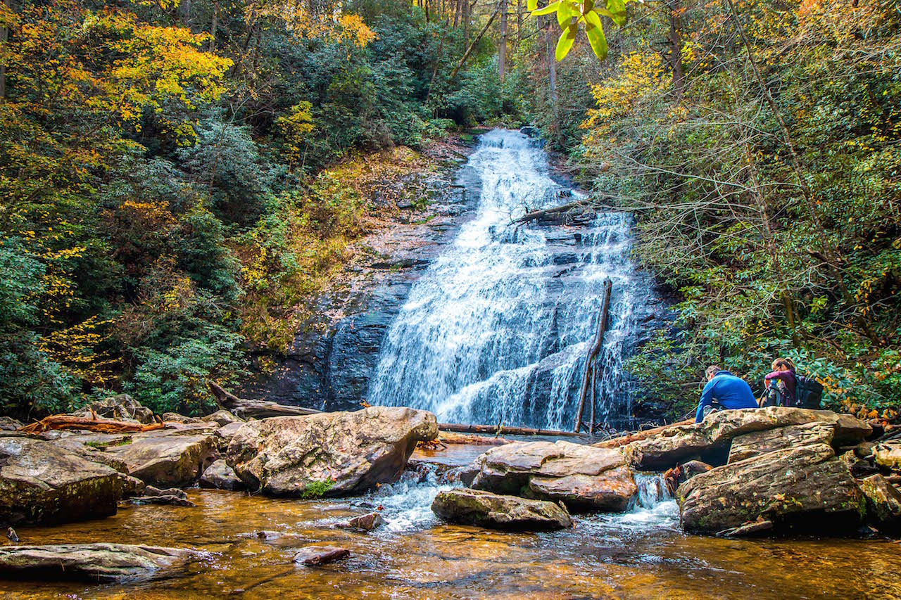
8. Helton Creek Falls
Tucked away in the Chattahoochee National Forest, Helton Creek Falls is a pair of beautiful falls near Blairsville.
At less than a mile, the hike to the mesmerizing cascades descends into the enveloping array of hardwood trees, rhododendron, and conifers.
The trail continues down a set of wooden stairs to the lower Helton Creek Falls, where the waterfall flows down into a crystalline pool of water.
Shortly after, the trail leads to a viewing platform where you can get a clear view of the upper falls situated along a huge rock outcrop. When you’re ready to make your way back, you can follow the trail back to the trailhead.
Driving Directions to Helton Creek Falls:
From downtown Blairsville, take US 19/129 south for 11 miles. Just after the entrance to Vogel State Park, turn left on Helton Creek Road. Continue for 2.2 miles to a small parking area, and the trailhead will be on your right.
READ MORE: The 15 Best Things to Do in Blairsville GA & Union County
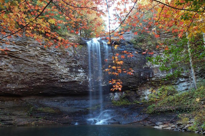
9. Hemlock Falls (Cloudland Canyon)
The Waterfalls Trail in Cloudland Canyon State Park is a relatively difficult hike compared to others on this list. But it’s well worth the trek thanks to two stunning North Georgia waterfalls– Cherokee Falls and Hemlock Falls.
To reach Hemlock Falls, the hike starts at the East Rim parking area and winds throughout the forest and a series of stairs.
Make sure to watch out for falling rocks, because the canyon walls will be right next to you throughout a good portion of the hike.
The trail will reach an intersection where you can turn left to visit Cherokee Falls, or continue through more stairs to reach a wooden viewing platform for Hemlock Falls.
Dropping over 90 feet, the falls tumble off a towering rock wall into the canyon floor, where large boulders sit along the placid stream.
Once you have taken in the beauty of the falls, the trail will loop around back to the trailhead, finishing at 2.1 miles.
Driving Directions to Cloudland Canyon:
From Ellijay, follow GA-382 W and GA-136 W to Cloudland Canyon Park Rd in Rising Fawn. Turn right onto Cloudland Canyon Park Rd, and the waterfall trail will be on your left near the state park cabins.
READ MORE: The 10 Best Things to Do in Summerville GA
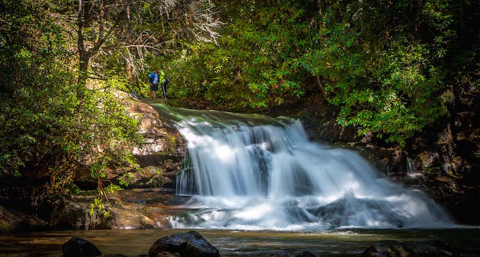
10. Hemlock Falls (Clayton)
Not to be confused with the Hemlock Falls at Cloudland Canyon, this easy 1.9-mile trek proved to be one of the most picturesque Georgia waterfall hikes we’ve ever done.
The in-and-out Hemlock Falls trail boasts several stunning cascades, pristine forest landscape, and just over 200 feet of elevation gain over the course of a mile.
The climb is both gorgeous and gradual, with excellent overviews of the rushing rapids of Moccasin Creek all along the way.
After the bridge crosses the creek at the 3/4-mile mark, look for a small-but-impressive waterfall off the side trail to your left.
There’s a nice rock outcropping here that makes it a great spot to catch a breather.
The picturesque upper Hemlock Falls makes this one of our favorite waterfall hikes in GA, with rhododendron up top and big rocks down below. Just get there early on weekends if you want to beat the crowds!
Driving Directions to Hemlock Falls:
From downtown Clayton, turn left onto US-76 W/E Savannah St and follow it for 10.8 miles. Turn left onto GA-197 S, and follow it for 3.7 miles. After you see Lake Burton and Moccasin Creek State Park on your left, take the next right onto Andersonville Ln. Park in the small lot on your left at the end of the gravel road.
READ MORE: The 20 Best Lakes in the North Georgia Mountains
11. Holcomb Creek Falls/Ammons Creek Falls
Located in the state of Georgia‘s northeast corner, Holcomb Creek Falls is a gorgeous waterfall with a nearly 150-foot drop.
To reach the stunning spectacle, there’s a 1.75-mile loop trail that features two great North GA waterfalls, Ammons Creek and Holcomb Creek Falls.
The moderate hike begins at the intersection of Hale Ridge Road and Overflow Road, then descends into a section of the Chattahoochee National Forest that’s filled with rhododendron and other wildflowers.
Along the way to the main falls, you’ll cross several small cascades. The trail will lead you straight to Holcomb Falls, and then loop back around to where you started.
Driving Directions to Holcomb Creek Falls:
From Clayton, take Warwoman Rd east for 10 miles. Take a left on FS Rd 7 and continue on for 9 miles. At the intersection with Overflow Creed RD (FS Rd 86), park on the east side. The trailhead is marked with a blue band around a tree and a rock engraved with Holcomb Creek Trail.
READ MORE: The 10 Best Campgrounds in North Georgia
12. Horse Trough Falls
If you’re looking for a remote, secluded waterfall that rarely attracts large crowds, the 60-foot-tall Horse Trough Falls (near Blairsville and Helen) offers excellent rewards for those willing to make the arduous trip to get there.
The hike itself is surprisingly short and very easy, with no incline. But the rugged 5-mile Forest Service Road to get there has large ruts and rocks and requires either a 4X4 or a patient, experienced driver.
The Horse Trough Falls trailhead located in the back of the Upper Chattahoochee River Campgrounds, which reopened in October 2021 after being closed for 3 years.
Note that the campground will likely be locked from early November through mid-March. But even if the gate for cars is closed, you can still visit the waterfalls all year round.
Simply park outside the gate and walk through the campground to find the trail at the very back.
Note that this option will add around a half-mile to the hike each way, but it’s still an easy hike to a spectacular waterfall!
Driving Directions to Horsetrough Falls:
From downtown Helen, take GA75 North for 8 miles to Unicoi Gap, then make a left turn onto FS Road 44 (Wilkes Creek Rd). You’ll see the Mark Trail Wilderness sign at the entrance. Follow that road for 4.5 miles to a sharp curve and take the right fork, where you’ll find the Upper Chattahoochee River Campgrounds parking area.
READ MORE: The 15 Best Restaurants in Helen GA for Breakfast, Lunch & Dinner
13. Jacks River Falls
Nestled in Georgia’s Cohutta Wilderness (the largest wilderness area in North Georgia), Jacks River Falls is one of the most remote and strikingly beautiful Georgia waterfalls.
To reach the falls, you’ll have to embark on one of the more intense waterfall hikes in north Georgia– the 18-mile round-trip Jacks River Trail. Be prepared to get wet, because the hike features nearly 40 river crossings!
At mile 9, you’ll reach the crystal-clear water of Jacks River Falls, which spills over 80 feet into an open pool filled with rocks and lined with lush vegetation. From there, it’s 9 miles back to the Daily Gap trailhead.
If you’re looking for an easier hike, the Beech Bottom Trail is 4.5 miles downhill, and converges with the Jacks River Trail to lead you to the falls. Round-trip, it’s just over a 9-mile hike.
Driving Directions to Jacks River Falls:
From Atlanta, take Hwy 75 to Cartersville and exit North to Chatsworth on Hwy 411 towards Cisco, GA. Find Old Hwy 2 on the right and follow the road for 7 miles. When you see signs that point to Beech Bottom, turn right and cross a gravel road. The first right turn will be the Daily Gap trailhead. For the Beech Bottom Trailhead, keep going for 5 miles and you’ll see a parking area
READ MORE: The 15 Best North Georgia Mountains for Hiking
14. Long Creek Falls
There are hundreds of waterfalls in North Georgia to explore, with five located near Blue Ridge in Fannin County.
Long Creek Falls is arguably the most impressive and popular, despite its location on a remote forest service road along Noontootla Creek, which can be rough for small cars after recent rains.
Perhaps its popularity is due to the fact that the waterfall is on the Appalachian Trail near Three Forks, where the AT, Benton MacKaye, and Duncan Ridge Trails all come together.
The Long Creek Falls trail is moderately difficult and dog-friendly. The 2-mile out-and-back trek wanders through a gorgeous valley that runs along the creek, then climbs in elevation, with excellent views along the way.
This beloved Georgia waterfall falls 50 feet in two distinct drops, with the cascade surrounded by a forest filled with hemlock, rhododendron, and tulip poplar. It’s a great place for an afternoon picnic!
Driving Directions to Long Creek Falls:
From downtown Blue Ridge, follow Church St to Mineral Springs Rd and turn left. In one mile, turn right onto Aska Rd and follow it for 12.9 miles. Turn right and follow Newport Rd for 4.2 miles, then turn left onto Doublehead Gap Rd and .7 miles. Turn right onto Forest Srv Rd, which briefly becomes Noontootla Creek after 3.1 miles, then quickly turns back into Forest Srv Rd. The Long Creek Falls trailhead will be 2.2 miles further.
READ MORE: The 15 Best Blue Ridge Georgia Cabins to Rent
15. Minnehaha Falls
Minnehaha Falls is one of the most popular falls in north Georgia, and deservedly so.
We rank it as one of the best waterfalls to visit with kids because of the short, relatively easy hike. But the stunning beauty offers maximum payoff for minimal physical investment.
Departing from the Bear Gap trailhead (which is distinguished by a green diamond and the number 147), the hike travels near the rhododendron-lined banks of Lake Rabun and ascends a set of wooden stairs.
At just 0.2 miles you’ll reach a clearing where you can enjoy the dazzling, multi-tiered cascades of Minnehaha Falls. This gorgeous in-and-out hiking trail is less than half a mile in total!
Driving Directions to Minnehaha Falls:
From Clayton GA, head south on US 441 to Old US 441. Turn left on Lake Rabun Road. After you pass the first Rabun Beach Campground, turn left onto Flat Creek Road. Continue straight on Bear Gap Road for 1.5 miles to find a small parking area on your left.
READ MORE: The 20 Best Fall Fairs and Festivals in Georgia
16. Panther Falls/Angel Falls
Another great 2-for-1 hiking trail on one of the most beautiful lakes in Georgia, this 1.75-mile out-and-back trek takes waterfall chasers through a gorgeous forest filled with hemlock and rhododendron.
You can park for free along Lake Rabun Rd, which adds an extra mile or so to the trek, or pay $5 to park in the Lake Rabun Beach Campground lot.
Either way, the official trailhead starts off with a lovely cascade over a terraced rock ledge as you cross a wooden bridge over Joe Creek before climbing stone stairs deeper into the forest.
You’ll reach Panther Falls– easily the more impressive of the two– at the 0.6-mile mark, and it’s worth taking a break here to have a drink and snack and snap a few photos.
Then comes the trail’s most challenging section, with switchbacks and an incline steep enough to require handrails.
But it’s worth it when you reach the viewing platform for Angel Falls at the top.
Driving Directions to Panther/Angel Falls:
From downtown Clayton GA, head south on US-23 S/US-441 S for 5.9 miles. Turn right on the Wiley Connector for .1 mile, then left onto S Main St/Old 441 S. Follow Old 441 S for 1.5 miles, then continue straight onto Lake Rabun Rd for 4.5 miles, where you’ll see a small free parking on the right hand side.
READ MORE: Appalachian Folklore, Monsters and Superstitions
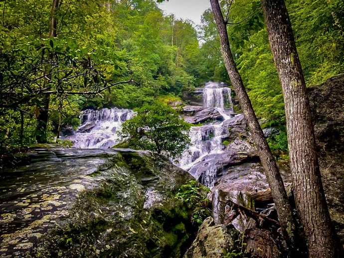
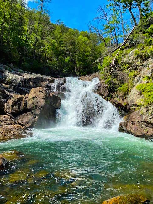
17. Panther Creek Falls
One of the most breathtaking North GA waterfalls, Panther Creek Falls is located near Clarkesville in the beautiful Chattahoochee National Forest.
Recently reopened to intermediate and experienced hikers only (due to storm damage to the trail), the 7-mile hike is great for backpacking trips, with backcountry campsites that are open on a first-come basis.
The trail follows Panther Creek downstream, crosses the creek, and begins to narrow before veering left and reaching a series of impressive waterfalls.
You’ll begin to hear the roaring sound of water before you reach the upper part of Panther Creek Falls.
Continue along the trail to the sandy shores at the base of the falls, where you can swim and admire the gorgeous scenery.
When you’re ready to go back, all you have to do is follow the trail in reverse.
Driving Directions to Panther Creek Falls:
From Tallulah Falls GA, take US 23/441 south. After 3 miles, turn right on Historic 441 to reach the Panther Creek Recreation Area on the right.
READ MORE: Visiting the Expedition Bigfoot Museum (aka Sasquatch Museum)
18. Raven Cliff Falls
With a background of towering hardwood trees, verdant moss, and banks lined with vibrant wildflowers, Raven Cliff Falls is one of the most gorgeous waterfalls in North GA.
To reach the falls, you can take the Raven Cliff Trail, one of Georgia’s most popular and beloved hiking trails with waterfalls.
The adventure begins at a gravel trailhead and follows Dodd Creek upstream.
After crossing the creek on a wooden bridge, the trail continues through the forest, crossing small streams and side paths leading to smaller cascades.
A little over 2 miles in, you’ll reach Raven Cliff Falls. After taking in the breathtaking sight of the 40-foot falls, the hike follows Dodd Creek back downstream to the trailhead, completing the hike at just under 5 miles.
Driving Directions to Raven Cliff Falls:
From Helen, GA, take GA 75 North for 1.5 miles and turn left on FA 356 (75 Alternate). Continue for 2.3 miles to the Richard Russell Scenic Highway and turn right. After 2.8 miles, you will see the trailhead and parking area.
READ MORE: Non-Venomous vs Venomous Snakes In Georgia (Identification Guide)
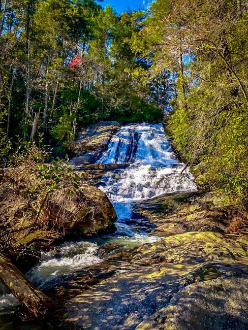
19. Sea Creek Falls
The 30-foot-tall Sea Creek Falls is located in the Coopers Creek Recreation Area near Suches GA, and can be reached by an easy half-mile, in-and-out trail.
The relatively flat trail follows alongside Sea Creek. Note that the path get quite muddy after heavy rains, so it’s smart to wear grippy hiking shoes for this one.
The gorgeous waterfall flows into a shallow pool that’s great to splash around in and cool off during warmer months.
While this Blue Ridge GA waterfall tends to be very popular in summer, it’s particularly striking in late winter or spring, when the water flow tends to be much stronger.
Driving Directions to Sea Creek Falls
From Blue Ridge GA, follow Old US 76 east 5 miles to the intersection with GA 60 South. Continue 14.7 miles south on GA 60 through Morganton, past the entrance to Deep Hole Recreation Area, to the junction with FS 4 on left.
Follow FS 4 an additional 3.0 miles to a right-hand curve in the road just inside the U.S. Forest Service boundary.
Turn left on FS 264, the road just before the curve. Park in the area at the end of this spur (about .3 mile).
READ MORE: The 15 Best Wineries in the North Georgia Mountains

20. Tallulah Falls
The Tallulah Gorge is a 2-mile long, 1,000-foot deep chasm formed over millions of years by the Tallulah River. Offering some of the best hiking in North Georgia, Tallulah Gorge State Park promises an unforgettable adventure.
Tallulah Gorge’s Hurricane Falls Trail is one of the most popular hiking trails with waterfalls in this region.
The two-mile hike offers a chance to explore the north and south rims of Tallulah Gorge, encompasses 10 overlooks with jaw-dropping views, and visit the massive Hurricane Falls.
Another great hike is the 3.4-mile Sliding Rock Trail, which gives you an up-close look at the Bridal View waterfall.
For this hike, you need to get a permit. They’re free, but limited to just 100 per day, so get to the park early!
For a bird’s-eye view of the Tallulah Falls waterfalls from the canyon’s rim, you can also try the 2.5-mile North Rim & South Rim Trails.
Driving Directions to Tallulah Gorge:
From Atlanta, take I-85 North to I-985, which will turn into 365. From there, take Hwy 441 North to Tallulah Gorge. Depending on which area you want to visit in the Georgia State park, you can follow various signs that will direct you.
READ MORE: The 20 Best Hiking Trails in North Georgia Bucket List
21. Toccoa Falls
One of the best waterfalls in North Georgia (and one of the tallest free-falling cascades east of the Mississippi River), Toccoa Falls is a magnificent sight to see.
Located on the campus of Toccoa Falls College in the foothills of the Blue Ridge Mountains, these falls are privately owned, but are open to the public.
The ADA-accessible hike to Toccoa Falls is more like a short walk– just 100 yards away from the visitor center and gift shop.
The trail starts on asphalt and ends with gravel when you get up close to the 186-foot-tall falls (that’s 19 feet taller than Niagara Falls)!
The towering waterfall plummets into a stream that flows throughout the 1,000-acre campus.
Driving Directions to Toccoa Falls:
Get on Highway 17 north of Toccoa GA. Follow the signs to the campus of Toccoa Falls College. Drive to the back area of the visitor center to find a parking area.
READ MORE: The 40 Best North Georgia Cabins to Rent
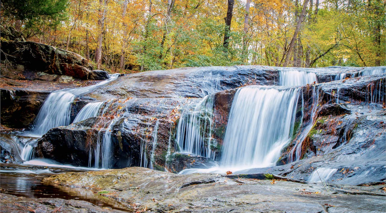
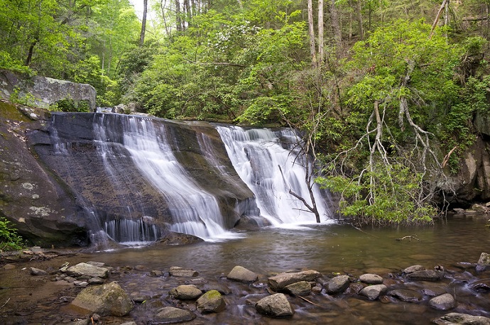
23. Toonigh Creek Falls (a.k.a. Allatoona Falls)
Commonly known as Allatoona Falls or Toonigh Creek Falls, this beautiful 20-foot waterfall is located near the mouth of Toonigh Creek, where it spills into Lake Allatoona.
It can be accessed from Olde Rope Mill Park in Woodstock GA, where you can either choose the water route in a kayak or take an unofficial 3-mile round-trip hiking trail.
The trail starts at the park, crossing the Little River bridge before heading north for 0.3 miles. Turn left and follow a broad road under the I-575 overpass, which leads to a well-worn path along the Little River.
Follow the sounds of the waterfall to your left and you’ll reach the falls at around 1.5 miles. When you’re ready to head back, just follow the path back the way you came.
Driving Directions to Allatoona Falls:
Take I-75 North to I-575 North, and take it for approximately 10 miles to exit 9. Turn right onto Ridgewalk Parkway, then get into the left lane and make a quick turn onto Olde Rope Mill Park Rd. The parking lots are located at the very bottom of the hill.
READ MORE: Exploring Olde Rope Mill Park & Allatoona Falls in Woodstock GA
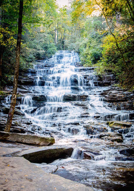
24. Trahlyta Falls
Located in Vogel State Park, one of Georgia’s oldest state parks, Trahlyta Falls is a 110-foot-tall cascading waterfall surrounded by the Chattahoochee National Forest.
The Trahlyta Lake Trail hike begins near the Vogel State Park Visitors Center and sets off into the forest, crossing over a wooden boardwalk.
It continues onto an earthen dam where you can see Trahlyta Lake and, if the water is calm, the reflection of the majestic Blood Mountain.
Descending a set of wooden stairs, you’ll reach a large viewing platform where you will be incredibly close to the rushing cascades of Trahlyta Falls.
When you’ve finished taking in the wonder of the falls, the gentle trail retraces its steps around the lake to the trailhead, completing the hike at a little over a mile.
Driving Directions to Vogel State Park:
From Blairsville GA, take US 19/129 south for 11 miles and turn right into Vogel State Park. You can park on the south end of Lake Trahlyta, but will have to walk to reach the falls on the north side of the mountain lake.
READ MORE: The 10 Best Restaurants in Blairsville GA for Foodies
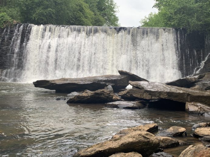
25. Vickery Creek Falls
If you’re looking for an awesome waterfall that makes for an easy day trip from Atlanta, Vickery Creek Falls at the Roswell Mill makes for an excellent excursion.
A longtime favorite of Atlanta locals, the trail leads you along the banks of Vickery Creek to the ruins of the Roswell Manufacturing Company Mills.
Built in the late 1830s and 1850s, the mill was burned by Union forces during the Civil War. They were eventually rebuilt, only to be destroyed again by fire in 1926.
The waterfall you’ll see is man-made, created when the creek was dammed to provide hydroelectric power.
If you just want to get to the waterfall and back, the trail is less than a mile round-trip. This is a great place for a picnic, a swim during the warm summer months, or you can just enjoy the rich history of the area.
Driving Directions to Vickery Creek Falls
From metro Atlanta, head north on GA-400 to exit 6, Northridge Rd. Turn right, following signs for Roswell Road/Dunwoody Place and merging onto Dunwoody Place. In 1.2 miles, turn right onto GA-9/Roswell Rd, then take another right in 1.7 miles onto Mill St to reach the Vickery Creek Trail parking lot. -by Christina Maggitas, with additional reporting by Bret Love; lead photo of DeSoto Falls by Jason Dominy

Comments are closed.