Great Smoky Mountains National Park is so studded with outstanding attractions (including myriad hiking trails and waterfalls), it can be difficult to know which ones to prioritize during your visit.
From hiking to the top of Clingman’s Dome and spotting the Cataloochee Valley Elk to visiting Mingus Mill and exploring the Mountain Farm Museum at the Oconaluftee Visitor Center, you could easily spend a week there.
When my husband and I decided to explore the Smoky Mountains, it didn’t take long for Mingo Falls in Cherokee NC to make the top of our must-do list.
Wherever we travel, visiting North Carolina waterfalls tends to take up a good portion of our itinerary. And the stunning Mingo Falls Trail did not disappoint.
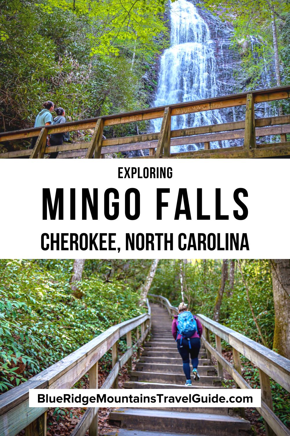
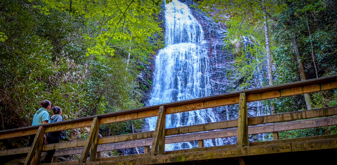
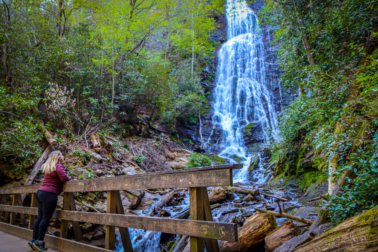
The 0.4-mile trail is a gem of a short hike to the base of the falls, where you’ll find a spacious viewing deck dotted with folks taking and posing for photos.
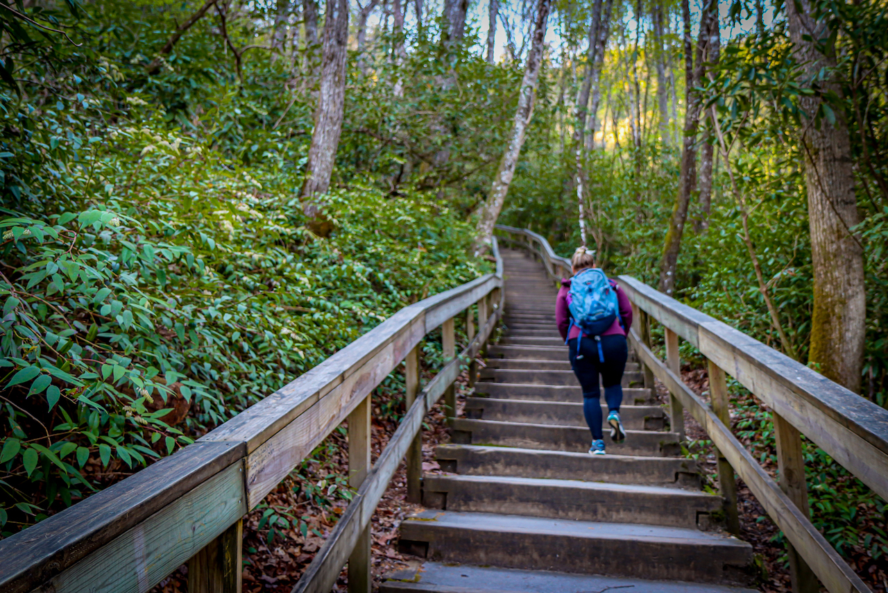
Despite its brevity, the Mingo Falls Trail is rated as moderately difficult due to the stairs— all 160 of them! Sometimes the monotony of stairs can make it more tiring to ascend, but it really is worth climbing 16 flights.
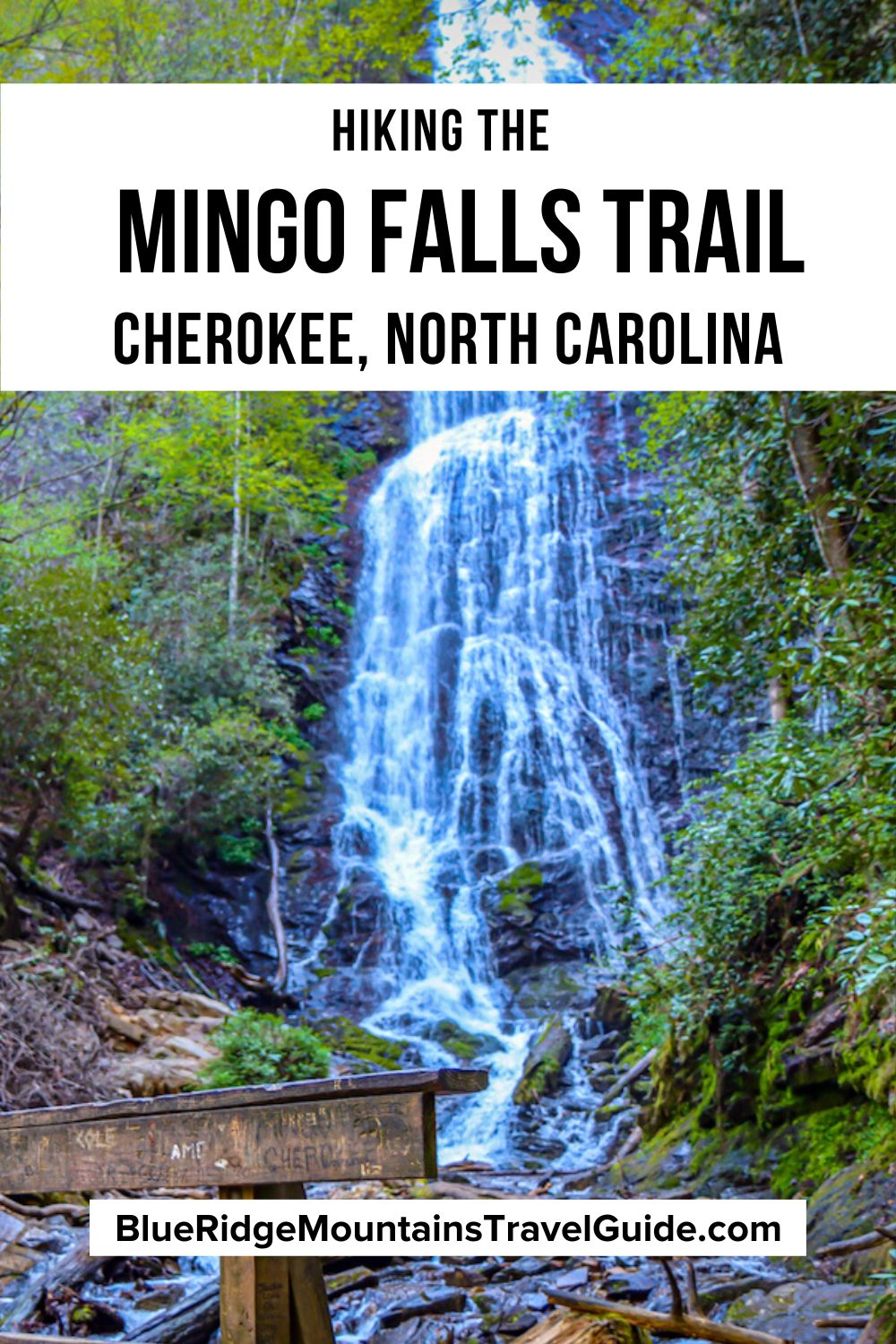
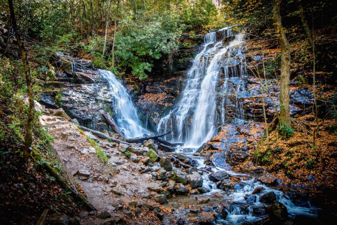
The 120-foot-tall Mingo Falls is one of the most impressive Cherokee waterfalls. It’s located on the Eastern Cherokee Reservation, which is a land full of fanciful legends and tragic history.
Learning about traditional Cherokee culture at the Museum of the Cherokee Indian was an important prelude to visiting Mingo Falls and other waterfalls near Cherokee NC.
Read on for our guide to hiking the Mingo Falls Trail, including driving directions, an overview of the trail, and other fun things to do in Cherokee NC.
Mingo Falls NC Info
ADDRESS: Eastern Cherokee Reservation, Cherokee NC, 28719
PHONE: (828) 497-1904 (Oconaluftee Visitor Center)
COST OF ENTRY: Free (including free parking)
HOURS: Always open
PARKING: Room for about 6 cars
Directions from Asheville NC
To get to Mingo Falls, head out of Asheville on the I-240 West. In 1.7 miles, keep right at the fork to continue onto I-26 E. In 3.2 miles, take exit 31B to merge ont I-40 W.
After 18.3 miles, stay in the right 2 lanes to take exit 27 US-74 toward US-19/US 23/Clyde/Waynesville/Maggie Valley/Franklin/MurphyAtlanta.
In about 4 miles, take exit 103 onto US-19 toward Maggie Valley/Cherokee. In 0.4 miles, continue onto US-19 S/Dellwood Rd/Dellwood City Rd. Then, in 4.8 miles, continue straight onto US-19 S/Soco Rd.
Stay on this road for 18.9 miles before turning right onto Acquoni Rd. In 0.6 miles you’ll come to a traffic circle. Continue straight at the traffic circle to stay on Acquoni Rd.
In 1.1 miles, turn right onto Big Cove Road and continue for 3.5 miles before turning right onto Sherrill Cove Rd. After another 1.4 miles, turn right onto Mingo Falls Bridge Rd.
Directions from Downtown Cherokee NC
Mingo Falls is less than a 15-minute drive away from downtown Cherokee NC.
From downtown Cherokee, head north on US-441 N/Tsali Blvd toward Nickeh Dr. In 0.6 miles, turn right onto Drama Road. When you come to a traffic circle, take the 3rd exit onto Acquoni Rd.
In 1.1 miles, turn right onto Big Cove Road and continue for 3.5 miles before turning right onto Sherrill Cove Rd. After another 1.4 miles, turn right onto Mingo Falls Bridge Rd.
READ MORE: The 15 Best Cabins in Cherokee NC for Rent
Mingo Falls History
This waterfall is also referred to as Big Bear Falls, because Mingo means “Big Bear” in the Cherokee language.
Mingo Falls in Cherokee, North Carolina is located within the Qualla Boundary, a land trust held by the U.S. government on behalf of the federally recognized Eastern Band of Cherokee Indians.
The Qualla Boundary is just a small part of a much larger expanse of land in the Blue Ridge Mountains that was home to the Cherokee people for some 12,000 years.
When the gold rush brought thousands of prospectors to the states of North Carolina and Georgia in the early 1800s, the government wanted to take land from the indigenous people to give to white settlers.
After the passage of the Indian Removal Act in 1830 and the signing of the Treaty of New Echota in 1835, the Cherokee Indians were sent west along the tragic Trail of Tears.
Many of the native people died along the arduous 5,043-mile journey.
The Eastern Band of Cherokee Indians ultimately purchased the land that is now the Qualla Boundary from the U.S. government in the 1870s, and it was later put into a land trust.
READ MORE: The 15 Best Things to Do in Cherokee NC & the Qualla Boundary
Hiking the Mingo Falls Trail
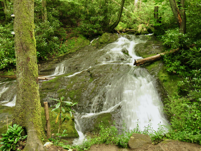
Mingo Falls NC is one of the tallest waterfalls in the southern Appalachian Mountains, so making the effort to reach it is incredibly rewarding.
To reach Mingo Falls, you’ll actually take the Pigeon Creek Trail, which is located by the Mingo Falls Campgrounds.
The trailhead has its own parking lot, with room for about six cars. Between the limited parking and the popularity of this trail, we strongly recommend visiting Mingo Falls earlier on in the day.
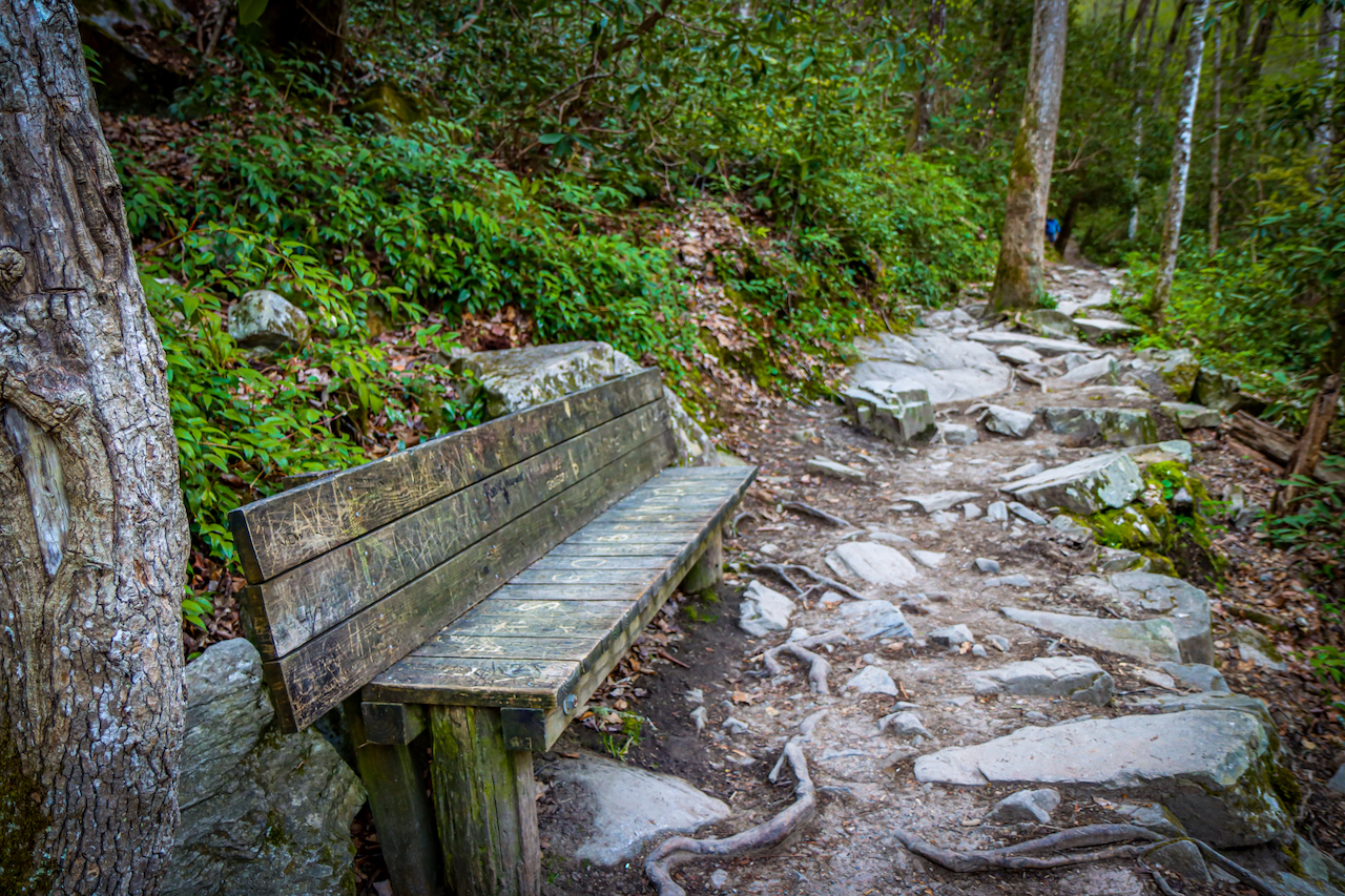
Although the 0.4-mile Mingo Falls trail is pretty short, there are a daunting 160 steps to contend with before the terrain flattens out and creeps around a dramatic rock outcropping.
Finally, you’ll be rewarded with a perfect view of the 120-foot falls from a wooden bridge right at its base.
Assuming you don’t have any issues with climbing stairs, the whole trip can be done in under an hour, including plenty of time for taking spectacular Mingo Falls photos and soaking in the stunning views.
The rushing cascade plunges the down the moss-covered rocks on the cliffside, then passes under the bridge and continues into Mingo Creek.
Note that heavy rain can make the stairs ands bridge pretty slick, but it can also make for an even more intense experience of the falls.
READ MORE: The 15 Best Cabin Rentals in Bryson City NC
Mingo Falls Campgrounds
According to its Facebook page, the beloved Mingo Falls Campground has closed down permanently.
It’s unfortunate, because it was always a great camping spot right next to the creek, not to mention an important landmark for finding the Mingo Falls Trailhead.
However, there are a few nearby campgrounds that will keep you close to all the NC Smoky Mountains action.
The Stoney Campground is a great spot just a stone’s throw away (1.4 miles) from Mingo Falls, offering lots of full-hookup RV and tent sites to choose from.
The Standing Deer Campground and Welch Family Campground are even closer– within a half-mile of the Mingo Falls parking lot.
The Smokemont Campground is a little further out, but just 3 miles north of the Oconaluftee Visitor Center.
This is a perfect central location for all of your Great Smoky Mountains adventures. It also offers great access to hiking trails to some of our favorite Western North Carolina waterfalls.
There are also several nearby campgrounds in Bryson City NC.
READ MORE: The 15 Best Great Smoky Mountains Campgrounds to Visit
Other Waterfalls Near Mingo Falls
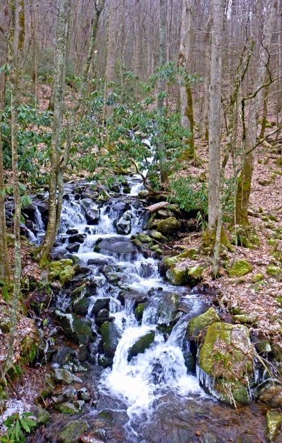
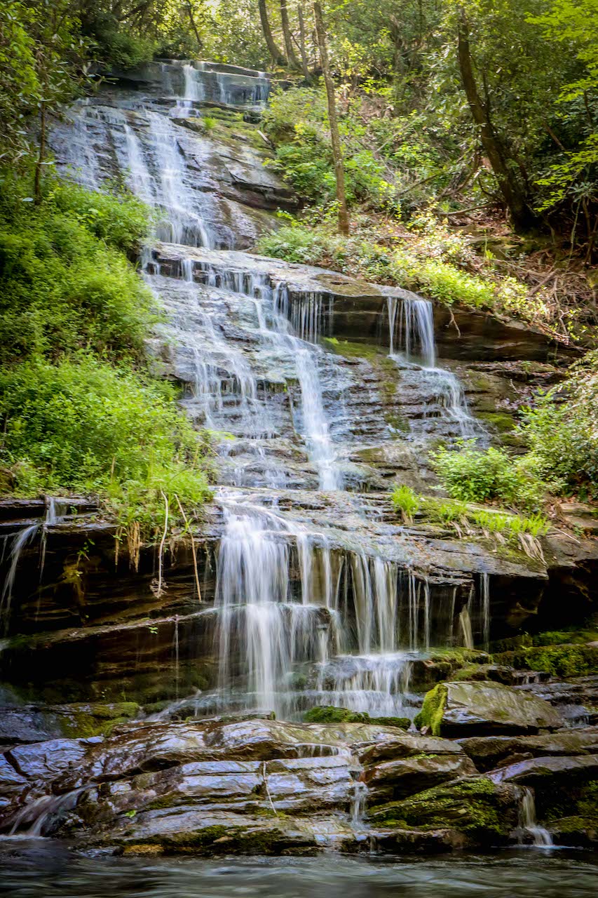
Chasteen Creek Cascade
The Smokemont Campground is where you’ll find the trailhead that leads to the Chasteen Creek Cascade.
At the far end of the campground, head out along the Bradley Fork Trail for about 1.7 miles before turning right onto the Chasteen Creek Trail.
This is about a 3.6-mile in-and-out hike, with lots of colorful North Carolina wildflowers along the way.
Once you’re on the Chasteen Creek Trail, you’ll come to a horse-hitching post, after which you’ll reach the side trail to the cascades.
READ MORE: The 25 Best Blue Ridge Parkway Waterfalls in North Carolina
Cliff Branch Falls
Cliff Branch Falls is one of those lovely little waterfalls that can be viewed right from the roadside, without even having to hike.
As you’re leaving the Oconaluftee Visitor Center, turn right onto US-441 N and travel for 6.4 miles, heading towards Newfound Gap.
The waterfall will be on your left, emerging from a lush forest thick with rhododendron before tumbling down into a small pool at the bottom.
READ MORE: The 15 Best Bryson City Restaurants for Breakfast, Lunch & Dinner
Soco Falls
Soco Falls is located about 17 miles east of Mingo Falls, on the edge of the Cherokee Indian Reservation between the North Carolina mountain towns of Cherokee and Maggie Valley.
From the parking lot on Highway 19, you can hear the falls calling you. It’s just a short walk to an observation deck that allows you to view the taller of the two waterfalls.
During the Winter, the bare branches of the trees give you a great glimpse of the smaller cascade on the left.
If you’re sure-footed, you can get a closer look by making your way down to the base of the two falls.
But note that this involves hanging on to ropes and navigating slick, relatively steep terrain.
READ MORE: 10 Best Cherokee NC Restaurants for Breakfast, Lunch & Dinner
Indian Creek Falls and Tom Branch Falls
Head 9 miles west of downtown Cherokee and you can see 3 waterfalls on the Deep Creek Trail during one easy 1.6-mile hike.
Follow the wide, flat path of the Deep Creek Trail and you’ll soon spot Tom Branch Falls to your right. It’s especially convenient for those pushing baby carriages, or anyone who just isn’t a fan of hiking.
Continue further along the trail to the junction with the Indian Creek Trail and turn right. From there, it’s just 200 feet more to view the gorgeous 25-foot waterfall.
This creek is also a favorite spot for fishing and river tubing in the North Carolina mountains.
As you approach the trailheads just past the Deep Creek Campground, you’ll see a number of outlets that rent out tubes, including Deep Creek Creekside Tubing.
READ MORE: 20 Best Things to Do in Bryson City NC & Swain County
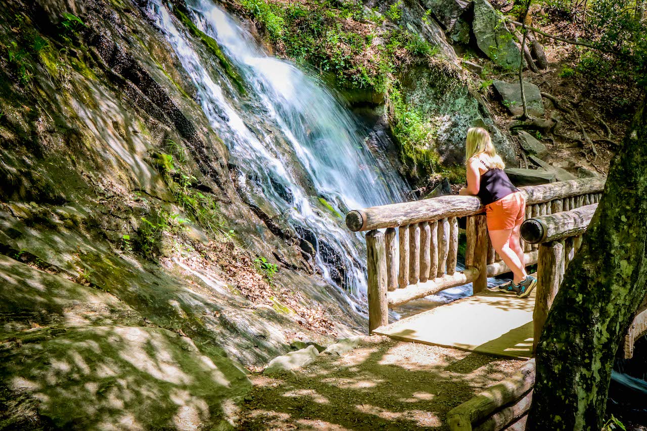
Juney Whank Falls
If you’re feeling adventurous, you can also see Juney Whank Falls while you’re exploring Deep Creek.
The two tiers of this waterfall make up a 90-foot drop, and can be viewed from a small observation bridge.
This trail is just 0.8 miles round-trip, but it’s considered moderate because there are some steep, slippery parts. So it should only be attempted if you’re fairly steady on your feet.
The Juney Whank Falls trail is a loop that attaches to the Deep Creek Trail, making it easy to see Tom Branch and Indian Creek Falls, too. -by Emma Gallagher; all photos by Bret Love and Mary Gabbett unless otherwise noted