
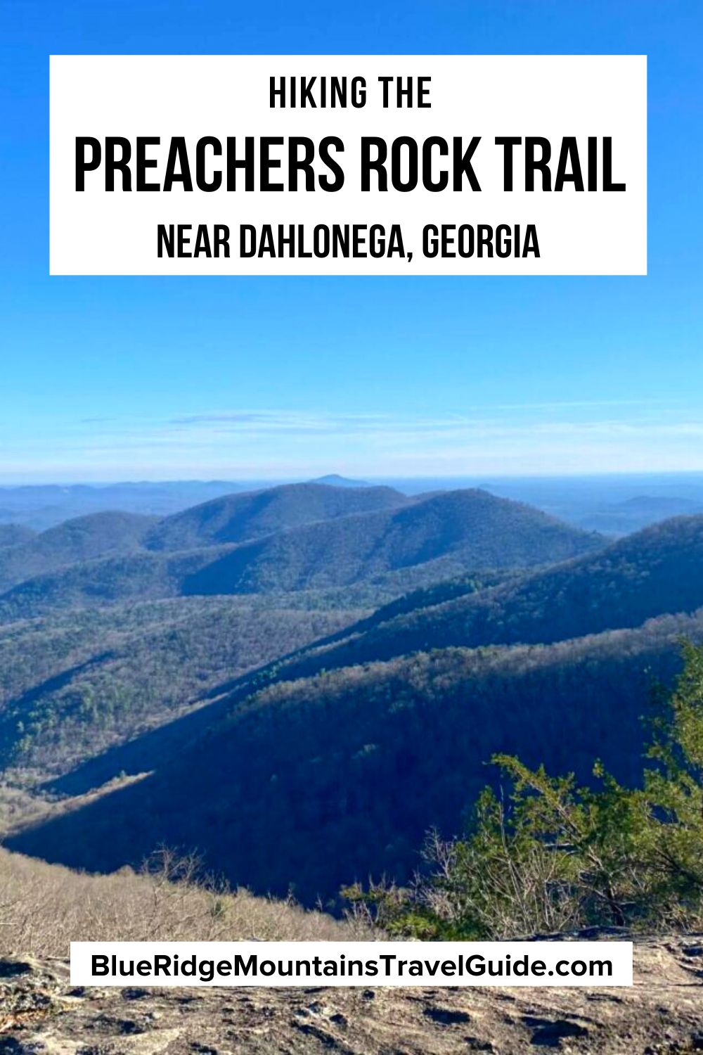
One of the most popular places on our Best Hiking Trails in North Georgia Bucket List, the Preachers Rock Trail is located approximately 18 miles north of Dahlonega GA.
The 2-mile trek from Woody Gap to Preachers Rock is part of the Appalachian Trail, with the trailhead less than 2 miles from the small town of Suches.
The Preachers Rock hike is long enough to be considered a “real hike,” but short and easy enough to be accomplished by most able-bodied people.
Reaching an elevation around 3,600 feet, it offers some of the most impressive views of the Blue Ridge Mountains that can be accessed by a short day trip from Atlanta.
Read on for our guide to hiking the Preachers Rock Trail, including some history of the area, an overview of the hiking trail, and driving directions from metro Atlanta.
READ MORE: The 20 Best Hiking Trails In Atlanta GA (& Hikes Near Atlanta)
The History of Preachers Rock
Preachers Rock is a large rock outcropping near the summit of Big Cedar Mountain, with a trailhead at Woody Gap. The closest Blue Ridge Mountain towns include Dahlonega to the south, and Suches to the northwest.
Woody Gap is named after conservation icon Arthur Woody, who was born in Suches in 1884 and served as a U.S. Forest Service ranger from 1912 to 1945.
He was instrumental in the land acquisition that became the Chattahoochee National Forest, and he helped plot out the path of the Appalachian Trail through his district.
Woody also built lakes and fire towers, brought roads to the area, built the Woody Gap School in Suches, and did a lot to help the Appalachian people of Georgia during the Great Depression.
Known as the “Barefoot Ranger,” Woody was a revered steward of wildlife. He’s widely credited with repopulating white-tailed deer and trout in the North Georgia mountains after poor land usage led both species into severe decline.
The name Preachers Rock comes from Joe “Bear” Lunsford, a local farmer and minister who’d hike up to the rock outcropping on Big Cedar Mountain to practice his sermons.
Other common names (misnomers, really) for the popular spot include Pulpit Rock, Preaching Rock, and Preacher Rock.
We can thank Pastor Lunsford and Arthur Woody for the road over Woody Gap.
Woody’s initial request to build a road through this part of his Blue Ridge Ranger District was denied, because federal funds were only dedicated to improve roads.
This prompted the Ranger and his friends to carve a rough “road” through the gap by repeatedly driving through it.
The first automobile passed through Woody Gap in 1925, carrying Joe Lunsford and Arthur Woody’s son, Walter. Only then was the road approved for improvement by federal authorities.
READ MORE: The 15 Best Cabin Rentals in Dahlonega GA

Getting to the Preachers Rock Trailhead
Preachers Rock is one of my favorite Dahlonega hiking trails. Getting there from metro Atlanta will likely include passing by a large rock pile in the middle of a roundabout on GA Highway 60.
Cherokee legend acknowledges this rock pile as the site of the grave of a Cherokee Indian princess named Trahlyta. So people will commonly leave stones and pebbles at the site for good luck.
Trahlyta (for whom Trahlyta Lake and Trahlyta Falls at Vogel State Park in Blairsville GA were named) is said to have lived in the vicinity of Big Cedar Mountain.
I always drive slowly and let my kids throw a small rock out the window when we go past Trahlyta’s grave. But the drive from there to the Preachers Rock trailhead at Woody Gap is not as fun for them.
In fact, the back seat passengers in my family generally encounter car sickness as the twisting and climbing of the winding roads take us higher into the North Georgia Mountains.
Luckily, there’s a pull-off at the Chestatee Overlook that’s perfectly placed for anyone who needs a stop for fresh air.
You’ll know you’ve arrived at Woody Gap when the road passes between two parking lots. The parking lot to the south has a sign reading “Chattahoochee National Forest Woody Gap,” with a trail going downhill and a nice view.
The parking lot to the north will have a Smokey the Bear sign, a building for pit toilets, and two trails going uphill. Park on the north side to easily access the hiking trail to Preachers Rock.
READ MORE: The 20 Best Things to Do in Dahlonega GA & Lumpkin County
Hiking the Preachers Rock Trail
If you’re exploring the mountains around Dahlonega, Preachers Rock is a must-see because it offers one of the most accessible vistas on the Appalachian Trail in Georgia. From the north parking lot, the hike is a mere 1.1 miles.
I love it because I can leave my metro Atlanta house in the morning, hike to the summit to catch the sunrise, and still be home in time to catch my son’s soccer game at 9:30AM!
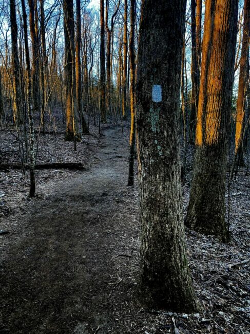
When you arrive, you’ll see two hiking trails: The one on the left has a Blue blaze and leads to a water source. The one on the right has a White blaze, which indicates that it’s part of the Appalachian Trail.
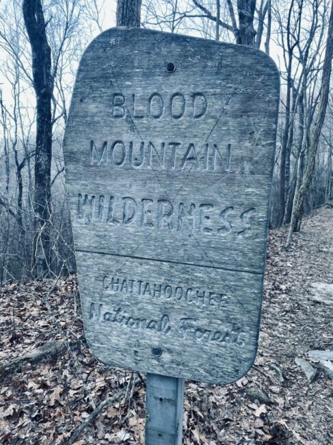
Following the white blazes will take you past a wooden sign for the Blood Mountain Wilderness and several signs listing distances several popular places on the Appalachian Trail, including Jarrard Gap, Neels Gap, and Blood Mountain.
The first half-mile of the Preachers Rock Trail is easy and wide, with lots of roots but minimal incline. This is a very popular day-hike, so the trail may be crowded, especially on weekends.
After a 1/2-mile, the trail drops through Lunsford Gap, and soon passes by a short trail leading to a single primitive camping site (one of the few campgrounds in this area).
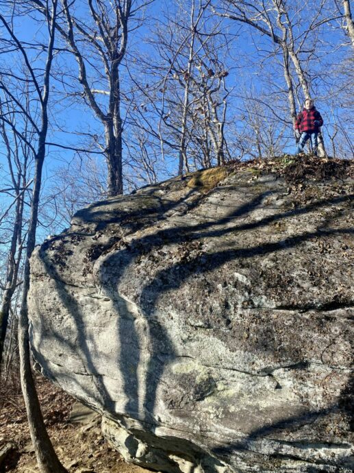
The last 1/4-mile to the Preachers Rock overlook is an aggressive climb, with around 8 switchbacks as it ascends 300 feet in a very short distance.
This final section of the trail is very narrow, rocky, and full of boulders, which can be very slippery when it rains.
Navigating it feels like a winding stone staircase, but there are two small outcrops along the way to the top that provide a preview of the stunning view at the summit.
The Preachers Rock summit can get a little crowded on peak weekends, but these smaller outcroppings offer a nice private place to sit and commune with nature.
READ MORE: The 7 Best Restaurants in Dahlonega GA for Foodies
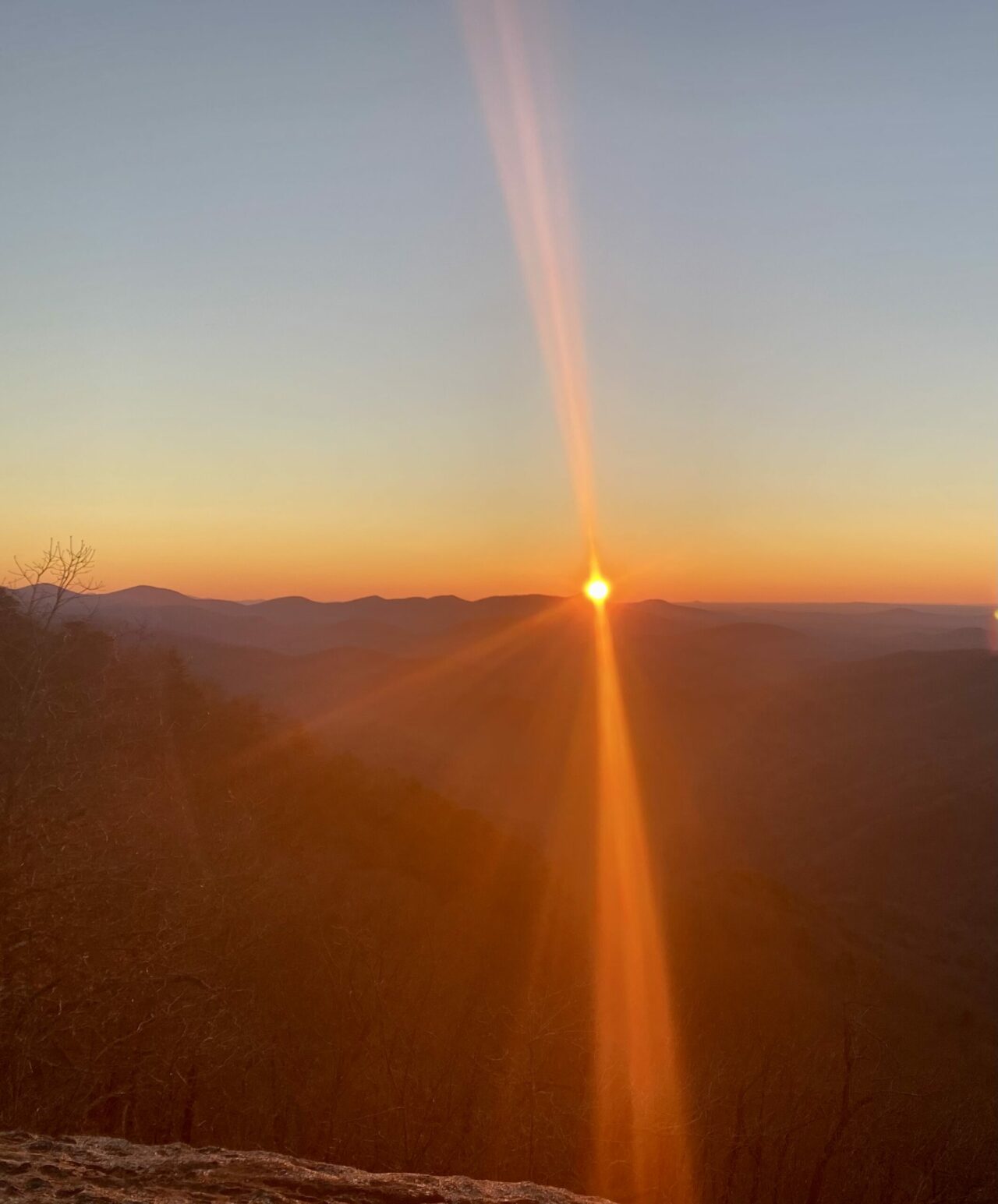
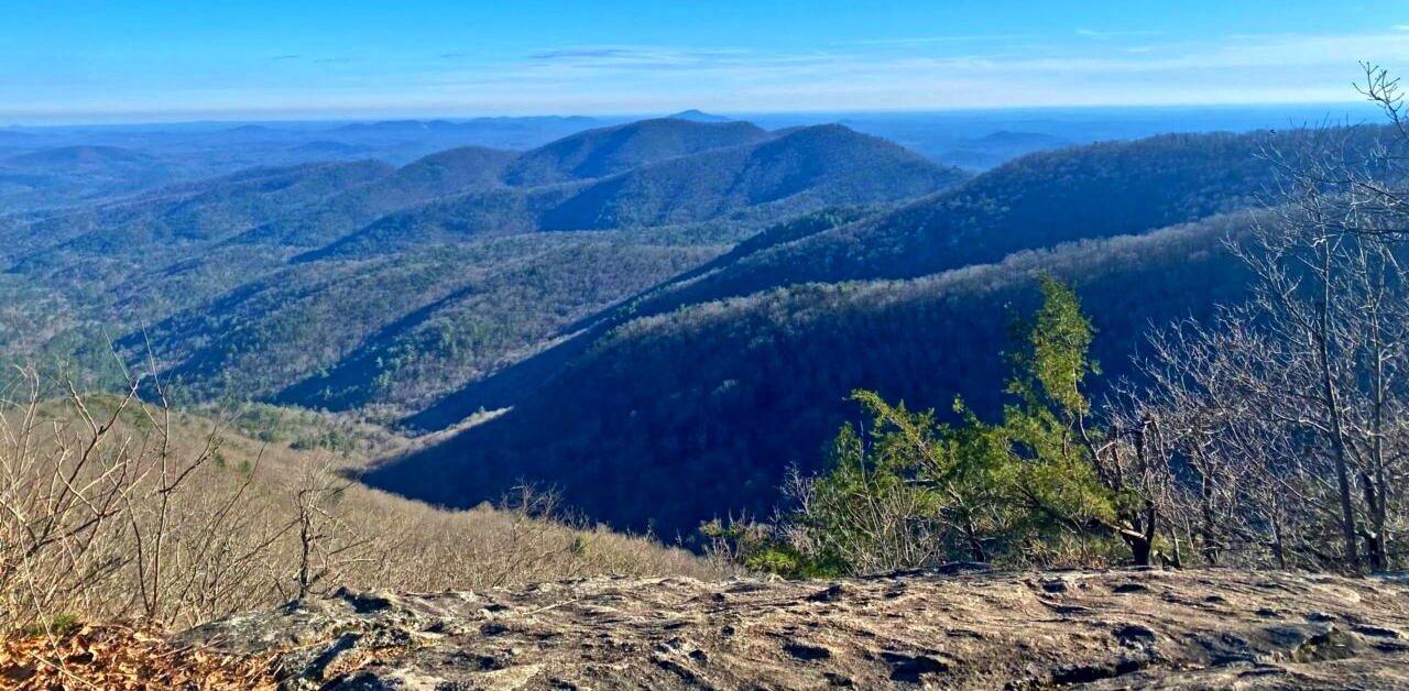
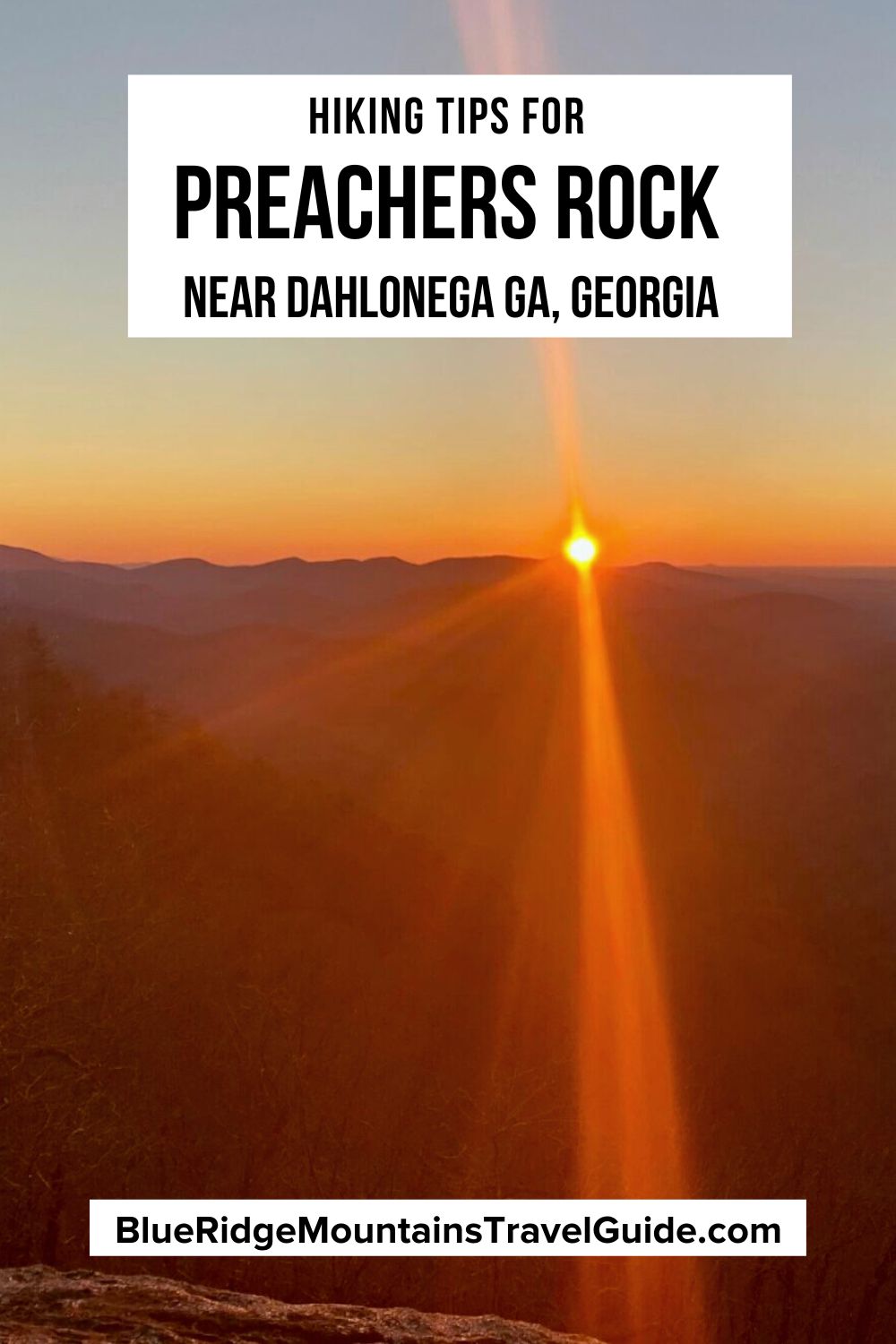
The View From Atop Preachers Rock
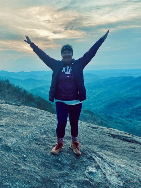
Arriving at a large rock face will be the indication that you’ve arrived at Preachers Rock.
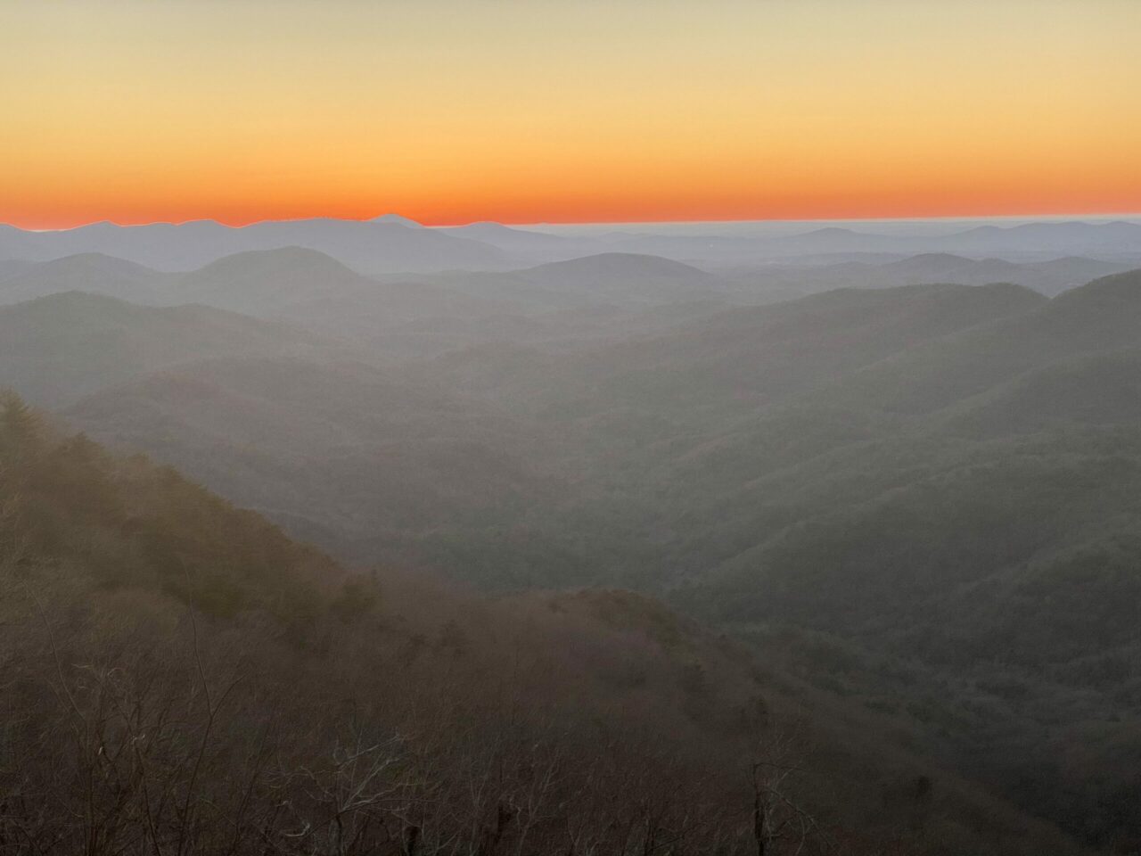
Though there may be other people here, there’s plenty of room to spread out. On weekends, it’s not uncommon to see small groups having picnics or sharing a thermos of coffee as they watch the sunrise.
The wide rock slab provides an exceptional view of the Blue Ridge Mountains looking to the southeast across the Yahoola and Dicks Creek Valleys.
If the weather is good, you’ll see an undulating carpet of mountains beneath you. But if the weather is bad, you may feel as if you’re standing in a cloud!
I especially enjoy this scenic vista because it’s largely uninterrupted by any North Georgia towns or development.
If you do the Preachers Rock hike to see a sunrise, it’s best to make the trek at least once beforehand to get an accurate idea of how long it will take for you to make the ascent. I’d advise leaving at least 30 minutes.
You’ll also need a powerful flashlight or headlamp to see the trail. If you can’t see any stars in the sky, it’s unlikely you’ll get much of a sunrise, as the cloud cover will probably be too dense.
Also, make sure to bring sunglasses. When the sun peeks over the mountains, the glare will be blindingly bright.
READ MORE: Fall in the Mountains of North Georgia: 25 Places to See Fall Colors
Preachers Rock Tips
The rocks at the top are generally flat, but they get steeper as you move down the face of Big Cedar Mountain. So be careful if it is wet or cold, because slipping and falling is a risk here.
Because Preachers Rock is located at 3,600 feet above sea level, it’s cooler in the summer and much colder in winter. Dress in layers, and have a pair of gloves and a hat handy if the weather forecast looks questionable.
Although the view from Preachers Rock is amazing, you can get a different perspective by continuing on the trail to the summit of Big Cedar Mountain. This adds another 100 feet of elevation and 2/10ths of a mile to the trek.
There’s a campsite at the top of Big Cedar Mountain, and enough space for a picnic. This clearing is smaller and less popular than the overlook at Preachers Rock, but offers a nice respite from the crowds.
Once you decide to return to the parking lot, note that the hike back is nearly all downhill.
This may be good news for your lungs, but it’s bad news for your knees. Take your time and be careful descending, especially on the rock switchbacks.
At the end, you’ll feel highly accomplished. Two miles on the Appalachian Trail and one of the best views of the Blue Ridge Mountains makes this a great way to spend part of a day!
READ MORE: The 15 Best North Georgia Mountains for Hiking
Preachers Rock Directions
From metro Atlanta, take GA-400 North to Dahlonega, then turn left where GA-400 intersects GA-Hwy 60. Go through Dahlonega and follow US-19/GA-Hwy 60 another 20 miles until you arrive at Woody Gap.
The popular Georgia hiking trail departs from the Woody Gap trailhead in the parking lot on the north side of the road (which is free and has around 31 spaces).
Plugging in “Preachers Rock” on Apple Maps, Google Maps, or Waze will lead you right to the Woody Gap trailhead. The GPS Coordinates are N 34°40.67, W 83°59.98. –by Jennifer Worrel; all photos by Jennifer Worrel unless otherwise noted
