
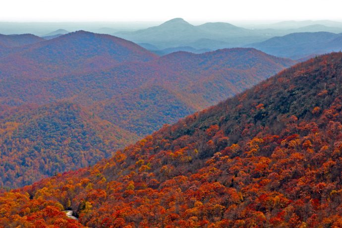
Once best known for gold and gem mining, Helen GA is a unique Georgia mountain town (population: 582) that reinvented itself as a tourist destination in the late 1960s.
The entire Downtown Helen area was modeled to look like a traditional Bavarian village, providing a taste of the Alps in the foothills of the Appalachian Mountains.
Located along the banks of the Chattahoochee River, the quirky town is best known for its myriad German restaurants, Southern-style arts and crafts, and the largest Oktoberfest celebration outside of Germany.
But the area also offers a bevy of natural wonders for outdoor enthusiasts, with popular activities including river tubing, canoeing, fishing, horseback riding, and more.
Hiking in Helen GA is also exceptional, with hiking trails for every level of ability and more than a dozen accessible waterfalls within a 15-mile radius of the downtown area.
Read on for our guide to 15 Helen GA hiking trails worth exploring, including the distance, difficulty, elevation gain, and descriptions of each trail’s highlights.
READ MORE: The 25 Best Things to Do in Helen GA
Best Helen GA Hiking Trails Guide
(Arranged by distance from Downtown Helen)
- Helen to Hardman Heritage Trail
- Unicoi Lake Trail at Unicoi State Park
- Smith Creek Trail at Unicoi State Park
- Chunanee Falls at Smithgall Woods State Park
- Dukes Creek Falls
- Anna Ruby Falls
- Raven Cliff Falls
- Mount Yonah Trail
- Hogpen Gap to Unicoi Gap
- Tesnatee Gap to Cowrock Mountain
- Horse Trough Falls
- Helton Creek Falls
- Brasstown Bald
- Trahlyta Lake Trail/Trahlyta Falls Spur Trail at Vogel State Park
- Blood Mountain
READ MORE: The 30 Best Hiking Trails in North Georgia Bucket List
Hiking Trails in Helen GA
1. Helen to Hardman Heritage Trail
Distance from Downtown Helen: 1.3 Miles
Level of Difficulty: Easy
Trail Length: 1.6 Miles
Elevation Gain: 55.8 Ft
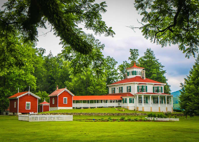
The 1.6-mile Helen to Hardman Heritage Trail is an easy paved path that leads visitors from the heart of Helen to the Hardman Farm State Historic Site.
This ADA-accessible trail offers interpretive signs along the way, encouraging hikers to learn more about the state of Georgia‘s native plants and animals.
Hikers can expect beautiful views of the Chattahoochee River and the surrounding forest before reaching two of the most popular historic sites in Georgia– the Hardman Farm and the Sautee Nacoochee Mound.
The Hardman Farm is especially fun to visit around the holidays, when they host a Victorian Christmas celebration.
READ MORE: 10 Fun, Festive Ways to Celebrate Christmas in Helen GA
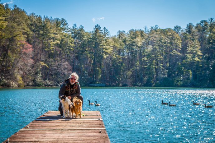
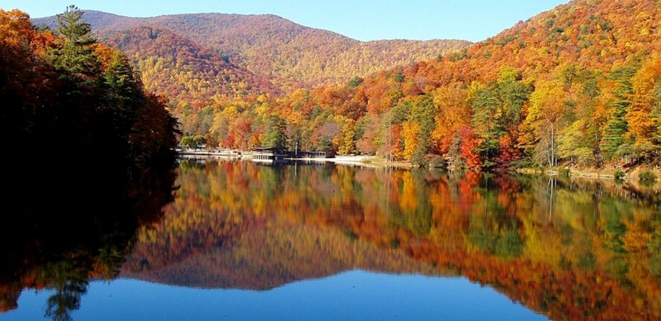
2. Unicoi Lake Trail
Distance from Downtown Helen: 2.9 Miles
Level of Difficulty: Easy to Moderate
Trail Length: 2 Mile Loop
Elevation Gain: 141 Ft
If you’re looking for easy hiking in Helen GA with stunning views, try the Unicoi Lake Trail at Unicoi State Park.
This 2-mile loop takes hikers around the banks of Unicoi Lake and past the unique Unicoi Barrel Cabins, with multiple entry points scattered around the loop.
One of the smaller lakes in North Georgia, Lake Unicoi is perfectly picturesque, and much of the gentle trail is in the shade of the forest.
If you’re looking to make a day out of this hike, there’s also kayaking, fishing, ziplining, and a beach for swimming.
READ MORE: The 15 Best Rental Cabins in Helen GA

3. Smith Creek Trail
Distance from Downtown Helen: 3.3 Miles
Level of Difficulty: Strenuous
Trail Length: 8.4 Miles
Elevation Gain: 1663 Ft
One of the least-visited hiking trails in Helen GA, the Smith Creek Trail to Anna Ruby Falls is perfect for those seeking for a more serene hike.
The fact that it’s 8.4 miles round-trip and requires trekking up some pretty steep sections probably explains why this trail is considerably less traveled.
Access to the trailhead can be found in Unicoi State Park, near the lake. You’ll see wildflowers along the way in spring and summer, with spectacular views of Anna Ruby Falls as your ultimate reward.
The strenuous hike makes for a great day trip from Atlanta, as it’s one of North Georgia’s least crowded trails to waterfalls.
READ MORE: The 15 Best Restaurants in Helen GA for Breakfast, Lunch & Dinner
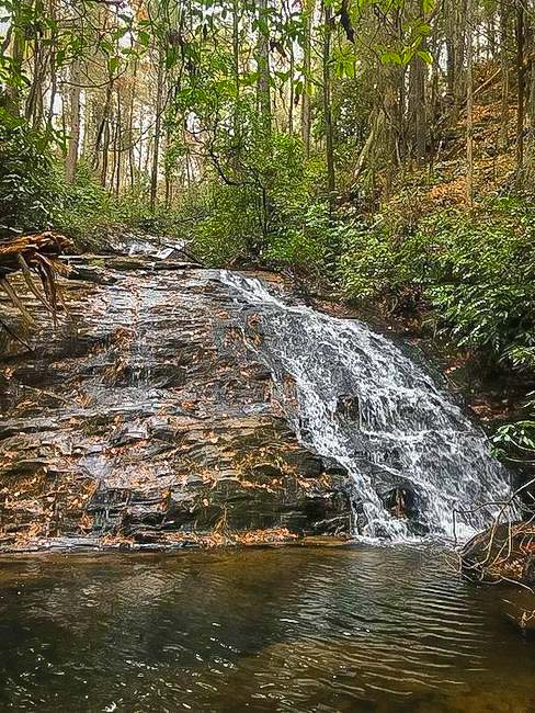
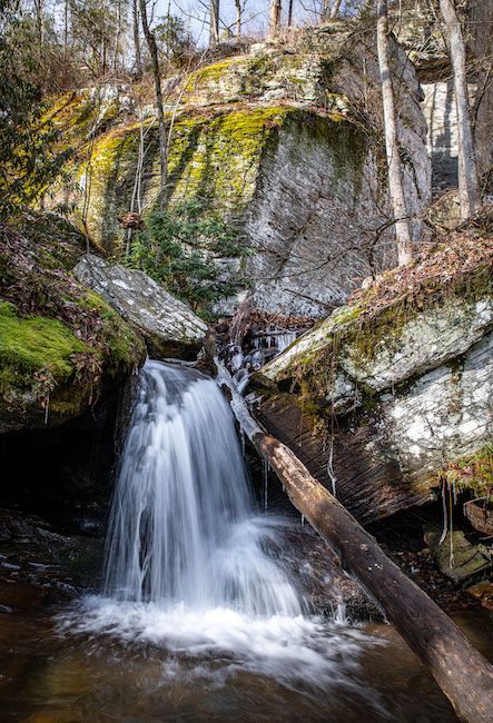
4. Chunanee Falls
Distance from Downtown Helen: 3.8 Miles
Level of Difficulty: Moderate
Trail Length: 6.6 Miles
Elevation Gain: 298 Ft
Located in Helen’s Smithgall Woods (one of North Georgia’s least-crowded state parks), the Chunanee Falls Trail starts on the paved Tsalaki Trail near the park’s Visitor Center.
The trail meanders through the forest alongside Dukes Creek before reaching the trailhead for the Cathy Ellis Trail at the 2.8-mile mark.
After continuing on the Chunanee Falls Trail, the last half-mile of the hike is all downhill, shaded with rhododendron and dotted with wildflowers during the spring and summer months.
Due to the length of the trail, it’s not very crowded, so you can have the peacefulness of the falls mostly to yourself!
READ MORE: The 15 Best North Georgia State Parks & Historic Sites
5. Dukes Creek Falls
Distance from Downtown Helen: 5.4 Miles
Level of Difficulty: Easy
Trail Length: 2 Miles
Elevation Gain: 300 Ft
One of the most popular Helen, Georgia hiking trails, the Dukes Creek Falls Trail is a great option for hikers of all ages and abilities.
It is both kid- and dog-friendly, and partly wheelchair accessible.
With spectacular views of Mt. Yonah (one of the most picturesque mountains in Georgia), this hike starts with a paved trail to an ADA-accessible viewing platform at the 1/10-mile mark.
Continuing on the well-maintained path, you’ll see glimpses of smaller cascades on Dukes Creek, which was an important site in the early days of gold mining in Georgia.
Once you reach the viewing platform at the trail’s end, you can soak in the sights of the 150-foot waterfall or take a dip in the beloved swimming hole at the bottom.
READ MORE: The 25 Best North Georgia Waterfalls (& How to Get to Them)
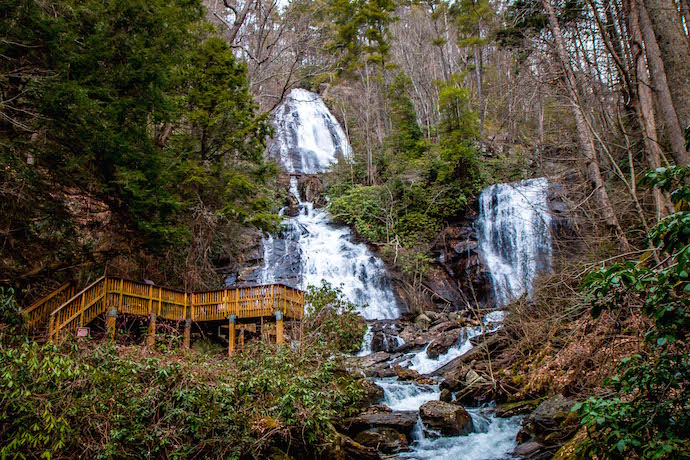
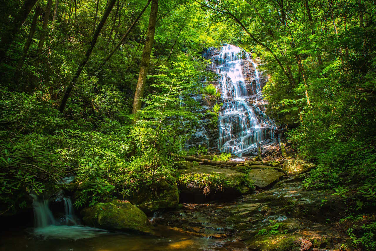
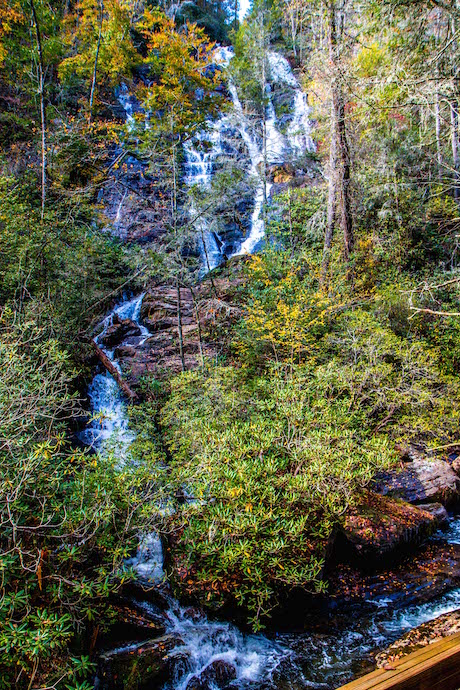
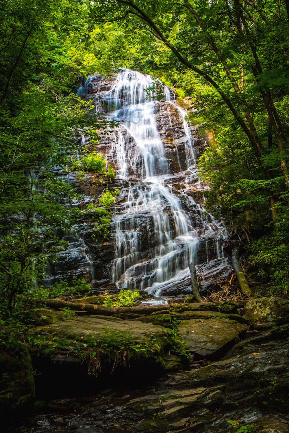
6. Anna Ruby Falls
Distance from Downtown Helen: 5.7 Miles
Level of Difficulty: Easy
Trail Length: 0.8 Miles
Elevation Gain: 219 Ft
Arguably one of the easiest hikes to waterfalls in Georgia, Anna Ruby Falls Trail is a short out-and-back trail that takes hikers directly to the falls.
The trail is fairly wide and paved, but the steep grade can make it a bit more difficult for wheelchairs and strollers.
It follows along a rushing creek, with numerous signs teaching hikers about the area’s history and wildlife.
Note that because this trail is so popular, it can be quite crowded, so early mornings are your best bet for a quiet hike.
But the sight of Curtis Creek and York Creek dropping 150 feet down Tray Mountain (GA’s 6th highest peak) to create twin waterfalls is well worth the trek!
READ MORE: The 25 Best Easy Hiking Trails to Waterfalls in Georgia
7. Raven Cliff Falls
Distance from Downtown Helen: 6.4 Miles
Level of Difficulty: Moderate
Trail Length: 4.9 Miles
Elevation Gain: 400 Ft
Surrounded by beautiful trees, lush moss, and wildflowers, Raven Cliff Falls is easily one of the most gorgeous waterfalls in Georgia.
The trail, which follows alongside Dodd Creek, starts by crossing a wooden bridge before continuing through the verdant forest.
Just after passing the 2-mile mark, you’ll find yourself facing a 40-foot waterfall that drops down the rock outcrop and pools serenely at the bottom.
Spend time here taking in the gorgeous views before heading back on the trail, which continues following Dodd Creek downstream before reaching the trailhead at just under 5 miles.
READ MORE: The 15 Best Christmas Towns in Georgia to Visit
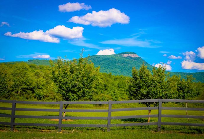
8. Mount Yonah Trail
Distance from Downtown Helen: 6.5 Miles
Level of Difficulty: More Difficult
Trail Length: 2.25 Miles
Elevation Gain: 1466 Ft
The Mount Yonah Trail is one of the best Helen, Georgia hikes for anyone who’s looking to add a bit of a challenge to their outdoor adventures.
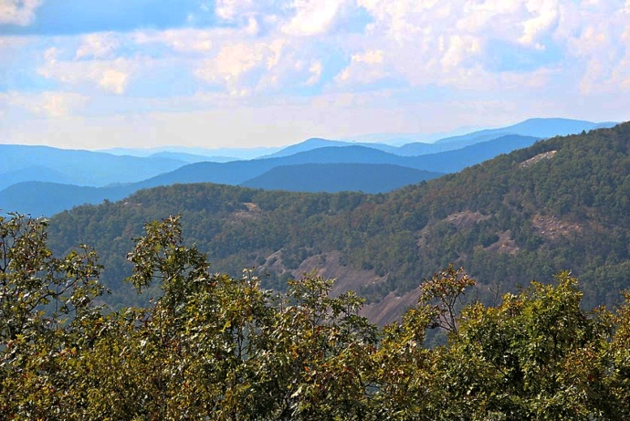
Located in the Chattahoochee National Forest, this trail overlooks the towns of Helen and Cleveland. It’s one of Georgia’s most popular rock-climbing destinations, with a summit reaching 3160 feet.
The trailhead can be accessed via a short Forest Service Road, and there are no permits or fees required to enter. Dogs are welcome on the trail as long as they are leashed.
The summit offers breathtaking views of the Blue Ridge Mountains in GA. But be careful, as the rocks can be especially slippery after rain or frost, and several people have died here in recent years.
Those looking for a longer trip can book a stay at the Yonah Mountain Campground, which is located right at the base of Yonah Mountain.
READ MORE: The 15 Best Campgrounds in North Georgia
Hiking Near Helen GA
9. Hogpen Gap to Unicoi Gap
Distance from Downtown Helen: 10.6 Miles
Level of Difficulty: Hard
Trail Length: 14.5 Miles
Elevation Gain: 3000 Ft
This challenging 14.5-mile trek from Hogpen Gap to Unicoi Gap offers hardy hikers a great chance to explore an uncrowded portion of the Appalachian Trail.
Perfect for an overnight backpacking trip, this hiking trail near Helen GA is best known for its serenity and stunning scenic overlooks.
While there isn’t necessarily an awe-inspiring end point, this trail’s fortune is found as it winds through, and over, different sections of the Chattahoochee National Forest.
The serene ambiance of the forest is a great place for hikers who want some peace and quiet while being surrounded by the natural beauty of North Georgia at its purest.
The trail can be accessed from either end, and visits two AT shelters along the way.
READ MORE: The 10 Best National Parks in Georgia to Visit
10. Tesnatee Gap to Cowrock Mountain
Distance from Downtown Helen: 11.3 Miles
Level of Difficulty: Moderate
Trail Length: 2.5 Miles
Elevation Gain: 400 Ft
This section of Georgia’s Appalachian Trail starts at Tesnatee Gap and continues west until it reaches the summit of Cowrock Mountain at 3,852 feet.
While the spectacular summit views are reason enough to make this moderately difficult trek, the colorful North GA wildflowers that decorate the trail are also a nice bonus.
At 0.85 miles in, the trail reaches an opening that is the perfect place to rest and recharge before continuing on.
After reaching the summit, just retrace your steps back down to Tesnatee Gap to exit off the trailhead.
READ MORE: The Best Christmas Lights in Atlanta and North Georgia
11. Horse Trough Falls
Distance from Downtown Helen: 14 Miles
Level of Difficulty: Easy
Trail Length: 0.4 Miles
Elevation Gain: Negligible
Located at the end of a rugged 5-mile Forest Service road that is best navigated with a 4×4 (or a lot of patience), this is one of the least crowded waterfall hiking trails near Helen we’ve visited.
The Upper Chattahoochee River Campground (from which the trail departs) was closed for several years due to storm damage, which required visitors to walk an extra half-mile from the parking lot through the campgrounds.
Thankfully it was reopened in late 2021, making access to the trail much easier.
Now the path is an easy, 0.4-mile walk through a flat stretch of forest to one of the most beautiful waterfalls in Georgia, Horse Trough Falls.
The stunning setting is even more picturesque when surrounded by fall colors, which make the surrounding forest look like glistening gems in the sunlight.
READ MORE: 15 Great Places to Go Horseback Riding in Georgia
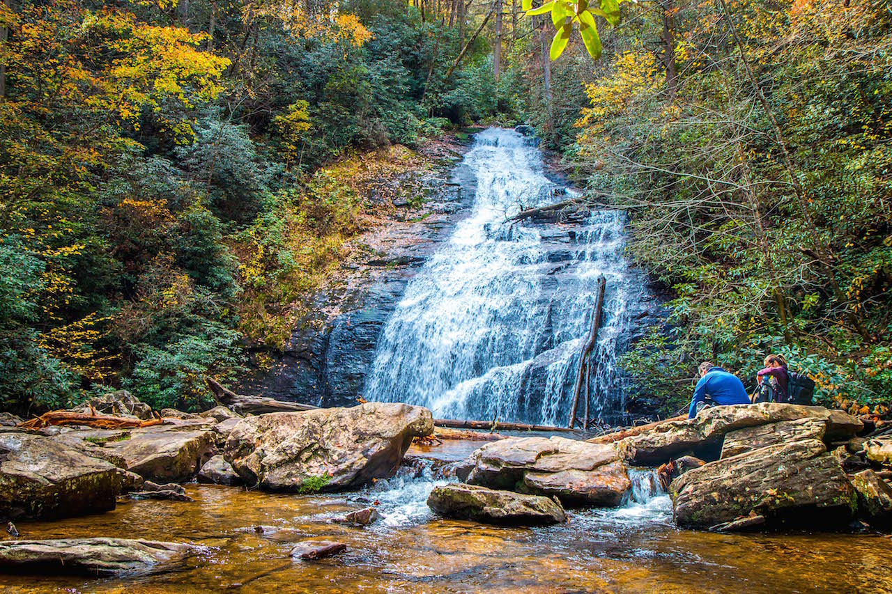
12. Helton Creek Falls
Distance from Downtown Helen: 16.6 Miles
Level of Difficulty: Easy
Trail Length: 0.6 Miles
Elevation Gain: 29 Ft
Helton Creek Falls is known as one of the easiest waterfall hikes in Georgia, making it perfect for kids, dogs, and anyone who can’t hike long distances.
Located in Blairsville GA, the trail is just over a half-mile round trip, with minimal elevation gain, descending a set of stairs into a forest of native plants and trees.
You’ll soon reach another set of wooden stairs that leads to the base of Helton Creek Falls, which has a small pool of water where kids (and adults!) can splash around.
From there, the trail continues to Upper Helton Creek Falls, where there’s an observation platform. There are also plenty of large rocks where you can sit, have a picnic, and take in the gorgeous view of the falls.
READ MORE: The 15 Best Treehouse Rentals in the Georgia Mountains
13. Brasstown Bald
Distance from Downtown Helen: 17 Miles
Level of Difficulty: Easy
Trail Length: 0.55 Miles
Elevation Gain: 500 Ft
At the summit on a clear day, Brasstown Bald hikers can take in the view of four different states— including North Carolina, South Carolina, and Tennessee— from the top of the tallest mountain in GA.
At an elevation of 4,784 feet above sea level, this Hiawassee GA mountain is a great place to bring the whole family (dogs are allowed as long as they are on a leash).
There’s an 8,000-square-foot Visitor Center at the top, with interactive nature exhibits and educational films about the bald. The 360º observation deck that allows visitors to fully take in the jaw-dropping views.
For those who are unwilling to unable to make the short, steep climb, a shuttle bus will take visitors straight to the summit of one of our favorite North Georgia mountains for a small fee.
READ MORE: The 15 Best Things to Do in Hiawassee GA & Young Harris GA
14. Trahlyta Lake Trail/Trahlyta Falls Spur Trail
Distance from Downtown Helen: 21.8 Miles
Level of Difficulty: Easy
Trail Length 1.1-Mile Loop
Elevation Gain: 70 Ft
One of several great attractions at Vogel State Park, the Trahlyta Lake Trail ranks among our favorite hiking trails near Helen because of its accessibility and stunning scenery.
This relatively flat 1.1-mile loop hiking trail begins right outside the Vogel State Park Welcome Center. It offers scenic views of the picturesque lake and great places to picnic all along the way.
The wide trail winds along the shore, with trees shading the path most of the way. It continues over the dam, where you’ll find a great view of the lake and Blood Mountain.
You’ll soon see a short side trail on the left, which leads down to an observation deck for the extremely photogenic Trahlyta Falls.
After soaking in the rushing views of one of the best waterfalls near Helen, you can continue around the lake to complete the loop.
READ MORE: The 20 Best Lakes in the North Georgia Mountains

15. Blood Mountain
Distance from Downtown Helen: 23.7 Miles
Level of Difficulty: Strenuous
Trail Length: 2.15 Miles
Elevation Gain: 1400 Ft
The 4.3-mile Blood Mountain Trail is widely considered one of the toughest and most rewarding day hikes in North Georgia.
But the 4,458-foot Blairsville GA landmark is worth climbing for the jaw-dropping views you get at the summit.
Local legend suggests the mountain’s dark name derives from the bloody feud between the Cherokee and Creek Indians. Others believe it was named after the red wildflowers that grow at its summit.
Regardless, the strenuous hike gains 1,400 feet of elevation before opening up to the spectacular views awaiting hikers at the mountain’s summit.
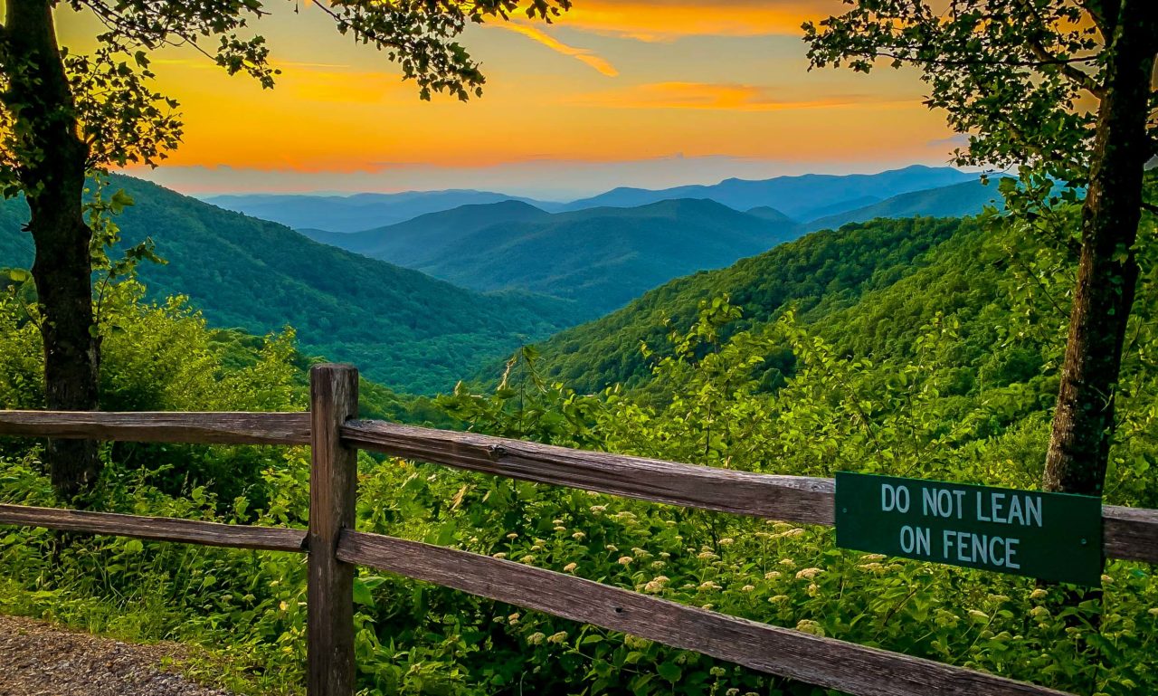
Blood Mountain’s views are sure to leave hikers breathless. It’s ranked as the tallest point on the Appalachian Trail in Georgia, and Georgia’s sixth highest peak. -by Molly Frazier; lead image by Bret Love & Mary Gabbett
