
[Updated September 30, 2021] Some experts suggest there are as many as 700 waterfalls in Georgia, although many of these remain remote and inaccessible to all but the hardiest of bushwhackers.
Other than accessibility, there are a lot of other factors that play into the relative popularity of a given GA waterfall.
Some folks focus on the sheer beauty of the waterfall. Some care more about the ease or beauty of the hiking trail. Others want amenities, such as campgrounds, picnic tables, or swimming holes.
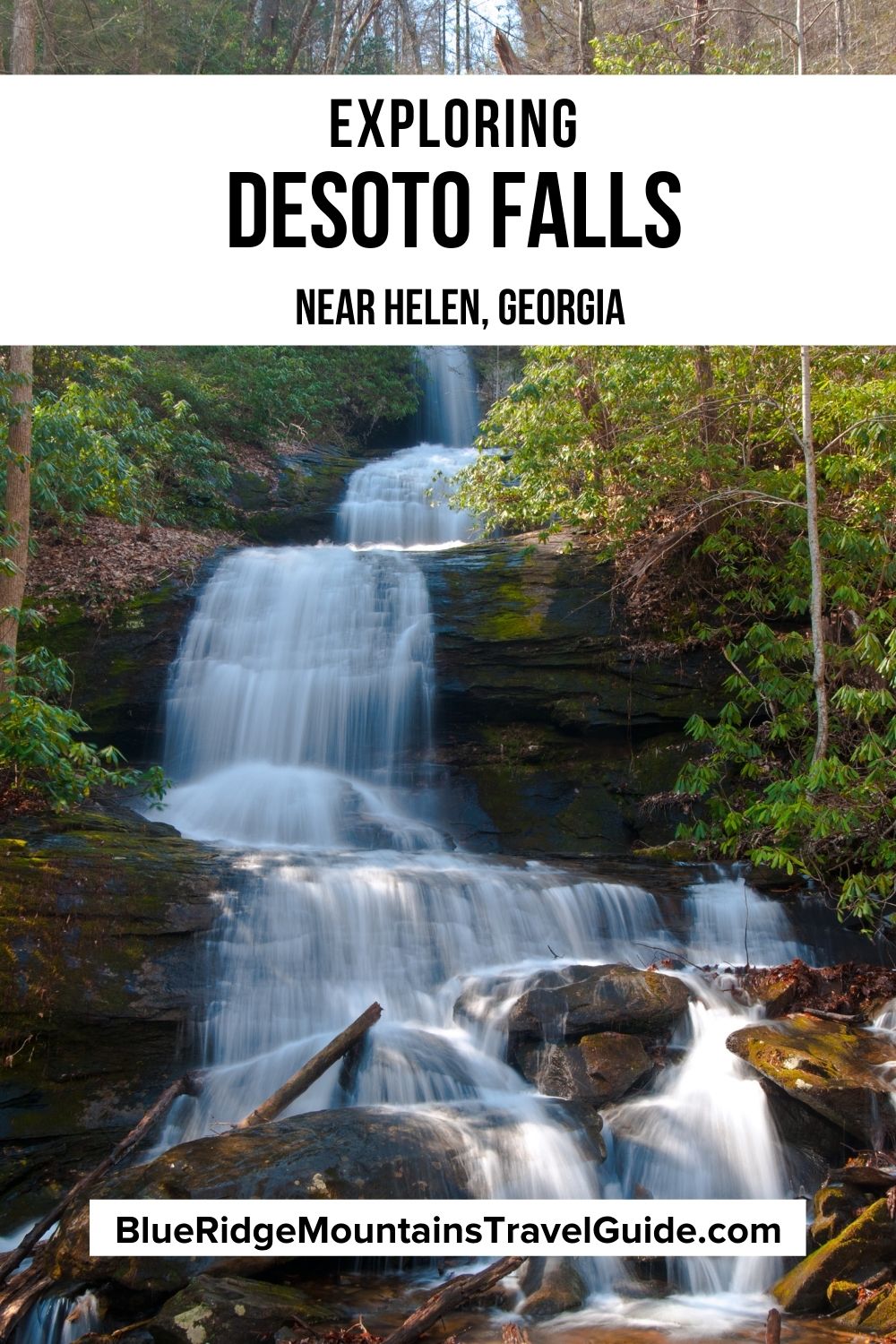
I pondered these personal preferences as I made the 1.9-mile hike to see DeSoto Falls, a series of two waterfalls situated in a rhododendron-lined forest along Frogtown Creek.
One of the most popular waterfalls near Helen GA, DeSoto Falls is extremely accessible, with the smells of breakfast cooking and the sounds of laughter from the campsites echoing along the trail.
As an avid hiker who adores waterfalls for the peace, serenity, and energetic cleansing they provide, I generally prefer places that offer a sense of being immersed in the wilderness.
I didn’t really get that feeling on the DeSoto Falls trail, whose amenities seem more geared to families who want to picnic or camp and have a relatively short, easy hike afterwards.
But watching people interact at different Georgia waterfalls has served to remind me how there are perfect spots in these pristine forests to appeal to people from all walks of life.
Read on for our guide to the DeSoto Falls Scenic Area, including some history of the area, an overview of the trail, and driving directions.
READ MORE: 101+ Things to Do in North Georgia
DeSoto Falls Scenic Area Info
ADDRESS: Desoto Falls Recreation Area U.S. 129 Cleveland, GA 30528
PHONE: 706-745-6928
COST OF ENTRY:
Day Use: $5
Camping in Peak Season: 4/1-10/31, $20 per night; $40 Double Site (Site # 14)
Camping in Non-Peak Season (no water): 11/1-3/31, $10 per night; $20 Double Site (Site # 14)
WEBSITE: www.fs.usda.gov
HOURS: Open 24 hours a day. Quiet hours 10pm to 6am.
HIKING TRAIL: Rated as easy, 1.9-miles round-trip, heavily trafficked hike.
AMENITIES: One flush facility with warm shower, 4 chemical flush facilities, and drinking water from faucets centrally located in campground.
Other available amenities include picnic tables, fire rings, vault toilets, lantern posts, and a dumpster for bagged garbage.
Reservations are required to camp in this campground: Call 1-877-444-6777 or visit www.Recreation.gov for more info.
Love North GA Waterfalls? Check out these great guides!
The 20 Best North Georgia Waterfalls (& How to Get to Them)
The 10 Best Waterfalls Near Helen GA
The 10 Best Waterfalls Near Blue Ridge GA
How to Get to Anna Ruby Falls Near Helen GA
How to Get to Dukes Creek Falls Near Helen GA
How to Get to Helton Creek Falls in Blairsville GA
How to Get to Hemlock Falls at Moccasin Creek State Park
How to Get to Minnehaha Falls on Lake Rabun
How to Get to Panther Falls & Angel Falls at Lake Rabun Beach
How to Get to Long Creek Falls in Blue Ridge GA

DeSoto Falls History
Part of the Chattahoochee National Forest, DeSoto Falls were named for famed Spanish explorer Hernando DeSoto, the conquistador who spent time in Georgia in 1540.
DeSoto participated in many conquests in Central America and Peru. In North America, he was the first European documented to have seen the Mississippi River.
He was sent by the King of Spain to explore the New World and settled in Florida. He is known to have made his fortune due to his heavy involvement in the African slave trade.
According to historical reports, a plate of armor once used by the explorer was discovered at the base of the falls in the 1880s.
The waterfalls are located in Lumpkin County, which was named after Georgia Governor Wilson Lumpkin.
It was officially established in 1832, when it was carved out of parts of Cherokee, Hall, and Habersham Counties.
All of the North Georgia mountains surrounding the falls were originally inhabited by the Cherokee people, who were forced to give up their land and head west on the Trail of Tears after the signing of the Treaty of New Echota in 1835.
Today, these North Georgia waterfalls are part of the 650-acre DeSoto Falls Scenic Area. Trout fishing is extremely popular in Frogtown Creek, which is stocked regularly by the Georgia Department of Natural Resources.
READ MORE: The 15 Best Rental Cabins in Helen GA

Hiking the DeSoto Falls Trail
After you pay the $5 dollar parking fee, you’ll walk through a lovely tree-covered picnic area that offers running water, grills, and 10 picnic tables for dining in this beautiful setting.
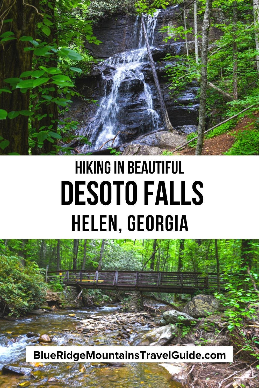
You’ll proceed along a paved road that connects the parking lot to the DeSoto Falls camping area, where you’ll reach the wooden bridge that brings you to the trails.
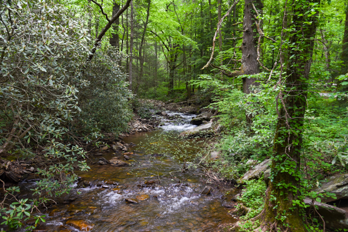
The wooden bridge is a picturesque spot from which to see the rhododendron, mountain laurel, and other North GA wildflowers growing along Frogtown Creek.
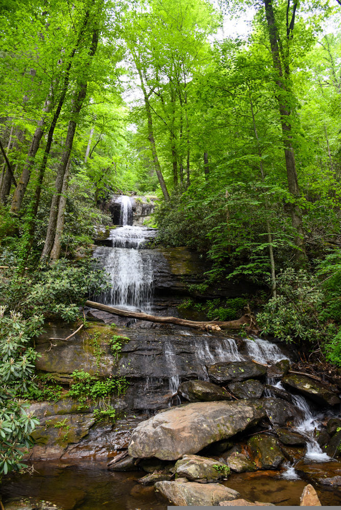
At the signed intersection, venture left to visit Lower DeSoto Falls. The trail climbs gently in elevation for a quarter-mile before you reach the wooden viewing platform.
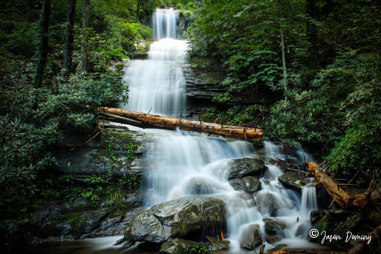
Here you can see the waterfall spilling 35 feet into a pool of water surrounded by lichen-covered rocks and trees. Then simply retrace your steps to the intersection and head to Upper DeSoto Falls.
The one-mile descent takes you through old growth pines and along small streams with bridges to cross. The upper falls are 200 feet tall, multi-tiered, and much more impressive than the lower falls.
The viewing platforms offer many places to soak into the lush surroundings, but the setting somehow felt less organic than other North Georgia waterfalls I’ve visited. The array of amenities made it feel more like a city park than a taste of wild, untamed nature.
The DeSoto Falls trail is an ideal hike for children and people with mobility issues. It’s relatively easy, and there are benches lining the path and spots to stop and rest as needed.
But this may not be your top pick if you’re seeking moderately challenging hiking trails in North Georgia or those breathtaking scenic views the Blue Ridge Mountains are known for.
READ MORE: The 15 Best Things to Do in Helen GA

Camping at the DeSoto Falls Campground
The DeSoto Falls Campground is open 24 hours a day, but quiet hours are from 10pm to 6am.
The campground has 24 campsites arranged in two loops, with several located along Frogtown Creek. There are no water hook-ups, electric hook-ups, or dump sites.
Reservations are required for DeSoto Falls camping. They can be made through the National Recreation Reservation Service online at www.Recreation.gov, or by calling 1-877-444-6777.
Note that camping reservations can be made up to 6 months in advance, but they cannot be made in-person at the facility.
The DeSoto Falls Campground charges $20 per night, or $40 for the double site (Site # 14), during Peak Season, which lasts from 4/1-10/31.
Their Non-Peak Season (when no water is available in the campgrounds) lasts from 11/1 to 3/31, and costs $10 per night or $20 for the double site.
There is a 14-day stay limit for camping at DeSoto Falls, with a maximum of 2 vehicles per campsite, and dogs must be leashed at all times.
READ MORE: The 10 Best Restaurants in Helen GA for Breakfast, Lunch & Dinner
DeSoto Falls Scenic Area Directions
From Blairsville GA, take U.S. Highway 19/129 South for 17 miles. You’ll see the DeSoto Falls entrance on your right.
From Helen GA, take U.S. 75 North for 8 miles, then turn right onto U.S. 129 North. Follow that for 11 miles (merging with U.S. Hwy 19 along the way) and you’ll see the DeSoto Falls entrance on your left.
From Dahlonega GA, follow U.S. Highway 19 north for approximately 18 miles and you’ll see the DeSoto Falls entrance on your left. –text and photos by Hope Cross; lead photo by Jason Dominy
