
[Updated September 21, 2021] From Anna Ruby and Amicalola Falls to Hemlock, Minnehaha, and Angel/Panther Falls, one of our favorite things about our 2020 staycations has been exploring many of the amazing waterfalls in North Georgia.
But until recently we hadn’t made our way to the Richard B. Russell Scenic Hwy to hike the waterfalls near Helen GA, including Dukes Creek, Raven Cliff and Helton Creek Falls.
Our friend Rachael Seeley, who wrote our in-depth guide to Vogel State Park in Blairsville while volunteering there, had raved about how Helton Creek was high on the list of her favorite North Georgia waterfalls.
So last week we made a day trip to drive the scenic highway from Blairsville to Helen and back, hiking some of the best waterfalls in GA along the way.
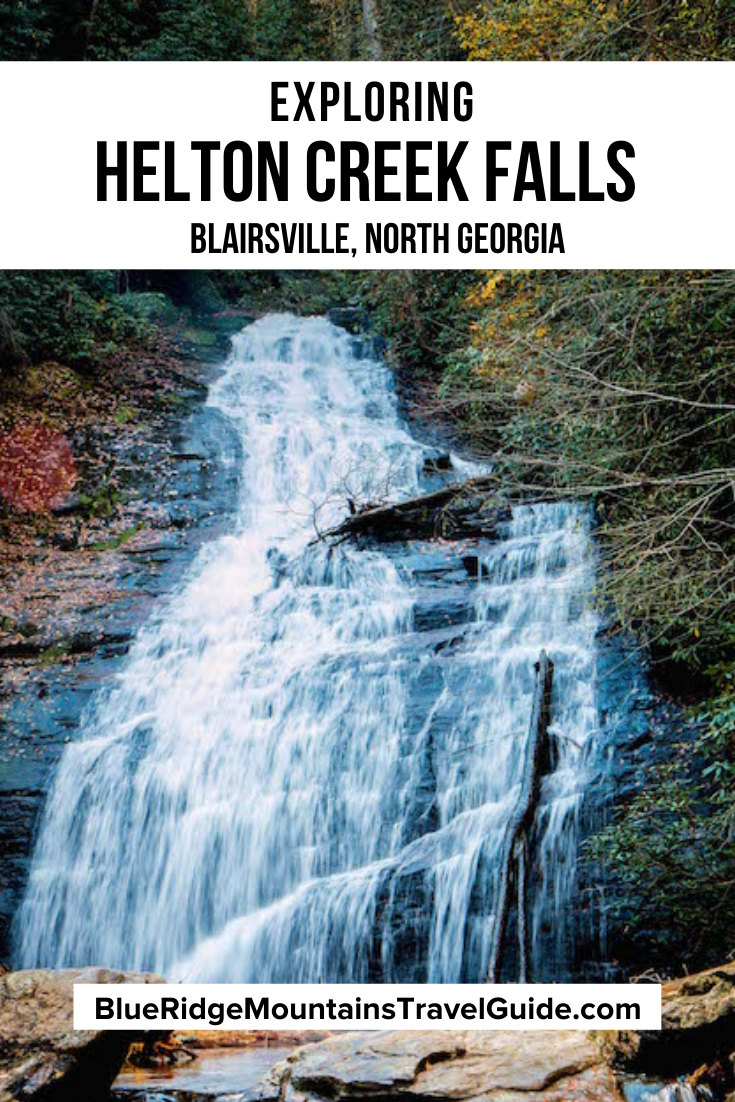
So here’s our in-depth guide to Helton Creek Falls, including the history of this part of the Chattahoochee National Forest, driving directions, and an overview of the .6-mile hiking trail to reach the lower and upper falls.
READ MORE: 101+ Things to Do in North Georgia
Helton Creek Falls, GA Info
ADDRESS: Off Hatchet Creek Rd/Helton Creek Rd in Blairsville GA 30512
PHONE: 706-745-6928
COST OF ENTRY: Free (including free parking)
HELTON CREEK FALLS HOURS: Always open
WEBSITE: https://www.fs.usda.gov/recarea/conf/recarea/?recid=10546

Love North GA Waterfalls? Check out these great guides!
The 20 Best North Georgia Waterfalls (& How to Get to Them)
The 10 Best Waterfalls Near Helen GA
The 10 Best Waterfalls Near Blue Ridge GA
How to Get to Horse Trough Falls in Helen GA (Upper Chattahoochee River Campground)
How to Get to Anna Ruby Falls Near Helen GA
How to Get to Minnehaha Falls on Lake Rabun
How to Get to Panther Falls & Angel Falls at Lake Rabun Beach
How to Get to Long Creek Falls in Blue Ridge GA
How to Get to Sea Creek Falls in Suches, GA
Helton Creek/Blairsville History
Like much of the North Georgia mountains (and Appalachia as a whole), the area that is now Blairsville was originally Cherokee and Creek Indian territory.
The Chattahoochee National Forest takes its name from the Chattahoochee River. In the Muskogean dialect, Chatta means stone and ho chee means flowered or marked. Settlers adopted the name used by natives when they arrived.
The area attracted lots of European settlers after gold was discovered nearby in the 1820s. Union County was formed during the Georgia Land Lottery of 1832, and named after a political party that was in favor of removing Native Americans entirely.
Interestingly, local residents were largely pro-Union, and county delegates voted against the secession movement at 1861 Georgia state convention.
Although most locals in the Blairsville area wound up supporting the Confederacy, many fought and died for the Union.

The land on which Helton Creek Falls sits was purchased by the US Forest Service in 1911, as part of a 31,000-acre package.
Sold by a local family at a price of $7 an acre, this prime North Georgia property was set aside as the Cherokee National Forest in 1920.
Ranger Arthur Woody played a major role in the conservation of the national forest‘s Blue Ridge Wildlife Management Area, in which Helton Creek is located.
Decades of poor resource management had depleted North Georgia’s populations of deer and trout. Woody helped stock local creeks and streams with trout, and hand-fed fawns purchased with his own money until they were old enough to release into the wild.
Several landmarks in the Chattahoochee National Forest bear Ranger Woody’s name in tribute, and Blairsville’s 175-acre Sosebee Cove is set aside as a memorial in his honor.
READ MORE: The 15 Best North Georgia State Parks

Hiking the Helton Creek Falls Trail
One of the easiest North Georgia hiking trails we’ve done, the most difficult part of the Helton Creek Falls trail is just getting to the parking lot.
There had been heavy rains in the days before our early November visit, so we actually had to cross two shallow, rocky creek beds on Helton Creek Rd in our tiny Hyundai Elantra.
Still, as the best of the waterfalls in Blairsville GA (and one of our picks for the best waterfall hikes in North Georgia), it was totally worth the effort!
The .6-mile round trip, dog-friendly path is well maintained and wide enough for passing. And the scenery along the way is stunning, especially when Fall colors are popping.
You get your first glimpse of the waterfall through the trees as you make your way down the trail’s entry staircase.
The descent is gradual enough for little kids, leading into a gorgeous forest valley of hardwoods and hemlocks mixed with conifers and rhododendrons.
If it’s been raining recently, you’ll likely see a few little side creeks crossing under you, as the sound of Helton Creek Falls’ rushing waters gradually grows louder.
READ MORE: The 15 Best Lakes in the North Georgia Mountains

Helton Creek Waterfall Viewpoints
Lower Helton Creek Falls
You’ll be less than 1/3 of a mile into your glorious stroll when you’ll spy a short side trail where a set of wooden stairs leads you down to the base of Helton Creek’s lower falls.
Reminding us of a small version of Sliding Rock (one of the most famous North Carolina waterfalls), Lower Hemlock Falls has a smooth rock face slide that sends the rushing water cascading into a tranquil pool at its base.
It was particularly picturesque in Autumn, with yellow and orange leaves scattered all around, green rhododendron flanking the falls, and beautiful blue sky above.
All around us along the forest floor were verdant mosses and ferns.
And for just a few minutes on that weekday afternoon we were the only people there, feeling like we had this little slice of paradise all to ourselves.
Lower Helton Creek was unique among the Georgia waterfalls we’ve visited thus far, but it was only a sneak peak of the glorious vision to come!
READ MORE: The 20 Best Hiking Trails in North Georgia Bucket List
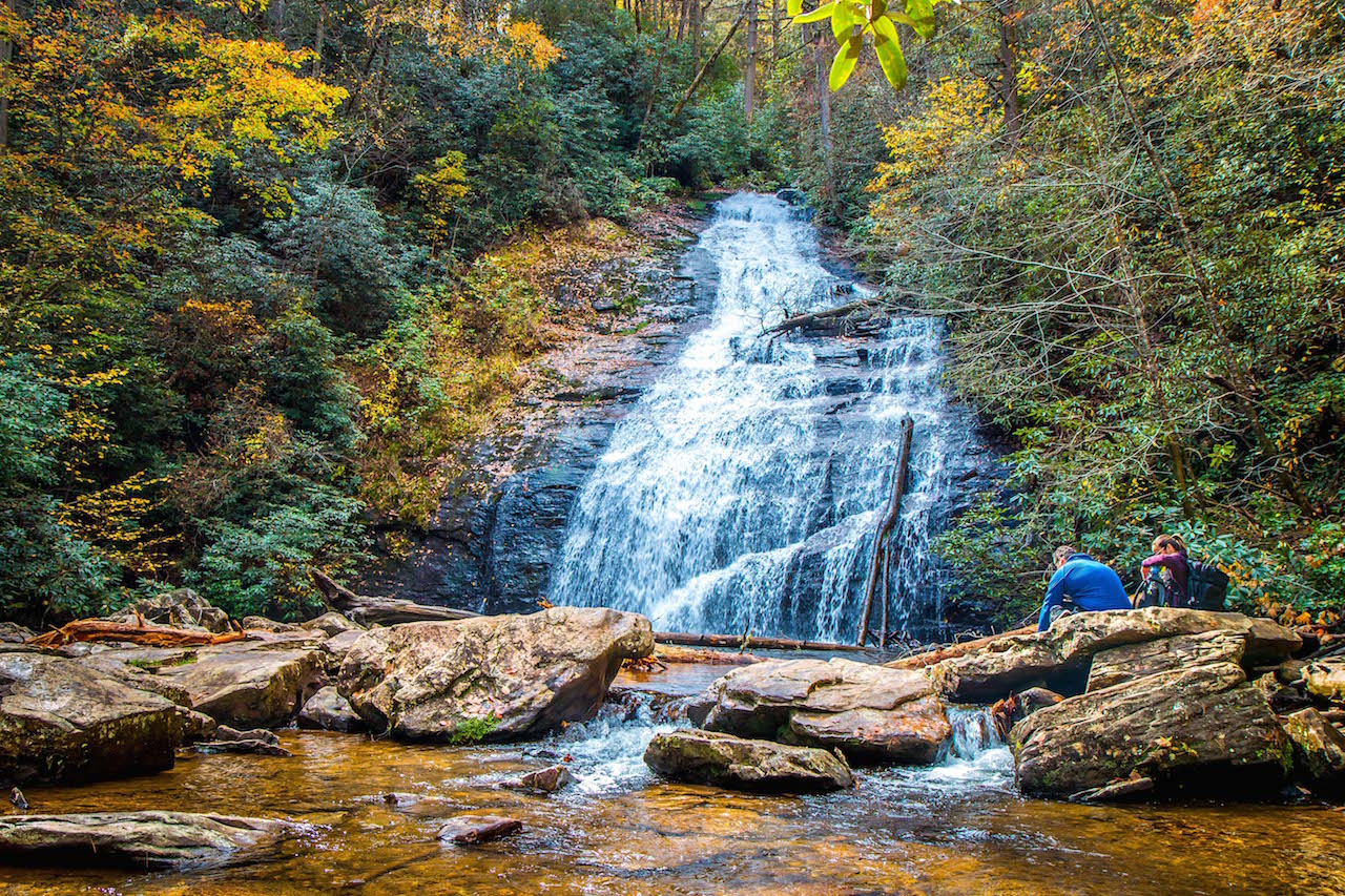
Upper Helton Creek Falls
Once you make your way back to the main trail, you’ll quickly begin to climb in elevation, reaching a spot where you can stand beside the falls as they tumble down into the valley.
This is a great selfie spot, but do watch your step, as the water moves quickly and the rocks are slippery in spots!
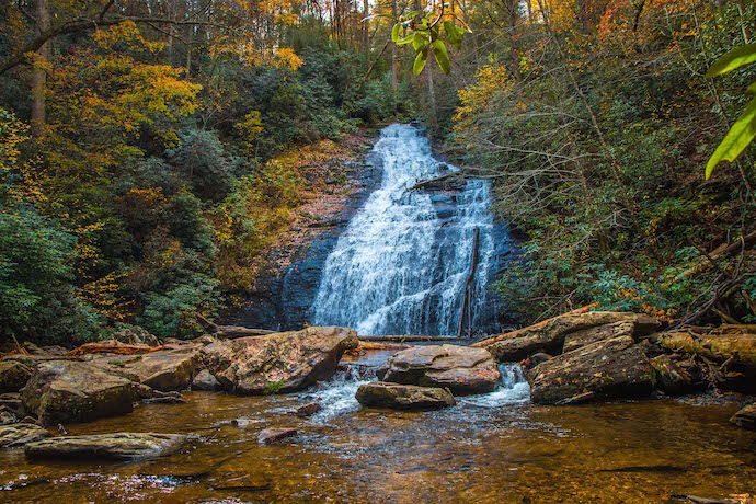
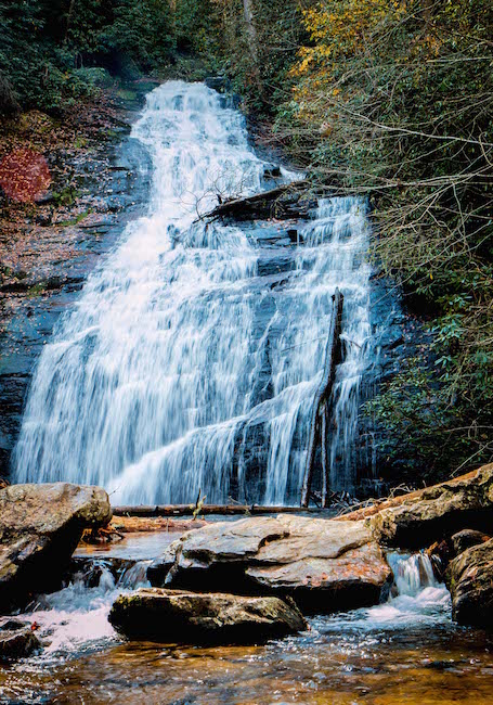
Continuing to climb, you’ll reach the Upper Helton Creek Falls viewing platform. The upper falls is taller and wider, rushing down the face of a massive rock in flowing cascades.
It made for an extremely impressive sight with the North Georgia Fall colors all around, and massive boulders and fallen trees at its base.
It’s the sort of postcard-worthy spot that would’ve made a perfect place for a picnic, had we not already gorged ourselves at the Run Cake Lady Cuban Cafe in Blue Ridge before heading to Helton Creek.
But a word to the wise: This place gets PACKED even on weekdays in peak season, so in retrospect we would recommend arriving before 10AM if you want to avoid the crowds.
There were just a few other people at Upper Helton Creek Falls when we arrived. But there were literally dozens of folks crowding those rocks by the time we made our way back to the trailhead, ending a lovely waterfall hike that’s just over a half-mile in total length.
READ MORE: The 15 Best North Georgia Mountains for Hiking
Helton Creek Falls Directions
Directions to Helton Creek Falls From Blairsville, GA (13.3 Miles)
From downtown Blairsville, head south on US-129/US-19 for 6.9 miles to State Route 180.
Turn left onto State Rte 180 and follow it for .9 miles, then turn right onto GA-348 E and go 2.9 miles.
Turn right and take the dirt/gravel Hatchet Creek Rd for 1.3 miles, where it turns right and becomes Helton Creek Rd. Note that you may have to cross two shallow creek beds if recent rains have been heavy.
You’ll see the Helton Creek Falls parking area on the left in .6 miles.
READ MORE: Hiking the Blood Mountain Trail in Blairsville GA

Directions to Helton Creek Falls From Helen, GA (16.6 miles)
From downtown Helen, head west on GA-17 N/GA-75 N/N Main St/Unicoi Turnpike toward White Strasse. You’ll pass Unicoi State Park & Lodge along the way.
After 1.3 miles, turn left onto GA-75Alt N and follow it for 2.3 miles. When you see Smithgall Woods State Park on the left, make a right onto GA-348 W.
This road is also known as the Richard B. Russell Scenic Highway, which has several stunning scenic overlooks and passes Dukes Creek Falls and Ravel Cliff Falls.
So it’s worth taking your time to explore the next 11.1 miles slowly before making a left turn onto Hatchet Creek Rd.
Follow it for 1.3 miles, where it turns right and becomes Helton Creek Rd. You’ll see the Helton Creek Falls parking area on the left in .6 miles. –by Bret Love; all photos by Bret Love & Mary Gabbett

Comments are closed.