[Updated September 21, 2021] There’s something about waterfalls that feels magical somehow.
When I explore the many waterfalls in Georgia, I feel as if my soul is being washed free from anything weighing it down. It’s a spiritual cleansing in the deepest form.
I don’t even have to physically touch the water to feel transformed by it. The sound of rushing rapids seems to permeate into my being, and I’m suddenly cleared from burdens I didn’t even know I was carrying.
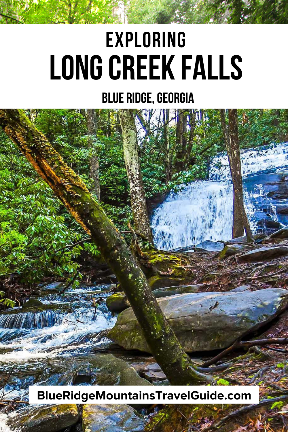
The first time I ever felt this sensation and really held it in my awareness was during my first visit to Long Creek Falls in Blue Ridge GA, which quickly emerged as my favorite Georgia waterfall.
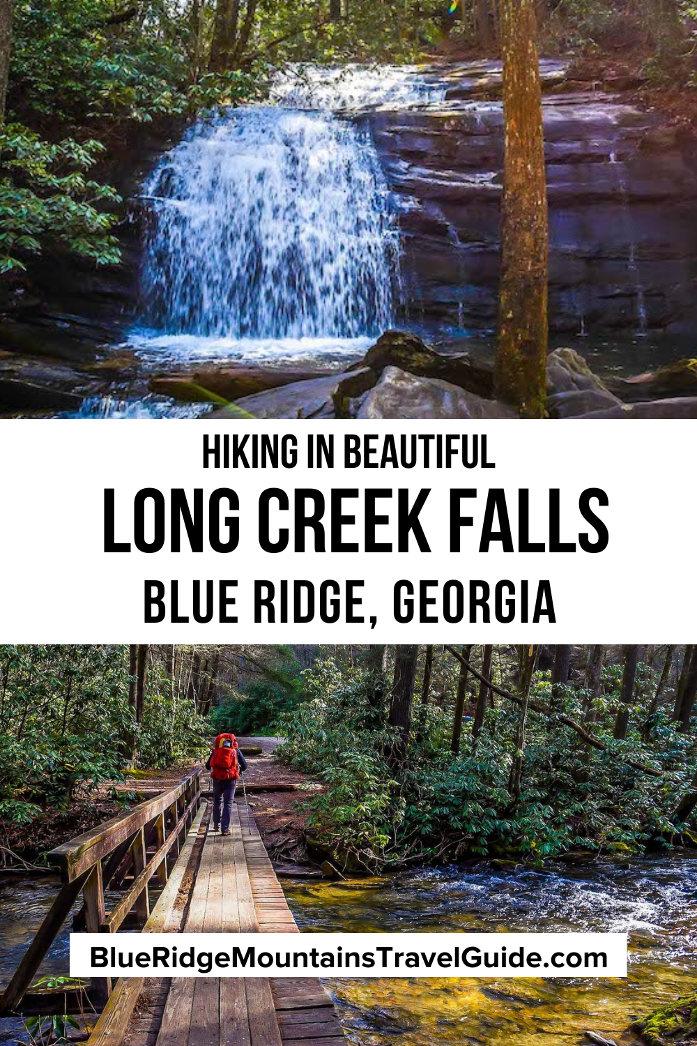
Long Creek Falls is an easy to moderate 2-mile in-and-out hike that allows you to explore a small section of the Appalachian Trail, the Benton Mackaye Trail, and the Duncan Ridge Trail.
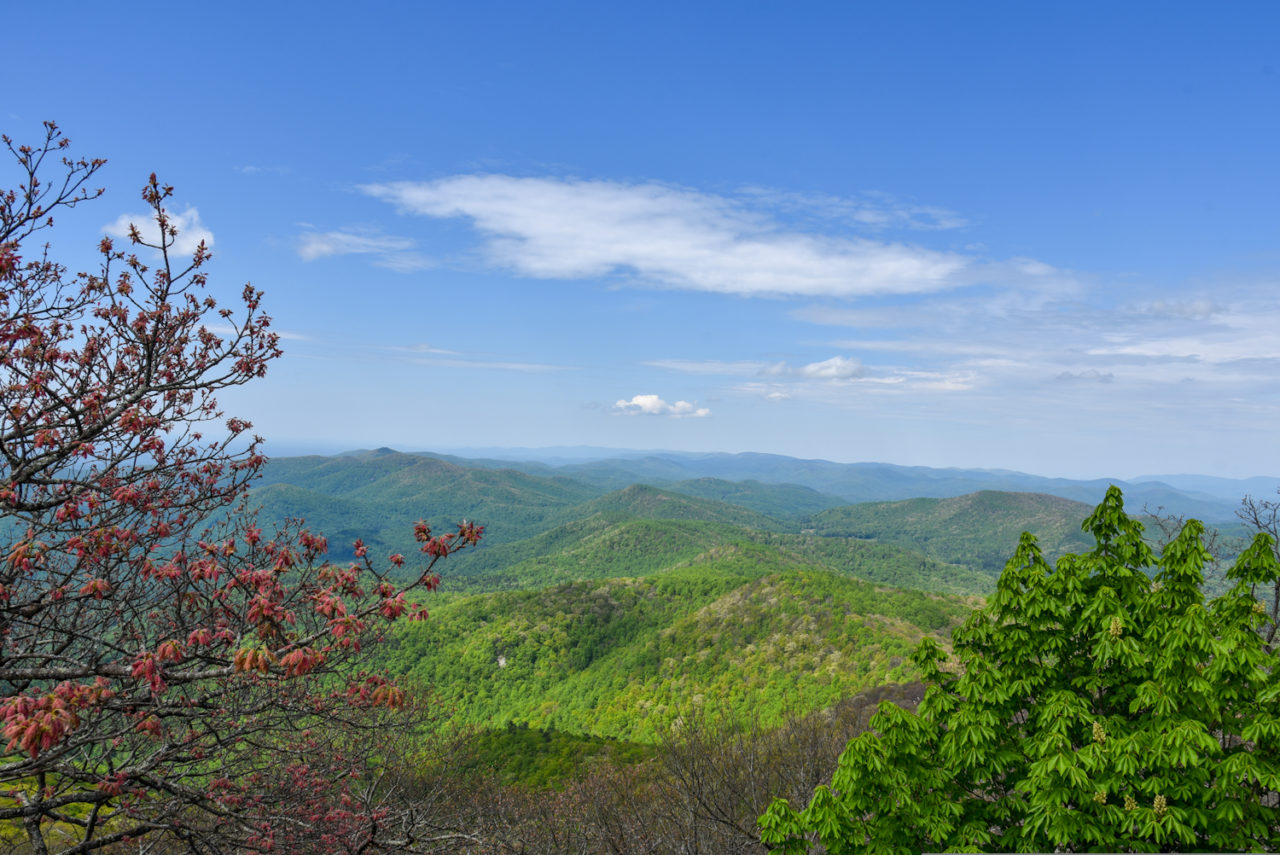
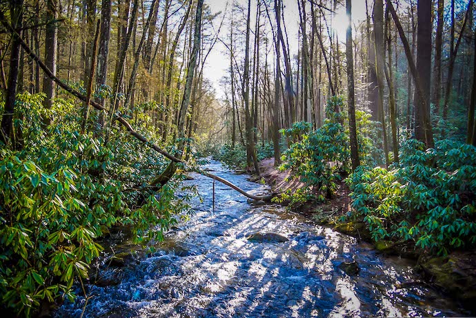
The 5-mile drive along a dirt and gravel Forest Service Road to the trailhead is a breathtaking experience that take you into the heart of the Blue Ridge Wildlife Management Area.
The drive offers gorgeous views of Noontootla Creek, Noontootla Falls, and Chester Creek that will take your breath away as they peek through the trees and rhododendron.
Read on for our guide to Long Creek Falls, including some history of the area, driving directions, and the highlights of hiking to this beautiful Blue Ridge waterfall.
READ MORE: 101+ Things to Do in North Georgia
LONG CREEK FALLS INFO
ADDRESS: Long Creek Falls Forest Service Road Blue Ridge, GA 30513
PHONE: 706-745-6928 or 706-970-9776
COST OF ENTRY: Free
LONG CREEK FALLS HOURS: Sunrise to sunset.
WEBSITE: http://www.fs.usda.gov/conf
HIKING TRAIL: Easy to Moderate, 2 miles in-and-out
AMENITIES: There are no amenities at this trail, and it is not handicap accessible.
Love North Georgia Waterfalls? Check out these great guides!
The 20 Best North Georgia Waterfalls (& How to Get to Them)
The 10 Best Waterfalls Near Helen GA
The 10 Best Waterfalls Near Blue Ridge GA
How to Get to Horse Trough Falls in Helen GA (Upper Chattahoochee River Campground)
How to Get to Anna Ruby Falls Near Helen GA
How to Get to Minnehaha Falls on Lake Rabun
How to Get to Panther Falls & Angel Falls at Lake Rabun Beach
How to Get to Helton Creek Falls in Blairsville GA
How to Get to Sea Creek Falls in Suches, GA
Long Creek Falls & Blue Ridge GA History
The entire Chattahoochee National Forest that surrounds Long Creek Falls once belonged to the Cherokee Nation.
Enclosed by the Blue Ridge Mountains, the Cherokee lived off the land, hunting, fishing, and gathering in the forest.
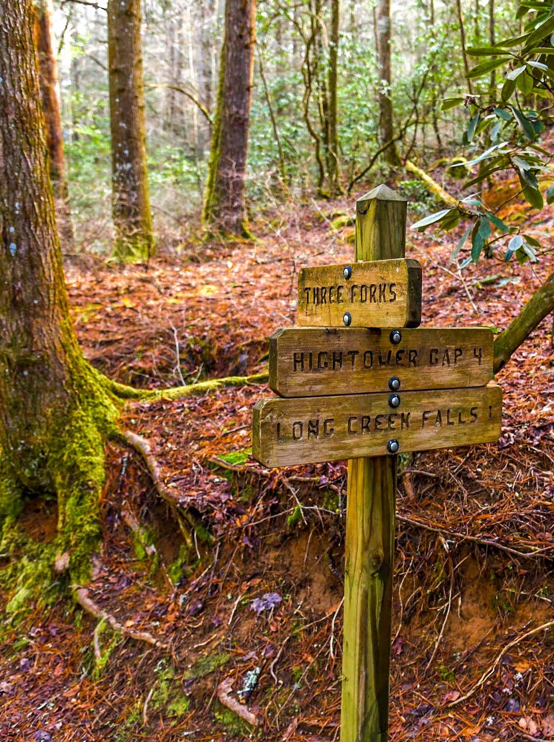
This area is called Three Forks because of the convergence of three crystal clear trout streams (Chester Creek, Long Creek, and Noontootla Creek) near Forest Service Road 58.
The excellent fishing opportunities in this the Three Forks area is among the reasons Fannin County is called the “Trout Capital of Georgia.”
Early Appalachian settlers first arrived in Blue Ridge from the north in 1790. In 1838, the Cherokee people were forced off their land in the tragic Trail of Tears.
Fannin County was established 16 years later, named after Col. James Fannin, who was born in Georgia and led the Texas Revolution for independence.
READ MORE: The Top 10 Treehouse Rentals in the Georgia Mountains
In 1921, conservationist Benton Mackaye (who later co-founded The Wilderness Society) proposed the idea to create the Appalachian Trail.
By 1925 he had enough support to organize the Appalachian Trail Conference, with the mission to present more specific plans to rally support in creating the hiking trail.
In 1937, Judge Arthur Perkins, who ran the Appalachian Mountain Club, took over the reins of the ATC in order to speed up progress.
Thanks to the efforts of Myron H. Avery, a federal admiralty lawyer, the creation of the epic trail along the eastern seaboard began soon thereafter. By the summer of 1937, the Appalachian Trail from Maine to Georgia was completed.
In 1968, 47 years after Mackaye first proposed the Appalachian Trail, the National Trails System Act was passed, making the Appalachian Trail the first National Scenic Trail in the USA.
In 1979 the Benton Mackaye Trail Association was organized in order to build the route through the Western Blue Ridge Mountains, naming the 300-mile trail after the famed conservationist.
READ MORE: The 15 Best Things to Do in Blue Ridge GA
Hiking the Long Creek Falls Trail
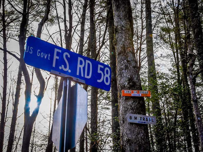
After stunning sightings of the creek popping out between the trees along the 5-mile dirt and gravel Forest Service road, you’ll reach the Long Creek Falls parking area. There’s a trailhead on each side, and Springer Mountain is to your right.
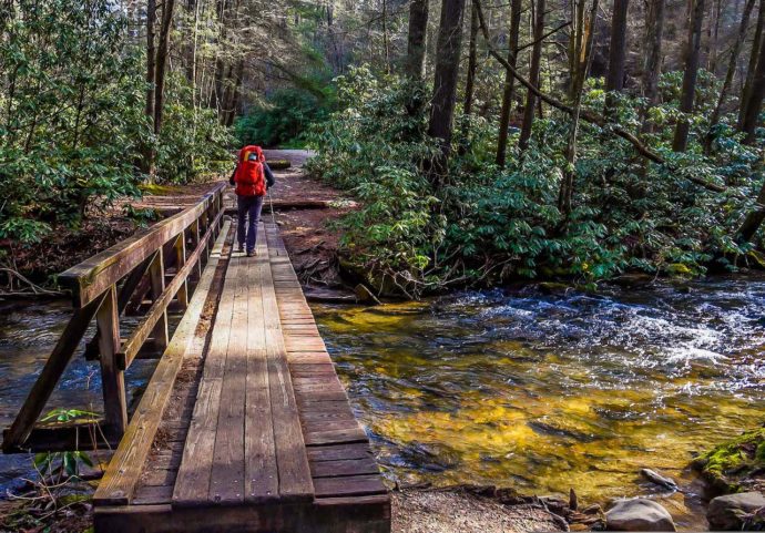
When you park, it’s worth taking the extra few steps to walk towards Springer Mountain. You’ll find a simple wooden bridge crossing Chester Creek, which makes for gorgeous photos.
The Long Creek Falls trailhead is to the left, and is marked clearly. You may even spot family members checking in on Appalachian Trail through-hikers here.
As a result of its AT proximity, this area is really abuzz with energy. The excitement of the various thru-hikers and day hikers alike is palpable here.
Note that if you go during a weekend getaway, it’s best to arrive early in the morning (by 9-9:30 AM at latest). Any later and you’ll likely see dozens of cars parked there. Weekday hikes thankfully feature slightly smaller crowds.
READ MORE: The 10 Best Wineries in the North Georgia Mountains
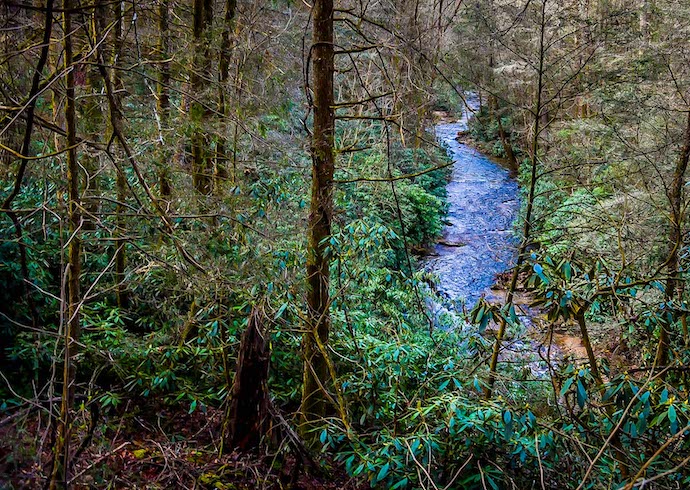
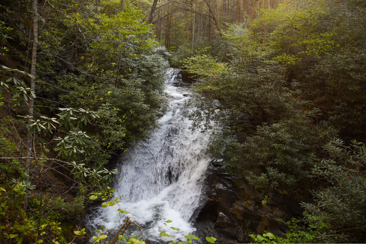
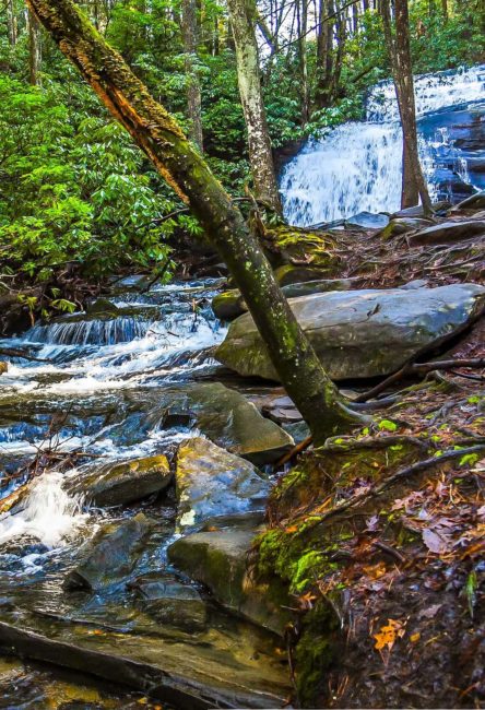
Surrounded by trees and rhododendrons, the one-mile hike to these beloved North Georgia waterfalls meanders alongside Long Creek, with many camping and picnicking areas to explore off the trail before reaching the falls.
It’s a fairly easy to moderate hike, but there are tree roots and several small streams crossing the path. The elevation gain is about 300 feet as you trek to the waterfalls.
You’ll probably see AT and Benton Mackaye Trail thru-hikers stopped to grab lunch, or readjusting their packs in little creekside nooks filled with colorful river rocks.
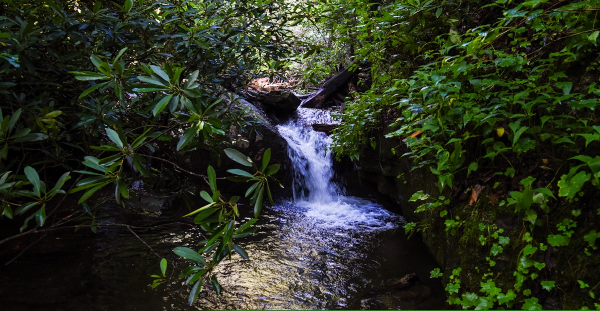
There are also remnants of old campfires and minor waterfalls along the creek.
If you want to make a full day of it, pack a picnic lunch (or grab one from the great restaurants in Blue Ridge) and find one of the picturesque spots along the creek to enjoy the awesome energy this place has to offer!
READ MORE: The Best Places to Go White Water Rafting in GA
VIEWING LONG CREEK FALLS
When you’re just a few hundred feet from Long Creek Falls, you’ll see where the Appalachian Trail and Benton Mackaye Trail separate. This is another fun place to stop and people-watch the passing thru-hikers.
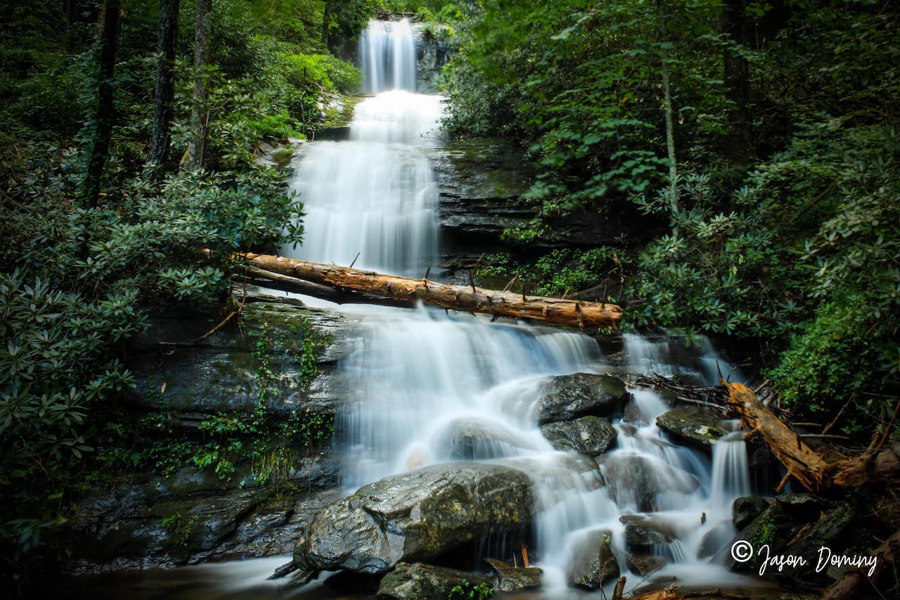
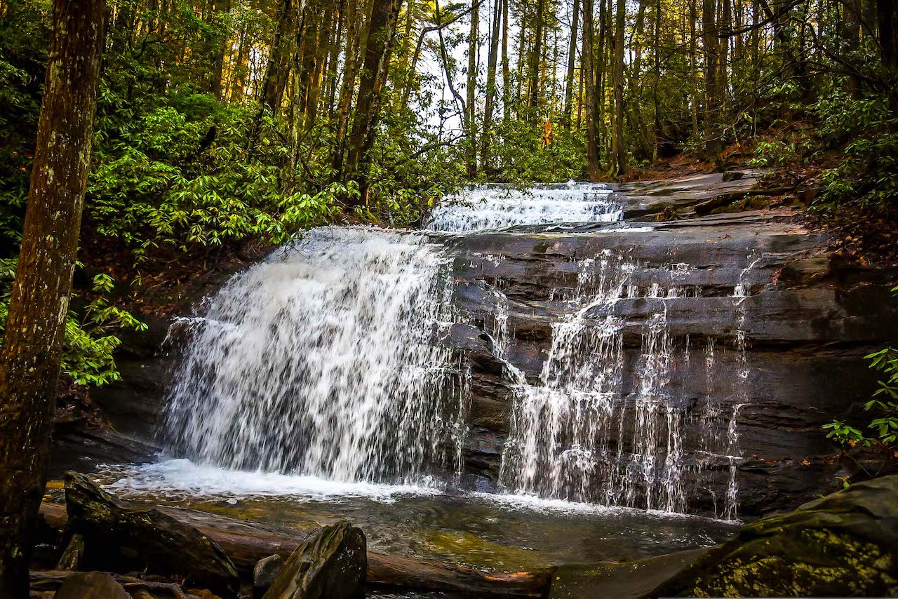
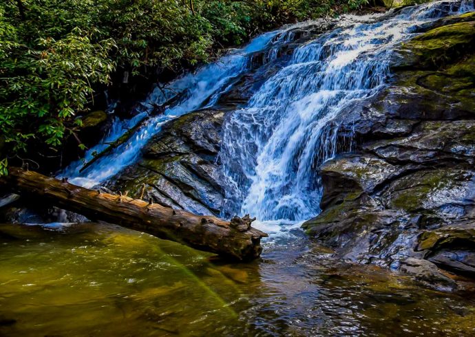
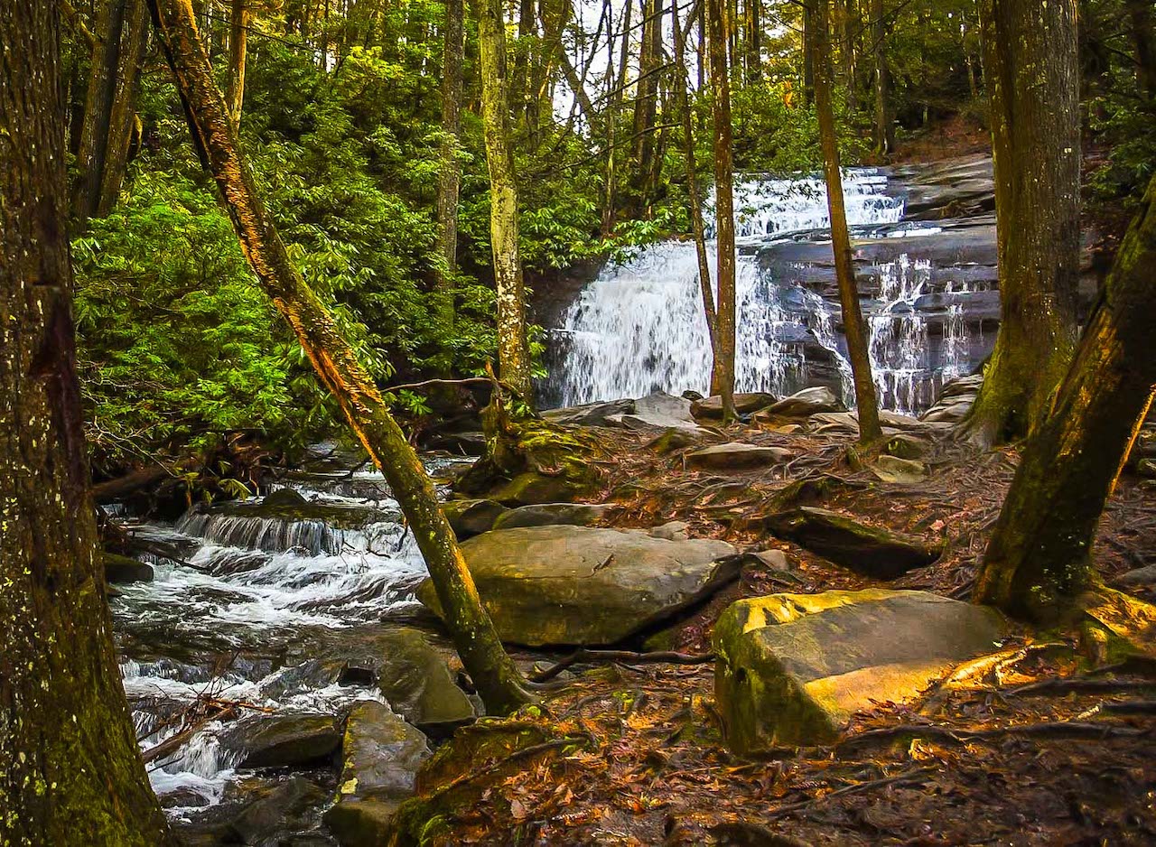
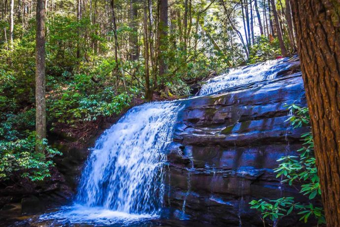
To reach the falls, you simply take the path on the left, following the blue marks on the trees. You’ll see the rhododendron-lined trail clear and open up to reveal Long Creek Falls in all its glory.
The cascade plummets into the serene creek, which is littered with moss-covered stones and boulders. In my opinion, the areas surrounding Long Creek Falls are just as beautiful as the rushing water itself.
On a sunny day, the sun dances across the reflective water, syncopated to the splashes of the falls’ rhythmic beat as the water tumbles 50 feet in two distinct drops.
The smiles on the faces of hikers all around me left a remarkably uplifting impression on my experience at Long Creek Falls.
READ MORE: Lake Blue Ridge Boat Rentals, Cabin Rentals, Camping & Fishing
AT hikers filled their filtered water bottles in the stream, getting ready to head back on their journey just as another group of joyful day hikers arrived.
I was enraptured by the wide-eye looks on their faces as they soaked in the scenery before them, bodies warmed from hiking and ears filled with the sounds of the clear water rushing along the creek.
They smiled as they pulled out their phones and cameras to snap selfies, in order to always remember this day, this moment, here in this special spot in front of the most stunning waterfalls in Blue Ridge GA.
This spot is what lit up a passion for hiking in me the first time I visited. Despite living up here in the Georgia mountains, surrounded by other stunning waterfall trails, I return to Long Creek Falls over and over again.
READ MORE: The 15 Best North Georgia Mountains for Hiking
Long Creek Falls Campsites
As you’re driving in to the trailhead, you’ll like notice four dispersed primitive campsites where you can spend the night in the national forest.
The chance to sleep under a canopy of rhododendron, pines, and oaks next to a clear stream is available at the permitted camping sites, which are clearly marked with signs.
Please practice Leave No Trace camping and pack out whatever you bring in.
These primitive campsites have no amenities aside from rustic stone campfire rings. But what they lack in facilities, they make up for in the serene natural beauty.
Note that all the Three Forks Campsites are first come, first served.
So if you’re planning on going on a weekend or holiday, make sure you arrive early, and with backup plans in case all the spots are taken!
READ MORE: Visiting Expedition Bigfoot Museum (aka Sasquatch Museum) in Cherry Log, GA
Long Creek Falls Directions
Directions to Long Creek Falls from Atlanta GA
Take I-85 N toward GA-400/Greenville, and use the right 2 lanes to take exit 87 for GA-400 N toward Buckhead/Cumming.
Continue onto GA-400 N for 6.3 miles, where it turns into US-19 N. Keep left to stay on US-19 N for 4.9 miles, then keep left to stay on US-19 N for another 26.1 miles.
Turn left onto Martin Rd, which you’ll follow for 1.4 miles before turning right onto GA-9 N. In 5.8 miles you’ll take a right to stay on GA-9 N. Then take the 1st exit at the traffic circle onto Shoal Creek Rd.
In 2.6 miles, Shoal Creek Rd becomes GA-136 W, which you’ll take for 3.2 miles to turn right on State Rte 342. Go 2.4 miles to turn right on Max Wehunt, then 1.2 miles to turn right on GA-52 E, then 1.8 miles to turn left on Nimblewill Church Rd.
In 1.3 miles, take a left on Forest Service 28-1/Fs 28-1 Rd. Follow it for 2 miles, then turn left to stay on Fs 28-1 Rd. In 312 feet it turns right and becomes Winding Stair Gap Rd.
Follow that for 4.9 miles to make a slight left onto Forest Service Road 58. The trailhead will approximately 2.7 miles.
Directions to Long Creek Falls from Downtown Blue Ridge GA
Head south on Aska Rd for 12.9 miles, then turn right onto Newport Rd. Follow that for 4.2 miles to turn left onto Doublehead Gap Rd.
In 0.7 miles, turn right onto Forest Service Rd/FS Rd 58. Follow it for approximately 5 miles until you reach the Long Creek Falls trailhead. –story and photos by Hope Cross