
Adventures in the great outdoors almost always offer a reward of some sort.
Maybe it’s a waterfall, or a scenic mountain overlook. Maybe it’s a cool cave, spotting some interesting wildlife, or a trail through a meadow filled with North GA wildflowers.
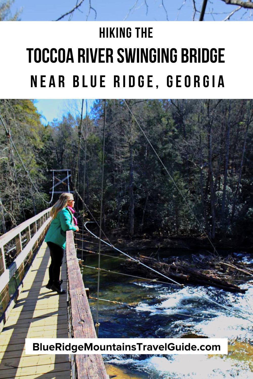
Last week I took an excursion to see a bridge. Specifically, the swinging bridge over the Toccoa River near Blue Ridge GA. There are two ways to get to the Toccoa River Swinging Bridge, and each of these hiking trails is fairly different.
I really like the fact that accessing the bridge from either end can make a trip to this Blue Ridge Mountains bridge customizable. It’s a good fit for almost anyone who can walk on unpaved trails and roads.
I hesitate to use the term “hike” regarding the Swinging Bridge trail in Blue Ridge, because, for hardcore hikers, that may be overstating things a bit.
If your goal is simply a visit to the bridge itself, the shortest way to access it is a 1/4-mile trek on an earthen path. The other approach requires a walk of about a mile on a gravel Forest Service Road, plus a short jaunt on an actual trail.
Serious adventurers looking for a more challenging Toccoa River swinging bridge hike should opt for the Benton Mackaye Trail/Duncan Ridge Trail. From the trailhead on GA Highway 60, the round-trip trek is just under 7 miles.
One of the most famous bridges in Georgia, the swinging bridge can also be accessed via paddling on the 13.8-mile Toccoa River Canoe Trail.
Kayakers can reach the swinging bridge between the put-in at Deep Hole Recreation Area and the take-out at the Sandy Bottoms Recreation area.
READ MORE: The 25 Best Things to Do in Blue Ridge, GA

Toccoa River Swinging Bridge History
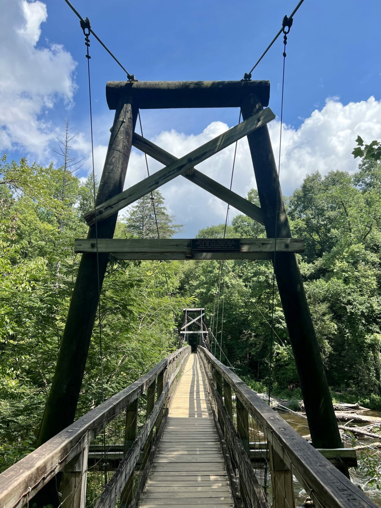
The bridge over the Toccoa River was constructed in 1977 through a cooperative effort between the US Forest Service and the Georgia Appalachian Trail Club.
Back then, they were considering extending the Blue Ridge Parkway all the way to Kennesaw Mountain (rather than its current southern terminus in Cherokee NC).
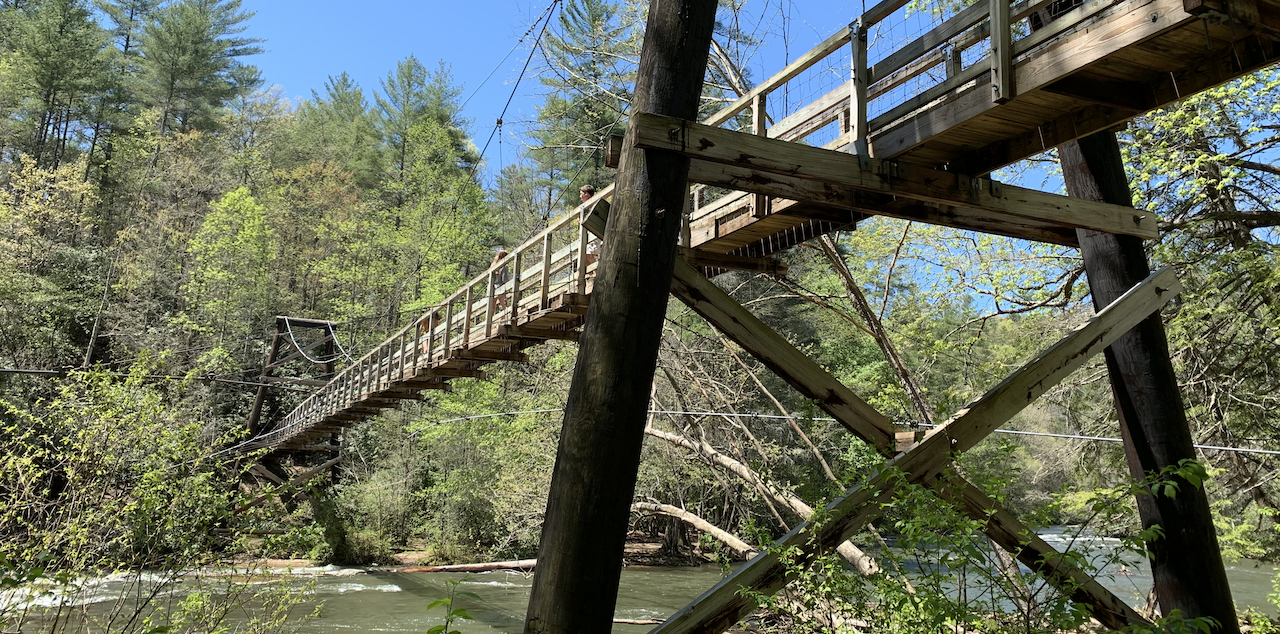
At 270 feet long, the Blue Ridge swinging bridge is the longest swinging bridge in the US east of the Mississippi River.
The swinging bridge is meant for foot traffic only. Bridges with a similar design and engineering intended for automobiles are called suspension bridges.
It’s located in the Chattahoochee National Forest, but can be accessed from the south via the Blue Ridge Mountain Wildlife Management Area.
The Toccoa River Swinging Bridge is located in Fannin County, and is a very popular attraction near the towns of Blue Ridge and Suches.
But don’t get confused: The Toccoa River Swinging Bridge is not in the town of Toccoa, nor is it related to the equally popular Toccoa Falls (which is approximately 70 miles east, near Clayton GA).
READ MORE: 101+ Things to Do in North Georgia
Hiking to the Toccoa Swinging Bridge
The Easy Trail
I first visited the Toccoa River bridge with my children when they were four and six years old. Back then we accessed the bridge from the shorter Forest Service side.
To make the short walk from the parking area, we first had to drive on about 3 miles of very rough, old Forest Service Roads.
We have an SUV with good clearance, but the road was narrow, bumpy, and had large potholes. Lower-clearance vehicles may struggle unless the driver has experience on such rugged roads.
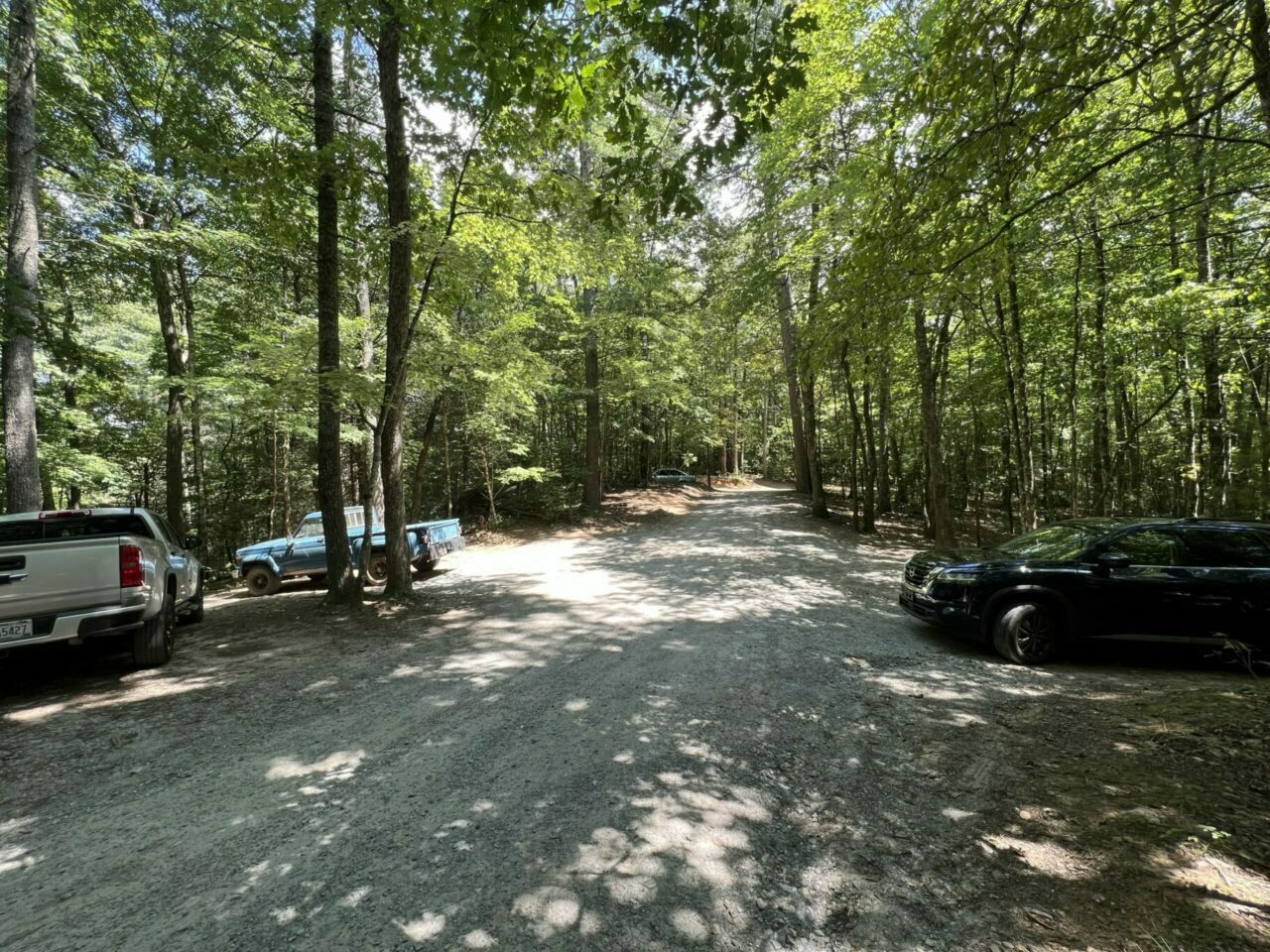
The small parking area has space for one or two cars parked in several pull-offs, accommodating perhaps a dozen vehicles in total.
If you plug “Toccoa River Swinging Bridge” into Apple Maps on an iPhone, the directions will lead to this parking lot.
The 1/4-mile walk from this parking area is hard-packed dirt, with exposed roots. There are a few steep spots to get down to the river and the bridge, but the decline is not sustained.
The trail from the parking area is uneven, but it is wide, without much encroaching vegetation.
In the heat of summer, the easy hiking trail is also nicely shaded. This is the most common way to access the bridge, and will lead you to the north side.
READ MORE: The 10 Best Waterfalls Near Blue Ridge GA

The Moderate Trail
On my most recent visit to the swinging bridge in Blue Ridge, I wanted a longer hike in the forest. So I drove on GA Hwy 60 and turned off onto the maintained gravel of Rock Creek Road.
Rock Creek Road is also the road to the Chattahoochee Forest National Fish Hatchery, which can be used as a GPS destination for finding this route to the swinging bridge.
After driving just over two miles, I saw a sign next to a bridge over a small creek that read “National Fish Hatchery 2 ½ Miles.” I parked my car there, and walked over the bridge on John Dick Creek Road (a.k.a. FS 333).
There is no parking place on this road to access the short hiking trail down to the swinging bridge, so I walked it.
There’s one water crossing along the way, which I managed on foot. Other than one couple with a dog, and one off-road vehicle, I had the lesser-known trail all to myself.
The trail took me past several dispersed tent campgrounds. The campsites were all very private, with some right next to the water. But all were primitive, with no running water or restroom facilities.
READ MORE: The 30 Best Hiking Trails in North Georgia Bucket List
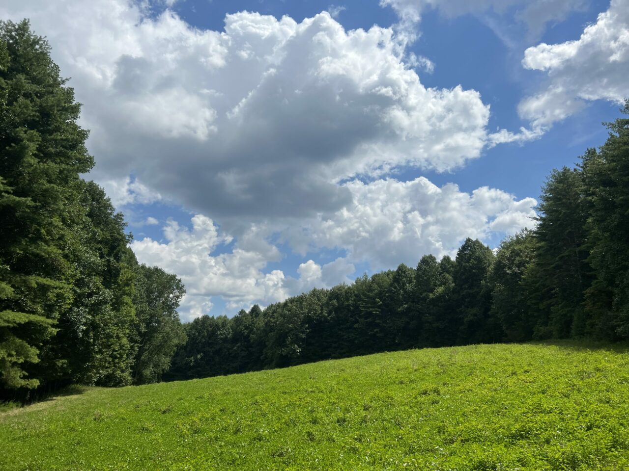
At one point, the road ran parallel to a mountain meadow, which is dotted with wildflowers in the spring.
The lush expanse of grass was beautiful, although hikers should be wary of exploring this area during hunting season, lest they be mistaken for a deer!
The Benton Mackaye trail crosses the gravel forest service road that’s uphill, and to the south, of the Toccoa River.
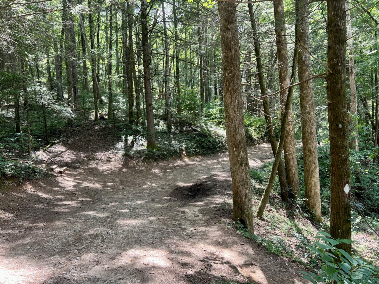
After walking a mile on the Forest Service Road, I looked for the White Diamond blazes of the BMT on my right. At this point, I could hear the rushing sounds of the river down below, and I turned to hike down the hill.
Following the short trail through the woods brought me to the south side of the bridge. The hike between the Forest Service road and the swinging bridge was less than two-tenths of a mile, but the descent was very steep.
I knew the hike back up would be short, but it was challenging enough that I had to stop and catch my breath once on the way out.
READ MORE: The 15 Best Day Hikes on the Appalachian Trail in Georgia
The View From the Swinging Bridge
The swinging bridge is made of wood, with suspension cables anchored to the banks in huge concrete pilings. So the bridge will move, shake, and sway slightly as people move across it.
My little kids loved running and jumping up and down on the bridge.
But I would caution anyone wanting to jump to make sure they were the only group on the bridge at the time. Not everyone enjoys the movement!
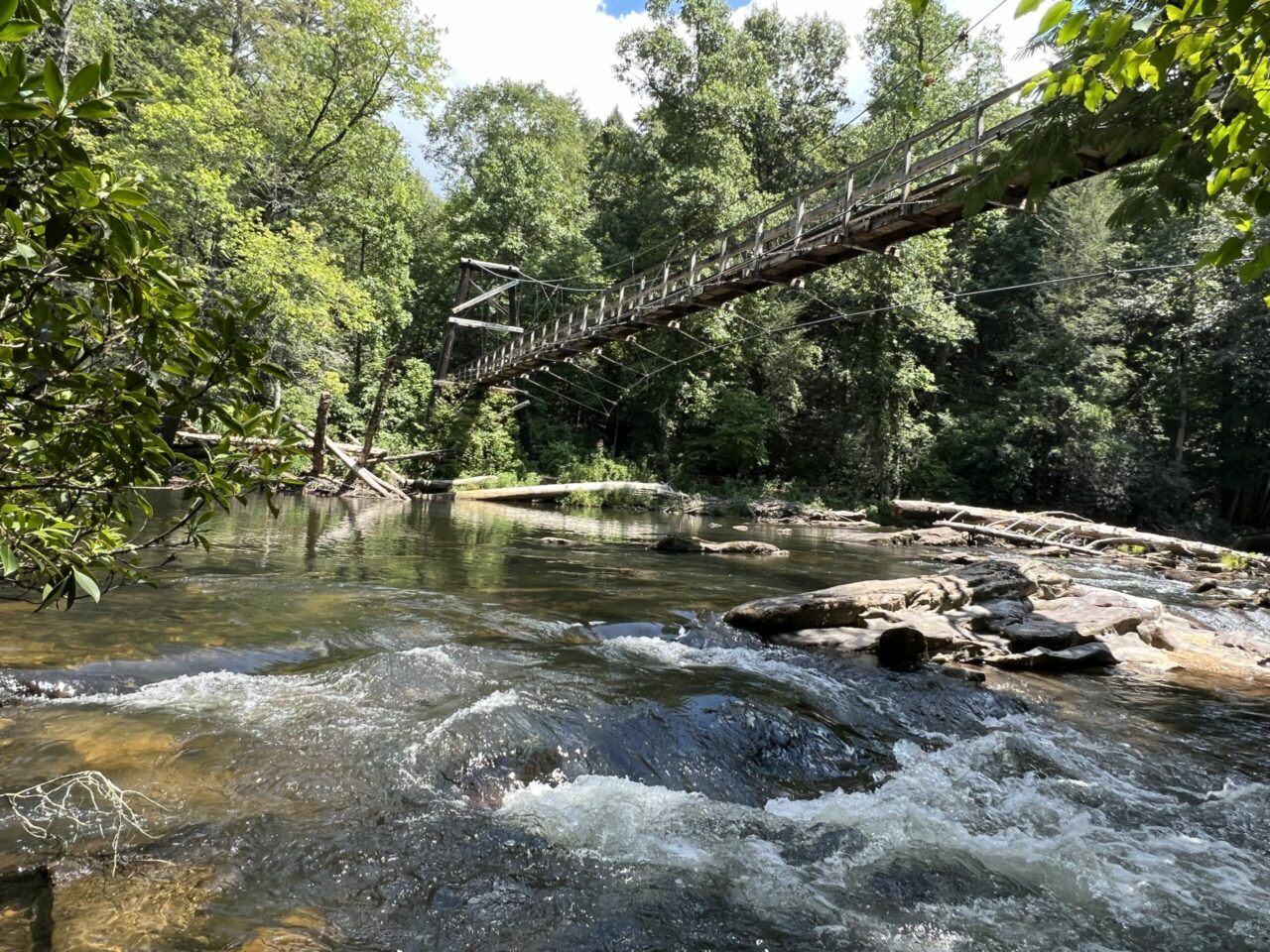
The bridge crosses the Toccoa River right where the flow transitions into beautiful rapids underneath.
The view from one side is serene flat water; the view from the other is interspersed with rocks and white water.
The sound of the river is soothing as it flows over and around the obstacles down below. The banks of the river are lined by lush trees on both sides.
READ MORE: The 10 Best Kayaking Rivers in Georgia
On weekends, the area can get quite crowded, with people taking pictures from the bridge and enjoying the scenery of the wilderness from the elevated vantage point.
The blue sky reflecting off the sparkling waters of the river and the sunlight filtering through the trees are breathtaking.
The water of the Toccoa River can be accessed under each end of the bridge. There is plenty of space to picnic, fish, or camp along the river. Dogs are allowed on the trails approaching the bridge, but they must be on a leash.
It should be noted that Toccoa River Swinging Bridge camping would essentially be backpacking or hammock camping. There are no picnic tables, grills, trash cans, or restroom facilities here.
Campers will need to practice the principals of Leave No Trace: Pack your trash out, and be aware of campfire regulations for the National Forests in America.
READ MORE: The 10 Best Places for River Tubing in North Georgia

The river flows north into Lake Blue Ridge, and the depth and speed of the current can change depending on the weather and the season.
While wading and swimming here may be safe at times, it can also be quite dangerous when the water is running high and fast. Use caution and keep safety in mind if you (or your kids) decide to play in the water.
I visited the bridge late on a Sunday in summer. There were just a handful of people relaxing at the river, but most of them had arrived from the north side parking area.
It was a longer trip for me via foot from the south, but I enjoyed the solitude of the less common access point.
Exploring the river with the swinging bridge in the background was a great way to end my week.
READ MORE: The 15 Best Blue Ridge Georgia Cabins to Rent
Toccoa Swinging Bridge Directions
Here are three options for visiting the Toccoa River Swinging Bridge:
Short Quarter-Mile Walk from Parking Area: From GA Hwy 60, take FS 816 and go 3 miles to the parking lot. The approximate GPS coordinates are N 34°44.350′ W084°10.213′. Cars with low ground clearance are not recommended.
One-Mile Walk + Short Hike via Forest Service Roads: Turn onto Rock Creek Road off of GA Hwy 60. Drive just over two miles and park near a sign reading “National Fish Hatchery 2 ½ Miles.” This access is suitable for any vehicle.
Three-Mile Hike on the Benton Mackaye Trail: Access the BMT trailhead at GA Hwy 60 and Tooni Gap Road, then hike south for 3.5 miles. –text and photos by Jennifer Worrel; lead image courtesy of SoutheastCyclingRoutes.com

