
[Updated October 26, 2021]
Stepping out of my car to hike the Sea Creek Falls Trail, I was soon surrounded by 50 butterflies, fluttering around as if to welcome me to this enchanting forest in the North Georgia mountains.
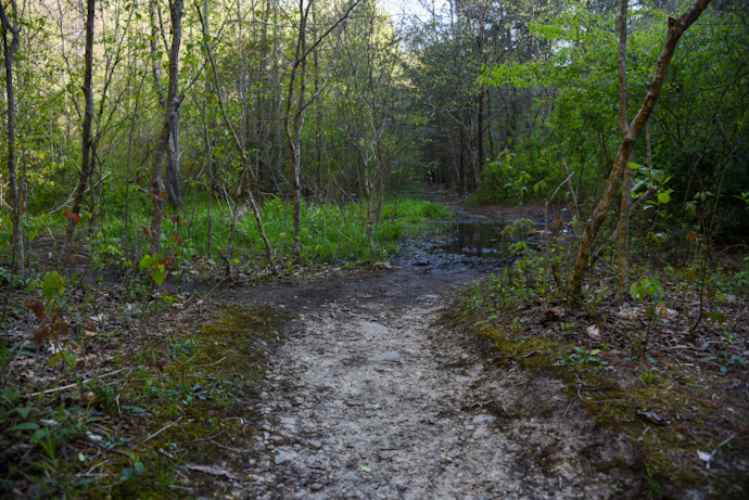
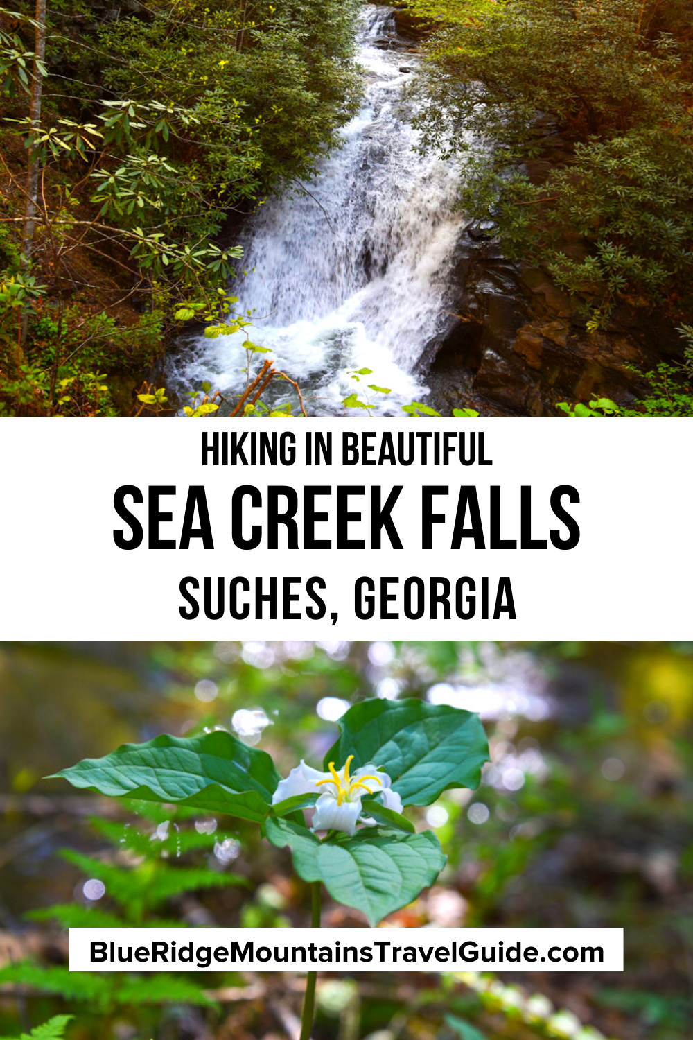
The .5-mile, in-and-out hike to Sea Creek Falls takes you through a serene part of the Chattahoochee National Forest, with its swampy paths covered in wildflowers such as trillium, geraniums, and violets.
This creekside trail offers many breathtaking places to stop along your journey through this special section of wilderness, which is located about 25 miles southeast of Blue Ridge GA.
As an enthusiastic watcher of Georgia birds, I was focused on new bird songs I wasn’t familiar with. It was then that I spotted my first-ever Yellow-throated Warbler dashing between the oak and pine trees.
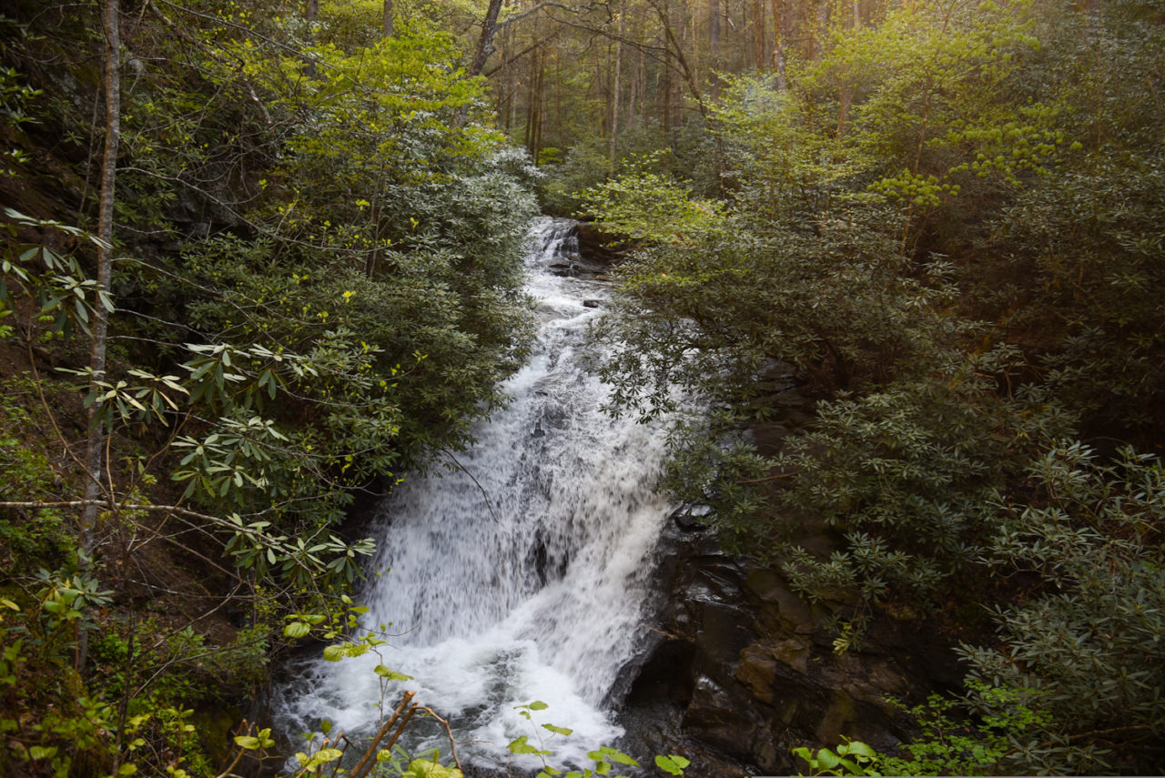
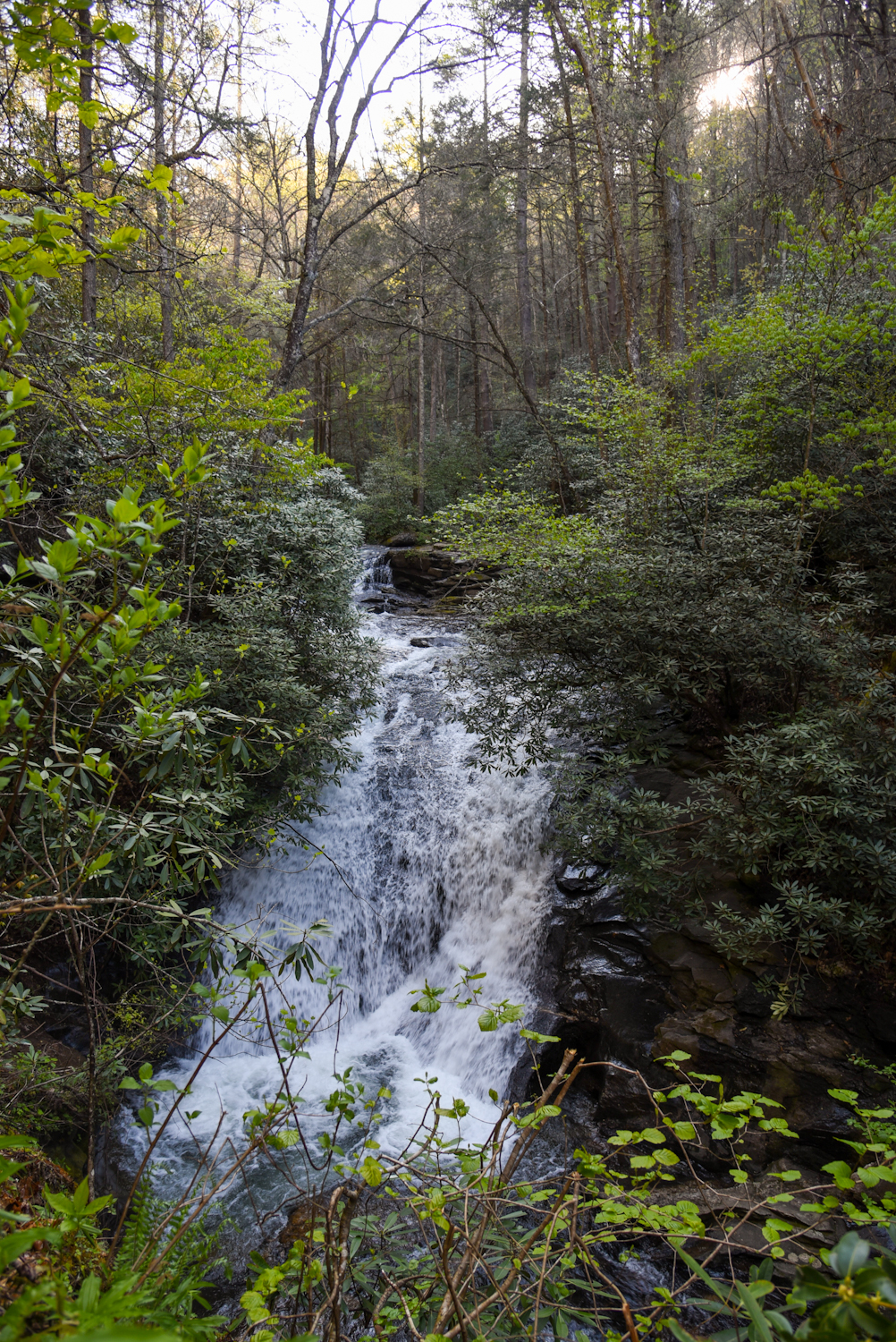
The hike to this stunning waterfall nestled in a moss-covered rock grotto is short but scenic, though the bog-like muddiness of the trail may be off-putting to some. For me, each step of the trails feels otherworldly somehow.
Read on for our complete guide to hiking Sea Creek Falls, which includes some history of the area, details on the hike, nearby camping options, and step-by-step driving directions.
READ MORE: 101+ Things to Do in North Georgia
SEA CREEK FALLS INFO
ADDRESS: Sea Creek Trailhead, Sea Creek Rd, Suches GA 30572
PHONE: 706-745-6928
COST OF ENTRY: Free
SEA CREEK FALLS HOURS: Sunrise to sunset.
WEBSITE: http://www.fs.usda.gov
HIKING TRAIL: Easy to Moderate, .5 mile in-and-out
AMENITIES: There are no amenities at this trail, and it is not handicap accessible.
Love North GA Waterfalls? Check out these great guides!
The 20 Best North Georgia Waterfalls (& How to Get to Them)
The 10 Best Waterfalls Near Helen GA
The 10 Best Waterfalls Near Blue Ridge GA
How to Get to Anna Ruby Falls Near Helen GA
How to Get to Dukes Creek Falls Near Helen GA
How to Get to Helton Creek Falls in Blairsville GA
How to Get to Hemlock Falls at Moccasin Creek State Park
How to Get to Minnehaha Falls on Lake Rabun
How to Get to Panther Falls & Angel Falls at Lake Rabun Beach
How to Get to Long Creek Falls in Blue Ridge GA

Sea Creek Falls & Suches GA History
Like most of North Georgia, the entire Chattahoochee National Forest that surrounds Sea Creek Falls once belonged to the Cherokee Nation.
Enclosed by the Blue Ridge Mountains, the Cherokee people lived off the land, hunting, fishing, and gathering in the forest.
Sea Creek Falls is located within the 30,000-acre Coopers Creek Wildlife Management Area, one of Georgia’s largest WMAs. It’s home to a plethora of wildlife, including deer, bear, turkey, and various small game animals.
Thanks in large part to the creation of the U.S. Forest Service in 1911, much of the wilderness in the Cooper Creek area is considered old growth forest.
This means that it has reached a great age without significant disturbance by humans, and therefore boasts some unique ecological features.
Early Appalachian settlers first arrived in the area around Blue Ridge GA in 1790. In 1838, the Cherokee people were forced off their land in the tragic Trail of Tears after the signing of the New Echota Treaty.
Suches, an unincorporated community that straddles Union County and Fannin County, came together in 1955 after the US Postal Service consolidated several smaller postal districts into one.
Today the largely agricultural community is known as “The Valley Above the Clouds.” It’s home to numerous popular outdoor attractions, including Cooper’s Creek, the Appalachian Trail’s Woody Gap, Preacher’s Rock, Sosebee Cove, Dockery Lake, and Lake Winfield Scott.
READ MORE: The 20 Best Things to Do in Blue Ridge, GA
Hiking the Sea Creek Falls Trail
The 1/4-mile Sea Creek Falls hiking trail meanders beside the creek and the many streams and springs feeding into it. Note that the path to the waterfall can get quite swampy, especially after recent rains.
I personally try to practice the Leave No Trace principles of environmental stewardship. But many hikers have left their footprints, creating a smaller path beside the original trail in order to avoid walking through the mud.
The short trail is surrounded by seemingly ancient, overgrown, and untouched forest, where birds and butterflies flit between the trees at the edge of your peripheral vision.
Muddiness aside, this is one of the easier waterfall hikes in North Georgia, and suitable for all ages and skill levels.
Although the Sea Creek hike may be short in length, it is what I would consider a memorable experience. In fact, since my first trip there, I’ve taken 3 other people to this spot so they could experience it for themselves!
In comparison to Long Creek Falls, this place feels a little less crowded, although weekends do tend to bring in more visitors hiking the trail.
On weekdays, you can find yourself sitting at the top of the falls for a few hours before another visitor will come along to remind you that you’re not in some secret tucked-away forest.
READ MORE: The 15 Best Blue Ridge Georgia Cabins to Rent
Viewing Sea Creek Falls
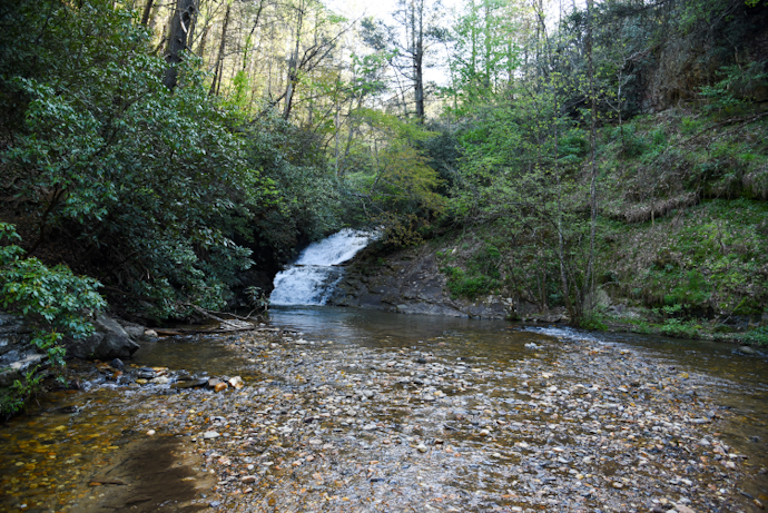
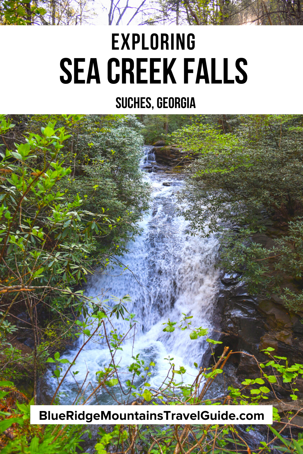
Once you reach this stunning waterfall surrounded by wildflowers, trees, and leathery rhododendrons, you can venture out towards the shallow base along colorful river rocks to see it up close and personal.
Standing in the rock-filled pool, you can feel the sheer volume of water crashing into it from the falls, with energy radiating back into the base off of the tall rock walls.
If you want to view the top of the waterfall, there’s a short and steep incline that’s covered in tree roots. If you navigate the climb carefully, you can see the stunning top of this 30-foot waterfall bursting out between the rhododendrons.
After climbing up to the top, you can disappear into this part of the forest and sit among the wildflowers. You’ll feel the cooling mist from the falls crashing down into the pool below, as warblers and thrashers sing happily in the background.
On a warm day, you can also spend some time wandering through the colorful creek bed, which is surrounded by rocks and trees.
Standing in the pool the water is crashing down into holds a uniquely lively energy, with the clear water moving between your feet. It’s another delightful way to experience the beauty of this lesser-known Georgia waterfall.
READ MORE: The Top 10 Treehouse Rentals in the Georgia Mountains
Campsites Near Sea Creek Falls
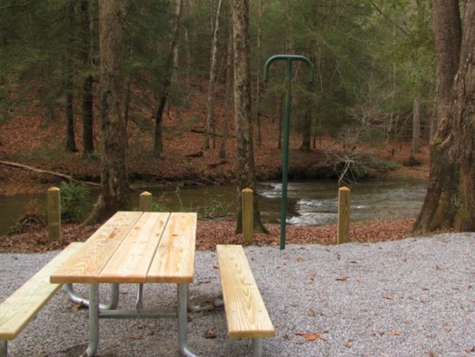
Sea Creek Falls is located near the Cooper Creek USFS Campground and Recreation Area. If you want to make a weekend getaway of it, this lush area of forest would make for a perfect trip.
The Cooper Creek Campsite address is 6050 Appalachian Highway, Suches GA 30572
Many people come to this North Georgia campground in order to hunt wild game or fish for the well-stocked trout.
There are two vault bathroom facilities located in the campsite, as well as faucets for water centrally located in the North Georgia campground.
Camping prices during peak season (4/1-10/31) is $15 per night, or $30 a night for a double site.
Camping during non-peak season (11/1-3/31) is just $7.50 per night, or $15 for a double site. The campground is open all year round, and quiet hours at the campsite are from 10 PM to 6 AM.
READ MORE: The 13 Best Restaurants in Blue Ridge GA

Sea Creek Falls Directions
From Blue Ridge GA, follow old US 76 east 5 miles to the intersection with GA 60 South at Lakewood Junction.
Continue 14.7 miles south on GA 60 through the town of Morganton, past the entrance to Deep Hole Recreation Area, to the junction with FS 4 on left.
Follow FS 4 an additional 3.0 miles to a right-hand curve in the road just inside the U.S. Forest Service boundary.
Turn left on FS 264, the road to the immediate left before the curve (note that it is very rough, and may have several deep potholes you may want to avoid).
Park in the area at the end of this spur (about .3 mile), and walk upstream about 150 feet to view the falls. –text & all photos by Hope Cross unless otherwise noted
