
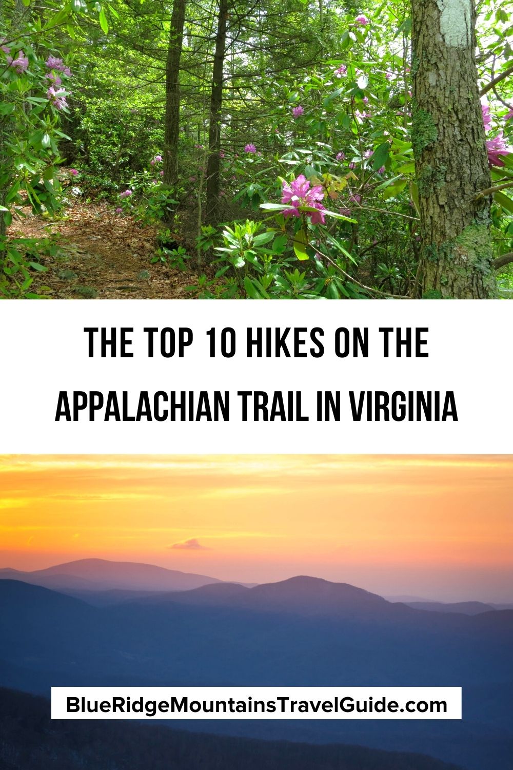
The Appalachian Trail extends 2,190 miles north to south in the eastern United States. Nearly a quarter of that—more than 550 miles— lies within (or along the borders of) the state of Virginia.
The AT in Virginia passes by award-winning VA state parks, through the George Washington and Jefferson National Forest, and into the world-renowned Shenandoah National Park.
The AT in Virginia winds around quaint Blue Ridge mountain towns (including Damascus, Marion, Luray, and Front Royal) and alongside semi-urban destinations (like Roanoke and Harrisonburg).
The Appalachian Trail map in Virginia climbs majestic mountain peaks, including Mount Rogers, the tallest in Virginia at around 5,500 feet. It also dips down to one of the AT’s lowest points, at just 265 feet above sea level.
With all of these historic landmarks, natural wonders, and topographical extremes, the Appalachian Trail in Virginia is full of rewarding and memorable hiking experiences.
The best day hikes on the Appalachian Trail are in Virginia offer something for people of almost all ability levels, from the most experienced trekkers to novice hikers.
Read on for our guide to the 10 Best Hikes on the Appalachian Trail in VA, including total distance, elevation gain, and a description of each hiking trail section..
READ MORE: The 10 Hiking Essentials Packing List for the Blue Ridge Mountains
Best Hikes on the Appalachian Trail in VA Guide
- Angel’s Rest
- Apple Orchard Falls
- Blackrock Summit
- Chestnut Knob
- Crabtree Falls to The Priest
- Kelly Knob
- McAfee Knob
- Mount Rogers High Country
- Bluff Mountain
- Jones Run Trail to Big Run Overlook
1. Angel’s Rest
Location: Jefferson National Forest
Distance: 5.6 miles
Trailhead: 402-522 Cross Ave, Pearisburg VA
This out-and-back route has a big-time change in elevation, climbing over 1600 feet in under two miles. Naturally, the trail drops just as far on the way back.
That being said, the Angel’s Rest Hike in VA is a well-worn path, with lots of switchbacks and notorious inclines. But at the top there are rewarding views of the New River and nearby Pearisburg.
There are lots of tall hardwoods (mostly oaks and poplars) along the route, as well as Virginia wildflowers blooming from thickets of rhododendron and mountain laurels in late spring.
Though Angel’s Rest gets more press, the Wilburn Valley Overlook is just a little further down the Appalachian Trail (0.6 miles) and offers more expansive scenic views.
READ MORE: 30 Fascinating Facts About the Appalachian Mountains for Trivia Buffs
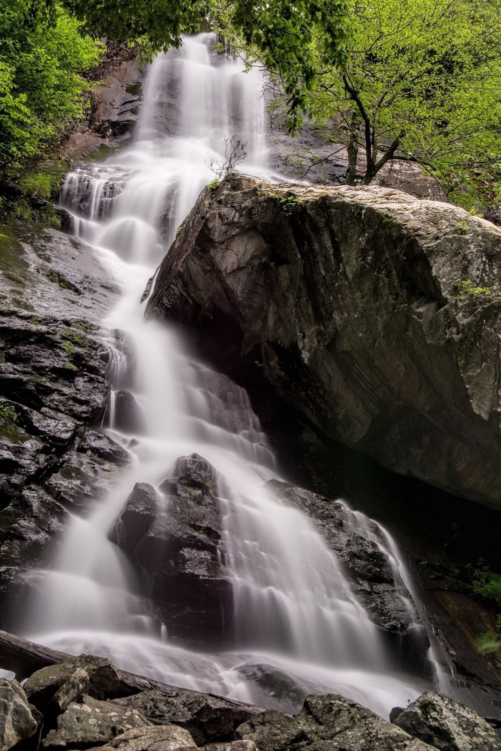
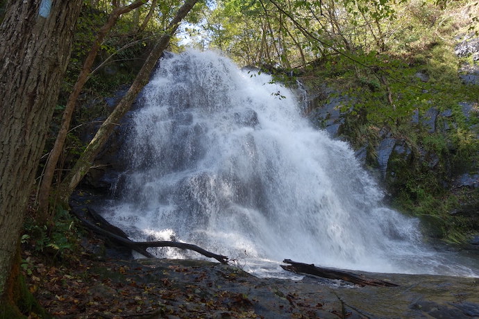
2. Apple Orchard Falls
Location: Jefferson National Forest
Distance: 7.5 miles
Trailhead: FS Road 59
Though very little of this hike is actually on the AT, visiting Apple Orchard Falls is a popular thing to do (and a short spur) when hiking the Appalachian Trail in Virginia.
It’s one of the most popular waterfalls in the Virginia mountains, and the trail can be accessed by car from two spots.
One is at the end of FS Road 59 in the Jefferson National Forest, while the other is at the Sunset Field Overlook on the Blue Ridge Parkway. In our opinion, the FS Road 59 trailhead offers a more pleasant route.
Either way, the 7.5-mile hike referenced above combines Apple Orchard Falls Trail and the Cornelius Creek Trail to make a loop route. It’s filled with creekside hiking, creek crossings, and a jaunt on the AT, which connects the two trails to make the loop.
Apple Orchard Falls is a 200-foot waterfall with a great viewing area that is 100% worth the long hike.
READ MORE: The Best Restaurants in Lexington VA & Natural Bridge VA for Foodies
3. Blackrock Summit
Location: Shenandoah National Park
Distance: 1 mile
Trailhead: Blackrock Parking Area
It can feel wonderful to take short, easy hiking trails with a big payoff, particularly when it involves the Appalachian Trail and the Shenandoah Valley.
For some, that alone might make the Blackrock Summit one of the best hiking trails in Virginia.
The trek to Blackrock Summit is only a mile and takes about an hour round-trip. But it leads to one of the most popular spots in Shenandoah National Park.
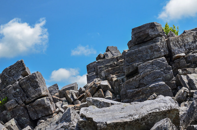
The summit at Blackrock has a talus slope, meaning it is basically a tilted field of large rocks. But the path cuts through them and provides extraordinary views with no clambering necessary.
For an extra 0.8 miles of steep trail, hikers can also reach another (possibly more impressive) stunning overlook from the summit of Trayfoot Mountain.
READ MORE: The 10 Best Things to Do in Waynesboro VA (Augusta County)
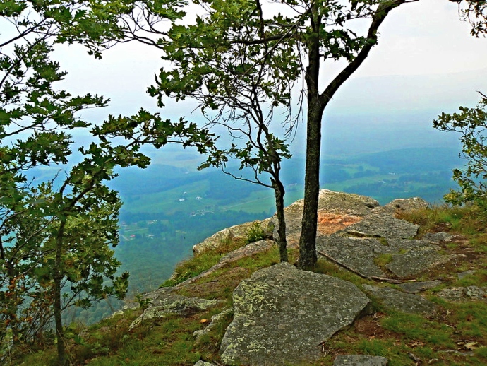
4. Chestnut Knob
Location: Beartown Wilderness in Jefferson National Forest
Distance: 2.6 miles
Trailhead: State Rte 727 near Ceres VA
Chestnut Knob is one of the treeless mountaintop balds that are common in the Southern Appalachian mountains (such as North Carolina’s Max Patch and Georgia’s Brasstown Bald).
The hike to Chestnut Knob is through the Jefferson National Forest, climbing to the bald from Medley Valley Road via the Appalachian Trail.
From there, the stellar Blue Ridge Mountains scenery is worth writing home about, and it’s a wonderful place to spread out a picnic blanket.
Another cool feature at Chestnut Knob is the AT shelter, which exudes a sort of mystical aura around those brave souls who attempt the entire 2,190-mile hike.
READ MORE: Appalachian Folklore, Monsters and Superstitions
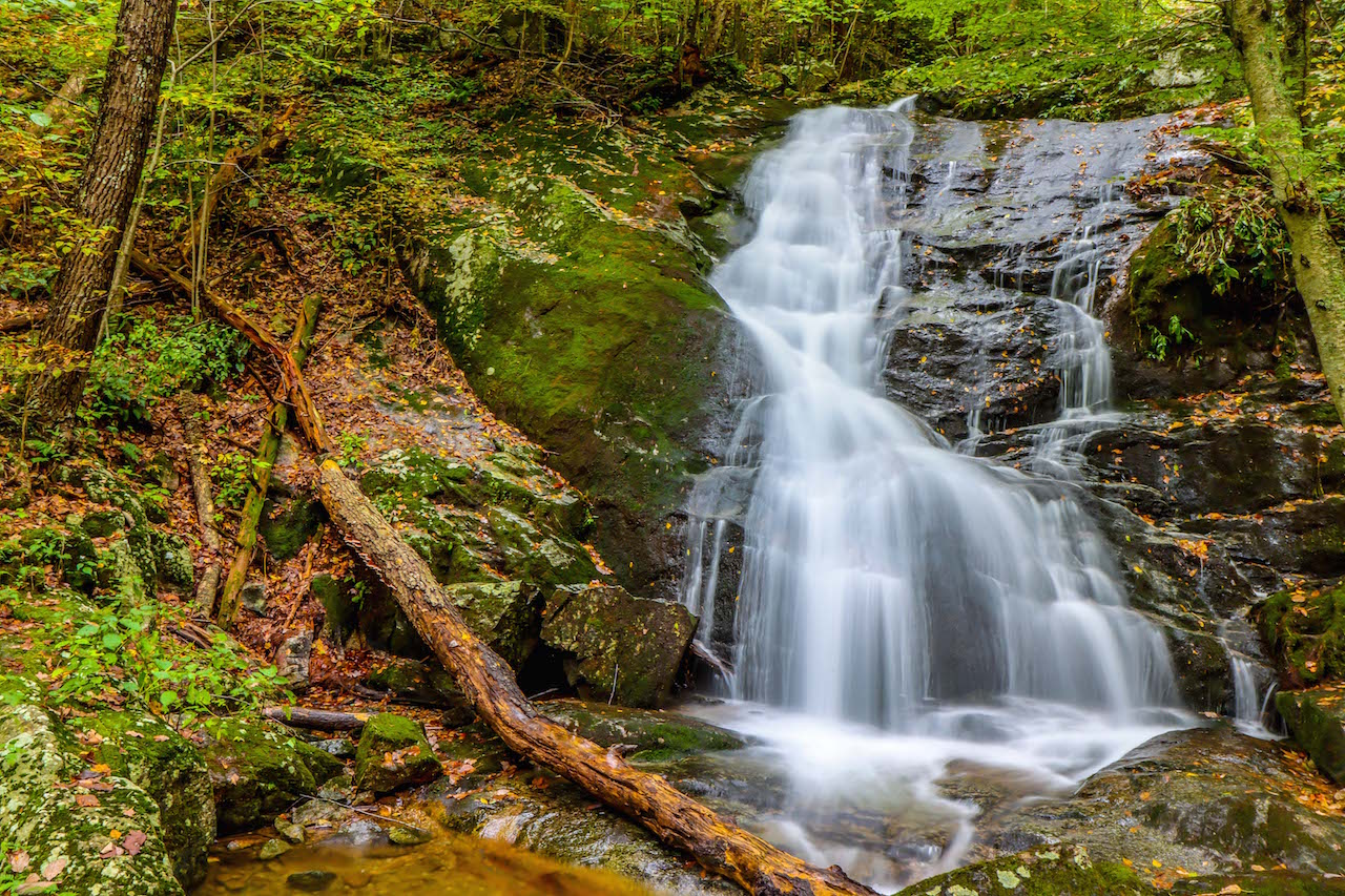
5. Crabtree Falls to The Priest
Location: George Washington National Forest/Priest Wilderness Area
Distance: 9 miles
Trailhead: Crabtree Falls Trailhead Parking Area, VA-56 near Tyro VA
There are easy routes for seeing Crabtree Falls and The Priest summit separately. But the hike between them is a challenging route that includes multiple waterfalls, sensational views, and a memorable AT trekking experience.
Crabtree Falls in Virginia (there is another Crabtree Falls in North Carolina) is a multi-tiered 1200-foot waterfall.
Though the epic scenic route is around six miles away, Crabtree Falls is usually featured as one of Virginia’s must-see Blue Ridge Parkway waterfalls.
The Priest has an amazing summit that offers huge panoramas of the rugged Blue Ridge Mountains and George Washington National Forest. The Priest AT shelter is only a quarter of a mile in.
This hike is a seriously strenuous one, with a lot of miles to travel and a significant change in elevation (2500 feet). But it is totally doable for hardy hikers with a bit of experience under their belt.
READ MORE: Camping and Hiking in Natural Bridge State Park, VA
6. Kelly Knob
Location: North of Newport, VA
Distance: 4 miles
Trailhead: Kelly Knob Parking on Clover Hollow Rd.
A great hike for those visiting Blacksburg VA, Kelly Knob can be approached from two different directions on the AT, with the trailhead listed above providing the shorter route.
The moderate to strenuous hiking trail is consistently noted as “very steep” at the beginning– roughly ¾ of a mile– but it levels off significantly after that, with a rolling landscape.
The big draw here is a remarkable overlook of the New River Valley that doesn’t require quite the arduous physical commitment that nearby AT hikes such as McAfee Knob or Angel’s Rest do.
The ridge to Kelly Knob stretches between John’s Creek Mountain and Clover Hollow Mountain, with lush forest and striking rock formations as along the way.
READ MORE: The 8 Best Breweries in Roanoke VA, the Heart of Virginia’s Blue Ridge
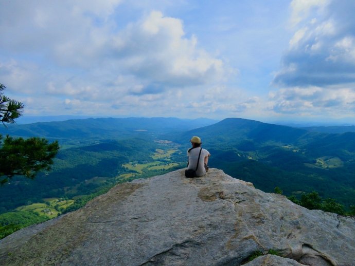
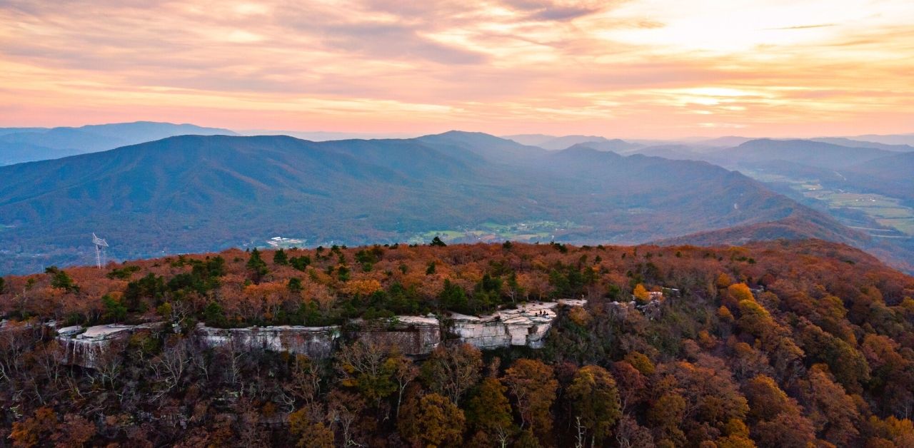
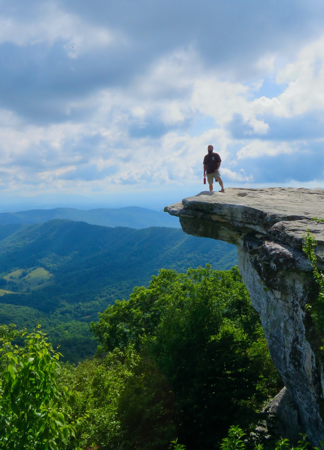
7. McAfee Knob
Location: Near Roanoke VA
Distance: 7.8 miles
Trailhead: Catawba Valley Dr., Catawba VA
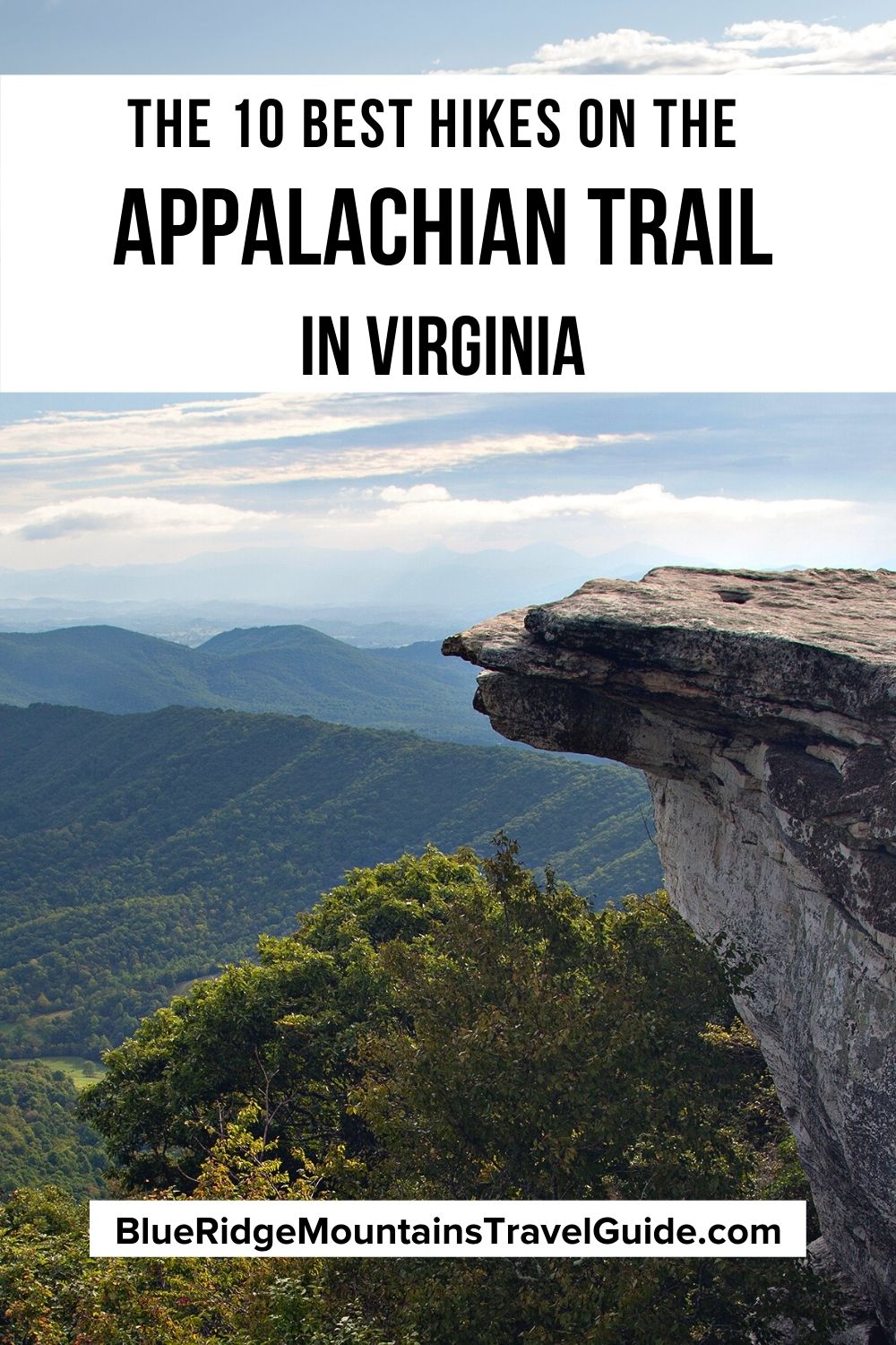
Considered THE spot for day-hikers looking to hit the Appalachian Trail in Roanoke VA, McAfee Knob is the most photographed attraction along the Appalachian Trail.
The hike to McAfee Knob is nearly 4 miles of moving uphill, passing through dense forest and huge rock formations as the trail flattens out atop the mountain.
The view from McAfee Knob includes the Catawba Valley, Roanoke Valley, and the city of Roanoke VA. But it’s more famous for the jutting rock formation where most hikers have their photos taken.
McAfee Knob is a very popular hike, and the Appalachian Trail parking lot tends to fill up quickly, especially on weekends.
This is one piece of a longer AT section referred to as “the Virginia Triple Crown hike,” which includes Dragon’s Tooth, McAfee Knob, and Tinkler Cliffs.
READ MORE: The 15 Best Things to Do in Roanoke VA
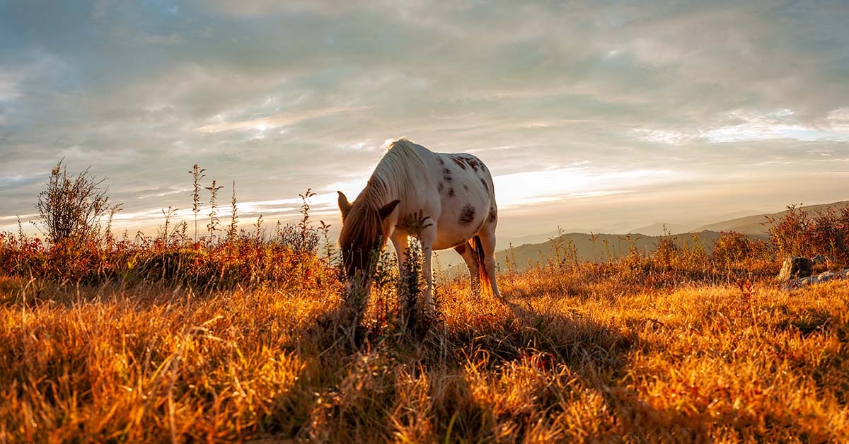
8. Mount Rogers High Country
Location: Mount Rogers National Recreation Area
Distance: 9 miles
Trailhead: Massie Gap Parking Area
The Mount Rogers National Recreation Area has 60 miles of the AT within its boundaries, and over 400 miles in total.
The most popular part of the Appalachian Trail in Mount Rogers can be accessed from Grayson Highlands State Park, with the hike starting from Massie Gap.
The Rhododendron Trail and Horse Trail North climb out of the park to join the Appalachian Trail, ultimately taking hikers to the towering summit of Mount Rogers.
Mount Rogers peaks at 5,729 feet, making it the tallest mountain in Virginia.
READ MORE: The 15 Best Things to Do in SWVA (Southwest Virginia)
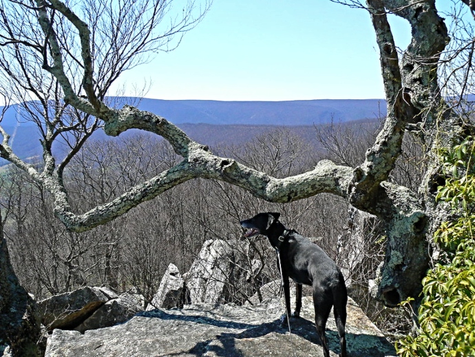
9. Bluff Mountain
Location: Jefferson National Forest
Distance: 3.7 miles
Trailhead: Milepost 51.7 on the Blue Ridge Parkway
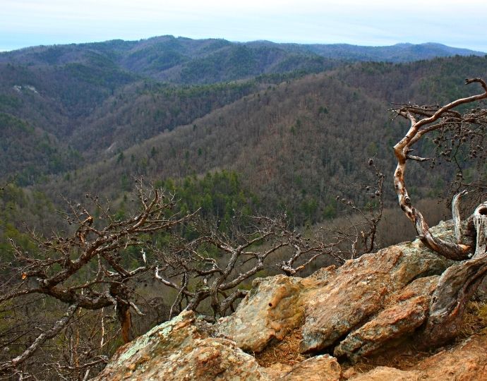
The hike to Bluff Mountain’s summit is about two miles of strenuous uphill hiking, climbing roughly 1200 feet in elevation.
This trek departs from the Blue Ridge Parkway, goes to the top of Punchbowl Mountain, and continues on to the summit of Bluff Mountain for great views of Virginia’s Shenandoah Valley.
Though it’s only a short section of the Appalachian Trail, there are some other famous sites along it, including Punchbowl Shelter (which was made famous by a National Geographic photo) and the Ottie Powell Memorial.
Another popular thing to do here is to use binoculars to try to spot the George Washington statue atop Washington & Lee’s University Hall.
READ MORE: The 15 Best Things to Do in Lexington VA & Natural Bridge VA
10. Jones Run Trail to Big Run Overlook
Location: Shenandoah National Park
Distance: 7.3 miles
Trailhead: Milepost 84.1 on Skyline Drive
The road trip to this hike along Skyline Drive is worthy of taking in and of itself. But the hike rewards your effort with multiple waterfalls, creeks, cool rock formations, and stunning forest.
Despite its 7.3-mile length, this loop is considered less strenuous than some of the shorter AT hikes in Virginia, primarily because the elevation gain is stretched out.
The loop is chock full of cool stuff to see, and a lot of it either runs parallel to the Skyline Drive or just off of it, from Doyles River Parking to Brown Gap Parking back to Jones Run Parking.
There are also three Skyline Drive Overlooks and picnic grounds to enjoy along the way, including the Doyles River Overlook, Dundo Overlook & Picnic Grounds, and Big Run Overlook. –by Jonathon Engels; featured photo of Mcafee Knob from above via Canvas
