
In terms of outdoor recreation, my native state of Georgia is home to 50+ state parks and historic sites and more than a dozen national parks and forests.
Our plethora of options to explore includes majestic mountains, ancient geological formations, canyons carved out over the course of time, wild and scenic rivers, and a seemingly endless array of waterfalls.
But with such an abundance of natural beauty within a few hours of Atlanta, sometimes it’s easy to overlook the amazing green spaces in your own back yard.
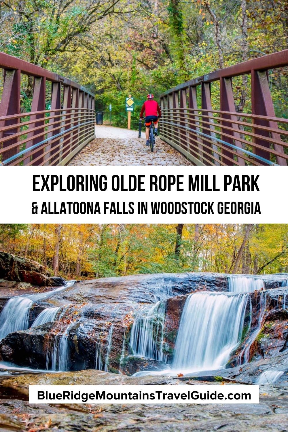
City parks provide an essential resource for locals, and Olde Rope Mill Park has been one of my favorite places ever since I moved to Woodstock GA back in 2004.
It’s where I took my dogs for riverside walks, took my daughter to learn to ride her bike and go roller skating, and took my wife for numerous picnics.
This Woodstock park has everything you could want from a state park, including a historic site, 20 miles of hiking and mountain biking trails, fishing and kayaking on the Little River, and access to one of the most beautiful lakes in Georgia.
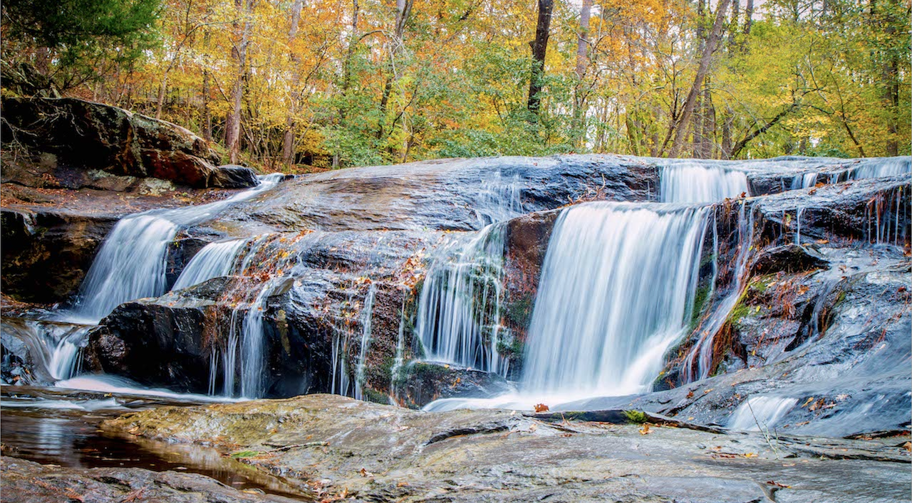
But it also offers access to Allatoona Falls (a.k.a. Toonigh Creek Falls), a gorgeous waterfall that’s so under-the-radar, I lived in Woodstock for 16 years before I heard about it in a Facebook group!
Read on for our guide to exploring Olde Rope Mill Park and Allatoona Falls including an overview of the myriad biking and hiking trails and directions to the waterfall.
READ MORE: 101+ Things to Do in North Georgia
Olde Rope Mill Park Info
ADDRESS: 690 Olde Rope Mill Rd, Woodstock GA 30188
PHONE: 770-517-6788
PARK HOURS: 7AM to 11PM Daily
OFFICE HOURS: Mon to Fri 8AM-5PM
ENTRY FEES: Free
OFFICIAL WEBSITE: City of Woodstock Parks & Recreation
PARK AMENITIES: Picnic areas, restrooms, swings, pavilion with BBQ grill, kayak launch
DRIVING DIRECTIONS:
From metro Atlanta, take I-75 N to GA-5 N/I-575 N, following the signs for Canton GA. In 9.7 miles, take exit 9 for Ridgewalk Pkwy.
Keep right at the fork and merge onto Ridgewalk Pkwy, then make an immediate left onto Olde Rope Mill Rd.
You’ll enter the parking lot for Rope Mill Park in 0.7 miles.
READ MORE: The 25 Best Day Trips From Atlanta GA
Olde Rope Mill Park History
Long known as Rope Mill by Woodstock GA locals, this park was home to the last mill on Little River in the 1920s, when Georgia Power began purchasing land with the intention of building a dam and hydroelectric plant.
With construction delayed by the Great Depression, some tracts of land were leased back to locals. From 1928 to 1949, brothers Joe and Smith Johnston leased this riverside parcel for their Cherokee Cotton Mills.
The mill used low-grade cotton to make 3- and 4-ply rope that was used for plow lines, tents, and wells. When the river ran low, a diesel engine supplied additional power.
There was a lot of airborne lint inside the mill, so a reservoir was built on the hill above the factory, feeding water into sprinklers that improved humidity levels inside.
By the time the factory reached its peak production levels in the late 1940s, the mill’s 30+ employees made it the largest employer in Woodstock (which had around 500 residents). Most of them, and their families, lived in housing on site.
In January 1950, the Lake Allatoona hydroelectric plant near Cartersville GA finally began operating. The U.S. Army Corps of Engineers removed or disabled all buildings on the flood plain, including those at Rope Mill.
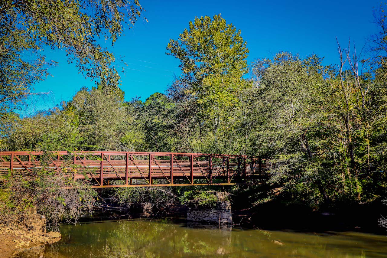
Visitors to Olde Rope Mill Park today can still cross a bridge over the river to see the ruins of the foundation of the mill, breached raceway, and a significant portion of the dam.
There are also signs with diagrams showing the layout of the Cherokee Cotton Mills, helping to preserve the memory of Woodstock’s early 20th century heritage.
READ MORE: The 20 Best Lakes in the North Georgia Mountains
Biking & Hiking Trails at Olde Rope Mill Park
Today, Olde Rope Mill Park offers more than 20 miles of biking and hiking trails, including the unofficial 3.2-mile trail to Allatoona Falls (a.k.a. Toonigh Creek Falls), which we consider one of best waterfalls in North Georgia.
Overseen by SORBA Woodstock (the Southern Off-Road Bicycle Association), the park’s mountain biking trails are dedicated to the memory of Taylor Randahl.
The Woodstock native grew up riding in the woods around Rope Mill, and went on to develop his skills in cross country mountain bike racing.
Unfortunately, he died at the age of 16 in a freak accident while cycling along a nearby country road. But the Taylor Randahl Memorial Bike Trails at Olde Rope Mill Park serve as a testament to his legacy more than 20 years later.
Note that while these trails are multi-use, hikers must yield the trail to cyclists and travel in the opposite direction.
Eight of the 10 biking trails are directional, with cyclists moving clockwise (a.k.a. to the left) on Sunday, Monday, Wednesday & Friday, and counter-clockwise on Tuesday, Thursday, and Saturday.
READ MORE: The 30 Best Hiking Trails in North Georgia Bucket List

Avalanche Trail Loop (6.25 miles)
The longest of the Taylor Randahl Memorial Bike Trails, the Avalanche Trail Loop is comprised of three different loops ranging from 1.5 to 2.5 miles.
All of them are rated as intermediate mountain biking trails, which means they are, “Mostly stable with some variability, 10% or less grade, unavoidable obstacles 8 inches or less, avoidable obstacles may be present, technical trail features 2 feet high or less may be present.”
The clearly marked trail entrance is on the right as you enter the main parking lot at Olde Rope Mill Park, and takes cyclists/hikers up into the hills on the south side of the Little River.
There is some climbing in elevation and switchbacks as you get deeper into the forest, with a narrow and twisty single-track in and among the pines.
Note that there are some rough areas with difficult rock and root combinations. but you also get lovely views of the river along the way.
READ MORE: The Best 15 Hiking Trails in the Chattahoochee National Forest
Explorer Trail Loop (3 miles)
If you’re looking for an easier trail designed for mountain biking beginners, the Explorer Loop Trail is considerably shorter, with less elevation gain and fewer switchbacks.
The 0.5-mile first section is actually rated for beginners, but the 1.5-mile second loop and 1-mile third loop crank up the difficulty a bit and are rated as intermediate.
To get to the Explorer Trail Loop, it’s better to park in the lot on the left side as you enter Olde Rope Mill. Follow the access trail at end of the parking lot, which will take you under an I-575 bridge to the Explorer Trail entrance.
Loop 1 is smooth, taking you across bridges above a creek bed. But Loop 2 offers more of a challenge, with tricky corners and several speedy downslopes. Overall this trail flows well, without many technical features to tackle.
READ MORE: The 25 Best Easy Hiking Trails to Waterfalls in Georgia

The Mill Trails (5.1 miles)
If you’re looking to hike the unofficial trail to Allatoona Falls/Tonight Creek Falls, the sign pictured above will be an important marker along the way.
To get there, you’ll cross the bridge leading from the Olde Rope Mill parking lot to the east side of the Little River. Turning right will take you to the mill ruins, but turning left takes you to the four Mill Bike Trails.
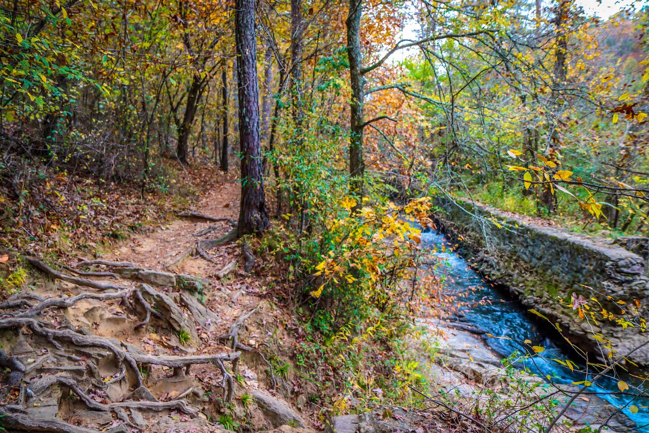
The trail starts with Moore’s Pass, a long, easy single-track climb to the trailhead, which is known as The Knot.
This leads to the 1.8-mile Raceway, a wide path that dips, rolls, zigs and zags. It has boardwalk-style bridges over a lush creek valley that’s dotted with Georgia wildflowers in spring and is especially beautiful when the fall colors peak.
The 1.8-mile Powerhouse is the signature trail of this section, with advanced sections that are faster, higher, and narrower than other Rope Mill trails. Sculpted doubles offer serious air time, and rock garden alt-lines offer technical elements.
This section ends with the Turbine, a mile of tight, twisty single-track to the peak of the park above the Rope Mill historic site. The descent to Moore’s Pass offers big doubles and big speed, with an optional armored rock drop.
READ MORE: The 15 Best Day Hikes on the Appalachian Trail in Georgia
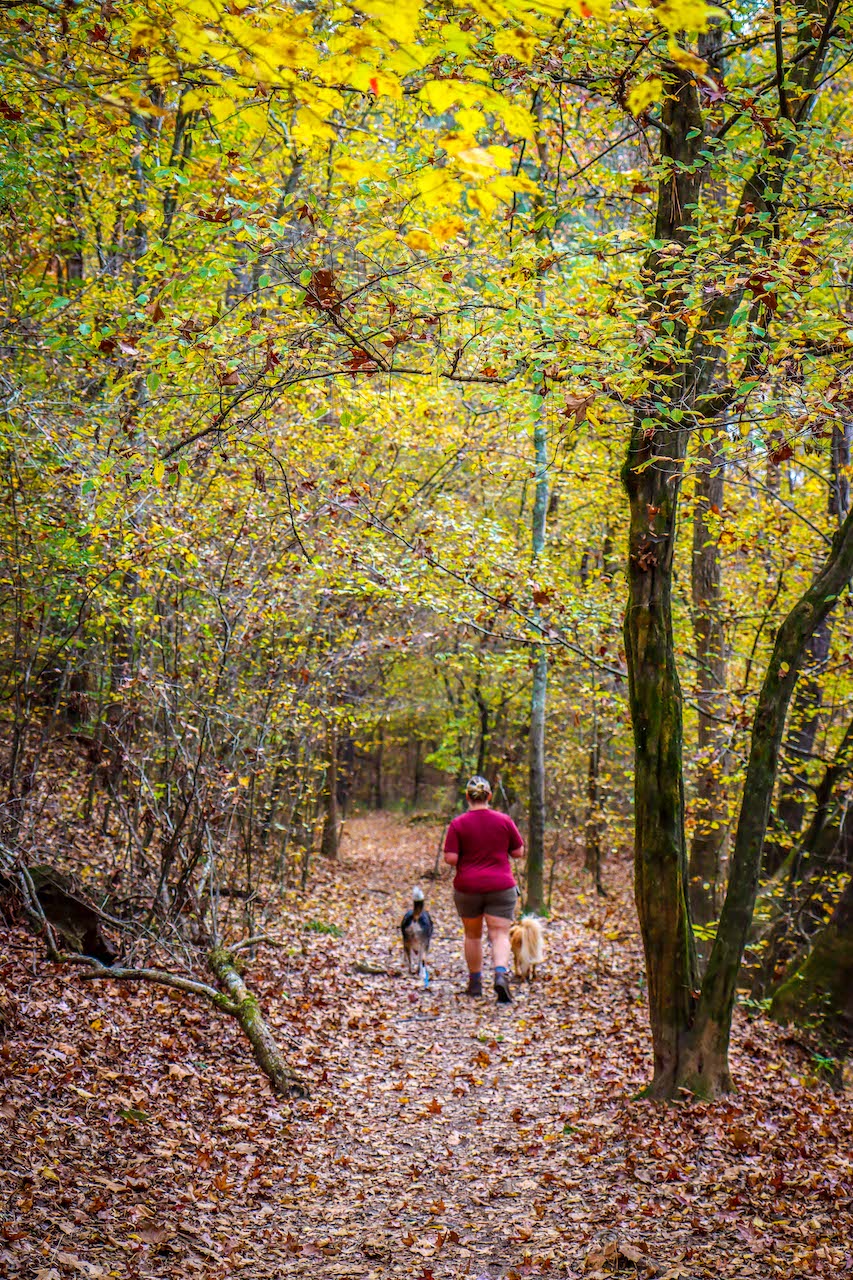
Olde Rope Mill Little River Trail (2.2 Miles)
Our favorite of the Olde Rope Mill hiking trails, the Little River Trail leads to the right after crossing over the bridge.
The trail heads south, offering an opportunity to see the ruins of the Cherokee Cotton Mills up close.
You’ll see sections of the mill’s foundation (including an 8 x 13′ concrete platform that served as its entrance), raceway, and dam immediately to your right. The southern end of the dam and a portion of the raceway were destroyed long ago.
The trail continues southeast alongside the river, through a mixture of hardwood and pine forest that is especially lovely in autumn, when the fall colors of the leaves are reflected on the water.
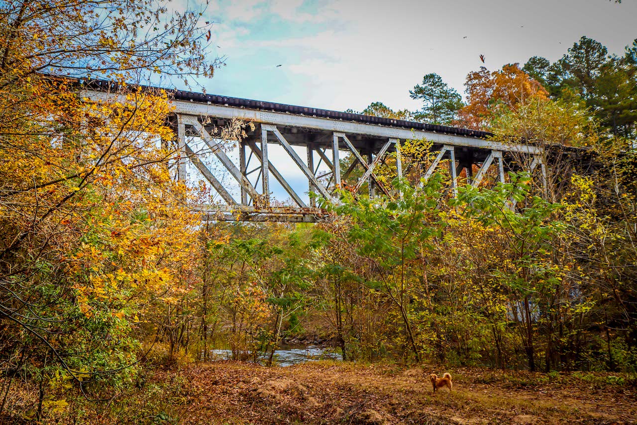
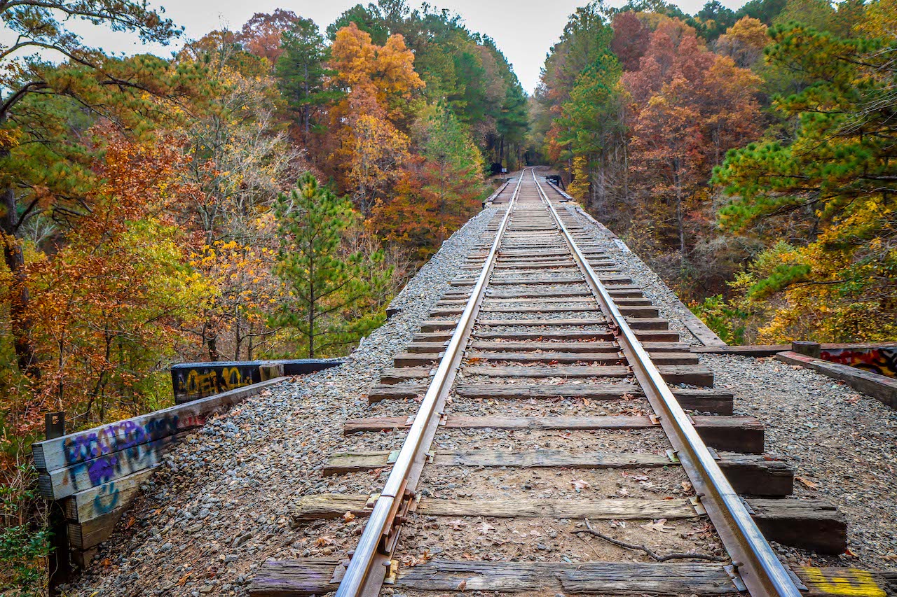
The path eventually makes a sharp left and opens up into a small meadow, heading north a bit further from the river. At just over a mile, it reaches a train trestle over the Little River, which is used by the Georgia Northeastern Railroad.
READ MORE: The 15 Best North Georgia Mountains for Hiking
Trestle Rock Trail (1 mile)
At just one mile round-trip, this is by far the easiest of all the Olde Rope Mill Park hiking trails.
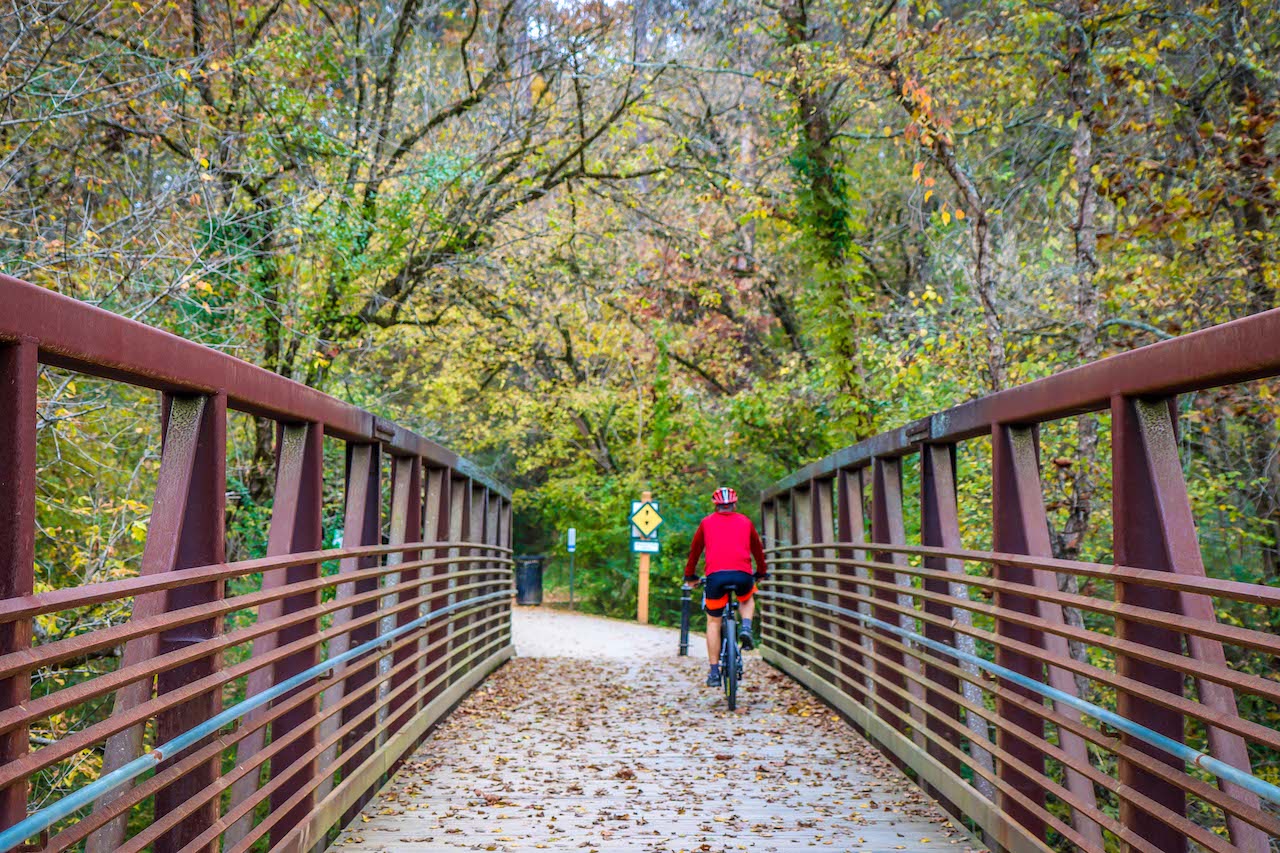
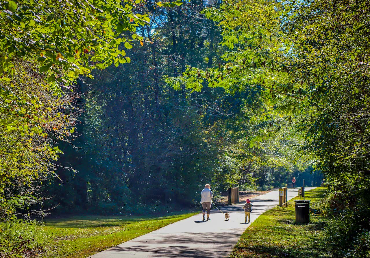
Heading right from the main parking lot, the Trestle Rock Trail is short, wide, and paved the entire way, offering a great path for walking dogs (on-leash only), younger kids on bikes, or even roller skating.
This trail offers excellent views of the bridge over the Little River and the ruins of the Cherokee Cotton Mills, and offers a spot where kids can go wading in the river when water levels are normal.
Note that there are snakes seen along the riverside fairly often, with signs warning visitors accordingly. And though most of them are non-venomous, there’s always a possibility of seeing venomous snakes, so caution is advised.
Signs suggest that this trail will eventually connect to other parts of the Woodstock Greenprints Trail System, all of which will allow for non-motorized transportation (bikes, scooters, skateboards, etc.) and pedestrians.
READ MORE: Non-Venomous vs Venomous Snakes In Georgia (Identification Guide)
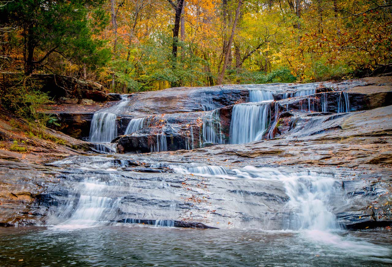
How to Get to Allatoona Falls/Toonigh Creek Falls
This 20-foot waterfall is located near the mouth of Toonigh Creek, just before it spills into Lake Allatoona. You can reach it via kayak or canoe from the park, but there are also unofficial hiking trails you can take.
The trail option starts at the park, crossing the bridge before following a path north for about .3 miles. Turn left and follow a broad road under the I-575 overpass, keeping to the well-worn path along the Little River.
You’ll soon pass through a sand dredging area, after which the riverside path narrows considerably. It eventually rises to a ridge in-between two fingers of the lake.
Take a right and follow the sounds of the waterfall to your left, being careful not to enter the path that leads to a private neighborhood (which has a posted “No Entry” sign). You’ll reach the multi-tiered waterfall at approximately 1.5 miles.
For our money, it’s one of the most picturesque waterfalls in North Georgia, with lots of rocks for a picnic and an area that’s perfect for taking a cool dip on a hot summer’s day. –by Bret Love; photos by Bret Love & Mary Gabbett

