
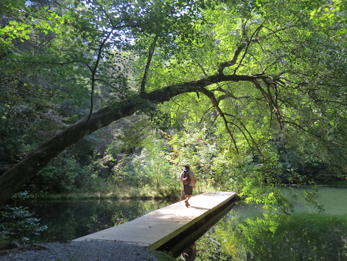
For those looking to take on a unique physical challenge, dive into some mental clarity, and explore a beautiful state, we’ve assembled a great list of the best hikes in North Carolina.
The worldwide 52 Hike Challenge encourages participants to tackle 52 hiking trails over the course of the year, essentially completing one a week. But obviously it can be broken up differently to suit your schedule.
As they finish various hiking trails, participants are encouraged to post their accomplishments on social media with the #52HikeChallenge hashtag and the number of hikes completed (such as #hike1, #hike2, etc).
This is a great way for keen hikers and other outdoor enthusiasts to connect, encourage each other, and maybe even find out about some great new places to hike in North Carolina.
To make things easier, we’ve compiled a phenomenal list of the best hiking trails in NC, including some of the best hikes near Asheville, Boone, Blowing Rock, and other awesome North Carolina mountain towns.
Each one includes the total distance and info about the trail’s highlights and level of difficulty. Read on to find some inspiration for your next hike!
READ MORE: The 10 Hiking Essentials Packing List for the Blue Ridge Mountains
Hiking Near Asheville NC
Easy Hiking Trails
1. Cratyon Trail- This half-mile loop runs through Asheville’s botanical garden, passing over a creek and alongside beautiful meadows of wildflowers. Enthused hikers can also extend this trail with a couple of sidetracks. The botanical garden warrants a visit anyway, so this is a great excuse to check it out.
2. Black Balsam Knob- Part of the 30-mile Art Loeb Trail, the hike to Black Balsam Knob is less than 1.5 miles round-trip and offers magical views of some of the highest mountains in North Carolina. This route is over 6,000 feet in elevation through a carpet of North Carolina wildflowers and a collection of wild berries.
3. Craggy Pinnacle Trail- The trails at Craggy Gardens NC are fantastic for quick jaunts and staggering views, not to mention the awesome rhododendrons and blueberry bushes. The Craggy Pinnacle Trail barely takes 20 minutes to walk, but it provides a 360º panorama, including views of Mt. Mitchell, the tallest mountain east of the Rockies.
4. Devil’s Courthouse Trail- This short hike is less than a mile, but it does have a quick gain in elevation, climbing about 275 feet. It leads to a famous rock formation in the Nantahala National Forest, just off the Blue Ridge Parkway. The view from the top encompasses four states: North Carolina, South Carolina, Tennessee, and Georgia.
5. Max Patch Loop- Max Patch is considered one of the best hikes on the Appalachian Trail in North Carolina. It’s a high elevation grassy bald with lots of sunshine, expansive views, and wildflowers. The hiking trail is about 1.5 miles round-trip, and it’s one that begs to be broken up with a picturesque picnic.
READ MORE: The 30 Best Things to Do in Asheville NC
Moderate/Strenuous Hiking Trails
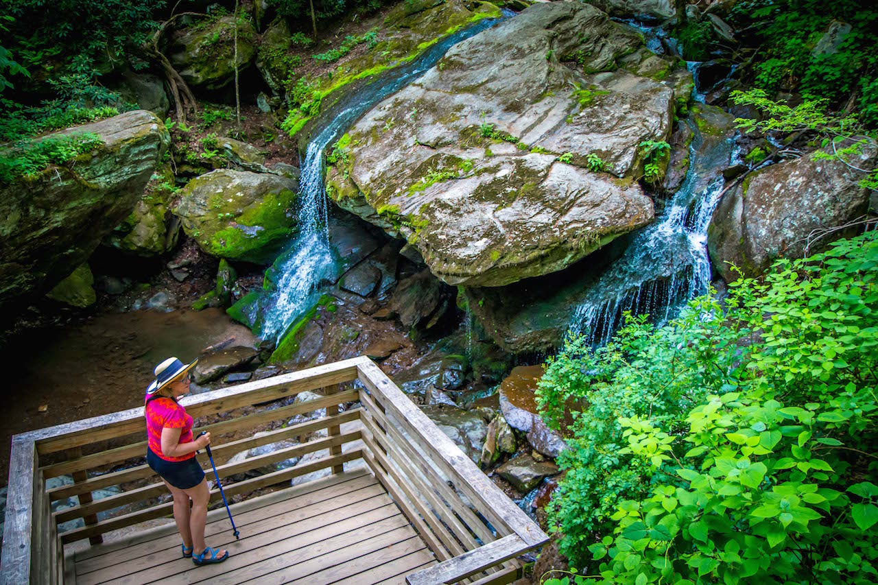
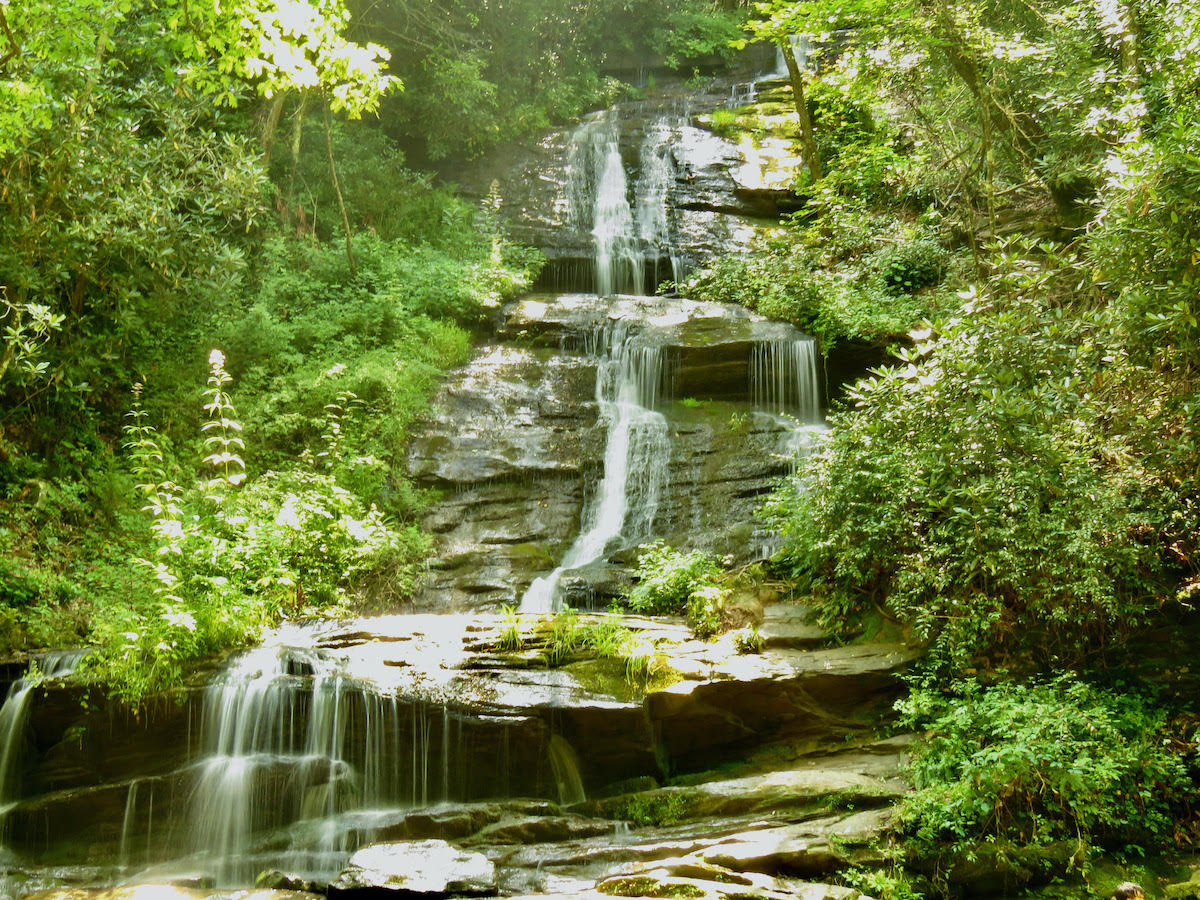
6. Catawba Falls Trail- For those who love chasing waterfalls, this is one of the top waterfalls near Asheville NC. The headwaters of the Catawba River come tumbling down rocky outcrops in a moss-laden forest. The hike isn’t exceptionally difficult, but it is nearly three miles long.
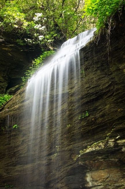
7. Crabtree Falls Trail- One of the best Blue Ridge Parkway hikes for NC day trips, the trail to/from Crabtree Falls is a 2.5-mile loop that does have some steep terrain. The 60-foot waterfall clambers down an imposing rockface, and a good half of the trail crisscrosses Crabtree Creek for a beautiful hike.
8. Graveyard Fields Trail- Graveyard Fields is one of the most popular hikes in Asheville for locals and visitors alike. It has stunning waterfalls as well as some of the best wild blueberry picking in the state. The loop is an easier hike, but the spurs lead to some of the best Blue Ridge Parkway waterfalls in North Carolina and add to the challenge.
9. Mt. Mitchell Trail- The namesake of Mt. Mitchell State Park, Mt. Mitchell is the tallest mountain east of the Rockies. It must be climbed! This is the pinnacle of Black Mountain hiking. The route to the top is six miles, and it’s best to put aside at least 8 hours to get there and back.
10. Rattlesnake Lodge Trail- This is a 3.7-mile trek along a lollipop loop just northeast of Asheville (near Craggy Gardens). The trailhead is at Milepost 374.4 on the Blue Ridge Parkway. The lodge was once the summer retreat of Dr. Chase Ambler, who encountered dozens of venomous snakes in the first few years there in the early 1900s.
READ MORE: The 15 Best VRBO Cabins in Asheville NC
Hiking Near Blowing Rock NC
Easy Hiking Trails
11. Beacon Heights Trail- Though this trail has its challenges in terms of roots and rocks, it’s less than a mile long and only climbs about 100 feet. It’s a good option for hiking families, and provides stunning vistas of Table Rock, Hawksbill Mountain, and the beloved Grandfather Mountain.
12. Bass Lake Loop- At the foot of the mountain below Moses H. Cone Manor, Bass Lake is a beautiful lake in the North Carolina mountains with an easy, flat trail. The loop is about a mile, but for a longer hike (with added elevation changes), it can be accessed via the Blue Ridge Parkway. There’s also an access point in Blowing Rock.
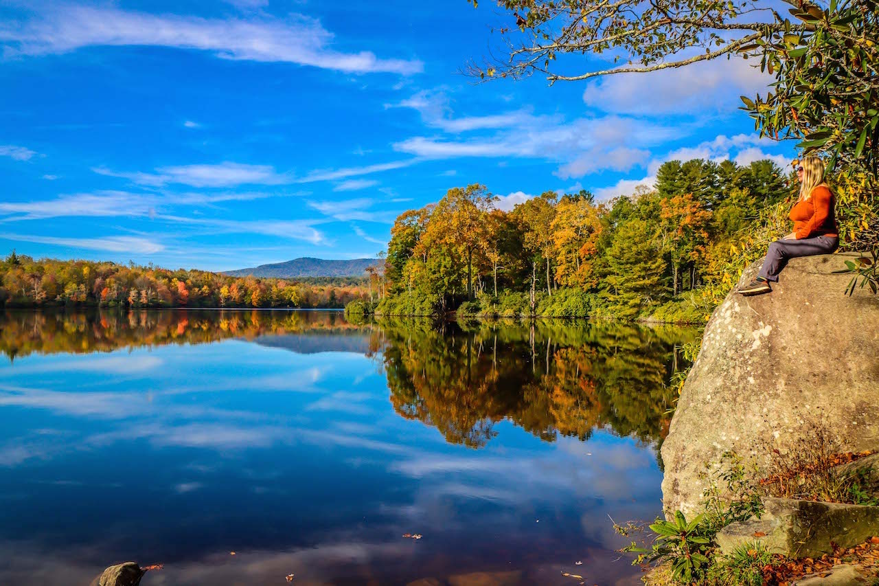
13. Price Lake Loop- With very little change in elevation, the two-mile journey around beautiful Julian Price Lake is an easy hike that’s suitable for just about able-bodied hiker. There’s a nice campground on this route, water sports available on the lake, and plenty of vistas to soak in some serious Blue Ridge Mountain scenery.
14. The Blowing Rock Trail- A major tourist destination for centuries, The Blowing Rock hangs suspended 3,000 feet over Johns River Gorge. Its famous winds are so strong that they can lift light objects, such as snow. The Blowing Rock Trail is highly developed and short (1/2 a mile), but the unusual geological feature merits a visit.
READ MORE: The 15 Best Things to Do in Blowing Rock NC
Moderate/Strenuous Hiking Trails
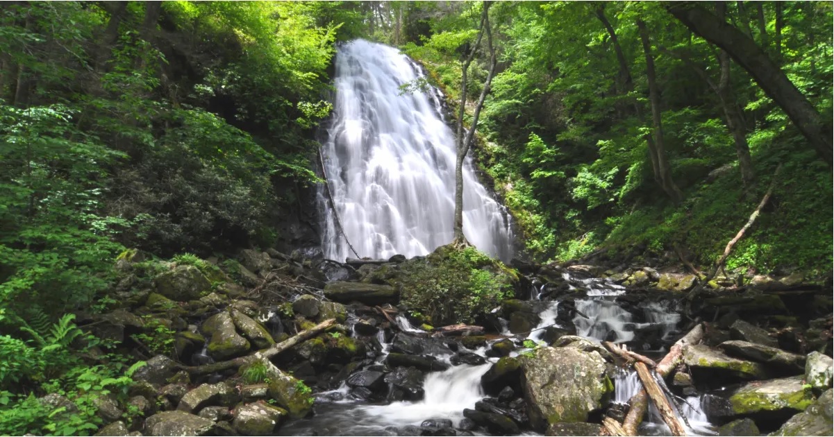
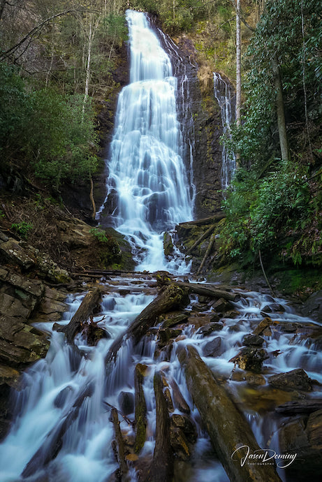
15. Glen Burney Trail- A hike in Blowing Rock proper, the Glen Burney trail is adjacent to Mayview Lake and Annie Cannon Park. It features The Ruins (an abandoned 1920s sewage treatment system) and Glen Burney Falls on New Year’s Creek. The trail is only 3.2 miles, but its change in elevation makes it a somewhat strenuous hike.
16. Green Knob Loop- Another great mountain lake hike is the Green Knob Loop in Julian Price Memorial Park, just a couple miles down the Parkway from Moses H. Cone Memorial Park. Due to winter road closures along the BRP, this trail is best planned for spring, summer, and autumn. It’s a fantastic place to see fall colors reflecting off the lake.
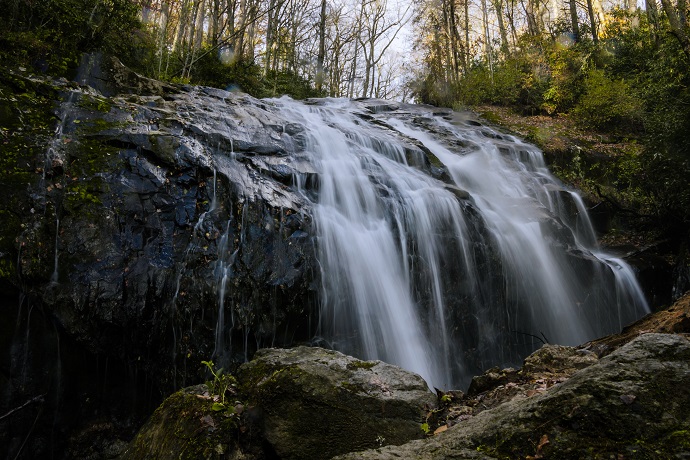
17. Harper Creek Falls Trail- Clocking in at just under three miles, the Harper Creek Falls Trail (which is oddly along Wilson Creek) is a hugely popular hike. It includes a stunner of a waterfall and several enticing pools to swim in. The hike can be extended to about 8 miles if you want to reach the second of the waterfalls on Harper Creek.
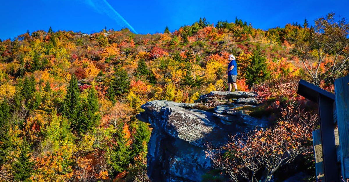
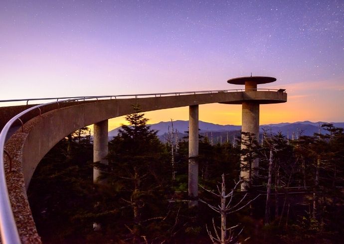
18. Rough Ridge Trail- This is not a particularly long NC hiking trail at 1.5 miles, but it is steep and can get very muddy after heavy rains. Nevertheless, the Rough Ridge Trail is a popular trek off the Blue Ridge Parkway (Milepost 302.8). The views of the Linn Cove Viaduct and rolling Blue Ridge Mountains from atop the ridge are absolute knockouts.
READ MORE: The 10 Best Restaurants in Blowing Rock NC for Foodies
Hiking Near Boone NC
Easy Hiking Trails
19. Cascades Trail- Located in E.B. Jeffress Park at Milepost 271.9 of the BRP, the Cascades Trail is among the most popular Boone NC hiking trails. It’s a short walk, taking 30 to 45 minutes to get from parking lot to the waterfall and back. The trail follows along Fall Creek and is very well-maintained.
20. Otter Falls Trail- For another nice waterfall with minimal effort, the Otter Falls Trail is less than a mile. It has a somewhat odd figure-eight shape, with a small spur down to Valley Creek. This hike is located in a town called Seven Devils, which is relatively close to Banner Elk and Blowing Rock as well.
21. Rocky Branch Loop- Part of the Rocky Knob Mountain Bike Park trail system (which caters to mountain bikers more than hikers), the Rocky Branch Loop is a hiker-friendly trail that follows Rocky Branch Creek. The easy trail is just 1.5 miles, and sets off from the parking area.
22. Figure 8 Trail- A very short trail (less than half a mile) in Moses H. Cone Memorial Park, the Figure 8 Trail is where Cone and his wife took their daily strolls. It has beautiful wildflowers and overviews Bass Lake. This is more of a leg-stretcher when you’re driving along the Blue Ridge Parkway.
READ MORE: 20 Best Things to Do in Boone NC (Blue Ridge Parkway MM 291.8)

Moderate/Strenuous Hiking Trails
23. Boone Fork Trail- Another nice hike at Julian Price Memorial Park, this 5-mile loop has lots of rhododendrons and one of the best waterfalls near Boone NC, Hebron Falls. While long, this trail isn’t overly challenging in terms of elevation change. This is also a good place for hiking near Banner Elk and Blowing Rock.
24. Summit Trail- The relatively new trail to the summit of Elk Knob is a really unique hike. Volunteers spent over 6,000 hours making this nice, 1.9-mile trail (3.8 miles round-trip) up to the top of Watauga County’s third highest peak. There are two impressive overlooks at the 5,540-foot summit.
25. Flat Top Road- Moses H. Cone is famous for having 25 miles of horse carriage trails, which means that most routes there aren’t steep. Flat Top Road is a 5-mile out-and-back through some lovely high-elevation meadows. The trip culminates at Flat Top Tower, which can be climbed for spectacular views of the Blue Ridge Mountains.
26. Profile Trail to Calloway Peak- A truly challenging hike (as are all the Grandfather Mountain State Park treks), the Profile Trail to Calloway Peak is 4 miles one-way, with a 2,000-foot increase in elevation. Aside from the stunning views atop Grandfather Mountain, this trail has a section along a beautiful river and passes cool rock formations.
27. Boone Greenway Trail- It’s great when there’s a good hike in town, and the mountain town of Boone has The Greenway. Some of it’s along the New River‘s South Fork, some is along Winklers Creek, and it has trailheads in the Watauga Country Recreation Complex and Clawson Burnley Park. This trail offers miles of exploration!
READ MORE: The 15 Best Cabin Rentals in Boone NC
Hiking Near Brevard NC
Easy Hiking Trails
28. Moore Cove Falls Trail- There are a ton of great waterfalls in Transylvania County (250 falls in all), and Moore Cove Falls always makes the list of ones to see. It’s in Pisgah National Forest, right off the main throughway (US-276). This hike is a little over a mile, relatively flat, and absolutely lovely. There’s also a waterfall you can walk behind!
29. Log Hollow Falls- One of the lesser-visited waterfalls in Pisgah National Forest, this is a 25-foot fall that is easy to reach. Finding the closed Forest Service Road 5043– the “trail” to it– is the bigger challenge. Log Hollow Falls is the named waterfall feature on this trail, but there’s also an 80-footer a 1/4-mile further down the road.
30. Fryingpan Tower Trail- Mount Pisgah is perhaps the most popular peak in the southern Asheville skyline. This trail leads to Frying Pan Fire Tower and offers a spectacular vista of it. The 70-foot tower is reached by a 1.5-mile hike down Forest Service Road 450, which is only open to hiking (no cars).
READ MORE: The Top 15 Waterfalls Near Brevard NC (Transylvania County)
Moderate/Strenuous Hiking Trails
31. Rainbow Falls Trail- Jointly managed by Gorges State Park and Pisgah National Forest, the trail to Rainbow Falls follows Horse Pasture River upstream. The one-way trip to Rainbow Falls is about 1.5 miles, and another quarter of a mile beyond that is Turtleback Falls. Rainbow Falls throws up enough mist to cause frequent rainbows in front of it.
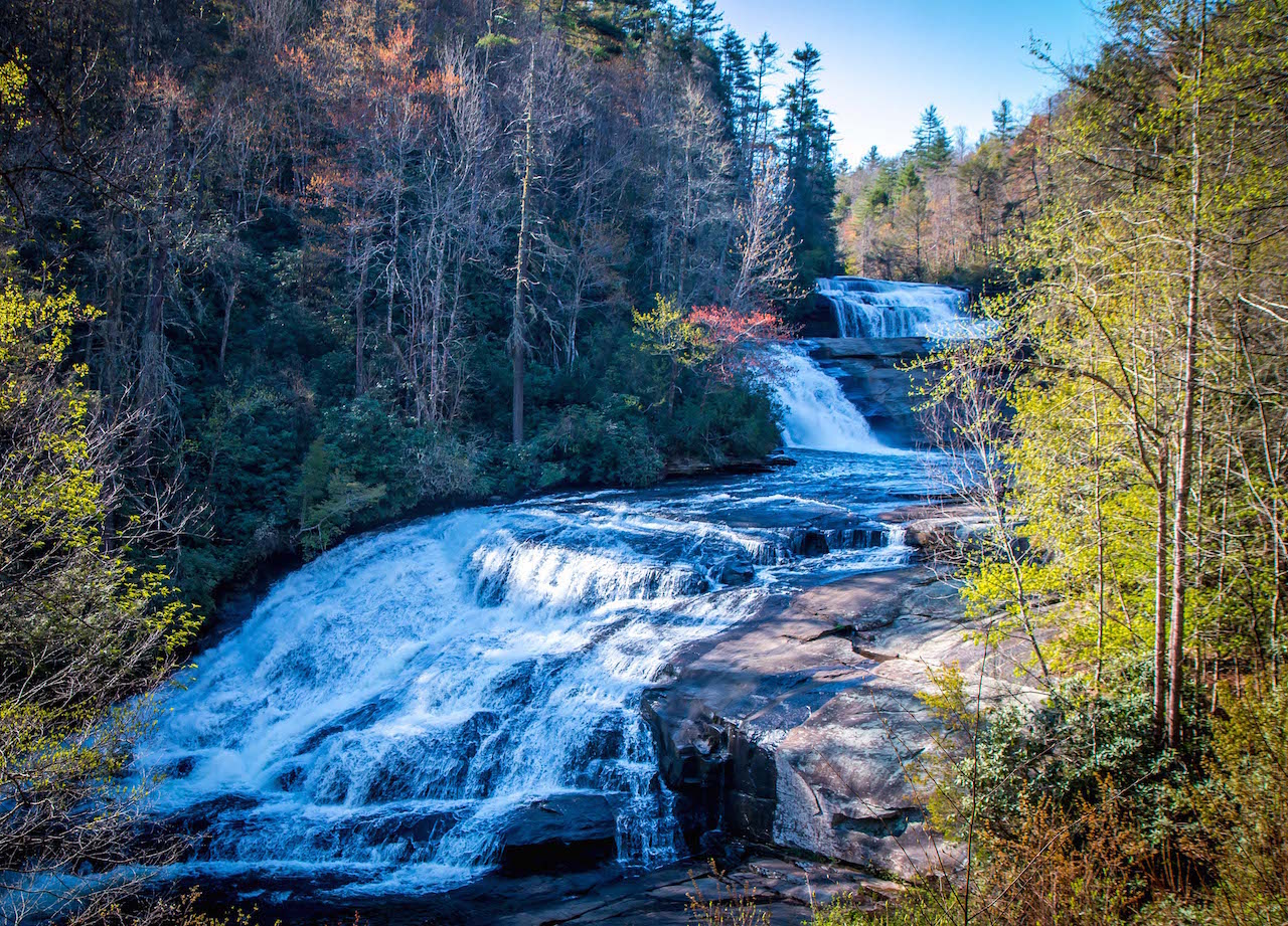
32. Three Waterfall Hike- Possibly the best hiking in Brevard NC, this one of the state’s absolute must-do trails. The Three Waterfall Hike is a combination of the Triple Falls Trail and High Falls Loop, and it includes an up-close-and-personal view of Hooker Falls as an added bonus. It’s only 3 miles, but does have some elevation change.
33. Pink Beds Loop Trail- Though there isn’t much change in elevation, this loop trail can’t be called easy because it’s 5 miles long. It’s through an area called Pink Beds Valley due to its mountain laurel and rhododendron blooms in the spring. There are lengthy bog bridges here that add a cool effect of walking in spots where you normally wouldn’t go.
34. Mount Pisgah Trail- When taking on challenging trails, it’s hard to resist hiking Western North Carolina mountains. The Mount Pisgah Trail is truly a great one. This is a 4.5-mile climb (and descent) of just over 1,000 feet, with a lot of rocky terrain along the way. The view from up top is just as splendid as one might imagine.
35. Daniel Ridge Loop Trail- A monster 150-foot waterfall, Daniel Ridge Falls is sometimes called Tom Spring Falls or Jackson Falls. The loop trail for viewing it is 4 miles long in a relatively remote, though frequented, part of the Pisgah National Forest. The trail is wide and comfy, good for both hiking and biking.
READ MORE: The 20 Best Treehouse Rentals in the North Carolina Mountains
Hiking Near Bryson City NC
Easy Hiking Trails
36. Juney Whank Falls Trail- The Deep Creek section of Great Smoky Mountains National Park is resplendent with waterfalls, including one— the 75-foot Tom Branch Falls— that tubers can glide right by. Juney Whank Falls Trail takes hikers on a 0.8-mile side trip to see a smaller waterfall. The hike is very short, but does require some level of fitness.
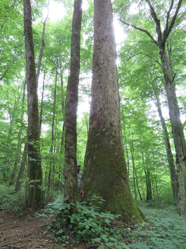
37. Joyce Kilmer Lower and Upper Loops- Though the Joyce Kilmer Memorial Forest is an hour’s drive away from Bryson City NC, the two loop trails through it are among the most timeless mountain trails in NC. The rare remaining old-growth forest contains huge poplar trees, some of which are over 20 feet around and over 100 high!
READ MORE: The 15 Best North Carolina Mountain Towns to Visit
Moderate/Strenuous Hiking Trails
38. Deep Creek Waterfall Loop- One of the best day hikes in Great Smoky Mountains National Park and best hiking trails in NC, this loop trail hits 3 impressive waterfalls. In 5 miles, it crosses multiple streams and creeks, yet never requires a huge amount of effort. Tom Branch Falls, located only half a mile in, is truly unique and photogenic.
39. Noland Divide Trail to Lonesome Pine Overlook- For a serious hike in the Deep Creek/Bryson City area, the trek to Lonesome Pine Overlook is nearly 7 miles out and back, and climbs over 2,000 feet. The reward for making it up is a tremendous view of Great Smoky Mountain National Park and Bryson City NC.
READ MORE: The Cataloochee Valley Elk in Great Smoky Mountains National Park
Hiking Near Cherokee NC
Easy Hiking Trails
40. Oconaluftee River Trail- More like a really amazing walking path, the Oconaluftee River Trail is 1.5 miles long (three miles roundtrip) from the Oconaluftee Visitor Center to the outskirts of Cherokee NC. The trail provides stunning views of the river, as well as access to the Mountain Farm Museum, which is rich in Appalachian history.
41. Clingmans Dome Observation Tower Trail- Though the route to the top of Clingmans Dome is all uphill, it’s paved and isn’t very long. So we can’t rate it too difficult, but it does get the heart rate up! Still, the payoff is really worth it: Clingmans Dome is the highest point in Great Smoky Mountains National Park, and the view matches the position.
READ MORE: Fall in North Carolina: 20 Great Places to See Fall Colors in Western NC
Moderate/Strenuous Hiking Trails
42. Mingus Creek Trail- Following Mingus Creek for nearly six miles, this trail begins at the parking area for visiting Mingus Mill, a must-see historic grist mill.The Mingus Creek Trail is part of the Mountain-to-Sea Trail in Western North Carolina, which stretches over 1,100 miles from Clingmans Dome to the Outer Banks.
43. Pigeon River Trail- Right outside Great Smoky Mountains NP in the Qualla Boundary (Cherokee land), Mingo Falls is a stunning waterfall that can be accessed via the Pigeon River Trail. The waterfall is 120 feet tall and the trail is less than half a mile, but it can be somewhat treacherous and requires some scrambling ability.
44. Newfound Gap to Charlies Bunion- One of North Carolina’s most frequented sections of the Appalachian Trail, the route from Newfound Gap to Charlies Bunion is 8 miles round trip. It traverses some sheer cliffs en route to the breathtaking views, but this is some of the premier hiking in the North Carolina Mountains.
READ MORE: The 20 Best Blue Ridge Parkway Overlooks in NC & VA
Hiking Near Hendersonville NC
Easy Hiking Trails
45. Glassy Mountain Trail- Located on the 267-acre Historic Site of poet Carl Sandburg’s home, this trail is a comfortable 1.3-mile journey to the top of Glassy Mountain. The elevation gain is only 523 feet, and the trail passes by a lake, the house, and historic barns from Paula Sandburg’s goat farm.
46. Hickory Nut Falls Trail– The other natural wonder in Chimney Rock State Park (besides the iconic landmark), Hickory Nut Falls is a tower of a waterfall, towering at a whopping 404 feet. The Hickory Nut Falls Trail leads to its base, providing amazing views of the high cliffs above and ultimately the waterfall itself.
47. Bullington Gardens- In Hendersonville NC, Bullington Gardens offers several walking paths through a beautifully sculpted landscape. The non-profit offers lots of courses throughout the year and is part of Bee City USA Hendersonville. Features include a Reflection Garden, Native Woodland Garden, Dahlia Garden, and more.
48. Jump Off Rock Trail(s)- There are three trails at the Jump Off Rock Overlook, just 5 minutes from Downtown Hendersonville. None of them is particularly difficult, but they are rated, with blue being easy, yellow moderate, and red difficult. Jump Off Rock has an awesome view, and it’s accompanied by an interesting Cherokee legend.
49. The Homestead Trail– Located in the Bent Creek area of Pisgah National Forest between Asheville and Hendersonville, the Homestead Trail has a lot to offer. It runs beside Bent Creek, then beside Lake Powhatan, and crosses Small Creek. It’s an easy, one-mile hike with very little elevation change.
READ MORE: The 15 Best Things to Do in Hendersonville NC
Moderate/Strenuous Hiking Trails
50. Three Lakes Hike- This route requires a bit of jumping from trail to trail, but it’s well worth it and not very difficult to navigate. The payoff for the 3.2-mile hike is visiting three lakes—Lake Dense, Lake Alford, and Lake Julia—in Dupont State Recreational Forest. Seeing 3 mountain lakes on one hike is pretty tough to beat!
51. Forest Demonstration Trail- The Forest Demonstration Trail in Holmes Educational State Forest is 3 miles long. It takes hikers from the bottom to the top of the forest, which is about a 500-foot gain in elevation. The trail includes forest management exhibits, a pond, and an observation deck.
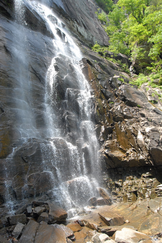
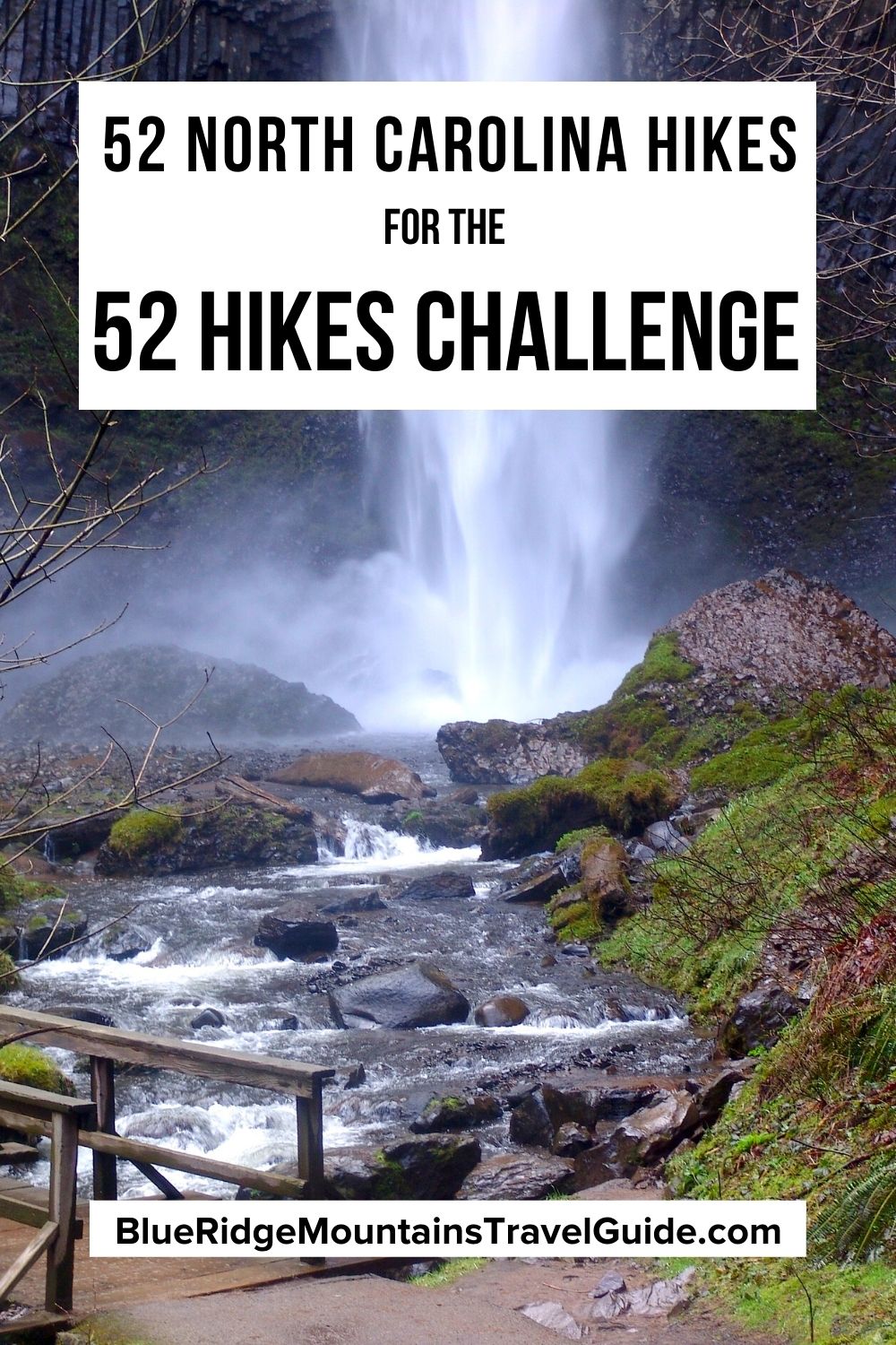
52. Hard Times Loop Trail- For a good long walk, the Hard Times Loop Trail might be the perfect choice for hiking near Hendersonville. Nearly 6 miles long, it takes hikers through Bent Creek Experimental Forest, with glimpses of the North Carolina Arboretum, Lake Powhatan, and the Biltmore along the way. –by Jonathon Engels; lead image of the Rough Ridge Trail by Mary Gabbett

